We found 109198 price guide item(s) matching your search
There are 109198 lots that match your search criteria. Subscribe now to get instant access to the full price guide service.
Click here to subscribe- List
- Grid
-
109198 item(s)/page


Lot 449
A LARGE SCROLL MAP OF ENGLAND AND WALES BY JOHN CARY hand-coloured engraving, composed of seventy-eight individual plates laid down, titled 'Cary's New Map of England and Wales with part of Scotland on which are carefully laid down all the direct and principal cross roads, the course of the rivers and navigable canals..', 'Published June 11th 1794 by J. Cary, Engraver & Map-Seller, No. 181 Strand' 225 x 177.5cm

Lot 451
A MAP OF SAINT HELENA BY LIEUTENANT R. P. READ a hand-coloured engraving, 'This Geographical Plan of the Island & Forts of Saint Helena is Dedicated by permission to Field Marshall His Royal Highness The Duke of Kent and Strathearn', 'Published for the Proprietor June 4th 1817 by J & M. Rippin, No. 21 Theobald's Road' 46 x 60cm


Lot 732
A printed silk scarf, 19th century, titled 'THE RAILWAYS IN GREAT BRITAIN ALSO THE LINE OF NAVIGATION FROM THE PRINCIPAL SEA PORTS TO BOTH HOME AND FOREIGN STATIONS', the red printed map with railway lines and navigation routes picked out in black, within a red floral bordered, illustrated title block to top right corner, 55cm x 60cm (at fault) CONDITION REPORT:The piece shows staining in several areas, particularly around the title panel, over Northern Ireland and north of the Cornish peninsular. There are three small tears to the lower edge, the largest 15mm long. There is a further small tear in the top left hand corner.

Lot 357
THE SCRIPTURE ATLAS, OR A SERIES OF MAPS, TO ILLUSTRATE THE OLD AND NEW TESTAMENT, full red leather, gilt embossed decoration to cover and spine, engraved title page, twenty hand-coloured engraved maps including five double-page, tissue-guards, bound with A COMPLETE INDEX TO THE SCRIPTURE ATLAS, with advertisement and list of Patrons, Matthews And Leigh, London 1812 and 1813, with Farrar (F.W.), THE LIFE OF CHRIST, full leather, gilt title and decoration to spine, marbled endpapers, gilt edges to block, inscribed to front free endpaper and dated '1882', coloured Palestine map frontispiece, engraved title page, engraved illustrations throughout, Cassell Petter & Galpin, London, and LEONARD'S CHRONOLOGICAL AND GEOGRAPHICAL FAMILY GUIDE TO THE HOLY BIBLE, fold out coloured map engraved by John Dower, paper panels on linen, embossed leather boards, 64cm x 76cm, C.W. Leonard, circa 1860 (3)

Lot 11
The Regality of Kirriemuir by Alan Reid with a map of the district and 140 illustrations from original photographs and drawings, published John Grant 1909 - 1st edition, 650 copies of this book were printed, 600 were for sale, list of subscribers at rear. Bound in maroon gilt cloth with top edge gilt, very good clean condition.

Lot 3
5 Biggles and Gimlet by Captain W. E. Johns inc. Biggles Takes a Holiday pub. Hodder & Stoughton 1st Ed. June 1949 small tear top and bottom of dust jacket on spine and some wear on front flap, and Biggles in the Jungle, pub. the OUP 1947 reprint, jacket torn on spine, and The Murder at Castle Deeping revised and reset 1951 pub. Latimer House in dj tear to rear, and Gimlet Bores In pub. Brockhampton Press 1950 1st Ed. lower portion of jacket missing on spine, and Jimlet Off the Map, pub. Brockhampton Press 1st Ed. 1951, has inscription otherwise nice clean copy, together with Boys Will Be Boys by E. S. Turner: 'The Story of Sweeney Todd,' 'Deadwood Dick,' 'Sexton Blake,' 'Billy Bunter,' 'Dick Barton,' et. al. pub. Michael Joseph 1948 3rd Impression.
Lot 76
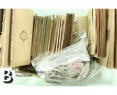
Quantity of cigarette cards, both loose and in several albums, approx 40 in total, makers include W.D & H.O Wills, Players, Park Drive, Mobil cigarette cards, History of Naval Dress, National Flags, Railway Equipment, Wild Flowers, Association Footballers, Regimental Badges, Military Uniforms, Coronation of H.M King George VI and H.M Queen Elizabeth, Sea Fishes, Tennis, Cricketers, Aeroplanes including a Philips Ten-Sheet Road Map of England and Wales cloth edition and collection of Lyon tea cards Australia, Gallagher's Wild Animals, Will's Garden Flowers and Wild Animals, Do You Know?, Craven Black Cat Military Uniforms, amongst many others.

Lot 123
12 BOTTLES NEW ZEALAND WHITE AND ROSE WINEHaulashore Sauvignon Blanc 2020; Anchorage Reserve Sauvignon Blanc 2020; Map Maker Sauvignon Blanc 2019; Kim Crawford Sauvignon Blanc 2020; Kim Crawford Small Parcels Sauvignon Blanc 2019; Kim Crawford Pinot Gris 2019; Spinyback Pinot Gris 2020; Blind River Sauvignon Blanc 2019; Oyster Bay Sparkling Rosé; Freeman's Bay Rosé 2019; Lansdowne Pinot Gris 2015; The Ned Rosé 2020


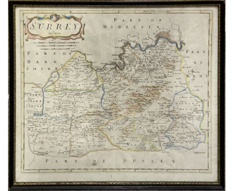
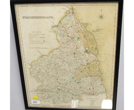
Lot 143
County maps etc. A collection of 19th Century maps including Cary, John. A New Map of Hampshire, 1811; A New Map of Warwickshire, 1818; A New Map of Derbyshire, 1823 - Bettison's Map of the Country Twenty Miles Round Cheltenham, n.d. All folding hand coloured, in board slipcases. With 14 others and a pamphlet on Buxton (19)/Provenance: Spetchley Park


Lot 170
Kirwan, Richard. Elements of Mineralogy, 1784, Orig. boards (worn) - Buckland, Rev. William. Geology and Mineralogy, 2 vols., 1837 - Mossman, Samuel. The Origin of the Seasons Considered from a Geological Point of View, Edinburgh and London 1819. Engraved map and diagrams - Burr, Frederick. Introduction to the Study of Geology, 1836. Hand coloured frontispiece. With 2 other volumes. 8vo., orig. cloth (7)/Provenance: Spetchley Park


Lot 233
Wright (Andrew) Court-Hand Restored or, The Student's Assistant in Reading Old Deeds, Contracts, Records etc., London 1879, two photographic souvenir booklets, The Beauty of Argyll and Memories of Skye, various ephemera including small hotel adverts, one with maps of Jersey, another with panoramic map of the Rhine, a silk bullfighting poster, 1871, a hand written diary of a trip with Sir Walter Currie 'Through Kaffir Land and No-Man's-Land Jany-April 1862'


Lot 749
Frederick De Wit - Nova Orbis Tabula, in Lucem Edita, late 17th century hand coloured engraved map of the world, with figural vignettes, total size 52 x 62cmCondition report: Some staining/discolouration. Tear on the left. Central vertical fold has torn in places and been reinforced on the back - please see photos.


Lot 125
A pair of vintage A Bulzoni snakeskin shoes, size 38, with similar handbag; a black and purple Radley handbag, shoulder strap; another handbag; and a quantity of vintage scarves, to include 'The "Fairest Cape of All"' hand-painted map of South Africa by Monica Wilson, signed and dated 1953, plus Pierre Cardin, Chanel, Kreier, Christian Lacroix, Guy Laroche, Norma Legge, Paloma Picasso, Schiaparelli, mainly silk.


Lot 671
POSTERS / POP & ROCK MEMORABILIA, music posters comprise two Hawkwind posters, Road Hawks and Silver Machine, four Pink Floyd The Wall themed posters by Gerald Scarfe, one Susie Quatro poster, Tour Programmes from Hawkwind, Earth Ritual and Genesis, Mama tours, a Psychedelic Furs badge, other posters include an anti PLO poster from the Union of Jewish Students, a Salvador Dali Sleep Poster, a Stonehenge Poster, a World Map 132cm x 100cm and various others
Lot 795
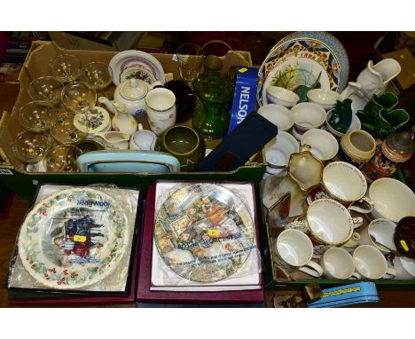
TWO BOXES AND LOOSE CERAMICS, GLASS AND METALWARES, to include ten boxed collectors plates by Royal Worcester, Wedgwood, Coalport, etc, mainly Christmas themed, decorative metal mould featuring a dog, vintage Huntley & Palmers 'Cocktail Biscuits' triangular tin, Portmerion British Fishes 'Pike' large cup, cigarette case with map of the UK design, four Dartmouth Pottery fish vases tallest 23cm, shortest 10cm, eight Babycham glasses, Macallan and Glen Grant 'Pure Malt' advertising jugs, Wade Johnny Walker and Nelson tipped cigarette ashtrays, Wedgwood 'Humming birds' vase height 15.5cm, etc (sd) (2 boxes and loose)

Lot 562
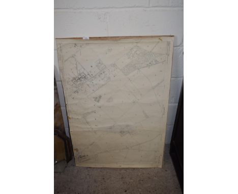
A FRAMED BRADSHAWS RAILWAY MAP OF ENGLAND, WALES AND SOUTHERN SCOTLAND, undated but would appear to date from before 1950, map has been stuck to a board, complete but has some marking and wear, mould and minor water damage to bottom right corner, size including frame approximately 70cm high x 51cm wide
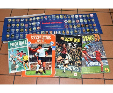
Lot 690
A QUANTITY OF F.K.S. THE WONDERFUL WORLD OF SOCCER STARS PICTURE STAMP ALBUMS, 1971/72, 1972/73 AND 1976/77, all are incomplete with missing picture stamps, some wear, creasing and damage to covers especially 72/73 album which has tear to back cover, some yellowing to pages and page edges, two earliest albums have some loose/damaged stamps that have become detached from the page, all albums complete with all pages but have had the order form and/or the results and transfer pages filled in pen, the 76/77 album has a quantity of loose stamps that have never been stuck into the album, with a copy of the Bartholomew Football History Map of England and Wales which is complete but has some tears along the folds down from the top and smaller ones to each side, some other minor holes to folds, pin holes to corners, reasing to covers and an Esso Collectors of Football Club badges which is complete but has some damage to the display case


-
109198 item(s)/page