

JOHN OGILBY - THE ROAD FROM OXFORD TO CAMBRIDGE Engraving with hand colouring strip road map, circa 1675, the figural cartouche with central Royal armorial Image 33.5 x 41cm Condition: Condition Report Central vertical fold as issued, some light wrinkling at title cartouche, general signs of age and some light wear to frame This is an auction of preowned and antique items. Many items are of an age or nature which precludes their being in perfect condition and you should expect general wear and tear commensurate with age and use. We strongly advise you to examine items before you bid. Condition reports are provided as a goodwill gesture and are our general assessment of damage and restoration. Whilst care is taken in their drafting, they are for guidance only. We will not be held responsible for oversights concerning damage or restoration.
We found 109198 price guide item(s) matching your search
There are 109198 lots that match your search criteria. Subscribe now to get instant access to the full price guide service.
Click here to subscribe- List
- Grid
-
109198 item(s)/page


JOHN SPEED hand coloured engraved map of Wales - John Sudbury and George Humble (1611 or later) with twelve oval vingettes of principal cities of Wales to the vertical margins, inset views of Bangor, St Davids, Llandaff and St Asaph, with English text versoDimensions: 41 x 51cmsProvenance:private collection LondonCondition Report:framed and glazed

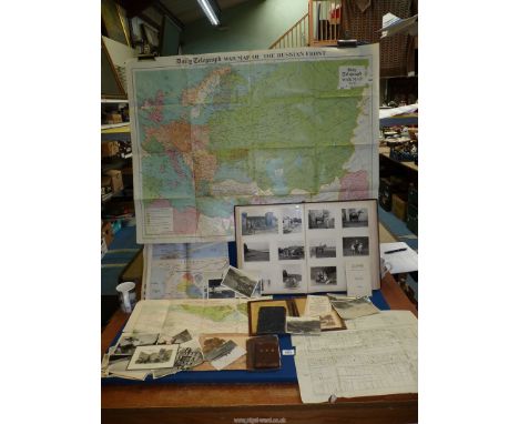
A quantity of ephemera including an album of vintage photographs and postcards of South America and Canberra (some loose), Daily Telegraph Map of the Russian front 1941, Plan of assembly of the fleet at Spearhead for the Review by his Majesty the King, 16th July 1935 and Cabin plan of Harrison line, S.S. Ingoma.


A JAPANESE SHOWA-ERA SHIN GUNTO SWORD, WITH BRITISH ATTRIBUTION The machine-made blade mounted with brass habaki and seppa, the gilt bronze tsuba with floral castings below ray skin-covered tsuka adorned with cast metal menuki, wrapped with traditional ito cloth and capped with plain bronze kashira suspending Company/Warrant Officer's brown and blue tassel, the whole housed in a brown leather-covered wooden scabbard. Included with the lot is a selection of items pertaining to the military career of 14875306 Sergeant Ian Foster de Banzie of the General Service Corps and later Intelligence Corps, the sword's owner. The record comprises a large quantity of photographs (many annotated) taken while posted in Malaya in the years immediately post-WW2, Intelligence Corps cloth shoulder titles and brown plastic cap badge; embroidered Malaya Command and 2nd Infantry Division cloth patches, silk maps showing on one side Sheet J: French Indo China (Central) and Siam (Thailand - East) and verso Sheet K: French Indo China (South) and Siam (Thailand - Part of), Living in the Jungle pamphlet, Army in India Identity Card, 2nd Division Malaya 1946-47 Note of Thanks, Confidential typewritten document titled Special Report on PENGERANG -- Kg. PUNGGAI,, various paper Malay maps, copies of The Straits Times reporting on raids organised by Sgt. de Banzie, a small Malay knife, a Japanese officer's leather map case etc. Condition Report:Available upon request
![18th Century coloured map the road from Edinburgh to Glasgow continued to Ayr & Hamilton on reverse side. [55x25cm]](https://cdn.globalauctionplatform.com/1676e14a-5de3-4967-b620-afd100a842e8/de1c4306-e2b9-43d9-889e-afd2014de2c2/468x382.jpg)
![18th/19th Century coloured map (BUTHE INSULA)[54x64cm]](https://cdn.globalauctionplatform.com/1676e14a-5de3-4967-b620-afd100a842e8/55a4dfa8-f546-4909-a8ec-afd2014dcb57/468x382.jpg)

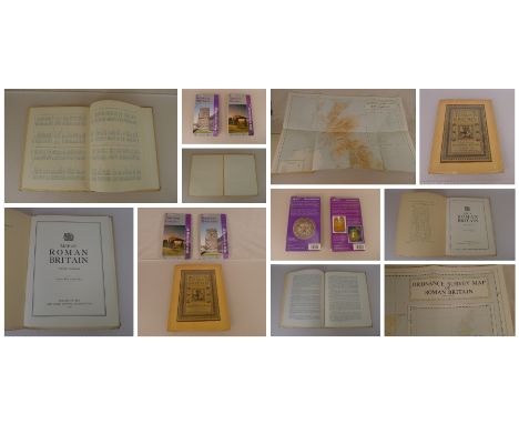
3 x Historical Maps comprising a large fold out Map of Roman Britain (Third Edition) published by The Ordnance Survey Chessington 1956, an Ordnance Survey Roman Britain Historical Map 5th Edition and an Ordnance Survey Roman Britain Historical Map, all three maps are in good, very good condition (see photographs. Good condition. All autographed items come with a Certificate of Authenticity. We combine postage on multiple winning lots and can ship worldwide. UK postage from £5.99, EU from £7.99, Rest of World from £9.99


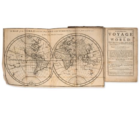
Rogers (Capt. Woodes) A Cruising Voyage Round the World: First to the South-Sea, thence to the East-Indies, and homewards by the Cape of Good Hope, second edition, engraved folding map frontispiece and 4 folding maps, bookplate of Frederick E. Ellis, his ownership inscription to front free endpaper, frontispiece trimmed at head along ruled border and with tiny hole to horizontal fold, one or two neat and expert repairs to other maps, occasional light foxing, the odd small stain but overall a crisp copy, contemporary panelled calf, rebacked, preserving rather worn backstrip, worn at corners, elsewhere rubbed, [Sabin 72754], 8vo, Printed for Andrew Bell & Bernard Lintot, 1718.⁂ Famous account of privateering in the South Seas. Rogers set out from Bristol with William Dampier as his pilot, travelling along the coasts of Chile and Peru to seek out Spanish prizes. He landed on the Juan Fernandez islands in order to shelter from a storm, and there rescued the marooned Alexander Selkirk, the inspiration for Defoe's Robinson Crusoe.
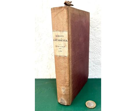
Egypt.- Light (Sir Henry) Travels in Egypt, Nubia, Holy Land, Mount Libanon, and Cyprus, in the year 1814, first edition, half-title, engraved map misbound as frontispiece, 19 plates (2 folding), vignettes, some foxing and offsetting, contemporary blind-stamped calf, a little rubbed, joints cracked, 4to, 1818.
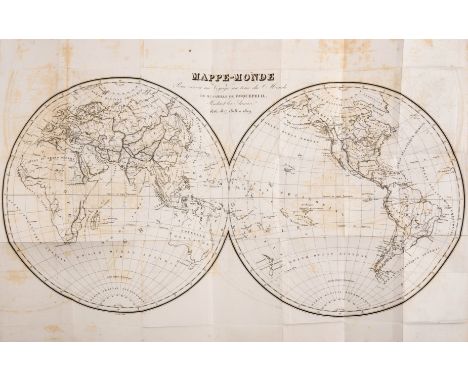
Roquefeuil (Camille de) Journal d'un Voyage Autour du Monde, Pendent les Années 1816, 1817, 1818 et 1819, first edition, 2 vol., 2 folding engraved maps, including double-hemisphere world map, contemporary ink ownership inscription of Mr. de Flavigny tipped-in before half-titles, maps with light offsetting, some foxing, contemporary calf-backed boards, spines gilt, rubbed, [Sabin 73149], 8vo, Paris, 1823.⁂ The scarce sole account of the third French circumnavigation of the globe. Commanded by Roquefeuil, the ship Bordelais visited the Pacific and Northwest coast of America, including Hawaii, California and Alaska.
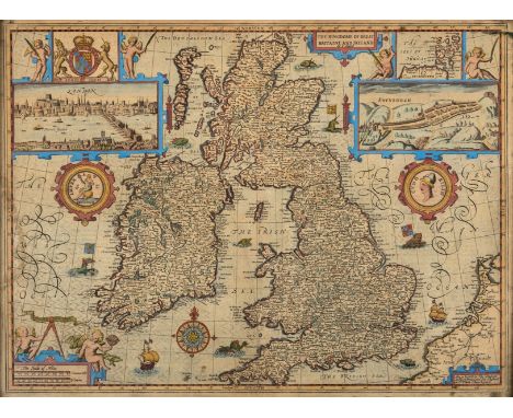
British Isles.- Speed (John) The Kingdome of Great Britaine and Ireland, map of the British Isles with inset panoramic views of London and Edinburgh, decorated with coat of arms, medals, putti, sea monsters, ships, a compass rose, and three cartouches, engraving with early hand-colouring, platemark 385 x 510 mm (15 x 20 in), sheet 405 x 530 mm (15 3/4 x 20 1/2 in), central vertical fold with repaired splitting, associated repaired tear running from tip of Welsh coast to the east coast of Ireland, some marginal nicks, tears, and small losses, even toning and surface dirt, framed, Bassett & Chiswell, [1676].
Voyages.- Roberts (Captain George) The Four Years Voyages of Capt. George Roberts; being a series of Uncommon events, first edition, 4 engraved plates, 1 folding engraved map, scattered spotting, lightly browned, bookplate, later calf, rebacked, bumping to corners and extremities, [Sabin 71888], 8vo, 1726.⁂ This work is occasionally attributed to Daniel Defoe, however this is disputed by Furbank and Owens.

Laplace (Cyrille Pierre Theodore) Campagne de Circumnavigation de la Frégate l'Artémise, 6 vol., half-titles, 31 engraved plates, 2 engraved maps with partial hand-colouring, tissue-guards, half-titles with lower outer corner torn away and repaired, also to portion of vol. 6 title, not affecting text, 1 map with short tear but no loss, some foxing, occasional browning, mostly to plates in vol. 6, contemporary red morocco-backed cloth, spines gilt, lightly rubbed, some faint spotting to spines, g.e., [Sabin 38983; Hill 981], 8vo, Paris, 1841-54.⁂ A handsome set of the official account of Laplace's second circumnavigation, most notable for its exploration of the relationship between colonial powers and the indigenous populations of the Pacific, including Tahiti and Hawaii.
Meares (John) Voyages Made in the Years 1788 and 1789, From China to the North West Coast of America. To which are Prefixed...A Voyage Performed in 1786, from Bengal, first edition, engraved portrait frontispiece, 17 engraved or aquatint plates, many folding and neatly mounted on stubs, 10 engraved maps and charts, list of subscribers, book-label of Carl Wendell Carlsmith to front free endpaper, 1 folding map with small hole to central fold, printing flaw to p.169 affecting text, offsetting, some light foxing or browning, contemporary marbled calf, rebacked, preserving original gilt backstrip, new spine label, corners repaired, rubbed, endpapers renewed, [Sabin 47260; Hill 1126; Abbey, Travel 594], large 4to, Printed at the Logographic Press, 1790.
Pacific.- Porter (Capt. David) Journal of a Cruise Made to the Pacific Ocean...in the United States Frigate Essex, 2 vol. in 1, first edition, engraved portrait and 13 plates, including 2 maps (1 folding), bookplate of Frederick E. Ellis, small marginal worming to first few leaves, map torn, repaired and silked, browning and light foxing throughout, p.107 with small portion of loss, affecting a few letters, contemporary marbled calf, neat repairs to spine, 8vo, Philadelphia, 1815.
India.- Burton (Sir Richard Francis) Goa, and the Blue Mountains; or, Six Months of Sick Leave, first edition, first issue, half-title, lithographed frontispiece and 3 plates, 1 folding map, old strengthened tape to folds verso, scattered spotting, faint marginal staining, ex-Barnsley Institute with occasional ink-stamps, number to first B1 in manusript, modern half-calf, [Penzer pp.37-38], 8vo, 1851.⁂ First issue of Burton's first work, with the frontispiece being the 'View of Old Goa.'
Middle East.- Saudi Aramco (publisher) North East Rub Al Khali, pilot's map with pencil annotations, on a scale 1:500,000, offset-lithograph printed in blue ink on fine linen, sheet 970 x 660 mm (38 1/4 x 26 in), stamped in ink on the reverse 'Confidential Material' and 'To R.F. Morris', some toning to old folds, hanlding creases, unframed, Arabian American Oil Co. Exploration Division, 1951 [with revisions to September 1953]

Pacific.- Agüeros (Pedro González de) Descripcion Historial de la Provincia y Archipielago de Chilóe, en el Reyno de Chile, only edition, engraved folding map and plate, map neatly mounted on stub, plate with minor and expert repairs, repaired tears to V3, V4, 2B1 and 2D3, affecting text but without loss of sense, occasional minor spotting, contemporary marbled calf, spine gilt with crimson morocco label, lightly rubbed, wear to spine ends, [Sabin 27822], 4to, [Madrid], Benito Cano, 1791.⁂ A rare history of Chile's largest island. The last 65 pages form an appendix on the Spanish colonisation of Tahiti.
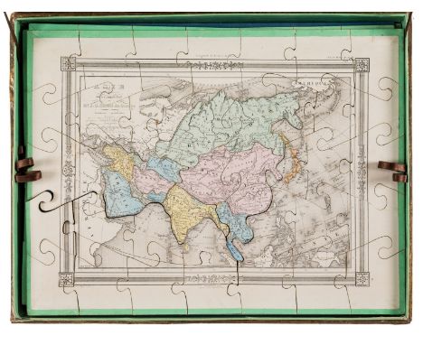
Puzzle Atlas.- Boxed set of eight jigsaw puzzle maps of the world, engraved maps with hand-colouring, laid down to wood and resting upon supporting card layer (loose), recent brown ribbon tags, a few pieces with chips or discretely replaced, together housed within original decorative paper-covered box with embossed lid, paper label of original retailer to lid underside, slight crack to lid, some toning, rubbed and worn, each map c.285 x 380mm., Paris, [late nineteenth century]
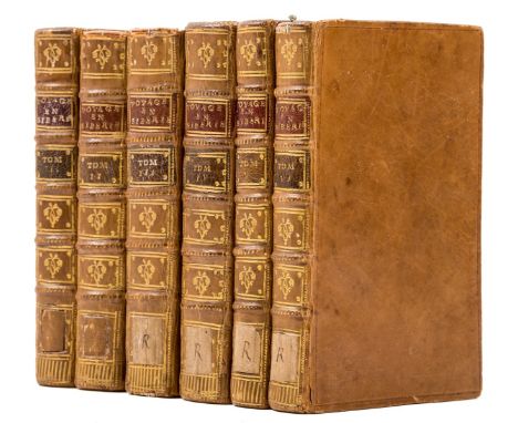
Russia.- d'Auteroche (Chappe) Voyage en Sibérie, 2 vol., folding engraved frontispiece, 5 engraved plates, 6 folding tables, 1769-70 § Kracheninnikow [(Stepan Petrovich)] Histoire et Description du Kamtchatka, 2 vol., 7 engraved plates (6 folding), large folding map of Kamchatka over 2 sheets, 1 bound in and other loosely inserted, 1770 § [?Catherine II, Empress of Russia.] Antidote, ou Examen du Mauvais Livre Superbement Imprimé Intitulé: Voyage en Sibérie..., 2 vol., 1771-72, half-titles, a few folding plates with short tears to inner margin but no loss, occasional slight browning or spotting, uniform contemporary polished calf, spines richly gilt, small paper labels to spine foot (removed and repaired to vol. 1 & 2), occasional small loss to spine head, lightly rubbed, an attractive set, small 8vo, Amsterdam, Marc Michel Rey. ⁂ The first two works, in four volumes, constitute d'Auteroche's famous account of his voyage to Siberia, as well as his translation of Krasheninnikov's history of Kamchatka. This edition is scarce compared with the first Paris edition of 1768, and while the exact number of plates appears to vary, is seemingly complete.
Arago (Jacques) Promenade Autour du Monde, 3 vol. including Atlas, first edition, half-titles, Atlas with engraved map and 25 lithographed plates, bookplate of Carl Wendell Carlsmith to front free endpapers, scattered foxing, Atlas with portion of marginal damp-staining throughout, modern half calf, spines gilt but a little sunned, Atlas in later boards with printed paper label to spine, rubbed at spine ends and corners, uncut, text partly unopened, [Hill 28; Ferguson 850], 8vo & folio, Paris, 1822.⁂ A personal and sometimes eccentric narrative of the Freycinet circumnavigation by the voyage's official artist, written in the form of letters to a friend. Extensive portions relate to Australia, with descriptions of Sydney and the Blue Mountains. The plates largely depict individuals encountered during the voyage.
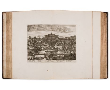
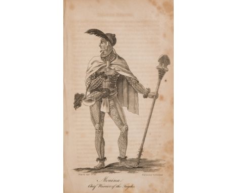
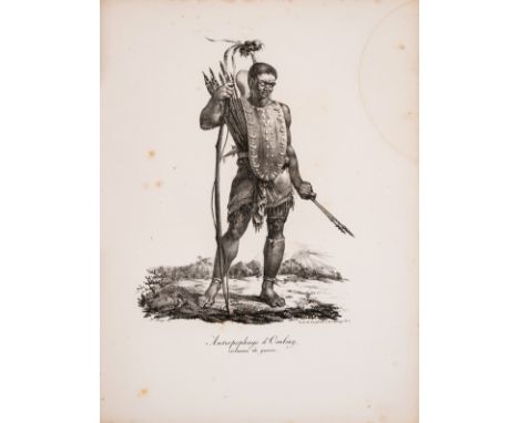
Japan.- Montanus (Arnoldus) Atlas Japannensis: being Remarkable Addresses by way of Embassy... to the Emperor of China, translated by John Ogilby, first English edition, large paper copy, engraved additional pictorial title, 24 double-page engraved plates and 69 illustrations in text, letterpress title in red and black (a little soiled), lacking map of Japan, some damp-staining towards end, a few small, neat repairs, bookplates of John Leveson Gower, 1st Earl Gower to title verso and of Gower Earl Gower, Richard Ponsonby-Fane and Strathallan to front pastedown, contemporary panelled calf, gilt arms of the Order of the Garter to upper cover, neatly rebacked, retaining original backstrip, rubbed, [Wing M2485], folio (440 x 320mm.), by Tho. Johnson, 1670.
-
109198 item(s)/page