![Rennie (George, Broum [Brown], Robert and Shirreff, John). General View of the Agriculture of the West Riding of Yorkshire, w](https://cdn.globalauctionplatform.com/4839b208-d815-4d8e-b853-aeeb010dbac6/b51ccee2-5633-419d-88a3-aeec0114538d/468x382.jpg)

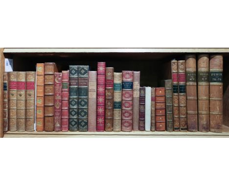
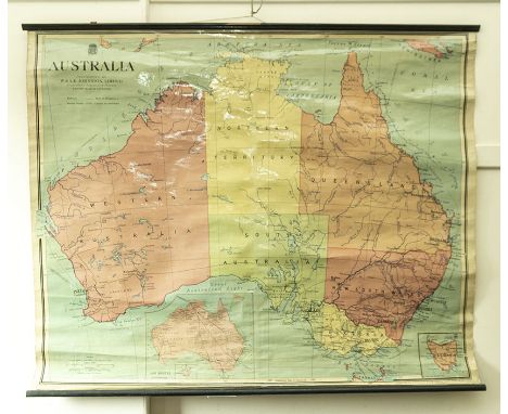
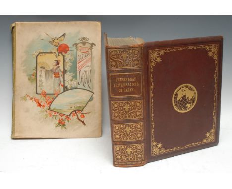
Rennie (George, Broum [Brown], Robert and Shirreff, John). General View of the Agriculture of the West Riding of Yorkshire, with observations on the means of its improvement, drawn up for the consideration of the Board of Agriculture and internal improvement, 1st edition, London: W. Bulmer & Co., 1794, single-page engraved map, 140pp., final few leaves with some rather heavy staining, half-title with contemporary ownership inscription of James Johnstone of Alva, some spotting to half-title and margins of preliminary leaves, bound with Leatham (Isaac). General View of the Agriculture of the East Riding of Yorkshire, and the Ainsty of the City of York, with observations on the means of its improvement..., 1st edition, London: W. Bulmer & Co., 1794, single-page hand-coloured map, five single-page engraved plans, and two uncoloured aquatint plates of sheep, 68pp., some minor marks and final leaf with some spotting, contemporary calf-backed marbled boards, worn with covers near detached, small 4to, together withStillingfleet (Benjamin). Miscellaneous Tracts relating to Natural History, Husbandry, and Physick. Two which is added the Calendar of Flora, 2nd edition, corrected and augmented with additional notes throughout, particularly on some of the English grasses, London: R. & J. Dodsley, 1762, eleven engraved plates of grasses, mostly light spotting, marbled endpapers, contemporary mottled calf, somewhat worn with joints cracked and spine labels missing, 8vo, plus a defective copy of Charles Leigh, The Natural History of Lancashire, Cheshire, and the Peak, in Derbyshire, 1st edition, Oxford, 1700, lacking the portrait frontispiece and double-page hand-coloured engraved map by Moll, and with 22 of the 24 engraved plates, some marks, contemporary calf, some minor marks and minor defects, contemporary calf, heavily worn with back strip mostly deficient, folioQTY: (3)
We found 109182 price guide item(s) matching your search
There are 109182 lots that match your search criteria. Subscribe now to get instant access to the full price guide service.
Click here to subscribe- List
- Grid
-
109182 item(s)/page
Bloomfield (Robert). The Farmer's Boy. A Rural Poem, 2nd edition, London: printed by T. Bensley for Vernor and Hood, 1800, wood-engraved illustrations, some light spotting and toning, bookplate of A C Sewter (1912-1983, art critic and curator), contemporary sprinkled calf, upper joint cracked, a little rubbed, 8vo, together with Irving (Washington). The Life and Voyages of Christopher Columbus; together with the voyages of his companions, 3 volumes, new and revised edition, London: John Murray, 1849, folding map to volumes I & II, contemporary tan calf gilt by Hayday, 8vo, plus Gay (John). The Shepherd's Week. In six pastorals, 2nd edition, London: printed for J.T., 1714, engraved frontispiece, 6 engraved plates, a little light toning, contemporary owner signature to title, disbound, 8vo, with others including Charles Dickens' Master Humphrey's Clock, volumes II & II only (of 3), 1st edition, 1841, Catalogue of a Collection of Engraved Portraits... Connected with the history and literature of this country/Catalogue of Engraved British Portraits... Connected with the history & literature of Great Britain, the British Colonies and the United States of America, 2 volumes, circa 1850, The Poems of Oliver Goldsmith, edited by Robert Aris Willmott (with colour illustrations by Birket Foster & H.N. Humphreys), 1859, George Cruikshank's Table Book, edited by Gilbert Abbott A Beckett, new edition, 1869, George Cruikshank's Omnibus, edited by Laman Blanchard, new edition, 1870, and English Inn Signs, 1951 (in a deluxe binding by the Collectors Book Club, London)QTY: (27)
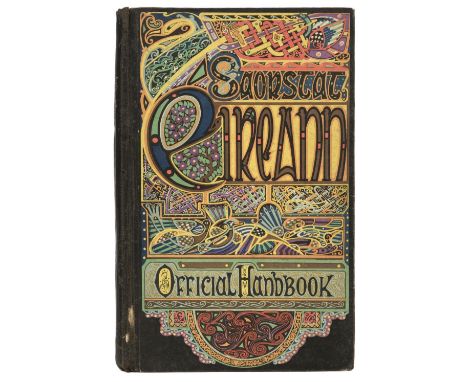
Conall (Donnachadh M.). Reul-Eolas: Annas Am Bheil Cunntas Air Cuspairibh An Rian-Ghreine;...Edinburgh: Oliver & Boyd, 1857, monochrome illustrations, a folding plate of the solar system, pencil annotation to the head of pp.29, some light toning & spotting, original brown cloth, boards slightly marked, boards & spine slightly rubbed with minor fading, small 8vo, together with:Bulmer (Hobson, editor), Saorstát Eireann, Irish Free State Official Handbook, Dublin: The Talbot Press, 1932, 45 monochrome plates, folding map to the rear pocket, period inscripton the the head of the front endpaper, some minor toning, original black cloth with illustrated boards, boards & spine lightly rubbed with some minor loss the front hinge, 8vo, plusGibson (William), The Year Of Grace: A History Of The Ulster Revival Of 1859, Edinburgh: Andrew Elliot, 1860, ex-library book plate to the front pastedown, period inscriptions to the front endpapers, gutters cracked, some light toning throughout, heavy toning to pp.210/211 from a folded scrap of newspaper, original brown embossed cloth, spine slightly toned & rubbed to head & foot with some minor loss, 8vo, and 6 futher volumes of Irish literature & reference, including, Disturbed Ireland, The Plan of Campaign Estates, by T. W. Russell, London: Truslove & Shirley, 1889, 8vo, Vindiciae Hibernicae; or, Ireland Vindicated:..., by M. Carey, 3rd edition, Philadelphia, 1837, 8vo, all original cloth, 8voQTY: (9)
Schweinfurth (Georg). The Heart Of Africa..., 2 volumes, London: Sampson Low, Marston, Low and Searle, 1873, monochrome illustrations, folding map to the front of volume 1, some toning & light spotting throughout, ex-library copy with bookplates to the front & rear pastedowns & associated marks, contemporary red half calf, boards & spines rubbed, 8vo, together with:Smith (A. Donaldson), Through Unknown African Countries, The First Expedition from Somaliland to Lake Rudolf, London: Edward Arnold, 1897, monochrome illustrations, 6 folding maps to the rear, some toning & light marks throughout, ex-library copy with bookplates to the front & rear pastedowns & associated marks, contemporary half calf, boards & spine rubbed, 8vo, plusEnriquez (C. M.), Kinabalu, The Haunted Mountain of Borneo..., London: H. F. & G. Witherby, 1927, 13 monochrome illustrations including a map, some marginal spotting & toning, original cloth, boards & spine lightly rubbed to head & foot, 8vo, and other late 19th & early 20th-century travel reference & related, including The Exploration Of The Caucasus, 2 volumes, by Douglas W. Freshfield, 2nd edition, London: Edward Arnold, 1902, ex-library copy with associated marks, original blue cloth, large 8vo, & approximately 40 issues of L'Écho Des Alpes, Organe Mensuel du Club Alpin Suisse, & La Montagne, Revue Mensuelle du Club Alpin Français, all in original wrappers, mostly original cloth, some ex-library copies with associated marks, 8voQTY: (Approximately 80 )

Folio Society. A Secret Pilgrimage To Mecca And Medina, by Richard Burton, 2004, includes a folding map, Seven Pillars Of Wisdom, by T. E. Lawrence, 2000, Charlemagne, Father of a Continent, by Alessandro Barbero, 2006, Mass-Observation, Britain in the Second World War, edited by Sandra Koa Wing, 2007, The Folio Book of Historical Mysteries, edited by Ian Pindar, 2008, as new in original plastic wrap, together with 77 further volumes of Folio Society publications, all non-fiction, all original cloth, 68 volumes in slipcases, some minor damp marks to some of the slipcases, G/VG, 8voQTY: (82)


JACOBITE RISING OF 1745 MAP OF CULLODEN MOOR J. Gowie. Edinburgh: W. Forrester, 1846. Folding linen backed map 'Map of Culloden Moor and part of the Adjacent Country, on which are laid down the different Roads leading to the Field of Battle fought on the 16th April 1746., 72.5 x 51cm, original red cloth covers


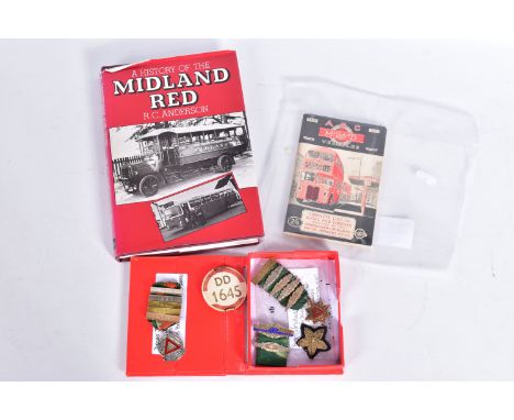
A BUS DRIVERS P.S.V. LICENCE BADGE AND SAFE DRIVING MEDALS, silver (J.A. Wylie & Co., Birmingham 1938) National Safety First Association Safe Driving Competition 5 Years Driver Award Medal named to J.C. Linford with badges/bars for 1938, 1939, 1940, 1941 and 1942, with a R.O.S.P.A 10 Years Safe Driving Medal (W. Fattorini, Birmingham) with badges/bars for 1943, 1944, 1945, 1946 and 1947, with a badge for 15 Consecutive Years (1948) and bar for 1949, 20 years' Service Star, all awarded to Mr. J.C. Linford who worked at the Stafford garage of B.M.M.O./Midland Red, all are in fairly good condition but drivers badge has some fading and wear, with a copy of the 1948 1st edition of the Ian Allan ABC of Midland Red, complete with map, good condition, no markings or underlining's, rusting to staples and minor damage/wear to cover (original issue not 1998 reprint) and a copy of a History of the Midland Red by R.C. Anderson published by David & Charles in 1984, good condition but has some damage, wear and fading to dust jacket


Of Antiquarian Interest - The Sacred Bible of the Old and New Testament: According to a published edition with greater study than ever before, for the study of the learned and proven Hebrew truth. the revised fidelity of the copies / with figures and descriptions, including the chorus, in which the structures of the various buildings and works and the regions are placed before the eyes of all. Publisher in: Geneva : with Peter Santandreanus , 1574. 435pp to include one map.


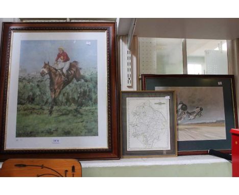
A collection of pictures to include; C Morris, landscape with a shepherd, oil on board, frame and glazed, 14cm x 19cm; Figures in front of architectural ruins, oil on canvas, framed 21.5cm x 28cm; Harold Forster, 'The Sad Jester', watercolour, framed and glazed, 42cm x 33cm; a map of Berkshire by Robert Morden; an ordinance survey style map of Milton; a map of Oxfordshire engraved by John Cary; and further pictures and maps (12)Frames with dents and scratches consistent with use; maps with foxing and discolouration; Morris picture in good condition; figures in front of ruins with some craquelure.

A group of four antique maps comprising Xaintonge together with pages from the description of the country of Xaintonge, Stafford Countie and Towne, a New and Accurate Map of Africa by Thomas Bowen and Gironide, all framed and glazed, the largest 52cm x 39cmXaintonge, Stafford and African map with fold creases, all maps with signs of discolouration to the edges


Edition of Homann's map of Suabia, etc., extending from Manheim, Straussburg and Basel on the Rhine River, to the Loch River and Fussen (train stop for day trips to Ludwig's Castle). Centered on the Boden See and the Upper Donau River. A striking dark impression of this edition of Homann's map, pre-dating Homann's receipt of his Priviledge.Sheet Size: 20.25 x 23 in. Unframed.

Collection of Early and Interesting Books on the History of Minorca, ie Journal Historique de La Conquete de L'Isle Minorque, 1st Edition 1756, 174pp., plan of Fort St Philippe & Port Mahon,table Combat Naval du 20 Mai 1756. Some foxing, very good in handsome "leather" binding. Armstrong, The History of the Island of Minorca, folding plate of Island, Dublin, 1756. Note Preface has been mis bound towards end of book. Some foxing, neat bookplate, full leather raised bands etc., The History of the Island of Minorca by John Armstrong, 1752, 1st Edition with folding map and letter from Richard Kane bound in at front (only published in later 2nd Edition), another copy with map repair and loose endpaper etc. Also Observations on the Epidemical Diseases in Minorca from the year 1744 to 1749 ... by George Cleghorn Third Edition 1768, Half leather very nice condition. together with an American edition of Cleghorn's book printed in 1809, some staining to endpapers, else good copy, leather binding and two further editions, (8)


William Faden, circa 1800, The Country Twenty-Five Miles Round London, engraved and partly hand coloured large folding map backed on to linen. In 36 plates, (one plate detached, some wear and slight discolouration) 103cm x 83 21, together with Parish of Clerkenwell engraved by James Wyld, published by J.T. Pickburn, a People's Weekly Edition of Cassell's Old & New London (1720) and The Graphic Map (1890) map of South-Central Africa Showing the British & German Possessions

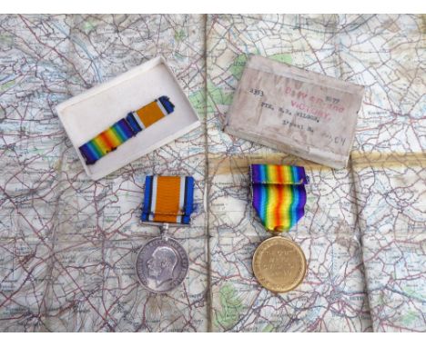
The Victory and War Medals to 2353 PTE. R.B. WILSON - L'POOL R. Together with a 1916 linen-backed map of Hazebrouck (Flanders) showing signs of much use in the Givenchy and Vielle Chapelle areas. (Belgium 1:100,000 Edition 2 - Hazebrouck 5A (1916)). Soldier's name indistinctly signed 'Sgt? Wilson'.


![Arctic and Polar Exploration - Nansen (Fridtjof), The Norwegian Polar Expedition 1893-1896/"Farthest North" [...], two-volume](https://cdn.globalauctionplatform.com/8f09b207-1d82-4f0a-9189-aed900cda020/5854775a-f65e-4f8d-aef0-aee10124488b/468x382.jpg)
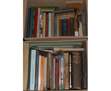
Arctic and Polar Exploration - Nansen (Fridtjof), The Norwegian Polar Expedition 1893-1896/"Farthest North" [...], two-volume set, first edition, London: George Newnes, Ltd., 1898, illustrated with 1 chromolithograph after Dr Nansen, fold-out coloured map/chart, b/w full-page and in-text illustrations, original publisher's pictorial cloth, red-speckled edges, 8vo, [2]

Byronmania, Messrs Pott and Neale of Nottingham, Particulars and Conditions of Sale of the Venerable Abbey and Baronial Residence of Newstead, Nottinghamshire, [...] Will be Sold by Auction [...] At the Auction Mart, Bartholomew Lane, Opposite the Bank of England, [London], On Wednesday, the 13th day of June, 1860, at 12 at Noon, In One Lot, the auction catalogue illustrated with 2 named-view full-page lithographs of the country house by Waterlow & Sons, 1 plan of it and its gardens, 2 plates of its floorplan, and 1 large three-fold hand-coloured map of the estate and its parochial liberties, original cloth over printed paper wrappers, royal folio (50cm 32cm), (1); Local Interest, The Wollaton Estate, Nottingham, Part III, Portions of the Estates of [...] Lord Middleton, 23rd & 24th March, 1925, b/w plates and plans, original paper wrappers, crown folio (40.5cm x 25.5cm), (1), [2]
Japan - Morton-Cameron (W.H.) & Feldwick (W., editor), Present Day Impressions of Japan: The History, People, Commerce, Industries and Resources [...], first edition, London: The Globe Encyclopedia Company, 1919, title-page and prelims chromolithograph-printed, profusely illustrated throughout, fold-out colour map, original publisher's decorative binding of brown leather gilt (slightly rubbed, split and chipped upper-joint on upper-cover), all-edges gilt, marbled endpapers, large 4to, (1); Netto (C.) & Bender (Paul, illustrator), Papier-Schmetterlinge aus Japan, first edition, Leipzig: T.O. Weigel, 1888, 1 chromolithographic plate, further monochrome lithographs, in-text illustrations, original publisher's cloth over papered pictorial boards, crown folio (36.5cm x 28cm), (1), [2]
Local Interest – A History of Arnold, Nottinghamshire, Map and Collotype Illustrations, Nottingham: Henry B. Saxton, 1913, original cloth, 8vo, (1); further early 20th century and later parish and city histories, various, including West Bridgford, etc; Felkin’s History of Machine-wrought Hosiery and Lace Manufactures, subscriber’s copy, Cambridge: W. Metcalfe, 1867, original cloth (chipped, worn, losses), 8vo, (1); Nottingham almanacs and directories, various imprints and dates, mostly original bindings; Henry Kirk White; topography and antiquities; etc., [approx. 40]
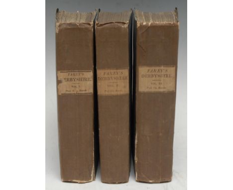
Local Interest - Farey (John, Senior), General View of the Agriculture and Minerals of Derbyshire; with Observations on the Means of their Improvement. Drawn up for the Consideration of The Board of Agriculture and Internal Improvement, three-volume set, volumes I & II second editions, volume III first edition, London: Printed by B.M'Millan [...], 1815, pp: xlvii, 532, [2], [2], & illustrated with 3 folding tables (belonging to vols. II & III too), 2 folding hand-coloured maps, 2 similar geological sections, & 1 hand-coloured plate of strata; xx, 522, [2], [2], & illustrated with 4 plates; xxvii, 725, [2], & illustrated with 2 plates and 1 folding county map, uniformly bound and rare in original publisher's two-tone cloth, titled paper labels to each spine, 8vo, [3]
![Local Interest - Glover (Stephen) & Noble (Thomas, editor): The History Gazetteer, and Directory of the County of Derby [...]](https://cdn.globalauctionplatform.com/8f09b207-1d82-4f0a-9189-aed900cda020/f6614932-4db2-4b29-8833-aee10125037b/468x382.jpg)
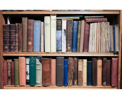
Local Interest - Glover (Stephen) & Noble (Thomas, editor): The History Gazetteer, and Directory of the County of Derby [...], Illustrated by a Map of the County, and Numerous Copper-plate and Wood Engravings by the First Artists, two volumes (all published), Derby: Henry Mozley and Son, 1829 & 1833, in-keeping 20th century half-calf over marbled boards, retaining their contemporary lettered title-labels, later endpapers, 8vo, (2), [&] The Peak Guide, with Plates and Pedigrees, Derby: Henry Mozley and Son, 1830, original publisher's cloth boards, printed paper label to upper-cover, 8vo, (1), [3] Provenance: 2nd: 1) George Folliott, contemporaneous armorial bookplate to recto pastedown; 2) L. Udall, 1973, MS pencil inscription above.
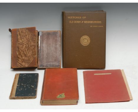
Local Interest - Lipscomb (George, Esq), A Description of Matlock-Bath; with an attempt to explain the Causes of Heath, and of the Petrifying Quality of the Springs: to which is added, some account of Chatsworth, Kedleston, and the Mineral Water of Quarndon and Kedleston, first and only edition, Birmingham: Printed by the Executors of T.A. Pearson, 1802, original boards, later pencil ownership inscription: L. Richmond, 8vo, (1); Adam (W.), The Gem of the Peak; or Matlock Bath and its Vicinity [...], London: Longman & Co., 1838, map frontispiece, engraved title-page and plates, repaired calf, 12mo in 6s, (1); [Cox (The Rev. Thomas)], Derbyshire, off-print complete with fold-out map, from Magna Britannia, [London, In the Savoy: E. and R. Nutt, 1720-1731], later issued title-page and wrappers, 4to, (1); Keys (John) & Gadd (George Frederick, editor), Sketches of Old Derby and Neighbourhood, London: Bemrose and Sons, Limited, 1895, original cloth, 4to, (1); [Cartography], Cary (John, engraver), Cary's Traveller's Companion; or, a Delineation of the Turnpike Roads of England and Wales; [...] [with] a New Set of County Maps [...], third edition, London: Printed for John Cary, Engraver, Map & Printseller, Strand, 1791, illustrated with some fold-out and other full-page hand-coloured engraved maps, black-ruled tables, late 19th century half-calf (faults, rubbed and chipped losses), 8vo, (1); etc., [6]
Local Interest - Pilkington (James), A View of the Present State of Derbyshire; with an Account of its Most Remarkable Antiquities; Illustrated by an Accurate Map and Plates, two-volume set, Derby: J. Drewry, 1789, 20th century quarter-calf over printed marbled boards, red-speckled edges, 8vo, (2); Davies (The Rev. D.P.), A New Historical and Descriptive View of Derbyshire, from the Remotest Period to the Present Time, Embellished with a Map and Plates, Belper: Printed and Published by and for S. Mason, 1811, later 19th century oxblood quarter-morocco gilt over cloth, marbled edges and endpapers, 8vo, (1), [3]
Local Interest – Shilton (Richard Phillips), The History of Southwell […[, Newark: S. & J. Ridge, 1818, frontispiece, once owned and annotated by The Reverend Canon R.F. Smith, of Vicar’s Court, Southwell, 20th century half-calf over marbled boards, 8vo, (1); Allen’s Illustrated Hand-book and guide to Nottingham and its Environs, Nottingham: Richard Allen & Son, 1866, illustrated, original cloth, 8vo, (1); Presentation Copy from the Author, Bramley’s Guide to Nottingham Castle, Nottingham: Shepherd Brothers, [n.d., c. 1860]; further histories and guides to the city of Nottingham and its antiquities, mostly provincial Nottingham imprints, various bindings of original cloth or wrappers, mixed sizes, various; Wake’s History of Collingham […], Cheaper Edition, Newark-upon-Trent, 1869, original wrappers, 4to, (1); Stapleton (Alfred), All about the Merry Tales of Gotham, Nottingham, 1900, later leather, 12mo, (1); two copies of Cox’s Nottinghamshire, 1700, only 1 map present between the two, various states and bindings, 4to, (2); Pigot’s Directory of Nottinghamshire & Rutland, 1828-9, fold-out county map, 20th century gilt-lettered calf over marbled boards, 8vo, (1); Ilkeston; etc., [approx. 20]

Tolkien (J.R.R.) & Tolkien (Christopher, editor), The Silmarillion, first edition, London: George Allen & Unwin, 1977, complete with the map of Beleriand and The Lands of the North, original pictorial dustjacket over blue cloth, 8vo, (1); Kerr on horse-riding, two works, 1891 & 1894, (2); Swayne (Henry James Fowle), Churchwardens' Accounts of S. Edmund & S. Thomas, Sarum, 1443-1702 [...], Salisbury: Bennett Brothers, 1896, large fold-out frontispiece, original cloth, 8vo, (1); Maiden Castle, Dorset, 4to, (1); etc., [6]
Topography – Kelly’s Post Office Directory of Derbyshire, Leicestershire, Nottinghamshire, and Rutlandshire, with Maps Expressly for the Work […], Subscriber’s Copy, London, 1855, original cloth (chipped), contemporary ink MS. ownership inscription: William Lloyd, dated 1855, 8vo, (1); Poole (George Ayliffe) & Hugall (J.W.), An Historical & Descriptive to York Cathedral and its Antiquities, York: R. Sunter, [n.d., 1850], contemporary papered boards, 4to, (1); Fletcher (J.S.), Picturesque History of Yorkshire […], six-volume set, London: The Caxton Publishing Co., [n.d., 1903-04], original cloth, 4to, (6); Scotland, five Chromo-view Guide Books, cloth, (5); map of Scotland, 1842, (1); Our Beautiful Homeland, six volumes; Ireland; etc., [approx. 25]
-
109182 item(s)/page