We found 109198 price guide item(s) matching your search
There are 109198 lots that match your search criteria. Subscribe now to get instant access to the full price guide service.
Click here to subscribe- List
- Grid
-
109198 item(s)/page
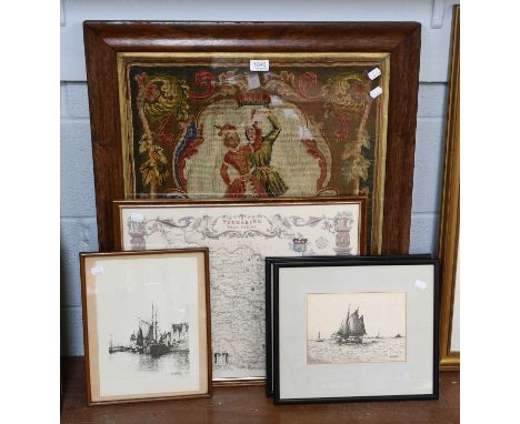


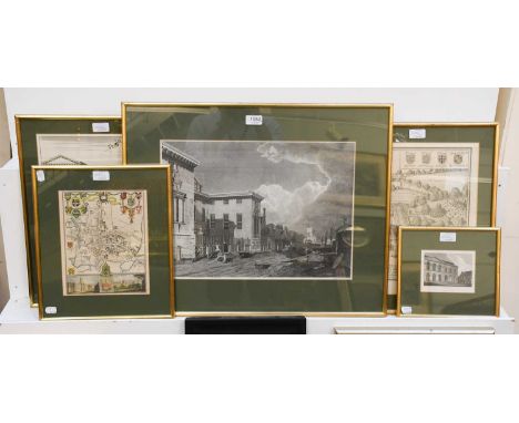
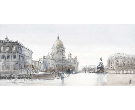
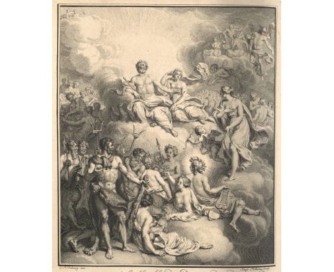
Lot 1081
After Philips Wouwerman (1619-1668)''Les Sangliers Forces''Black and white engraving; together with a map of Leicester, two black and white prints, a print of Lancaster castle, a print of the resurrection , a landscape watercolour, a Russian watercolour of St Issac's catherdral and a painted panel river landscape inlaid with mother of pearl (9)

Lot 121
China - - Frank Dorn. A Map and History of Peiping. With Explanatory Booklet. Sowie: The Map of Peiping with Street Directory (Alphabetical and Numerical). Mit mehrfach gefalteter chromolithogr. Karte von Peiping (Peking). Tientsin-Peiping, The Peiyang Press, 1932 bzw. 1936. (I) 1 Bl. 22 S. (II) 20 S. Kl.-8°. OHLwd d. Zeit mit Einstecklasche und OKt. (im Rand etw. knickspurig u. mit kl. Einrissen). Der mehrfach gefaltete und chromolithographische Stadtplan (ca. 61 x 50 cm) von 1932 hier als Einlage im Reiseführer von Frank Dorn aus dem Jahr 1936. In dieser wohl originalen Zusammenstellung sehr seltene Publikation. Diese Broschüre und Karte war ursprünglich eine Ergänzung zu dem "Peiping Shopping Guide". Mit alphabetischen Register der Straßen in romanisierter Schreibweise sowie chinesischer Schrift. - Die erläuternde Broschüre Frank Dorns umschreibt in kurzer Zusammenfassung die Geschichte der Stadt, listet die versch. Dynastien Chinas seit ca. 3000 v. Chr. auf und geht schließlich auf einzelne Sehenswürdigkeiten der auf der Karte genannten Orte mit kurzen Beschreibungen ein. - Papierbedingt zart u. gleichmäßig gebräunt, wenige Bll. etwas stärker, mehrere Bll. betreffende punktuelle Druckstelle, im Randbereich tls. etw. knickspurig. Der Plan von Peking bis auf wenige kleine Stockflecken im Rand u. kl. Einriss in der Falz in sehr schönem Zustand, die Farben kräftig erhalten. With multiple folded chromolithographic map of Peiping (Beijing). Contemporary half cloth with flap and original cardboard binding (in the margins somewhat creased and with small tears). - The multi-folded and chromolithographic city map (ca. 61 x 50 cm) from 1932 here as an insert in the travel guide by Frank Dorn from 1936. In this probably original compilation very rare publication. This brochure and map was originally a supplement to the "Peiping Shopping Guide". With alphabetical index of the streets in romanized form as well as Chinese characters. - The explanatory brochure by Frank Dorns briefly describes the history of the city, lists the different dynasties of China since ca. 3000 B.C. and gives short descriptions of individual sights of the places mentioned on the map. - Paper conditionally lightly and evenly browned, a few p. somewhat stronger, several p. concerning punctual pressure mark, in the marginal area partly somewhat creased. The map of Peking in very fine condition, except for a few small foxing spots in the margin and a small tear in the fold, the colours well preserved.
Lot 305
François de Salignac de La Mothe Fénelon. Les Avantures de Télémaque, fils d'Ulysse. Par feu Messire François de Salignac, De la Mothe Fénelon, Précepteur de Messeigneurs les Enfans de France, & depuis Archevêque-Duc de Cambray, Prince du Saint Empire. Nouvelle Édition, Conforme au Manuscrit original, Et enrichie de Figures en taille-douce. Mit gest. Frontispiz, gest. Porträt, gest. Karte, 24 Kupfertafeln sowie zahlreichen Vignetten. Amsterdam, J. Wetstein und G. Smith, Rotterdam, J. Hofhout, 1734. 2 Bll., X, XXVII (recte XVII), 424 S. 4°. Geflecktes Kalbsleder d. Zt. auf 5 Bünden mit reicher verg. RVerzierung und RSchild. Steh- und Innenkantenfileten, Marmorvorsätze, Rotschnitt. (Etwas berieben und bestoßen, Gelenke angeplatzt, oberes Kapital mit Fehlstelle) Brunet II, 1214. Fürstenberg 71. Sander 657. Cohen-R. 381. - Wunderbar illustrierte Ausgabe dieses Meisterwerks des 18. Jahrhunderts, einschließlich der drei oft fehlenden Blätter der Ode am Ende und der Kupferstichkarte "Carte des voyages de Télémaque selon Mons.r Fénelon par le S.r Rousset". Die Tafeln gestochen u.a. von Folkema nach Dubourg und Picart und Gunst nach Debrie. Das Porträt des Autors von Drevet nach Vivien. - Papierbedingt gebräunt und vereinzelt etwas fleckig. 1 Bl. im unteren Rand hinterlegt. Insgesamt wohlerhalten. With engr. frontispiece, engr. portrait, engr. map, 24 copper plates and numerous vignettes. Cont. mottled calf with rich gilt ornamentation and label on spine. (Somewhat rubbed and bumped, joints chipped, upper capital with missing part). - Wonderfully illustrated edition of this 18th century masterpiece, including the three often missing leaves of the ode at the end and the engraved map "Carte des voyages de Télémaque selon Mons.r Fénelon par le S.r Rousset". The plates engraved by Folkema after Dubourg and Picart and Gunst after Debrie, among others. The portrait of the author by Drevet after Vivien. - Paper browned and a little bit stained in places. 1 sheet backed in lower margin. Altogether in good condition.

Lot 148
Marokko - - James Grey Jackson. An Account of the Empire of Marocco, and the District of Suse. Compiled from Miscellaneous Observations Made During a Long Residence in, and Various Journeys Through, those Countries, to Which is Added an Account of Timpuctoo, the Great Emporium of Central Africa. Mit 11 (2 koloriert, 5 gefalt.) Aquatintatafeln und 2 gefalt. Kupferstichkarten. London, W. Bulmer, 1809. xvi, 287 S. 4°. Mod. Lwd. mit goldgepr. schwarzem RSchild. Abbey 296. - Gay 1248. - Henze II, 696. - Graesse III, 441. - Vgl. Brunet III, 477 (3. Ausgabe). - Umfangreiche Reisebeschreibung über das Königreich Marokko. Behandelt wird die Geographie, die Flüsse, Klima, Berge, Kultur, Wirtschaft, Zoologie (insbesondere Schlangen), Metallurgie, Mineralogie, Bevölkerung, der Islam und die Sprachen, sowie die Pandemie 1799/1800. - "Jackson lebte sechzehn Jahre in verschiedenen Teilen Marokkos, wo er emsig Nachrichten über dieses Land wie auch über das Innere Nord-Afrikas, u.a. über Handel und Handelsstraßen nach Timbuktu und diese Stadt selbst, einzog" (Henze). - Eine Karte mit kleinen Defekten, nur seltener minimal fleckig bzw. gebräunt. Gutes Exemplar. Arabia - Northafrica - Morocco - With 11 (2 coloured, 5 folded) aquatint plates and 2 folded copper engraved maps. Mod. cloth with gilt stamped black spine labels. - Extensive travel description of the Kingdom of Morocco. Covers geography, rivers, climate, mountains, culture, economy, zoology (especially snakes), metallurgy, mineralogy, population, Islam and languages, as well as the pandemic of 1799/1800. - "Jackson lived for sixteen years in various parts of Morocco, where he assiduously gathered news about that country as well as about the interior of North Africa, including trade and trade routes to Timbuktu and that city itself" (Henze). - One map with small defects, only rarely minimally spotted, resp. browned. Good copy.

Lot 158
Südost-Asien - Indonesien - Philippinen - - Thomas Forrest. Voyage aux Moluques et a la Nouvelle Guinée, fait sur la galere La Tartare en 1774, 1775 & 1776 par ordre de la Compagnie Angloise. Mit 1 gefalt. Kupferkarte u. 27 teils gefalt. Kupfertafeln. Paris, Hôtel de Thou, 1780. 3 Bll., 470 S., 1 Bl. 4°. Ldr. d. Zt. mit RSchild u. reicher RVerg. (nur minimal berieben). Erste franz. Ausgabe. - Graesse II, 616. - Henze II, 261. - vgl. Eutiner Landesbibl. I, 436 (engl. Ausgabe): "Kapitän Forrest erkundete im Dienst der Englisch-Ostindischen Compagnie in den Jahren 1774-76 zahlreiche indonesische und philippinische Inseln. Er war 1770 beauftragt worden, auf Balambangan neue Kolonien anzulegen. Die mehr als zweijährige Reise führte in einem winzigen Schiff durch die südostasiatischen Küstengewässer. Forrests Bericht zeichnet u.a. auch die Entdeckungsgeschichte Ostindiens und die konkurrierenden europäischen Handelsinteressen nach." - "Sein 1779 erschienenes Reisewerk brachte vielerlei Neues über den O Insulindes ... und besondere Bedeutung kommt ihm zu als 'Erstem genauen Beobachter von Neu-Guinea'" (Henze). - Mit dem häufig fehlenden "Vocabulaire des la langue Magindano". - Die Tafeln mit Karten, Ansichten und völkerkundlichen Darstellungen. - Etwas gebräunt bzw. etwas fleckig, bis etwa S. 40 stärker, die Tafeln etwas gebräunt bzw. braunfleckig, sonst meistens wohlerhalten. Southeast Asia - South Seas - Moluccas - New Guinea. - First French edition. - Contains the often missing "Vocabulaire des la Langue Magindano". - With 1 folded copper engraving map and 27 (some folded) copper engraving plates. - Contemp. calf, label and gilt to spine (minimally rubbed). - "Captain Forrest explored numerous Indonesian and Philippine islands in the service of the English East India Company in 1774-76. In 1770 he was commissioned to establish new colonies on Balambangan. The voyage, which lasted more than two years, took him in a tiny ship through the coastal waters of Southeast Asia. Forrest's report also traces, among other things, the history of the discovery of East India and the competing European trade interests". - His travelogue, published in 1779, brought many new facts about the O Insulindes ... and he is of special importance as the 'first precise observer of New Guinea'". (Henze). The plates with maps, views and ethnographic illustrations. - Somewhat browned and somewhat stained, heavier up to about p. 40, the plates somewhat browned resp. brown-stained, otherwise mostly in good condition.

Lot 116
Giovanni Botero. Allgemeine Historische Weltbeschreibung ... in vier Bücher abgetheilt: Im ersten wirdt Europa, Asia, Affrica, vnd die Sitten ..., im andern wirdt die Macht..., im dritten wirdt gehandlet von dem Standt deß Glaubens ..., im vierten von den Aberglauben der Völcker der Newen Welt. 4 Teile in 1 Bd. Mit Titel in Rot und Schwarz und Holzschnittvignette sowie 5 doppelblattgroßen Kupferstichkarten. München, N. Henricus für A. Hierat, 1611. 10 Bll., 471 S. 4°. Flexibler Pgt. d. Zt. mit hs. RTitel u. fragmentarisch erhaltenem RSchild (berieben, bestoßen, etw. fleckig, die Schließbänder entfernt). Staatsbibliothek Berlin: Kriegsverlust. - VD 17 23:233078R. - Alden 611.6. - JCB II, S. 74. - Borba de Moraes (1983), S. 113. - Dünnhaupt 34.1. - Sabin 6808. - Erste vollständige deutsche Ausgabe mit Karten von Quad. Zuvor erschien 1596 eine Ausgabe in Köln, welche jedoch nur die Tle. I-II der 1591 erschienenen Originalausgabe enthält. - "Topographisch-historische Darstellung der gesamten damals bekannten Welt. Der schon 1507 von Martin Waldseemüller geprägte Name "America" hat bei Albertinus ein Jahrhundert später den Ausdruck "Newe Welt" offenbar noch immer nicht verdrängt" (Dünnhaupt). Teil I behandelt die Alte Welt, die Teile II u. III handeln von Herrschern und dem Christentum, der IV. Teil widmet sich dem Aberglauben, in welchem die Völcker der Newen Welt leben" sowie der Geschichte der christlichen Mission in Südamerika. Die detaillierten Karten von Johann Bussemacher (für Matthias Quad, erstmals 1596) zeigen die Welt (Shirley 197, 2. Zustand ab 1600), Europa, Asien, Afrika und Nordamerika (Novi orbis pars borealis, Burden 133 Anm.: "There is only one known state"). Bei der Karte von Nordamerika handelt es sich weitgehend um eine verkleinerte Version von AMERICAE PARS BOREALIS von Cornelius de Jode. De Jode war der erste, der die Ostküstenkartographie sowohl von John White als auch von Jacques le Moyne nutzte, wenngleich er sie ungenau platzierte. Quad setzt hier zudem den Fehler fort, die Nomenklatur von Virginia zu weit nördlich zu platzieren. Eine lange schmale Wasserstraße im Norden ermutigt den Glauben an eine Nordwestpassage ... Eine merkwürdige "zweite" Halbinsel wird westlich von Florida gezeigt, die eine frühe Darstellung des Mississippi-Deltas sein könnte ..." (Burden 82) - Botero war einer der größten Wirtschaftswissenschafter des 16. Jahrhunderts. Als er dieses Werk 1592 schrieb galt es über ein Jahrhundert als eine der besten geografischen Schriften mit Beschreibung Amerikas im IV. Teil. Es wurde in mehrere Sprachen übersetzt. - Wenige Bll. im Randbereich etw. stockfleckig, insgesamt wohlerhalten. 4 parts in 1 vol. With title in red and black and woodcut vignette as well as 5 double sheet copper engraved maps. Contemp. flexible vellum with handwritten spine title and fragmentary preserved spine label (rubbed, bumped, slightly stained, the closing bands removed). - First complete German edition with maps by Quad. Previously, an edition was published in Cologne in 1596, which only contains the parts I and II of the original edition published in 1591. - "Topographical-historical representation of the entire then known world. The name "America", already expressed by Martin Waldseemüller in 1507, has apparently not yet displaced the expression "Newe Welt" in Albertinus' work a century later" (Dünnhaupt). Part I deals with the "Old World", Parts II and III deal with emperors and Christianity, and Part IV is devoted to the "superstitions in which the peoples of the New World live" and the history of the Christian mission in South America. The detailed maps by Johann Bussemacher (for Matthias Quad, first 1596) show the world (Shirley 197, 2nd state from 1600), Europe, Asia, Africa and North America (Novi orbis pars borealis , Burden 133 note: "There is only one known state"). The map of North America is largely a reduced version of AMERICAE PARS BOREALIS by Cornelius de Jode. De Jode was the first to use the east coast cartography of both John White and Jacques le Moyne, although he placed them inaccurately. Quad also continues here the error of placing the nomenclature of Virginia too far north. A long narrow waterway to the north encourages belief in a Northwest Passage ... A curious "second" peninsula is shown west of Florida, which may be an early representation of the Mississippi Delta ..." (Burden 82) - Botero was one of the greatest economists of the 16th century. When he wrote this work in 1592, it was considered one of the best geographical writings describing America in Part IV for over a century. It was translated into several languages. - A few pages with some foxing in the margins, overall in good condition.

Lot 247
Zoologie - - Eberhard August Wilhelm Zimmermann. Geographische Geschichte des Menschen und der allgemein verbreiteten vierfüßigen Thiere, nebst einer hierher gehörigen zoologischen Weltcharte. Mit 2 gestoch. (ident.) TVignetten u. 1. gefalt., tls. handkol. gestoch. Karte. Leipzig, Weygand, 1778-1783. 8 Bl., 308 S., 1 Bl. (Anz.). 4 Bl., 432 S. 5 Bl., 278 S. 32 S. 8°. Pp. d. Zt. mit RSchild (berieben u. bestoßen). Stark erweiterte deutsche Ausgabe nach der lateinischen Erstausgabe von 1777 basierend auf zusätzlichen Quellen und einer aktualisierten, tiergeographischen "Tabula mundi geographico zoologica sistens quadrupedes hucusque notos sedibus suis adscirptos" bezeichneten Karte (ca. 47 x 66 cm). Diese im Anhang des letzten Teils von Band drei mit separatem Titelblatt: "Kurze Erklärung der zoologischen Weltcharte ...". Ursprünglich unter einem anderen Titel in Zimmermanns 'Specimen zoologiae geographicae, Quadrupedum domicilia et migrationes sistens' (Leiden, 1777) veröffentlicht, spiegelt diese Weltkarte von 360° einige aktualisierte geographische Daten wider, darunter James Cooks Entdeckung der Sandwich-Inseln (Hawaii). Es sind jedoch nur die grundlegendsten Ortsnamen angegeben. Es ist die Hinzufügung und geographische Platzierung der lateinischen Namen von Vierbeinern, die die Karte von allen zuvor veröffentlichten Karten unterscheidet. Castor (Biber) zum Beispiel taucht im gesamten nördlichen Nordamerika auf, Leo (Löwe) in Afrika und Kanguro (Känguru) im Nordosten Australiens, wo Cooks Männer es zum ersten Mal sahen. Obwohl die Karte in Stil und Genauigkeit sehr rudimentär ist, markiert sie einen vielversprechenden Moment in der Geschichte der thematischen Kartierung. - Eberhard August Wilhelm von Zimmermann (1743-1815) lehrte Mathematik und Naturgeschichte am Collegium Carolinum im ehemaligen Herzogtum Braunschweig in Mitteldeutschland. Einer seiner Schüler war Carl Friedrich Gauß (1777-1855), der zu einem der einflussreichsten Mathematiker der Geschichte wurde. Zimmermann reiste durch ganz Europa, um die wirtschaftlichen Bedingungen und natürlichen Ressourcen zu studieren. Heute gilt er als einer der Begründer der Tierzoogeographie. - 2 Titel verso mit rasiertem Stempel (davon 1 mit kl. Fehlstellen in der TVign.), papierbedingt gebräunt, tls. wenig fleckig, einige Anm. mit Bleistift im Rand. Zoology - With 2 engraved title vignettes and 1 folded, partly handcoloured engraved map. Contemp. cardboad with label to spine (rubbed and bumped). - Much enlarged German edition after the Latin first edition of 1777, which was based on additional sources and updated the map. Last part of volume three with separate title page: "Kurze Erklärung der zoologischen Weltcharte ..." and with the animal geographic map "Tabula mundi geographico zoologica sistens quadrupedes hucusque notos sedibus suis adscirptos" (47 x 66 cm). Originally published under a different title in Zimmermann's Specimen zoologiae geographicae, Quadrupedum domicilia et migrationes sistens (Leiden, 1777), this 360° world map reflects some updated geographical data, including James Cook's discovery of the Sandwich Islands (Hawaii). However, only the most basic place names are given. It is the addition and geographical placement of the Latin names of quadrupeds that distinguishes the map from all previously published maps. Castor (beaver), for example, appears throughout northern North America, Leo (lion) in Africa and Kanguro (kangaroo) in north-eastern Australia, where Cook's men first saw it. Although the map is very rudimentary in style and accuracy, it marks a promising moment in the history of thematic mapping. Eberhard August Wilhelm von Zimmermann (1743-1815) taught mathematics and natural history at the Collegium Carolinum in the former Duchy of Brunswick in central Germany. One of his students was Carl Friedrich Gauss (1777-1855), who became one of the most influential mathematicians in history. Zimmermann travelled throughout Europe to study economic conditions and natural resources. Today he is considered one of the founders of animal zoogeography. - 2 titles with shaved stamp on verso (1 of which with small missing part in title vignette), browned due to paper, partly somewhat stained, some annotations in pencil in margin.
Lot 157
Sri Lanka - - John Whitchurch Bennett. Ceylon and its Capabilities. An Account of its Natural Resources, Indigenous Productions, and Commercial Facilities. Mit 12 gestochenen Tafeln, davon 7 handkoloriert, und einer kolorierten Karte. London, William H. Allen and Co, 1843. XII., 427 S., LXXXIV. 4°. Handgebundener Halbkalbsldr. im Stil d. Zt. mit Kammmarmorpapierbezug und goldgepr. RSchild. Der Band beschreibt Geographie, Geschichte, Landeskunde und Bräuche, Bevölkerung, Sprache, Landschaft, Zoologie und Botanik von Ceylon (Sri Lanka). Die schönen Tafeln zeigen vor allem die eindrucksvolle exotische Botanik des Landes die von Edwards nach den Zeichnungen von Bennett gestochen wurden. - John Whitchurch Bennett (1790-1853) war ein britischer Offizier, Beamter und Drucker, und wurde bekannt als Naturforscher. Er diente in den Royal Marines von 1806 bis 1815. 1815 wechselte er zur britischen Armee und wurde 1816 nach Ceylon versetzt. Dort diente er bis 1827. Im Jahr 1829 wurde Bennett Fellow der Linnean Society sowie Fellow der Horticultural Society. - Vorsätze erneuert, vereinzelt nur im vollen weißen Außenrand etwas fleckig, insgesamt noch sehr gutes Exemplar im attraktiven Einband. With 12 engraved plates (2 handcol.) and 1 col. map. Marbled handbound half calf in style of the time and gilt stamped label to spine. - The volume describes geography, history, geography and customs, population, language, landscape, zoology and botany of Ceylon. The beautiful panels show all of the country's impressive exotic botany engraved by Edwards on Bennett's drawings. - John Whitchurch Bennett (1790-1853) was a British officer, official and printer, and became known as a naturalist. He served in the Royal Marines from 1806 to 1815. He joined the British army in 1815 and was transferred to Ceylon in 1816. He served there until 1827. In 1829, Bennett became a Fellow of the Linnean Society, as well as a Fellow of the Horticultural Society. - Flyleaves renewed, occ. somewhat stained only in the full white outer margin, overall very good copy in an attractive binding.
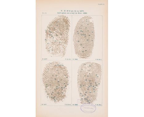
Lot 102
NO RESERVE Galton (Francis) Finger Prints, 16 lithographed plates, one double-page, 1892; English Men of Science: Their Nature and Nurture, 1874; Natural Inheritance, illustrations, 1889; The Narrative of an Explorer in Tropical South Africa, 4 tinted lithographed plates, folding colour map, foxing, 1853, first editions, all but the first with advertisement leaf at end, all but the second ex-library copies with stamps, original cloth, the last pictorial gilt, all rubbed, wear to spine ends, the second recased, the last rebacked preserving original spine; and 11 others, Galton, Darwin etc., 8vo & 4to (15)
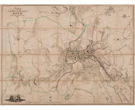
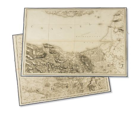
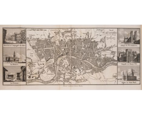
Lot 119
NO RESERVE Bath.- Holloway & Son, engravers of Bath. Plan of the City and Borough of Bath and its suburbs, engraved plan with some boundaries marked with outline hand-colouring, 725 x 950 mm (28 1/2 x 37 1/2 in), dissected and mounted on linen, some spotting, browning and surface dirt, brown paper ends, folding with lower cover only, upper cover and spine missing, 8vo, 1852; together with Bowen's 'An Improved Map of the County of Somerset Divided into it's Hundreds', and a good group of 8 maps and plans of Bath, including Pratt & Marshall's 'An Improved Map of the Villages, Roads, Farm Houses, &c., Five Miles round the City of Bath', 1787, Meyler's 'Plan of the City of Bath', C. Harcourt Masters 'Map of 24 Miles Round the City of Bath', and 'Houlston's New Large-Scale Plan of Bath and Suburbs', a copy of 'Cary's Traveller's Companion', 1791, all folding, mainly 19th century; with 2 others (12)
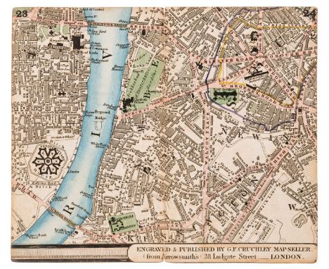
Lot 124
NO RESERVE London.- Cruchley's New Plan of London in Miniature..., letterpress title, 8pp. index and advertisement leaf, hand-coloured double-page key map and 15 double-page hand-coloured engraved maps numbered 1-30 and pasted back to back in book form, a little browned, especially final double-page, a few short splits to folds, original cloth, yellow paper label to upper cover, lacking spine, covers detached, [c.1830] § Grand Panorama of London (The), from the Thames, long folding wood-engraved map, staining to joints, some splits and fraying to folds, loose in binding, folding concertina style into original cloth, gilt, Charles Evans, [1844] Reynolds & Sons (James) The Oarsman's and Angler's Map of the River Thames from its Source to London Bridge, long folding hand-coloured map mounted on linen, light soiling, one or two splits to folds, folding concertina-style into original cloth, damp-stained, James Reynolds, [1880s], all rubbed or worn; and c.15 others on London, 8vo et infra (c.20)
Lot 126
NO RESERVE Ordnance Survey Office. Four folding map sheets, including plate numbers XVII, XVIII, XIX, XX, detailed maps on a scale of 1 mile to the inch, engravings, each sheet approx. 635 x 800 mm (25 x30 3/4 in), dissected and mounted on linen with blue silk edges, each section with tab label, printed index label to case, folding neatly into original book-style slipcase, blue morocco, spine with five raised bands, gilt armorial device with three canons and canon balls [?Royal Artillery] to upper cover, rubbed and scuffed, 4to, [c.1811 or slightly later].
Lot 129
NO RESERVE Central Asia & Great Game.- Burnaby (Capt. Fred) On Horseback through Asia Minor, 2 vol., mounted oval Woodburytype portrait, 3 folding maps, one torn and repaired, vol.1 with 24pp. publisher's catalogue at end and with portrait & one Contents leaf loose, traces of labels, original pictorial cloth, rubbed, one joint split, 1877 § Cobbold (Ralph P.) Innermost Asia: Travel & Sport in the Pamirs, first American edition, photogravure frontispiece, folding colour map at end, plates and maps, hinges weak, original pictorial cloth, gilt, rubbed and faded, 1900 § Bailey (Lt.-Col. F.M.) China - Tibet - Assam: A Journey 1911, 1945; Mission to Tashkent, 1946, first editions, the last two with plates, original cloth, slightly rubbed; and c.15 others on Central Asia, mostly Great Game, 8vo (c.20)
Lot 134
NO RESERVE Middle East.- Bishop (Isabella L., née Bird) Journeys in Persia and Kurdistan, 2 vol., original pale blue cloth, gilt, spines browned and worn at ends, 1891 § [Bell (Gertrude)] The Arab of Mesopotamia, rather browned, first few leaves slightly nibbled at fore-edge, upper hinge weak, covers stained, Basrah, Government Press, 1918; Amurath to Amurath, folding map torn and repaired, upper hinge weak, joints split, 1911 § Blunt (Lady Anne) Bedouin Tribes of the Euphrates, first American edition, ex-library copy with label, New York, 1879 § Stark (Freya) Baghdad Sketches, first English edition, 1937 § Forster (E.M.) Alexandria: a History and a Guide, upper hinge broken, original boards, Alexandria, 1922 § Nakhlah (Yacoub) New Manual of English and Arabic Conversation, title foxed, old roan-backed cloth, spine detached, Boulack nr. Cairo, H.H. The Khedive's Press, 1874, most first editions, some maps, plates and illustrations, all but the last two original cloth, all rubbed; and c.25 others on the Middle East, v.s. (c.30)
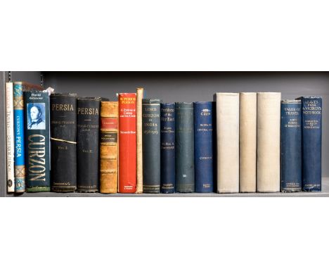
Lot 135
NO RESERVE Middle East.- Curzon (Hon. George Nathaniel) Persia and the Persian Question, 2 vol., original cloth, gilt, new endpapers with folding map attached to rear pastedown of vol.1, vol.1 spine detached, traces of labels to spine, 1892; Russia in Central Asia in 1889 and the Anglo-Russian Question, ex-library copy with stamps, later cloth-backed boards, 1889; The Pamirs and the Source of the Oxus, first edition in book form, original calf-backed cloth, spine torn at foot, Royal Geographical Society, [1897], first editions, maps, plates and illustrations, all rubbed; and 13 others by or about Curzon, 8vo & 4to (17)
Lot 144
NO RESERVE Jouy (Etienne de) L'Hermite de Londres, ou Observations sur les Moeurs et Usages des Anglais au commencement du XIXe Siècle, 3 vol., first edition, half-titles, engraved frontispieces and folding map with vignettes, wood-engraved tail-pieces, contemporary half calf, spines gilt, a little rubbed, vol.1 with gouge to spine and upper cover, Paris, 1820-21 § Veritable Secretaire (Le) ou la belle maniere d'écrire avec justesse sur differens sujets. Par un Gentilhomme Francois, engraved frontispiece, a little browned, contemporary mottled calf, spine gilt, slight worming to spine, Amsterdam, Henri Desbordes, 1696; and others, French, 8vo et infra (18)
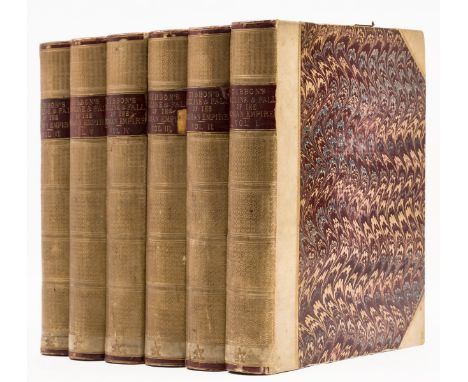
Lot 146
NO RESERVE Gibbon (Edward) The History of the Decline and Fall of the Roman Empire, 6 vol., vol. 1 second edition, the rest first editions, one engraved map only (of 3), lacking portrait frontispiece, half-titles and errata, vol. with worming and start, light foxing and browning, bookplates of Sir William Wilson Hunter, later half vellum, spines gilt, spines darkened with some chipping to labels, 4to, W. Strahan; and T. Cadell, 1776-88.

Lot 89
NO RESERVE Astronomy.- Pickering (William H.) A Photographic Atlas of the Moon, photograph of the moon and other ephemera loosely inserted, original cloth, Cambridge, Mass., 1903 § Neison (Edmund) The Moon and the Condition and Configurations of its Surface, ex-library copy with stamp to title, later cloth, 1876 § Elger (T.G.) The Moon: A Full Description and Map of its Principal Physical Features, cloth (?alternative binding), 1895, first editions, plates, a little rubbed; and 2 others on the moon, 8vo (5)


Lot 152
(BRINDLEY JAMES). The History of Inland Navigations Particularly that of the Duke of Bridgwater. 2 eng. maps. Rebound in old blue 'morocco effect' cloth, close cropped throughout. 1779.N.B. - 2 eng. maps of 3. Missing frontis map. Rebound in old blue 'morocco effect' cloth, not leather as originally catalogued, close cropped throughout.

Lot 161
LEIGH CHARLES. The Natural History of Lancashire, Cheshire & the Peak, in Derbyshire, with An Account of the ... Antiquities in Those Parts. Eng. port. frontis & eng. plates. Folio. Def. calf with brds. det. but present. Oxford, 1700; also Gregson's Portfolio of Fragments ... Duchy of Lancaster, 1869 & 1 other. (3).Condition report:Leigh - All plates there, as called for 26 in total including map (no plate list though). Pagination very random. Condition not great, browning, foxing and damp staining, etc.

Lot 162
GRAVES JOHN. The History of Cleveland. Fldg. eng. map, eng. plates (extra illus.?) & pedigree. Quarto. Rubbed calf gilt, internal foxing & spotting. Carlisle, 1808; also Atkinson's Cleveland Glossary, orig. cloth, 1868. (2).Graves - 11 plates in total including map and pedigree but subscriber list appears to be incomplete.


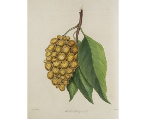
Lot 327
SIR HENRY COLLETT: FLORA SIMLENSIS A HANDBOOK TO THE FLOWERING PLANTS OF SIMLA AND THEIR NEIGHBOURHOOD, introduction William Botting Hemsley, Calcutta and Simla, Thacker Spink, London [printed], W Thacker, 1902, first edition, frontis and folding map [with a memoir of the author by Field Marshall Lord Roberts of Kandahar and Sir William Turner Thiselton-Dyer] plus a separately published memoir pamphlet loosely inserted, original cloth, spine gilt lettered and decorated

Lot 328
RICHARD LUBBOCK: OBSERVATIONS ON THE FAUNA OF NORFOLK AND MORE PARTICULARLY ON A DISTRICT OF THE BROADS, Norwich, Jarrold & Sons, 1879, new edition, folding frontis map, (split at fold), 2 plates as list, original cloth worn, plus ERNEST H WILSON: ARISTOCRATS OF THE GARDEN, New York, Doubleday Page, 1917 (1200), first edition, numbere (369), plates collated complete, original two-tone cloth worn, ex-lib plus F A HAMPTON: THE SCENT OF FLOWERS AND LEAVES, London, Dulau & Co, 1925, first edition, original cloth back boards (3)
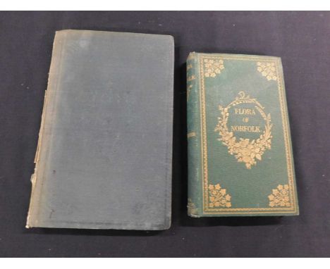
Lot 329
RICHARD LUBBOCK: OBSERVATIONS ON THE FAUNA OF NORFOLK AND MORE PARTICULARLY ON THE DISTRICT OF THE BROADS, Norwich, Charles Muskett, 1845, first edition, engraved folding frontis map and 2 plates as list, original blind stamped cloth, lacks part of back strip plus KIRBY TRIMMER: FLORA OF NORFOLK A CATALOGUE OF PLANTS FOUND IN THE COUNTY OF NORFOLK, London, Hamilton Adams, Norwich, Henry W Stacy, 1866, first edition, 12 mo, original decorative cloth gilt, all edges gilt (2)


Lot 406
GEORGE CHRISTOPHER DAVIES: THE HANDBOOK TO THE RIVERS AND BROADS OF NORFOLK AND SUFFOLK, London and Norwich, Jarrold & Sons [1908], 41st edition, folding map (splits at folds and closed tears), in pocket at end, adverts at front and rear, original pictorial cloth worn + WILLIAM ALFRED DUTT: A GUIDE TO THE NORFOLK BROADS... WITH A CHAPTER BY ARTHUR PATTERSON, London, Methuen, 1923, 1st edition, 13 plates including 8 coloured, folding map, 8pp adverts at end, original cloth (2)
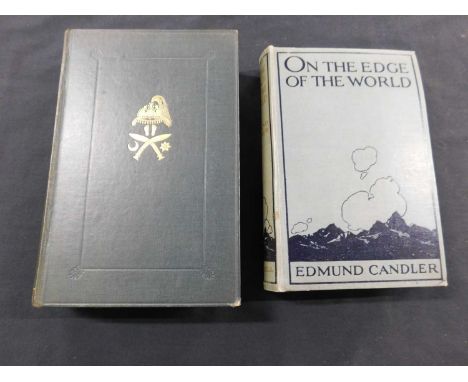
Lot 425
EDMUND CANDLER: ON THE EDGE OF THE WORLD, London, Cassell, 1919, first edition, plates collated complete, inscription at head of chapter 1, original pictorial cloth, re-cased, new front free end paper and front paste down plus WILLIAM BROOK NORTHEY AND CHARLES JOHN MORRIS: THE GURKHAS THEIR MANNERS CUSTOMS AND COUNTRY, London, John Lane, The Bodley Head, 1928, first edition, folding map and plates collated complete, original cloth gilt (2)
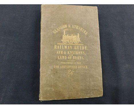
Lot 451
GUIDE TO THE GLASGOW AND AYRSHIRE RAILWAY WITH DESCRIPTIONS OF THE GLASGOW AND EDINBURGH AND GLASGOW AND GREENOCK RAILWAYS TO AYRE AND ITS AND TO THE LAND OF BURNS, Ayr M'Cormick and Gemmell, Glasgow, Andrew Rugherglen, 1841, first edition, folding frontis litho map, 13 litho plates including double page plan and 2 multi folding views plus a folding facsimile of Burns' handwriting, 16mo original cloth gilt a little worn, otherwise vgc, very scarce


Lot 1979
Levanto,F.M.: Prima parte dello Specchio del Mare, nel quale si descrivono tutti li porti, spiaggie baye, isole, scogli, e seccagni del Mediterraneo... Non mai piu cosi ampiamente descritto, & arricchito di Carte Maritime nuovamente costrutte. Genua, Marion u. Cele 1664. Fol. Mit breiter gest. Titelbordüre mit kl. Seegefechtsszene, 25 (24 dplblgr.) Kupferkarten sowie zahlr. Textholzschnitten. 2 Bl., 152 S. Prgt. d. Zt. (Gebräunt u. fleckig, best. u. berieb.). Koeman Lev 1. Phillips/Le Gear 7858. Nat. Maritime Mus. Cat. III/1, 42. LGK I, 349 (irrig mit 28 Ktn.). Nicht in der Crone Library und im Scheepvaart Museum. Erste Ausgabe. - ╔Seltener Mittelmeer-Seeatlas╗. Nur der vorliegende erste Teil ist erschienen. - "Little is known about its author, but the work displays a strong Dutch influence, particulary in the style of the Van Keulens." (Nat. Maritime Mus. Cat.) - Italienische Übersetzung von P. Goos' Straets-Boeck von 1662 mit den Karten in der Überarbeitung von F. M. Levanto, der schöne Kupfertitel wiederum ist eine spiegelverkehrte Kopie des Titels von Goos' Zee-Atlas. - Die zahlr. Holzschnitte im Text zeigen Navigationsinstrumente, Küsten- und Hafenkarten und v.a. Hunderte von Küstenaufrissen; die Karten mit den schönen gest. Küsten- und Inselkarten. - "Ein Handbuch, das sogleich bei See- und Steuerleuten beliebt war. Es war das Ergebnis einer 20jährigen Navigationserfahrung in diesem Raum." (LGK II, 503) - Stärkere Gebrauchssp. Wenige Karten mit Falzeinriss (1 Kte. gelockert), wasserrandig, etw. Randläsuren, stellenweise gebräunt u. fleckig, Karten tls. knapp beschn., Textbl. oft im Bug verstärkt, 1 Ktn. mit kl. Ausbesserungen (ohne Bildverlust). - Contemporary vellum (browned and stained, bumped and rubbed). Few maps with tears (1 map loosened), partly browned and stained, 1 map with small repairs (without image loss).

Lot 1978
Robert de Vaugondy,(D.).: Nouvel atlas portatif destiné principalement pour l'instruction de la jeunesse, d'après la geographie moderne de feu l'Abbe Delacroix. Revu, corrigé et augmenté par (C. F. De)lamarche. Paris, (De)lamarche, An II.e (= 1794). 28,5 x 24 cm. Mit 9 S. gest. Text u. 53 (statt 54; 1 gefalt.) doppelblattgr. grenzkol. Kupferkarten. Ldr. d. Zt. mit Rückenverg. u. farb. Rsch., wasserfleckig bzw. fleckig u. beschabt, Ecken bestoßen u. Bezug abgestossen. Vgl. Shirley T.ROBV-2a Anm. sowie Phillips 3528 u. öfter. - In mehreren Auflagen erschienener Handatlas für die Jugend. Vorliegend Variante mit 2 Karten mehr, als das Tafelverzeichnis angibt, nämlich der gefalteten Frankreichkarte mit Departements (auf dem Titel angegeben) sowie der zusätzlichen Karte "Premiers ages du monde" (47.2). Enthält Weltkarten (3 von 4), Erdteilkarten (4), Detailkarten von Europa (29), Asien (4), Afrika (2) und Amerika (4) sowie 7 historische Karten. Karten wie meist verso nummeriert. - Vereinzelt etwas gebräunt od. kl. Läsuren (Einrisse od. Löchlein), Oberecken fast durchgehend wasserfleckig, teilw. bis in das Kartenbild. Die gefalt. Frankreichkarte mit mehreren langen Einrissen. Fehlt Kte. 4. - Leather of the time with spine gilding a. col. spine label, waterstained resp. stained and scuffed. scuffed, corners bumped and cover worn. The present variant with 2 more maps than the list of plates indicates. - Occasionally somewhat browned or with small tears or holes, upper corners waterstained almost throughout, partly reaching the map image. The folded map of France with several long tears. Map 4 missing.

Lot 3012
Ontario.: Head of Lake St. Peter. Karte mit Meilenzeiger und Schiffsrouten unter Berücksichtigug des extrem niedrigen Wasserstandes von 1897. Lithographie Ottawa, 1923. Ca. 51 x 110 cm. Mehrfach gefaltet. Falz tls. gebräunt, Gebrauchssp. u. hs. Marginalien. ╔Dabei: Map of the Canadian Pacific Railway.╗ Um 1911. Ca. 47 x 110 cm. Gefaltet. - Gebrauchssp. D

Lot 1768
Schneider,J.J.: Das Badische Oberland. Lith. Ansichten mit Text. Lörrach, Gutsch 1841. Mit lithogr. Titel, 26 Taf. in Federlithogr. u. 1 gefalt. Karte. 1 Bl., VIII, 143 S. Opbd. (Rckn. mod. mit Lwd. erneuert, neu aufgebunden, fleckig u. best.). Vgl. KVK (nur 1 Ex.). - Die Taf. zeigen Ansichten von: Lörrach, Schopfheim, Kandern, Badenweiler, Todtnau, Vogelbach, Bürgeln, Römerbäder in Badenweiler, Istein, Säckingen, Schönau, Zell, Müllheim, Wasserfall bei Todtnau, Sulzburg, Laufenburg, Staufen, Hassler Höhle, Feldberger See, Tüllingen, Leopoldshöhe, Beuggen, Röthler Schloss, Hausen, Wehr, Fabriken im Wiesenthale. - stärker). - Selten. - Text stockfleckig, Tafeln (auf besserem Papier) meist sauber, Vors. erneuert, Widm. a.V. - Rare. With lithographed title, 26 lithographed plates and 1 folded map.

Lot 76
Omega. A rare and desirable stainless steel manual wind chronograph bracelet watch made for the Italian marketModel: Speedmaster Apollo SoyuzReference: ST 145.022, Limited Edition No.159Date: Manufactured 3rd May 1976, Purchased 29th May 1980Movement: 17-jewel Cal.861 manual wind, No.39181308Dial: Black, Apollo Soyuz logo at 12, luminous baton hour markers, white outer 1/5th second divisions, subsidiary dials at 3, 6 and 9 for seconds, 30 minute and 12 hour recording, white pointed baton hands with luminous inserts, centre secondsCase: Brushed and polished tonneau form, screw down back engraved Gemini Apollo Союз, shouldered crown flanked by twin pushers, tachymetre to bezelStrap/Bracelet: Fitted brushed 1168 Omega linkBuckle/Clasp: Signed folding claspSigned: Case, dial & movement Size: 41mm Accompaniments: Receipt dated 29/5/80, Omega service case, Extract from the Archives, spare parts replaced during serviceFootnotes:On the 17th of July 1975, in the depths of the Cold War, space became the meeting point of two of the space faring nations, the United States of America and the Soviet Union. Every Astronaut and Cosmonaut were equipped with an Omega Speedmaster Professional and in the case of Alexey Loenov, two. To celebrate this, in 1976 the Jeweller De Marchi of Turin took delivery of a group of special celebratory Apollo Soyuz watches with the mission badge on the dial and a special embossed case back depicting the Saturn Rocket on a map of the world. The back was also lightly engraved with the limited edition number, an I for Italy and an Ω.The present watch was bought new in 1980 at a large discount when it is possible that the Italian market was a difficult place to sell this particular piece. It was soon inherited by the present owner who left it unused in a draw for many years and only sporadically wearing it. For this reason, the dial is in excellent condition with virtually no UV damage. Very few of these original pieces were created and they have been celebrated ever since with anniversary editions being produced at 20, 25 and 30 years.For further information on this lot please visit Bonhams.com
Lot 10
ROSS (Sir John): 'Narrative of a Second Voyage in Search of a North-West Passage, and of a residence in the Arctic Regions...' London, A W Webster, 1835: FIRST EDITION. With frontispiece, folded map and 28 plates, a few small waterstains, neat repair to folding map, recent blue cloth with spine gilt lettered, 4to. (1)
Lot 14
BACON (G W, publisher): 'Bacon's Large Scale Atlas of London and Suburbs...' London, G W Bacon & Co, 1910: title page and contents list, numerous double page and folding social, geographic and industrial maps, one map loose and another with tear, blank verso of one sheet with handwritten manuscript entry, publishers burgundy cloth gilt with some wear, folio. (1)

Lot 173
SPEED (John & NORDEN, John): 'Sussex Described and Divided into Rapes with the Situation of Chichester the Cheife Citie Thereof...', London, Bassett & Chiswell: double page copper engraved map with hand colouring, vertical fold line to centre, approx 52 x 40cm within mount, framed and glazed to both sides, text to verso. (1)

Lot 176
LONDON BLITZ: ARP OBSERVER'S MAP: BOND (Arthur): 'London - 1944...as seen by an ARP Observer on the roof on the Bank of England in the summer of that year': London, Baynard Press, circa 1945: colour litho map within 360 degree projection of the city, approx 73 x 67cm, framed and glazed. Apparently one of 200 produced for the ARP Wardens working from the Bank of England. Accompanied by presentation letter to a Miss Prosser, Bank of England July 1945, also framed and glazed. (2)
Lot 263
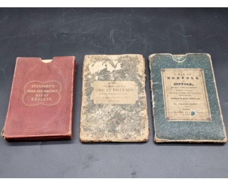
FOLDING MAPS: EBDEN (Williams):'A Map of Norfolk and Suffolk, divided into hundreds, exhibiting the whole of the mail, direct and principal crossroads...', London, pub. R H Laurie, 1832: engraved map with contemporary hand colouring, dissected into 20 sections and folded, original slipcase with printed label, rubbed: with 2 other 19th century folding maps. (3)
-
109198 item(s)/page