We found 109182 price guide item(s) matching your search
There are 109182 lots that match your search criteria. Subscribe now to get instant access to the full price guide service.
Click here to subscribe- List
- Grid
-
109182 item(s)/page
![After John Speed (1552-1629), a two-fold map, Darbieshire (sic) [Derbyshire], 1676 edition, hand-coloured engraving, 40cm x 5](https://cdn.globalauctionplatform.com/2376f376-52c9-452a-b37a-a62c0081b790/c976eb85-3a74-4add-fd38-e99989e9bba5/468x382.jpg)


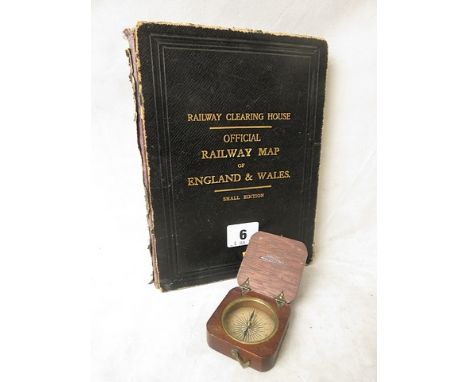

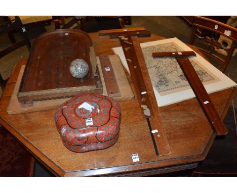
Lot 1340
STAMPS. 3 stock books. 'Map cover St Bk' contains CW mostly used, a few mint (eg Zanzibar), Cape of GH; 'Blue Stk Bk' has ranges of QV to QE2 mint and used CW; 'Brown Stk Bk' has good qty foreign stamps incl Austria, S America, China (incl some Mao) and many other countries. Also 50+ pkts foreign stamps sorted. 2 GB presentation packs, 2 GB FDCs


Lot 734
A quantity of ephemera to include indenture papers, a Ration Book, postcards and stamps, an early 20th century book relating to the Royal Insurance Companies building in Liverpool, a book pertaining to Chester: A Plan for Redevelopment, framed and glazed cigarette cards and a mid 19th century map of Cheshire by Chapman & Hall of Picadilly, London.


Lot 312
After John Speed (1552 -1629). 'WILSHIRE', a hand-coloured engraved map with a plan of Salisbury and a view of Stonehenge in a glazed, ebonised frame, 40.8 x 53.3, together with a Robert Morden hand-coloured engraved map titled 'THE SMALLER ISLANDS in the BRITISH OCEAN', and a map of 'DORSET SHIRE by H. Mole'. (3)


Lot 311
Tobias Conrad Lotter (German 1717-1777). 'PETROPOLIS', a hand-coloured engraved city plan map of St. Petersburg, 'TOPOGRAPHIA SEDIS IMPERATORIAE MOSCOVITARUM PETROPOLIS anno 1744 delignata jam publici juris facta per TOBIAM CONRADUM LOTTER, Geographum Aug. Vind', 50.5 x 58.3cm, in a later mounted and glazed frame and Homann Heirs 'INGERMANLANDIAE feu INGRIAE', a hand-coloured engraved map showing the environs of St. Petersburg, dated 1734, mounted, glazed frame. (2)

Lot 315
Pieter van den Keere (Dutch 1571-1646). 'CONNACK', a hand-coloured map, 8.8 x 12.5cm, in a later, glazed Hogarth style frame, together with 'The Continuation of the Road from LONDON to the LANDS END Plate 2', a hand-coloured engraved map 32.5 x 44.3cm, in a later glazed Hogath style frame. (2)


Lot 429
Sanson map 1652 in frame "L'Arabie Petree Deserte et Hevrevse" with COA from Arabesque Gallery & Interiors dated 17/6/84. Gallery is still in Bahrain, this map is the first of two Sanson maps produced of the area, the second two years later by his son. (Please note, this lot includes only ONE framed map)


Lot 666
Geographic / Topographical interest books: comprising an 'Account of the Pelew Islands' by George Kate, 'to the chairman, deputy chairman and directors of the Honourable East India Company', includes engravings by Wilson / Medland / Reeve / Kirk London 1788, plus map, PLUS 'A Topographical Dictionary of England' by Samuel Lewis 3rd edition Vol V, London Pub Lewis, 1835, including numerous maps of the different counties and islands, PLUS 'The Gallery of Geography, a pictorial and descriptive tour of the world; by Rev. Thomas Milner, two vols, I and II, new edit to 1872. (4)


Lot 658
Early 18th century religious texts: Holy Bible with annotations: Samuel Humphreys,'The Sacred books of the Old and New testament recited at large and illustrated with critical and explanatory annotations,...embellished with proper maps and other ornamental and useful representations', in three volumes, Published London printed R. Penny, 1735, gilt spine, folio, full leather bound brown leather, 40cm by 24cm, first vol. includes map of Paradice by T. Hutchinson. (3)

Lot 642
Welsh Interest: 'A Topgraphical Dictionary of Wales' in two volumes by Samuel Lewis, 'with historical and statistical descriptions illustrated by maps of the different counties and a map of Wales, published by S.Lewis and Co, 1833, fo, Vls I and II, PLUS three books written in Welsh: Traethodydd am y fleyddyn by Thomas Gee,1847, pub London Hughes, leather bound, 'A Testament Newydd' (Ne Testament) in WElsh by James Hughes, pub Evans, 1876. and 'Destament Newydd' by William Burkitt, Josiah Jones , 1835 pub. Jones Caernarfon. (5)

Lot 662
A set of small historical subject books, all similarly bound in brown leather with red spine labels gilt lettering, 21 volumes in total to include 1831 Palgrave's History of England (including maps), Life of Mary Queen of Scots vols 1 and II, Life of William Wallace, 1830, Lives of Scotish Worthies, 1831, A Voice from Waterloo, 1847 includes plan map of the battle of Waterloo, the Reformation in England 1831. (21)

Lot 109
A GENTLEMAN'S STAINLESS STEEL CHOPARD MILLE MIGLIA 1000 AUTOMATIC CHRONOGRAPH WRIST WATCH CIRCA 2002, REF. 8920 MADE FOR COMPETITOR NO. 46 D: Black dial with luminous Arabic numerals & hands, triple register recording hours, minutes & continuous seconds, date aperture. M: Automatic movement, signed Chopard. C: Circular case with tachymeter bezel, signed MM Competitor 046, numbered, Mille Miglia race map embossed on case back, original crown & pushers, case diameter measures approx. 40 mm. S: Original Chopard Mille Miglia rubber strap.CONDITION REPORT D: Original dial in excellent condition. M: Working at present. C: In excellent condition with some small scratches due to general use. S: In fair condition. D: Dial / M: Movement / C: Case / S: Strap / B: Bracelet


Lot 477
A collection of assorted Second World War related items to include a tin helmet, gas mask, canvas map holder, various cap badges (to include RAF, ATS and South Staffordshire), a J. Hudson & Co ARP whistle, 'Laughs with the Home Guard', a pair of glasses 'designed for ordinary use and for use when wearing a respirator', various sheet music and a Fire Guard and a Home Guard armband together with a folder of pamphlets, maps and leaflets relating to service in Italy to include British Military Authority and Y.M.C.A currency notes, propaganda papers and maps (qty)


Lot 931
[Defoe (Daniel) The Life and Strange Surprizing Adventures of Robinson Crusoe, Engraved front piece portrait by Clarke & Pine in vol I, Second Edition (variant with p343 Line 2 reading 'Pilot' and Line 21 'Portuguefe', printed for W.Taylor at the ship in Pater-Nofter-Row, 1719, together with vol II, The Farther Adventures of Robinson Crusoe, Being the second and laft part of his life (vol II missing Map). (2)
-
109182 item(s)/page