We found 109182 price guide item(s) matching your search

Refine your search

Year

Filter by Price Range
  • List
  • Grid
  • 109182 item(s)
    /page

Lot 353

A small unsigned Watercolour of a river landscape, 3 1/4" (8cms) x 5" (13cms) and a coloured map of Lincolnshire.

Lot 1845

James Grosvenor and John Bean, A New and Accurate Chart of the Mouth of the Thames and its entrances, engraving, 1794, unframed, together with a map of suffolk engraved by Cary and its supporting text. (2)

Lot 1891

M. Tavernier, Map: Britannia Insulae, engraving, 1641, with hand colouring, 41cm x 53cm.

Lot 1106

A model of a windmill, possibly Dutch, a small folding ruler, a whistle, a banded agate seal, a gilt metal propelling pencil, two thimbles, an A.R.P. badge, a map reading compendium, a folding spy glass and a collection of mostly costume jewellery, including: bead, imitation pearl and other necklaces, brooches, pendants, bracelets, earrings and sundry jewellery, contained in a brown case.

Lot 518

Antique tinted map of Essex in glazed Hogarth style frame with label to reverse - Essexia Comitatus Joannes Blaeu 1645, 42cm x 53cm

Lot 106

A 17th Century Coloured Map, entitled Reprasentatio Georgraphica Itineris Maritimi Navis Victoria, with figures storming a building, 24cms x 37cms

Lot 113

A 17th Century Style Coloured Map of France, 35cms x 49cms

Lot 114

A Late 18th/early 19th Century Map of Great Britain, from the most accurate surveys with improvements by T. Bowen, 45cms x 35cms, together with a group of four reproduction maps, three similar unframed maps, a pair of unframed French coloured prints and a photograph of The Empress of France, Canadian Pacific

Lot 9

A JOHN NORDEN MAP OF SURREY 1610 by WILLIAM KIP. 11 x 15ins.

Lot 586

AFTER BLOME. A map on paper 'Warwickshire with it's Hundreds'. 12.1/2" x 10.1/4"

Lot 171

HENRY REED: A MAP OF VERONA POEMS, 1946, 1st edn, orig cl, d/w + JOHN COWPER POWYS: HOMER AND THE AETHER, 1959, 1st edn, orig cl, d/w + MICHAEL DRAYTON: THE QUEST OF CYNTHIA, Chelsea, The Swan Press 1925 (100), numbered, orig decor wraps + ARCHIBALD MACLEISH: ACTFIVE AND OTHER POEMS, 1950, 1st edn, orig decor bds, d/w + SIMON ARMITAGE: THE ANAESTHETIST A NEW POEM, ill Valerii Mishim, Prospero Poets 1994, (499) (350), numbered, orig decor bds + W H AUDEN: FOR THE TIME BEING, 1945, 1st edn, orig cl, d/w (tatty) + JOHN REDWOOD ANDERSON: PARIS SYMPHONY, 1947, 1st edn, sign pres copy, orig cl, d/w + KATHLEEN RAINE: THE HOLLOW HILL – ON A DESERTED SHORE, 1965, 1973, 1st edns, orig cl, d/ws (9)

Lot 514A

R B TALBOT KELLY: THE WAY OF BIRDS, 1937, 1st edn, 4to, orig cl, d/w + THOMAS LITTLETON POWYS 4TH BARON LILFORD: LORD LILFORD ON BIRDS, Ed Aubin Trevor-Battye, ill A Thorburn, 1903, 1st edn, lacks ffep, orig pict cl gt + ERNEST R SUFFLING: THE LAND OF THE BROADS, [1892], fdg frontis col’d map, lacks ffep, orig pict cl gt worn (3)

Lot 534

G P SANDERSON: THIRTEEN YEARS AMONG THE WILD BEASTS OF INDIA THEIR HAUNTS AND HABITS FROM PERSONAL OBSERVATION WITH AN ACCOUNT OF THE MODES OF CAPTURING AND TAMING ELEPHANTS, L 1879, 2nd edn, col’d frontis, map (loose), 22 plts, orig pict cl gt

Lot 605

E M FORSTER: ALEXANDRIA A HISTORY AND A GUIDE, Alexandria 1922, 1st edn, fdg map in pocket at end, orig cl (laminated)

Lot 611

THOMAS SHARP: AN EPITOME OF THE COUNTY OF WARWICK -------, L 1835, 1st edn, engrd fdg col’d map, torn without loss, port frontis, some water staining, orig cl gt worn and soiled

Lot 617

SIR HENRY CHAUNCY: THE HISTORICAL ANTIQUITIES OF HERTFORDSHIRE -------, L 1700, 1st edn, engrd port frontis, fdg map (reinforced with part loss), 21 plts including 9 fdg and 2 double pge, most with faults, fo, old diced cf gt restored (A/F)

Lot 632

WILLIAM WHITE: HISTORY GAZETTEER AND DIRECTORY OF HAMPSHIRE AND THE ISLE OF WHITE, 1859, lacks map, ttl pge and some prelims torn with part losses, mod cl, ex lib + THE POST OFFICE DIRECTORY OF HERTFORDSHIRE, 1867 with map (defects), mod cl, ex lib + KELLY’S DIRECTORY OF BEDFORDSHIRE, 1890, lacks ttle and map, mod cl, ex lib (A/F) (3)

Lot 633

FRANCIS WHITE: HISTORY GAZETTEER AND DIRECTORY OF WARWICKSHIRE -----, 1850, lacks map, ttl page, prelims and a few other leaves loose, old cf rebkd, ex lib, + KELLY’S DIRECTORY OF WORCESTERSHIRE, 1900 map damaged with loss, orig cl, ex lib, (2)

Lot 645

GEORGE CHRISTOPHER DAVIES: NORFOLK BROADS AND RIVERS, 1884, new edn, orig cl + E R SUFFLING, 2 ttls: THE LAND OF THE BROADS, [1892], col’d fdg frontis map, orig pict cl gt; HOW TO ORGANISE A CRUISE ON THE BROADS, [1909], 4th edn, orig pict bds worn and soiled, lacks backstrip (3)

Lot 647

“A VISITOR”: THE ILLUSTRATED GUIDE TO CROMER AND ITS NEIGHBOURHOOD, Jarrold & Sons, circa 1890, 12th edn, fdg frontis map, 3 plts, orig wraps worn + WALTER RYE: TOURISTS GUIDE TO THE COUNTY OF NORFOLK, L 1885, 3rd edn, fdg frontis map, orig cl gt + McLEAN’S NEW ALBUM OF HUNSTANTON AND NEIGHBOURHOOD, circa 1900, orig cl gt (3)

Lot 649

THE NORFOLK AND NORWICH REMEMBRANCER AND VADE-MECUM ------, Norwich, Matchett & Stevenson, 1822, engrd fdg frontis map, 12 mo, old cl bkd bds worn

Lot 656

THE VICINITY OF LEAMINGTON A GUIDE TO THE NEIGHBOURING TOWNS OF WARWICK COVENTRY STRATFORD KENILWORTH AND SURROUNDING COUNTRY, Leamington, W Reeve, circa 1844, 4 engrd plts, fdg map at edn, orig blind stpd cl gt

Lot 657

REV D P DAVIES: A NEW HISTORICAL AND DESCRIPTIVE VIEW OF DERBYSHIRE --------, Belper 1811, engrd col’d fdg frontis map, damaged (no loss) and trimmed, 2 plts, as called for, old cl bkd bds, v worn, near disbnd

Lot 673

OLIVER BAKER: LUDLOW A TOWN AND NEIGHBOURHOOD, Ludlow, G Woolley, 1888, 1st edn, etched frontis, 4to, orig pict cl gt worn + R H GEORGE: A HISTORY OF THE HEREFORDSHIRE BORDERLAND, Leominster 1914, 1st edn, double page map at end, orig cl gt worn (2)

Lot 675

DANIEL AND SAMUEL LYSONS: TOPOGRAPHICAL AND HISTORICAL ACCOUNT OF DERBYSHIRE, [1817], engrd fdg map, plan, 34 plts including 1 hand col’d and 12 fdg, as list, 4to, old hf cf worn

Lot 677

KELLY’S DIRECTORY OF DERBYSHIRE, 1895, lacks map, mod cl, ex lib + KELLY’S DIRECTORY OF STAFFORDSHIRE, 1900, lacks map, worn and soiled, bds crudely reinforced, ex lib (2)

Lot 680

THOMAS WRIGHT: HISTORY AND TOPOGRAPHY OF THE COUNTY OF ESSEX, 1831-35, 2 vols, engrd vig ttls, fdg map, 99 plts, 4to, old hf cf (2)

Lot 685

KELLY’S DIRECTORY OF NORFOLK, 1925, with map, orig cl worn + KELLY’S DIRECTORY OF NORFOLK, 1929, lacks map + KELLY’S DIRECTORY OF SUFFOLK, 1937, with map, orig cl gt (3)

Lot 693

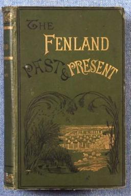
SAMUEL H MILLER AND SYDNEY B J SKERTCHLY: THE FENLAND PAST AND PRESENT, Wisbech 1878, 1st edn, col’d frontis, 26 plts, table, fdg map at end, orig pict cl gt, recased

Lot 694

NEIL WALKER AND THOMAS CRADDOCK: THE HISTORY OF WISBECH AND THE FENS, Wisbech 1849, 1st edn, fdg map, 16 plts, inner jnts split, some leaves loose, old hf cf, crudely rebkd

Lot 701

JARROLD AND SONS: COUNTIES OF NORFOLK AND SUFFOLK BASED ON THE ORDNANCE SURVEYS, engrd col’d map circa 1881, fdg bkd onto linen, approx 38 ¾” x 36 ½”, orig cl, ptd paper label, soiled

Lot 703

THOMAS COX: SUFFOLK, circa 1725, extract from “Magna Britannia”, engrd fdg map, 4to, old hf cf

Lot 707

JOHN GLYDE: THE NORFOLK GARLAND A COLLECTION OF THE SUPERSTITIOUS BELIEFS AND PRACTICES PROVERBS CURIOUS CUSTOMS BALLADS AND SONGS OF THE PEOPLE OF NORFOLK ------, [1872], bkplt of J J Colman, orig blind stpd cl gt + R BEATNIFFE: THE NORFOLK TOUR OR TRAVELLER’S POCKET-COMPANION -----, Norwich 1808, 6th edn, engrd fdg frontis map, old bds worn (2)

Lot 710

WILLIAM WHITE: HISTORY GAZETTEER AND DIRECTORY OF NORFOLK --------, 1845, lacks map, orig blind stpd cf, rebkd + one other (2)

Lot 1009

J OGILBY: THE ROAD FROM KING’S LYN TO HARWICH, engrd col’d road map, circa 1698, approx 13 ½” x 17”, f/g

Lot 1011

J OGILBY: THE ROAD FROM KING’S LYN TO HARWICH, engrd col’d road map, circa 1698, approx 13 ½” x 17 ½”, f/g

Lot 1013

BADESLADE AND TOMS: A MAP OF NORFOLK – A MAP OF RUTLANDSHIRE, engrd col’d maps, 1741, approx 6” x 6 ½”, f/g, (2)

Lot 1014

J SPEEDE: THE BISHOPRICK AND CITY OF DURHAM, engrd col’d map, circa 1676, approx 15” x 19 ½”, f/g

Lot 1015

J TALLIS: JAMAICA, engrd map, ca 1850, approx 10 ¼” x 13 ½” f/g

Lot 1017

R MORDEN: NORFOLK, engrd map, [1695], approx 14 ½” x 23”

Lot 1019

J SPEEDE: SUSSEX, engrd col’d map [1611], close mntd, a few faults at centrefold, approx 14 ¾” x 19 ¾”

Lot 1020

J UTTING: A MAP OR PLAN OF THE SURVEY AND LEVELS TAKEN IN THE COUNTRY OF MARSHLAND BY ORDER OF HIS MAJESTIES COMMISSIONERS OF SEWERS FOR THE COUNTY OF NORFOLK, engrd map, 1826, some repairs, approx 37 ¾” x 24”, f/g

Lot 1022

R SAYER: A NEW AND ACCURATE MAP OF THE COUNTY OF NORFOLK, engrd outline col’d map circa 1760, approx 23 ½” x 40”, f/g

Lot 1023

T BADESLADE: A MAP OF LYNN-HAVEN AND OF THE RIVER OUSE TO GERMANS, two engrd col’d maps on one sheet circa 1724, approx 12 ¾” x 8”, f/g

Lot 1035

JOHN BARTHOLOMEW: THE IMPERIAL MAP OF ENGLAND AND WALES, 1868, engrd col;d map, fdg on 18 lge sheets with index, in orig worn cl gt case

Lot 1037

T CONDER?: A NEW MAP OF NORFOLK, engrd col’d map circa 1784, approximately 8” x 6 ½”, f/g + THE ROAD FROM KINGS LYNN TO NORWICH CONTINUED TO YARMOUTH, engrd col’d road map circa 1780, approximately 6” x 8 ½”, f/g (2)

Lot 1038

T MOULE: CAMBRIDGESHIRE, engrd col’d map circa 1850, approximately 10 ½” x 8”, f/g

Lot 1039

N DE FER: L’EUROPE -------, engrd col’d map 1810, approximately 18 ¼” x 23 ¼”

Lot 1040

J OGILBY: THE ROAD FROM LONDON TO KING’S LYN, engrd road map circa 1675, approximately 7 ½” x 13”

Lot 1041

E BOWEN AND J OWEN: A MAP OF NORFOLK, engrd col’d map circa 1720, approximately 7 ¼” x 4 ½”, road map verso + four other Bowen/Owen road maps printed back-to-back, all in one mount + D PATERSON: LITTLEPORT TO KINGS LYNN, engrd hand col’d road map circa 1796, untitled, approximately 7” x 3 ¾” (2)

Lot 1046

C SAXTON/W KIP: HUNTINGDON COMITATUS ----------, engrd col’d map circa 1610, approximately 10 ¾” x 13”

Lot 1049

J VINCENT: OXFORD IN EPITOME, engrd col’d “Map” 1832, 2nd edn, approximately 8” x 8 ½” (map), approximately 15” x 9 ½” overall

Lot 1051

MORTIER, COVENS EN ZOON: NIEUWE ALGEMEENE KAART DE VEREENIGDE NEDERLANDEN, engrd col’d map 1814, fdg bkd onto linen, approximately 30” x 35 ½”, s-c

Lot 1052

BONNE: CARTE D’ALLEMAGNE OU SE TROUVENT LE ROYAUME DE PRUSSE, LES ETATS D’AUTRICHE ------, engrd col’d map 1813, fdg bkd onto linen, approximately 35” x 47”, s-c

Lot 1055

A ARROWSMITH: MAPS OF THE ROADS OF PORTUGAL, engrd map 1811, fdg bkd onto linen, approximately 22” x 52”, s-c

Lot 1063

J JANSSON: NORTFOLCIA VERNACULE NORFOLKE, engrd col’d map circa 1646, approximately 15 ½” x 19 ½”

Lot 1064

R BLOME: A MAPP OF THE COUNTY OF SUFFOLK, engrd col’d map circa 1673, approximately 10 ¾” x 13”

Lot 320

The Street Road Map, 1930s

Lot 496

Various prints, to include a map of Sussex, pair of comical dog prints and five other pictures

Lot 120

A Schuco Teddy Bear Perfume Bottle; a Clark & Co. Anchor sewing cotton ball in the form of a globe; a military figural clay pipe; a treen pipe holder; a map reader's magnifying glass (5)

Loading...Loading...
  • 109182 item(s)
    /page

Recently Viewed Lots