

The American Geography; or, a View of the Present Situation of the United States of America... With the folding maps: ""A Map of the Northern and Middle States; Comprehending the Western Territory and the British Dominions in North America from the Best Authorities;"" ""A Map of the States of Virginia, North Carolina, South Carolina and Georgia; Comprehending the Spanish Provinces of East and West Florida;"" and ""A Map of Kentucky Drawn from Actual Observations."" Rebound in quarter faux leather over red marbled boards. Quarto, 642 pp. (deckled edges) with three folding maps. This is the John Stockdale edition published from London. Of particular interest is the rare Kentucky map which was first produced by Filson in 1784 and here republished in 1793. The map extends from the Ohio River in the north to the Cumberland River in the south and shows three counties: Fayette, Jefferson and Lincoln. It is filled with notations including ""a bloody battle fought here"" and ""the large Bones are found here"", settlements, the river system and topography. Includes an inset at top ""A Plan of the Rapids, in the River Ohio"" which was not on the 1784 edition. John Filson (1753 - 1788) was the first Historian of Kentucky. Moving from Pennsylvania about 1782, he settled in Lexington where he divided his time between teaching and surveying land claims. He wrote The Discovery, Settlement and Present State of Kentucke in 1784. In 1788, while on a surveying expedition near the Great Miami River, he disappeared when the party was attacked by Shawnee Indians. The second map, by Joseph Purcell, is an uncommon, early depiction of the Southeast and shows a well defined New State of Franklin, within the borders of North Carolina. In 1785, settlers in present-day western North Carolina and eastern Tennessee organized a state government to be named in honor of Benjamin Franklin. Congress turned down their appeal but the state maintained a legislature and governor until 1788. This ephemeral state appeared on a small number of maps into the early part of the 19th century. The map shows early settlements, including a Moravian Settlement in North Carolina, and the Cumberland Settlements in present-day Tennessee. The map also notes native tribes and various Bounty Land Grants lands along the upper Mississippi River. The third map of the Northern and Middle States describes the area from Maine (Province of Main), south to Virginia. Lesser detail extends west to the Great Lakes and the confluence of the Ohio and Mississippi Rivers, and north to eastern Canada up to James Bay. There are several Bounty Land Grants including Genl. Clarks, Donation Lands from the Commonwealth of Virginia, and Ohio Company in Ohio, and Wabash Company, New Jersey Company, and Illinois Company in Illinois. This is the first edition, with information taken from Amos Doolittle`s map of the same title. Condition code is for the maps which have moderate to heavy offsetting with numerous fold separations closed on verso with old paper and archival tape. Text is good with some light scattered foxing, and the top blank margin of the title page has been replaced with old paper. New binding is excellent. 11.5 W x 9.2 H Morse, Jedidiah (Rev.) 1794
We found 109198 price guide item(s) matching your search
There are 109198 lots that match your search criteria. Subscribe now to get instant access to the full price guide service.
Click here to subscribe- List
- Grid
-
109198 item(s)/page
![[Lot of 4] Colton and Fitch`s Modern School Geography... [and] Physical Geography [and] A System of Modern Geography... (187](http://lot-images.atgmedia.com/SR/36385/2906594/753-201458131737_468x382.jpg)
[Lot of 4] Colton and Fitch`s Modern School Geography... [and] Physical Geography [and] A System of Modern Geography... (1874) [and] ... (1890) A. Colton and Fitch`s Modern School Geography. Illustrated by Forty Maps, and Numerous Engravings, by George Woolworth Colton, published 1866, hand color (8.2 x 9.6""). Includes double page world map, large North America, the United States and a fine ""Texas and Indian Territory."" Many other maps in text. Pictorial paper covers, 1/2 leather, large 8vo, 134pp, numerous maps. Condition: Contents tight, covers with some rubbing to spine and light stains on cover. (B+) B. Physical Geography, by Arnold Guyot, published 1873, printed color (10.3 x 12.8""). Filled with thematic maps, graphics, and more. Pictorial paper covers, 1/2 leather, 124pp. Very nicely colored maps, double page are tipped in. Condition: Spine with 1"" missing section at center, covers rubbed and soiled. Contents tight and pages mostly clean with even ivory toning, a few with short edge tears. (A) C. A System of Modern Geography, Designed for the Use of Schools and Academies..., by Samuel Augustus Mitchell, published 1874, hand color (9.7 x 12.2""). Numerous full page maps each with one or more states. The ""Map of Louisiana, Texas and Arkansas"" includes Indian Territory. Condition: Double page map of the United States has short split at lower centerfold. Covers worn, rubbed and bumped, spine chipped at top and bottom. Contents tight except first and last end papers, front cover starting. (C+) D. A System of Modern Geography, Designed for the Use of Schools and Academies..., by Samuel Augustus Mitchell, published 1890, hand color (10.1 x 12.7""). These maps are late examples of hand coloring, done in a very fine hand with lovely color and a wider pallet than we`re accustomed to seeing in a school geography. Basically the same maps as the 1874 geography above including Texas. Includes a very nice map of Canada. Condition: Three pages are torn with loss, not affecting maps except for Great Britain of which most is missing. Covers rubbed and a little faded. Contents are completely loose. (C+) See description above. 1866-90
![[Three Facsimile Volumes] A Journey in North America, Containing a Survey of the Countries Watered by the Mississipi, Ohio,](http://lot-images.atgmedia.com/SR/36385/2906594/754-201458131739_468x382.jpg)
[Three Facsimile Volumes] A Journey in North America, Containing a Survey of the Countries Watered by the Mississipi, Ohio, Missouri, and Other Affluing Rivers This example is a 1924 reprint of Collot`s famous journey to the interior of the United States. In 1796, Collot was appointed by Pierre Adet to reconnoiter the interior parts of the country. Adet was concerned that the United States would join British forces in the Anglo-Spanish War and needed better intelligence on the area if they did. Collot`s journey took him from Pittsburgh down the Ohio River, and then up to St. Louis on the Mississippi before finally heading downstream to New Orleans where he was promptly arrested by the Spanish. He was released shortly thereafter and returned to France in 1800 with the intention of publishing his maps and notes. Collot died in 1805 prior to printing, but his accounts were eventually published by the firm of Arthur Bertrand in 1826. A mere 300 French copies and 100 English copies were produced. This reprint includes two separate volumes of text (310 pp. and 290 pp. respectively) and an atlas volume with 36 folding maps, several of which are large. Published for Reprints of Rare Americana No. 4. Hardbound in quarter calf and tips over marbled boards. Overall the maps and text are clean and bright but are stiff and rippled throughout. A few of the maps have small edge and binding tears with the most notable being a 5"" binding tear in plate 29 (Map of the Missouri). Covers and spine show typical wear with bumped corners and the front hinge of volume 1 has separated. 13.5 W x 10.2 H Collot, George Henry Victor 1924

The Gentleman`s Magazine, and Historical Chronicle This lot includes 8 individual monthly issues and the supplement from 1759 during the heart of the Seven Years War (missing April, May, October and November). All maps and plates are present for the monthly issues included. The six maps, all listed in Jolly, include: A. Compleat Map of Germany Comprehending in One View the Different Seats of the Present War (11 x 13.3""). B. A Map of Martinico, from the Latest and Best Authorities, by John Gibson (7.5 x 9.5""). C. A New and Accurate Map of the Isles of Guadaloupe, Marie-Galante &c. from the Best Authorities, by John Gibson (4.8 x 11.5""). D. Plan of Have de Grace [on sheet with] The Bombardment of Have de Grace July 4th 1759 [and] [Untitled - English Channel] (7.5 x 10""). E. A Map of That Part of Westphalia, in which the French Army Where [sic] Defeated Aug. 1. 1759 (4.3 x 7.3""). F. A Map of Pomerania and Brandenburg with the Frontiers of Poland (7.5 x 10.3""). In addition to the maps listed above, there is a folding View of the Trinity Bridge over the Arno at Florence and a schematic depiction of battle lines entitled Line of Battle of the Allied Army, before the Engagement, on the First of August, 1759. Disbound, 8vo. The maps and plates are very good with some occasional foxing. The map of Germany has a 0.5"" binding tear at lower right. Disbound. 8.3 W x 5.3 H Anon., 1759

The American Lawyer, and Business-Man`s Form Book This is the second edition with an 1852 publication date on the title page. It contains numerous double-page maps, each printed on a separate page. The map Utah New Mexico and California shows a huge Gold Region with important rivers named including the Feather and American. There are numerous other state maps, mostly from east of the Mississippi River, but also Louisiana and a nice Texas. The map of the United States shows Oregon Territory, a large Nebraska Territory (encompassing present-day Montana, Wyoming and Colorado), and an extremely large Indian Territory. Full calf, 12vo, 359pp. A very clean example of this book with some occasional light scattered foxing. Covers and spine show moderate wear with a few small stains and bumped edges, and the top portion of the spine is partially detached. 7.7 W x 5 H Beadle, D. W. 1852

The Island of Lost Maps: A True Story of Cartographic Crime This is the dramatic tale of famed map thief, Gilbert Bland; an especially interesting story in light of the recent similar crimes. Written by Miles Harvey. 405 pages. Hardbound with pictorial dust jacket. Like new. 7.6 W x 5.8 H 2000
![[Lot of 2] The New World - The First Pictures of America [and] Atlas of Columbus and the Great Discoveries A. The New World](http://lot-images.atgmedia.com/SR/36385/2906594/758-201458131745_468x382.jpg)
[Lot of 2] The New World - The First Pictures of America [and] Atlas of Columbus and the Great Discoveries A. The New World - The First Pictures of America, by Stefan Lorant, published 1946 (9.3 x 12.3""). A fascinating history of the first French and English settlements on eastern North American seaboards from eyewitness accounts including those of John White and Le Moyne. Heavily illustrated in b/w and color with the water colors of John White (1585), de Bry`s engravings of the Virginia and Florida settlements, and excerpts from Thomas Hariot`s ""New Found Land of Virginia"" (1588). 292 pp., index, bibliography. First edition, Duell, Sloan & Pearce, NY. Hardbound in beige linen with gilt map on front cover. Condition: Contents fine with slight wear to the dust jacket including a partially repaired small tear on the back. B. Atlas of Columbus and the Great Discoveries, by Kenneth Nebenzahl, published 1990 (11.3 x 14.8""). This wonderful reference illustrates a selection of the most significant materials of the period, beginning with the world as known to Europeans before Columbus` first voyage. More than 100 color illustrations depict maps by Ptolemy, Pizzagano, Martellus, Waldseemuller, Mercator, Hondius and others. 168 pp., with index & bibliography. Published by Rand McNally. Hardbound in blue cloth with title in gilt and illustrated dust jacket. Condition: Near fine. 1946-90
![[Lot of 3] A Topographical Description of the Dominions of the United States of America... [and] The Discovery of North Amer](http://lot-images.atgmedia.com/SR/36385/2906594/759-201458131747_468x382.jpg)
[Lot of 3] A Topographical Description of the Dominions of the United States of America... [and] The Discovery of North America [and] The Exploration of North America 1630-1776 A. A Topographical Description of the Dominions of the United States of America..., by Thomas Pownall, published 1949, black and white (8.8 x 12.3""). This is the revised and enlarged version of Pownall`s work, originally published in 1776. 235 pp. with 2 large folding facsimile maps including A Map of the Middle British Colonies in North America by Pownall and A General Map of the Southern British Colonies by Romans. Hardbound in tan cloth boards with gilt text on the front cover and spine. Condition: Contents very good with minimal shelf wear. (A)B. The Discovery of North America, by W.P. Cumming, R.A. Skelton, and D.B. Quinn, published 1972, printed color (9.3 x 12.2""). This extensive textual history, profusely illustrated, covers early explorations across the Atlantic to 1633. It is an important reference for any library. 304 pp. with 370 plates, 75 in color. Hardbound in black cloth with gilt titles and an illustrated dust jacket. Condition: Near fine condition. (A)C. The Exploration of North America 1630-1776, by W.P. Cumming, S.E. Hiller, D.B. Quinn, and G. Williams, published 1974, printed color (9.3 x 12.2""). Written by four experts in American history and cartography. The book is a follow-up to The Discovery of North America, presenting a well documented and meticulous survey of European expansion in the New World, featuring eye-witness accounts and narratives of the explorers and settlers. Each chapter contains a historical survey of the opening up of new land and the main exploration routes. 272 pp, 400 illustrations, 47 in full color. Hardbound in original green cloth with gilt title on spine, and pictorial dust jacket with additional plastic cover. Condition: Light toning along sheet edges with some slight wear to the dust jacket, including a few short tears closed with tape. (B+) See description above. 1949-74
![[Lot of 2] Maps - A Historical Survey of Their Study and Collecting [and] Decorative Printed Maps of the 15th to 18th Centur](http://lot-images.atgmedia.com/SR/36385/2906594/761-201458131752_468x382.jpg)
[Lot of 2] Maps - A Historical Survey of Their Study and Collecting [and] Decorative Printed Maps of the 15th to 18th Centuries A. Maps - A Historical Survey of Their Study and Collecting, published 1972, black and white (5.5 x 8.3""). This compact and thought-provoking volume originated in Skelton`s series of lectures at the Newberry Library and focuses on the history of cartography and how it has evolved as a field of study. 138 pp. Hardbound in gray cloth boards with a pictorial paper dust jacket. Condition: Contents generally very good with a few pages highlighted in red ink with minor wear to dust jacket.B. Decorative Printed Maps of the 15th to 18th Centuries, published 1952, printed color (9.8 x 12.6""). First edition of this revised edition of Old Decorative Maps and Charts by A.L. Humphreys. Mr. Skelton was the Superintendent of the Map Room at the British Museum when he published this work. 84 images in color and b/w, 80 text pages. Hardbound in red cloth, titled in gilt on spine. The dust jacket features Danckerts`s Novi Belgii... and is protected by a plastic cover. Condition: Contents very good with light toning along sheet edges and minor wear to dust jacket. See description above. Skelton, R. A. 1952-72

The Mapping of the World Early Printed World Maps 1472-1700 This standard reference work on world maps includes 18 color-plates and hundreds of black and white illustrations, each with a detailed description and carto-bibliography. The scholarship behind this work is unparalleled, providing comprehensive information about each map. 669 pages, extensive index and appendices. Hardbound in red cloth with gilt and black titling at spine and illustrated dust jacket. Slips into a matching red slipcase. An absolutely essential reference work. Internally very clean with some minor wear to covers, spine and dust jacket. The slipcase is structurally sound with some minor surface abrasions. 13.7 W x 9.8 H Shirley, Rodney W. 1983


SALTER, T.F. The Anglers Guide the eighth edition. London: 1833. Engraved frontispiece, engraved title, 9 plates, 1 folding map. [Bound with:] J. MARCH. The Jolly Angler. London: [n.d.] Frontispiece. 2 vols. in one, 12mo (178 x 102mm.) (Some light spotting or browning, occasional ink marginalia, 2I to first work torn without loss.) Near contemporary half-calf (somewhat rubbed and scuffed, spine faded).

MAP, NORWAY. J. WALIGORSKI & N. WERGELAND. Veckart over Norge. Udarbeitet efter de Bedste Kilder. Christiana: Jac Dybwad, [n.d. but circa 1865.] Hand-coloured engraved folding map on two sheets (each 575 x 810mm.) each in 25 sections and backed onto linen. (Minor light browning.) Both folding within original cloth (extremities bumped).
![MAP, LONDON. Edward STANFORD (publisher). Collins Standard Map of London. London: [n.d. but circa 1870.] Hand-coloured fo](http://lot-images.atgmedia.com/SR/10123/2906286/3023-201451418128_468x382.jpg)
![MAP, SUSSEX. ORDNANCE SURVEY (publishers). [Map of Sussex. N.p: n.d] Engraved folding map on two sheets (each 680 x 965mm.](http://lot-images.atgmedia.com/SR/10123/2906286/3024-201451418130_468x382.jpg)

MAP. J.A. KNIPE. Geological & Mineralogical Map of England and Wales, with Parts of Scotland, Ireland & France. London: 1871. Hand-coloured engraved folding map (1165 x 855mm.) in 42 sections backed onto linen. (Some light browning and spotting.) Folding within contemporary calf (worn, upper cover detached).

MAP, LONDON. Edward STANFORD (publisher). Daviess New Map of the British Metropolis, The Boundaries of the Boroughs, County Court Districts Railways, and Modern Improvements. London: 1883. Hand-coloured engraved folding map (980 x 1000mm.) in 40 sections and backed onto linen. (Heavy damp-staining and some browning, a few sections becoming loose, lacking title label).
![MAP, MAURITANIA. A. MEUNIER. Afrique Occidentale Française. [N.p.:] 1922. Colour lithographic folding map (1480 x 1072mm.)](http://lot-images.atgmedia.com/SR/10123/2906286/3027-201451418137_468x382.jpg)
![MAP, SUSSEX, SURREY & KENT. ORDNANCE SURVEY (publishers). [Map of Sussex, Surrey and Kent.] [N.p.:] 1865. Hand-colou](http://lot-images.atgmedia.com/SR/10123/2906286/3028-201451418140_468x382.jpg)
MAP, SUSSEX, SURREY & KENT. ORDNANCE SURVEY (publishers). [Map of Sussex, Surrey and Kent.] [N.p.:] 1865. Hand-coloured engraved folding map on four sheets (each 645 x 945mm.) each in 24 sections and backed onto linen. (Minor light browning.) All folding within contemporary black half-morocco case (scuffed).
![MAP, SUSSEX, SURREY & KENT. ORDNANCE SURVEY (publishers). [Map of Sussex, Surrey and Kent.] [N.p.:] 1868. Hand-colou](http://lot-images.atgmedia.com/SR/10123/2906286/3029-201451418142_468x382.jpg)
MAP, SUSSEX, SURREY & KENT. ORDNANCE SURVEY (publishers). [Map of Sussex, Surrey and Kent.] [N.p.:] 1868. Hand-coloured engraved folding map on four sheets, (each 643 x 946mm.) each in 24 sections and backed on linen. (Some light browning.) All folding within a contemporary red half-morocco case (somewhat scuffed).

LEMPRIERE, William. A Tour from Gibraltar to Tangier, Sallee, Mogodore, Santa Cruz, Tarudant; and thence, over Mount Atlas to Morocco. London: 1791. 8vo (206 x 124mm.) Folding engraved map. (Map torn at fold without loss, occasional spotting.) Near contemporary half-calf (re-cornered in vellum, head of spine chipped, joints splitting).
![[LAMBARD, William. A Perambulation of Kent. N.p. but London: n.d. but circa 1576.] 4to (178 x 123mm.) 1 map only (of 2). (La](http://lot-images.atgmedia.com/SR/10123/2906286/3036-201451418156_468x382.jpg)

DANGUY, M.R., and others. An Extract from the Work Entitled The Grand Wines of Burgundy (Cote-Dor). Dijon: 1893. 8vo (252 x 165mm.) Plates, colour folding map bound at rear. (Minor browning, occasional spotting, cut to first few leaves.) Original wrappers (browned, tattered and with incision).

DRAKE, Edward Cavendish. A New Universal Collection of Authentic and Entertaining Voyages and Travels. London: 1771. Folio (344 x 220mm.) Engraved frontispiece, 9 engraved maps (1 folding), 54 plates. (Occasional old creasing, browning or spotting, folding map reinforced, four plates repaired, 1 leaf with marginal tear.) Near contemporary half-calf (worn, covers detached). Provenance: Viscount Birkenhead (armorial bookplate to front pastedown); Edward Phillips (signature to title page).

MILNER, John, and Oswald W. BRIERLY. The Cruise of H.M.S. Galatea in 1867-1868. London: W.H. Allen and Co., 1869. 8vo (224 x 142mm.) Albumen-print portrait frontispiece, 7 chromolithographed plates, 1 folding map. (Some spotting.) Original cloth (extremities bumped, spine worn). And fourteen others of naval and military interest (15).


Bellin, Jacques Nicolas (1703-1772) A French World Map - Du Globe Terrestre 1784 edition (revised from 1755) published Paris 1784 with early map of Australia, later coloured framed and glazed 53cm.; 21ins high by 81cm.; 32ins wide This map is particularly interesting as it is one of the earliest depictions of Australia where the outline of the country is reasonably accurately delineated. It was produced at a time when the French were trying of vie with British global domination.


An early 18th century coloured map of Lancaster after J C Blome, 34 x 27 cm (unframed) together with a late 18th century caricature engraving after Gilray - Evidence To A Character, Being a Portrait of a Traitor, 31 x 28 cm in wooden frame, an 18th century song sheet - Damon`s Petition to Cupid, two coloured prints after Arthur Rachkam, Redoute`s Roses, etc


A collection of WW1 ephemera, including Winston Churchill 'The Great War' (vol. 15 lacking), Bruce Bairnsfather 'The Bystander Fragments from all the Fronts', a Trench map, map showing the Line, Spring 1917, a book of poetry 'The Undying Splendour' by J. W. Streets, a steel compass and a French book of postcards of bombed towns


Six various unframed coloured antique map engravings of Scotland - Sanson & Marette 'L'Escosse de le Tay divisee en toules.....(North Scotland) 49 x 58.5 cm; John Speed 'Kingdome of Scotland' sold by Thomas Bassett & Ric. Chiswell, flanke, the verso with two page text from Book 3, p.131/132; 41 x 53.7 cm; Robert Morden 44 x 38.5 cm; new map part of Southern Scotland 42.5 x 39.5 cm; Ortelius 'Scotia Tabula' 42 x 54.2 cm the verso with single page text 'Scotia'; Daniel De La Feuille, a small map of Scotland flanked by fourteen views of townsa nd fortresses 18.6 x 26.5 cm (6) Condition Report conditions generally good although some showing small tears, some cut down to map edges (see images for clarification)

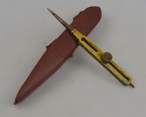
A Georgian jigsaw map engraving of the world by W. Cary (some losses) in original box with paper label for John Wallis, Ludgate Street, London, to/w a set of drawing instruments, 1930 map of Doncaster, a small leather suitcase, swagger stick with carved ivory bunched fist pommel and three whips

A collection of twenty two World War I magic lantern slides - photographs of Naval ships, to/w a map of German trenches, August 1918, four Air Leaguer's Albums of British Aircraft, and two albums of Player cigarette cards, RAF and Civil aircrafts and other cigarette cards (box) Condition Report Condition: Trench map holed at each centre 4-way fold, otherwise good for age, the slides good apart from submarine slide cracked.


-
109198 item(s)/page