We found 109182 price guide item(s) matching your search
There are 109182 lots that match your search criteria. Subscribe now to get instant access to the full price guide service.
Click here to subscribe- List
- Grid
-
109182 item(s)/page


Lot 74
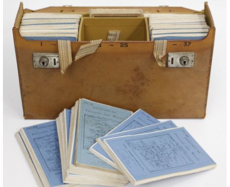
Six maps: 'Turkey in Europe' (with) inset map of Candia drawn and engraved by J. Rapkin with illustrations by H. Warren and engraved by J. Rogers; 'The Grecian Archipelago' according to the British Admiralty Survey drawn by Augustus Petermann, engraved by G. H. Swanston x 2; Plan of Ancient Athens, after Kiepert; Grecia Antica by T. Duvotenay and Macedonia all mounted but not framed and two engravings of London landmarks, all in good condition (8)


Lot 134
Assorted Wedgwood collectable's and an armorial framed printsTo include Wedgwood Jasper Ware trinket boxes, Wedgwood Queens Ware bowl, Burleigh Ware George V commemorative cup, Wedgwood tapering glass paper weight, three framed armorial prints, framed map "The road London to Buckingham", and an 18th Century pewter plaque, qty

Lot 607
David's Harp, consisting of about three hundred tunes adapted to Mr Wesley's selection of hymns, printed for R.Lomas early 19th century, The Students Instructor in drawing and working the five orders of architecture by Peter Nicholson, 1795, A Plea for Religion and the Sacred Writings addressed to the disciples of Thomas Paine by the Rev. David Simson, 1814, together with A.H. Swiss, No. 9 Hunting Map, with cloth cover


![[HUNTING] Collyns, Charles Palk. Notes on the Chase of the Wild Red Deer in the Counties of Devon and Somerset, limited edit](https://cdn.globalauctionplatform.com/b1cb7ef6-73ba-4eca-9be5-a73e009a6072/a47e1d89-8709-4289-93e5-8cf6acc33e5f/468x382.jpg)
Lot 601
[HUNTING] Collyns, Charles Palk. Notes on the Chase of the Wild Red Deer in the Counties of Devon and Somerset, limited edition of 1000, Lawrence & Bullen, London, 1902, full buckram gilt (upper joint split and spine strip glued), top edges gilt, eight plate and further text illustrations, quarto; Mills, John. The Life of a Foxhound, Hurst, London, 1848, pictorial green cloth gilt, seven plate illustrations, octavo; Aldin, Cecil. Exmoor, the Riding Playground of England, second edition, Witherby, London, 1935, cream cloth, five plate and further vignette illustrations, two folding maps, small quarto; three other works; and a Devon & Somerset Staghounds folding hunt map by Sifton, Praed & Co. (lacking lower cover), (7).
![[HUNTING] Evered, Philip. Stag-Hunting with the 'Devon and Somerset' 1887-1901. An Account of the Chase of the Wild Red Deer](https://cdn.globalauctionplatform.com/b1cb7ef6-73ba-4eca-9be5-a73e009a6072/fb016252-fa12-4ca3-aa80-3a5e6c93f732/468x382.jpg)
Lot 607
[HUNTING] Evered, Philip. Stag-Hunting with the 'Devon and Somerset' 1887-1901. An Account of the Chase of the Wild Red Deer on Exmoor, Chatto & Windus / Commin, London / Exeter, 1902, crimson cloth gilt (re-backed), top edges gilt, plate and text illustrations from photographs, quarto; Goss, Fred. Memories of a Stag Harbourer. A Record of Twenty-Eight Years with the Devon and Somerset Stag Hounds 1894-1921, second impression, Witherby, London, 1931, nine illustrations on seven plates (as called for), octavo; Scarth-Dixon, W. Devon and Somerset Staghounds, The Hunts Association, London, 1925-26, stiff paper covers, illustrations from photographs, period advertisements, 19cm x 13cm; Vowles, Alfred. Stag-Hunting on Exmoor, Barnicott & Pearce, Taunton, 1920, stiff paper covers, twelve plate illustrations from photographs, 18.5cm x 12.5cm; Vowles, Alfred. Wild Deer of Exmoor: History, Haunts, Habits, Cox Sons & Co. Ltd, Minehead & Williton, no date [circa 1936], orange boards, plate illustrations from photographs, folding map, 19cm x 13cm; and two other works, (7).
![[FISHING] Webster, David. The Angler and the Loop-Rod, Blackwood & Sons, Edinburgh & London, 1885, pictorial green cloth, ti](https://cdn.globalauctionplatform.com/b1cb7ef6-73ba-4eca-9be5-a73e009a6072/3c9ea5ee-0af5-4d8f-c15d-8f08361b2c03/468x382.jpg)
Lot 646
[FISHING] Webster, David. The Angler and the Loop-Rod, Blackwood & Sons, Edinburgh & London, 1885, pictorial green cloth, tissue-guarded portrait frontispiece, four colour plate, one folding and two text illustrations, one map, publisher's 'Books on Sport' advertisement leaf, twenty-four page publisher's catalogue, octavo.
![[FISHING] Grimble, Augustus. The Salmon Rivers of Ireland, second (revised) edition, Kegan Paul, Trench, Trubner & Co. Ltd,](https://cdn.globalauctionplatform.com/b1cb7ef6-73ba-4eca-9be5-a73e009a6072/b01cbd9d-3461-455c-e1e3-ec81a0927513/468x382.jpg)
Lot 648
[FISHING] Grimble, Augustus. The Salmon Rivers of Ireland, second (revised) edition, Kegan Paul, Trench, Trubner & Co. Ltd, London, 1913, pictorial bevelled navy blue cloth gilt, folding map frontispiece, plate illustrations from photographs, one further folding map, octavo (covers with damp marking at lower fore edge corners); and Grimble, A. Shooting and Salmon Fishing, Chapman & Hall, London, 1892, dark blue-green cloth gilt, eighteen tissue-guarded plate illustrations (one detached and lacking guard), octavo (hinges tender; front free endpaper almost detached), (2).


Lot 605
H. JALLIOT, TWO 17TH CENTURY FRENCH COLOURED ENGRAVINGS Map of Orleans, by H. Jalliot, 1696, inscribed in a Rococo style cartouche 'Gouvetnment D'Orleans et la Generalite devisee en ses elections par Le St Sanson Geographer Ord Du Roy A Paris chez H Jalliot aux Deum globes Alec privilege du Roy', together with a map of Nantes inscribed in a Rococo stake cartouche 'Carte de L'Evesche de Nantes dediee A Monseigneur Le Duc De Bourgogne', framed and glazed.
Lot 633
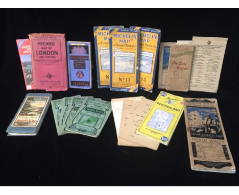
A SELECTION OF 1920'S AND LATER ROAD AND MOTOR TOURING MAPS To include W&AK JOHNSTON'S Motoring and Touring Map of Scotland, The Graded Road Maps, The Lake District and 'Bartholomews Revised Half-Inch Contoured Maps', sold together with two posters from Kent Motor Club Hill Climb, at the Devils Kneading Trough.


Lot 358
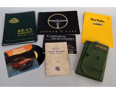
Automobile interest: A Lotus Elan Workshop Maual; a Jaguar "E" Type 1960s Sale Brochure together with a Jaguar Cars Ltd Apreil 1963 Price List of all models; a 1986 brochure for VW Polo; Peugeot 104 "The Year of the 104" 7" promotional vinyl record; a 1960s vintage AA pack, driving licenses and Motoring and Hiking Map;a 1937 International Driving Permit; Motor Fuel Ration Book; The Wolseley Fifteen Hundred Driver's Handbook (Fourth edition) and a 1968 "Cumfydrive car accessories" promotional handbook


![A 17th century map of 'Coventre' [sic] including two prospect views and a ground plan, a Robert Morden map of Cheshire c.1695](https://cdn.globalauctionplatform.com/1242238c-f718-4a88-a1a4-a74500e5b3d7/408d4955-6565-4471-e834-19705a3e9e2f/468x382.jpg)


Lot 2386
**AMENDED DESCRIPTION** An 18th century hand coloured engraving 'An East View of Dolwyddelan Castle in the county of Caernarvon', published 1742, a similar image 'The South East View of Cumner Abby [sic] in the County of Merioneth', published 1742 and three similar engravings of Welsh topographical subjects and a small double sided 18th century map of the road from Welshpool to Caernarvon and Dolgellau to Harlech, all framed and glazed (6).
-
109182 item(s)/page