Gibbon, Edward, The History of the Decline and Fall of the Roman Empire in 6 vols, London: Strahan and Cadell 1776, full calf with dec. gilt spines, 4toAll have half title.Portrait in vol II, map present in vols II and IIIVolume V has detached front coverVol II 1781, vol III 1781 vol 4 1788 vol 5 1788 vol 6 1785vol II has front cover coming away from spine but attachedNo torn or lost leaveserrata in vol II and III
We found 109182 price guide item(s) matching your search
There are 109182 lots that match your search criteria. Subscribe now to get instant access to the full price guide service.
Click here to subscribe- List
- Grid
-
109182 item(s)/page
An original WW1 Battle of Deville wood trench map, dated 1916 Somme, France, plus other examples (8) the Battle of Delville Wood (15 July - 3 September 1916), was a series of engagements in the 1916 Battle of the Somme in the First World War, between the armies of the German Empire and the British Empire. Delville Wood (Bois d'Elville), was a thick tangle of trees, chiefly beech and hornbeam (the wood has been replanted with oak and birch by the South African government), with dense hazel thickets, intersected by grassy rides, to the east of Longueval. As part of a general offensive starting on 14 July, which became known as the Battle of Bazentin Ridge (14-17 July), General Douglas Haig, Commander of the British Expeditionary Force, intended to capture the German second position between Delville Wood and Bazentin le Petit
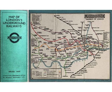
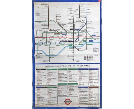
A selection of 19th century printed ephemera of The Americas to include an engraving by Isaac Weld, 'View of Rock Bridge' described in Thomas Jefferson's 'Notes on Virginia; View of Greytown and the harbour of St. Juan, Nicaragua, illustration of General Walker from London Illustrated News: Cuba, West Indies, Canada, etc, from The London Illustrated News, The Graphic and other publications to include: Views of Havana, Cathedral of Havana, Saint Helena map 1896, A View of the Town and Island of St. Helena by Alex Hogg, Longwood House; Port of Spain, Trinidad colour print, earthquake at St. Thomas, Jamaica Maroon town, Civil War of Guatemala, Barbados print of The Diving Boys, The Island of Montserrat, Codrington College, Hordley Estate, City of Paramaribo, St. George's Grenada, Iron Bridge, Falmouth, Jamaica, The Market at Nassau; Map of Newfoundland, Labrador, 1921; The Block, Collins St., Melbourne by Melton Prior, approximately 65 in total and A VOYAGE WITH THE MAILS BETWEEN BRISBANE - LONDON, AUSTRALIA AND GREAT BRITAIN, a memento by an Amateur Photographer with 103 Original Photographs, published by The London Stereoscopic Company, Ltd., London, 1911
Large quantity (80+) of 1920s onwards London Transport etc POCKET MAPS & LEAFLETS including Central & Country Buses, Trams & Trolleybuses, Green Line Coaches, Underground, Coronations, special events etc. Includes 2 copies of 1926 Map & Timetable for West London Association service 526D. Some are heavily used but most are good to very good. [84]
c1867 Metropolitan Railway MAP. The first London Underground map depicted in 'No Need to Ask' by Leboff & Demuth and certainly the earliest we have ever seen. Shows the original 1863 line plus the 1864/5 extensions to Kensington, Hammersmith & Moorgate plus further planned lines and those under construction, incl the first section of the Metropolitan District Railway. Single-sided, opens out to 12" x 13.5" (31cm x 34cm). In very good condition. [1]
c1910 Evening News LONDON TUBE MAP & GUIDE. Produced by George Philip & Sons and features a unique cover design of tunnel segments, one for each tube line (the sub-surface Underground lines are given equal status on the map!). Folds out from card covers to 23.5" x 19.5" (60cm x 50cm) and has a tramways map on the reverse. Light wear to the covers, the map is in very good condition. [1]
1929 and 1931 editions of "METRO-LAND" BOOKLET published by the Metropolitan Railway. The first is in generally very good condition, no fold-out map (did this issue have one?) and the second is in well-used condition, complete with fold-out Metropolitan Railway/Underground map, print-code M.1246/50M. The map is in very good condition. [2]
1919 edition of "Metro-Land' BOOKLET, published by the Metropolitan Railway. Includes the original fold-out map of 'Extension Lines into Metro-Land' on one side and the central section of the Metropolitan Railway, rest of the Underground and other railways on the reverse. Booklet has a loose cover and reinforced spine, otherwise in very good condition. The fold-out map is in excellent condition. [1]
Complete set (6) of 1912 Metropolitan Railway POSTCARDS, the 'geographical' series, a number of which were initially given away, the envelope stating that the cards would shortly be available for sale at booking offices. Each card shows a section of the line, along with golf courses, superimposed on a map of the area. This set comes with its original envelope, the latter shows some wear but the cards themselves are in excellent condition. [6 + envelope]
1950s/60s Southern Vectis Omnibus Co DISPLAY BOARD for Isle of Wight tours. One side has a permanent display for the 'Round the Island' tour with an attractive painted pictorial map, the other is a blank blackboard for chalked displays. These boards were displayed outside the company's booking offices or in front of a stationary bus or coach. Wooden-framed, measures 23.5" x 39" (66cm x 99cm). In generally good, well-used condition, a little loss on the painted side, not affecting the display, some damage to one leg. [1]
1913/14 Metropolitan Railway POCKET MAP. This is the standard Underground map of the time, overprinted in large red letters 'Metropolitan Railway shewn in red' and with the East London Railway changed to that colour also. The reverse carries the Met's own information although, interestingly, the cover includes the then standard UERL slogan 'What to see and how to see it'. A most unusual issue. Opens out to 13.5" x 11" (34cm x 28cm). In used condition, fragile on some folds with some tape repairs to the reverse. [1]
1979 British Railways Southern Region CARRIAGE DIAGRAM of suburban services with inset 'Inter-Terminal Links by London Underground'. Printed onto aluminium and curved to fit the carriage profile. Measures 42" (106cm) x 8" (20cm) and in very good, ex-use condition. Plus a thin-card CARRIAGE MAP 'Southern Region' and 3 x 1960s-on Southern Region fold-out MAPS ex-timetables, all in fair to good condition. [5]
1947 London Underground quad-royal POSTER MAP by H C Beck 'London Transport Railways'. Print-code 1047/2292M/5000. Shows the planned extensions of the Central Line to Ongar and West Ruislip and the subsequently abandoned Northern Line ones to Alexandra Palace, Mill Hill (The Hale) and Bushey Heath. Beck has thickened the lines to allow the line names to be included within them. A few short inward tears, minor edge-scuffs, some creasing in places but overall a good example. Previously folded. [1]
1911 (May-July) Southwold Railway TIME TABLE BOOKLET, including fold-out map of the line. This famous 3ft gauge railway connected the Suffolk seaside resort of Southwold with the GER main line at Halesworth. It operated from 1879-1929. Today's Southwold Railway Trust aims to restore the railway. The booklet has a loose front cover and no back cover but the contents are very good. [1]
c1928/9 London Underground linen-card POCKET MAP from the Stingemore-designed series of 1925-32. This is one of the two first issues of the larger, second series and is the one with the yellow cover. These were issued before any of the line extensions were projected. An excellent example, crisp and firm. [1]
"The Improved 'District Railway' MAP of London", 3rd edition, dated 1882. An early issue from this series that ran from 1873-1907. Shows the final part of the Inner Circle and the extension to Whitechapel as authorised or under construction. Backed onto heavy linen with a thin linen cover and opens out to 42" x 26" (107cm x 65cm). In heavily-used but still reasonable condition, cover is tatty. [1]
Selection (3) of 1920s Metropolitan Railway etc MAPS comprising c 1923 Met Rlwy Map of London (the Met's version of the Underground pocket map) with print-code G1608/100,000 (map side is very good, reverse has tape on folds), c1924 Met Rlwy 'Map of Extension Lines into Metro-Land' with Diagram of Lines in/near London on reverse (one tatty edge with short tear, otherwise good) & 1924 British Empire Exhibition official guide with plan & Underground map by Kennedy North in MacDonald Gill style (lightly-used, good condition). [3]
1933 London Underground H C Beck diagrammatic, card POCKET MAP from the first-year series titled 'Underground Railways of London'. Issued c.September 1933 and has print reference 33-2791. Shows the escalator connection between Bank and Monument stations. In used condition with some wear, small stains, date written at top of cover in tiny writing but overall still a good example. [1]
c1911 London Underground POCKET MAP printed by Johnson, Riddle & Co Ltd. This edition shows the 3 separate Hammersmith stations, the CLR extension to Liverpool St under construction and the LBSCR lines to Crystal Palace. Opens out to 10.5" x 8" (27cm x 20cm). In very good, lightly-used condition. An ex-guidebook copy, folded accordingly, with the usual printer's cut-out at the margin and a trace of adhesive at one edge. [1]
1947 London Underground quad-royal POSTER MAP by H C Beck 'London Transport Railways'. Print-code 1047/2292M/5000. Shows the planned extensions of the Central Line to Ongar and West Ruislip and the subsequently abandoned Northern Line ones to Alexandra Palace, Mill Hill (The Hale) and Bushey Heath. Beck has thickened the lines to allow the line names to be included within them. Short inward tears at the l/h side, minor edge-scuffs, some creasing in places but overall a good example. Previously folded. [1]
1946 London Underground double-royal POSTER MAP by H C Beck 'Underground Routes to and from the main-line stations'. An early post-war issue of a poster first issued during WW2 mainly for military personnel. Shows the subsequently-abandoned Northern Line extensions. Below the Beck map is an index showing travel details between main-line stations. Some foxing spots towards the top and bottom, scuffs, creases and short tears at the bottom edge, small label at the top r/h corner but still presents well. A most unusual issue. Previously folded. [1]
-
109182 item(s)/page