We found 109182 price guide item(s) matching your search
There are 109182 lots that match your search criteria. Subscribe now to get instant access to the full price guide service.
Click here to subscribe- List
- Grid
-
109182 item(s)/page


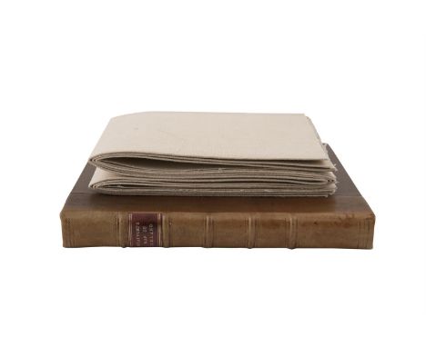
Lot 206
MCCANCE, CPT. SHistory of the Royal Munster Fusiliers, Cork, 1995, Schull Books, a facsimile reprint of the first edition from Gale & Polden in 1927, consisting of 2 hardback volumes of text and a map case of 41 large individual map sheets. A fine set of the 3 oversize volumes in slipcase, limited edition copy numbered 196/200. Illustrated with colour plates; together with Lieutenant-Colonel H. S Jervis, The 2nd Munsters In France, Cork, 1998, Schull books a facsimile reprint of the first edition from Gale & Polden in 1922. (4)
Lot 33
BEAUFORT, D.AA New Map of Ireland Civil and Ecclesiastical by The Rev. D.A. Beaufort, London and Dublin, 1792, 1st. Edition, 1120 x 890. Dedicated to King George the third by the author. Depicted are the counties, towns, cities, villages, parishes, boroughs, churches, antiquities, rivers, mountains, lakes and islands. Title set within an engraved trade and commerce scene with a ship on the ocean, a large oak tree, a round tower and four cherubs. Contemporary colouring. Lines of latitude and longitude. Scale in English and Irish miles and French leagues. Fine condition in a half leather solander fitted box with morocco title label


Lot 157
"From the Library of William Morris, Kelmscott House". BOOTH G. (Trans). The Historical Library of Diodorus The Sicilian. 3 eng. maps incl. double page map of Sicily. Occasional page repairs & two leaves apparently in old facsimile, browning & foxing. Folio. Old calf brds. neatly rebacked. 1700. Bears the book label of William Morris, the bookplate of Buxton Foreman & the card of Tchine Pomm.


Lot 192
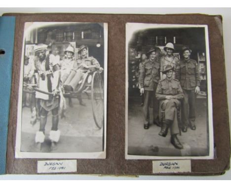
A BOX CONTAINING A LARGE QUANTITY OF MILITARY CAP BADGES, shoulder titles from the WWI/WWII era, some possible re-strikes, together with a large number of loose enamel badges covering various topics, to include Motor Cycles, cars, bowling, TUC etc, together with a copy of Medal Year book 1981, loose medal ribbons and an old fold over map, also included is an album with further Military Cap badges etc


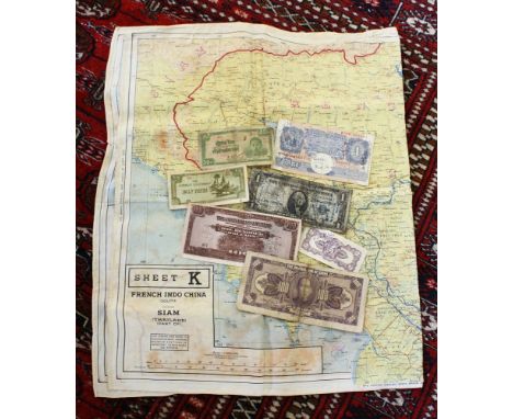
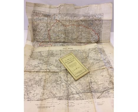
Lot 482
A WW2 military double sided silk map, Sheets J - French Indo China (Central) and Siam (Thailand) (East) and Sheet K - French Indo China (South) and Siam (Thailand) (Part Of), 1:1,000,000 scale, 36.5 x 22.25in. (92.5 x 56.5cm.), together with a small collection of international bank notes, some signed by troops during WW2. (8)
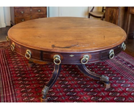
Lot 160
A Regency mahogany plan or map table, the deep, circular revolving top with four frieze drawers alternating with four faux drawers, with ring handles on rosette back plates, raised on a substantial turned column with gadrooned upper section, on four swept, channelled supports with decorative brass cap castors, 60in. (152.5cm.) diameter, 29½in. (75cm.) high.* The family believes that the table was made by Trotter & Young of Edinburgh, c.1830.** Condition: Although low, the table doesn't appear to have been reduced in height. The top revolves, although it is a little stiff. The base has a substantial iron bracket beneath the top of the supports - this may have been added later, as there appear to be some old splits and cracks around the lower section of the column and top of one of the legs. The end of one leg has been repaired, approx. 2in. in from the brass cap. The table shows sign of considerable daily use as a dining table - the polish throughout is worn and there is wear around the brasses from cleaning and use. One side of the top has some dark spirit stains and the centre joint of the top is separating a little. Three of the legs appear to have a worn dark stained finish, but the other is not stained, which is a little odd - possibly this leg has been off and repaired at some point, as there are three dowels showing near this leg in the lower column. The table overall is stable and useable but would benefit from restoration to the finish.


Lot 97
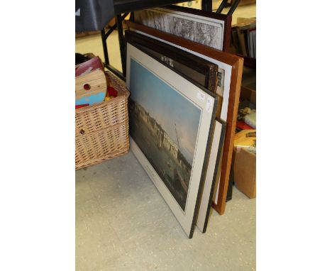
Two indistinctly pencil signed artist's proofs, Aix En Provence and Abergavenny, an architectural print of Berlin, a reproduction map of Northamptonshire, a print after Matisse, a 19th century coloured engraving of Boughton Church and other prints, including a cut down canvas portrait in the manner of Van Gogh


Lot 852
Genius of Friendship "T E Lawrence" by Henry Williamson, first edition published by Faber & Faber Limited, Seven Pillars of Wisdom by T E Lawrence, deluxe edition 1938 together with an interesting collection of postcards and black and white photographs both loose and in albums of various areas of the middle east and North Africa together with a map of Amman


Lot 376
1057821 Gnr C Stannard - Royal Artillery military medal, 1914-15 Star, 14-18 War Medal and Victory Medal, Long service and Good Conduct medal (George V In Field Marshalls Uniform), 39-45 War Medal & Defence medal in postage box addressed to C Stannard, together with a cloth map of Europe and a brooch made from two spent bullets


Lot 771
A 19th century oil painting on canvas of a river scene with figure and cottage, signed bottom right Francis, 51 x 77 cm approx, unframed together with a further unframed oil painting on canvas of a mountainous lake scene, a mid-20th century coloured print of a floral still life after Barbara Shaw, dated 1951, in swept gilt frame, a 1921 Ordnance Survey map of the Synwell area of Wotton under Edge and another of the Bournstream area, both unframed


-
109182 item(s)/page