We found 109182 price guide item(s) matching your search
There are 109182 lots that match your search criteria. Subscribe now to get instant access to the full price guide service.
Click here to subscribe- List
- Grid
-
109182 item(s)/page


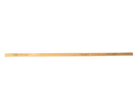
Lot 123
Captain Sir Robert Beaufin Irving, OBE, RNR (Rtd) (1877-1954). A brass map rule inscribed 'Capt R B Irving':, 91.5 x 2.5 x 0.5cm*Notes- Sir Robert joined Cunard in 1904 and during WWI he was mentioned in dispatches for his service at the battle of Jutland on the light cruiser HMS Yarmouth. In 1932 he was marine adie de camp to King George V and took command of RMS Queen Mary in 1937. In 1938 he won renown by docking the Queen Mary without the aid of tug boats by his own judgement and skill and two helpers in a rowboat. In the same year he became Commodore of the Cunard fleet.


Lot 160
"Geographia" railway map of Great Britain and Ulster, produced by Geographia 1923 for Fleet Sales Service Limited, London, a Trains Illustrated Summer annual no.3, a Trains annual 1955, a Trains Illustrated annual 1959, a Trains annual 1957, "Memories of Steam" LP, a collection of steam locomotive stereophonic recordings and a collection of early 20th century train postcards


Lot 263
Edward GibbonTHE HISTORY OF THE DECLINE AND FALL OF THE ROMAN EMPIRE, 4 VOLSLondon: J Mc Gowan, 1825-18268vo, 501pp, 489pp, xxx + [1] + 538pp, 498pp, three plates + 4 folding maps, half bound, boards rubbed and worn, foxing and tanning especially in prelims and plates, hinges starting, Vol I: short tear in map; Vol II: one text page with closed tears, large folding map loose, Vol III: faded blue ink on first page(4)

Lot 267
James Alexander (ed)LIFE OF FIELD MARSHALL, HIS GRACE THE DUKE OF WELLINGTON, 2 VOLSLondon: Henry Colburn, 1839-18408vo, Vol I: [xv] + 491pp, 7 plates + 1 fold out plan + one fold out map; Vol II: [vii] + 576pp, 5 plates + one fold out map; half bound, marbled text block edges, boards and edges worn, previous owners' names in prelims, one plate in Vol I absent, foxing and tanning in prelims and plates, maps with short tears in map hinges(2)

Lot 276
Henry H StanleyTHROUGH THE DARK CONTINENTLondon: George Newnes, 18994to, volume I and II bound as one, Vol I: xxv + 400pp, 16 plates + 6 maps of which one folds out; Vol II: xi + 419pp, 18 plates; half bound, wear to boards, front hinge starting, 2cm tears in map hinge; and David LivingstoneA POPULAR ACCOUNT OF MISSIONARY TRAVELS AND RESEARCHES IN SOUTH AFRICALondon: John Murray, 18758vo, ix + 436pp, 13 plates of which one folds out + one folding map, half bound, wear to boards with small damp marks, hinges worn with back hinge half cracked, award plate on ep and stamp on title page, foxing and tanning, 3cm tear in map hinge(2)

Lot 277
John Hanning SpekeWHAT LED TO THE DISCOVERY OF THE SOURCE OF THE NILEEdinburgh & London: William Blackwood and Sons, MDCCCLXIV [1864]8vo, halfbound, 380p, frontis + 1 fold out map + 1 double page map, wear to boards, previous owners' names in eps, foxing especially in prelims, first and last free fly leaf tanned

Lot 278
John Hanning SpekeJOURNAL OF THE DISCOVERY OF THE SOURCE OF THE NILEEdinburgh & London: William Blackwood and Sons, MDCCCLXIV [1864]SECOND EDITION, 8vo, xxxi + 658 + [ii] ad pp, 26 plates + 1 folding map, half bound, one plate mostly loose, 3cm tear at map hinge, wear to head and foot cap, corners bumped, back hinge opening, inside hinge starting
![George RollosACCURATE MAP OF AFRICALondon: S Crowder, (1764)[1760s]Copperplate engraving, outline colour, centrefold, waterma](https://cdn.globalauctionplatform.com/eb6e9d57-bfe2-4122-9544-aeab00dd00fd/9c69375f-2c95-42c3-8abb-aeac00beec7d/468x382.jpg)
Lot 307
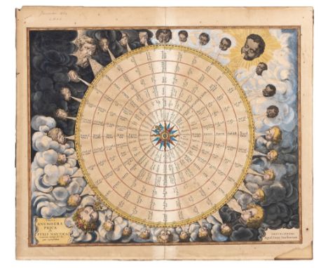
Jan JanssonTABULA ANEMOGRAPHICA SEU PYXIS NAUTICA VENTORUM NOMINA SEX LINGUIS REPRAESENTANS[Wind Rose, Anemographic, or Map of the Winds]Amsterdam: Jan Jansson, (1650)[c1650]Copperplate engraving, full colour, centrefold, age toned with light strip along centrefold, pencil note in margin, damp mark in bottom right corner within border, light foxing; verso: Dutch text, 5cm closed tear 3cm within neatline; framedFrom Jansson's Atlas Maritimus or Atlantis Majoris43,5 by 54,5cm


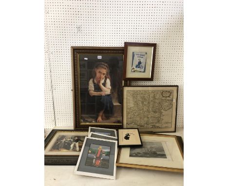
Lot 315
A collection of 19th century engravings and prints to include: 'The Magic of the Mersey' watercolour drawings by Sam. J. M. Brown, printed and published by the Liverpool Daily Post; 'A Map of Devonshire with its Hundreds by Richard Blome' from 'Britannica', published 1677; engravings by Win Ward Jun, after E Debat-Ponsan, W. O. Geller after Joshua Reynolds, and others; and 'Royal Aquarium programme and arrangements for week ending October 26th 1889, 66 x 44 cm, framed and glazed (12)
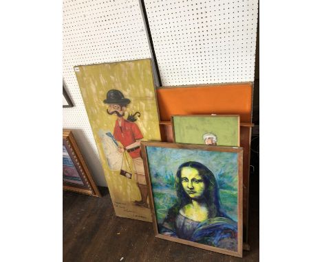
Lot 344
Six original artworks to include: modernist abstract painting, oil on canvas, indistinctly signed and dated verso., 79 x 103 cm; student painting of a dalek 60 x 74 cm; framed relief of a giraffe 50 x 87 cm; Paul Shreder, caricature portrait of a professor, 1961, 37 x 93 cm; mixed media Mona Lisa on paper, 60 x 76 cm; and caricature of a gentleman holding map of London 'Thanks for the Safari in London', signed 'Gabris 1970' 122 x 51 cm (6)


Lot 411
Large group lot of thirty-eight framed prints to include: engraved portraits of George Calvert, Countess of Suffolk and Margaret Countess of Cumberland; two lithographs after Margaret W. Tarrant; a colour map of Gloucestershire; four colour prints of engravings of horses, a quantity of coloured engravings of birds; lithographic prints of plants and others (39)


Lot 172
An interesting late 19th century album containing photographs of China, the building of a church and hospital, also allied troops involved in the Boxer uprising, local life, etc, early 20th century sailors diaries, etc, together with an Official Railway Map of England and Wales published by the Railway Clearing House (15)


-
109182 item(s)/page