We found 109182 price guide item(s) matching your search
There are 109182 lots that match your search criteria. Subscribe now to get instant access to the full price guide service.
Click here to subscribe- List
- Grid
-
109182 item(s)/page


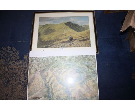


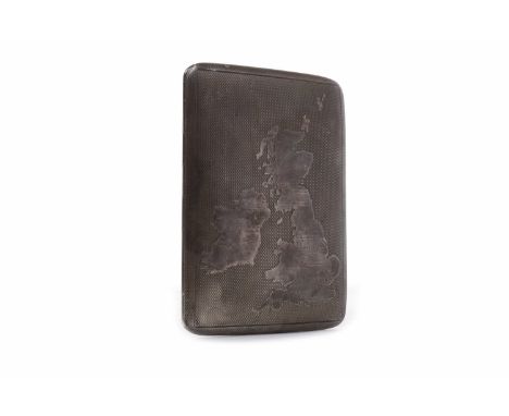
Lot 87B
The Silver Map Of Great Britain' with Boundary Lines and the Coats of Arms of the Historic Counties, hallmarked silver with embellished with 24ct gold, limited edition no. 0221/3000 for the Golden Jubilee, 1977 with certificate, framed, 50cm x 70cm Condition Report Click here for further images, condition, auction times & delivery costs


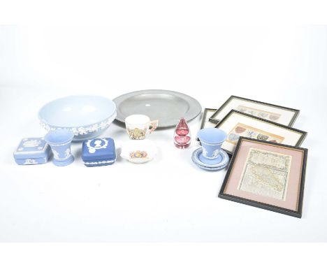
Lot 216
Assorted Wedgwood collectable's and an armorial framed printsTo include Wedgwood Jasper Ware trinket boxes, Wedgwood Queens Ware bowl, Burleigh Ware George V commemorative cup, Wedgwood tapering glass paper weight, three framed armorial prints, framed map "The road London to Buckingham", and an 18th Century pewter plaque, qty


Lot 160
Dun (Douglas) and Ackroyd (Norman) - The Pictish Coast, 1988 Penny Press, 4to., numbered 18 of a limited edition of 45, signed by the poet and the artist, double page map, nine etched plates with aquatint (some plates not as per title sheet), each titled, numbered, dated and signed in pencil to the margin by the artist, unbound as issued, with wraps in cloth solander box Condition Report / Extra Information In excellent overall condition.


Lot 390
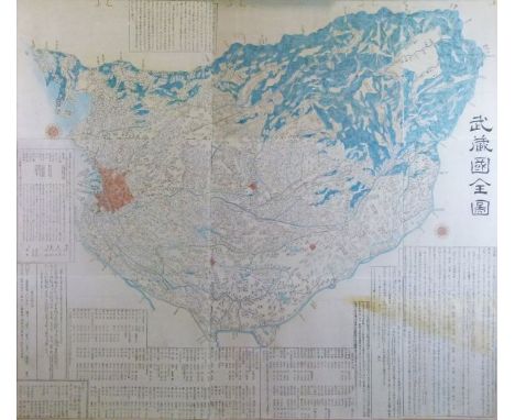
Japanese Edo period large scale wood block map of Musashi Kuni (Tokyo or Edo Province), made from separate sheets, but now laid down as one, 111cm x 127cm Condition: Large area of yellow staining to bottom right corner, old worm damage across top margin, laid down - **General condition consistent with age

Lot 402
Early 19th Century Newton's 3" New & Improved Terrestrial Pocket Globe having coloured engraved gores and with original fish skin case decorated to the interior with a celestial map Condition: There are a few areas of the globe where the varnish is a little rubbed, most noticeably to South America and the title cartouche, the celestial chart is a little rippled in places, light wear to the outside of the case and possible patching of fish skin to the top of dome on each half - **General condition consistent with age


Lot 480
A vintage leather map case containing a map measuring instrument, together with assorted vintage Bartholemew's maps of England and Wales, published by Edward Stanford, 12,13 and 14 Long Acre London CONDITION REPORTS The case has a wax seal on it and paper labels, ripping to the stitching and leather and surface scratching and staining, scuffing, etc. There is also a chunk of leather missing from the board at the very front and on the right hand corner especially. Missing map No. 9. Map Nos. 4, 6, 10, 12, 17, 18, 19, 20, 23, 24, 26, 28, 30, 32, 35 and 36 appear to be cut at the base. No. 11 has some heavy staining to the crease. No. 13 also appears to have been cut and has various red ballpoint pen marks in various places. No. 16 has discolouration all over and especially to the right hand and bottom edges, as well as some foxing to the sea. No. 23 also bears blue and black ballpoint pen. circles in various places. No. 33 has some dark browny red spots to the left hand side. All maps smell a bit musty and have general wear and tear conducive with age and use to include some foxing, discolouration, etc. See images for further details. There are some marks to the fronts and backs of the covers.

Lot 369
A Tombleson's panoramic map of the Thames at Medway, published by T Reynolds, 174 Strand,folding map with board covers; Taunts Map and Guide to the Thames, New Pocket Edition; an early 19th century plan of the City of Chichester and a print after H Cook ,North View of Chichester Cathedral (a/f) 27cm by 35cm


Lot 137
Eight pieces of Quimper pottery, and a Dorincourt commemorative plate. Largest length 41 cm. CONDITION REPORT: One fish plaque has a break across the tail which has been poorly glued. Both have minor glaze nibbles particularly around each fish mouth. The octagonal plate is in good order. The circular plate with man wearing a cap has a small under edge glaze nibble and 2 cm faint hairline crack. The circular saucer with yellow band has an edge glaze nibble and minor surface scratches. The shallow saucer has a small glued chip repair to the top lip. The cup is in generally good order. One of the pair of plates has a substantial 3 cm loss to the foot rim. The other plate is in good order. The map plate is in good condition. All items are a little dirty.


Lot 859
An 1838 geological mineral map of England and Wales, by J.A. Knipe. 80 cm x 106 cm, with mahogany roll. CONDITION REPORT: The top wooden cornice is in generally good condition. The map itself has various old creases and scuffs which should be evident from our image. The main problem is a small tear and loss to the top right hand corner between and below the M and the I on mineralogical. There are numerous small scuffs and marks all over the map but no other real issues. Both map edges have lost most of their original edge cloth. The bottom of the map is detached from the original tacks on the bottom roll. The map is now held in place by tape. This should be relatively easy to rectify.


Lot 934
An antiquarian map, probably Michael Drayton, Map of Gloucestershire circa 1612. 26 cm x 33 cm, framed. CONDITION REPORT: There is a small tear and loss to the very top centre of the map just above the top point of the fold near the margin. To disguise this the black line surrounding the map has been inked in for approximately 1 cm. This should be visible on our images. Apart from this the map is in generally good condition with no further issues. We cannot access the back of the map.


![JOHN SPEEDE, (British, 1552-1629), 'Penbrokshyre', [sic], original uncoloured map with English text verso, Thomas Bassett and](https://cdn.globalauctionplatform.com/5d5fda85-31af-410b-b571-a71900a35a3c/186580e2-2d08-47db-fa81-6bc73743693d/468x382.jpg)

Lot 185
JOHN SPEEDE, (British 1552-1629), 'Wales', an uncoloured map of the entire Principality together with vignettes, John Sudbury and George Humble edition bearing date: 1610. 39 x 51.5cm. Burr maple frame. CONDITION REPORT: Appearing in good original condition with ample margin to the plate mark, minor marks, a little grubby.


Lot 186
R. SAYER AND J. BENNETT, 'A Plan of Milford Haven in Pembroke Shire', sparsely coloured. 52 x 70cm approx., together with Captain Greenvile Collins, 'The River Avon from the Severn to the Citty of Bristoll', [sic], coloured map, with dedication to the Right Worshipfull Robert Yate esq. Mayor of Bristoll. 41 x 94cm approx. (2) CONDITION REPORT: Milford Haven map has minor foxing in places and is very flat so may be stuck down, River Avon map is not stuck down, has some foxing and creasing.

-
109182 item(s)/page