We found 109182 price guide item(s) matching your search

Refine your search

Year

Filter by Price Range
  • List
  • Grid
  • 109182 item(s)
    /page

Lot 123

Nottinghamshire. Blaeu (Johannes), Comitatus Nottinghamiensis Nottingham Shire, Amsterdam, circa 1645, engraved map with contemporary hand-colouring, 385 x 500 mm, French text on verso, together with Bowen (Emanuel). An Accurate Map of Nottinghamshire Describing its Wapotakes and Divisions Drawn from the Best Authorities, Illustrated with Historical Extracts..., H. Overton, J. Bowles & Son, T. Bowles, Bakewell & Parker, J. Ryal, R. Sayer and T. Kitchin [1762 or later], engraved map with contemporary outline colouring, slight overall toning, 510 x 415 mmQty: (2)Footnote: The second map described was originally published in 'The Royal English Atlas' and appears to be the first state.

Lot 125

Ogilby (John). A collection of 9 road maps, 1675 or later, nine uncoloured engraved strip road maps, some marginal fraying and closed tears, slight staining, occasional duplicates, one map torn with loss and laid on later newspaper, each approximately 330 x 450 mmQty: (9)Footnote: The map sheet numbers are: 15, 35, 48, 55, 60 (2), 66, 82 & 97,

Lot 126

* Ortelius (Abraham). Spectandum dedit Ortelius mortalib orbem Orbi spectandum Galleus Ortelium. Papius, [1579 or later], hand-coloured engraved portrait of Abraham Ortelius, 325 x 220 mm, mounted, framed and glazed, together with Title Page. Theatrum Orbis Terrarum, Antwerp [1570 or later], hand-coloured engraved title page, frayed and creased with slight loss to the lower right corner, some dust soiling and slight staining, 370 x 230 mm, mounted, framed and glazed, with Ortelius (Abraham). Schlavoniae, Croatiae, Carniae, Istriae, Bosniae, Finitimarumque Regionum Nova Descriptio, Auctore Augustino Hirsuogelio [1603], engraved map with contemporary hand-colouring, old watercolour oxidised causing the paper to crack and flake with some loss, crudely repaired on verso, 335 x 460 mm, mounted, framed and double-glazed, Latin text on versoQty: (3)Footnote: The last item described. Marcel van den Broecke, Ortelius Atlas Maps,145.

Lot 127

Pine (John). Three sea charts, nos. 1 & 2, 3 & 4, and 5 & 6, and one pictorial representation of the Spanish & English fleets, originally published in 'The Tapestry Hangings of the House of Lords, Representing the Several Engagements between the English and Spanish Fleets, in the Ever Memorable Year MDLXXXVII ..., London: John Pine, 1739, three hand-coloured engraved sea charts comprising double charts of the English Channel showing the progress of the Spanish Armada and the deployment of the English fleet, after H. Gravelot, each map displayed within highly decorative borders, library blind-stamp to the lower margin of sheet 1, faint marginal staining, each approximately 385 x 615 mm and one hand-coloured engraving (no. 3), after C. Lempriere of the English fleet bearing down on the Armada, 385 x 605 mm,Qty: (4)

Lot 128

* Playing Card Maps. Morden (Robert), Cardigan Sh. & Carmarthen Sh. 1676 - 1733, two playing card maps of Cardiganshire, both with contemporary outline colouring, one from the earlier edition with the suit mark (6 of spades) and one from the later edition with the suit mark, both trimmed to the image, each approximately 90 x 55 mm, mounted with Carmarthen Sh. uncoloured playing card map without the suit mark but with the Roman numeral 'IX' in the upper right corner, 90 x 55 mm, the two cards without a suit mark placed inside a mount aperture, the VI of Spades tipped on to the mount and displayed between them, all presented in a single frameQty: (1)

Lot 129

Polish Cities. Munster (Sebastian), Der Herrlichen und weitberhuempten Statt Stettin in Pomern warhaffte abcontrafactur, Basle, circa 1570, hand-coloured engraved panorama, slight text show through, 240 x 360 mm, German text on verso, together with Merian (Matthaus). Cracovia, circa 1650, hand-coloured engraved panorama, old folds, slight staining, some damage to the central fold, strengthened and repair on verso, trimmed to the neatline along the horizontal borders, margins extended, 205 x 365 mm, with Camoccio (G. F.). Fortessa di Soppoto, circa 1575, engraved city panorama with contemporary hand-colouring, 225 x 300 mm, plus De Fer (Nicolas). Varsovie, Paris, circa 1715, hand coloured city plan with a panorama below the map, engraved by A. Coquart, 235 x 340 mm, with another uncoloured copy, and Pufendorf (Samuel Baron von). Yltze, circa 1700, hand-coloured engraved panorama of the city of Liza, very small area of restoration at base of the central fold, 215 x 345 mm, together with Ferdinand Venus in Zittau (Karl August). Munsterberg, [1798], hand-coloured engraved panorama, descriptive German text below the image, 170 x 250 mm, with another eleven small city views, maps and plans, including examples by or after Cellarius, Meisner, Sandrart, Hartknoch, Rauert and Leich, various sizes, good conditionQty: (18)

Lot 131

* Prussia. Ruscelli (Giralomo), Tavola Nuova di Prussia et di Livonia, originally published in 'La Geographia di Claudio Tolomeo Allessandriono', Venice, circa 1561, hand-coloured woodblock map, margins torn and frayed with slight loss to the title (replaced in facsimile), 190 x 250 mm, mounted, framed and glazed, together with Euler (Leonhard). Borussia Regia et Ducalis..., Berlin, [1760], engraved map with contemporary outline colouring, slight overall toning and staining, some crude tape repairs to the recto of the central fold, 305 x 415 mm, mounted, framed and glazed, with Ortelius (Abraham). Prussiae Descrip. [1598], uncoloured engraved miniature map, Italian text above, below and on the verso, map size 75 x 105 mm, mounted, framed and glazed, plus Van der Schley (Jakob). Carte Generale des Villes et des Bailliages de la Prusse avec Partie de la Pologne et de la Vistule depuis Dantzig jusques a Warsovie, circa 1740, hand-coloured engraved map, old folds, 255 x 410 mm, mounted with another uncoloured and slightly later edition, framed and glazed, and Merian (Matthaus). Prussiae Nova Tabula [1650], engraved map with contemporary outline colouring and some later enhancement, mounted with another copy similar, framed and glazedQty: (5)

Lot 132

* River Thames. Stockdale (John, publisher), Map of the River Thames, 1796, engraved map with contemporary outline colouring, old folds, 235 x 855 mm, mounted, framed and glazed, together with Bowen (Thomas). A Correct Draught of the River Thames from its Spring in Glocester Shire to its Influx into the Sea..., The London Magazine, 1775, hand-coloured engraved map, inset table of locks, bridges and weirs, old folds, some creasing and dust soiling, thread margin on the left-hand vertical border, 190 x 605 mm, mounted, framed and glazed, with Whitworth (Robert, Surveyor). Plan of the Intended Navigable Canal from Moor Fields into the River Lee at Waltham Abbey, Surveyed by order of the City of London, circa 1775, uncoloured engraved map, old folds, slight toning, 130 x 510 mm, mounted, framed and glazed, plus Coronelli (Vicenzo Maria). Disegno Idografico del Canal E Reale..., circa 1695, uncoloured engraved map, two large decorative cartouches, slight creasing, 455 x 605 mm, mounted, framed and glazedQty: (4)

Lot 134

S. D. U. K. (publishers). Maps for the Society for the Diffusion of Useful Knowledge, vol.2 (only) Chapman and Hall, 1844, printed title, loosely inserted map of 'The World on Mercator's Projection' (not called for), 45 (only of 49 maps), lacking British North America, New South Wales, Western Australia & Islands of New Zealand, 42 city plans (only) lacking Berlin, Birmingham, Dresden, Frankfort, Geneva, Hambourg and Munich, slight dust soiling throughout, upper hinge broken, contemporary half morocco, rubbed and worn, folioQty: (1)Footnote: Sold as a collection of maps, not subject to return.

Lot 136

* Shropshire. Speed (John), Shropshyre Described, The Sittuation of Shrowesbury Shewed with the Armes of those Earles and other Memorable things Observed, Thomas Bassett & Richard Chiswell [1676], hand-coloured engraved map, inset town plan pf Shrewsbury, large strapwork cartouche and compass rose, slight text show through, 385 x 510 mm, mounted, framed and glazed, together with Blaeu (Johannes). Staffordiensis Comitatus vulgo Stafford Shire, Amsterdam, circa 1650, engraved map with contemporary hand-colouring, decorative cartouche and mileage scale, 415 x 510 mm, mounted, framed and double-glazed, French text on verso, with Buck (Samuel & Nathaniel). The South West Prospect of Shrewsbury, 1732 [but a later impression], uncoloured engraved panorama, old folds, trimmed to the neatline on the vertical margins, right-hand margin replaced in facsimile, repaired closed tears, 305 x 780 mm, mounted, framed and glazedQty: (3)

Lot 137

Staffordshire. Speed (John), Stafford Countie and Towne with the ancient Citie Lichfeild described, John Sudbury & George Humble, 1627, hand-coloured engraved map, inset town plans of Stafford and Lichfield, slight overall toning, lower margin strengthened on verso, central fold strengthened at the base on the verso, some creasing, 385 x 510 mm, English text on versoQty: (1)

Lot 138

* Surrey. Blaeu (Johannes), Surria vernacule Surrey, Amsterdam, circa 1650, engraved map with contemporary outline colouring, slight creasing, on e marginal closed tear affecting the printed surface, slight staining, 385 x 500 mm, mounted, framed and double-glazed, Latin text on versoQty: (1)

Lot 142

The Fens. Wells (Samuel), To the Most Noble The Governor, The Bailiffs and Conservators of The Great Level of the Fens Called Bedford Level..., 1st edition, G & I Cary, 1829, engraved map with contemporary hand-colouring, sectionalised and laid on linen, calligraphic title cartouche, mileage scale, table of explanation, compass rose and the arms of the company which undertook the drainage, slight staining, 820 x 790 mm, marbled endpapers, bound in contemporary red half morocco gilt over marbled boards, joints cracked, some wear to extremitiesQty: (1)Footnote: A scarce map of the Fens. The coat of arms bears the motto '“Arridet Aridum”. A translation would be? 'dryness pleases'. We could find only one copy listed on Copac which is held by the National Trust Libraries. There is also another copy in the Victoria State Library in Australia.

Lot 143

Thomson, (John, publisher). A New General Atlas Consisting of a Series of Geographical Designs on Various Projections Exhibiting the Form and Component Parts of the Globe..., Edinburgh & John Cumming Dublin. 1817, folding frontispiece of a comparison plate, printed title, dedication to Alexander Keith of Dunottar and Ravelston, index and 22 pages of introductory text and 22 pages of a consulting index, 50 (only) double page and folding engraved maps, lacking The Northern Hemisphere, Western Hemisphere, North Horizontal Hemisphere, South Horizontal Hemisphere, Remote British Islands, Denmark & Iceland, Chart of the Mediterranean, Switzerland, Persian Empire, General Map of America, North America, Spanish North America Northern part, Spanish North America Southern part, Jamaica, Barbados & St. Vincent [and] Chart of the North-West Passage, slight staining, bookplate of Thomas King, text block cracked and broken, hinges and joints cracked and split, contemporary half calf gilt, rubbed and worn, folioQty: (1)Footnote: Sold as a collection of maps, not subject to return.

Lot 146

Wales. Saxton (Christopher & Webb William), Radnor, Breknok, Cardigan et Caermarden, quatuor australis Cambriae comitatuum (B.Dehenbart. A Southwales) descriptio, Ano. Dini, 1642 [1645], uncoloured engraved map of the four counties on one sheet, large strapwork cartouche surmounted by the coat of arms of Charles I, large margins, 370 x 475 mmQty: (1)Footnote: Originally published in 'The Maps of all the Shires of England and Wales...,'.The map is dated 1642 but was not published until 1645. Considered as rare as the first printing of 1579, this map is sometimes referred to as the 'Civil War Issue'.

Lot 147

Walling (H. F. & Gray O. W.). Official Topographical Atlas of Massachusetts from Astronomical, Trigonometrical and Various Local Surveys, Stedman, Brown & Lyon, Boston, 1871, title page torn with some loss, 14 single page maps and town plans ( 5 printed 'back-to-back') and 12 double-page maps, one map separated along the central fold, 25 with contemporary hand-colouring and one uncoloured, some spotting and strengthening to the verso, occasional closed tears, lacking all text and disbound, single sheet maps 425 x 300 mm, double sheet maps, each approximately 410 x 570 mmQty: (26)Footnote: Sold as a collection of maps. not subject to return.

Lot 148

Wiltshire. Jansson (Jan) Wiltonia, sive, Comitatus Wiltoniensis, Anglis Wil Shire, John Overton, circa 1680, uncoloured engraved map, slight toning to the central fold, slight fraying to the margins, 395 x 485 mm, no text on versoQty: (1)Footnote: A scarce map based on Jansson's earlier map of Wiltshire, published by John Overton. It is distinguishable from the original version by the absence of a full stop after the county name in the title.

Lot 149

Yorkshire. Blaeu (Johannes), Ducatus Eboracensis pars Orientalis, The East Riding of Yorkshire, Amsterdam, circa 1648, engraved map with contemporary outline colouring, 385 x 505 mm, German text on verso, together with Ducatus Eboracensis pars Occidentalis; The West Riding of Yorke Shire [and] Ducatus Eboracensis Anglice York Shire, Amsterdam, circa 1648, two uncoloured engraved maps, each approximately 385 x 500 mm, German text on verso, with Westmoria Comitatus Anglice Westmorland, Amsterdam, circa 1648, engraved map with contemporary outline colouring, slight browning to the central fold, marginal closed tear to lower margin, professionally repaired on the verso, 380 x 500 mm, German text on versoQty: (4)

Lot 15

McCance (Captain S.) History of the Royal Munster Fusiliers, 2 volumes, Aldershot: Gale & Polden, 1927, maps and illustrations, extra-illustrated with a few mounted illustrations, occasional annotations and light spotting, all edges gilt, original half morocco gilt, 4to, Edition de Luxe 38/114, together with Mainwaring (Major Arthur). Crown and Company. The Historical Records of the 2nd Batt. Royal Dublin Fusiliers, formerly the 1st Bombay European Regiment, 1662-1911, London: Arthur L. Humphreys, 1911, illustrations, folding map of India, some light spotting, top edge gilt, original green cloth gilt, 4to, plus two others: Henry Hanna's The Pals at Sulva Bay. Being the Record of "D" Company of the 7th Royal Dublin Fusiliers [1917], limited edition 150/200, and The Regimental Records of the First Battalion the Royal Dublin Fusiliers... 1644-1842, 1910Qty: (5)

Lot 212

Bible [English]. The Holy Bible: containing the Old Testament and the New: Newly translated out of the originall [sic.] tongues..., Printed at London by Robert Barker ... and by the Assignes of John Bill, 1638, general title within woodcut border and with woodcut royal armorial to verso (two short closed tear at head), New Testament title within woodcut border and with early manuscript ownership inscription to verso 'Richard Altree his booke June 1681 Anno Domm cost 0-m at Thomas Heath's s[t]alle' and 'John Altr. his book God give him grace into look 1695', Apocrypha present, three leaves torn to lower outer corners with text loss (2E8, 2M7 & 3I6), manuscript alphabet letters to verso of final leaf, text block heavily trimmed affecting running titles and marginal notes, bound with The Genealogies recorded in the sacred scriptures, according to every family and tribe..., by J[ohn]. S[peed]., 1638, woodcut genealogies and double-page woodcut map of Canaan (map close-trimmed), also bound with an incomplete Common Prayer at front (lacking all before A4) and incomplete Whole Book of Psalmes, London: by G.M. for the Companie of Stationers, 1638 at rear, some light toning and occasional light dust-soiling, all edges gilt, early 19th century blind panelled red morocco gilt, 8vo, together with: Charles I, The Acts made in the first Parliament of our soveraign, Charles the first. By the grace of God, King of Great Britaine, France, and Ireland, defender of the faith, &c. Holden by himselfe, present in person, with his three estates at Edinburgh, upon the twenty eight day o June, anno Domini, 1633, Edinburgh: printed by David Lindsay, 1653, woodcut armorial to title, bound with An index or abridgement of the Acts of Parliament, made by K. James the I. and II. III. IV. V. Queen Mary, Ja. VI. K. Charles I. and Charles the II. Kings and Queen of Scotland. Digested into heads, set down after the order of the alphabet, Edinburgh: printed by John Reid, 1685, woodcut thistle & rose device to title, some light browning throughout and occasional minor marks, modern calf, 12moQty: (2)Footnote: 1. Herbert 525; Darlow & Moule 405. Ornament before Ezra - lion and unicorn; ornament before Hebrews - lion and unicorn (inverted). 2. Wing S1168C; ESTC R183958 and Wing S1247; ESTC R22587.

Lot 223

[Daniel, Samuel]. The Collection of the History of England, printed for Simon Waterson, 1626, licence leaf, title within woodcut border, bound with A Continuation of the Collection of the History of England, beginning where Samuel Daniell Esquire ended, with the raigne of Edward the Third, and ending where the honourable Vicount Saint Albones began...[by John Trussell], 1636, occasional light water stains and soiling, one or two small burnholes, ownership signature of D.L. Cumming, later half calf, small split to upper joint, folio, together with [Bentivoglio, Cardinal Guido]. The History of the Warrs of Flanders... Englished by the Right Honorable Henry, Earl of Monmouth, 1st English edition, London: Humphrey Moseley, 1654, bound with Historicall Relations of the United Provinces & of Flanders, 1652, folding engraved map by John Speed (a couple of small splits along folds), 23 engraved portraits only (of 24, lacking frontispiece), one detaching at gutter, a few small marginal wormtracks, some light spotting, contemporary signature of Henry Bradshawe to title, ownership signature of D.L. Cumming, booklabel of William Reynolds, contemporary mottled calf, joints cracked (upper joint splitting), a little rubbed, folio, together with two others: The History of Diodorus Siculus. Containing all that is most memorable and of greatest antiquity in the first ages of the world until the war of Troy [translated by Henry Cogan], 1653, and The Historie of Guicciardin: Containing the warres of Italie and other partes..., translated by Geffray Fenton, 2nd edition in English, 1599 (lacking leaves X3-4)Qty: (4)

Lot 241

Heylyn (Peter). Cosmographie, in Four Books. Containing the Chorographie and Historie of the Whole World, and all the Principal Kingdoms, Provinces, Seas, and Isles thereof ... With an accurate and an approved Index ... much wanted and desired in the former, and now annexed to this last Impression, Revised and Corrected by the Author himself immediately before his death, London: Anne Seile, 1666, imprimatur leaf not present, additional engraved title stating 3rd edition and with imprint 'London: Printed for Philip Chetwind, 1666' and early inscription to upper margin 'Thomas Knapp Queen's College Oxford' (engraved title torn to lower outer corner with loss and repaired), letterpress title in red & black, one folding engraved map of Asia only (of four, lacking map of Europe, Africa, and Americas), lower left corner of map torn away and short closed tears & fraying to margins, divisional titles present (with varying imprints Philip Chetwind 1665 & 1662), without leaf A6 (blank?), some leaves with short worm trail or hole to lower blank margins at gutter, contemporary calf, rebacked, rubbed and light wear to extremities, folioQty: (1)Footnote: Wing H1691; Sabin 31655.

Lot 29

Duncan (James). A Complete County Atlas of England & Wales containing Forty-Four Superior Maps, with all the Railroads and Improvements..., circa 1840, printed title, double-page geographical and statistical table, 44 (complete) engraved maps with contemporary hand-colouring, additional uncoloured folding wood-engraved map of the Isles of Manbound in, map of Hertfordshire with frayed margins, old folds and marginal closed tears, repaired on verso, map of England & Wales with the foredge margins strengthened on the verso, map of Devon with later pencil reticulation, slight dust soiling and some offsetting throughout, ornate manuscript presentation inscription to the front blank, later endpapers, later quarter morocco gilt, folio, with another seven small scale late 19th and early 20th century atlases, including examples by 'The Children's Friend', A & C Black and Philips, various conditionQty: (8)

Lot 33

Ireland (Samuel). Picturesque views on the Upper, or Warwickshire Avon, from its source at Naseby to its junction with the Severn at Tewkesbury..., London: R. Faulder & T. Egerton, 1795, half-title, sepia aquatint frontispiece, 31 plates (mostly sepia aquatints) and single-page map, wood engraved illustrations, light toning and scattered spotting, contemporary calf, rebacked and corners repaired, 8vo, together with: Strutt (Jacob George), Sylva Britannica; or, portraits of forest trees, distinguished for their antiquity, magnitude, or beauty. Drawn from nature, London: published for the author, [1830], additional vignette title on india paper & 49 etched plates by Strutt, all on India paper mounted, scattered spotting, edges untrimmed, bookplate removed from front endpaper with light adhesive staining, contemporary half straight-grain morocco, gilt armorial at foot of spine, extremities rubbed, large 8vo, Corry (John), The history of Bristol, civil and ecclesiastical..., 2 volumes, Bristol: W. Sheppard, 1816, half-titles, 10 engraved plates including frontispiece to volume 1, folding lithograph map (hand-coloured in outline), scattered spotting throughout and some toning, contemporary marbled calf (wear to leather surface on boards), rebacked and corners repaired, 8vo, [Fenton, Richard], A tour in quest of genealogy, through several parts of Wales, Somersetshire, and Wiltshire, in a series of letters to a friend in Dublin; interspersed with a description of Stourhead and Stonehenge..., by a barrister, London: Sherwood, Neely, and Jones, 1811, engraved frontispiece and five plates, browning and spotting, 19th century half morocco, 8vo, [Anstey, Christopher], The New Bath Guide: or, memoirs of the B-R-D family..., 6th edition, Cambridge: J. Dodsley, 1768, engraved frontispiece, front endpaper with contemporary ownership of James Smith 1769, contemporary calf, rebacked and corners repaired, small 8vo, plus four other topography relatedQty: (10)

Lot 377

[Hannett, John], "John Andrews Arnett". An inquiry into the nature and form of the books of the ancients; with a history of the art of bookbinding, from the times of the Greeks and Romans to the present day..., 1st edition, London: Richard Groombridge, 1837, wood engraved frontispiece, plates and illustrations, small ink stamp to lower outer corner of title, initial leaves neatly strengthened to inner margins, original green cloth, rebacked preserving original spine, small area of wear to front board, 12mo in 6s, together with: Hannett (John). Bibliopegia; or, Bookbinding: in two parts. Part I. The books of the ancients, and history of the art of bookbinding. Part II. The practical art of bookbinding, 6th edition, London: Simpkin, Marshall, & Co., 1865, frontispiece, plates & illustrations, manuscript ownership to second part title and repaired to verso, toning and few marks, near-contemporary brown half morocco, spine rubbed, small 8vo, Hannett (John), The Forest of Arden, its towns, villages, and hamlets..., London: Simpkin, Marshall, and Co., 1863, half-title, folding map frontispiece, single-page map and wood engraved vignette illustrations, occasional spotting and light dust-soiling, original green cloth gilt, slight wear at head & foot of spine, light fading, 8voQty: (3)Footnote: The first title is the first work on the history of English bookbinding.

Lot 4

Cluver (Philipp). Mundus Chartaceus, sive Geographia totius mundi accuratissima Cluveriana. Das ist: Ausfuhrliche und grundliche Beschreibung desgantzen Erd-Kreyses und dessen4. Haupt theilen Europa, Asia, Africa und America, Nuremberg, Johann Leonhard Buggels, 1687, engrved forntispiece, 25 (of 26) folding engraved maps, lacking map of Spain, bound with Geographia Generalis, oder: Grundliche Beschreibung der Erd-Kugel..., Nuremberg: Johann Leonhard Buggel,1687, eleven engraved maps and plates, including eight folding, some light browning to endpapers, contemporary calf, sun marks, lacking one (of two) clasps, thick 12moQty: (1)

Lot 400

Macmillan (Harold). Winds of Change 1914-1939, 1st edition, London: Macmillan, 1966, half-tone illustrations, slight toning, original cloth, dust jacket, a few tears and small stains, 8vo, signed by the author, together with: Thatcher (Margaret), The Path to Power, later impression, London: HarperCollins, 1995, illustrations, previous owner signature, original cloth, price-clipped dust jacket, 8vo, signed by the author to label, 8vo, Churchill (Winston S., grandson), First Journey, 1st edition, London: William Heinemann, 1964, illustrations, map endpapers, original cloth, dust jacket, a couple of small tears, 8vo, inscribed by the author with letters and ephemera loosely inserted, with other signed and inscribed books including Henry Cooper. An Autobiography, 2nd impression, 1972, C.S. Forester's The General, 1936 reprint , Gordon Brown's Courage. Eight Portraits, 2007, Reveal. Robbie Williams, by Chris Heath, 2017 (signed by Williams to label), The Orient Flight LZ 127-Graf Zeppelin. A philatelic handbook, by Fred Blau and Cyril Deighton, 1980 (signed by Len Deighton), Arthur C. Clarke's The Treasure of the Great Reef, 1964, Christy Brown's A Promising Career, 1982, and David Farrer's The Warburgs, 1975 (both formerly in the library of Christy Brown), Al Stewart's Light... Camera... Folk Rock!, by Neville Judd, 2004, Gilbert & George's Twenty London East One Pictures, 2003, and John Arlott's Basingstoke Boy, 1990, Collector's Edition 161/200Qty: (17)

Lot 402

Mandela (Nelson). Long Walk to Freedom. The Autobiography of Nelson Mandela, London: Little, Brown and Company, 1994, half-tone illustrations, map endpapers, all edges gilt, original green morocco gilt, slipcase, 8voQty: (1)Footnote: Limited edition 166/250, signed by Nelson Mandela.

Lot 449

Heller (Michael). London Clerical Workers, 1880-1914, [perspectives in economic and social history], 1st edition, London: Pickering & Chatto, 2011, previous owner inscription to the front endpaper, publishers original boards, 8vo, together with; Harben (Henry A.), A Dictionary of London..., 1st edition, London: Herbert Jenkins, 1918, monochrome folding map frontispiece, 6 folding plans including 3 to the rear pocket, some light toning & spotting, publishers original green cloth, boards & spine slightly rubbed with some minor loss, 8vo, Woolven (Robin), The London Diary of Anthony Heap 1931-1945, [London Record Society volume LII], 1st edition, London Record Society, 2017, publishers original cloth in dust jacket, 8vo, and other late 19th-century & modern London reference & related, including Analytical Index to the series of records known as the Remembrancia. Preserved among the archives of The City of London A.D. 1579-1664, London: E. J. Francis & Co., 1878, 8vo, mostly original cloth, many in dust jackets, some paperbacks, G/VG, 8vo/4toQty: (6 shelves & a carton)

Lot 451

Howard-Bury (C. K.). Mount Everest The Reconnaissance, 1921, 1st edition, London: Edward Arnold & Co., 1922, 33 monochrome illustrations & 3 folding maps to the rear, period inscription & booksellers blind stamp to the front endpaper, some light toning & spotting, publishers original blue cloth, board & spine slightly rubbed, 8vo, together with; Barns (T. Alexander), The Wonderland of The Eastern Congo..., 1st edition, London: G. P. Putnam's Sons, 1922, numerous monochrome illustrations, folding map to the rear, some toning & light spotting, some minor worming to the foot of the front pastedown to the half-title, top edge gilt, publishers original gilt decorated brown cloth, boards & spine slightly rubbed, 8vo, plus Stebbing (E. P.), Jungle By-Ways in India..., 2nd edition, London: The Bodley Head, 1911, numerous monochrome illustrations, previous owners name & address ink stamp to the front endpaper, some toning & light spotting, top edge gilt, publishers original decorated green cloth, boards & one slightly rubbed, 8vo, and other late 19th & early 20th-century travel reference & related, including The Spirit of Paris, by Frankfort Sommerville, 1st edition London: Adam and Charles Black, 1913, contemporary inscription to 'Lady Shrewsbury with love from Rhona' to the front pastedown, 8vo, all original cloth, overall condition is generally good/very good, 8vo/4toQty: (6 shelves )

Lot 453

Stephens (John L.). Incidents of Travel in Yucatan, 2 volumes, 1st edition, New York: Harper & Brothers, 1843, 120 monochrome engraved illustrations including 2 folding frontispieces, folding map post-contents to volume 1 with a small tear to the bottom left margin, previous owner inscriptions to the head of both title pages, some spotting & toning throughout, publishers original uniform gilt decorated brown cloth, boards & spines slightly rubbed, volume 2 spine partially detached, 8vo, together with; Cave (Henry W.), Golden Tips. A description of Ceylon and its great Tea Industry, 1st edition, London: Sampson Low, Marston and Company, 1900, 214 monochrome illustrations plus a map of Ceylon, lacking the front endpaper, small tear to the foot of the title page, some light toning, all edges gilt, publishers original gilt decorated white cloth, lightly rubbed to head & foot, 8vo, Brehm (Alfred Edmund), From North Pole to Equator: studies of Wild Life and Scenes in Many Lands, 1st edition, London: Blackie & Son, 1897, 82 monochrome illustrations, period inscription to the head of the half-title, some light spotting & toning, top edge gilt, publishers original gilt decorated red cloth, boards & spine lightly rubbed & marked, 8vo, and other late 19th & early 20th-century travel reference & related, including The Baganda At Home by C. W. Hattersley, London: The Religious Tract Society, 1908, 8vo, all original cloth, overall condition is generally good/very good, 8vo/4toQty: (3 shelves )

Lot 454

Grose (Francis). The Antiquities of Scotland, 2 volumes, London: printed for Hooper & Wigstead, 1797, numerous monochrome engraved plates, folding map frontispiece to volume 2, bookplates to the front pastedowns, some light spotting & toning, gutters reinforced, later gilt decorated calf spine retaining contemporary tree calf boards, boards & spines rubbed with some loss, large 4to, together with; Pennant (Thomas), Tours in Wales, 3 volumes, London: printed for Wilkie and Robinson et al, 1810, numerous monochrome engraved plates, period inscriptions to the original front endpapers, modern front endpapers, some toning & spotting throughout, modern gilt decorated calf spines retaining contemporary full calf boards plus contemporary calf spine labels to volumes 1 & 2, boards rubbed, 8vo, plus Billings (Robert William), The Baronial and Ecclesiastical Antiquities of Scotland, 4 volumes, Edinburgh: William Paterson, 1852, numerous monochrome illustrations, some light offsetting & spotting, all edges gilt, contemporary uniform gilt decorated blue three quarter morocco bound by Morrell, spines lightly faded & rubbed to head foot, boards slightly rubbed, large 4to, and other 18th & 19th-century British topography reference, including A Series of Picturesque Views of Seats of Noblemen and Gentlemen of Great Britain and Ireland, 6 volumes, edited by F. O. Morris, London: William Mackenzie, circa 1880, large 4to, some leather bindings, some original cloth, some volumes incomplete, sold as seen, overall condition is generally good/very, 8vo/4to 46 volumesQty: (3 shelves )

Lot 457

Lempriere (William). A Tour from Gibraltar to Tangier, Sallee, Mogodore, Santa Cruz, Tarudant; and thence over Mount Atlas to Morocco: including a particular account of the Royal Harem, &c., 1st edition, London: printed for the author, 1791, folding map to B1, period inscriptions to the front pastedown & title page, some light spotting & toning, front gutter cracked, contemporary gilt decorated tree calf with red morocco spine label, front board partially detached, boards & spine lightly rubbed, 8vo, together with; Dickens (Charles), Master Humphrey's Clock, 3 volumes, London: Chapman and Hall, 1860, monochrome illustrations by George Cattermole & Hablot Brown, modern endpapers, some light spotting, toning & marks throughout, modern uniform gilt decorated half calf, spines slightly toned, 8vo, Scott (Walter), Scott's Novels, 13 volumes, Edinburgh: Adam & Charles Black, 1862-67, some minor toning, contemporary uniform gilt decorated green half morocco, spines very lightly rubbed, 8vo, and other mostly 19th-century literature & reference, including An Interesting Narrative of the Travels of James Bruce, Esq; into Abyssinia to discover the Source of the Nile,:..., London: 1790, 8vo, Patterson's Roads;..., by Edward Mogg, 18th edition, London: Longman, Rees et al, 1826, 8vo, many leather bindings including some modern, some original cloth, overall condition is generally good/very good, 8vo/folio Approximately 105 volumesQty: (3 shelves )

Lot 66

Americas. Speed (John), America with those known parts in that unknowne worlde, both people and manner of Buildings. Discribed and inlarged by J. S. Ano. 1626, George Humble, circa 1627, uncoloured engraved carte-a-figure map, 10 costumed figures to the vertical margins and eight oval vignettes of principal cities along the upper margin, inset map of Greenland, insular California, thread margins to three borders, central fold skilfully strengthened on the verso, small areas of restoration to the lower corners, very small area of skilful restoration in facsimile to the title of the 'Magellanican' in the lower right corner, slight creasing, 390 x 510 mm, English text on versoQty: (1)

Lot 67

Anglesey. Speed (John), Anglesey Antiently called Mona..., Thomas Bassett & Richard Chiswell [1676], hand-coloured engraved map, inset town plan of Beaumaris, large strapwork cartouche and compass rose, some fraying to margins but not affecting the printed surface, 385 x 510 mm, English text on versoQty: (1)

Lot 68

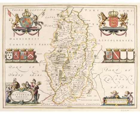
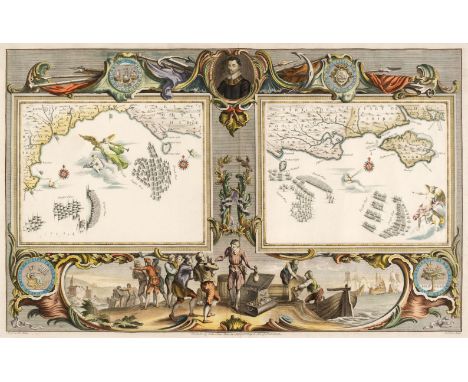
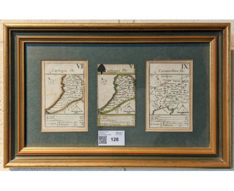
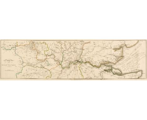
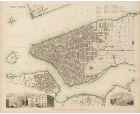
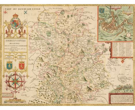
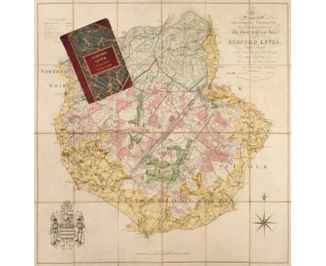
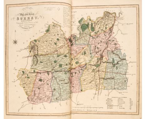
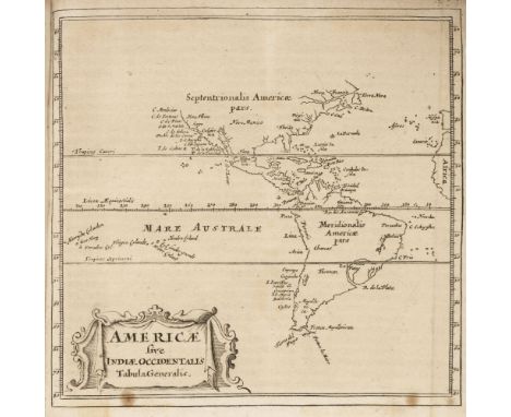
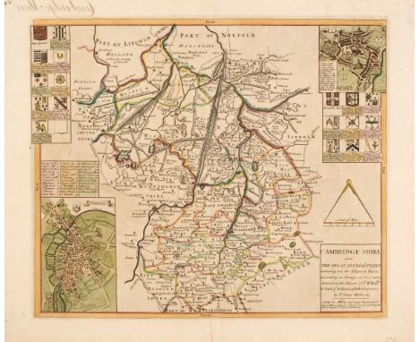
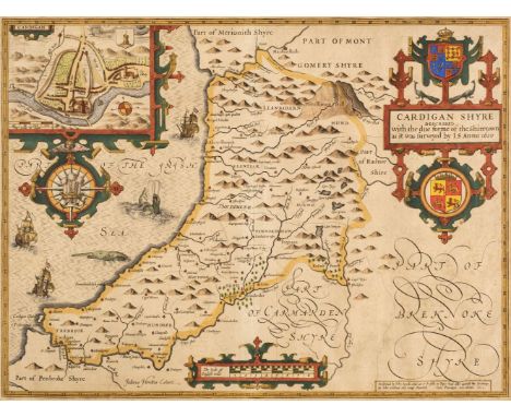
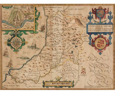
Atlases. A collection of 16 atlases, 18th & 19th century, historical and geographical atlases, including Buffier (P.). Geographie Universelle, Exposée dans les Differentes Méthodes qui Peuvent Abréger l'étude & faciliter l'usage de cette Science..., 8th edition, Pierre-Francois Giffart, Paris 1759, additional half-title, title pages with near-contemporary ownership signature, advertisement and index, 18 uncoloured engraved maps including the world and four continents, text block a little shaken and loose, marbled endpapers, contemporary gilt calf, worn and rubbed, 8vo, together with Longman, Rees, Orme, Brown and Green (publishers). The Edinburgh Gazetteer to Compendious Geographical Dictionary..., 1829, uncoloured engraved folding frontispiece of a hemispherical projection of the world by A. Arrowsmith and nine uncoloured engraved folding maps, later half calf, rebacked but retaining original spine, spine frayed with some loss, 8vo, with Dufour (Adolphe Hippolyte). Atlas Universal de Géographie Ancienne et Moderne..., J. Langlumé, Paris, circa 1860, title page and index, comparison table, astrological chart and 47 (of 48, lacking Ireland), engraved maps with contemporary outline colouring, very slight spotting, contemporary quarter sheep, worn and rubbed, oblong 4to, plus Monin (Charles V.). Atlas Classique de la Geographie Ancienne du Moyen Age, et Moderne, a l'Usage des Colleges et des Pensions, Paris, circa 1845, title page with old library stamps, folding engraved comparison table, forty engraved maps and charts, some old ink staining, underlining and marginalia throughout, text block shaken and loose, crude tape repair to hinges and joints, contemporary boards, heavily rubbed and worn, 4to and Anson (George). A Voyage round the World in the years MDCCXL, I, II, III, IV..., compiled..., by Richard Walter..., 8th edition, Dublin, 1754, frontispiece of a folding engraved map of the world, backed with later paper, containing numerous engraved plates and diagrams, heavily frayed, 19th century half calf gilt, worn and rubbed, 8vo, with another copy similar, plus another 10 atlases and travelogues, including examples by or after Mavor, Ordnance Survey, Milner, Butler, Cellarius, Goldsmith and Murphy, all containing maps and plates, various sizes and conditionQty: (16)Footnote: Sold as a collection of maps and prints, not subject to return.

Lot 69

Badeslade (Thomas & William Henry Toms). Chorographia Britanniae. Or a new set of Maps of all the Counties in England and Wales, C. Hitch & W. H. Toms [1742], double-page calligraphic title, dedication, 4 general maps of England & Wales, 7 pages of tables and 31 (only) uncoloured double-page engraved maps, lacking, Devon, Dorset, Hampshire, Lincolnshire, Monmouth, Norfolk, Rutland and Suffolk, Hertfordshire torn and lacking half the map, a few maps trimmed with loss to the printed title, very slight spotting throughout, old bookseller's label to the front pastedown, contemporary calf gilt, re-backed but retaining the original spine, 8vo, together with Owen (John & Bowen Emanuel). Britannia Depicta or Ogilby Improved..., 4th edition, 1724, engraved title detached, two sets of tables, contents defective, lacking pages, 41 - 44, 47 - 50, 73 & 74, 115 & 116, 119 - 122, 127 & 128 and 205 & 206, retaining numerous uncoloured engraved strip road and county maps, all edges gilt, contemporary speckled calf gilt, boards, detached, slight wear to extremities, 8voQty: (1)Footnote: Chubb CLXXIV and CL. Sold as a collection of maps, not subject to return.

Lot 70

Belgium & Germany. Ortelius Abraham), Namurcum Comitatus, circa 1630, hand-coloured engraved map, two additional vertical folds, folds strengthened on verso, slight creasing, trimmed to the platemark along the upper margin, 385 x 510 mm, no text on the verso, together with Blaeu (Willem Janszoon). Iuliacensis et Montensis Ducatus. De Hertoghdomen Gulick en Berghe, Amsterdam, circa 1635, uncoloured engraved map, some creasing, additional old folds, slight spotting and staining, 380 x 495 mm, no text on verso, with Homann (Johann Baptist). Ducatus Bremae et Ferdae nova tabula, Nuremberg, circa 1710, engraved map with contemporary hand-colouring, large uncoloured allegorical cartouche, 490 x 570 mm, plus Homann (Johann Baptist, heirs of). Belgii Universi seu Inferioris Germaniae quam XVII Provinciae..., 1748, hand-coloured engraved map, additional title in French above the map, 490 x 535 mm, and Blaeu (Johannes). Gothia, Amsterdam, circa 1640, engraved map with contemporary hand-colouring, 420 x 530 mm, Latin text on versoQty: (5)

Lot 71

Berkshire. Speed (John), Barkshire Described, John Sudbury & George Humble, 1st edition, [1611], hand-coloured engraved map, strapwork cartouche and compass rose with a panorama of Windsor castle, two repaired marginal closed tears affecting the printed image, slight creasing to the central fold, strengthened on the verso, 385 x 510 mm, English text on versoQty: (1)

Lot 72

Black (Adam & Charles, publishers). Black's General Atlas of the World, New Edition, Edinburgh, 1857, title and index, 60 engraved maps by T. Bartholomew, all with contemporary outline colouring (lacking the map of Palestine), slight spotting to the endpapers and pastedowns, all edges gilt, contemporary half morocco gilt worn and rubbed, folioQty: (1)Footnote: Sold as a collection of maps, not subject to return.

Lot 73

Blaeu (Johannes). Bedfordiensis Comitatus Anglis Bedford Shire [and] Buckinghamiensis Comitatus Anglis Buckingham Shire, Amsterdam, circa 1645, two engraved maps on one sheet (as published), both with bright contemporary outline colouring, overall size 420 x 530 mm, Dutch text on verso, together with Nortfolcia, Norfolke, Amsterdam, circa 1648, engraved map with contemporary outline colouring, toned overall, slight abrasion to the margins, 380 x 500 mm, Latin text on verso, with, Jansson (Jan). Essexiae Descriptio. The Description of Essex, Amsterdam, circa 1650, hand-coloured engraved map, toned overall, central fold split and repaired at base but not affecting the image, 385 x 495 mm, Latin text on the versoQty: (3)

Lot 75

British Isles. Blaeu (Johannes), Britannia prout divisa suit temporibis Anglo-Saxonum praesertim durante illorum Heptarchia, published Amsterdam, [1645 or later], engraved map with contemporary hand colouring, vertical margins decorated with fourteen scenes of Saxon figures and events, 415 x 535 mm, Latin text on verso,Qty: (1)Footnote: R.W.Shirley. Early Printed Maps of the British Isles 1477 - 1650, 549.

Lot 76

British Isles. Waldseemüller (Martin), Tabu Moder Angliae & Hiber, editors Gaspar & Melchior Treschel, Lyons, 1535, uncoloured Ptolemaic woodblock map, title displayed in a 'ribbon cartouche' above the map, graduations of latitude marked on the east and west borders, slight toning, 325 x 410 mm, no text on versoQty: (1)

Lot 78

Cambridgeshire. Saxton (Christopher& Lea Philip), Cambridge-Shire and the Great Levell of ye Fenns, extending into the Adjacent Shires, according to Surveys as it is now Drained, at ye Charges of ye Rt. Honble. W. Earl of Bedford and ye other Proprieters by Sr. Jonas Moore &c. circa 1690, hand-coloured engraved map, inset town plans of Cambridge and Ely and decorated with 18 heraldic shields, slight dust soiling and spotting, but largely confined to the margins, central fold split and repaired on the verso, slight creasing, 400 x 485 mm, together with Blaeu (Johannes). Regiones Inundatae in sinibus comitatus Norfolciae, Suffolciae, Cantabrigiae, Huntingtoniae, Northamtoniae et Lincolniae, Amsterdam, circa 1646, engraved map with contemporary outline colouring, spotted and stained, narrow margins, 435 x 545 mm, French text on versoQty: (2)

Lot 79

Cambridgeshire. Saxton (Christopher & Lea Philip), Cambridge-Shire and the Great Level of ye Fenns extending into Adjacent Shires, according to Surveys as it is now drained at the Charges of ye Rt. Honble. W. Earl of Bedford & ye other Proprieters by Sr. Jonas Moore &c. G. Willdey, circa 1732, engraved map with contemporary outline colouring and some later enhancement, inset town plans of Cambridge and Ely, 18 coats of arms, manuscript title to verso causing some show through, 400 x 470 mm, no text on the versoQty: (1)Footnote: Scarce with the George Willdey imprint.

Lot 8

Fortune (Robert). A Journey to the Tea Countries of China; including Sung-Lo and the Bohea Hills, 1st edition, London: John Murray, 1852, map, 2 tinted lithographs & 1 uncoloured wood engraving, further wood-engravings in text, publisher's advertisements to rear, front hinge cracked, endpapers spotted, occasional light dust-soiling, original publisher's cloth gilt, faintly marked & rubbed, 8voQty: (1)Footnote: Abbey 529.

Lot 82

* Cardiganshire. Speed (John), Cardigan Shyre Described with the due forme of the Shire Towne as it was surveyed by J. S. in 1610, John Sudbury & George Humble, [1611 - 27], hand-coloured engraved map, large strapwork cartouche and compass rose, an inset town plan of Cardigan, 385 x 510 mm, mounted, framed and glazed, together with Jansson (Jan). Ceretica sive Cardiganensis comitatus Anglis Cardigan Shire, Amsterdam, circa 1650, engraved map with contemporary outline colouring, decorative cartouche and mileage scale, compass rose and numerous rhumb lines, 380 x 505 mm, mounted, framed and glazedQty: (2)

Lot 83

* Cardiganshire. Speed (John), Cardigan Shyre Described with the due forme of the Shire town as it was surveyed by J. S. in 1610, Thomas Bassett & Richard Chiswell [1676], hand-coloured engraved map, inset town plan of Cardigan, large strapwork cartouche and compass rose, central fold partially split and a little frayed, slight overall toning, 380 x 510 mm, mounted, framed and glazed, together with Blaeu (Johannes). Ceretica sive Cardiganensis Comitatus Anglis Cardigan Shire, Amsterdam, circa 1645, engraved map with contemporary outline colouring, decorative cartouche and mileage scale, 380 x 500 mm, mounted, framed and glazedQty: (2)

Lot 84

* Carmarthenshire. Speed (John), Caermarden Both Shyre and Towne Described, 1st edition, John Sudbury and George Humble, 1611, hand-coloured engraved map, inset town plan of Carmarthen, large strapwork cartouche and compass rose, large margins, 385 x 510 mm, mounted, framed and double-glazed, English text on verso, together with Blaeu (Johannes). Penbrochia Comitatus et Comitatus Caermaridunum, Amsterdam, circa 1648, engraved map with contemporary hand-colouring, decorative cartouche, 410 x 530 mm, mounted, framed and double glazed, French text on versoQty: (2)

Lot 86

* Cheshire. Blaeu (Johannes), Cestria Comitatus Palatinus, Amsterdam, circa 1645, engraved map with bright contemporary hand-colouring, decorative cartouche and mileage scale, large margins, 385 x 505 mm, Dutch text on verso, framed and double-glazedQty: (1)

Lot 87

Cheshire. Blaeu (Johannes), Cestria Comitatus Palatinus, Amsterdam, circa 1648, engraved map with contemporary outline colouring, slight creasing and staining, 385 x 500 mm, French text on verso, together with Jansson (Jan). Cestria Comitatus Palatinus. The Countye Palatine of Chester, Amsterdam, circa 1660, uncoloured engraved map, 380 x 500 mm, Dutch text on versoQty: (2)

Lot 88

Cheshire. Smith (William). Praeter Civitatem Cestriae) Continet in se Oppida Mercatoria XII. Ecclesiasque Parochiales LXXXVI, published John Overton, [1665 - 1707], engraved map with sparse outline colouring, old folds, slight fraying to old folds repaired on verso, narrow margins, slight staining caused by juvenile scribbling on the verso, slight marginal fraying, the whole backed with archival tissue, 370 x 485 mmQty: (1)Footnote: One of only twelve county maps produced by William Smith, probably as the basis for an uncompleted English County Atlas. John Overton acquired Smith's plates from Peter Stent and included the maps in the five composite atlases that he published between 1670 and 1700. Overton's son, Henry, continued to publish the maps up until 1755. Uncommon.

Lot 89

Cornwall. Saxton (Christoper & Lea Philip), Cornwall Described by C. Saxton, Corrected & many Additions as the Roads etc. by P. Lea, G. Willdey, 1732, engraved map with contemporary outline colouring, the royal coat of arms sits above a panorama of Launceston, eight heraldic coats of arms, an ornate cartouche and mileage scale, good margins, slight mount staining, 370 x 475 mmQty: (1)Footnote: R. C. E. Quixley. Antique Map of Cornwall and the Isles of Scilly, 2nd edition, 2018, 22. Scarce.

Lot 91

De L'Isle (Guillaume & Jaillot Alexis-Hubert). A collection of 46 maps, circa 1790, forty-six double-page engraved maps with contemporary outline colouring, mostly of parts of France, Germany, Switzerland, Austria and Spain, but also including a hemispheral map of the World (some damage), Moscovie, Prussia, Chile, the islands of Martinique and St Domingue, Persia and Tartary, some water staining, and marginal fraying and tears, each approximately 465 x 665 mmQty: (46)

Lot 92

* Devon. Speed (John), Devonshire with Excester Described and the Armes of such Nobles as have borne the titles of them, Thomas Bassett & Richard Chiswell [1676], hand-coloured engraved map, inset town plan of Exeter, some creasing, 385 x 510 mm, mounted, framed and glazedQty: (1)

Lot 93

* England & Wales. Ortelius (Abraham & Lhuyd Humphrey), Angliae Regni Florentissimi nova descriptio auctore Humfredo Lhuyd Denbygiense [1584 - 1602], engraved map with contemporary hand-colouring, large strapwork cartouche and mileage scale, toned overall, 380 x 470 mm, mounted, framed and glazedQty: (1)Footnote: Marcel Van den Broecke. Ortelius Atlas Maps,19.

Lot 95

Essex. Speed (John), Essex devided into Hundreds, with the most ancient and fayre Towne Colchester Described and other Memorable Monuments observed, 1662, Thomas Bassett & Richard Chiswell [1676], uncoloured engraved map, inset town plan of Colchester, 385 x 505 mm, English text on versoQty: (1)

Lot 96

Finley (Anthony). A New American Atlas, designed principally to Illustrate the Geography of the United States of North America..., 1st edition, Philadelphia, 1826, printed title and index, 14 (only of 15), engraved maps with contemporary hand-colouring on 13 double-page sheets, lacking map No. 1 (North America), map of Pennsylvania with short split at the base of the central fold, occasional marginal closed tears, some dust and finger soiling, slight staining, front endpaper near detached, contemporary half morocco gilt, heavily worn and frayed, slim folioQty: (1)Footnote: Uncommon. Finley published maps of the United States, and of each state until 1831 when he sold his map and atlas copyrights to S. Augustus Mitchell.

Lot 98

Germany. Homann (Johann Baptist), Prospect und Grundris der Keiserl Freyen Reichs und Ansee Stadt Bremen samt ihrer Gegend, Nuremberg, circa 1716, engraved map with contemporary hand-colouring, inset panorama of the city flanked by uncoloured allegorical vignettes, slight thinning to the central fold, 495 x 575 mmQty: (1)

Lot 99

* Gillray (James). 'Britannia', published H.Humphrey, June 25th 1791 [but later edition published H.G.Bohn, circa 1850], uncoloured etched anamorphic map, trimmed with loss to the printed margin along the upper border, 240 x 190 mm, together with Taking Physick, Gentle Emetic, Breathing a Vein [and[ Charming Well Again, H. Humphrey 1800 - 04 [but later edition published H.G.Bohn, circa 1850], together four uncoloured medical caricatures, some staining and spotting, each approximately 260 x 195 mm, mounted, framed and glazedQty: (5)

Loading...Loading...
  • 109182 item(s)
    /page

Recently Viewed Lots