We found 109198 price guide item(s) matching your search
There are 109198 lots that match your search criteria. Subscribe now to get instant access to the full price guide service.
Click here to subscribe- List
- Grid
-
109198 item(s)/page


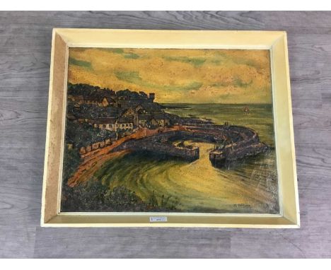
Lot 7053
Zwei historische Landkarten von Böhmen und Preussen, 1. H. 19. Jh., Stahlstichkarte ''Prussia'' von Johnston aus dem ''National Atlas'' um 1845, hinter Glas (defekt) u. Pp. ger., sowie ''New Map of Bohemia and Moravia by John Cary 1801'', teilkol. Kupferstich, Randläsuren, unger., Rahmenmaße der Preussenkarte 60 x 71 cm
Lot 248
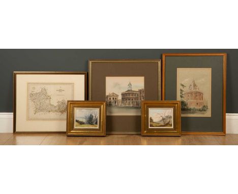
Ken J Messer (1931-2018), The Radcliffe Camera and the Sheldonian Theatre, watercolour and ink, both signed, framed and glazed, 19cm x 27.5cm and 22cm x 22.5cm; Gerald Hughes (1920-2016), 'Spriggs Holy View' and 'Copse near Quainton', oil on board, both signed and dated '78, framed, 13cm x 10cm; and a map of Berkshire, engraved by J Cary, framed and glazed, 26cm x 22cm (5)


Lot 118
A 19th century engraving of The County of Hartford by C & J Greenwood, engraved by J & C Walker, framed and glazed, 74cm x 60cm; together with a copy of A New and Accurate Map of Africa by Eman Bowen, framed and glazed, 43.5cm x 35.5cm (2)Condition report: Map of Hartford with tear to the centre top, some small marks; map of Africa discoloured


Lot 263
A collection of framed paintings and similar to include A pair of framed oils on boards, one depicting a river scene and the other of a lake with mountainous views, both signed 'G Brown' (2). Largest inc frame 66 x 55cm, a framed reproduction map of Cumbria by Johan Blaeu: Atlas Novus 1648. Printed by John Bartholomew & Son Ltd, Edinburgh, Scotland. 64 x 54cm inc frame and a framed collage depicting two ladies made from butterfly wings. 40 x 37cm inc frame. (4 in total)

Lot 340
Maps of areas of England and Wales, believed 1940s/50s including Bartholomews maps of Lake District (cloth), Oxford (cloth) and North Wales (paper), Geographia large scale road map of Peak District and Derbyshire Dales (cloth), Geographia road map of North Wales (cloth) and Geographia Reversible Map of Midlands backed by South West England (paper)


Lot 737
Astor and Cheveley interest: a collection of books and booklets including Mr Blake of Newmarket, a sale catalogue for the Astor Estate in London, dated 1920, Sporting and Rural Records of the Cheveley Estate, dated 1899, Documents Relating to Cambridgeshire Villages, a map of the Cheveley Park Estate with a black and white photograph of staff and other early 1900's re-printed booklets by William Waldorf Astor

Lot 111
Flammarion (Camille) Astronomie Populaire, chromolithographed frontispiece, numerous illustrations, folding map of constellations, scattered spotting, some foxing, one gathering loose, upper hinge cracked, original morocco-backed blind-stamped cloth, lightly rubbed, corners and spine-ends chipped, Paris, 1881 § Figuier (Louis) Vies Des Savants Illustres...Savants De L'Antiquité, engraved frontispiece and 36 portraits, book-label to pastedown, hinges cracked, but holding, contemporary morocco-backed cloth, lightly rubbed, Paris, 1877, e.g.; and 10 others, French, including 3 further volumes of Figuier's 'Vies Des Savants Illustres', v.s. (12)
Lot 15
Kuwait.- Shamlan (Saif Marzuq) Tārīkh al-ghaws. 'alá al-lu'lu' fī al-Kuwayt wa-al-Khalīj al-'Arabī[Pearling in the Arabian Gulf: a Kuwaiti memoir], 2 vol., first edition, signed presentation inscription in arabic from author to front endpaper, additional colour title, vol. 1 folding map, marginal tear and tape repair to verso, vol. 2 folding colour diagram, photographic illustrations and plates, some colour, original cloth, gilt, corners and extremities lightly scuffed, 8vo, 1975-78.⁂ Presentation inscription is dedicated to Dr. Peter Clark, who later translated the work into English under the title as given in English above, in 2000. The inscription reads, 'It gives me great pleasure as author of this to present it to Mr Peter Clark, in appreciation, and as a memento of the diwaniya [reception] this year. With Greetings, 10 May 1998. The Author, Saif Marzuq Shamlan'. The author, born 1926 to a distinguished Kuwaiti family of pearl-merchants and seafarers, evokes the last decades of the pearling industry after 1900, basing his account on personal recollections as well as documentary and oral sources, including divers, ships masters and peal merchants, with numerous illustrations of sailing vessels, divers, crew and members of his own family.
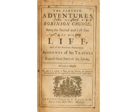
Lot 156
Defoe (Daniel) The Farther Adventures of Robinson Crusoe, first edition, later (C19th?) plate inserted at title as frontispiece, printer's device to title and advertisement at rear, 5 leaves of advertisements, ink ownership inscription to title and rear pastedown, lacking folding map, some browning, spotting and soiling, contemporary calf, rebacked, corners and covers worn, 8vo, for W. Taylor, 1719.
Lot 231
Bindings.- Gibbon (Edward) The History of the Decline and Fall of the Roman Empire, 7 vol., folding map, scattered spotting, previous owner's ink inscription, bookplate, contemporary half-morocco, gilt, 1900-1902 § Carlisle (Nicholas) A Concise Description of the Endowed Grammar Schools in England and Wales, 2 vol., list of subscribers, previous owner's ink signatures, faint spotting to first few leaves, contemporary calf, gilt, slight bumping to spine extremities, 1818 § Jesse (John Heneage) George Selwyn and His Contemporaries, 4 vol., engraved portrait frontispieces, engraved plates, scattered spotting, bookplate, later half-morocco, gilt, lightly sunned spines, 1842-44; and others, most sets, 8vo & 4to (43)
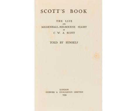
Lot 248
Scott (Charles William Anderson) Scott's Book: the Life and Mildenhall-Melbourne Flight, second edition, signed by author, portrait frontispiece, plates, folding map at end, original cloth, lightly browned spine, price-clipped dust-jacket, 4 short tears, a little rubbed, slight creasing to edges, 1934 § [Davis (Reginald)] & Hodder-Williams (Sir Ernest, editor) One Young Man, signed by Davis, original cloth, lightly faded spine, printed for private circulation, [1936]; and another similar (3)⁂ Charles W. A. Scott was an aviation pioneer who, together with pilot Tom Campbell Black, won the 1934 London to Melbourne Air Race or the MacRobertson Trophy Air Race in just 71 hours, winning £15,000 (about £750,000 today) and making him world-famous.
Lot 31
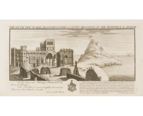
NO RESERVE Durham.- Raine (Rev. James) The History and Antiquities of North Durham, first edition, engraved portrait frontispiece and 9 plates, 2 genealogical tables, 1 engraved map, scattered spotting, contemporary half-calf, gilt, a little rubbed, folio, 1852⁂ With a large section on Holy Island, which is now known as Lindisfarne.

Lot 33
NO RESERVE Essex.- Wright (Thomas) The History and Topography of the County of Essex, 2 vol., engraved frontispieces, additional engraved titles, plates, 1 engraved map, tissue-guards, previous owner's ink inscription, later half-morocco, gilt, g.e., lightly sunned spines, 4to, 1836.⁂ The inscription reads, "I bought these two volumes about 1888 - and had them bound at great expense. T. A. Leggitt."

Lot 37
NO RESERVE Kent.- Ireland (William Henry) A New and Complete History of the County of Kent, 4 vol., additional engraved title, loss to bottom edge, old repair, 124 engraved plates, 1 folding map, occasional spotting and staining, vol. 1 wiht cracked upper hinge, contemporary half-calf, rubbing to corners and spine extremities, 8vo, 1829-30.
Lot 38
London.- Journey (A) from London to Scarborough in Several Letters, lacking frontispiece, small loss to foredge of first few leaves, possibly affecting text on title, spotting, disbound, for A. Dodd, [1735] § Tallis's Illustrated London; in commemoration of The Great Exhibition ..., 2 vol., engraved frontispieces (1 folding), additional vignette titles, faint damp-staining to title (vol. 1), steel engraved plates (one or two folding), contemporary half-calf, rubbed, n.d. § Pinks (William J.) and Edward J. Woods, editior. The History of Clerkenwell, portrait frontispiece, folding colour map (short tear), map, illustrations, plates and illustrations, scattered faint spotting, contemporary half-morocco, 1880; and others London, including a 2 vol. set of 'Old & New London' and a small quantity of Westminster City Council civil defence planning public shelter survey 1952, v.s. (small qty.)⁂ The first is scarce, with only 3 on ESTC at; Leeds Central Library, Liverpool University Library and Folger Shakespeare.
Lot 4
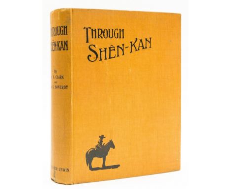
China.- Clark (Robert Sterling) & Arthur de C. Sowerby. Through Shên-Kan: the Account of the Clark Expedition in North China 1908-9, first edition, map frontispiece, plates, some colour, folding colour map in pocket at end, scattered faint spotting, original cloth, slight bumping to corners and extremities, 4to, 1912.
Lot 41
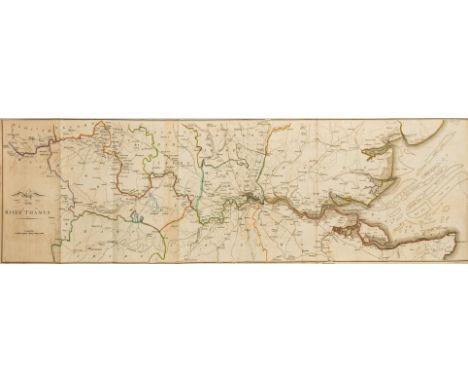
River Thames.- Ireland (Samuel) Picturesque Views on the River Thames, 2 vol., extra illustrated, folding map frontispiece, additional aquatint titles, 142 plates, of which 52 sepia aquatints called for, 6 folding, 4 loosely inserted, illustrations, manuscript index at end each vol., occasional faint off-setting, contemporary calf, gilt, a little rubbed, 8vo, 1801.
![NO RESERVE Scotland.- [Pennant (Thomas)] A Tour in Scotland, and Voyage to the Hebrides, together 3 vol., fifth edition, 1790](https://cdn.globalauctionplatform.com/590b44bf-8e48-4195-ae9e-adff0121b94c/d137fc53-85b6-4c7d-976c-adff01282d30/468x382.jpg)
Lot 42
NO RESERVE Scotland.- [Pennant (Thomas)] A Tour in Scotland, and Voyage to the Hebrides, together 3 vol., fifth edition, 1790; A Tour in Wales, 2 vol., 1784, engraved vignette titles, map and plates, some folding, some light foxing, bookplate of John Maude, uniform contemporary diced russia, gilt, joints worn, one or two covers detached § Nimmo (Rev. William) History of Stirlingshire, 2 vol., second edition, folding hand-coloured engraved map, engraved plates, folding tables, contemporary diced calf, worn, some covers detached, Stirling, 1817 § Dalyell (J.G.) The Darker Superstitions of Scotland, contemporary blind-stamped calf, 1834 § Stuart (Robert) Caledonia Romana: a Descriptive Account of the Roman Antiquities of Scotland, second edition, lithographed plates and plans, some folding, original cloth, gilt, Edinburgh, 1852 § Stewart (Walter) Inchmahome and the Lake of Menteith, illustrations, original cloth, gilt, spine faded, privately printed, 1933 § Macdonald (G.) & Alexander Park. The Roman Forts on the Bar Hill Dumbartonshire, illustrations, later half blue morocco, by Maclehose of Glasgow, spine gilt with Roman helmet motifs, t.e.g., Glasgow, 1906, most a little rubbed; and 14 others on Scotland including vol.1-3 of Wainwright's Scottish Mountain Drawings, 8vo & 4to (25)
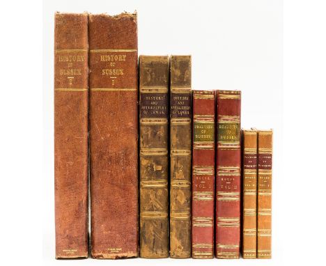
Lot 45
Sussex.- Horsfield (Thomas Walker) The History, Antiquities and Topography of the County of Sussex, 2 vol., 2 engraved portrait frontispieces, 54 plates, 2 folding maps, spotting, mostly marginal, contemporary half-morocco, bumping to corners and extremities, a little rubbed, Lewes & London, 1835; The History and Antiquities of Lewes, 2 vol., folding lithograph frontispiece, short tear to fold neatly repaired, engraved frontispiece, vignette titles, 29 lithographs, 10 engraved plates, illustrations, folding map, 6 folding pedigrees, list of subscribers, off-setting, occasional browning, near contemporary half-calf, a little rubbed, Lewes & London, 1824; and others Sussex, 4to & 8vo (8)
Lot 46
NO RESERVE Wales.- Malkin (Benjamin Heath) The Scenery, Antiquities, and Biography, of South Wales, first edition, 12 soft-ground etchings with watercolour wash by J.Laporte, one or two highlighted with body colour, folding engraved map (torn, creased at edges), light foxing and offsetting, a few plates with imprint shaved, contemporary calf, gilt, rebacked, rubbed, joints split, 1804 § Walker (J. & A.) Map of South Wales, folding hand-coloured engraved map, c.650 x 825mm., dissected and mounted on linen, light offsetting, cloth slip-case with paper label, J. & A.Walker for James Wyld, 1833, 4to & 8vo (2)

Lot 7
NO RESERVE Europe.- Geographical, historical, and political description of the Empire of Germany, Holland ... Switzerland, Prussia, Italy, Sicily..., 2 parts in 1, engraved map key frontispiece, 23 plans of European cities (Rome & Paris folding), and 1 (of 3) large folding maps, list of subscribers, contents f. with loss to lower margin, a few small splits to folds of folding map, offsetting, spotted, contemporary tree calf, spine gilt and with black morocco label, small piece missing from spine, joints splitting, but holding firm, head of spine and corners worn, rubbed, 4to, For John Stockdale, 1800. sold not subject to return.


Lot 182
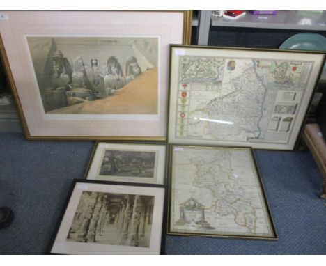
After David Roberts RA - Front Elevation of the Great Temple of Aboosimble, Nubia - a print published F.G Mourn Aug 1st 1848, a 20th century framed and glazed map of Northumberland, a Robert Morden 18th century map of Buckinghamshire, 42cm x 35cm, glazed frame, a print after Birket Foster of Burnham Beeches, and a framed and glazed photograph of the Ralithoras Temple in Delhi, and an unframed aircraft print entitled Sole Survivor, Wing Commander Peter Ayerst DFC 73 Squadron France 1939, signed by the artist (6)Location: BWR


-
109198 item(s)/page