We found 109182 price guide item(s) matching your search
There are 109182 lots that match your search criteria. Subscribe now to get instant access to the full price guide service.
Click here to subscribe- List
- Grid
-
109182 item(s)/page


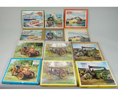
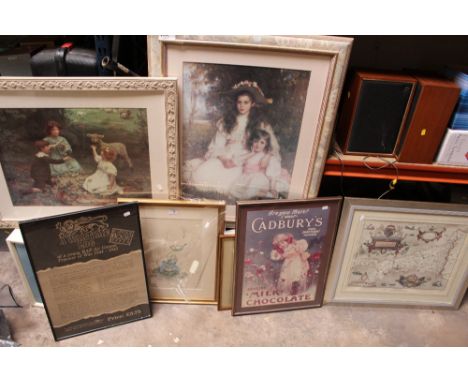
Lot 202
Thirteen Victory Children’s wooden Jig-Saw puzzles, Golden Arrow Express, Canadian Pacific Express, A Busy Quayside, Trooping of the Colour, P & O Liner Oriana, Looe Cornwall, Vintage car series 1908 Renault and 1907 Standard, Traction Engine series 1927 Wallis and Steevens Steam roller and 1919 Garrett Showmans Traction Engine, Emergency Services Series – Police, two Map puzzles the World and U.S.A, (13 items).

Lot 134
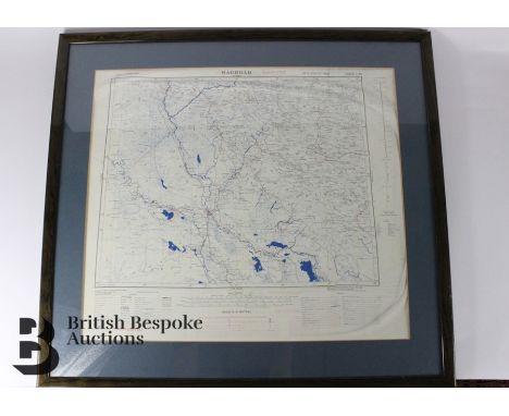
Emanuel Bowen (British, 1694-1767), after, a map of Lincolnshire, printed by 'Rob Sayers and John Bennett, no 53 Fleet St, et John Bowles, no 13 Cornhill and Barrington Bowles, No 69 St Paul's Church Yard', dated 1777, with title 'An Accurate Map of Lincoln Shire divided into Wapontakes', 51 by 41cm.

Lot 315
Local History Interest - Edward VII when he was The Prince of Wales Doffing his Hat to the Crowd, Queens Park Annex Chesterfield, sepia photograph, by Crosby, 456cm x 60cm; Charles C Bates, High Sheriff of Derbyshire, November 1923; H B W white Washing Brigade 1915; map of Derbyshire, Chesterfield booklets etc

Lot 24
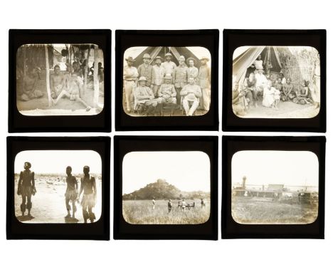
* Central Africa. A group of 92 diapositive magic lantern slides of scenes and people in the Congo, early 1890s, including 40 with ink manuscript caption labels, subjects include a group of Western men titled 'J Maloney Expedition', another of Mwasi and his wives calling on Maloney, a slave boy at Chenundas, native contingent during native rising, Angoni warriors, Angoni dancing boys, Ognomo & Angori at Hora, views in Chenindas, Bandawe, Nyassa, Rabwiro, Lobengulla's Battery on the Tinfuli River, Hora, North Anzoniland, Fort Johnson, Upper Shiri River, Monkey Bay, Lake Nyassa, inside Rabivine's Kraal, Msoro's Kraal, Osiolo's Kraal, Mago's River, Koyakoya, Lake Nyassa, Bally Hooly, near Salisbury, Old Camp, Salisbury (1892) and Simonk Ruf (1893), plus 5 contemporary diapositive lantern slides of Central Africa credited to George Washington Wilson and a map diagram lantern slide of Africa, many slides with cracks, contained in a wooden lantern slide boxQty: (98)NOTESIt is not clear whether any of these photographs overlap with the Stairs Expedition to Katanga (1891-92). The expedition was led by Captain William Stairs, a race between two imperial powers to claim Katanga for colonization. Joseph Maloney (1857-1896) was the Irish-born medical officer on the Expedition which seized Katanga for the Belgian King Leopold II, killing its ruler, Msiri, in the process. Dr Maloney took charge of the expedition for a few weeks when its military officers were dead or incapacitated by illness, and wrote a popular account of it, With Captain Stairs to Katanga: Slavery and Subjication in the Congo 1891-92 (1893). There is little sign of military conflict in these photographs and no mention of Katanga on any of the labels.


Lot 85
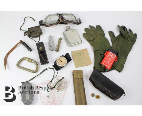
Special Air Services interest - miscellaneous items including an American lock picking set, green leather gloves, a pair of vintage Stadium desert goggles, pewter flasks, Warris Sheffield military issue pocket knife, vintage brass carabiner made by Clog. Wales 3000 weight distribution, Silva Swedish map readers (one with compass), Demolition Charge Computing Tape, US Army compass, original British Amy Case Pointer Staft MK1 in the original canvas case, J. Hudson & Co military issue whistle and a US Leatherman multi-tool device housed in a leather case.
Lot 140
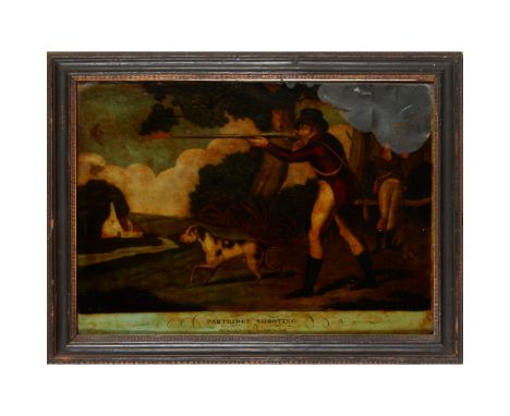
COLLECTION OF ELEVEN REVERSE GLASS MEZZOTINTS 18TH & 19TH CENTURY comprising: 'The Rt Honble Earl of Loudoun', Ramsey Pinxt, Spooner Fecit, 43cm high x 42.5cm wide; 'His Royal Highness Prince Edward &C &C', Morland Pinxt, Richard Houston fecit, 41cm high, 30.5cm wide; 'Maria Countess of Coventry', 47cm high, 37cm wide; 'Pastora', Ryall 7 R.Withy, Fleet Street, 45cm high, 34.5cm wide; 'Beating and Trailing for a Hare', J.Seymour invent, T.Burford delin etg fecit, 36.5cm high, 46.5cm wide; 'Going to Cover', Published July 14 1794 by John Fairburn, Map, chart and print seller, No. 146 Minories, London, 31cm high, 41cm wide; 'Partridge Shooting', Pubd Dec 1804 by Stamp and Son, 74 Leather Lane, London, 31cm high, 41.5cm wide; 'Going Out in the Morning', Published according to act of parliament, June 20th 1753, J.Seymour invt, T.Burford del at fect, 36cm high, 46.5cm wide, 'Woodcock Shooting', Pubd. Dec 1804 by Stampa & Son, 74 Leather Lane, London, 42cm wide, 31.5cm high; and an untitled print depicting two stabled horses, Seymour pinx, T.Burford fec,(46cm wide, 36cm high)Provenance: Property from Kilmany House, Fife


Lot 284
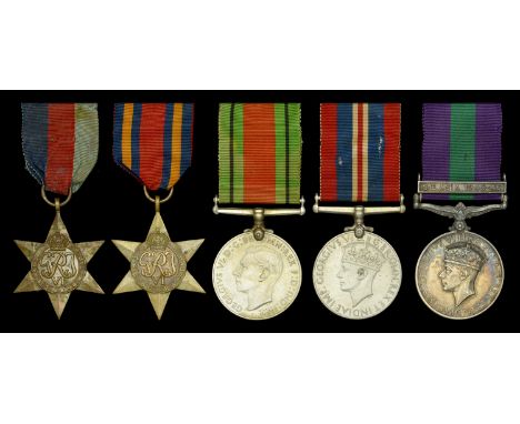
Five: Captain R. B. Howick, Machine Gun Battalion, The Jat Regiment, Indian Army 1939-45 Star; Burma Star; Defence and War Medals 1939-45; General Service 1918-62, 1 clasp, S.E. Asia 1945-46 (Capt. R. B. Howick. 9 Jat. R.) good very fine (5) £100-£140 --- Robert Bernard Howick was born on 17 March 1923 and was commissioned in the Jat Regiment on 15 November 1942. Promoted Lieutenant on 15 May 1943, he served during the Second World War with the 7th Battalion and then the Machine Gun Battalion of his regiment in Burma. The Machine Gun Battalion saw extensive and arduous active service from Imphal to the Sittang River, 1944-1945. Companies of the battalion nearly always operated independently in support of various forces. From joining the unit in 1944 Howick served as the only company officer of “W” Company and eventually, from May 1945, as company commander. After Burma the battalion saw further service in French Indo-China, qualifying for the General Service with clasp South-East Asia 1945-46. ‘MG Jat’ was organised as four MG Companies (W, X, Y, and Z), each with an establishment of twelve guns, and was the MG Battalion of the 20th Indian Division. The following notes on Howick’s active service in Burma are extracted from the battalion history published at Bangalore in July 1947: Capture of Monywa ‘From Maukkadaw one platoon of W Company under Lieutenant Howick left to join 100 Infantry Brigade where they received orders to form part of a strong mobile column which was to move as rapidly as possible through Budalin to occupy Monywa… The force duly left on the 4th January [1945], but on approaching Budalin found 32 Infantry Brigade in contact with the enemy who contrary to expectations were making a stubborn stand, in well dug in positions inside the village. The platoon then came under command of 32 Brigade, subsequently being joined by the remainder of W Company which remained with the Brigade right through the Burma operations... Monywa was the Division’s first large prize so far, and had been an important base for the Japs this side of the Irrawaddy… W Company under Major Davies and Lieutenant Howick played their share in its recapture.’ The Irrawaddy Crossing During the battle of the Irrawaddy shore W Company supported 1st Battalion Northamptonshire Regiment in a desperate action ‘One battalion of 32 Brigade [1 Northamptonshires] had been given the task of making a diversionary landing from Myaung to the South of the main crossing. No. 3 platoon were to cross with the assaulting troops to assist consolidation, while No. 2 platoon gave supporting fire from a sandbank in mid river. The landing was effected according to plan on the 13 February and that night Major Davies, and Lieutenant Howick with Company H.Q. and the remaining platoon crossed to join the platoon with the Northants on the bridgehead... The Japanese reacted strongly to this surprise landing, and launched counter attacks, one after the other mainly at night, all of which were repulsed, assisted by our M.G. fire which took heavy toll of the enemy and won many tributes from the men of the Northants. The bridghead was only 800 yards by 300 yards in very soft sand, and no cover of any description, but in spite of these conditions and merciless enemy Artillery fire day and night the morale of the men remained magnificently high… By the end of the month the bridghead was still firmly holding out… We left W Company entrenched with the Northants on their small bridgehead across the Irrawaddy. Not a day or night passed without incident, and the machine guns were constantly in action, beating off enemy attacks, dealing with jitter parties, map shoots and harassing shoots. Enemy artillery continued to pour shells down on to this relatively small and completely exposed area, making any movement by day a very hazardous procedure, and one not indulged in lightly. With the remainder of the Brigade across the river… the by now completely isolated party had completed its task… Thus ended a very trying period of 25 days, spent in exposed positions, subject to constant attacks, and continual shelling, added to which was blazing heat and myriads of flies… many individual acts of gallantry were performed, and the Company with Major Davies and Lieutenant Howick can truly say they had done a difficult job well… A most appreciative signal was received at Battalion H.Q. from the C.O. of the Northants, thanking W Company for the very excellent support they had rendered, and for the magnificent manner in which they had carried it out.’ Final Advance in Burma 32 Brigade now advanced across country to cut the Mandalay road, and ‘Mopping up of nearby parties of enemy was carried out with machine gun support whenever required… Lieutenant Howick was with the company throughout as Company Officer and frequently out with detached platoons.’ These operations continued until the end of March followed by a rest period from 1-9 April. 32 Brigade, with W Company, still attached, then formed a mechanised column to act as spearhead of the next advance, to Taundingwi, which was accomplished in six days. The history continues: ‘From the 23 to the 27 April, one platoon under Lieutenant Howick with guns and ammunition on bullock carts moved South with the 4/2nd Gurkha Rifles, and by the end of the month the Company had concentrated North of Allanmyo on the Rangoon Road... W Company continued with 32 Brigade and reached Tharrawaddy in May. Major Davies had left the company at Tharrawaddy to proceed on leave in India, leaving Lieutenant Howick in charge. While in India orders came through sanctioning Major Davies his home leave in lieu of repatriation, and that was the last we saw of him for about six months.’ Presumably Captain Howick remained in charge of W Company for the remainder of the campaign in Burma and the move to Saigon in French Indo-China, where the task of disarming and rounding up 72,000 Japanese was hampered by a state of near civil war and considerable unrest. The Battalion was still on active service and in action with rebels on a number of occasions. There were casualties and several awards for gallantry were earned during this period. Around October 1945 Howick went on leave to India and was away for several months but must have returned before the Battalion was disbanded in India in August 1946 as he appears in the group photograph of officers present on disbandment.
Lot 627
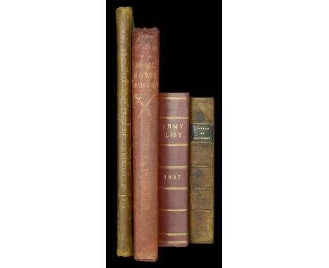
Records of the Royal Horse Artillery Published by W. Mitchell & Co., London, 1888, 279pp, including lists of Officers in the various companies &c., embossed cloth covers, spine slightly damaged, generally good condition List of Officers of the Royal Artillery As they stood in the year 1763, with a continuation to 1835, 99pp, card covers, spine somewhat damaged, reasonable condition The Battle of Waterloo An historical account of the Battle, with map and engraved portraits, published by J. Gleave, Manchester, 1816, 572pp, morocco covers, heavy foxing, fair condition Army List 1837 Published by F. Pinkney, London, 652pp, rebound in board covers, good condition (4) £80-£120
Lot 416
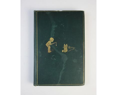
Milne (A.A.), WINNIE THE POOH, first edition, green cloth boards with embossed gilt illustration to cover, gilt top edge to block, inscription in pen to free end paper, E.H. Shepard illustrations throughout including title page, frontispiece and Hundred Acre Wood map endpapers, Methuen & Co Ltd, London 1926Provenance: Ruyton Hall, Shropshire

Lot 424
Ransome (A), the SWALLOWS AND AMAZONS series, comprising: SWALLOWS AND AMAZONS, SWALLOWDALE, PETER DUCK, WINTER HOLIDAY, COOT CLUB, PIGEON POST, WE DIDN?T MEAN TO GO TO SEE, SECRET WATER, THE BIG SIX, MISSEE LEE, THE PICTS AND THE MARTYRS and GREAT NORTHERN, all green cloth boards with embossed title to cover, unclipped DJs, map endpapers, engraved illustrations throughout, Jonathan Cape, London 1930 to 1947 (all reprinted) (12)Provenance: Ruyton Hall, Shropshire

Lot 430
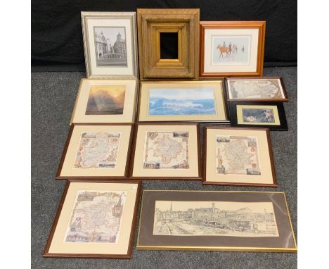
After J Speed,A 19th century copy of a map of Pembrokeshire, originally published in 1610 by John Sudbury and George Humbell, Engraving with later hand colouring,39cm x 51cm (PL)together with a map of Denbighshire after J. Speed, and a Robert Morden map of Shropshire (3)Provenance: Ruyton Hall, Shropshire
Lot 2
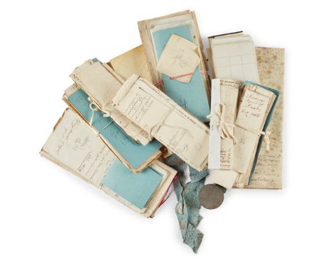
EARLS OF BREADALBANE - A COLLECTION OF MANUSCRIPTS, INCLUDING 1) Papers mainly concerning the Earls of Breadalbane. (1) Burgess ticket of John Campbell, Earl of Breadalbane, as burgess of St. Andrews, 24 October 1789; (2) Burgess ticket of John, Earl of Breadalabane, admitting him burgess of Dundee, 3 Nov. 1796; (3) Commission by Grand Master Maston to John Lord Viscount Glenorchy as Provincial Grand Master, 30 Nov. 1827; (4) Burgess ticket of John Lord Glenorchy as free-man of the burgh of Dumfries, 21 August 1739; (5) Burgess ticket of John Earl of Breadalbane as burgess of Inverary, 26 Sept. 1785; (6) Royal warrant authorising John, Marquis of Breadalbane.. to invest the King of Prussia with the ensigns of the Garter, 22 Feb. 1861, signed by Queen Victoria; (7) Bundle of executory papers, 1834-7, comprising interim state of the personal estate of John Marquis of Breadalbane as at 11 Nov. 1837, & statement of the personal funds and effects of the Marquis, Oct. 1834, (8) Letters relating to the Earl of Breadalbane on personal affairs and military news, June 1795-Dec. 1814 (20 items); (9) Papers concerning the 4th Earl of Breadalbane, 1802-1831, relating to a loan relating to the Langton estate, letter to Miss Gavin regarding marriage provision, manuscript prayers, observations on estate accounts; (10) Estate papers, with personal and household accounts pertaining to the 1st Marquis of Breadalbane 1803-31, 18 items, including copy letter to Mr Telford regarding improvements to Highlands, cellar list, warrant, letter regarding Langton Mill, letting of hill farms, bills for furnishings, regulations for factory accounts, building works at Achmore, proposed Reform Bill; (11) Various documents and letters on military matters including one concerning use of military doctors on civil business, 1797-1838, 14 items; (12) Correspondence on various political and personal matters mostly to Lord Breadalbane, including several on geographical matters, 1848-1853, 24 items, relating to candidate for the Chair of Greek or Latin in the New Irish colleges, copying pictures for the Queen, petition, Queen's journey through Lanarkshire, contributions to a fund for emigration of workwomen, apologising for non attending at Parliament, completion of the Geographical Map of Scotland, &c.; (13) Miscellaneous letters, mostly to Lord Breadalbane 1862-96, 11 items including correspondence from Landseer, letter of introduction, building of a chapel in Oban for the Free Church, &c.; (14) Forms of prayer (printed) for use in the consecration of the colours of the Irish Guards, 1902; (15) Copies of correspondence with original letters and other papers concerning Charles Grant, viscomte de Vaux, and the raising of regiments from among French emigrants, 1794, 14 items; (16) Printed and manuscript list of cargoes landed by ships of the Company of Merchants of England trading to the East Indies, the French Compagnie des Indes and the Dutch Oost-Indische Compagnie, at London, Gottenburg, Copenhagen and elsewhere, 1755, 25 items, mainly Dutch; (17) Business and personal accounts of David Gavin, 1750-57, 8 items; (18) Langton Estate accounts, 1759, 23 items, comprising account books of day labourers, tasks carried out, accounts of land and grass rents, oxen and cows grazed, receipts for cartage, wright and tannery work &c.; (19) Small papers relating to affairs of David Gavin of Langton 1769-1772, 25 items; (20) Receipts and small papers, similar to those above 1759-72, 28 items; (21) Miscellaneous papers relating to the Langton estates, 1758-1770, 15 items; (22) Letters on personal, estate and agricultural matters by Robert Scott of Dunninald, mostly to David Gavin of Langton, 1761-1771, 18 items; (23) Edinburgh Almanack for the year 1756, containing a memorandum on cash drawn at Middelburgh; (24) Cuttings-book pertaining to Lady Elizabeth Gavin, containing receipts for wages paid, books purchases, personal and estate expenses 1812-15; (25) Correspondence, mostly by Elizabeth Gavin to the Earl of Breadalbane on personal, business and family matters, principally the upbringing of Lord Glenorchy, 1797-1816, 24 items, including news on progress of work on the new house at Langton, list of books required for Lord Glenorchy and sending news of his studies, diet and temperament, &c.; (26) Diary, June-Nov. 1849, containing personal notes and observations, including details of a trip to Rotterdam on 26 Oct. 1849; (27) Papers relating to the Dukes of Buckingham and Chandos - Printed Lyrics (2), a Farewell Song and A War Song, 1899-1900; Account of the Marquis of Chandos for cash advanced for election expenses in 1830 (quantity)Footnote: Note: A substantial collection of legal papers and correspondence, chiefly relating to Lieutenant-General John Campbell, 4th Earl and 1st Marquis of Breadalbane (1762–1834), John Campbell, 2nd Marquess of Breadalbane, (1796–1862), John Lord Glenorchy, John 4th Earl of Breadalbane (1802-1831), Gavin Campbell, 1st Marquess of Breadalbane, ( 1851-1922), personal matters and their estates around Loch Tay in the central Highlands of Scotland.

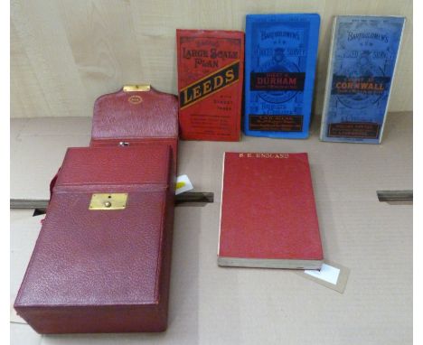
Lot 215
INDIA, BURMA and CEYLON, Murray's Handbook, 7th edition 1909 with railway map; FRANKS - In and Around Poona 7 volumes (1943). The books are in poor - fairly good condition, with faded wrappers. Spine faded with some damage top and bottom, some spotting internally. the binding is tight and all maps appear to be present, including that in the rear pocket.


Lot 321
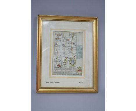
An 18th Century engraved Irish Map, containing Plans of Drogheda, Derry, Kinsale Harbour, Charlemont Fort, City of Dublin, Coleraine, The Harbour of Cork, Galway, The City of Kilkenny, Carrickfergus, The City of Cork, Athlone, Waterford, Belfast, The Royal Fort of Duncannon, and Limerick, approx. 39cms x 48.5cms (15 1/2" x 192) gilt frame. (1)


Lot 326
A group of four commemorative plates to include three 19th century Victoria, Queen & Empress, Jubilee year, 1887, octagonal polychrome plate illustrated with transfer illustrations of the Queen and the Prince of Wales, heraldic crests of Australia, Canada, Cape Colony and India and a hemispheral map of the world highlighting the British Empire, with figures illustrating the balance of trade within the empire, pattern number 63164, 24 cm diameter and Jubilee Year Commencing June 20th 1886, Victoria Queen of Grate Britain and Ireland and Empire of India. Was Born On The 24th of May 1819 and Ascended The Throne On The 20th of June 1837. Condition: good condition overall, the all Jubilee Year 1887 has crazing and general wear and tear. The other plat has a large chip on the back.


-
109182 item(s)/page