We found 109198 price guide item(s) matching your search

Refine your search

Year

Filter by Price Range
  • List
  • Grid
  • 109198 item(s)
    /page

Lot 330

A large framed the penguin map of the world including frame 83.5cm x 125cm.

Lot 363

A large map of China, 'shewing railways, telegraphs and treaty ports', English war office, ca. 1911 Dim.: 99 x 71,5 cmÊ Inscribed on the front 'Ed. Goldschmidt - Map of China - War Office'. ------ Please request condition reports by e-mail on info@rm-auctions.com. The reports, additional images and high-resolution images will be published on our website: www.rm-auctions.com. The absence of a condition report does not imply that the lot is in perfect condition.

Lot 488

Framed map of the Borders 37cm by 40cm

Lot 188

Edward Weller, FRGS, framed Map of Iceland and Greenland, 32 x 46cm

Lot 190

Reproduction map of 'Strathspey', in a glazed frame, 55 x 45cm

Lot 393

An enamelled Michelin Map of Britain

Lot 63

An 18th century silk embroidered map of Europe, circa 1770, oval, within a floral vine border, 50cm x 44cm, framed

Lot 988

A Napoleonic creamware cartoon mug, circa 1790-1810, red transfer printed decoration of Napoleon and John Bull over a map of Europe, 11.5cm high

Lot 277

Partie des Isles Antilles, hand coloured map, framed and glazed

Lot 142

Framed Saxton's Map of Cornwall - 1576

Lot 1063

Comitatus Rotelandiae Tabula Nova & Aucta By Robert Morden an Engraved Map of Rutland Published in 1695 & Sold by A Swale, A Churchil & Partners.

Lot 1184

A Map of Herefordshire showing Hereford Cathedral.

Lot 1254

A military handbook for the 12 PR quick firing guns 1913 and a manual of map reading 1929; original official publications.

Lot 1257

A printed map of Warwickshire, framed and another.

Lot 1393

John Speed, Africa, engraved hand coloured map, dated 1676, 40cm x 51cm

Lot 422

Antique Robert Morden Hand Coloured Map Engraving of South Wales, 42cms x 36cms together with a Framed and Glazed Map of Pembrokeshire

Lot 57

Vintage Folded Panoramic Map ' Panorama of the Rhine and the adjacent country from Cologne to Mayence drawn from nature by F W Delkeskamp engraved by John Clark together with the accompanying ' The Steam-Boat Companion from Cologne to Mayence to accompany the Panorama of the Rhine '

Lot 692

Two boxes of various early 20th century jigsaw puzzles to include The Academy puzzle, British Made The Victory jigsaw puzzle, Bacons Reversable map puzzles etc

Lot 83A

A box of map books and other maps

Lot 39

Vietnam / American war interest - a Zippo lighter inscribed when the power of love is as strong as the love of power then there will be peace and an engraved airplane, inscribed verso Vietnam Tan Son Nhat 70 - 71 also showing map of Vietnam, marked to the base Bradford PA Zippo Est £30 - £50

Lot 1206

Two various sterling silver tableware pieces including souvenir napkin ring, with applied enamel map of Australia decoration; and a sterling silver trinket box, marked 925; (total weight 90grams approx).

Lot 1436a

Georgian pre-industrial antique map of Cheshire by John Carey, 84.5cm x 76cm (frame), dated 1801, printed 1809

Lot 163

9ct gold Tasmania map brooch marked 9ct approx weight 0.7 grams

Lot 638

A map of Worcestershire with a print of Worcester

Lot 716

An unframed map of Dorchester 1805, and a map of Oxfordshire

Lot 798

A George Humble Speed map of Sussex, 40 x 52 cm

Lot 165

MALTHUS ON COMMODITIES' 'TRANSACTIONS OF THE ROYAL SOCIETY OF LITERATURE OF THE UNITED KINGDOM', Volume 1 part 1 (1827) & part 2 (1829), these contain the following articles by the Rev. T. R. Malthus - On The Measure of the Conditions necessary to the Supply of Commodities (Part 1). On the Meaning which is most usually and most correctly attached to the term "Value of a Commodity" (Part 2). The volumes also include other important articles - Egyptian Monuments in the British Museum and other Collections (Part 1) with 20 plates by Hulmandel. On the Demi Attica (Part 2) with 6 maps including one folding map of Greece. Bound in original publishers' cloth. NOT LISTED ON COPAC OR B. L. CATALOGUE.

Lot 203

REV. J. NIGHTINGALE - 'ENGLISH TOPOGRAPHY OR, GEOGRAPHICAL, HISTORICAL, AND STATISTICAL DESCRIPTIONS OF THE SEVERAL COUNTIES OF ENGLAND AND WALES accompanied by an accurate map of each county, from actual survey', printed for James Goodwin, Upper Thames Street; and Thomas McLean, Haymarket, c.1816, 58 engraved maps with original outline colourCondition Report:Binding has wear, spine partially detached, a few pages detached to rear, foxing to initial pages and some light foxing throughout

Lot 208

THOMAS COX - 'MAGNA BRITANNIA', c.1720 with folded map by Robert Morden and distance table in back, together with Staffordshire section from a gazetteer including Pigot map and vignette of Lichfield cathedral, rebound Staffordshire section from 'Tymms' Topography of Staffordshire 1834'

Lot 231

TO NORWAY & SPITZBERGEN BY ORIENT CO'S S. S. "LUSITANIA", Fenchurch Avenue, London E. C. Aug 1894, Pleasure Cruise to the Norway Fiords and Spitzbergen (for Midnight Sun) by the Orient Company's full-powered Steamship, "Lusitania," 3,877 Tons Register, 4,000 Horse-power, J. H. F. Nixon, Commander, booklet giving arrival and departure times, map, deck plans etc.

Lot 238

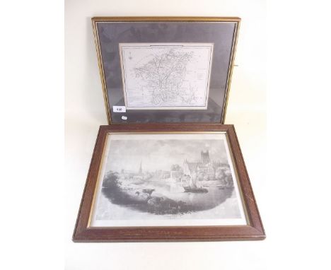
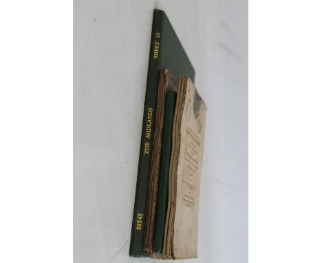
BROOKES' TRAVELLING COMPANION THROUGH ENGLAND AND WALES, folding map on linen, published by William Darton 1819, 2nd edition together with, Philips' County Map of Staffordshire - sectional folded map by Bartholomew on linen, folded Ordnance Survey map of the Midlands and Ordnance Survey folding map of Louth c.1910 (4)

Lot 239

MEXICAN INTERNATIONAL RAILROAD FOLDING MAP & TIMETABLE 1892, American bank Note Company, New YorkCondition Report:Torn on folds and some edge loss

Lot 240

C & J GREENWOOD COUNTY MAP OF STAFFORDSHIRE, c.1830 together with same of Cambridgeshire c.1834, 57.5 x 69 cm, unframed (2)Condition Report:Staffordshire - tear on centre fold into map (no loss), loss to top marginCambridgeshire - tatty edges, loss to edge at bottom, brown staining

Lot 243

SAXTON-KIP MAP OF BRECKNOC, c.1610, in later frame along with a reproduction map of the world (2)

Lot 244

JOHN SPEED MAP OF WILTSHIRE c.1627, double framed, English text on the back, frame size 43 x 56 cmCondition Report:Repair on back to centrefold otherwise very good condition

Lot 245

MICHAEL DRAYTON ALLEGORICAL MAP OF SOUTHERN HEREFORDSHIRE, part of Gloucestershire and part of Worcestershire from the Polyolbion c.1612 in Hogarth frame 28 x 35.5 cmCondition Report:Areas of browning, no visible signs of repair but not examined outside of frame

Lot 246

ROBERT MORDEN MAP OF OXFORDSHIRE, together with two prints of Lincoln College, Oxford (3)

Lot 247

FRAMED ANTIQUE MAPS OF DORSET, WILTSHIRE AND HAMPSHIRE to include Saxton-Kip of Dorset, Saxton-Kip of Wiltshire, Richard Blome of Hampshire, Ogilby road map of Bagshot to Salisbury, Gardner road map of Oxford to Salisbury, Archer of Hampshire, Keith Johnston of Spain and Portugal, together with two coloured engravings of Bath and Southampton (9)Condition Report:Several have over all browning, particularly the Ogilby, Blome and Saxton-Kip of Wiltshire

Lot 248

A JOHN SPEED MAP OF SHROPSHIRE, Henry Overton edition 1743, in traditional Hogarth frame. 42,5 x 55 cm together with Robert Morden map of Staffordshire and J & C Walker map of Staffordshire (3)

Lot 35

MILITARY INTEREST - A QUANTITY OF EPHEMERA AND PAPERWORK RELATING TO THE WAR, to include "Driver Electrician Training", "Notes on Map Reading", 1929, "Basic Atomic Warfare", "Basic Chemical Warfare" etc

Lot 55

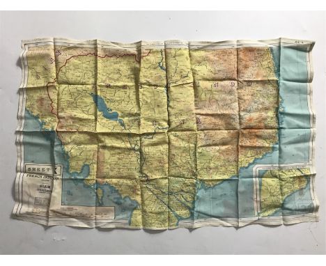
LOCAL INTEREST, THE MILITARY COLLECTION ARCHIVE OF FRANK SWANN OF COSELEY, (NORMANDY VETERAN) 12TH BN YORKSHIRE PARACHUTE REGIMENT, A COLLECTION OF BADGES PLAQUES, AND EPHEMERA FROM WWII ONWARDS, to include a silk escape map of France, captured German Swastika flag (printed type), a copy of the 12th Yorkshire Parachute Battalion in Germany, framed pictures relating to parachute drops, a copy of the Express and Star D-day special supplement dated 30/5/94 with a section on Frank etc.

Lot 313

A Plan Map Of The Town Of Nairn By John Wood, Dated 1821, together with a small collection of other maps and plans

Lot 65

An Early Coloured Map Of Devonshire By Robert Morden, together with two other similar maps

Lot 1012

A BRITISH RAILWAYS POSTER, 'A MAP OF YORKSHIRE' after Estra Clark, 1949, printed by Waterlow & Sons Ltd, London & Dunstable, Leeds, 101.5cm x 126cm.

Lot 1050

A cased set of Birmingham Mint The Ancient Counties of England limited edition silver collectors' coins, commemorating the boundary changes to the ancient counties of England on 31st March, 1974, together with booklet and framed map

Lot 1226

Robert Morden (c.1650-1703) Westmorland, a 17th Century engraved map, hand-tinted, in Hogarth frame under glass, 38 x 44 cm

Lot 1227

Robert Morden (c.1650-1703) Cumberland, a 17th Century engraved map, hand-tinted, in Hogarth frame under glass, 37 x 44 cm

Lot 1229

William Kip (fl. 1585-1618) after Christopher Saxton (c.1540-1610) Cumbria sive Cumberlandia, 17th Century engraved county map, hand-tinted, under passe-partout, 30 x 34 cm

Lot 374

A Second World War silk escape map, H2 Spain and North Africa

Lot 375

A Second World War silk escape map, F/G, Scandinavia and the Baltic

Lot 376

A Second World War silk escape map, K1/K2, Cyrenaica

Lot 383

A Second World War silk escape map, 43 A/B, France, Belgium, Holland

Lot 411

A Second World War British Army webbing map case, anklets and a lifebelt

Lot 507

A Second World War Home Guard Zone map of part of London, printed, dissected and laid on cotton folded within boards

Lot 591

A map entitled "Where the Doodle Bugs Crashed in Kent", published by the Kent Messenger in 1944, 51 cm x 68 cm

Lot 609

A Second World War silk escape map, 44 J/K, French Indo-China, Siam

Lot 502

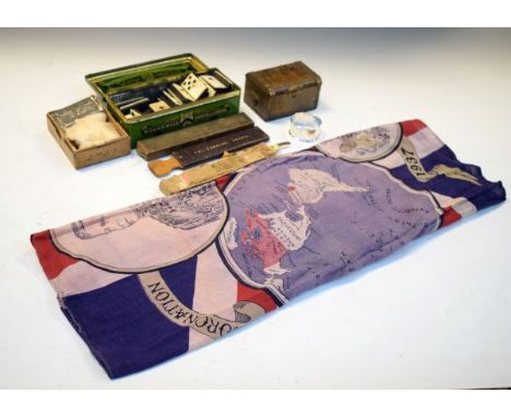
Assorted collectables to include; King Edward VIII 1937 Coronation flag with world map and portrait, together with cut throat razors, cased strop stamped Tho.Furniss, Truro, silver napkin ring, Wills 'Three Castles' cigarettes tin containing a set of bone and hardwood dominoes etc Condition:

Lot 301

Johann Baptist Homann - Antique hand coloured engraved map - Statuum Marocca Morum (Morocco and Canary Islands) with inset map of Madeira Islands, 48.5cm x 56.5cm, framed and glazed Condition:

Lot 514

[TOPOGRAPHY]. YORKSHIRE Speight, Harry. Nidderdale and the Garden of the Nidd: A Yorkshire Rhineland, first edition, Elliot Stock, London, 1894, original pictorial brown cloth gilt, folding map frontispiece, plate and text illustrations, subscribers list, three pages of publisher's advertisements, quarto; Speight, Harry. Upper Wharfedale, being a complete account of the history, antiquities and scenery of the picturesque valley of the Wharfe, from Otley to Langstrothdale, first edition, Elliott Stock, London, 1900, original blue cloth, folding map frontispiece, plate and text illustrations, subscribers list, five pages of publisher's advertisements, quarto; Bogg, Edmund. From Edenvale to the Plains of York: A thousand miles in the valleys of the Nidd and Yore, Bogg / Sampson, Leeds / York, no date, pictorial crimson cloth, text illustrations, period advertisements, quarto; 'An inhabitant'. A Glossary of Yorkshire Words and Phrases, collected in Whitby and the Neighbourhood, Smith, London, 1855, original brown blind-stamped cloth (spine strip torn, frayed and glued, with losses at ends), octavo; Fletcher, J.S. A Picturesque History of Yorkshire, three volumes, Dent, London, 1899, armorial green cloth gilt, top edges gilt, frontispieces, full-page and text illustrations, quarto; Home, Gordon. Yorkshire, first edition, Black, London, 1908, decorative cloth, top edges gilt, paper-protected colour plate illustrations by the author, eight-page publisher's catalogue, quarto; and six other works, (14 vols).

Loading...Loading...
  • 109198 item(s)
    /page

Recently Viewed Lots