![-. Portlock - and Capt. George Dixon.- [Beresford ] A Voyage round the World;... ( Capt. Nathaniel) and Capt. George D](https://cdn.globalauctionplatform.com/a105c5f5-8362-4b43-aa55-a4c600f65430/661e59dc-9d8a-4c90-eeff-46035295e6a7/468x382.jpg)

-. Portlock - and Capt. George Dixon.- [Beresford ] A Voyage round the World;... ( Capt. Nathaniel) and Capt. George Dixon.- [Beresford (William)] A Voyage round the World; but more particularly to the North-West Coast of America , performed in 1785, 1786, 1787, and 1788 Captains Portlock and Dixon, second edition, half-title, large folding engraved map, 20 engraved maps and plates only (of 21, lacking engraved sheet of music, supplied in facsimile), 7 folding, one or two plates cropped affecting imprint, occasional spotting and soiling, some offsetting, Nn1 & 4 soiled and frayed at edges, contemporary calf, a little rubbed and stained at edges, rebacked, spine gilt with red morocco label (old label loosely inserted), tips of corners repaired, [Sabin 20364 & 64390], 4to, 1789. The first commercial voyage to the Pacific North-West, with the aim of establishing fur-trading posts. It contains detailed information on the Native Americans and Russians, also on the Sandwich Islands (Hawaii).
We found 109182 price guide item(s) matching your search
There are 109182 lots that match your search criteria. Subscribe now to get instant access to the full price guide service.
Click here to subscribe- List
- Grid
-
109182 item(s)/page
[Warburton (John)] - Some Account of the Alien Priories, 2 vol. in 1, engraved folding frontispiece map of Normandy, 9 engraved plates of churches and monasteries, offsetting, occasional spotting, contemporary tree calf, rebacked in modern calf, preserving original morocco labels, corners worn, 8vo, by and for J.Nichols, 1779.
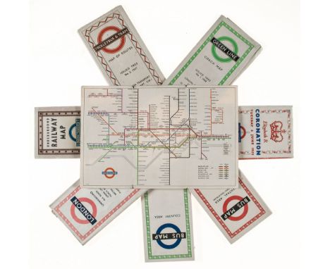
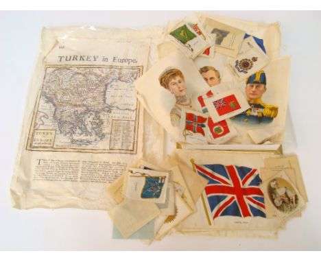
Ephemera.- - Underground Railway Map, number 1, 1937; Trolleybus and Tram, 1947; Green Line, 1948; Bus Map, Country Area, 1952; Bus Map, Central Area, 1953; Elizabeth R Coronation, 1953; London, with Peter Robertson designs, 1956; Railways, 1953, London Transport folding maps, a few with closed tears along folds, some light finger-soiling and fading, v.s. (8)
Norfolk.- Armstrong - History and Antiquities of the County of Norfolk (Mostyn John) History and Antiquities of the County of Norfolk, with contributions and plates by Humphry Repton, 10 vol., folding engraved map and plates, foxed and browned, some offsetting, ex-library copy with ink stamps, contemporary uniform calf, gilt, edges rubbed, corners repaired, rebacked in modern calf retaining original labels, printed by J. Crouse, for M. Booth, 1781; and 7 others, 8vo ; sold not subject to return (17).
Sykes - On the Atmospheric Tides and Meteorology of Dukhun ( Lt.-Col W.H .) On the Atmospheric Tides and Meteorology of Dukhun , presentation copy from the author to Sir William R. Hamilton, inscribed at head of title, 1835 § Wheeler (W.H.) A Practical Manual of Tides and Waves, 1906 § De Rance (C.E.) The Water Supply of England and Wales, folding map, 1882, Lee (John Edward) Note-Book of an Amateur Geologist, mounted Woodburytype as frontispiece, title foxed, ex-library copy with stamps and labels , 1881 § Johnson (R.H.) & L.G. Huntley. Principles of Oil and Gas Production, New York , 1916 § Anderson (J.-W.) Manuel du Prospecteur, contemporary morocco-backed boards, original wrappers bound in, Paris , [c.1901], some plates and illlustrations, all but the last original cloth, rubbed, the first worn (lacking spine and covers detached) ; and c.60 others, geology, meteorology, mineralogy, including Dunn's Geology of Gold in the original sheets, v.s. (c.65)
Savary des Brulons (Jacques) - Universal Dictionary of Trade and Commerce, Translated from the French..., first edition in English , translated by Malachy Postlethwayt, 2 vol., engraved allegorical frontispiece, titles printed in red & black with engraved vignette, engraved vignette to head of both dedications, 24 folding engraved maps, tables including folding, diagrams, lacking 4pp. of text (pp.477-480, vol.I), worm-track affecting fore-edge margin of last map and last 8 pp. in vol.II, light offsetting from frontispiece and vignettes, vol.II title slightly browned at head, but overall internally in excellent condition, full contemporary sprinkled calf, spines gilt, worn at edges with some splitting to joints, folio, for John & Paul Knapton , 1751-55.

An 18th Century coloured map, Herefordshire, 13cm x 15cm, Jenkins, A view of part of the City of Hereford 19 x 27cm, an engraving of H.M.S. Victory by S.C.U. Nicholls, 1930, the margin signed in pencil, 21cm x 28.5cm, Lieutenant C. Graham-Hall (Camouflage Section), sailing ship, inscribed verso, gouache, 21cm x 35cm and a view of Gatcombe (5) £45-65

Blaeu (Johan and Willem): An Engraved Map of the British Isles: 'Britannia prout divisa fuit temporibus Anglo-Saxonum præsertim durante illorum Heptarchia', decorative title cartouche of putti and crown, bordered with 7 cartouches on each side depicting kings of the Anglo-Saxon heptarchy, map with outline hand-colouring, the cartouches fully coloured H 41.5 x W 52.5 cm


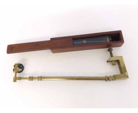
A Mixed Lot comprising: a Mahogany Cased Government Issue Surveyor's Tool, of patinated brass rectangular and glazed form, and marked Director No 1, W Ottway & Co Ltd, 1917, No 1544 on the Government Broad Arrow, together with a further Table Mounting Map Reading Instrument of brass construction, various dates and makers (2)

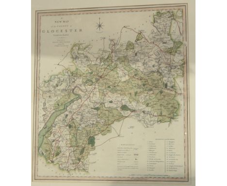
A collection of pictures and prints including early 20th century coloured prints of worldwide street vendors in national costumes, after E Herzig, a set of four small watercolours of middle eastern style landscapes with camel, donkey and riders, water carriers, etc, all signed bottom right Eliana, 8 x 12 cm approx., a further set of four similar watercolour studies of middle eastern characters (in one frame) together with a black and white etching of Brixham Harbour, indistinctly signed bottom right, 15 x 11 cm, Langley's New Map of Gloucestershire, published by J Phelps 1820, 32 x 21 cm, etc, all framed


Lavars's Plan of Bristol and Suburbs 1874, in two sided glazed frame with various advertisements verso and original covers of the map, 49 x 68 cm together with Lavars's Map of the Country 9 Miles Round the City of Bristol, again in two sided glazed frame and with facsimile advertisements displayed to reverse, 50 x 62 cm, both framed together, with an oil painting on canvas of a river scene with thatched buildings, figure, rowing boat, etc, signed bottom right Marus (?), 40 x 50 cm in moulded gilt frame


James Morrison "LOW WATER" signed and dated no. 8/xi/99; with inscriptions on gallery and exhibition labels verso oil on board 102 x 152.5cms; 40 x 60in. EXHIBITED The Royal Scottish Academy Connections 2000 Exhibition, Edinburgh, July-September 2000. Purchased The Scottish Gallery, October 2000. Sold with a letter from the Artist and an annotated map indicating the exact view from the North Shore of the Montrose basin looking West. See illustration

Gordon Bryce, RSA, RSW "RHUM AND EIGG SUMMER" signed with monogram; signed and inscribed verso oil on board 67.5 x 78cms; 26 1/2 x 30 3/4in. PROVENANCE Purchased The Scottish Gallery, Edinburgh, New Paintings By Gordon Bryce, April-May 2004. Sold with a letter from the Artist to the purchaser containing an annotated map indicating the exact location of the scene depicted. See illustration


FOLK - Collection of 6 x original title LP's. Titles are Paul McNeil - Contemporary Folk (Decca mono LK 4699), Tír na nÓg - S/T (ILPS 9153), Various - The Mushroom Folk Sampler (Mushroom 100 MR 16), Muckram Wakes ?– A Map Of Derbyshire (Trailer - LER 2085), Various - Clogs (PS1) and Club Folk Volume 1 (PS2). Condition is generally VG to Ex.


1915 Star Trio to 2509 Pte E Long Oxf & Bucks L.I. Sgt Ernest Long was Killed In Action 29th Oct 1918 as 265784 with the 1st Bn Ox & Bucks L.I.. Lived High Wycombe. Buried Barenthal Military Cemetery. Lot also includes box of issue, envelopes, map, and a letter from an Officer to his Sister. EF (3)


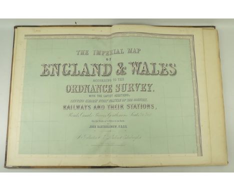
A copy of 'The Imperial Map of England & Wales according to the Ordnance Survey, with the latest additions; shewing clearly every feature of the country, railways and their stations, roads, canals, rivers, gentlemen's seats, &c. &c, on the scale of 4 miles to an inch, by John Bartholemew FRGS,' published by A Fullerton & Co, London & Edinburgh, half calf, folio.


A collection of Antique county maps, to include Essex by J Archer, Nottinghamshire by Hogg, Derbyshire by Chapman & Hall, Scilly Isles by Fullarton & Co, Bedfordshire by Cary, Buckinghamshire by Cary, Leicestershire by Cary, three of Nottinghamshire, and a Smith's folding map of Nottinghamshire


-
109182 item(s)/page