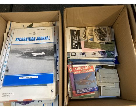

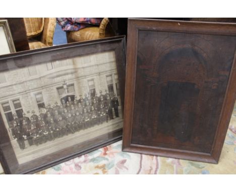
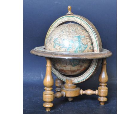
Aircraft & Civil Defence Memorabilia. A large archive of memorabilia assembled by ROC Officer D.H. Taylor, 8 Section No. 2 Crew, based at RAF Gaydon, including a group of 8 large Ministry of Aviation aircraft silhouette posters, c. 1950s, including Vulcan B Mk 1, Sea Vixen FAW Mk 1, Comet Mk 4, Vulcan B Mk 1, 5 Episcope packs of aviation silhouette cards, a set of 6 photo postcards showing inside the Civil Defence school 'the Hawkhills', Manual of Civil Defence: Volume 1 'Nuclear Weapons', published by HMSO, 1956, 2 'Operations Room Training Aid' booklets, 1960s, a large war room map showing the world as double hemisphere, Coventry ROC No. 5 Group plotting chart, Aircraft Armament Past and Present, Parts 1 & 2, published Real Photographs Company Ltd, a group of approximately 60 journals from ROC Gaydon (1952-1971) including 51 x Joint Services & ROC Recognition Journals, a collection of personal effects belonging to D.H. Taylor, including ATC soft blue cap (inside dated 1964), black tie, ATC Cadet's flying log book, gold cloth badge, belt, etc., plus a further assortment of mostly printed booklets, documents and ephemeraQTY: (2 cartons)NOTE:Much of the material is marked 'Restricted' or 'Confidential' and reflects the classified nature of the work undertaken by the Ministry of Aviation personnel at RAF Gaydon during Britain's early Cold War period.
We found 109198 price guide item(s) matching your search
There are 109198 lots that match your search criteria. Subscribe now to get instant access to the full price guide service.
Click here to subscribe- List
- Grid
-
109198 item(s)/page
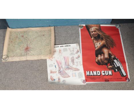
Posters and prints including Stu Francis Crackerjack Roadshow poster, Return of the Heroes Print Spitfire by Ivan Berryman, Vintage Picture Map of London by Francis Chichester, posters of the Magna Carter and British Museum Translation of. Dambusters Print after Alan Roe, 'Dam Buster VC', signed by 2 members of the squadron and the artist, limited edition 74/250 (42cm x 59cm), a Royal Navy Guide to the Fleet Poster and USA Globemaster III airplane poster (tear at left) and photocopy of a newspaper story (9)
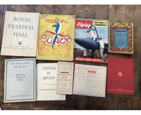
Festival of Britain ephemera: the Royal School of Church Music Festival Service Book VGC and 1951 Royal Festival Hall Souvenir Programme - Ceremonial Opening and Inaugural Concerts 3 May - 9 May 1951 in good condition and Commemorative Poster Stamps Sold in Aid of The Greater London Fund for the Blind, 2s6d in VGC and Edition of Punch magazine, good condition and 1951 Festival of Britain Cable & Wireless Telegram Souvenir Message via Imperial and 1951 Festival of Britain Information Summary Mar 3rd - Sept 30th published by HMSO and "News Chronicle" London Map and Guide, full colour, 1951 News of the World Almanac and Household Guide, good and Royal Air Force 'Flying Review' Magazine September 1955 with an exclusive on Britain's Guided Missiles, cover showing Folland's Gnat. VGC


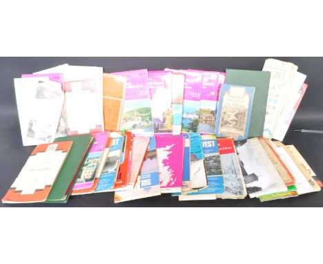
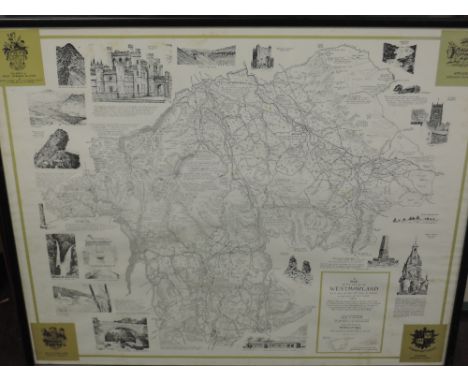
A collection of vintage 20th century O.S (Ordnance Survey) British maps. The lot to include maps or varied areas and scales, some also mounted on cloth. Including Ordnance Survey On-inch map of Great Britain Torquay, scale one inch to one statute mile 1/63360, Ordnance Survey Oxford & surrounding area, scale 2cm to 1km, RAC South East, including maps of London, Brighton, Canterbury, Dover, Portsmouth, Folkestone, Windsor, scale 3 miles to 1 inch, and more.


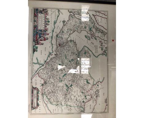


An early 19th century George III map of Worcestershire entitled a Map of Worcestershire from the best Authorities. Engraved by John Cary, for publication in Richard Gough's translation of William Camden's 'Britannia' in 1789. Published by John Stockdale, Piccadilly, 26th March 1805. Framed and glazed. Measures 45cm x 45cm.


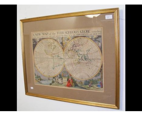
published 1645hand-colored engravingfull sheet: 44 x 58 cm (17 3/8 x 22 7/8 in.)framed dimensions: 53 x 67 cm (20 7/8 x 26 3/8 in.)CONDITIONObserved in frame, the map is in good age-appropriate condition. Minor scattered surface soiling and toning.N.B. All lots are sold in as-is condition at the time of sale. Please note that any condition statement regarding works of art is given as a courtesy to our clients in order to assist them in assessing the condition. The report is a genuine opinion held by Shapiro Auctions and should not be treated as a statement of fact. The absence of a condition report or a photograph does not preclude the absence of defects or restoration, nor does a reference to particular defects imply the absence of any others. Shapiro Auctions, LLC., including its consultants and agents, shall have no responsibility for any error or omission.

John Ogilby (Edinburg 1600 - 1676 London)Asia, the First Part. Being an Accurate Description of Persia, and the Several Provinces Thereof. The Vast Empire of the Great Mogol, and Other Parts of India, zweifarbiger Titel, Widmungsblatt, 7 Seiten Vorwort, 256 Textseiten, 15 Seiten Index und Tafelverzeichnis mit 5 doppelseitigen Landkarten (dabei große, ausklappbare Asienkarte signiert von Francis Lamb), Titelkupfer, 29 Kupfertafeln (davon 12 doppelseitig) inklusive Titelkupfer und 30 Textkupfer, John Ogilby London 1673 ("Printed by the Author"), vollständig mit allen Kupfertafeln und allen Karten, der seltenen Bindeanleitung ("Directions For Placing the Sculps") und den üblichen Paginierungsfehlern (Seiteangabe 8 doppelt, Seitenangaben 55/56 fehlen, Seite 90 als "82" und Seite 95 als "87" nummeriert, Buchblock insgesamt guter Zustand mit fester Bindung und üblichen Gebrauchsspuren, wenige Seiten an den Kanten angeschmutzt oder leicht fleckig, Vorsatzblätter, Titelkupfer und Titel jeweils an der unteren rechten Ecke professionell hinterlegt, alle Kupferstiche mit breiten Rändern, originaler Ledereinband auf fünf Bünden mit Stempel-, Rollstempel- und Streicheisendekor, Rücken mit vergoldetem Titel, 41 x 27 cm, Einband mit deutlichen Gebrauchsspuren, Rücken und Kanten beschabt und an den Gelenken eingerissen, Vordergelenk gelockert, am Rücken Fehlstellen 5604 Vollständiges Exemplar dieser seltenen Ausgabe mit allen Tafeln und Karten, obwohl im Titel als "First Part" ausgewiesen, handelt es sich um die gesamte Ausgabe, die meist fehlende Hauptkarte "A new Map of Asia" ist von Francis Lamb (tatig 1667- 1701 in London) signiert, möglicherweise stammen auch die anderen Karten von ihm


An early 19th century oval embroidered map on card of England and Wales, cut out and re-mounted, the oval 48cm x 41cm, framed and glazedIn the 18th and early 19th centuries girls received their geography knowledge by embroidering such maps. This may have been a template to be copied CONDITION REPORT: Please note - Descriptions do not include condition reports. Please contact us to if you require further information or images.PLEASE CONSIDER SHIPPING COSTS BEFORE BIDDING. THE COST OF SHIPPING MAY AFFECT YOUR DECISION TO BID.
-
109198 item(s)/page