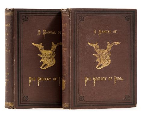
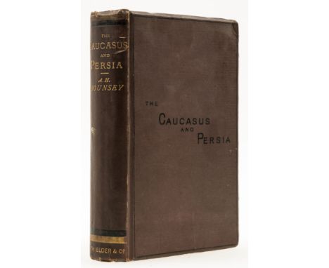
We found 109182 price guide item(s) matching your search

Refine your search

Year

Filter by Price Range
  • List
  • Grid
  • 109182 item(s)
    /page

Lot 30

Middle East.- Mounsey (Augustus H.) A Journey Through the Caucasus and the Interior of Persia, first edition, folding map, scattered spotting, bookplates, abrasion mark to front free endpaper, original cloth, bumping to corners and spine extremities, 8vo, 1872.⁂ Provenance: Bookplate of Lieutenant Commander Edward Scott Williams, and bookplate of Peter Hopkirk. Both to front pastedown.

Lot 19

Middle East.- Bonomi (Joseph) Nineveh and its Palaces, frontispiece, plates and illustrations, scattered spotting, faint marginal damp-staining, contemporary morocco, rubbed, bumping to corners and spine extremities, 1853 § Crichton (Andrew) History of Arabia, Ancient and Modern, 2 vol., folding map frontispiece, additional engraved titles, scattered faubt spotting, original cloth, slight bumping to corners and extremities, Edinburgh, 1834 § Flecker (James Elroy) Hassan, tipped-in colour frontispiece, plates, captioned tissue-guard, original pictorial cloth, a little rubbed, slight bumping to corners and extremities, 1924; and others similar, 8vo & 4to (8)

Lot 120

Geology.- Medlicott (H. B.) & W. T. Blanford. A Manual of the Geology of India, 2 vol., vol. 2 with half-title only, one folding map, 21 lithographs, captioned tissue-guards, illustrations, manuscript additions to errata, scattered spotting, original pictorial cloth, gilt, rubbed, bumping to corners and extremities, large 8vo, Calcutta, 1879.

Lot 78

Two boxes of 19th century prints, mounted in Hogarth style frames, to include map of Yorkshire and Lancashire etc

Lot 160

Mixed collection of pictures, needle works, mirror, Lake District photographs, map of Cumberland etc

Lot 157

Two early 20th century prints of Map of Cumberland and Chester

Lot 141

Victorian print of two children in gilt frame and framed map of Burton in Kendal

Lot 7084

A box of railway ephemera including GWR map, Hornby etc

Lot 353

Emanuel Bowen, The Road From Kings Lyn to Norwich, hand coloured engraving c. 1720, 18.5x12cm; together with a 19th century hand coloured map of Norfolk, by W. Schmollinger, 21x27cm (2)

Lot 404

John Blaeu, a hand coloured engraved map of Connaught 'Connachtia Vulgo Conaughty', c.1654, the plate 40x51cm

Lot 352

Robert Morden, an early 18th century engraved hand coloured map of Hampshire, c. 1722, 36x42cm

Lot 360

William Faden, 'Hind, Hindoostan or India', engraved and coloured map of India, c.1800, 71x54cm

Lot 597

A shoe box of postcards including literary, map cards (modern), novelty/fantasy, postal interest, relgion, romantic etc (300+)

Lot 1071

A framed map of the South West of England and Wales, 37 x 46cm

Lot 719

An 18th century Mediterranean map, publish 12th May 1794 by Laurie & Whittle 49x67cm

Lot 1180

An antique map of Prussia by Gasper Henneberg, Er lichen, 56 x 44cm

Lot 718

A later copy of The Howard Vincent map of the British Empire 1924, 64 x 56cm

Lot 676

Briton or Boer Fourth edition linen backed map of Johannesburg by Wood and Ortlepp Compilers to Her Majesty's forces in South Africa 1900 published by Forster Groom & Co

Lot 1032

An Ogilby road map Exeter to Dorchester 1698, 38 x 48cm

Lot 359

PHILLIP'S SCHOOL-ROOM MAP OF THE WORLD, THE BRITISH COMMONWEALTH AND THE PACIFIC mounted on original boardsapproximately 114cm x 183cm

Lot 592

MAP OF THE LONDON MIDLAND AND SCOTTISH RAILWAY AND CONNECTIONS, EARLY 20TH CENTURY published by McCorquodale & Co Ltd of London, with wooden baton ends94cm x 64cm

Lot 52

A color map going from Martha's Vineyard to Block Island and the surrounding area. Publishing stamp by "The U.S Coast and Geodetic Survey" located on bottom. Issued: 1941Dimensions: 46"L x 36"WManufacturer: U.S Coast and Geodetic SurveyCountry of Origin: United StatesCondition: Age related wear.

Lot 51

A map of the Gulf Coast of Florida from Chatham River to Clam Pass shown in feet. Publishing stamp by "The U.S Coast and Geodetic Survey" located on bottom. Issued: 20th CenturyDimensions: 43.5"L x 34.5"WManufacturer: U.S Coast and Geodetic SurveyCountry of Origin: United StatesCondition: Age related wear.

Lot 55

A colored map depicting the area of the Gulf Coast from the Sombrero Key to the Sand Key. Publishing stamp by "The U.S Coast and Geodetic Survey" located on bottom. Issued: 1940Dimensions: 43"L x 35"WManufacturer: U.S Coast and Geodetic SurveyCountry of Origin: United StatesCondition: Age related wear.

Lot 53

A map depicting the islands along the gulf coast along with the gulf. Publishing stamp by "The U.S Coast and Geodetic Survey" located on bottom. Issued: 1933Dimensions: 44"L x 34.5"WManufacturer: U.S Coast and Geodetic SurveyCountry of Origin: United StatesCondition: Age related wear.

Lot 50

A color map depicting the area of Alligator Alley to the Sombrero Key on a cloth backing. Publishing stamp by "The U.S Department of Commerce - Environmental Science Services Administration - Coast and Geodetic Survey" located on bottom. Issued: 20th CenturyDimensions: 35"L x 42"WManufacturer: U.S Department of CommerceCountry of Origin: United StatesCondition: Age related wear.

Lot 54

A color map going from Martha's Vineyard to Block Island and the surrounding area. Publishing stamp by "The U.S Coast and Geodetic Survey" located on bottom. Issued: 1941Dimensions: 46"L x 36"WManufacturer: U.S Coast and Geodetic SurveyCountry of Origin: United StatesCondition: Age related wear.

Lot 56

Title "USC&GS Map, Alligator Reef to Sombrero Key, Florida Gulf Coast". A color map depicting the land and sea area of Alligator Reef to the Sombrero Key. Publishing stamp by "The U.S Coast and Geodetic Survey" located on bottom. Issued: 1940Dimensions: 44"L x 36"WManufacturer: U.S Coast and Geodetic SurveyCountry of Origin: United StatesCondition: Age related wear.

Lot 501

A 271-page softcover book that discusses the flight and hatching patterns of insects in the New England area with biology information and photos of each species in color. The Housatonic Fly Fishermen's Association Map (1983) is a map that shows the coast of New England with roads, railroads, parking lots, and destinations along the route. Artist: Thomas Ames JrIssued: 2000Dimensions: 4.25"L x 0.75"W x 6.25"HManufacturer: Frank Amato Publications, Inc.Country of Origin: United StatesCondition: Age related wear.

Lot 308

German WWII era M35 map case, German WWII era M35 map case, containing two 1943 dated maps and later paperwork and pencils. Due to the nature of Third Reich items, it is up to the buyer to satisfy themselves of the age of this item prior to bidding. More images can be made available on request.26cm x 19cm

Lot 416

A 17th century hand-coloured map of the "Isles of Wight, Larsey, Garnsey, Sarke, Man, Orvades and Shetland", by Richard Bloom, in ebonised frame

Lot 238

Duncan, Archibald: "The Life of the Right Honorable Horatio, Lord Viscount Nelson...", 1 vol Cundee, 1806, has maps and plate, page 69 mostly torn out, half calf worn marbled boards, Fairburn, John: "Fairburn's Edition of the life of Admiral Lord Nelson", 1 vol, paper with map and inscription, 35th edition (both uncollated)

Lot 233

Brewer, I N: "A Topographical and Historical Description of the County of Warwickshire", 1 vol illust, Sherwood, Neely and Jones, 1820, quarter calf, marbled boards rubbed, map present (uncollated)

Lot 496

A Map of Middlesex by John Speed and John Norden, 'Midle-Sex described with the most Famous Cities of London and Westminster', Thomas Bassett and Richard Chiswell, a hand-coloured engraved map with inset views of Westminster, London, Saint Peters and Saint Pauls, 40.5 cm x 52.5 cm, within a glazed frame (glass a/f)Location:

Lot 297

A 9ct yellow gold ( stamped 9 ) Australian wishbone and map brooch, L. 3.5cm.

Lot 363

One volume “The British Atlas; comprising a complete set of county maps of England and Wales; with general map of navigable rivers and canals and plans of cities in principal towns”, printed for Vernor Hood & Sharp…. 1810, comprising 57 maps after G Cole, engraved by J Roper CONDITION REPORTS The spine is broken, mainly missing. The front and back boards are off. The first page hand inscribed "Hannington Hall". Devonshire is completely loose. Cambridge appears to be re-stuck or stuck down to additional sheet. Missing Shrewsbury. There is an additional map the Isle of Wight not listed Variously foxed throughout and some areas of darker mould. There are some small rips - see images for examples. Wear and tear conducive with age and use over the years including areas of the binding coming away - see images for more details The counties are hand coloured the town/cities are black and white.

Lot 33

Two boxes of assorted china wares to include Booths Real Old Willow pattern cups, saucers, jug, twin handled sucriere etc and a box of miscellaneous items to include a Uniform Brand British Made Competition tent, various cigar boxes, gramophone etc, camp bed, map and rug etc (3)

Lot 375

An Indian white metal cigarette case, engraved with the Taj Mahal, the reverse with a map, with flowers at each corner, 154gms Condition Report:Available upon request

Lot 68

A mixed lot to include 20th century yew wood drop end sofa table, teak coffee table inlaid with a map of Australia, two three tiered folding cake stands, rosewood tripod occasional table, tripod base standard lamp and contemporary wall mirror (7)  Condition Report:Available upon request

Lot 16

Kenneth Craigie & Company (publisher) - Craigie's Town, Road and Rail Map of Australia, six early 20th century lithographic folding maps, within a cloth covered cardboard case.This lot is subject to a Buyer’s Premium of 24.5% (including VAT @ 0%) of the hammer price. Purchased online via the-saleroom.com, this lot will attract an additional premium of 5% (including VAT @ 0%) of the hammer price.

Lot 8

Willem Benjamin Craan - 'Plan géométrique de la Ville de Bruxelles' (Map of Brussels), engraving, folding and backed onto linen, published by Etablissement ge?ographique de Bruxelles 1835, overall sheet size 122.5cm x 176cm.This lot is subject to a Buyer’s Premium of 24.5% (including VAT @ 0%) of the hammer price. Purchased online via the-saleroom.com, this lot will attract an additional premium of 5% (including VAT @ 0%) of the hammer price.

Lot 9

J. Plumer (cartographer) - 'Map of Broadbridge Estate Situate in the Parishes of Sullington, Horsham, Warnham…Itchingfield, in the County of Sussex, the Property of Mr Matthew Stanford', manuscript and watercolour map backed onto linen, signed and dated 1842, sheet size 173cm x 155cm.This lot is subject to a Buyer’s Premium of 24.5% (including VAT @ 0%) of the hammer price. Purchased online via the-saleroom.com, this lot will attract an additional premium of 5% (including VAT @ 0%) of the hammer price.

Lot 33

John Speed - 'Buckingham Both Shyre, and Shire, towne describ' (Map of Buckinghamshire), 17th century engraving on laid paper, 38cm x 51cm, within a stained wood frame.Buyer’s Premium 29.4% (including VAT @ 20%) of the hammer price. Lots purchased online via the-saleroom.com will attract an additional premium of 6% (including VAT @ 20%) of the hammer price.

Lot 4

L. Guilmin - 'Nouveau Plan de Paris', early 20th century lithograph, overall 61cm x 75cm, within cloth covered boards with silvered titles, together with another map by F. Draye, 'The War Front 1914-1918'.This lot is subject to a Buyer’s Premium of 24.5% (including VAT @ 0%) of the hammer price. Purchased online via the-saleroom.com, this lot will attract an additional premium of 5% (including VAT @ 0%) of the hammer price.

Lot 10

Theodor de Bry - 'Occidentalis Americae partis' (Map of Florida and the West Indies), copper engraving on laid paper, published Frankfurt circa 1594, sheet size 34.5cm x 45cm.This lot is subject to a Buyer’s Premium of 24.5% (including VAT @ 0%) of the hammer price. Purchased online via the-saleroom.com, this lot will attract an additional premium of 5% (including VAT @ 0%) of the hammer price.

Lot 25

Willem Kip, after Christopher Saxton - 'Huntingdon Comitatus qui pars fuir Icenorum' (Map of Huntingdonshire), 17th century engraving on laid paper, 27cm x 34cm, within a Hogarth style frame.Buyer’s Premium 29.4% (including VAT @ 20%) of the hammer price. Lots purchased online via the-saleroom.com will attract an additional premium of 6% (including VAT @ 20%) of the hammer price.

Lot 17

John Wallis (publisher) - London and Westminster in the Reign of Queen Elizabeth Anno Dom. 1563, engraving in 22 sections, folding and backed onto linen, published 1789, overall 38cm x 104.5cm, together with an 18th century John Rocque folding map, 'England and Wales'.This lot is subject to a Buyer’s Premium of 24.5% (including VAT @ 0%) of the hammer price. Purchased online via the-saleroom.com, this lot will attract an additional premium of 5% (including VAT @ 0%) of the hammer price.

Lot 34

John Speed - 'Italia' (Map of Italy), 17th century engraving with later hand-colouring on laid paper, 41cm x 53cm, within a stained wood frame.Buyer’s Premium 29.4% (including VAT @ 20%) of the hammer price. Lots purchased online via the-saleroom.com will attract an additional premium of 6% (including VAT @ 20%) of the hammer price.

Lot 5

Kummerly & Frey - 'Skitourenkarte von Davos und Umgebung' (Map of the Swiss Alps), early 20th century lithograph in 28 sections, folding and backed onto linen, overall 73.5cm x 97.5cm, together with a quantity of folding maps and books of European Alps interest.This lot is subject to a Buyer’s Premium of 24.5% (including VAT @ 0%) of the hammer price. Purchased online via the-saleroom.com, this lot will attract an additional premium of 5% (including VAT @ 0%) of the hammer price.

Lot 15

Nicolas Sanson - 'Tryk van Persien' (Map of the Middle East), 17th century engraving with later hand-colouring on laid paper, sheet size 27cm x 36cm, together with a small collection of other 17th, 18th and 19th century maps of European and Middle Eastern interest.This lot is subject to a Buyer’s Premium of 24.5% (including VAT @ 0%) of the hammer price. Purchased online via the-saleroom.com, this lot will attract an additional premium of 5% (including VAT @ 0%) of the hammer price.

Lot 28

John Speed - 'The West Ridinge of Yorkeshyre with the most famous and fayre Citie Yorke described 1610' (Map of Yorkshire), 17th century engraving with later hand-colouring on laid paper, 39.5cm x 52cm, within a Hogarth style frame.Buyer’s Premium 29.4% (including VAT @ 20%) of the hammer price. Lots purchased online via the-saleroom.com will attract an additional premium of 6% (including VAT @ 20%) of the hammer price.

Lot 77

Joan Blaeu - 'Hantonia sive Southantonensis comitatus vulgo Hant-shire' (Map of Hampshire), 17th century engraving with later hand-colouring on laid paper, 49.5cm x 60cm, within a Hogarth style frame.Buyer’s Premium 29.4% (including VAT @ 20%) of the hammer price. Lots purchased online via the-saleroom.com will attract an additional premium of 6% (including VAT @ 20%) of the hammer price.

Lot 24

William Hole, after Christopher Saxton - 'Oxoniensis Comitatus Vulgo Oxfordshyre qui pars olim Dobunorum' (Map of Oxfordshire), 17th century engraving on laid paper, 29cm x 30.5cm, within a Hogarth style frame.Buyer’s Premium 29.4% (including VAT @ 20%) of the hammer price. Lots purchased online via the-saleroom.com will attract an additional premium of 6% (including VAT @ 20%) of the hammer price.

Lot 3

William Allen (publisher) - 'Map of the Punjab and the Sikh Territory', engraving in 24 sections with hand-colouring in outline, folding and backed onto linen, published 1849, overall 64.5cm x 59.5cm, within cloth covered boards with gilt titles.This lot is subject to a Buyer’s Premium of 24.5% (including VAT @ 0%) of the hammer price. Purchased online via the-saleroom.com, this lot will attract an additional premium of 5% (including VAT @ 0%) of the hammer price.

Lot 11

B. Browne - 'Plan of Prome' (Pyay, Burma), 19th century manuscript ink and watercolour map showing the British military positions on the River Irrawaddy, sheet size 51cm x 72.5cm.This lot is subject to a Buyer’s Premium of 24.5% (including VAT @ 0%) of the hammer price. Purchased online via the-saleroom.com, this lot will attract an additional premium of 5% (including VAT @ 0%) of the hammer price.

Lot 27

Jan Jansson - Insalarum Britannicarum Acurata Delineatio ex Geographicis Contatibus, Abrahami Ortelli (Map of Great Britain), 17th century engraving with later hand-colouring on laid paper, 36cm x 50cm, within a stained wood frame.Buyer’s Premium 29.4% (including VAT @ 20%) of the hammer price. Lots purchased online via the-saleroom.com will attract an additional premium of 6% (including VAT @ 20%) of the hammer price.

Lot 13

Robert Morden - 'Hampshire' (Map of the County), 18th century copper engraving with hand-colouring on laid paper, 39cm x 45cm, within a Hogarth style frame, together with a small collection of other maps.Buyer’s Premium 29.4% (including VAT @ 20%) of the hammer price. Lots purchased online via the-saleroom.com will attract an additional premium of 6% (including VAT @ 20%) of the hammer price.

Lot 26

Abraham Ortelius - 'Angliae Regni Florentissimi Nova Descriptio, Auctore Humfredo Lhuyd Denbygiense' (Map of England and Wales), 16th century engraving with later hand-colouring on laid paper, 37.5cm x 46.5cm, within a stained wood frame.Buyer’s Premium 29.4% (including VAT @ 20%) of the hammer price. Lots purchased online via the-saleroom.com will attract an additional premium of 6% (including VAT @ 20%) of the hammer price.

Lot 6

John Thompson - 'Swisserland' (Map of Switzerland), engraving with later hand-colouring, published by Thompson circa 1817, 59cm x 50cm, together with a quantity of other maps and topographical engravings of European Alpine interest.Buyer’s Premium 29.4% (including VAT @ 20%) of the hammer price. Lots purchased online via the-saleroom.com will attract an additional premium of 6% (including VAT @ 20%) of the hammer price.

Lot 22

Joan Blaeu - 'Herefordia Comitatus' (Map of the County of Herefordshire), 17th century engraving with later hand-colouring on laid paper, 40cm x 49cm, within a stained wood frame.Buyer’s Premium 29.4% (including VAT @ 20%) of the hammer price. Lots purchased online via the-saleroom.com will attract an additional premium of 6% (including VAT @ 20%) of the hammer price.

Loading...Loading...
  • 109182 item(s)
    /page

Recently Viewed Lots