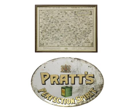

A 'Pratt's Perfection Spirit' mirror and a framed Pratt's map,the oval mirror with bevelled edge, with gilt-lettering, featuring image of a Pratt's petrol can and Royal Warrant emblem, some loss to silvering and with black paper backing, 46 x 58cm, lacking hanging chain; offered together with a Pratts High Test/Essolube pictorial map of the Eastern Counties and the Midlands, 50 x 38cm, framed and glazed. (2)Footnotes:This mirror and map (as well as lots 118 and 429) were displayed at the Great Yarmouth Motor Garage, 46 Northgate Street, Garfield House, Norfolk. The 1886 building was originally a builders' and stable yard and became repurposed as a garage by G.E. Sadler in the early 1900s, being one of the first garages in town to sell petrol, selling Pratts Motor Spirit from cans until Shell pumps were later installed. The garage was subsequently taken over by a Mr George Cooper in 1921 until 1969, then taken over by his son and eventually ceased trading upon his retirement in 1989.See lots 118 and 429 in this auction.Lot to be sold without reserve.This lot is subject to the following lot symbols: ◊◊◊◊ £60 + VAT uplift and storage at £12 + VAT per lot per dayFor further information on this lot please visit Bonhams.com
We found 109198 price guide item(s) matching your search
There are 109198 lots that match your search criteria. Subscribe now to get instant access to the full price guide service.
Click here to subscribe- List
- Grid
-
109198 item(s)/page

MEISSEN "Landkartenhändler" 20.Jh. Entwurf von P. Reinicke um 1744, polychrom staffierte Figur aus der Gruppe "Pariser Ausrufer", Schwertermarke, H: ca. 17 cm. Unbesch.| MEISSEN "Map Dealer" 20th century.Design by P. Reinicke circa 1744, polychrome painted figure from the group "Pariser Ausrufer", sword mark, h: approx. 17 cm. Uninspected.


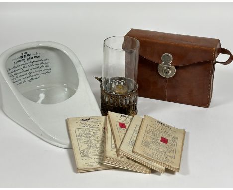
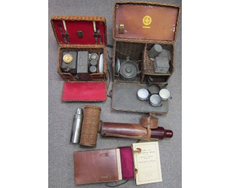
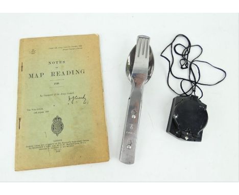
Two small wicker picnic sets,comprising a two person set with kettle and burner in basket with red lining; another by Drew & Sons, London, (incomplete); two vacuum flasks one in wicker case, another in leather case; together with a leather-cased map set for England and Wales, (condition and completeness unknown). (Qty)Lot to be sold without reserve.This lot is subject to the following lot symbols: † ◊† VAT at the prevailing rate on Hammer Price and Buyer's Premium.◊ £30 + VAT uplift and storage at £6 + VAT per lot per day.For further information on this lot please visit Bonhams.com

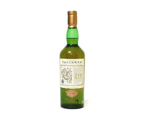
Miniature Whiskies: including Glenfarclas 105, Glenfarclas 10 Year Old, Laphroaig 10 Year Old, Bowmore 12 Year Old, Ardbeg 17 Year Old, Clynelish 14 Year Old Flaura and Fauna, BenNevis 1984, Lagavulin 16 Year Old (White Horse bottling), Talisker 10 Year Old (map bottling), James MacArthur set (Linkwood, Blair Athol, Glen Keith, Dufftown, Teaninich, Strathmill), and many others together with a small group of advertising tumblers and shot glasses, and four volumes on whisky (qty - 100+ miniatures)
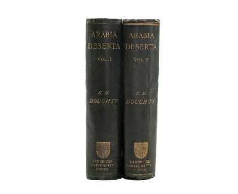
DOUGHTY (C.M), Arabia Deserta. 2 vols, FIRST EDITION, folding plates, illustrations, folding colour map in pocket at end of vol.1, original dark green clothbound, decorative gilt cover, gilt lettering to spine, 8vo. Cambridge, Cambridge University Press, 1888Comments: minor foxing to end papers, wear to extremities and edge of spines on both vols, vol 1 map, with wear on creases,
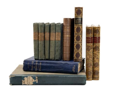
POLAR EXPLORATION: ASSORTED BOOKS comprising P.L.Simmonds, 'Sir John Franklin and the Arctic Regions: A Narrative Showing a Progress of British Enterprise for the Discovery of the Northwest Passage During the Nineteenth Century', second edition, London, George Routledge, 1851, frontis plate, two foldout maps, rebound, calf half bound, 16mo, together with Capt. John Franklin R.N., F.R.S., M.W.S., 'Narrative of a Journey to the Shores of the Polar Sea, in the years 1819-20-21-22', vols 1 and 2 (of 2), second edition, London, John Murray, 1824, calf half bound, ownership inscription to front end papers, 8vo, vol. 1 with ownership inscription to endpage; 'The Private Journal of Captain G.F. Lyon of H.M.S. Hecla, During The Recent Voyage of Discovery Under Captain Parry', London John Murray, 1824, frontis plate, fold out map, five plates, bookplate for 'John Drummond', full calf, gilt lettering to spine, 8vo, Captain McClintock, R.N., LL.D, 'The Voyage of the 'Fox in the Arctic Seas: A Narrative of the Discovery of the Fate of Sir John Franklin and his Companions', first edition, London, John Murray, 1859, frontis plate, two fold out maps, four plates, illustrations, clothbound, gilt ship to cover, gilt lettering to spine, 8vo; 'Appendix to Captain Parry's Journal', London, John Murray, 1825, quarter clothbound, 4to; Capt. W.E. Parry, R.N F.R.S., 'Journals of the First, Second, and Third Voyages for the Discovery of A Northwest Passage', vols 1-5, (of 5), London, John Murray, 1828, clothbound, 12mo (11)Provenance: private collection GlamorganComments: 'The Private Journal of Captain G.F. Lyon' spine minorly bumped, foxing to end papers, occasional foxing throughout, 'The Voyage of the 'Fox in the Arctic Seas' spine worn and beginning to fray, edges minorly bumped, cover minorly stained, 'Appendix to Captain Parry's Journal' spine worn, cover stained
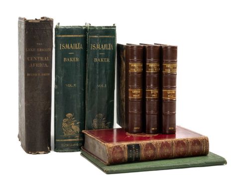
AFRICAN EXPLORATION: ASSORTED BOOKS, comprising Richard F. Burton, 'The Lake Regions of Central Africa: A Picture of Exploration', first American edition, New York, Harper & Brothers, 1860, frontispiece, 11 plates, illustrations, newspaper cutting related to Richard Burton inserted, leatherbound, gilt lettering to spine, 4to; Sir Samuel W. Baker, M.A, F.R.G.S, 'The Nile Tributaries of Abyssinia', London, Macmillan and Co., 1874, full calf, gilt lettering to spine, gilt Craigmount House School crest to font cover, marbled end papers, fold out map, all edges marbled, 8vo; Richard and John Lander, 'Journal of An Expedition to Explore the Course and Termination of The Niger with a Narrative of a Voyage Down That River to ots Termination, in Three Volumes', vols 1-3 (of 3), London, John Murray, 1832, frontis plate, all vols rebound, half Morocco, gilt lettering to spine, all edges marbled, 8vo; Captain Charles Chapman, 'The Suez Canal', second edition, London, George Berridge & Co. 1870, large fold out map, embossed gilt pictorial cover, 8vo, Sir Samuel W. Baker, Pacha, M.A., F.R.S., F.R.G.S., 'Ismailia: A Narrative of the Expedition to Central Africa For the Suppression of the Slave Trade', 2 vols (of 2), London, Macmillan and Co., 1874, clothbound, decorative gilt cover, gilt lettering to spine, 8vo (8)Provenance: private collection GlamorganComments: spine and corners bumped, minor tear to bottom of spine, spine and edges of 'The Nile Tributaries of Abyssinia' worn, cover worn with minor scratches, foxing to first and last few pages, occasional foxing throughout, 'The Suez Canal' back cover stained
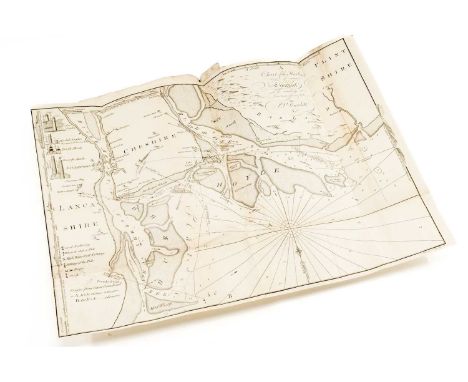
ENFIELD (WILLIAM) An Essay towards the History of Liverpool. FIRST EDITION, with large folding map, large folding diagram with tear and missing section lower left, folding chart of the Harbour with repairs, 7/9 plates, list of Subscribers, 116pp., small folio, nicely rebound in claret cloth and half leather with applied tile label to spine, Atherton of Walton Lancashire bookplate, Warrington, 1773Provenance: private collection West Wales


A large George III early 19th century 1802 needlework Quaker School map of England sampler. The sampler worked with coloured silks on a linen ground, with a map of England, Wales, part of Scotland & Ireland, the delineated counties (Lancashire in red) with some names inserted vertically. Sewn by Mary O'Connor in 1802. Framed & glazed. Measures approx. 53cm x 50cm, 74cm x 71cm to include framed. Provenance: Handed down through generations of an Irish family.
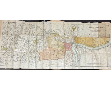

A collection of early 20th century books, maps and ephemera relating to China including 1922 New Plan of Peking, Map of Canton, Guide to Peking and it's Environs by Fei-Shi, Chips of China by Bella Sidney Woolf, numerous photographs including a large staff photo for a Chinese business or church.


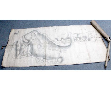
Estate Plan. A Plan of Cottonhope, A Stock Farm in the Parish of Elsdon, a large map of Cottonhope farm, Northumberland, belonging to Robert De Lisle, Robert Tate surveyor, 1809, backed on linen, rolled, 313cm by 145cm; together with a Plan of a Portion of the Lands of Lord Crewe's Trustees in the Parish of Hunstanworth in the County of Durham, on three linen backed sheets stitched together at one end, rolled; an "Imperial Chart" of Great Britain, and five engraved, framed maps. (8)

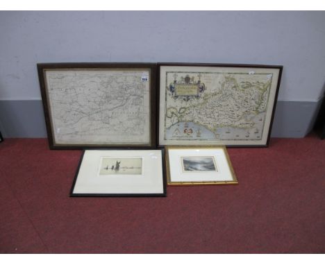
Saxton (Christopher) and Hole (William), Comitatus Bercherie vulgo Barkshyre qui olim Sedes Atrebatum, no date, hand-coloured engraved map of Berkshire, mounted, framed and glazed; together with Morden (Robert), The North Riding of Yorkshire, hand-coloured engraved map, mounted, framed and glazed (2)

A Variety of Books, including: Evans (E. T), Records of the Third Middlesex Rifle Volunteers, Simpkin, Marshall, & Co., 1885, plates; Hynes, Cocktail Cavalcade: A Picture Book for Grown-Ups, T. Werner Laurie, 1937; Swiss & Co's No. 8 Hunting Map; Tegetmeier (W. B.), Pheasants. Their Natural History and Practical Management, Horace Cox, 1904; Lunn (Arnold), Ski-ing, Eveleigh Nash, 1913; Barnard (Francis Pierrepont), The Casting-Counter and the Counting-Board, Oxford: The Clarendon Press, 1916; and others on hunting, game-keeping, golf, horse management etc. (qty: four boxes)


After John Speed, Kent with her Cities and Earles Described and Observed, later hand coloured engraving with town plans of Canterbury and Rochester, English text verso, 38 x 51 cm; another of Middlesex 'described with the Most Famous Cities of London and Westminster', later hand coloured engraving, with views of St Peters and St Pauls Cathedrals, English text verso, 38 x 51 cm; a third of Essex 'Divided into Hundreds, with the most ancient and fayre towne Colchester Described and Other Memorable Monuments observed Anno 1610', later hand coloured engraving with the arms of The Earles of Essex, English text verso, 38 x 51 cm; Surrey 'Described and Divided into Hundreds', later hand coloured engraving with views of Richmond and Nonesuch, arms of The Earles of Surrey, facsimile English text verso, 38 x 51 cm, all framed and glazed, frames 60 x 72 cm; another 20th century edition of the Surrey map, 35 x 47 cm, framed and glazed; John Ogilby, map of the road from London to Dover, hand coloured engraving, 32.5 x 45 cm, framed and glazed, frame 51 x 63 cmQty: 6

Francis Grose: The Antiquities of England and Wales, Second edition, published by S. Hooper, 1783, 8 vols, each volume with engraved frontispiece and title page, approximately 650 plates and plans; The Antiquities of Scotland, published by S. Hooper, 1784, 2 vols, each with engraved frontispiece and title page, approximately 180 plates and plans together with a folded map; The Antiquities of Ireland, published by S. Hooper, 1797, 2 vols, each with engraved frontispiece and title page, approximately 250 plates and plans; all in similar full leather binding with gilt-tooled spines, ex-library with bookplates to the endpapers and ink stamps throughout the pages.Qty: 12

After Abraham Ortelius (Flemish, 1527-1598), 'Typus Orbis Terrarum', a continental tin-glazed pottery tile map of the world, consisting of twelve enamelled panels, with Latin inscriptions from Cicero and Seneca, in a stained pine frame, 79 cm x 103 cm. Being sold in aide of the charity Sightsavers. Crazing evident throughout. No major damage, but some small chips and nicks to the tile edges.

Sharon Turner: The History of England, From the Earliest Period to The Death of Elizabeth, 12 volumes, published by Longman, Orme, Brown, Green and Longmans, 1839, volume 1 with folded map 'Territory inhabited by Ancient Saxons North of the Elbe', full leather binding with gilt and tooled spines, marbled endpapers and paper edges, ex-library with bookplates and stampsQty: 12

John Ogilby (1600-1676), two coloured strip road maps, 'Bristol to Worcester' and 'Bristol to Exeter', each 36 cm x 44 cm, together with a Georg Hoefnagel hand-coloured map of Brightstowe (Bristol), 35 cm x 44 cm, after Geradus Mercator (1512-1594), a hand-coloured map of Eastern England, 35 cm x 41 cm, a 19th-century map of 'Yorkshire West Riding', 19 cm x 25.5 cm and after John Bevis, 'Libra', a hand-coloured star map of the birth sign, dedicated to 'The Reverend John Conybear, Dean of Christ Church Colledge Oxford', 32 cm x 38 cm each framed and glazed. Qty: 6

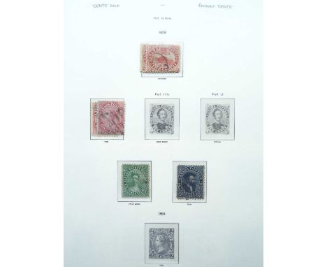
Canada Collection in six Lighthouse hingeless albums for issues to 2001, including a volume for booklets from 1930s onwards. Main strength in mint with many MNH plate blocks and multiples from 19th century onwards. Provinces include New Brunswick 1860-63 to 17cts incl. shades and 5cts unused block of four with earring flaw, Nova Scotia 5cts blue mint (SG.24, cat. £550), Newfoundland 1876 5cts blue rouletted mint, 1931 pictorial set mint, etc. Then Dominion of Canada incl. large and small queens in mixed condition, Jubilee 8cts MNH and 20cts used, 1897 widow-head 2cts MNH block of nine and 5cts MNH plate block of eight, 1898 map shades in mint blocks, 1908 Quebec 1ct MNH block of four especially well-centred (ex Barton and Steinberg), KGV imperf blocks of four SG.259/261 mint/MNH, 1928-29 defin set MNH (SG.275/285), 1930-31 series of eleven values to $1 in mint blocks of four (incl. SG.299/303), 1937-38 set in plate blocks, perfin officials 1939 13cts to $1 mint (SG.O127/O130), 1942-43 set mint (O137/O152), 1949 OHMS ovpt set mint with $1 plate blocks in three positions, and many further plate blocks MNH in this first volume and on later issues filling most of another album.


Collection of ephemera including 19th century 1892 catalogue for Royal Windsor mansion Queensmead, collection of Trade catalogues, 1950s circus and theatre programmes, transport leaflets including Herman Goerings bullet proof car, folding map of Spalding, Royal memorabilia, ephemera relating to Heatherleigh, Dorset, various 19th century memoriam cards, engravings and facsimile and other bank notes

The Australian Flower Paintings of Ferdinand Bauer... Introduction by Wilfrid Blunt. London, The Basilisk Press, 1976 Large folio (630 x 450mm). Text by William T. Stearn, double-page map of Australia, 25 mounted coloured plates after Ferdinand Bauer, numbered 388 from an edition of 500. Original green leather-backed marbled boards by A. W. Lumsden, Edinburgh, box. Provenance: Sir Giles Loder, Bart., The Bernard Sayers Collection of Natural History books
-
109198 item(s)/page