We found 109198 price guide item(s) matching your search
There are 109198 lots that match your search criteria. Subscribe now to get instant access to the full price guide service.
Click here to subscribe- List
- Grid
-
109198 item(s)/page


Lot 2264
Hermès Citrus Fruits Silk Scarf, by Valerie Dawlat-Dumoulin, printed with a design of lemons and oranges upon a wooden stand, on a green ground, 90cm square, with original box; together with a Hanae Mori Dark Blue Silk Scarf, printed with contrasting blue birds and a striped border, 8cm square, with original card packaging; and an Alviero Martini la Classe Silk Scarf, printed with a map, 50cm square, with original retail tag attached (3)


Lot 178
LUCINDA WILKINSON (BRITISH CONTEMPORARY) LARSEN B. ICE SHELF NO. 3, FROM 'MOSAIC OF ANTARTICA - INTERNATIONAL POLAR YEAR' Kiln formed, sand blasted and etched glass panel 58.5cm x 92cm (23in x 36.25in) Note: Lucinda is a graduate of the Wimbledon School Of Art and Glasgow School of Art where she obtained a BA Hons degree in Sculpture, and an MFA in Fine Art. Much of her sculpture is inspired by the landscape; looking at rhythms and dimensions, and the 'energy' of the land. In 2008, whilst representing Scotland during an International Polar Year expedition, she produced 'Mosaic Of Antarctica', a series of glass engravings of the Antarctic, documenting climatic environmental changes to the landscape. Collaborating with scientists, the visual imagery was transcribed from satellite data showing the translucence of melting ice from the region's ice shelves, glaciers and sea ice. A visual recording of these environmental changes is archived at the British map Library in London. In her glasswork Wilkinson is committed to producing sculptural artworks which evoke strong environmental messages through beautiful, poignant imagery, which she hopes will serve as a wakeup call to the world.


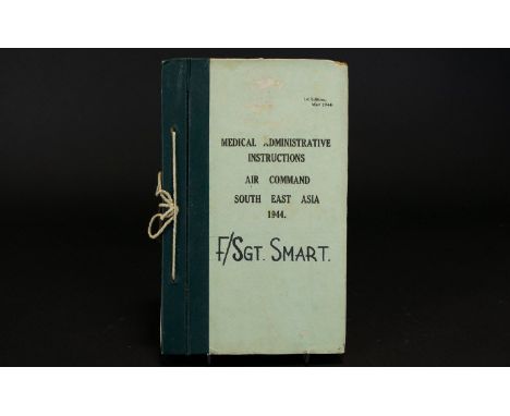


Lot 1332
Books - Naval History and Warfare - Baudry (Lieutenant A., French Navy), The Naval Battle: Studies of the Tactical Factors, Followed by Observations on Unity of Doctrine by Captain G. Laur (French Army), Translated by C.F.A., With an Introduction by Admiral Sir Reginald N. Custance, G.C.B., Etc., Hugh Rees, Ltd., London 1914, xvi, 387pp, only three pull-out charts (nos. III, IV and V), contemporary blue buckram as issued, 8vo; Paterson (Daniel), A New and Accurate Description of all the Direct and Principal Cross Roads in England and Wales [...], eighth edition, F. Power, London 1789, pp: viii, xxiv, 308, advertisement [i], fold-out engraved map to title-page, further early 19th century and later fold-out maps accompanying text throughout bound in at a later date, contemporary speckled tree calf, the spine with red morocco title label lettered in gilt within bands, 18th century ink MS annotations to verso endpaper and some later notes in MS pencil, 12mo; another, fifteenth edition, London 1811, some contemporary engraved fold-out maps, contemporary green vellum spine and marbled paper boards, contemporary ink MS dated ownership inscription: Kenyon 1812; [The New Testament in Arabic], [n.d., c. 1885], publisher's details and text printed in Arabic throughout, contemporary full red morocco and gilt tooled binding, the spine lettered in gilt, all edges gilt, one recto endpaper with contemporary ink MS inscription: Presented to Mifs (sic) Georgina Watson by her ****** friends Mr & Mrs: Menton ****, December 1885, inserted ink MS note from a contemporary bookseller, 8vo; British Travel and Topography - Shalder's Birmingham Directory 1854, Issued Annually, Wrightson and Bell, Birmingham [1854], line engravings and advertisements throughout, contemporary green buckram as issued, 12mo; The Illustrated Exhibitor, A Tribute to the World's Industrial Jubilee; Comprising Sketches, By Pen and Pencil, of The Principal Objects in the Great Exhibition of the Industry of all Nations 1851, John Casell, London [1851], fold-out and one-page line engravings, further vignettes within text, contemporary quarter-calf and marbled boards, 4to; The Pictorial Gallery of Arts, Comprising nearly four Thousand Illustrations on Wood, and a Series of beautiful Steel engravings, The London Printing and Publishing Company, Limited, London [n.d., c. 1855], buckram boards, later leather spine, crown folio; Marshall's Select Views In Great Britain, &c. &c., two-volume set, W. Marshall, London [c. 1825], full-page topographical copperplate engravings, papered pink boards as issued, 18mo; Dr Lardner's Cabinet Cyclopædia: Useful Arts, A Treatise on the Origin, Progressive Improvements, and Present State of the Silk Manufacture, Longman, Rees, Orme, Brown, and Green, London 1831, contemporary buckram as issued, 12mo; etc

![GORDON, ROBERT SCOTIA ANTIQUA: MAP OF SCOTLAND [Amsterdam: Blaeu,] 1653, hand-coloured in outline, heightened in yellow, f](https://cdn.globalauctionplatform.com/79c6261d-e90a-4531-8a6c-a92100d762ef/bd522956-5398-4773-927e-382aef5d2314/468x382.jpg)

Lot 54
SMITH, WILLIAM & ANDREW AUTHENTICATED TARTANS OF THE CLANS AND FAMILIES OF SCOTLAND Mauchline, Ayrshire: W. & A. Smith, [1850]. 4to, map, 69 colour plates, each mounted into book, text (Introductory Essay on the 'Scottish Gael' by a Member of the Society of Antiquaries of Scotland), original embossed red cloth gilt rebacked with later spine; and two other copies, each with 69 plates, lacking maps, one copy lacking text (3)
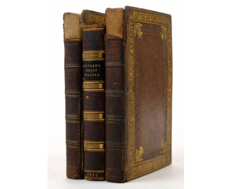
Lot 2
Giffard (Edward). A Short Visit to the Ionian Islands, Athens, and the Morea, 1st edition, 1837, title with vignette, map and six lithographed plates, a little light spotting and offsetting, frontispiece detaching (small bookseller stamp to verso), contemporary burgundy calf gilt, spine a little rubbed and darkened, 8vo, together with Travels, Comprising Observations made during a Residence in the Tarentaise, and various parts of the Grecian and Pennine Alps, and in Switzerland and Auvergne, in the Years 1820, 1821, and 1822, by R. Bakewell, 2 volumes, 1st edition, 1823, 3 hand-coloured aquatint plates only (of 4), wood-engraved illustrations, light offsetting, volume I front endpaper detached, bookplates, contemporary half calf gilt, volume I upper cover detached, loss at head of spines, 8vo First work Blackmer 683. (3)
Lot 25
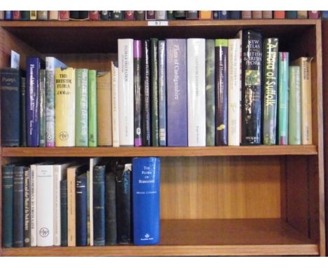
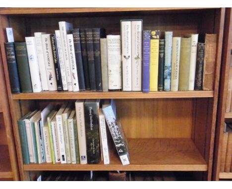
Sanford (Martin & Fisk, Richard). A Flora of Suffolk, published D.K. & M.N. Sanford, 2010, colour illustrations throughout, mostly from photographs, original pictorial laminated boards, small folio, together with Preston (C.D. & others, editors), New Atlas of the British & Irish Flora, 1st edition, Oxford University Press, 2002, colour distribution maps throughout, map overlay acetate loosely inserted, original cloth in dust jacket, rubbed, 4to, plus Hodgson (William), Flora of Cumberland, Containing a Full List of the Flowering Plants and Ferns to be found in the County, According to the Latest and most Reliable Authorities, with an Introductory Chapter on the Soils of Cumberland, by J.G. Goodchild, 1st edition, Carlisle, 1898, folding coloured map frontispiece, engraved plan, a little spotting, bookplate and early ownership name to front flyleaf, hinges slightly cracked, original cloth gilt, rubbed, 8vo, plus other county floras, including modern publications (40)
Lot 26
Sell (Peter & Murrell, Gina). Flora of Great Britain and Ireland, volumes 4 & 5, Cambridge University Press, 2006 & 1996 respectively, originally pictorial laminated boards, large 8vo, together with Lees (Edwin), The Botany of Worcestershire, or the Distribution of the Indigenous & Naturalized Plants of that County..., Worcester, 1867, hand-coloured map frontispiece, some spotting at front and rear, contemporary ownership inscription to front flyleaf, original cloth gilt, rubbed at head and foot of spine, 8vo, plus Boon (Christopher R. & Outen, Alan R.), Flora of Bedfordshire, published Bedfordshire Natural History Society, 2011, colour illustrations including many from photographs, original pictorial laminated boards, small folio, plus other county floras and natural history, including some supplements and booklets (48)
Lot 263
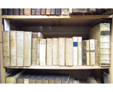
Boissard (Jean-Jacques, & others). Topographia Romae, 2nd edition, Frankfurt, 1627-8, parts 1-3 only (of 6), in 1 volume, engraved title to volumes 2-3, lacking in volume 1, 4 portraits in text, folding map of Italy, 148 plates of which 7 folding, occasional damp-staining in lower margins, part 2 browned, contemporary blind-stamped vellum, slightly soiled, front joint partially split, folio, together with Vroom (Henricus de; also known as Henricus Sedulius), Historia Seraphica, vitae Francisci Assisiatis, illustriumque virorum et feminarum, qui ex tribus eius Ordinibus relati sunt inter sanctos, 1st edition, Antwerp: Martinus Nutius heirs, 1613, title page with engraved border containing portraits of Franciscan saints, mild toning, a few trivial marks, bequest plate to the Bishopric of Cornwall dated 1883 to front pastedown, contemporary vellum, tawed ties, soiled, spine slightly defective, folio, plus Benitez de Lugo (Cajetano), Concursus Dei praevius, et efficax necessario cohaerens cum libero arbitrio humano à necessitate libero, 1st edition, Rome: Rochi Bernabo, 1730, woodcut head- and tailpieces and initials, toning, marginal spotting and browning, ink-stamps of St. Joseph's College, Mill Hill, contemporary vellum, rebacked to style, soiled, folio, and Plutarch, Comoediae, ex recognitione Francisci Guieti Andini, opera et studio Michaelis de Marolles, cum eiusdem Interpretatione Gallica, Paris: Pierre l'Amy, 1658, 1st edition, engraved title page to each volume, contemporary and later ownership inscription to front free endpapers and engraved and letterpress titles, mild damp-staining to first few leaves in volumes 1 and 3, contemporary vellum, contemporary manuscript spine-titles, 8vo, and others, classical texts and devotional Catholic works, 17th-19th centuries, all vellum-bound, various formats (3 shelves)
Lot 273
Curzon (Lord). British Government in India, 2 volumes, 3rd impression, 1925, black and white illustrations and folding maps, some spotting, uniform original gilt decorated blue cloth, spines lightly rubbed and faded, large 4to, together with Stark (James H.), Stark's Guide-book and History of Trinidad..., 1897, 43 black and white illustrations and maps (lacks folding map and 3 plates), some minor toning, original gilt decorated blue cloth, spine slightly faded and rubbed to head and foot, 8vo, plus other late 19th and early 20th century India and related reference, some leather bindings, mostly original cloth, G/VG, 8vo/4to (6 shelves)
Lot 302
Harley (J.B. & Woodward, David, editors). The History of Cartography, 3 volumes in 6, 1987-2007, numerous colour and black and white illustrations, uniform original cloth in dust jackets, spines lightly rubbed to head and foot, large 4to, together with Alai (Cyrus), General Maps of Persia 1477-1925, USA, 2005, numerous colour illustrations, original cloth in dust jacket, folio, and Blaeu (Joan), Atlas Maior of 1665, Taschen, 2005, numerous colour illustrations including folding maps and plates, original cloth in dust jacket, in original cardboard box, spine lightly rubbed with a small tear to the head, folio, plus other modern map reference and related, mostly original cloth, many in dust jackets, G/VG, 8vo/folio (5 shelves)
Lot 32
British Isles. De L'Isle (Guillaume), Les Isles Britanniques ou sont le Rme. d'Angleterre tiré de Speed celuy d'Ecosse tiré de Th. Pont &c. et celuy d'Irlande tire de Petti..., published Paris, [1702 or later], engraved map with contemporary outline colouring, large uncoloured cartouche, 470 x 615 mm (1)
Lot 321
Nansen (Fridtjof). The Norwegian Polar Expedition 1893-1896, "Farthest North", 2 volumes, 1898, numerous black and white illustrations, uniform original gilt decorated green cloth, spines lightly rubbed to head and foot, 8vo, together with Du Chaillu (Paul B.), The Land of the Midnight Sun:..., new edition, 1899, 250 black and white illustrations and folding map, some minor spotting, rebound retaining original gilt decorated blue cloth boards and spine, slightly rubbed to head and foot, 4to, and Ledger (Edmund), The Sun: Its Planets and Their Satellites, 1882, 94 monochrome illustrations, plus 9 plates, inscribed by the author to the front endpaper, some light spotting, original gilt decorated green cloth, lightly rubbed to head and foot, 8vo, plus other late 19th and 20th century travel reference and related, all original cloth, some in dust jackets, G/VG, 8vo/4to (3 shelves)

Lot 322
Newcourt (Richard). Repertorium Ecclesiasticum Parochiale Londinense: An Ecclesiastical and Parochial History of the Diocese of London, 2 volumes, 1st edition, by Benjamin Motte for Christopher Bateman [and others], 1708-10, engraved portrait frontispiece, 4 engraved plates of churches (3 folding), folding map, half-title to volume 2, occasional browning in volume 2, bibliographical annotations and ownership inscriptions to volume 1 front free endpaper, contemporary panelled calf, sympathetically rebacked and recornered, scuffed and rubbed, folio, together with Peck (Francis), Desiderata Curiosa, 2 volumes, 1st edition, [no publisher], 1722-5, engraved portrait frontispiece, 9 plates, title vignettes, headpieces and initials, bookplates of the Dashwood family of West Wycombe Park, contemporary speckled calf, gilt spines, tan morocco labels, joints worn but firm, extremities rubbed, folio, plus Lisle (Edward), Observations in Husbandry, 1st edition, by J. Hughs for C. Hitch [and others], 1757, engraved portrait frontispiece (offset), errata leaf, spotting to endpapers and outer leaves, contemporary calf, rebacked and recornered, 4to, and others, 18th-century English imprints, mainly history, contemporary bindings, various formats (3 shelves)
Lot 33
Cambridgeshire. Hondius (Henricus), A General Plott of the Fennes and Surounded grounds in the sixe counties of Norfolke, Suffolke, Cambridge, with in the Isle of Ely, Huntington, Northampton and Lincolne etc., Amsterdam, 1632 [or later], engraved map of The Fens with contemporary outline colouring, slight creasing, some marginal fraying and staining, 440 x 555 mm, French text on verso (1)
Lot 335
Henderson (W.O.). The Life of Friedrich Engels, 2 volumes, 1976, portrait frontispiece to volume 1, original cloth in dust jackets, spines faded, together with Conacher (J.B.), The Aberdeen Coalition 1852-1855, A Study in Mid-Nineteenth-Century Party Politics, 1st edition, Cambridge University Press, 1968, frontispiece, original cloth in dust jacket, a little rubbed and soiled, plus Foster (R.F.), Modern Ireland 1600-1972, 2nd impression, 1988, map frontispiece, original cloth, all 8vo, plus other history and politics including odd volumes in Italian and English of works by and about Giuseppe Mazzini (12 shelves)
Lot 35
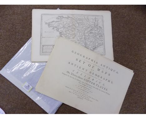
Cellarius (Andreas). Geographia Antiqua: Being a Complete Set of Maps, of Antient Geography ... Designed for the Use of Schools, and of Gentlemen who make the Antient Writers their Delight or Study, A new edition, printed for F. and C. Rivington, C. Law and T. N. Longman, 1799, printed title page and contents list, contents with near contemporary ink ownership signature, twenty-eight (only of thirty-three) uncoloured maps, engraved by R. W. Seale, disbound and loose, each map approximately 210 x 310 mm, oblong 4to Sold as a collection of maps, not subject to return. (28)
Lot 36
Devon. Bowen (Emanuel), An Accurate Map of Devonshire divided into its Hundreds. Drawn from the best authorities, assisted by the most approved modern maps with various improvements..., published Carington Bowles, Robert Sayer and Robert Wilkinson, [1785], engraved map with contemporary outline colouring and some later enhancement, inset map of Plymouth, slight staining, 535 x 680 mm (1)
Lot 38
England & Wales. Berry (William), A New Mapp of the Kingdome of England and Wales Containing all the Cities, Market Towns, with the Roades from Town to Town and the Reputed Miles between them, are given by Inspection without Scale or Compass. To the most serene and most sacred majesty William III, circa 1690, engraved map with contemporary outline colouring on two conjoined sheets, distances shown in straight lines and circles, side tables list cities and market towns, elaborate uncoloured cartouche, two small stains, occasional repaired marginal tears, trimmed to plate mark along upper margin, 590 x 870 mm Uncommon. R. W. Shirley. Printed Maps of the British Isles 1650-1750, Berry 2, state 2. (1)
Lot 4
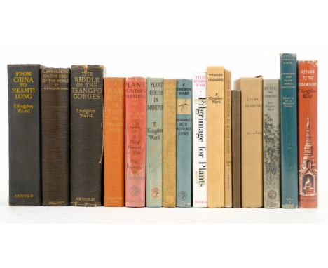
Kingdon-Ward (Captain F.). From China to Hkamti Long, 1st edition, 1924, folding map, half-tone illustrations, advertisement leaf at end, a few light spots, previous owner inscription, original cloth, edges lightly rubbed, 8vo, together with Plant Hunting on the Edge of the World, 1st edition, 1930, maps and illustrations, slight toning, bookplate, original cloth, spine a little faded, 8vo, plus A Plant Hunter in Tibet, 1st edition, 1934, maps and illustrations, some light spotting, bookplate, original cloth, spine a trifle faded, 8vo, with others by Kindon-Ward etc including The Riddle of the Tsangpo Gorges, 1926 (joints splitting), Plant Hunter's Paradise, 1937, Assam Adventure, 1941, Burma's Icy Mountains, 1949 and Plant Hunter in Manipur, 1952 (16)

Lot 41
France. Visscher (Nicolas), Galliae seu Franciae tabula..., circa 1680, engraved map with contemporary hand colouring, 470 x 565 mm, together with Homann (Johann Baptist, heirs of), Tres nouvelle carte du Royaume de France..., 1764, engraved map with contemporary hand colouring, additional title above map, 475 x 565 mm, with Senex (John), A new map of France agreeable to the observations of the Royal Academy at Paris, circa 1720, engraved map with contemporary outline colouring, short split at base of central fold, slight spotting and staining, 440 x 575 mm (3)

Lot 43
France. Senex (John), France corrected from ye observations made by the Royal Academy of Sciences at Paris, published Carington Bowles, John Bowles & Robert Sayer, circa 1760, engraved map with contemporary hand colouring on two conjoined sheets, slight staining, 650 x 920 mm, together with, A map of the Provostship and Vicounty of Paris..., sold by J. Senex, 1713 [or later], engraved map with contemporary hand colouring, 500 x 635 mm (2)

Lot 46
Holland. Jaillot (Alexis Hubert, Le Comté de Hollande dressé sur les memoires les plus nouveaux par le Snr. Sanson..., 1692, large engraved map with contemporary outline colouring on two conjoined sheets, large uncoloured ornate cartouche and compass rose, occasional marginal closed tears, 835 x 570 mm, together with Le Comté de Zeelande, 1692, large engraved map with contemporary outline colouring, slight creasing, large uncoloured ornate cartouche, compass rose and rhumb lines, slight staining, occasional marginal closed tears, 565 x 805 mm (2)
Lot 47
*Huntingdonshire. Speed (John), Huntington both shire and shire towne with the ancient citie Ely described, 1st. edition, published George Humble, [1611], hand coloured engraved map, inset town plans of Huntingdon and Ely, slight overall toning, some repaired worm holes affecting image, small hole in town plan of Ely, central fold and lower margin partially strengthened on verso, 385 x 510 mm, English text on verso, framed and double glazed (1)
-
109198 item(s)/page