We found 109182 price guide item(s) matching your search
There are 109182 lots that match your search criteria. Subscribe now to get instant access to the full price guide service.
Click here to subscribe- List
- Grid
-
109182 item(s)/page


Lot 935
SIR PATRICK MOORE 11x14 inch print Albedo Map of Mars produced from observations by Patrick Moore using his reflecting telescopes. Signed by the late Sir Patrick Moore. Good Condition. All signed items come with our certificate of authenticity. We combine postage on multiple winning lots and can ship worldwide. UK postage from £3.95, EU from £4.95, Overseas from £6.95
Lot 3069
Sportmans Library.- 'Nimrod' The Chase The Road and The Turf, chromolithograph plates, book plate different paste down and initials to half title, half-vellum over patterned boards, small 4to, 1898, Neilson (Harry B.) The Foxes' Frolic, colour illustrations throughout, publishers pictorial boards, oblong folio, n.d. [c.1920]; -. Nimrod's Hunting Tours, illustrations throughout, original publisher's pictorial cloth, folding map, 4to; and two others, (5).

Lot 215
Panckoucke (C.L.F.) La Germanie, 2 vol. (including Atlas), Atlas with 11 engraved plates (one hand-coloured) and map, some foxing, contemporary diced green half calf, Paris, 1824; and 31 others, miscellaneous illustrated, including French and German works, v.s. (33) ⁂ A translation of Tacitus' work.

Lot 221
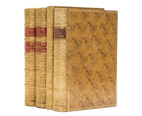
Sue (Eugene) Le Juif Errant, 4 vol. in 2, first illustrated edition, half-titles, wood-engraved plates and illustrations after Gavarni and others, folding map, some foxing, contemporary fine polished cat's paw calf, gilt, by Clarke & Bedford, spines richly gilt but slightly faded, double red morocco labels, raised bands, g.e., Paris, Paulin, 1845 § Karr (Alphonse) Voyage autour de mon Jardin, half-title, 8 hand-coloured wood-engraved plates and numerous wood-engraved illustrations, occasional foxing, contemporary polished cat's paw calf, gilt, probably by Clarke & Bedford but not signed, spine richly gilt but faded, g.e., Paris, 1851 § Boitard (Pierre) Le Jardin des Plantes, wood-engraved plates, some hand-coloured, and numerous illustrations, folding sepia plan, contemporary polished cat's paw calf, gilt, by Clarke & Bedford, spine richly gilt but faded, red morocco label, g.e., Paris, 1842, large 8vo (4)

Lot 38
India.- Mundy (Capt. Godfrey Charles) Pen and Pencil Sketches, being the Journal of a Tour in India, 2 vol., second edition, half-titles, folding engraved map, etched plates and illustrations, some foxing and offsetting, contemporary calf, gilt, spines a little rubbed and faded, 1833 § Markham (Col. Frederick) Shooting in the Himalayas, additional wood-engraved title, folding map, 8 tinted lithograph plates, wood-engraved illustrations, some foxing, hinges broken, original pictorial cloth, gilt, spine and covers sunned, 1854 § Hooker (Sir Joseph Dalton) Himalayan Journals, 2 vol. in 1, wood-engraved plates and illustrations, occasional spotting, original pictorial cloth, gilt, spine sunned, 1855; and 3 others, India, 8vo (7)
Lot 10
America.- Johnston (Alexander Keith) The National Atlas of Historical, Commercial, and Political Geography, first edition, engraved title, 46 double-page engraved maps, hand-coloured in wash or outline, occasional foxing, finger-tabs to fore-edge, contemporary half calf, rubbed, upper joint split, g.e., folio, Edinburgh etc, 1844. ⁂ Includes five maps of Australasia with one separate and detailed map of Van Diemen's Land. Two of the American maps show Texas as an independent country.

Lot 16
Australia.- Gold Mining.- Philip & Son (George) Philip's New Map of the Gold Fields of Australia, Comprising All the recent Discoveries of Mr. Hargraves, Mr. Hunter, Revd. W. Clark & Others in the Auriferous Districts, showing the south eastern coast of Australia, from Shoal Bay south to Cape Otway, lithograph with hand-colouring, 630 x 540 mm. (24 3/4 x 21 1/4 in), central horizontal fold, minor nicks and tears with surface dirt to extremities, unframed, 1852; together with Betts's Map of the Gold Regions of Australia, showing the south eastern coast of Australia, from Brisbane to Port Lincoln, with inset map of the district of Port Phillip, lithograph with hand-colouring, 320 x 433 mm. (12 1/2 x 17 1/8 in), some spotting and browning, nicks and tears to edges, unframed, [Tooley p. 25, no. 171], published by John Betts, [circa 1855], (2). ⁂ Scarce. Two maps illustrating the recently discovered gold finds of South Eastern Australia.

Lot 303
Library sets.- Lantier (E.F.) Voyages d'Antenor en Grece et en Asie, 5 vol., engraved frontispieces, folding map, some leaves in vol.4 heavily foxed, contemporary half vellum, spines gilt, olive green morocco labels, a little soiled, 1808; and 29 others, similarly bound in half or full vellum, 12mo (34)

Lot 25
Europe.- Johnston (Alexander Keith) General Map of Europe, constructed from the best authorities, and comprising the latest additions and rectifications, including Russia, Turkey, and the North African Mediterranean coast, lithograph, with hand-colouring, 1060 x 1260 mm. (41 3/4 x 49 5/8 in), dissected and mounted on linen, edged with green silk, minor spotting and surface dirt, folding with red gold painted endpanel into original red boards, gilt, stained and worn, 4to, published by Blackwood & Sons, 1855; with Blackwood & Sons Atlas to the Epitome of Alison's History of Europe, including the title page and 12 lithographed maps, 1848; and together with Ernest Bourdin's Carte de la Crimée, the map showing Crimea with inset plan of the port of Sevastopol, and an inset general map of the Black Sea, lithograph, 710 x 1040 mm. (28 x 41 in), dissected and mounted linen, very minor spotting and surface dirt, folding with green endpanels, housed in slip-case with printed label, 8vo, 1854, (3).
Lot 238
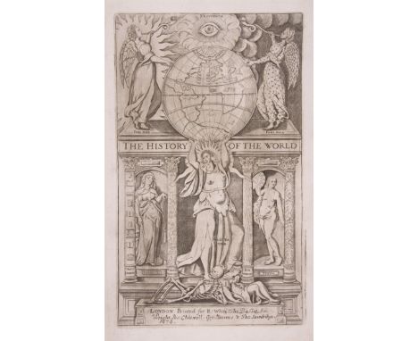
Raleigh (Sir Walter) The History of the World, 'mind of the frontispiece' leaf, engraved portrait frontispiece, additional engraved title, printed title in red and black, 8 double-page engraved maps and plates, all loose, extra map of Sicily by Cluverius also loosely inserted, 'To the Reader' leaf misbound at end, a few paper flaws, occasionally slightly affecting text, broken, some leaves loose, contemporary calf, worn, [[Wing R167], for Robert White [&c.], 1677; The Marrow of Historie, engraved portrait frontispiece, contemporary calf, rubbed, [Wing R172], by W.Du-gard, for John Stephenson, 1650, folio and 12mo (2)

Lot 6
Alps.- Arrowsmith (Aaron) Map of the Alpine Country in the South of Europe, showing from Florence to Regensburg, and Geneva across to Vienna, with large vignette of the village of Chamouny by Webber in the upper left corner, engraving, by W. West, with hand-colouring in outline, on four sheets joined, 1260 x 1500 mm. (49 1/2 x 59 in), dissected and mounted on linen, with pale-blue silk edge, even browning, surface dirt, and minor stains, folding into contemporary marbled slip-case, large 4to, rubbed, 1804.

Lot 72
World.- SDUK Atlas.- Maps of the Society for the Diffusion of Useful Knowledge, 4 parts in 1, parts 1-2 with 207 engraved maps, hand-coloured in outline, a few double-page, part 3 "Stars" with 6 hand-coloured engraved maps, part 4 Index, large folding map of Ireland torn, occasional spotting, broken with some maps working loose, title to part 1 with upper margin renewed, contemporary half calf, worn, upper cover detached, folio, 1851-52; sold not subject to return ⁂ Includes the suite of city and town plans.
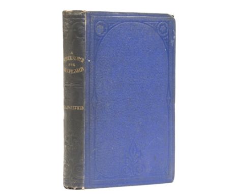
Lot 60
Polar.- Inglefield (Edward Augustus) A Summer Search for Sir John Franklin; with a Peep into the Polar Basin, first edition, half-title, 4 lithograph plates (including 2 chromolithographs and 1 folding panorama), folding map with short tears, some foxing, original cloth, spine a little darkened, [Abbey, Travel 642; Sabin 34758], 8vo, 1853. ⁂ "In 1852 Inglefield commanded Lady Franklin's private steamer, Isabel, in a summer expedition to the Arctic, and looked into Smith Sound for the first time since it had been named by William Baffin. On his return he published A Summer Search for Sir John Franklin (1853), was elected FRS (2 June 1853), was awarded the gold medal of the Royal Geographical Society, and the silver medal of the Paris Geographical Society, and was presented with a diamond snuff-box by Napoleon III" (ODNB).
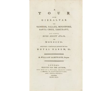
Lot 26
Europe.- Lempriere (William) A Tour from Gibraltar...to Morocco, first edition, list of subscribers, folding engraved map slightly foxed and with short tear, contemporary calf-backed boards, vellum corners, rubbed, head of spine nicked, Printed for the Author, 1791 § Southey (Robert) Letters written during a Short Residence in Spain and Portugal, second edition, half-title, occasional foxing, contemporary half calf, rubbed, 1799; and 7 others, European tours, journals etc., 8vo (9)

Lot 246
Gentleman's Magazine (The), vol.1-16, 18-19, 51-52, plus several individual monthly issues from the 1770s and 80s, engraved plates and maps, some defective, some titles and text leaves lacking, contemporary calf or half calf, monthly issues in original blue printed wrappers, 8vo, 1731-82 (sm.qty); sold not subject to return ⁂ Includes Map of Connecticut and Rhode Island (Nov. 1776), Map of the Country round Philadelphia (Sept. 1776), On Recollection by Phillis Wheatley (Sept. 1773, p.456), Map of Hudson's River (Jan. 1778), An Accurate Map of the West Indies (1740) and A New Chart of the Coast of New England, Nova Scotia... (1746, torn).
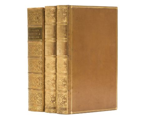
Lot 55
Middle East.- Layard (Austen H.) Discoveries in the Ruins of Nineveh and Babylon, first edition, half-title, plates (some tinted lithographs) and folding plans and maps, occasional foxing, contemporary polished calf, gilt, spine richly gilt, very slightly rubbed, 1853; Nineveh and its Remains, 2 vol., first edition, half-titles, tinted lithograph frontispieces, wood-engraved plates and plans, some folding, folding map, contemporary polished calf, gilt, spines richly gilt but faded, 1849, 8vo (3)
Lot 57
Pacific.- Martin (John) An Account of the Natives of the Tonga Islands, 2 vol., second edition, engraved frontispiece and folding map, some offsetting, abrasion and hole to title of vol.1, slightly affecting imprint, contemporary green half calf, gilt, 1818; and 6 others, Pacific and Australasia, 4to and 8vo (7) ⁂ First published a year earlier, Martin's work includes the folding map not present in the first edition. There is also a grammar and English/Tonga dictionary.

Lot 7
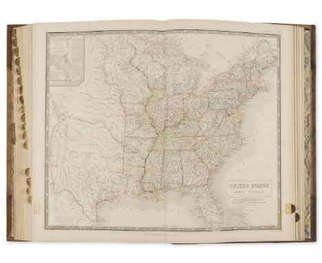
America.- Arrowsmith (John) The London Atlas of Universal Geography, engraved throughout, title, contents leaf and 68 double-page engraved maps, all with outline hand-colouring, all with finger tabs (dust-soiled) to fore-edge, maps listed and numbered 1-50 and dated 1842 then an additional 18 unnumbered and unlisted maps with some later dates to 1851, one with short tear near tab, another creased at gutter, generally in excellent and clean condition, contemporary diced half calf, gilt-lettered burgundy morocco label to upper cover, spine worn, [Phillips, Atlases 790], folio, 1842. ⁂ One of the great English atlases of the 19th century. Arrowsmith (1790-1870) published his London Atlas originally in 1834, with this new edition appearing in 1842. It was subsequently reissued with the date of the preface and imprints on individual maps revised. This copy is enhanced by an additional 18 Arrowsmith maps, including some of his scarcest and most important: Sketch of the Acquisitions of Russia, 1842 Ionian Islands and Malta, 1844 West Coast of Africa, 1843 The River Niger, 1843 Eastern Frontier of the Colony of the Cape of Good Hope, 1851 Asia Minor, 1842 The Caspian Sea, Khivah, and the surrounding country, 1841 The Punjab, 1849 Australia (2 sheets), 1850 The Maritime Portion of South Australia, 1840 New Zealand, 1851 Texas, 8th June 1843 Jamaica, 1842 The Leeward Islands, 1842 (creased) The Windward Islands, 1842 British Guiana, 1842 Discoveries in the Arctic Sea , between Baffin Bay and Melville Island, 1851 The map of Texas is particularly important. It is considered "probably the first to show the full extent of Texas's claim to the region of the upper Rio Grande, an area included within Texas's boundaries until the Compromise of 1850... [and] the best information on Texas geography available in Europe" (Martin & Martin, Maps of Texas and the Southwest, 32). There are four known issues of the Texas map with varying dates from 1841 to 1843 and one later issue dated 1858. Streeter notes that this issue (8th June, 1843) has a number of names added at various places indicating projected land holdings.

Lot 58
Polar.- Admiralty Hydrographic Office. Chart of the North Polar Sea, on a gnomonic projection, extending down to the 59th parallel, including Bristol Bay, Alaska, the northern part of Hudson Bay and Greenland, engraving, on cream wove paper with watermark 'Ruse & Turner's/ 1847', platemark 635 x 630 mm. (25 x 24 3/4 in), sheet 665 x 850 mm. (26 1/4 x 33 1/2 in), central and horizontal folds, some pencil annotations, faint spotting and browning, 29 June 1835, this issue corrected to 1849; together with Derby & Chesterfield Reporter's supplement Sketch Map of the North Polar Regions, Shewing the Coasts hitherto discovered and the farthest points reached by former Polar Expeditions, wood-engraving on wove paper, sheet 380 x 255 mm. (15 x 10 in), loose as issued, minor spotting and handling creases, unframed, May 28th 1875, (2).
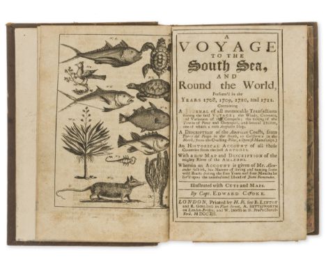
Lot 68
Voyages.- Cooke (Capt. Edward) A Voyage to the South Sea, and Round the World..., first edition, 20 engraved plates and maps, 3 folding (double-hemisphere map of world, map of River Amazon, city of Cusco), lacking 2pp. advertisements at end, foxed and browned, plate 14 with internal tear but no loss, map of Amazon torn and repaired, a little cropped shaving a few head-lines, U4 & 5 loose, nineteenth century calf, rubbed and rather scuffed, spine lacking label, [Sabin 16303], 8vo, by H.M. for B. Lintot and R.Gosling...A.Bettesworth...and W.Innys, 1712. ⁂ The rare true first edition, published in only one volume, of this buccaneering expedition around the world led by Capt. Woodes Rogers in 1708-11. Cooke and Rogers each rushed to publish an account; the second edition of Cooke's work expanded his final chapter into another volume. During the voyage they rescued Alexander Selkirk who had been marooned on the island of Juan Fernandez four years previously. "It is generally supposed that De Foe took his "Robinson Crusoe" from the account here given of Alex. Selkirk, as it was the first book containing it." Sabin
Lot 80
Britain.- Hall (Sidney) A Travelling County Atlas: with all the Railroads Accurately laid down, and the Boundaries Coloured, complete with 46 maps, 42 double-page, and 4 folding, including Ireland, Scotland, Wales, and Yorkshire, with title and list of maps, engravings, with outline hand-colouring, on wove paper, the double-pages each approx. 205 x 275 mm. (8 1/8 x 10 3/4 in), the folding maps each approx. 390 x 260 mm. (15 3/8 x 10 1/4 in), occasional offsetting, minor surface dirt and browning, some loose, in original limp green morocco wallet-style binding, rubbed, 8vo, [1848] § Cheffins (Charles F.) Cheffins's Map of the English & Scotch Railways, fourth edition, lithographed map with hand-colouring, 710 x 700 mm. (28 x 27 1/2 in), dissected and mounted on linen, folding with printed advertisement to endpanel into original cloth boards with printer's label, 8vo, [1844] § Cary (John) Cary's Six Sheet Map of England and Wales with Part of Scotland, engraved map, outline hand-colouring, dissected and not joined, each segment mounted on linen, each approx. 225 x 130 mm. (8 7/8 x 5 1/8 in), if joined total approx. 1140 x 930 mm. (44 7/8 x 36 5/8 in), spotting, surface dirt and staining, presented in slip-case, 1818 § Jackson (Frederick) Jackson's Plan of Nottingham, from Surveys made between the Years 1851 & 1861, lithographed map, with hand-colouring, 665 x 530 mm. (26 1/8 x 20 7/8 in), dissected and mounted on linen, folding with yellow endpanel into contemporary green boards, gilt title to upper cover, 8vo, rubbed, 1861; together with two Ordnance Survey maps, one of Cheshire showing Warrington, the other of North Shropshire covering the environs of Market Drayton, lithographed maps, each approx. 640 x 830 mm. (25 1/4 x 32 3/4 in), dissected and mounted on linen, surface dirt and browning, folding with green morocco endpanels, presented in original green morocco slip-case wallet, 8vo, 1833, (4).
Lot 15
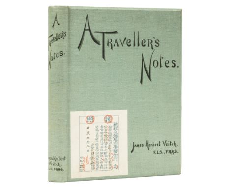
Asia.- Veitch (James Herbert) A Traveller's Notes, first edition, folding map, plates and illustrations, some foxing, original pictorial cloth, fine copy, For private circulation only, 1896 § Brooke (Sir James) Narrative of Events in Borneo and Celebes, 2 vol., edited by Capt. Rodney Mundy, first edition, 5 folding maps (1 hand-coloured), engraved portrait, 17 plates (tinted lithographs and wood-engravings), some foxing, mostly at beginning and end, contemporary half calf, rubbed, spines faded and worn, 1848; and 8 others, China, Japan and S.E. Asia, 4to and 8vo (11)
Lot 71
World.- Dionysius Periegetes. Geographia Emendata & Locupletata, engraved title-vignette and 16 maps, text in Greek and Latin, contemporary calf, Oxford, 1704 § Harris (Joseph) The Description and Use of the Globes, and the Orrery, tenth edition, 7 folding engraved plates, contemporary calf, spine gilt, joints cracked, 1768, 8vo (2) ⁂ First mentioned includes two twin-hemisphere world maps and a map of America showing California as an island.
Lot 64
South East Asia.- Crawfurd (John) Journal of an Embassy...to the Courts of Siam and Cochin China, 2 vol., second edition, folding map, 18 plates, some folding, some aquatint, wood-engraved illustrations, some foxing and offsetting, vol.1 upper hinge weak, 1830; Journal of an Embassy...to the Court of Ava, 2 vol., second edition, folding map, plan and 6 plates, wood-engraved illustrations, occasional foxing, [Abbey, Travel 405 for 1st ed.], 1834, both in original cloth, spines uniformly faded and encroaching on covers, 8vo (4) ⁂ First mentioned includes fine panoramic plates of Singapore and Bangkok.

Lot 13
America.- Railroads.- Sketch Map Showing the Utica, Ithaca & Elmira Railroad, & Connections, showing from New York in the lower right, to Niagra Falls and Lake Ontario in the upper left, lithograph printed in red and black ink, on wove paper, sheet 280 x 440 mm. (11 x 17 1/4 in), loose with minor handling creases and light spotting, unframed, [circa 1876-1891]; Sketch Map shewing the Little Rock Bridge Co.'s Railway Connections, showing from New York to San Francisco, lithograph printed in red and black ink, sheet 245 x 370 mm. (9 3/4 x 14 1/2 in), minor handling creases and folds, spotting, unframed,[circa 1870-1880]; together with a group of 7 miscellaneous maps, including three manuscript late 19th century pen and ink maps of France, Germany and Africa, and with James Wyld's Sketch of the Colony of Natal, 1850, Smith, Elder, & Co.'s The Punjab and Adjacent Countries, 1846, and George Philip & Son's 1852 map Canada, Nova Scotia & New Brunswick &c., lithograpghs, the latter the largest, 530 x 625 mm. (20 7/8 x 24 1/2 in), folds and handling creases, minor spotting and browning, all unframed, [the majority circa 1850-1900], (9).
Lot 43
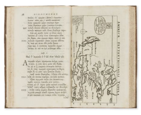
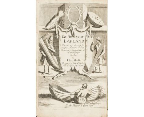
Lapland.- Schefferus (Joannes) The History of Lapland, first English edition, additional engraved title, folding map torn in several places, woodcut illustrations, some tears, worming and staining, contemporary sheep, worn, [Wing S851], Oxford, At the Theater, 1674; and another copy of the same, folio (2)
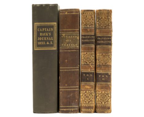
Lot 59
Polar.- Back (Sir George) Narrative of the Arctic Land Expedition, first edition, folding map and 16 engraved and lithograph plates, some foxing, original cloth, very good copy, 1836 § Franklin (Sir John) Narrative of a Journey to the Shores of the Polar Sea, 2 vol., second edition, 4 folding engraved maps, occasional foxing, manuscript acquisition note "Bought at Mr Andrew's sale, January 6 1830..." on front free endpapers, contemporary half calf, spines gilt, joints worn, rubbed, 1824; and another, Polar, 8vo (4)
Lot 75
Britain.- Book of the Names (A) of all Parishes, Market Towns, Villages, Hamlets, and smallest Places, In England and Wales, 37 engraved maps in text and one folding engraved map (of Yorkshire, detached), lacking the four leaves of tables at end, slight worming throughout, mostly marginal but occasionally affecting text or encroaching on engraved surface, endpapers loose or detached, contemporary ownership inscription of R. Cholmondeley to title and front free endpaper, contemporary calf, gilt, worn, [Wing B3717A], 4to, by M. S. for Tho. Jenner, 1662. ⁂ Scarce, ESTC lists only 8 copies. Only one copy in auction records for the last 40 years. Saleroom Notice: Lacks engraved title and 3 of the 4 folding leaves at end, 2 of which bear a map.

Lot 113
Botany.- Elwes (Henry John) A Monograph of the Genus Lilium, first edition, colour-printed map, albumen print by Bourne, 48 fine hand-coloured lithograph plates by W.H. Fitch, some spotting to photograph mount, contemporary green half morocco, spine gilt in compartments with 5 raised bands, t.e.g., [Great Flower Books, p.56; Nissen 594], [1877-] 1880. ⁂ A fine copy of this important work on lilies, a subject Elwes became interested in on a visit to the Himalayas. A 9-part supplement was issued from 1933-62.

Lot 32
Germany.- Lasinsky (Joh. Adolph) Sketchbook. Fifty-five picturesque Views of the Rhine from Mayence to Cologne, lithograph frontispiece and 55 plates, folding map with outline hand-colouring (and later ink referencing to plates), one leaf of letterpress, water-stain to lower corners throughout, occasional foxing, contemporary half roan over original printed boards, rubbed and soiled, oblong folio, Frankfurt am Main, Charles Juegel, 1829.
Lot 51
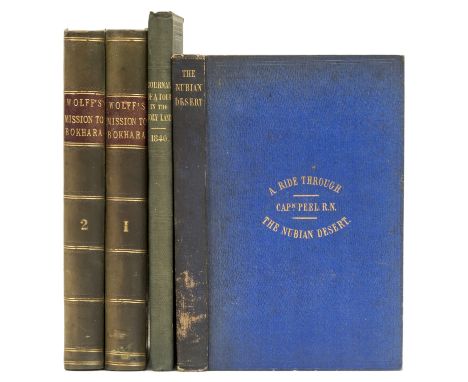
Middle East.- Egerton (Lady Francis) Journal of a Tour in the Holy Land, first edition, presentation inscription on front free endpaper, 4 tinted lithograph plates, original cloth, For Private Circulation only, 1841 § Peel (Capt. W.) A Ride through the Nubian Desert, first edition, map frontispiece slightly spotted and offset on title, 32pp. publisher's catalogue at end, original cloth, spine a little rubbed and darkened, 1852 § Wolff (Rev. Joseph) Narrative of a Mission to Bokhara, 2 vol., second edition, 9 lithograph plates, occasional foxing, contemporary half calf, 1845, 8vo (4)

Lot 34
India and The First Anglo-Sikh War.- Allen & Co. (William H.) Map of India, from the most recent Authorities, showing from modern-day Afghanistan to Myanmar, and including Sri Lanka, engraved map, by [?]J. Walker, with hand-colouring, and contemporary pen and ink notations relating to East India Company battles, including The Battle of Mudki, The Battle of Ferozeshah, The Battle of Ulleewul, and The Battle of Sobraon, the latter is further inscribed: 'Sir H. Gough Feb. 10/46/ attacked and defeated 36,000 Sikhs with a loss of 10,000 & all their Guns. Our loss was 2383 killed & wounded out of a force of 20,000 men. Sir H. Hardinge present', 970 x 850 mm. (38 1/8 x 33 1/2 in), dissected and mounted on linen, some spotting and browning, with minor offsetting, folding with buff endpanel into contemporary gilt and blind tooled boards, splitting to spine, worn, 8vo, 1844. ⁂ The First Anglo-Sikh War was fought between the Sikh Empire and the East India Company between 1845 and 1846. It resulted in partial subjugation of the Sikh kingdom.
Lot 117
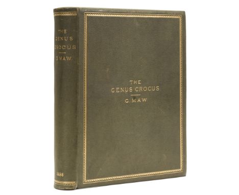
Botany.- Maw (George) A Monograph of the Genus Crocus, first edition, 81 hand-coloured lithograph plates, double-page colour map and two double-page tables, occasional spotting, mostly to first and last pages and endpapers, hinges weak, contemporary olive green morocco, gilt, g.e., [Nissen BBI, 1316; Stafleu & Cowan 5721], 4to, 1886. ⁂ "George Maw (1839-1912) was the industrious author and illustrator of his great 'Monograph of the Genus Crocus' (1886). A many-sided and remarkable man, Maw was not a botanist by profession but a chemist and geologist, a manufacturer of encaustic tiles at Broseley, Staffs. His monograph, the result of ten years of inquiry, was the most complete work of its kind that has been published on any genus. The plates of this work are marvels of comprehensive detail and put to shame those of many more skilled draughtsmen. From a botanical point of view this work is a landmark."(Blunt & Stearn p. 277 & 279).

Lot 220
Bellange (Hippolyte) Collection des Types de tous les Corps et des Uniformes Militaires, half-title, 50 hand-coloured wood-engraved plates, occasional foxing, some browning to text leaves, Paris, 1844 § Guinot (Eugene) L'Ete a Bade, 18 engraved plates (6 hand-coloured), map and illustrations, some foxing, Paris, [1847] § Autrefois ou Le Bon Vieux Temps, half-title, 40 hand-coloured wood-engraved plates, foxing, Paris, [c.1850], all handsomely bound in contemporary polished cat's paw calf, gilt, by Clarke & Bedford (second mentioned not signed), spines faded, g.e.; and 17 others, similarly illustrated French works, all similarly bound, 4to and large 8vo (20)
Lot 1
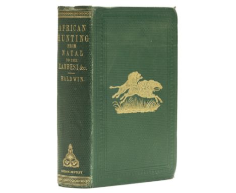
Africa.- Baldwin (William Charles) African Hunting from Natal to the Zambesi, first edition, folding map, wood-engraved plates and illustrations, 32pp. publisher's catalogue at end, some foxing, broken, 1863 § Holden (Rev. William C.) History of the Colony of Natal, folding map, 2 tinted lithograph plates and other wood-engraved plates and illustrations, one plate loose, original cloth, near fine copy, London & Cape Town, 1855 § Melly (George) Khartoum, and the Blue and White Niles, 2 vol., second edition, half-titles, engraved frontispieces, map, original cloth, spines faded, 1852; and 21 others, Africa, including a set of Bruce's Travels, 2nd edition, 7 vol. plus Atlas, 4to and 8vo (25)
Lot 17
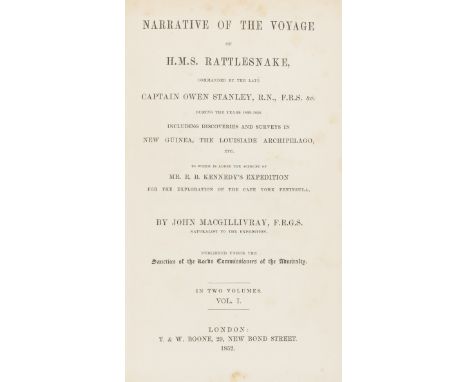
Australia.- Macgillivray (John) Narrative of the Voyage of H.M.S. Rattlesnake, 2 vol., first edition, folding map with tear repaired to verso, 13 plates, all but 2 lithograph, most tinted, wood-engraved illustrations, some foxing, mostly to plates, contemporary half calf, spines gilt with red and green morocco labels, slightly rubbed, small tear to head of joint/spine vol.1, [Ferguson 11972], 8vo, 1852. ⁂ Macgillivray was the naturalist on the expedition, which included Rio de Janeiro, Sydney, Bay of Islands and the Falklands on the itinerary.
Lot 5
Africa.- Lyon (Capt. George Francis) A Narrative of Travels in Northern Africa, first edition, folding engraved map and 17 hand-coloured lithograph plates, occasional offsestting, contemporary calf, gilt, spine gilt but faded, lower cover partially sunned, upper cover slightly scratched, [Abbey, Travel 304; Blackmer 1044], 4to, 1821. ⁂ Accompanied by Joseph Ritchie, Lyon left Tripoli to discover the source of the Niger river. They travelled disguised as Muslims but at Murzuq, the capital of Fezzan, Ritchie fell ill and died.

Lot 31
France.- Turgot (Michel Etienne) Plan de Paris, engraved throughout, folding key map and 20 detailed maps by Claude Lucas after Louis Bretez, on thick laid paper, all double-page and mounted on stubs, maps 18 and 19 joined and folding incorporating title in elaborate cartouche, some light browning, a couple of old creases, that in plate 3 resembling a tear slightly into image, generally clean, contemporary French mottled calf, gilt fleur-de-lys and double-fillet border, larger gilt fleur-de-lys corner-pieces, gilt central arms of the city of Paris, spine gilt in compartments, rubbed, extremities worn, upper joint split, [BAL 371; Berlin Kat. 2506; Cohen-de Ricci 807; Millard, French 39], folio, Paris, [c.1739]. ⁂ Turgot's magnificent plan of Paris comprises twenty sheets forming a single bird's-eye plan within a decorative engraved border, measuring approximately 2.5 x 3.2 metres. The extraordinary detail provides a fascinating guide to the city prior to its development by Haussmann in the 19th century.
Lot 37
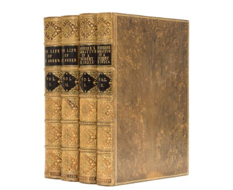
India.- Heber (Reginald) Narrative of a Journey through the Upper Provinces of India, 2 vol., first edition, 10 engraved plates and map hand-coloured in outline, wood-engraved illustrations, 1828 § Heber (Amelia) The Life of Reginald Heber, 2 vol., engraved frontispieces, folding map, 1830, uniformly bound in fine contemporary polished tree calf, gilt, by C. Lewis, spines elaborately gilt with double black morocco labels, some scuffs to covers, 4to ⁂ Superbly bound set.

Lot 39
India.- Stanford (Edward) Stanford's Map of India, in two sections, North and South, with large title encircled in upper right corner of North section, the South section with three diagrams illustrating 'Distances and Bearings from Bombay', and similarly 'Madras' and 'Calcutta', with inset map of the Malay Peninsula, lithograph with hand-colouring, each section approx. 830 x 1270 mm. (32 3/4 x 50 in), dissected and mounted on linen, some spotting and minor surface dirt, folding with buff endpapers and printed advertisement, presented in contemporary slip-case with printed label, rubbed, 8vo, published by Stanford, 1857.
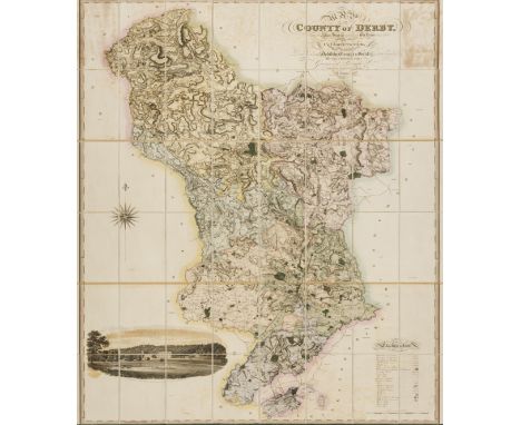
Lot 83
Derbyshire.- Greenwood (Christopher) Map of the County of Derby, from an actual Survey made in the Years 1824 & 1825, large map on four sheets, with decorative title upper right, and vignette showing Chatsworth House in the lower left, by R. Creighton, engraved map, with hand-colouring, 1545 x 1210 mm. (60 3/4 x 47 5/8 in), dissected and mounted on linen, edged in green silk, some offsetting, spotting and browning, minor surface dirt, housed in green morocco book-style slip-case, gilt-tooled and lettered, rubbed, 4to, 1825.
Lot 27
Europe.- Paget (John) Hungary and Transylvania, 2 vol., first edition, engraved portrait, folding hand-coloured engraved map, one engraved and 2 lithograph plates, wood-engraved illustrations, contemporary polished tree calf, gilt, spines richly gilt but faded, 1839 § Bury (Lady Charlotte) The Three Great Sanctuaries of Tuscany, Valombrosa, Camaldoli, Laverna..., additional etched title, engraved portrait, 6 sepia-printed aquatint plates, some foxing, contemporary blue half calf with gilt-lettered red morocco label to upper cover, 1833 § Wilson (Rev. S.S.) A Narrative of the Greek Mission; or, Sixteen Years in Malta and Greece, first edition, Baxter-printed colour frontispiece (detached), upper hinge broken, original cloth, spine torn, 1839 § Price (Edward) Norway. Views of Wild Scenery: and Journal, first edition, 21 fine mezzotint plates, tissue guards, occasional foxing, contemporary (?original) cloth, 1834; and 11 others, European travel, v.s. (16)

Lot 30
Paris.- Andriveau-Goujon (J.) Carte Topographique Des Environs de Paris, showing from Montfort-l'Amaury to Meaux, and Plailly to Arpajon, engraved map, with hand-colouring, 690 x 1000 mm. (27 1/8 x 39 3/8 in), dissected and mounted onto linen, some minor spotting and browning, with printed label of Charles Simonneau to endpanel, folding into contemporary marbled slip-case, spine with gilt morocco label, spine splitting, rubbed, 8vo, sold in London by James Gardner, 1838 § Vuillemin (A.) Nouveau Plan Illustré de la Ville de Paris, avec le système complet de ses fortifications et forts détachés, et des communes de la banlieue, plan of Paris with vignettes throughout illustrating notable sites and buildings, with identification key list below, engraved map of Paris, 860 x 1110 mm. (33 3/4 x 43 1/4 in), dissected and mounted onto linen, some minor surface dirt, folding with buff endpanel into blue cloth boards, upper cover with gilt title, 8vo, 1845, (2).
Lot 35
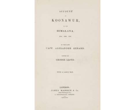
India.- Gerard (Alexander) Account of Koonawur, in the Himalaya, first edition, half-title, folding engraved map in pocket at front, advertisement leaf at end, ?library lending sticker removed from front free endpapers with some traces remaining, original brown cloth, one corner bumped, a couple of minor stains else near fine, 8vo, 1841. ⁂ Important work on this region of the Himalayas, taken from Gerard's papers and edited by George Lloyd, covering the languages, tribes and history as well as the geographical aspects.

Lot 87
East Midlands.- Burton (William) The Description of Leicestershire, engraved folding frontispiece map, 2 engraved plates (loosely inserted), second edition, some spotting or light foxing, contemporary calf-backed marbled boards, joints splitting, but holding firm, rubbed and scuffed, Lynn, W. Whittingham, 1777 § Pilkington (James) A View of the Present State of Derbyshire, 2 vol., folding engraved frontispiece map, hand-coloured in outline, 2 engraved plates, map with splits at folds, occasional spotting, contemporary calf-backed marbled boards, rubbed, Derby, J. Drewery, 1789; and 9 others, East Midlands, v.s. (12)

Lot 209
Cluverius (Philippus) Introductionis in Universam Geographiam, engraved title, 2 folding plates and 38 folding maps, a few lightly water-stained, contemporary calf, [Willems 1269], 12mo, Amsterdam, ex officina Elzeviriana, 1661. ⁂ Includes a twin-hemisphere world map showing California as an island.
Lot 50
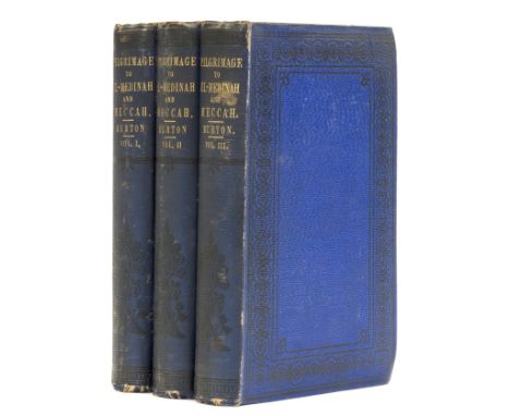
Middle East.- Burton (Sir Richard Francis) Personal Narrative of a Pilgrimage to El-Medinah and Meccah, 3 vol., first edition, half-title to vol. 3 only (as called for), folding map, 3 plans (2 folding), 14 plates (5 chromolithographs, 8 tinted lithographs, 1 wood-engraved), 24pp. publisher's catalogue at end of vol.3, vol.1 I4 with crease and paper-flaw causing marginal tear, original blue cloth, spines uniformly a little darkened, foot of spines slightly nicked, [Abbey, Travel 368; Penzer pp.49-50], 8vo, 1855. ⁂ A very good copy in original condition of "one of the greatest works of travel ever published" (Penzer). Disguised as a Muslim pilgrim, Burton was one of the first westerners to visit Mecca and other holy Islamic sites.


Lot 5211
Falkland Islands - Dependencies : (SG G7/a var) 1946-49 thick map 9d, block of 4, one with 'Gap in 80th Parallel' variety, all showing REVERSED DOUBLE OFFSET OF BROWN FRAME on obverse, slightly uneven impression of main stamps, unused no gum. Brandon Cert (2017). Stefan Heijtz detailed opinion, confirming genuine, believes caused by folding of sheets, but not a print-related phenomenon. Rare nevertheless. (image available) [US1]

Lot 88
AMHERST ALICIA. A History of Gardening in England. Illus. Large 8vo. Orig. green cloth gilt. Quaritch, 1896; also W. H. Lever, The Buildings Erected at Port Sunlight & Thornton Hough, map, illus. & plans, orig. prntd. card wrappers (browned), 1902; & W. Dobson Chapman, County Palatine, A Plan for Cheshire, illus. & maps, quarto, orig. cloth, 1948. (3).


-
109182 item(s)/page