We found 108737 price guide item(s) matching your search

Refine your search

Year

Filter by Price Range
  • List
  • Grid
  • 108737 item(s)
    /page

Lot 5589

1970 Denoyer-Geppert Social Science map depicting the peoples and tribes of Italy 112cm wide x 82cm high

Lot 5706

LESLEY DAVY (b. 1953) A framed and glazed coloured etching - "Map". Pencil signed and numbered 1/1

Lot 148

A framed map of Melrose by Rob Hain. size 49cm x 69cm

Lot 1127

A J. Carey framed Map of Hertfordshire and a Moules English Counties framed Map of Hereford.

Lot 1211

Four framed Prints of maps including an Ordinance Survey map centred on Blackheath Birmingham, Le Royaume D'Angleterre, Hereford and Worcestershire.

Lot 474

A hand coloured map, drawn and engraved by John Andrews, Bedfordshire (52cm x 69cm) glazed in an ebonised frame.

Lot 1279

A large framed Map of Herefordshire by Greenwood & Co together with a hand coloured Map of Shropshire.

Lot 1438

A large Philips' Commercial Map of England and Wales with Southern Scotland showing railways, roads and shipping routes, (Sales Manager's edition) framed with heavy duty plastic glazed front, 82 1/2'' x 61'' overall

Lot 723

LARGE FOLDER WITH PHOTOGRAPHS, PLANS, MAP, CERTIFICATES, SALE CATALOGUE ETC. (19)

Lot 243

Smith's Map of London, Smith's new plan of London, Westminster & Southwark, comprehending all the new buildings and 350 references to the principal streets, with the new docks at Wapping & Blackwall, 41cm x 74cm, 21 panels backed on linen, London: printed for C Smith, Map seller, 172 Corner of Surrey Street, Strand, 1819

Lot 244

19th Century Brookes's England folding map, Brookes Travelling Companion through England and Wales, Published by William Darton and Son, 2nd Edition, 52cm x 58cm

Lot 245

Thomas Kitchin, Asia and it's several Islands and Regions, according to their most approved divisions with Captain Cooks New Discoveries, the hand coloured map circa 1795, 54cm x 45cm

Lot 250

Robert Morden, 18th Century map Norfolk, hand coloured, 56cm x 38cm

Lot 251

Thomas Kitchin (1718-1784) hand coloured map of Cumberland and a hand coloured map of Derbyshire, together with a 17th Century map of Westmorland and a circa 1761 map of Derbyshire, (4)

Lot 253

Mixed maps, to include, John Cary Nottinghamshire, Derbyshire, Alex Hogg North Wales, East Riding and Halley map of the World, (5)

Lot 254

Mixed maps, to include Robert Morden, South Wales, 17th Century map of Lincolnshire, Robert Morden map of Norfolk, Montgomery shire and a Derbyshire Map, (5)

Lot 255

Johann Baptist Homann, Magna Britannia Complectens Angliae Scotiae et Hiberniae, published Nuremberg, circa 1740, engraved map with hand colouring, 58cm x 49cm

Lot 256

James Green, 1819, Map of the turnpike road from Plymouth to Exeter, J Cary Strand, 94cm x 26cm

Lot 258

New York street map, 1840, with City Hall and Broadway printed to the corners, 38cm x 30cm, together with a Philadelphia street map, 37cm x 30cm, (2)

Lot 260

William Swire, Liverpool and its Environs. Engraved from and Actual Survey made...in 1823 and 1824, pub. c.1824, uncoloured engraved plan, inset view of the town hall and map of Liverpool in 1720, 53cm x 41cm

Lot 262

Charles Harcourt, Map of 24 Miles round the City of Bath, hand coloured, 60cm x 58cm

Lot 264

John Cary, 1805, A Map of Devonshire, 48cm x 42cm

Lot 265

Johannes Janssonius, (1588-1664), Episcopatus Dunelmensis Vulgo The Bishoprike of Durham, hand coloured map, 51cm x 39cm

Lot 266

Michael Burghers, 1661, black and white map with three Saxon soldiers to one side, the king to the opposing side, 27cm x 19cm

Lot 270

John Speede, 1610, West Riding of Yorkshire, hand coloured map with plan of York, title cartouche, figural scale and various coats of arms, 51cm x 38cm

Lot 273

John Speede (1542-1629 ) Cornwall, Described by the travills of John Norden augmented and published by I. Speed, Map 51cm x 28.5cm

Lot 274

Peter Crosthwaite, 1783, two copies of An Accurate Map of the Grand Lake of Windermere, 60cm x 20cm, together with An Accurate Map of the beautiful Lake of Ulls-Water and Faden and Jefferys Low Ground between Muston and Malton which adjoin to the Rivers Derwent and Harford (4)

Lot 275

John Harrison, 1789, Map of Kent, 46cm x 34cm

Lot 278

Robert Morden, late 17th Century, Northumberland, hand coloured map, 36cm x 41cm

Lot 280

Alexander Hogg, 1790, coloured map of South Wales, 32cm x 20cm

Lot 281

John Harris, 1720, A Map of the Great Levell of the Fen Extending into the Countyes of Norfolk Suffolke Northampton Lincoln Cambridge Huntington and the Isle of Ely Surveyed by Sr Jonas Moor

Lot 282

Willem Blaeu, 1650, Mervinia et Montgomeria Comitatus, hand coloured map, 48cm x 38cm

Lot 283

Johannes Janssonius, (1588-1664) Radnoriensis Comitatus Vulgo The Countie of Radnor, hand coloured map 48cm x 38cm

Lot 287

Christopher Saxon, 1618, The Countie of Radnor described and the Shyretownes Sittuatione, hand coloured map, 51cm x 38cm

Lot 853

A Scarborough's wall map of England and Wales and a poster depicting Lord Byron

Lot 659

Five Brass Trench Art Shell Items plus a Silk Air Force Avigation Chart Map and a Board mounted with Nine H.M.S Hat Bands

Lot 771

Antique Hand Coloured Map of Radnor Shire

Lot 817

A framed 19th century T.Moule map of Wiltshire, labelled verso

Lot 357

Folex No. 1 military survey War office map

Lot 720

*Desktop model. A Lightning aircraft ashtray dated 1946 mounted on a map of Australia map base, together with an American made 1930 Spirit of St Louis chrome desk top lighter aircraft model, 14cm wingspan (1)

Lot 835

*WWII. A collection of WWII items belonging to Alan S. Angill, Adjutant., No.21 Squadron, R.A.F., including Observer's and Air Gunner's Flying Logbook, commencing 3 August 1944, last entry 28 August 1945, type of aircraft flown Mosquito IV, Oxford, various training exercises, plus RAF sidecap with brass inner lining inscribed 'A.A.', Mosquito FB.6 pilots notes, Code AF Foldex Europe (Air) 1/500,000 map plus North Europe silk escape map and related books, plus two logbooks bound together kept by Flying Officer F.B. Bristow, commencing 4 February 1930, last entry 29 March 1933, signed off by No.7 (B) Squadron, total flying time 603 hours, training exercises, type of aircraft flown Avro, Fairey Gordon, Sidestrand, Hyderabad etc, second logbook, commencing 11 July 1933, last entry 17 November 1936, training exercises, total flying time 721 hrs 20 mins (small carton)

Lot 685

An early map print by Robert Mordan 'Britannia Saxonica', 36 x 29cm

Lot 686

Robert Morden map of Buckinghamshire, 1696 - 41 x 33cm

Lot 689

Herman Moll - an original antique copper engraved map of Poland circa c1701 - 18 x 19cm (letter of authenticity to verso)

Lot 783

A WWII bayonet, a leather officers pistol holder and a map holder

Lot 40

An Early Coloured Map of Sussex to include a city plan of Chichester dated 1610, 39 x 52 cms

Lot 353

AFTER WILLIAM BLAEUW "Frisia Occidentalis", a black and white engraved map, later coloured, together with two modern coloured maps, triple dressing mirror and barometer

Lot 410

AFTER WILLIAM STRANG "Potato lifting", black and white etching, together with another by the same hand, a framed and glazed map of Gloucestershire by J & C Walker, together with various other prints, CASH "Woven studies of birds", a set of seven, etc

Lot 247

Hand tinted map of Cheshire produced by John Speede Showing various villages and parks, sold by Thomas Bassett in Fleet Street and Richard Chiseell in St Paul's Churchyard, signed engraving of a liner next to the Liver building, marked in pencil No: 04 signed Walter Richards (2)

Lot 208

A T kitchen map of Shropshire and a still life print

Lot 102

M. Burg, A New Map of Ancient Asia, three ornate cartouches, one with dedication to William Duke of Gloucester, later hand colouring, 37cm x 51cm, unframed and folded

Lot 104

John Senex, A New and Correct Map of the Ten Spanish Provinces, inset with engraved cartouche dated 1714, dedication to Charles Earl of Sunderland, later hand colouring, 63cm x 94cm, unframed and folded

Lot 107

Twenty-four unframed maps, including a set of twelve uncoloured Dutch town plans, 20cm x 25cm, J. Gibson Austrian and French Netherlands, 28cm x 31cm and A New and Accurate Map of the Netherlands, 20cm x 29cm, Plan of Dunkirk, 19cm x 29cm, Eugene Henry Frieux Plan De La Ville De Douay 1709, 20cm x 26cm, J. Gold Chart of Vigo Bay 1818, 13cm x 16cm etc
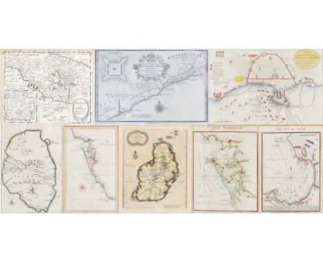
Lot 108

Eight small maps, comprising Cadiz Harbour 1809, The Bay of Acré 1815, Pierre Vander Aa, L'Ile Maurice c1714, Chart from Cadiz to C. Trafalgar 1805, Tusciae et Umbriae, Plan of the Intended and Actual Attack on Algier 1816, French map of Zelon c1630 and M. D'Anville A Map of the Kingdoms of Koto, Pop, Fida and Ardra c1727, most hand coloured, all in Hogarth frames (8)

Lot 109

J. Ellis, A Modern Map of Yorkshire, c1766, 20cm x 26cm, Thomas Moule, Yorkshire East Riding c1836, 21cm x 27cm, G. Neale town plan of Hull c1823, 25cm x 29cm, a pair of uncoloured town plans of Hull and York, 11cm x 13cm, a small hand coloured map of Yorkshire, 7cm x 11cm, a town plan of Hull with street index, 32cm x 49cm and two unframed folded Bartholomew maps entitled York and Leeds and Hull/Hornsea, 44cm x 55cm, various frames (9)

Lot 110

G. Smith, A Map of the Counties adjacent to Carlisle, inscribed in cartouche with engraved vignette of Carlisle Castle, hand coloured, 21cm x 26cm, Sir William Petty, The County of Longford, hand coloured, 27cm x 28cm, and H. Moll, A Map of the North West Part of the Western Islands, hand coloured, 26cm x 19cm, all in Hogarth frames (3)

Lot 112

16th/17th century continental school, map of Scandinavia with German title, possibly Sebastian Munster, 26cm x 34cm, a similar map of India and the Indian Ocean, hand coloured, 22cm x 34cm and Calechut Celeberri Mum Indiae Emporium after George Braun depicting a panoramic view of a town, 18cm x 47cm, all in Hogarth frames (3)

Lot 113

Captain Holland, A Plan of the Island of St. John, inscribed in cartouche and dated 1765, inset map showing Gulf of St. Lawrence, hand coloured, 38cm x 71cm, gilt frame

Lot 115

John Bill, Norfolke c1626, 9cm x 12cm, another map of Norfolk by J. Cary, some colouring, 14cm x 9cm, A Map of Brecknockshire, double glazed showing a section of the Chester to Cardiff road map verso, 19cm x 12cm, John Sellar, The Island of Garnsey, hand coloured, 12cm x 14cm, T. Jenner, Lincolnshire c1643 with distance table, hand coloured, 11cm x 11cm, J. Cary, Monmouthshire, 1810, hand coloured, 15cm x 10cm, and two hand coloured town plans entitled 'London' and Westminster', each 12cm x 19cm, predominantly in Hogarth frames (8)
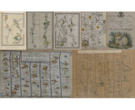
Lot 116

Six West Country road maps, comprising Thos. Gardner Exeter to Truro, double glazed showing manuscript verso, 18cm x 27cm, Sayer and Bennett Devonshire to Millbrook c1775, 16cm x 20cm, Ashburton to Tregony, two-sided in double glazed frame, 18cm x 12cm, two sections of Mogg's London to Falmouth c1815, 22cm x 15cm and a section of Mogg's London to Exeter c1828, 20cm x 14cm, together with an engraved title page from a road map book, most hand coloured, various frames (7)

Loading...Loading...
  • 108737 item(s)
    /page

Recently Viewed Lots