We found 109182 price guide item(s) matching your search
There are 109182 lots that match your search criteria. Subscribe now to get instant access to the full price guide service.
Click here to subscribe- List
- Grid
-
109182 item(s)/page


Lot 336
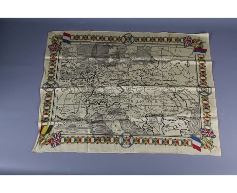
Military postcards / photographs to include five British soldier photographs, three WWI German solider postcards three WWI British postcards framed set of British navy postcards, Oxford 1941-1943 war atlas, Ordnance survey aviation map, and Die heere und flotten der fefenwart grofzbritsnnien 1897 (Guide to British arms,ports, navy, uniforms etc)


Lot 251
δ Adam Dant (b. 1967)London EnragedLithograph printed in colours, 2016, signed and numbered from the edition of 50 in pencil, on wove paper, the full sheet, 555 x 755mm (21 7/8 x 29 3/4) (unframed) The present art work was acquired from the artist's exhibition at The Map House of London, June 2018. δ This lot is sold subject to Artists Resale Rights, details of which can be found in our Terms and Conditions.


Lot 300
Military - Afghanistan. Field Notes, Afghanistan, General Staff, India, 2nd ed., 1915. Plates of sketches of Afghanistan soldiers, map of city environs, etc., 2 fldg. panoramas incl. Kabul & 3 maps in end pockets. Reprint, Calcutta, 1918; also Routes South of Kabul River (Provisional), large map in end pocket, Calcutta, 1919. (2).


Lot 83
Emanuel Bowen and Alexander Hogg Antique Maps. This lot includes Hartfordshire - Divided into Hundreds, landscape view, hand-coloured circa 1767, Map 2 Bedfordshire - Divided into Hundreds, portrait view, hand-coloured circa 1767. Map 3 by T. Condor and Alexander Hogg A New Map of Bedfordshire and Hartfordshire drawn from the latest Authorities, hand-coloured, Map 4 New Map of Oxfordshire and Buckinghamshire drawn from the latest Authorities and in a different colouring a map of Bedfordshire and Hartfordshire as published in the "New & Complete English Traveller" published 1784.
Lot 84
Herbert Moll, T. Kitchin and John Wilkes Antique Maps. This lot includes two maps by John Ellis 'A Modern Map of Bedfordshire' circa 1766 from the 'Ellis English Atlas' and a later map from Encyclopedia Londonensis 1819, together with a map of Hertfordshire by T. Kitchin Geographer, landscape view, hand-coloured circa 1786 and a rare map by Herbert Moll Geographer Buckinghamshire circa 1728 and a small quantity of 19th century maps by R. Creighton incl. a steel engraving on paper by John & Charles Walker after Creighton compiled and originally publ. by Samuel Lewis of Aldersgate in 1831 together with a series of maps incl. Buckinghamshire, Hertfordshire, Hertford, St Albans, Great Marlow, High Wycombe, Buckingham and Bedfordshire.

Lot 443
Group of various motoring interest posters and ephemera to include; reproduction BSA motorcycles poster, Exide car battery map of Great Britain, Fuller Batteries sign, FS the Dependable Rudge poster, Exide Battery poster, Melotte milk or cream separator poster, Osborne agricultural machinery poster etc. (B.P. 24% incl. VAT)


Lot 113C
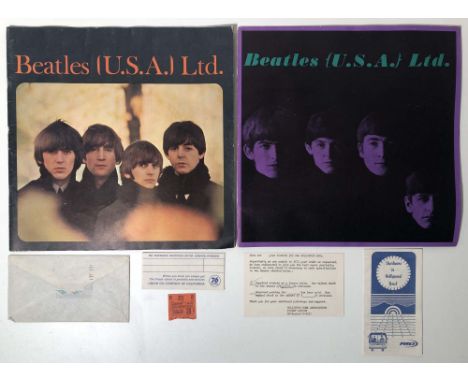
1965 BEATLES USA LTD PROGRAMMES WITH TICKET STUB, CORRESPONDENCE. To include two original 1965 'Beatles (U.S.A.) Ltd' programmes/books (both in good condition, with wear to spines, some discolouration, a portion removed from the rear cover of the purple version as per images), an original envelope to purchaser of Hollywood Bowl tickets, a portion of the original ticket, a printed note originally issued with tickets, a 'Starliners' coach pamphlet inc map of local area, a 'Union Oil Company' envelope.

Lot 9
A RARE CONTEMPORARY MAP OF TROOP POSITIONS AT SERINGAPATAM UNDER EARL CORNWALLIS, being a hand drawn and coloured aerial view of the fortress and surrounding river detailing the positions of Confederate Armies and Tippoo Sooltaun's Troops, further detailing numbers, type and disposition of troops and to include a fine and detailed profile image of the North Eastern side of the fortress. Water damage and laid down on card.


Lot 737
Charles Frederick Allbon (British 1856-1926) - View of Antwerp, black and white etching, signed, 16 x 40cm, together with an 18th century engraved map of the parish of St Mary Rotherhithe, published 1755 Stow's Survey, 40 x 51cm, a black and white engraving after JMW Turner - A View of the Inside of Brazen Nose (sic) College Quadrangle, 36 x 45cm, various sizes all framed

Lot 751
Early 19th century map of the County of Lancaster, by C & J Greenwood, 54 x 69cm, an 18th century coloured map of Rutlandshire by John Speed in double sided glass frame, 40 x 51cm approx, an early 20th century coloured map of a Fijian mining region and two framed pages of middle eastern type text, various sizes all framed


Lot 863
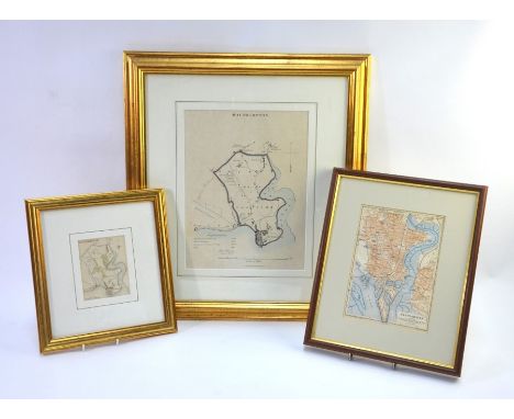
An early 19th century map engraving of Southampton by Robert Dawson, Lieutenant Royal Engineers c.1830, 30 x 23, to/w a smaller Southampton map of similar vintage, 11 x 8.5cm and a later map engraving of Southampton, framed with Bournemouth and the Southern New Forest on reverse (3 - all mounted, framed and glazed)


Lot 389
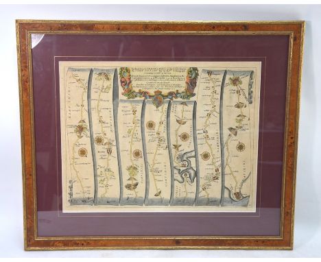
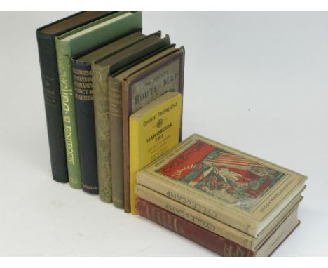
Highways & Byways in Normandy, by Percy Dearmer, 2nd Ed, 1910 reprint An octavo hardback volume in dark blue cloth with gilt lettering, top edge gilt, illustrated by Joseph Pennell, London, Macmillan and Co., Limited, a good copy, together with other touring-topographical mainly hardback titles, including: The Lakes of England, by George Tattersall, 1st ed, 1836, a good copy with etchings by W. F. Topham; Illustrated Guide to Lincolnshire, What To See and How To See It, by G. J. Wilkinson, 1900; The Rambler, a volume of bound issues from 1897; The Tourist's Route Map of England and Wales for All Cyclists and Roadmen, a folding map from c.1886, including period advertisements; and five other volumes. (10)

Lot 399
Cycles Français, HURTU, Advertising Poster Dating circa 1894, a large and important poster depicting a cyclist in a landscape, standing by his pneumatic-tyred safety bicycle and studying a map. The main text is headed: Cycles Francais, HURTU, PARIS, and along the bottom of the poster, in block capitals, the text reads: HURTU, HAUTIN & DILIGEON, Constructeurs, and the retailer EUGENE BOITARD. Smaller text to the right reads: Exp-on Univ-lle 1889, Membre du Jury, Hors Concours. With a licence stamp, the poster was printed by Charles VERNEAU, 114 Rue Oberkampf, Paris. Housed in a stout plain wooden frame with clear Perspex shield, image size 129 x 96cm. Slight damp-staining along the lower edge, but otherwise good colour and condition.


Lot 452
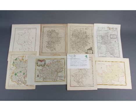
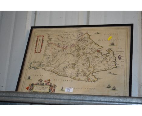
FOUR ASSORTED ENGRAVED FRAMED MAPS, to include a William Kip coloured map of Lincolnshire, approximately 36cm x 38cm, taken from Camdens c.1610, a Richard Blome map of Lincolnshire, approximately 27cm x 33cm, c.1673, a Pieter Van Den Keere map of Lincolunshire, approximately 13cm x 9cm, c.1627 and a Thomas Moule map of Lincolnshire, approximately 20cm x 25.5cm, c.1836 (4)


-
109182 item(s)/page