A collection of x4 early WWI First World War related trench maps / maps. Includes; a 1910 map of Belgium and surroundings, a Swedish linen backed map of Sweden and the coast, an 1889 linen backed map of Dunkirk ( French ), and a large French linen backed map. Interesting collection of antique maps.
We found 109198 price guide item(s) matching your search
There are 109198 lots that match your search criteria. Subscribe now to get instant access to the full price guide service.
Click here to subscribe- List
- Grid
-
109198 item(s)/page
A rare original WWI First World War RFC Royal Flying Corps pilot's leg map / chart holder board. Stamped with makers marks for Houghton-Butcher of London and dated 1915. The wooden chart with inset gauge and compass to top. The bottom edge designated as a rule, and the rear with leather strap for use around a leg. Rare piece of RFC equipment. Measures approx; 25cm tall.
America.- Annual Register (The)..., vol.1-67 plus 2 Index vol., a few early vol. later editions, vol.6 (1763) with 4 folding engraved maps at end including 'A New Map of the British Dominions of North America', vol.19 (1776) includes The Declaration of Independence (pp.261-264) and the Articles of Confederation (pp.264-270), contemporary calf, rubbed, some chipping to spine ends, but generally a sound set, 8vo, 17581824 (69).⁂ As well as the American War of Independence, this run includes much on India and other British colonies, the French Revolution and the Napoleonic wars. Edmund Burke was the editor for the first few years of the publication, which is still issued annually to this day.
NO RESERVE Fortescue (John) A Selection from the Papers of King George III..., 2 vol, for the Roxburghe Club, presentation slip from Harwood House loosely inserted , frontispiece to vol.1, original morocco-backed cloth, a little rubbed, uncut, Cambridge, 1927 § The Coronation of Her Majesty Queen Elizabeth II, approved souvenir programme, map of procession, illustrations, original decorative wrappers, a little marked, extremities creased, 1953 § Bemrose (William) Bow, Chelsea, and Derby Porcelain, plates, original pictorial cloth, gilt, spine ends bumped and creased, 1898; and c.170 others, non-fiction, miscellaneous, v.s. (c.170)
Birds.- Delacour (Jean) The Waterfowl of the World, 4 vol., first edition, frontispieces and colour plates by Peter Scott, illustrations, bookplates, faint spotting to first and last few leaves, original cloth, slight bumping to spine extremities, dust-jackets, slight chipping to corners and extremities, some small tears, small loss to spine extremities (vol. 1), 1954-64 § Meinertzhagen (Colonel R.) Birds of Arabia, first edition, colour plates, illustrations, large folding map in pocket at end, occasional very faint spotting, bookplate, previous owner's ink inscription, original cloth, slight bumping to spine extremities, Edinburgh & London, 1954; and a 1966 edition of 'The Original Water-Colour Paintings of John James Audubon for the Birds of America', 8vo & folio (6)
Africa.- Tully (Richard) Narrative of a Ten Years' Residence at Tripoli in Africa, second edition, folding engraved map, 7 hand-coloured aquatint plates by R. Havell, very light offsetting, bookplate of the Rt. Hon. Lord Gray to pastedown, contemporary calf, neatly rebacked, retaining original spine label, [Abbey Travel 301], 4to, 1817.
America.- Birkbeck (Morris) Notes on a Journey in America, from the Coast of Virginia to the Territory of Illinois, fourth edition, folding engraved map, hand-coloured in outline, occasional light spotting, original boards, spine label chipped and browned, spine ends and corners lightly bumped, spine chipped at foot, 8vo, 1818.
Atlas.- Orbis Terrarum Antiquus. Schul-Atlas der Alten Welt nach Mannert, Ukert, Reichard, Kruse, Wilhelm u. A. bearbeitet, 14 engraved maps, hand-coloured in outline, 1 map loose, title creased, some foxing and browning, original boards, paper label on upper cover, rubbed, spine defective, oblong 4to, Gotha, 1839.
NO RESERVE Belgium.- Seutter (Matthäus & Family) Germaniae Inferioris sive Belgii Pars Meridionalis Exhibens X Provincias Catholic, map showing Belgium, Flanders, Luxemburg and parts of France and Holland, engraving with hand-colouring on laid paper, 500 x 580 mm. (19 3/4 x 22 3/4 in), under glass, some folds and handling creases, minor nicks and tears, unframed, 1720.
Greece.- [Beauchamp (Alphonse de)] The Life of Ali Pacha, of Jannina, late Vizier of Epirus, surnamed Aslan, or the Lion. Including a compendious history of modern Greece, second English edition, 2 engraved portraits, engraved folding map, folding aquatint view, occasional foxing and offsetting, contemporary red straight-grain morocco, gilt, spine gilt in compartments, light rubbing to extremities, some light staining to covers, still an attractive copy, g.e., [Atabey 79; Blackmer 100], 8vo, 1823.
India.- [Butterworth (Captain William John)] The Madras Road Book, second edition, large folding colour lithographed map by the author (2 neatly repaired tears), occasional light browning, contemporary black morocco, lettered, in gilt on upper cover, 8vo, Madras, George Calder, published by Edward Marsden, at the Asylum Press, Mount Road, 1839.⁂ Rare. A colonial administrator and military officer in India, Butterworth was assistant Quarter Master General for the army and subsequently Governor of the Straits Settlements from 1843 to 1855.
India.- Rennell (James) Description of the Roads in Bengal and Bahar, first edition, folding frontispiece map, double page table at end, map torn at folds and repaired, margins torn with slight loss, marked & offset, table mounted, fore-edge trimmed with slight loss, title frayed, paper somewhat brittle, some marking, ink stamps of the New York Historical Society on title, modern calf-backed marbled boards, 8vo, 1778.⁂ Rare. Rennell was appointed Surveyor-General of India by Clive in 1767.
Italy.- Smith (John) Select Views in Italy, 2 vol., engraved dedication to Queen Charlotte, 72 engraved plates by J. Emes, W. Byrne and others after Smith, lacking map, vol. 1 title misbound at end of vol. 2 , occasional spotting and offsetting, bookplate of Sir John Stuart Forbes, contemporary half calf, extremities rubbed, oblong folio, T. Chapman for John Smith, William Byrne and John Emes, 1792-96.
NO RESERVE England.- Ireland (Samuel) Picturesque Views on the Upper, or Warwickshire Avon, first edition, sepia-printed aquatint additional pictorial title and 29 plates, engraved map and 2 etched portraits, light foxing to plates, later blue calf, gilt, by R. Faulder, 1795 § The Salisbury Guide, engraved map, 2 folding plates, ownership inscription of John Arlott, other 19th century ink ownership inscriptions to front free endpaper, calf-backed boards, rubbed, Salisbury, by J. Easton, 1800 § Twining (Henri) Voyage en Norwège et en Suède, 18 lithograph plates, some light spotting, later half calf, a little rubbed, Paris, chez Delaunay, 1836; and 58 others, topography, travel, London, v.s. (61)⁂ Second is scarce, with Library Hub recording only one copy of this edition.
A 16th Century Map of Vilnius, Lithuania, A 16th Century Map of Vilnius, Lithuania, Braun & Hogenberg, 1599, map title ‘VILNA LITVANIAE’ uncoloured, 53cm x 42cmNotes: From first Latin edition of Volume III, plate 59, of “Civitates orbis terrarum,” drawn 1576, possibly based on an image by the Flemishartist, Guillebert de Lannoy, who visited Vilna in 1414
Giuseppe Maria Garibaldi (Italian, 1807-1882), a collection of memorabilia to include a Bois Durci roundel of Garibaldi and one of Vittorio Emanuele II, a carved treen figure, a 19th Century Staffordshire pot lid, a copper spectacle case, a cartoon lithographic map of Italy and a modern Punch cartoon (7)
Cary, John. Cary's Traveller's Companion, or, A Delineation of the Turnpike Roads of England and Wales, London: John Cary, 1806. Featuring 42 [of 43] hand-coloured engraved maps as called for (lacking map of Yorkshire), includes three pages of advertisements at rear (one depicting globes). Full contemporary calf, lettered in gilt, raised bands, marbled endpapers. Contents good, clean, bright; several owner inscriptions; binding with some rubbing and wear to extremities
Speed, John. 17th-century map of Cambridgeshire, hand-coloured copper engraving on laid/chain-lined paper bearing manufacturer's watermark, published by Sudbury & Humble, first edition [1611], early hand-colouring. Featuring inset plan of Cambridge, royal coat-of-arms, academic figures, heraldic college shields. Framed & glazed recto & verso (both sides visible), approx. 38cm by 52cm
Speed, John (1552-1629). 17th-century map of Warwickshire, uncoloured copper engraving on laid/chain-lined paper, featuring inset views of Coventry and Warwick, Sudbury & Humble, framed and glazed to recto and verso, 39.5cm by 52.5cm. Very good, clean, bright. Together with a framed Robert Morden map of Warwickshire (2)
Collection of framed antique maps to include Great Britain and Ireland with ye Judges Circuits, John Stockdale, 1805; A Map of the Kingdom of Scotland for Mr Tindal's Continuation of Mr Rapin's History [1744]; Robert Morden map of Staffordshire; several Owen & Bowen road maps, and others, including Kitchin, Cary, Moule. Together with a small quantity of mounted topographical prints (copper and steel engravings), in one box
Speed, John. 17th-century map of Cornwall, hand-coloured copper engraving on laid/chain-lined paper, Sudbury & Humble. Featuring inset view of Launceston, ships, sea monsters and heraldic sheilds. General toning from age, some creasing around central fold-line with old tape reinforcement showing through from other side; there is possibly a tear along right-hand side but unxamined out of frame. Framed & glazed, 38cm by 50.5cm
Faden, William (1749-1836). George III period map of London, 1795. Hand-coloured copper engraving on laid/chain-lined paper; sectional; linen-backed; housed in marbled slipcase bearing bookseller's label (J. Anderson, Holborn Hill). 'The Country Twenty-Five Miles Round London, planned from a scale of one mile to an inch, by W. Faden, Geographer to His Majesty and HRH the Prince of Wales, 1795, NB: The extent of the Penny Post is coloured orange'. The map is very well-preserved; creamy laid paper; some discolouration/spotting verso, which is showing through slightly at recto; the slipcase is worn with loss. The slipcase includes a loosely-inserted programme for the Confirmation of HRH the Prince of Wales, 1 April 1858. The map measures 104cm by 125cm
Speed, John (1552-1629). 17th-century map of Warwickshire, first edition [1611], uncoloured copper engraving on laid/chain-lined paper bearing manufacturer's watermark, featuring heraldic shields, bear & ragged staff, and inset views of Warwick and Coventry. Sudbury & Humble, English text to verso
δ Grayson Perry (b.1960)Map of NowhereEtching from five plates printed on one sheet, 2008, signed and numbered from the edition of 68 verso, on Arches Paper, published by Charles Booth-Clibborn under his imprint The Paragon Press, with full margins, 1520 x 1120mm (59 ¾ x 44 1/8 in) (unframed)δ This lot is sold subject to Artists Resale Rights, details of which can be found in our Terms and Conditions.
A VINTAGE ILLUSTRATED MAP POSTER OF THE CITY OF BIRMINGHAM by W H Price, dating from 1949 and featuring Landmarks, Public Buildings and Parks and Gardens etc, the lot also includes two Black Country Society Publications of The Black Country and it's Borderland by T R Bennett 1969, Birmingham Canal System and Neighbouring Canals by the same illustrator 1970 plus two further maps, one on trace paper of Sutton Park and it's surrounding area and the Tyburn Road, Kingsbury Road and Chester Road area
FIVE GLAZED FRAMES CONTAINING A MAP AND FOUR SCENES all connected with 'Operation Corporate' Falklands Islands War, May 1982, of Parachute Regiment interest, Map of the Islands, Advance to Port Stanley, Teal Inlet, captured Argentine Gun position, Estancia House Farm, the latter four by the artist Reginald Reed (prints), one frame has cracked glass and Lady Butler (1846-1933) 'The Roll Call' an open edition print after the original in The Queens Collection, a study of the roll call after an engagement in Crimea, mounted, framed and glazed, approximate size 40cm x 78cm (6)
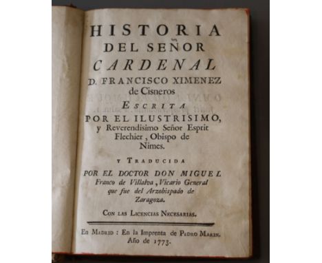
Flechier, Esprit, 1632-1710 - Historia del Senor Cardenal D. Francisco Ximenez de Cisneros, calf, 8vo, Pedro Marin, Madrid, 1773; Giustiniani, Bernardo - Historia Generale della Monarchia spagnvola antica e moderna …, vellum, quarto, with engraved portrait frontis, engraved armorials and 8 folding genealogical tables, vellum boards holed in places, Presso Combi & La Nou, Venice,1674 and Lafitau, Rev. Pere, Joseph-Francois, 1681-1746. - Histoire des decouvertes et conquestas des Portugais, 4 vols, vellum, 8vo, folding engraved frontis, panorama of Lisbon, and folding world map with small tears, and 14 folding plates, some worming in vols 3 and 4, Saugrain, Paris, 1733Note: A history of the Portuguese explorations of the 15th and 16th centuries. The World map delineates the voyages of Vasco da Gama, Cabral and Megallan
Sandys, George, 1578-1644. - Relation of a journey begun an: Dom: 1610 ... description of the Turkish Empire, 4th edition, calf, folio, pictorial title page, engraved by Francisco Delaram, with further illustrations in text, with vignettes and maps, including a folding double page map, bookplate of George Dunn, Woolley Hall, Maidenhead, printed by [Thomas Cotes] for Andrew Cooke, London, 1637Condition: Lacks View of Istanbul, iv, 309 pages, text and vignettes generally clean, period black ink writings (calculations) to reverse of final page, spine joints scuffed and with small loss to spine header, lacks leaves for pages 95/96 and 271/272
![Loading...](/content/bs/images/ajax-loader.gif)
-
109198 item(s)/page