We found 109182 price guide item(s) matching your search
There are 109182 lots that match your search criteria. Subscribe now to get instant access to the full price guide service.
Click here to subscribe- List
- Grid
-
109182 item(s)/page


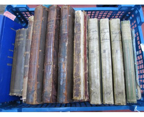
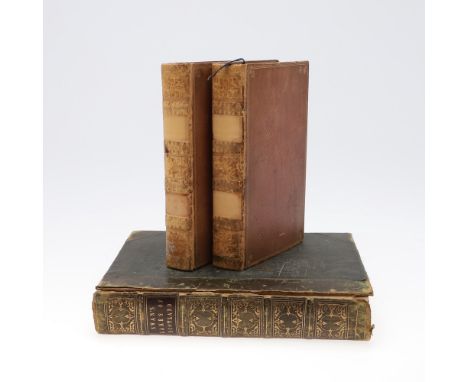
Lot 2032
Folio Society, a collection of ten volumes each in pictorial cloth and slip-case to include Bergon, Frank (ed:), Pathfinders of the Ameircan West The Journals of Lewis and Clark, 2000, Stanley, Henry M.: Into The Dark Continent, 2002 (with map), Hughes, Robert: The Fatal Shore, 1998, Prescott, William H.: The Conquest of Mexico, 1994, Hopkirk, Peter: The Great Game, 2010, Williams, Glyn: The Quest For The Northwest Passage, 2007, Burton, Richard: A Secret Pilgrimage to Mecca and Medina, 2004, Hudson, Roger. (ed:) William Russell Special Correspondent of The Times, 1995, Parkman, Francis: The Oregon Trail and Hudson, Roger. (ed:) The Raj An Eye-Witness History, 1999. (10)American West has written in pencil ‘Stand 22 £15’.No markings to the others.
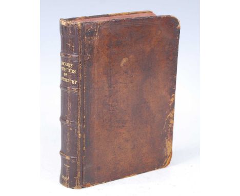
Lot 2019
Somner, William: The Antiquities of Canterbury or a Survey of That Ancient Citie with the Suburbs and Cathedrall, Richard Thrale, London 1640, first edition, with dedication to the Archbishop of Canterbury, arms of the See to rear of title page, fold-out map, fold-out engravings of the high altar and font, rebound in tooled full calf with gilt titled banded spine, 8vo. (1)
Lot 2020
Somner, William: The Antiquities of Canterbury or a Survey of That Ancient Citie with the Suburbs and Cathedrall, Richard Thrale, London 1640, first edition, with dedication to the Archbishop of Canterbury, arms of the See to rear of title page, fold-out map, fold-out engravings of the high altar and font, rebound in full calf with gilt titled spine and red edged pages, 8vo. (1)
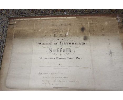
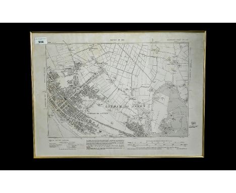
Lot 2613
A late Victorian engraved map of the 'Manor of Lavenham, Suffolk', (enlarged from Ordnance Survey Map), being hand-coloured, 150 x 140cm; together with a smaller scale map depicting the full parish, 224 x 150cm, both being canvas backed, rolled and based on an 1884 Ordnance Survey maps (1st edition)
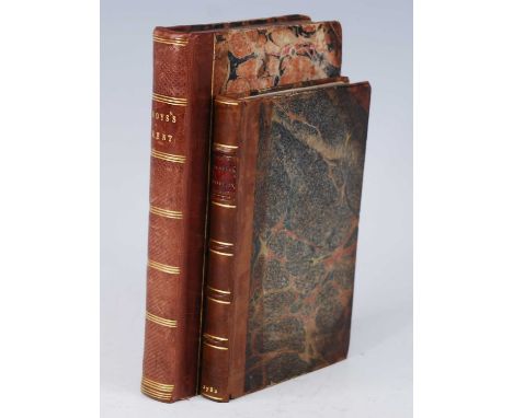
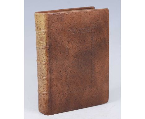
Lot 2011
Ducarel, Andrew Coltree: A Repertory of the Endowments of Vicarages in the Dioceses of Canterbury and Rochester, J Nichols, London 1782, quarter leather with marbled boards and gilt tooled banded spine, with bookplate for John R Lambert and previous owners notes, 8vo, together with Boys, John: A General View of the Agriculture of the County of Kent…,second edition, McMillan, London 1805, with fold-out map and table of principal woodland, in quarter morroco with marbled boards and gilt tooled to spine, marble edged, 8vo. (2)
Lot 2023
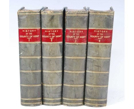
Ireland, William Henry: England's topographer, or A new and complete history of the county of Kent; from the earliest records to the present time, including every modern improvement. Embellished with a series of views from original drawings by Geo. Shepherd, H. Gastineau, &c. with historical, topographical, critical, & biographical delineations, four volumes, George Virtue, London 1828-1831, the first volume with dedication to the Nobility, Gentry and Clergy of the County of Kent, folding map and engraved plates, rebound in quarter green with pebbled boards, spines gilt tooled HISTORY OF THE COUNTY OF KENT and with volume number, previous owners notes to endpapers, 8vo. (4 vols)

Lot 2034
Bacon, G.W. F.R.G.S.: Bacons New Chart of the World Mergators Projection, a folding canvas backed map of the World showing the British Empire at it's height, marked bottom right G.W. Bacon & Co., Ltd., Royal London Buildings, Deansgate, Manchester, circa 1906, in red cloth with gilt title, 120.5 x 94cm open,
Lot 2025
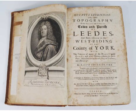
Thoresby, Ralph: Ducatus Leodiensis: or, the Topography of the Ancient and Populous Town and Parish of Leedes, And Parts Adjacent in the West-Riding of The County of York, London: Printed for Maurice Atkins, and Sold by Edward Nutt at the Middle-Tem-ple Gate in Fleet-Street, 1715, engraved portrait frontispiece, lacking map, contemporary panelled calf, red morocco spine label, folio, with T.D. Webster Antiquarian and Export Bookseller purchase receipt dated 20th January 1964. (1)


Lot 357
A late 18th century hand-coloured map engraving by Bowles & Carver: 'A New Plan of the Town Fortifications, Port and Harbour of Dunkirk shewing the Fortifications of the Town and Citadel as before they were demolished in 1714 in pursuance of the Treaty of Utrecht' (48 x 59 cm). (Mounted but unframed)


Lot 1237
Moore's Almanack with a Map of The Ship Canal and appendix, 1826; London and North Eastern Railway Company - General Directions to Management of Stations and Conveyance of Mechanised Traffic, 18th January 1931; Hargrove [W.M.}: History and Description of Ancient City of York, two vols; Arrowsmith's Atlas of Ancient Geography, etc. (12)


Lot 144
BARKER LADY. Station Life in New Zealand. Calf gilt prize bdg. 1883; also Julius Vogel, The Official Handbook of New Zealand, A Collection of Papers by Experienced Colonists, fldg. & other plates & illus., rebound qtr. calf, 1875 & Miss Tucker, The Southern Cross & Southern Crown or The Gospel in New Zealand, fldg. map, plates, orig. green cloth, 1858. (3).


Lot 140
HALL W. H. & BERNARD W. D. Narrative of the Voyages & Services of the Nemesis & of the Combined Naval & Military Operations in China, Comprising a Complete Account of the Colony of Hong Kong. Eng. frontis, 3 plates, plan & text illus. but one fldg. map only. Rebound half calf. 2nd ed., 1845.


Lot 38
KINLOCH A. A. A. Large Game Shooting in Thibet, the Himalayas, Northern & Central India. Fldg. map & 34 photo plates (lacking one?). Quarto. Rebound green cloth, internal damp stng. & browning. Calcutta, 1892; also a worn copy of J. H. Baldwin, The Large & Small Game of Bengal, 1877 & Frank Finn, Indian Sporting Birds, 1915. (3).


Lot 95
NICOLAY C. G. The Oregon Territory. Frontis & fldg. map. 32mo. Bound in orig. green cloth with The Backwoods of Canada being Letters from the Wife of an Emigrant Officer, plates, both 1846; also Jewett, Thomas & Co., Hand-Book for Travellers to Niagara Falls, Montreal & Quebec, frontis & illus. but lacking map, orig. cloth, Buffalo, 1854. (2).


Lot 228
John Speede (1552-1629), map of Gloucestershire, 'contrived into thirty thre several hundreds', hand coloured engraving, 39x52cm; together with a John Bowen map of Rutland, 19x12cm; and one other small French map of the Euphrates, 20x24cm (3)Provenance: from the estate of Professor James Griffin, formerly White's Professor of Moral Philosophy at Oxford University and an Emeritus Fellow of Corpus Christi college, Oxford

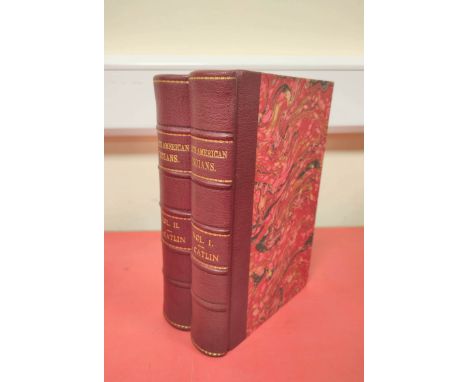
Lot 205
George Catlin. Letters and Notes on the Manners, Customs, and Condition of the North American Indians, 2 volumes, ninth edition, engraved frontispieces, guards, wood-engraved plates and illustrations in text, without folding map, original cloth gilt, 8vo, Philadelphia: Willis P. Hazard, 1857. ** Spotting throughout, spines repaired and endpapers renewed in the late nineteenth century.

Lot 150
Greenwood, Pringle and Co. Map of the County of Essex, From an Actual Survey made in the Year 1824, large hand-coloured folding map on two sheets, North and South, each of 35 sections, backed on linen, 1576mm x 680mm, in contemporary calf slipcase, London: Greenwood, Pringle and Co., 1st June 1825. ** Occasional slight browning, case heavily rubbed.


Lot 90
Swan's Views of the Lakes of Scotland, second edition, 6 additional engraved titles and 48 engraved plates, light spotting, contemporary half calf, spine cracked, upper cover detached, 4to, Glasgow: Joseph Swan, 1836; Stewart, David. Sketches of the Character, Manners, and Present State of the Highlanders of Scotland, 2 volumes, presentation copy from the author, large folding and-coloured engraved map, contemporary diced calf, spine rubbed, 8vo, Edinburgh: Archibald Constable and Co., 1825 (3). ** spine on first damaged, rubbed on second.
-
109182 item(s)/page