We found 109182 price guide item(s) matching your search

Refine your search

Year

Filter by Price Range
  • List
  • Grid
  • 109182 item(s)
    /page

Lot 301

A Corgi 50th Anniversary AN40814 Bristol Lodekka FS5G - Lincolnshire Road Car complete with presentation plinth, replica route map & anniversary booklet, gold lined packaging, pictorial box; Corgi Classics 35006 The Beatles Collection AEC Routemaster - Liverpool Corporation; 97750 The East Kent 75 Years Quality Service Set an AEC Regal & Bedford OB; 34801 Limited Edition Western Welsh Leyland Oylmpian Bus Set etc. all in original pictorial boxes (14)

Lot 426

Oriental items - cartographers map of The People's Republic of China; another, map of the world, carved wooden figure, etc (4)

Lot 589

Framed Map of the Province of Connaugh 1610 by John Speed

Lot 313

EDWIN EARP (1851-1945); watercolour 'Loch Awe', signed and dated 1871 lower right, 18 x 43cm, framed and glazed, unattributed; a mixed media artwork depicting a gentleman in the foreground carrying a bundle of sticks and basket with rose-covered cottage in the background amid trees, 25 x 32cm, framed and glazed, a print of a Johan Blaeu map of Yorkshire printed by John Bartholomew & Son Ltd, Edinburgh, Scotland, published by the Royal Geographical Society, 39 x 49cm, framed and glazed and a pair of early 20th century prints 'The Riverside Hamlet' and 'The Day's Work Ended', both in ebonised frames and glazed (5).

Lot 341

Gale, Roger; 'Registrum Honoris De Richmond', an 18th century contemporary calf bound volume with double-page genealogical table, four engraved plates of seals, a large folding map of Richmond (Surrey) backed on linen, an engraved plate of William the Bastard, Duke of Normandy, five double-page engraved heraldic and genealogical tables, various engraved plates of monuments and heraldic shields. CONDITION REPORT The spine has a split to the top of approximately 7cm, the calf binding is very worn in various places. Some loss of gilding to the front cover, the marbled endpapers are missing. Signs of water damage - particularly to the front pages and other age-related wear. There is a small hole in one of the folds, foxing and staining. Book is for Richmond Surrey

Lot 240

Robert Morden (British, 1675-c1703). Leicestershire, hand coloured engraved map, sold by Abel Swale and others, 39cm x 44cm, together with a reproduction of Saxton's Map of Lincolnshire and Nottinghamshire 1976, 50.5cm x 62cm. (2)

Lot 364

A Ceylonese dish, embossed with a map of Sri Lanka, within bands of embossed leaves and repeating elephants, white metal, 6.31oz.

Lot 970

TWO VINTAGE FRAMED LAKE DISTRICT POSTCARDS, VINTAGE FRAMED CORNWALL MAP AND FURTHER WATERCOLOUR OF NETHER ALDERLEY

Lot 277

A THIRD EDITION OF HUGHES AND HARBER DIRECTORY ROAD MAP 1910

Lot 279

A TOPOGRAPHICAL HISTORY OF STAFFORDSHIRE BY PITT PART 1 WITH MAP

Lot 615

Robert Morden, coloured engraving, Map of Hampshire, 38 x 43cm

Lot 647

Thomas Kitchin, an uncoloured late 18th century map of England and Wales, 48 x 39cm

Lot 684

John Senex, coloured engraving, A New Map of Africa, 50 x 57cm

Lot 685

Joannis Jansson, coloured engraving, Map of Guinea, Latin script verso, overall 48 x 57cm

Lot 336

Gordon Beningfield (British, 1936 - 1998) "Indian Paintbrush" Signed lower right. Original Watercolor painting on Paper. Provenance: Collection of James A. Helzer (1946-2008), Founder of Unicover Corporation. This painting was originally published on the Fleetwood First Day Cover of the U.S. 29c Indian Paintbrush stamp issued July 24, 1992. lthough Castilleja coccinea is the most common eastern species, most Castilleja species are often found in the western two-thirds of the continent as indicated on the map. Easy to recognize with their bright, brush-like forms, it is often difficult to identify them to the species level. Indian paintbrushes bloom from spring to summer in dry to moist soils of open sunny areas including grasslands, mountain meadows and forest clearings. Although the most common color is red, paintbrushes exhibit a rainbow of other hues, including pink, purple, yellow and orange. The colorful "petals" are actually pigmented leaves or bracts that help attract pollinators, such as bees and hummingbirds, to the nectar of the small, greenish-yellow flowers at the base of each bract. A member of the snapdragon family -- Scrophulariaceae -- Indian paintbrush grows best when it attaches itself to the roots of a host plant. Image Size: 7 x 6 in. Overall Size: 11.25 x 10.25 in. Unframed. (B12848)

Lot 542

A double sided silk scarf depicting WW2 map of Scandinavia & Baltics, approx. 22in x 19in

Lot 543

A scarf depicting the map of the German French theatre of war 1914

Lot 2157

War Office books 3 volumes Manual of Part 1 Map Reading 1955, Part II Air Photo Reading 1958 and Part III Field Sketching 1War Office books 3 volumes Manual of Part 1 Map Reading 1955, Part II Air Photo Reading 1958 and Part III Field Sketching 1957957

Lot 2266

A Manning family pedigree, 70 x 48 cm, and old map of Suffolk, 60 x 46 cm and an old map of Surrey 57 x 48 cm.

Lot 847

An 18th century hand tinted map of Chippenham to Wells and Marlborough to Wells, the mount inset with a brass Bath Token dated 1811, framed as one.

Lot 848

Robert Morden - Somersetshire, Part of Devonshire and Dorsetshire - a hand tinted map; together with a map by John Speed - Cornwall - both framed & glazed (2).

Lot 850

An 18th century map of the north of Scotland engraved by 'J Cary', framed & glazed; together with another similar (2).

Lot 1124

Two WW1 Field Message Books written mainly in ink by 1st Lieutenant B.L. Curtis of the British Army during May 1918. The first book with no cover starts on May 6th 1918 and is completely filled with mainly training notes on various subjects including map reading, automatic rifle, machine gun, messages and reports, 37mm gun, etc, etc. The second book in the cover carries on from the first book on May 23rd 1918 through to May 28th 1918. It is difficult to say if the training was done in England or actually in the trenches on the Western Front as there is too much to read

Lot 726

J.B. Wolters - Wandkaart Van Europa - an original early 20th century Dutch antique school map of Europe. Title to top, and printers marks to lower corner. Mounted upon its original wooden batons to top and base. Large. Measures approx; 208cm wide. 

Lot 325

F/G MAP OF BRITAIN

Lot 177

EARLY MAP OF HINDOSTAN OR INDIA FROM THE BEST AUTHORITIES App.size: 25cm x 21cm

Lot 181

CYCLIST ROAD MAP OF NORTHUMBERLAND AND DURHAM BY PATTINSONS LIMITED APP.SIZE: 33cm x 24cm

Lot 573

TWO BRITISH COUNTY MAP COLOURED PRINTS OF SOMERSETSHIRE

Lot 5

Important Royal Flying Corps Photograph Album for Second Lieutenant Richard Gerrard Ross Allen, late West Yorkshire Regiment, Casualty in a Aerial Dog Fight, Over the Somme, 16th November 1916, Contemporary Album produced as a "family" Memorial to a lost son. Album commences with images of Ross, as he liked to be called) in civilian clothes, one in a family group. On the facing page is his Imperial War Grave with other images of Serre Road Cemetery, (further photographs show the temporary contemporary grave on the battlefield), his medal ribbons etc., Interesting signed letter from the Keeper of the Privy Purse, Buckingham Palace expressing sympathy on behalf of the King and Queen. Tipped-in 1917 issue of the Tonbridgian (his old school) listing him in the Roll of honour. (School photographs of him are also included) There are some very clear group and other photographs of him with his 7th Squadron fellow Pilots. A propaganda leaflet dropped over the German lines is also included as is an original Trench map for August 1916. Also present with its original is one of the best letters from the front we have seen written by Ross to a friend and dated May, 1915." We have been in the trenches for twelve days... just about played out.. the attack started at 5.am..I can't describe the Hell that raged all day with shells flying all the time.. expected to be blown to blazes any moment.. and are happy as kings now that we are having a rest... ". There are also a couple of framed items, head and shoulders of Ross in uniform and "scroll "commemorating his sacrifice. In all a comprehensive and fascinating grouping to a Royal Flying Corps Casualty.

Lot 256

Framed Saxtons map of Durham 1576, two watercolours, still life, signed L. Petherick 1948 and 1950

Lot 266

A new edition 2nd June 1978, October 15th 1982, map featuring entrance to the River Tyne, Willington Quay to St Anthony's point and St Anthony's point to Dunston, depth in metres

Lot 12

Montblanc Meisterstuck Heritage Spirit Orbis Terrarum wristwatch, men, original box Montblanc Meisterstuck Heritage Spirit Orbis Terrarum wristwatch, men, reference 112309, automatic movement. Dial decorated with "World Map Motife", timezone register. Original strap, deployant-type closure and box. d=42 mm

Lot 13

An Edwardian Wooden Cased Four Scroll Motorist's Rolling Map, South England, 27cm x 22cm

Lot 190

A Printed 19th Century Wall Hanging Map of the County of Stafford by J Phillips and W F Hutchings, London, Some Damage to Border, 102cm wide

Lot 567

A Pine Fronted Four Drawer Map or Collectors Chest, 90cm wide

Lot 415

JOHN SPEEDE HAND COLOURED MAP OF ESSEX 39CM X 32CM

Lot 230

A vintage map print for the county of Chester

Lot 245

An antique map mounted and glazed in the form of a tray, of local interest 'The county Palatine of Lancaster by Rob Morden'

Lot 820

Antiquarian. Local History. Evans, Francis - Furness and Furness Abbey; or, A Companion through the Lancashire part of the Lake District. Ulverston: D. Atkinson, 1842. Complete with frontispiece, map and 4 other illustrations. Original cloth, re-cased with remains of spine laid-on. (1)

Lot 828

Folding Map. Oliver & Boyd's New Travelling Map of England and Wales. No date, circa 1820's. Coloured. 20 sheets/sections, linen backed. Measures total: 72cm x 58cm. Drawn by John Bell, Edinburgh. Engraved by Charles Thomson, Edinburgh. Housed in the original card case, rubbed. Original title label. Map clean. VG. (1)

Lot 839

Local History. The Furness Year Book. 1905 & 1907. Both in original state. 1905 edition with folding railway map, 1907 edition with folding town and railway maps. (2)

Lot 865

Maps. Antiquarian. British Isles. Titled - Anglia Regnum. Attributed to Gerard Mercator as a late 17th century issue. With; another map of the British Isles - not titled and no publication information. Both having later colouring. No text on reverse. (2)

Lot 869

Map. Wainwright - Westmorland. 4th edition. Not coloured. Framed and glazed. (1)

Lot 36

Hist. Kupferstichlandkarte des Herzogtums Württemberg - Handkolorierte, detailreiche Kupferstichlandkarte vom Baden-Württemberg des 16.Jhs. mit dekorativer Titelkartusche. "Wirtenberg ducatus accurata descriptio , in qua omnia eius opida, monasteria, pagi, nemora, flumina et rivuli alicuius nominis, diligentissime exprimuntur, auctore Georgio Gadnero". Original einst in der lat. Ausgabe des Theatrum Orbis Terrarum von 1579. Späterer Nachdruck. Maße mit Rahmen 62 cm x 51 cm. Gedruckter Text auf der Rückseite Artikel "Wirtembergensis Ducatus" aus dem Atlas des Abraham Ortelius. Stockfleckig, Verfärbungen, mit Mittelfalz. Erkennbare Alters- und Gebrauchsspuren. Hist. copper engraved map of the Duchy of Wurtemberg - Hand coloured, detailed copper engraved map of Baden-Wurtemberg of the 16th cent. with decorative title cartouche. "Wirtenberg ducatus accurata descriptio, in qua omnia eius opida, monasteria, pagi, nemora, flumina et rivuli alicuius nominis, diligentissime exprimuntur, auctore Georgio Gadnero". Original once in the Latin edition of the Theatrum Orbis Terrarum from 1579. Later reprint. Dimensions with frame 62 cm x 51 cm. Printed text on the back side article "Wirtembergensis Ducatus" from the Atlas of Abraham Ortelius. Foxing, discoloured, with centrefold. Visible signs of usage.

Lot 1223

Two boxes of books and maps including a linen backed map of Nottingham, a Whittard blue and white teapot, two glass vases, etc. **PLEASE NOTE THIS LOT IS NOT ELIGIBLE FOR POSTING AND PACKING**

Lot 703

Seven F1 Grand Prix programmes, plus Silverstone map/tickets

Lot 1482

John Speed, 'Herefordshire', an antique hand coloured map, pl.38 x 51cm, glazed to both sides.

Lot 1663

An antique hand coloured map of 'The Road from London to Rye', by John Ogilby, pl.31 x 47cm.

Lot 1100

John Cary: 'Cary's New Itinerary....of the Great Roads in Throughout England and Wales', 1826, 10th edition, large folding map (worn a/f) and six engraved maps (VGC) as called for, rebound cloth gilt

Lot 1428

Two Burrows R.A.C maps No. 4 and 11, a No. 35 AA map of England and Wales, a Philips cyclist map of the county of Essex and a Batholomews map of Essex "Sheet 26"

Lot 1023

A framed printed map of Winchester College. This lot can only be collected on Saturday 19th December (9-2pm). 

Lot 1036

An old gilt picture frame, aperture 59 x 69cm, together with an old map of Hampshire. This lot can only be collected on Saturday 19th December (9-2pm).

Lot 1

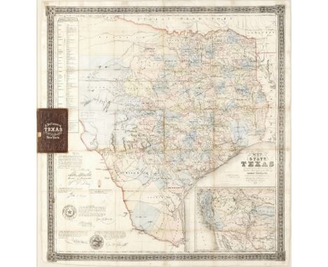
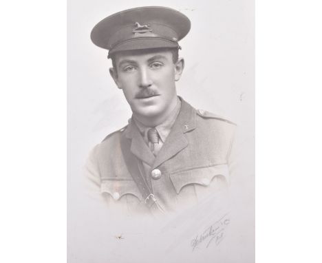
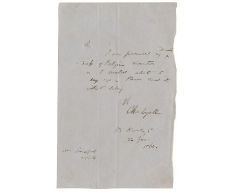
ALBUM - SIGNATURESNineteenth century album of over 150 cut signatures, and some autograph letters, from British and European artists, musicians, writers, and politicians, including David Livingstone, Victor Hugo, John Ruskin (autograph letter to S.C.Hall, expressing pleasure that his wife is recovered), W.M. Thackeray, George MacDonald, Charles Lyell (autograph letter requesting that he be sent a map of Belgium, 22 June 1869), Charles Kingsley, S.C. Hall, Matthew Arnold (autograph letter accepting a lunch invitation, 11 March 1871), William Etty, Landseer, John Linnell, James Nasmyth, Joseph Joachim, Arthur Sullivan, Maria Krebs, William Gladstone, John Bright, James Martineau and Lionel de Rothschild, most mounted, a few loose, pages loose in nineteenth century red morocco gilt album, [c.1850-1890]--ILLUMINATED ADDRESS 'To The Rev. Stephen Bridge M.A. on his Relinquishing the Incumbency of St. Matthew's, Denmark Hill, 1868', manuscript on vellum, 11 sheets, 2 ornamental opening pages in coloured and gilt inks, each page within gilt border, decorative red morocco gilt, gilt dentelles, blue watered silk doublures and front free endpapers, g.e., rubbed, folio, 'Designed & Executed by Witherby & Co., London', [1868]; and 8 others, miscellaneous manuscripts (10)For further information on this lot please visit Bonhams.com
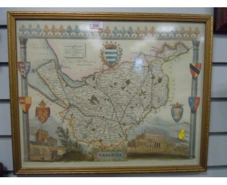
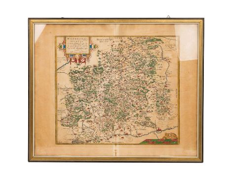
Lot 103

LIVERPOOLTAYLOR (THOMAS) Liverpool from an Actual Survey Made in the Year 1833, hand-coloured engraved map, with inset view of the Custom House, dissected and laid on linen, folding into the publisher's blue marbled slipcase, printed title label ('Price (coloured) 2.s.') on upper cover, 360 x 483mm., Liverpool, Thomas Taylor, 31 Castle Stree & 13 Church Street, [1833]Footnotes:A locally printed map of Liverpool, with an inset elevation of the Custom House (which was opened in 1839, and subsequently pulled down in 1948), showing the 'Line of the proposed Tunnel of the Liverpool and Manchester Railway for Passengers', which opened in 1836. This copy, with original hand-colouring, was priced at 2 shillings, whilst the uncoloured version was priced at 1s.6d.This lot is subject to the following lot symbols: •• Zero rated for VAT, no VAT will be added to the Hammer Price or the Buyer's Premium.For further information on this lot please visit Bonhams.com

Lot 105

LONDONLANGLEY (EDWARD) AND WILLIAM BELCH. Langley & Belch's New Map of London, hand-coloured engraved map, 24 small vignettes of London buildings in upper and lower borders, split at one fold [Howgego 256 (1)], 530 x 780mm., 1 May 1812--Bowles's New Pocket Plan of the Cities of London & Westminster... Comprehending the New Buildings, and Other Alterations to the Year 1783, engraved map, partially hand-coloured in green ink, one small ink smudge [Howgego 168(5)], 465 x 910mm., Carington Bowles, 6 January 1783--Wallis's New and Correct Plan of London and Westminster, Exhibiting All the Newly Erected Public and Private Buildings in St. Marylebone, Sommers Town.... St. George's Fields, &c., engraved map, partially hand-coloured in green and red ink [Howgego 1795], 440 x 870mm., James Wallis, 20 January 1795--Mogg's Twenty Four Miles Round London, engraved hand-coloured map, 1 January 1817--BANKS (J.H.) A Cosmoramic View of London, hand-coloured engraved bird's-eye panorama of London looking from South to North, small hole at one fold, 455 x 1045mm., E. Wallis, and others, 1 June 1843--CARY (JOHN) Cary's New and Accurate Plan of London and Westminster, the Borough of Southwark and Parts of Adjacent, engraved map, partially hand-coloured in green [cf. Howgego 184, this 1806 edition not recorded], 810 x 1240mm., J. Cary, 1 January 1806--Davies's New Map of the British Metropolis. The Boundaries of the Boroughs, Country Court Districts, Railways and Modern Improvements, hand-coloured engraved map, 980 x 930mm., B.R. Davies, [c.1850], all dissected and mounted on linen, the first 4 mentioned in original slipcases with original printed labels; and another (8)This lot is subject to the following lot symbols: •• Zero rated for VAT, no VAT will be added to the Hammer Price or the Buyer's Premium.For further information on this lot please visit Bonhams.com

Lot 108

PARISTURGOT (MICHEL ETIENNE) AND LOUIS BRETEZ. Plan de Paris commencé l'année 1734, folding double-page index map and very large perspective plan on 20 numbered sheets by Claude Lucas after Louis Bretez, nineteenth century quarter morocco, spine gilt [Cohen-de Ricci 807], folio, Paris, Levé et dessiné par Louis Bretez, gravé par Claude Lucas, 1739Footnotes:STUNNING BIRD'S EYE VIEW OF PARIS, conceived some 44 years before the first manned balloon flight, and thus a remarkable feat of the imagination. The 20 sheets form a single enormous plan (approximately 3200 x 2500mm.), with a decorative border and enough detail to still be of use to researchers into the pre-Haussmann architecture of Paris.This lot is subject to the following lot symbols: •• Zero rated for VAT, no VAT will be added to the Hammer Price or the Buyer's Premium.For further information on this lot please visit Bonhams.com

Lot 109

[SPEED (JOHN)The Theatre of the Empire of Great Britaine], 4 parts in 1 vol., additional printed titles (dated 1627) in parts 2-4, 66 double-page engraved maps (of 67), lacks map of Ireland, general title, preliminary leaf A2 and final blank H2, approximately 40 maps with some archival tissue repairs (mostly at central fold), 7 with minor or marginal losses, quarter moroccco by Anthony Bish [Chubb XXV; ESTC S95305], folio (425 x 270mm.), [John Dawson, for George Humble, 1627]Footnotes:Provenance: Undecipherable early ownership inscription dated 1 June 1861 on dedication leaf, early ink caricature faces and arms on title of second and third parts; Worth Abbey, bookplate, with a loosely inserted note from the Abbey librarian noting that the atlas came into their possession (possibly as a gift from John Basil Lowder Tolhurst) in 1962, and was sold by the Abbey in 2001.This lot is subject to the following lot symbols: •• Zero rated for VAT, no VAT will be added to the Hammer Price or the Buyer's Premium.For further information on this lot please visit Bonhams.com

Lot 111

TEXASCORDOVA (JACOB DE) Map of the State of Texas. Compiled from the records of the General Land Office of the State by Robert Creuzbauer, Revised and Corrected by Charles W. Pressler, large hand-coloured lithographed map within decorative outer border, 'engraved by J. M. Atwood', showing counties, cities, towns, roads, rivers and Indian villages, inset map of western United States lower right, original fold lines, one upper corner with neat repaired tear, some light spotting and toning, and one or two old stain marks, but generally clean, pencil annotation in blank area, framed preserving publisher's roan covers into which the map folds [cf. Eberstadt, Texas 162:241; Rumsey no. 3366.001; Taliaferro 295 C], 930 x 865mm., New York, J.H. Colton etc., no. 772 William Street, 1856Footnotes:FINE EXAMPLE OF CORDOVA'S LARGE MAP OF TEXAS, being the first edition revised by Charles Pressler and published by Colton, and the first map to show a railway line in Texas, between Richmond and Houston. We have not traced any examples of this edition in auction records.'The most correct and authentic map of Texas ever compiled' (Sam Houston) and 'possibly the finest of the period' (Eberstadt), Jacob De Cordova's map was first published in 1849. De Cordova was an enthusiastic land promoter during the days of the Republic and early statehood. Following the Mexican war, he sought to profit from the flood of settlers expected to arrive in the newly created state, and he commissioned Robert Creuzbaur, an employee of the Texas General Land Office, to compile this map with a view to fuelling his land speculation.The first detailed map of Texas east of the 102nd meridian, it was republished several times before De Cordova sold the rights to Colton in 1855, and it was issued with Pressler's revisions, including the inset map, the following year. The map includes signatures of four Texas senators and representatives, including Sam Houston, who recommended the map to 'every person who desires correct geographical information of our state. To persons desiring to visit Texas, it will be invaluable.'For further information on this lot please visit Bonhams.com

Lot 113

WORLDSEUTTER (GEORGE MATTHAUS) Diversi globi terr-aquei, statione variante et visu intercedente, engraved twin-hemisphere map with California as an island, borders with eight smaller circular projections depicting the world from differing angles, 4 smaller circular diagrams, numerous figures of the winds, and 2 decorative cartouches [cf. Shirley, World 578], 500 x 575mm., [Augsburg, c.1730]This lot is subject to the following lot symbols: •• Zero rated for VAT, no VAT will be added to the Hammer Price or the Buyer's Premium.For further information on this lot please visit Bonhams.com

Lot 114

WORLDTEESDALE (HENRY) New Chart of the World on Mercator's Projection, with the Tracks of the Most Celebrated & Recent Navigators, very large hand-coloured map engraved by John Dower, on 2 sheets (joined), laid on linen, black silk ribbon border, attached to a contemporary roller with ratchet mechanism and original release pull, the map terminating with contemporary wooden batten with metal ring pull, light soiling, a few small tears and repairs to blank margins, the map rolling into a contemporary semi-circular reeded mahogany and oak case (147 x 2130 x 133mm.), wooden title panel ('World') in black ink on gilt, total dimensions of map approximately 1280 x 1900mm., Henry Teesdale, 1839Footnotes:A FINE COPY OF TEESDALE'S MONUMENTAL WORLD MAP, rolling into a contemporary wooden case for fixing to the wall. Texas was declared a Republic in 1836, but not being recognised by Britain, it is still shown here as part of Mexico.This lot is subject to the following lot symbols: •• Zero rated for VAT, no VAT will be added to the Hammer Price or the Buyer's Premium.For further information on this lot please visit Bonhams.com

Loading...Loading...
  • 109182 item(s)
    /page

Recently Viewed Lots