We found 109182 price guide item(s) matching your search
There are 109182 lots that match your search criteria. Subscribe now to get instant access to the full price guide service.
Click here to subscribe- List
- Grid
-
109182 item(s)/page


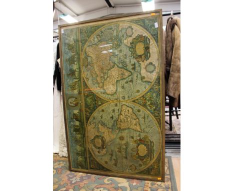


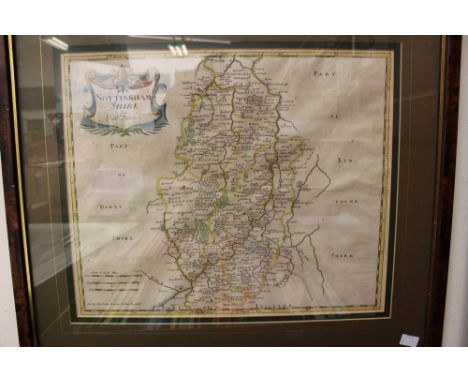

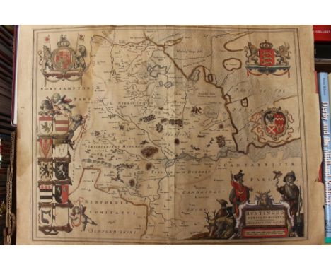
Lot 3035
Derbyshire interest: 'Darbieshire Described 1610' antiquarian map, John Speed, copper engraving on laid paper, hand-coloured, framed, glazed to recto and verso. Together with 'Huntingdonensis Comitatus', J. Blaeu, copper engraving on laid paper, hand coloured, unframed. Also 'A Catalogue of Old Maps' P.J. Radford (3)


Lot 10
2 maps of Luxembourg & Low Countries, including De Vaugondy, Gilles Robert Carte du Duché de Luxembourg dans laquelle on trouve la partie Meridionae & Limitrophe. 1753. Engraved map, some hand-colouring, framed and glazed; Vivien, L. Carte du Royaume des Pays-Bas. Paris: Menard & Desenne, 1824. Engraved map, hand-coloured in outline, 42 x 31cm., framed and glazed (2)

Lot 11
3 maps, comprising du Val d'Abbeville, F Isles d'Amerique dites Caribes et Antilles et de Barlovento. Paris, chez l'autheur, 1677. Engraved map, hand-coloured, 36 x 28cm., framed and glaze; Germania Inferior. Engraved map, hand-coloured, 20 x 26cm., framed and glazed; Moll, Herman Africa, according to ye newest and most exact observations. Engraved map, hand-coloured in outline, framed and glazed (3)


Lot 148
Miscellaneous books, a large quantity, including Huxley, T.H. Life and Letters. 1900. 2 volumes, 8vo, red morocco gilt by Hatchards, g.e.; Wallace, A.R. Island Life. 1892. Second edition, 8vo, original cloth; Paterson, Daniel A New and Accurate Description of all the direct and principal cross roads in England and Wales. 1775. 8vo, folding map, contemporary calf; Piper, E. The Church Towers of Somerset. Bristol, [n.d.] Vol. 2 only, limited to 225 copies, folio, red half morocco gilt, t.e.g.; Sopwith, T. An account of the mining districts of Alston Moor, Weardale and Teesdale. Alnwick, 1833, folding map, contemporary cloth; Templeton, W. The Engineer's Common-place Book. 1839. 4 folding plates, original cloth, spine worn; Mawe, John Familiar Lessons on Mineralogy and Geology. 1822. 8vo, hand-coloured plates, original boards, uncut, spine worn; Cobbett, William Cobbett's Sermons. 1822. 12mo, contemporary half calf, neatly rebacked; Cobbett, William Cottage Economy. 1822. Stereotype edition, original boards, uncut, rubbed; Bruce, J.C. The Roman Wall. 1851. 4to., plates, folding maps, contemporary red half morocco gilt; Marshall, A.B. The Book of Ices. [c.1850], 8vo, 4 plates, original cloth; Carroll, Lewis [Charles Luttwidge Dodgson] Feeding the Mind. London, 1907. 12mo, original paper wrappers; Lang, Andrew The True Story Book. London, 1893. Second edition, 8vo, blue cloth gilt; and a quantity of miscellaneous books; sold not subject to return
Lot 155
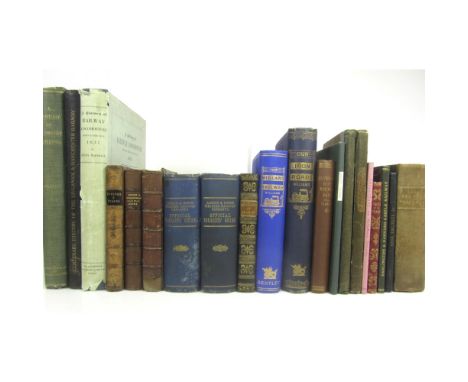
Railways and Tramways, a large collection including Clay, R., printer Report of the Directors of the Northern & Eastern Railway Company, incorporated 1836, to the Proprietors at their first General Meeting. 1836, disbound, folding map, housed in folding cloth covers; Wood, Nicholas A Practical Treatise on Rail-Roads. 1832. plates, contemporary cloth, some spotting, hinge broken; Osborne, E.C. & W. Osborne's Guide to the Grand Junction. Birmingham, 1838, folding map, original cloth; The Railway and the Mine Lever's Illustrated Year Book. 1861. 8vo, plates, original red cloth gilt; Grahame, Thomas A Guide to the North Midland and Midland Counties Railways. Leicester, 1842, folding map, engraved plates, bound with The History and Antiquities of Eyam, 1842; Day, J. A Practical Treatise on the Construction and Formation of Railways. 1848. Third edition, 8vo, original cloth; [Head, F.B.] Stokers and Pokers. 1849, 3rd edition, half calf; Osborne, E.C. & W. Osborne's London & Birmingham A treatise on Internal Intercourse and Communication in Civilised States. London, 1834, First edition, presentation copy from the author, original cloth-backed boards, uncut; Cundy, N.W. Inland Transit. The Practability, Utility and Benefit of Railroads. 1834. Second edition, 8vo, folding plate & 2 folding maps, original quarter cloth, rubbed; Lardner, D. The Steam Engine. 1840, frontispiece, original cloth; Railway Guide. Birmingham, [c.1845], 12mo, folding map loose, engraved plates, half calf; [Lever, C.] Tales of the Trains. 1845, 12mo, original pictorial cloth gilt; Measom, G. The Official Illustrated Guide to the North-Eastern, North British..... Glasgow, [n.d.], 8vo, half calf, cover detached; Young, F.T. The Economy of Steam Power on Common Roads. [1860], folding plate, illustrations, original cloth [Partridge, S., publisher] The Route of the Shrewsbury & Hereford Railway. 8vo, folding map, original wrappers, rubbed; Shaw, G. The Official Tourists' Picturesque Guide to the London & North Western Railway. [c.1875], 2 copies, maps, original blue cloth gilt, one rubbed; Kent, W., publisher History of the Darlington & Barnard Castle Railway. 1877. original blue calf gilt; Williams, F.S. Our Iron Roads. 1883, 8vo, original cloth, slightly rubbed; Williams, F.S. The Midland Railway. 1888. 8vo, original blue cloth gilt; Baker, E., publisher A Handbook to various publications, documents and charts connected with the rise and Development of the Railway System. 1893, 12mo, original upper wrapper bound in, quarter cloth; Grinling, C.H. The History of the Great Northern Railway. 1898; Clarke, S. Clitheroe in its Railway days. Clitheroe, 1900, 8vo, original cloth; Tomlinson, W.W. The North Eastern Railway. Newcastle, 1914. 4to; Steel, W.L. The History of the London & North Western Railway. 1914; Warren, J.G.H. A Century of Locomotive Building by Robert Stephenson & Co., 1823-1923. 1923, 4to., original cloth; MacDermot, E.T. History of the Great Western Railway. 1927. 2 volumes; Marshall, C.F.D. Centenary History of the Liverpool. & Manchester Railway. 1930. 4to, original cloth; Marshall, C.F.D. A History of Railway Locomotives down to the end of the year 1831. 1953. 4to, dustwrapper; Bourne, J.C. Bourne's London & Birmingham Railway. 1970, folio, original cloth, dustwrapper, glassine sleeve; and others, similar; sold as a collection not subject to return

![Collection of 10 maps, including Saxton, C. Barkshyre. [c.1637] and Huntingdon [c.1637], foot of map trimmed; Blome, Richard](https://cdn.globalauctionplatform.com/f7ecc0c4-f95b-425e-aa5a-a75201035f2b/826b3afa-60c6-49c4-ed85-339302e5798b/468x382.jpg)
Lot 18
Collection of 10 maps, including Saxton, C. Barkshyre. [c.1637] and Huntingdon [c.1637], foot of map trimmed; Blome, Richard A Mapp of Hartfordshire, [c.1673], engraved map hand-coloured in outline; Modern, Robert Essex; Middlesex; Buckinghamshire; Cheshire. Engraved maps, hand-coloured in outline, with accompanying text from Camden's Britannia (1722); Cary, J. A map of Surry from the best authorities. Engraved map, hand-coloured, with accompanying text from Camden's Britannia (1787); Smith, C. A New Map of the County of Berks. 1804, Corrected to 1808. Hand-coloured engraved map; Smith, C. A New Map of the County of Cambridge. 1804, corrected to 1808, hand-coloured engraved map; and 3 small engravings; Domesday Book Or the Great Survey of England. Facsimile of the part relating to Cheshire. 1861. 4to., original cloth gilt (14) Provenance: Appleby Castle Library, Appleby Castle, Westmorland

Lot 19
Cruchley, G., Mapseller Cruchley's New Plan of London, shewing all the new and intended improvements to the present time. [Slipcase lettered "Cruchley's New Plan of London, in Miniature, improved to 1828"], engraved map partly hand-coloured, dissected and backed on linen, 438 x 615mm., slipcase worn
![Bassandyne Bible [The Bible and Holy Scriptures... Edinburgh: Alexander Arbuthnot [and Thomas Bassandyne], 1579.] Small foli](https://cdn.globalauctionplatform.com/f7ecc0c4-f95b-425e-aa5a-a75201035f2b/8bd0b53f-9a24-43c6-cd12-d0d6520e0f8e/468x382.jpg)
Lot 191
Bassandyne Bible [The Bible and Holy Scriptures... Edinburgh: Alexander Arbuthnot [and Thomas Bassandyne], 1579.] Small folio, one map of Canaan only, lacking one map and one plan, woodcut illustrations throughout, inscribed Wm M? on free endpaper verso dated February 22nd 1892, 16th or early 17th century embossed panelled calf and banded spine, title-page lacking and substituted with late 19th century replacement, lacking all leaves before ai (i.e. title and 9 leaves), xvi-z8 lacking (i.e. final 15 leaves), foxing, significant repairs to all leaves up to dv with some loss to text to initial leaves in particular, final 2 leaves of the New Testament repaired with some significant loss, soiling and other repairs with some throughout, some text obscured, a few small holes, including wormholes, throughout with some loss to text, some dampstaining, upper cover detached, lower joints split, covers and spine worn [ESTC S122098; Darlow & Moule (Rev. 1968), 158] Provenance: Inscription to final leaf of Revelation reads: "This buik apperteins to Johne Duncane"; Sir William Fettes Douglas, sold as lot 399 in the sale of his books on 7th December 1891; Ownership signature of John Glasse, Reverend of Greyfriars Tolbooth & Highland Kirk, Edinburgh, to endpaper verso beneath inscription; thence by descent. Note: Known as the 'Bassandyne Bible', after the Edinburgh printer Thomas Bassandyne, this was "the first complete Bible to be printed in Scotland" [http://www.nls.uk/collections/rare-books/collections/bibles]. Bassandyne had produced the New Testament in 1576, the title-page bearing this date, and following his death in 1577, the Old Testament was added and the complete work published by Alexander Arbuthnot in 1579.
Lot 192
Bible in English - the "Great She Bible", 1611 The Holy Bible Conteyning the Old Testament and the New. London: Robert Barker, 1611. Second folio impression with "she" reading in Ruth 3:15 and 'Judas' for 'Jesus' in Matthew 26:36 (this error corrected by hand), 20th century embossed brushed calf, the remains of the contemporary 17th century binding in the same style accompany the book, lacking 15 leaves comprising the 13 initial and 2 final leaves (all replaced in facsimile), lacking map, some small rust-holes on C6-D3 slightly affecting engraved headers, some dust-soiling throughout (particularly where thumbed to lower right corners) and light damp-staining to several leaves, large closed tear to upper corner of Ll5 (c.12cm), hole to Qq6 with loss to a few words, Kkk1 badly torn with lower quarter to a third of the leaf lacking, almost-closed tear to 2L1 (New Testament) with only slight loss to text, almost-closed tear to Z1 (New Testament) reaching across the page with slight loss to some letters, with a similar tear to Z3, upper corner of 2A2 torn with some loss to text, with a similar tear to 2A4 [Darlow & Moule 309, the Genealogies without the large cut of the Royal Arms] Provenance: Genealogy of the Mosley family of Radford, dating from 1805-1847, written to verso of Bbb3; this is continued to 1886 on the verso of Lll6; this is continued to 1951 on the verso of the New Testament title-page
Lot 217
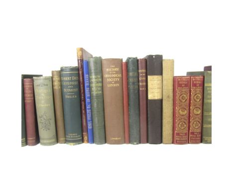
Coal Mining and Geology, a collection, including Dunn, M. A Treatise on the Winning and Working of Collieries. Newcastle, 1852. 13 plates and plans (1 folding), original cloth; [Holland, John] The History and Description of Fossil Fuel, the Collieries, and Coal Trade of Great Britain. 1835.First edition, original cloth; Mantell, G.A. The Medals of Creation. 1844. 2 volumes, plates, original red cloth gilt; Mantell, G.A. The Wonders of Geology. 1848. Sixth edition, 2 volumes, frontispiece, illustrations, original cloth, slightly soiled; Bryce-Wright's Catalogue of Mineralogical, Geological, Conchological & Archaeological Specimens. 8vo, plates, some coloured, original cloth; Anderson, J. The Course of Creation. 1850. 8vo, original cloth; Taylor, J. Geological Essays. 1864, original cloth; Hull, E. The Coal-Fields of Great Britain. 1861. 8vo, original cloth; Archier, M. A Sketch of the History of the Coal Trade of Northumberland and Durham. Part 1 (all published), with ALS from the author loosely inserted, original cloth; Greenwell, G.C. A Glossary of Terms used in the Coal Trade of Northumberland and Durham. 1888. 8vo, half calf; Duff, Joseph Notes and Investigations of the Coal Fields... of South Durham. Bishop AUckland, 1885. 8vo, folding map, original cloth; Smiles, Samuel Robert Dick... geologist and botanist. 1878, presentation copy to J.S. Smiles; Woodward, H.B. The History of the Geological Society of London. 1908; and others, similar (quantity); sold as a collection not subject to return
Lot 236
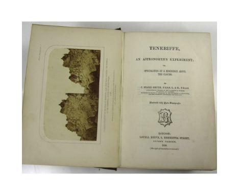
Tenerife - Astronomy - Smyth, C. Piazzi Teneriffe, an Astronomer's Experiment. London: Lovell Reeve, 1858. First edition, 8vo, map, 20 photo-stereographs by A.J. Melhuish, half-title, 2 +24 +16 +3pp. advert. at end, original pictorial maroon cloth gilt, the binding a little damp-soiled and marked, armorial bookplate of Henry Reginald Corbet
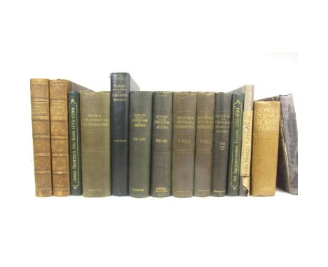
Lot 238
Aberdeen, a collection of 13 volumes, including Kennedy, William Annals of Aberdeen. London, 1818. First edition, 2 volumes, 4to., 1 folding plate, contemporary half calf, slight wear to joints; Selections from the Records of the Kirk Session, Presbytery and Synod of Aberdeen. Aberdeen: Spalding Club, 1846; Extracts from the Council Register of the Burgh of Aberdeen 1398-1570 & 1570-1625. Aberdeen, 1844-48. 2 volumes, 4to.; Fasti Aberdonenses. Selections from the Records of the University and King's College of Aberdeen 1494-1854. Aberdeen, 1854. 4to., frontispiece; Registrum Episcopatus Aberdonensis. Edinburgh, 1845. 2 volumes, 4to., chromolithographed plates; Henderson, J.A. History of the Parish of Banchory-Devenick. Aberdeen, 1890. 4to., number 34 of 50 large paper copies, with slip signed by the author tipped in, plates, folding map, original buckram, t.e.g., a trifle rubbed; Walker, R.S. James Beattie's Day-Book 1773-1798. Aberdeen, 1948. 4to, plates, quarter cloth; Hamilton, H. Life and Labour on an Aberdeenshire Estate 1735-1750. Aberdeen, 1946, quarter cloth; [Aberdeen] Epistolare in usum ecclesiae cathedralis Aberdonensis. Edinburgh, 1924. 4to., original buckram, dustwrapper frayed; Burns, Robert The Songs & Poems. Edinburgh: T.N. Foulis, 1913. Large 8vo, plates, original buckram, t.e.g., upper hinge weak (13)
Lot 240
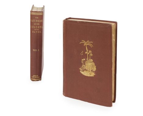
Bates, Henry Walter The Naturalist on the River Amazons. London: J. Murray, 1863. First edition, 2 volumes, 8vo, folding engraved map, 9 engraved plates, 32pp. advertisements at end of volume 1, original brown cloth gilt, blindstamp to titles and bookplates of American Antiquarian Society, blank leaf before title holed, very slightly rubbed
Lot 244
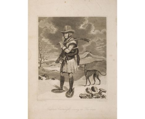
Cartwright, George A Journal of Transactions and Events during a Residence of Nearly Sixteen Years on the Coast of Labrador. Newark: Allin and Ridge, 1792. 3 volumes, 4to., frontispiece, 3 folding maps, 15pp. Poetical Epistle, modern green half morocco gilt with red morocco gilt labels to spines some occasional foxing, folding maps in volumes 2 & 3 repaired, occasional ink stains, mainly to fore-edges, some light dampstaining to map in volume 3, occasional light dust-soiling, a little rubbing to spine labels [ESTC T133714] (3)
Lot 247
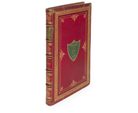
Coal Mining, Northumberland & Durham- Fordyce, William A History of Coal, Coke, Coal Fields, Progress of Coal mining... Iron, its ores and processes of Manufacture London: Sampson Low, 1860. First edition, large folio, presentation copy inscribed by the author to Robert Henry Allen Esq., in a presentation binding, large folding hand-coloured map, 32 steel engraved views, and 2 tables printed in red and blue, plates with tissue guards, contemporary red morocco gilt, with green morocco lettering piece on cover and spine, gauffered edges, watered silk endpapers, some spotting, lightly rubbed

Lot 249
Cook, James, Captain Captain Cook's Voyages Round the World. Newcastle: Printed by M. Brown, 1790. 2 volumes, 8vo, portrait, folding map and 49 plates, contemporary calf rebacked with modern spines, some offsetting and darkening, a little marginal worming to volume 1 and slight worming to boards, front free-endpaper of volume 2 repaired, covers a little rubbed [ESTC N26645] (2) Provenance: Ownership signature of J. Fishburn to title-pages.

Lot 250
County and Town Guides, a collection including Jenkins, A. The History and Description of the City of Exeter. Exeter, 1806. 8vo, 2 maps, plan, 7 plates, original boards, uncut, upper joint split; Woolmer, E., printer A Concise Account of the City of Exeter. Exeter, 1821. 12mo., original boards with printed label, uncut, rubbed; Birdsall, James, publisher The History of Northampton. Northampton, 1831, 12mo, frontispiece, contemporary quarter cloth; Carrington, H.E. The Plymouth and Devonport Guide. Devonport, 1830. 12mo., 4 plates, list of subscribers, original cloth, rubbed; Moncrieff Moncrieff's Guide to Leamington Spa. Leamington, 1830. 12mo., 2 maps, 10 plates, original quarter cloth; Slatter, H., publisher The Oxford University and City Guide. Oxford, 1827. 12mo, folding map and 8 plates, original wrappers, slightly rubbed; Rees, W.J. The Hereford Guide. Hereford, 1827. 12mo., engraved plates, original cloth; Fosbrooke, T.D.The Wye Tour or Gilpin on the Wye. Ross, 1818. 12mo, frontispiece and 2 plates, original boards, uncut, slightly rubbed; Deighton, J, publisher A Guide through the University of Cambridge. Cambridge, 1820. 12mo, folding plan, original boards with paper label, uncut, rubbed; Rooke, O. The Channel Islands. 1856. 8vo, original pictorial cloth gilt; Croydon, E., publisher The Handbook for Torquay. Torquay, 1854. 8vo, original cloth, head and tail of spine worn (11)

Lot 251
County Durham & Darlington, 5 volumes, including Longstaffe, W.H.D. The History and Antiquities of the Parish of Darlington. 1854. Large 8vo, 11 engraved plates, pedigrees, red morocco gilt by Riviere, g.e.; Sharp, Sir Cuthbert A History of Hartlepool. Durham: F. Humble, 1816. presentation copy from the author, 8vo, engraved title, 19 engraved plates (2 folding, 3 coloured), double-page pedigree, errata leaf, original boards, uncut, rubbed at head of spine; Sopwith, T. An Account of the Mining Districts of Alston Moor, Weardale and Teesdale, in Cumberland and Durham. Alnwick, 1833. Signed by the author on title, coloured engraved map, adverts. at end, original cloth; [Teesdale] A Glossary of Provincial Words used in Teesdale. 1849, 12mo, plan, original cloth; Wallace, W. Alston Moor. 1890, plates, original cloth (5)

Lot 253
Durham - Mackenzie, Eneas & M. Ross An Historical, Topographical and Descriptive View of the County Palatine of Durham. Newcastle upon Tyne: Mackenzie & Dent, 1834. 2 volumes, 4to., map and 19 engraved plates, list of subscribers, contemporary green half calf, morocco labels, joints rubbed or partly split

Lot 254
English Lake District, a collection, including Allison, J., printer Allison's Northern Tourist's Guide to the Lakes. Penrith, 1837. 8vo, folding engraved map, original pictorial cloth; Otley, Jonathan A Concise Description of the English Lakes. Keswick, 1834. 12mo, folding map, illustrations, original cloth, binding slightly soiled/faded; Black, A. & C. Black's Picturesque Guide to the English Lakes. Edinburgh, 1844. 8vo, maps (1 folding) & plates, original red cloth gilt, rubbed; another edition. 1858, original cloth gilt; Garnett, J., publisher The Tourist's Atlas of the Lake District. Windermere, [c.1854], 8vo, maps (1 in pocket), plates, original cloth; Postlethwaite, J. Mines and Mining in the Lake District. Leeds, 1889. 8vo, folding map, plates, original cloth; Crowther, J., publisher The unrivalled Album of ... Views of Grassington, Upper Wharfedale. Grassington, [c.1870]; Otley, J. A Correct Map of the Lake District. Keswick, c.1837. hand-coloured folding map, original slipcase; Bicknell, P. The Picturesque Scenery of the Lake District 1752-1855. 1990. 4to., dustwrapper (9)
![Gloucestershire and Cheltenham, Somerset, Bath and Bristol, 10 volumes including [Moreau, S.] A Tour to Cheltenham Sap. Bath](https://cdn.globalauctionplatform.com/f7ecc0c4-f95b-425e-aa5a-a75201035f2b/d029e3ce-4df5-4251-dc2a-0e5c4889d646/468x382.jpg)
Lot 256
Gloucestershire and Cheltenham, Somerset, Bath and Bristol, 10 volumes including [Moreau, S.] A Tour to Cheltenham Sap. Bath, 1783. 12mo., original boards, rubbed; [Dyde, W.] The History and Antiquities of Tewkesbury. Tewkesbury, 1790. 8vo, half-title, frontispiece, 3 plates, folding plan, contemporary half calf, rubbed; New edition of the Cheltenham Guide with Map and Views. [n.d.], 2 maps, frontispiece, 6 plates, advert at p.102, contemporary half calf, rubbed; Fosbroke, T.D. A Picturesque and Topographical Account of Cheltenham. Cheltenham, 1826. half-title, folding plan, original boards, uncut; Lee, John, publisher A New Guide to Cheltenham. Cheltenham, [c.1840, 12mo, original cloth-backed boards, spine cracking; Johnson, G.P., engraver Johnson's New Historical and Pictorial Cheltenham and County of Gloucester Guide. Cheltenham, [c.1845], 12mo, 2 maps, 40 plates, original boards, rubbed; Black, A. & C. Black's Guide to Gloucestershire. 1871, original cloth; Rutter, J. Delineations of the North Western Division of the County of Somerset. 1829. 8vo, frontispiece, 11 plates, 1 folding map, contemporary half calf; [Bath] The Original Bath Guide. Bath: Meyler & Son, [c.1838]. 12mo, folding map (small tear), engraved plates, original printed boards; Chilcott, J., publisher Chilcott's New Guide to Bristol. Bristol, 1826, 12mo., frontispiece, 2 folding plans, original printed boards, uncut, upper joint split (10)


Lot 27
Lincolnshire - Greenwood, C. & J. Map of the County of Lincoln from an actual survey, made in the years 1827 & 1828. Greenwood & Co., 1830, engraved map on 2 folding sheets, hand-coloured in outline, dissected and backed on linen, edged with green silk, contemporary calf pull-off case, slight offsetting, case rubbed
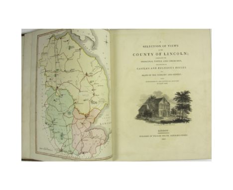
Lot 271
Lincoln - Howlett, Bartholomew A Selection of Views in the County of Lincoln. London: W. Miller, 1805. First edition, 4to., large paper copy (340 x 270mm.), list of subscribers, engraved title vignette, engraved dedication, hand-coloured map, 53 plates, vignettes, contemporary diced calf, gilt, neatly rebacked, spine gilt, corners rubbed
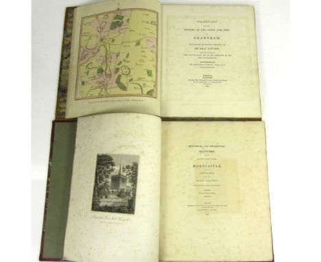
Lot 272
Lincolnshire, 2 volumes, comprising Turnor, Edmund Collections for the History of the Town and Soke of Grantham. London: W. Miller, 1806. First edition, 4to., large paper copy (338 x 267mm.), hand-coloured map and 8 plates, modern period style half calf gilt retaining original marbled sides, a little spotting; Weir, George Historical and Descriptive Sketches of the Town and Soke of Horncastle. London, 1820. First edition, 4to., large paper copy (350 x 275mm.), 8 engraved plates, vignettes, contemporary red half calf gilt, some spotting, rubbed (2)
Lot 273
Lincolnshire, a large collection, including Gough, R. The History and Antiquities of Croyland-Abbey in the County of Lincoln. 1783. 4to., engraved plates, extra-illustrated with additional plates and a pen and ink sketch, signed "J. Buck delin."; Stark, Adam The History of Lincoln. Lincoln, 1810. 12mo., frontispiece & 14 plates, quarter calf, rebacked; Yeoman, Thomas The Report of Thomas Yeoman, Engineer, concerning the Drainage of the North Level of the Fens. [No printer or publisher, 1769], 4to., folding chart, ?original wrappers; Pegge, S. Memoirs of the Life of Roger de Weseham, Dean of Lincoln. 1761, 4to., title dust-soiled, 2 works in one volume, contemporary half calf, rebacked retaining spine, corners rubbed; [Taylor and Hessey, publishers] The History of Lincoln. Lincoln, 1816. 8vo, frontispiece & 3 plates, original boards, uncut, joints splitting, head and base of spine worn; Weir, George Historical and Descriptive Sketches of the Town and Soke of Horncastle. 1822. Second edition, engraved plates, contemporary suede, title & frontispiece loose, head of spine worn, joints splitting; Stark, Adam The History and Antiquities of Gainsburgh. 1817. 8vo, folding map, 4 plates, folding genealogy, near contemporary cloth, original label on spine, uncut, slightly spotted; Creasey, J. Sketches, illustrative of the Topography and History of New and Old Sleaford. Sleaford, 1825, list of subscribers, plates and illustrations, original boards, uncut, some spotting, rebacked; Oldfield, Edmund A Topographical and Historical Account of Wainfleet. 1829. 8vo, 7 plates, vignettes, contemporary quarter cloth, uncut; Walker, N. & T. Craddock. The History of Wisbech. Wisbech, 1849. 8vo, engraved plates, folding plan, original decorative cloth gilt; Thompson, P. The History and Antiquities of Boston. Boston, 1856. plates, green morocco, spine gilt; Fletcher, T.C. Read's History of the Isle of Axholme. Epworth, 1858. Hand-coloured folding plans, plates, contemporary diced calf, upper joint splitting; [Bowstead R.] The very extraordinary case of a Clergyman, in consequence of an inclosure. Hull: Goodwill and Lawson, [?1834], 12mo., hand-coloured plan, disbound, clean; [Boston & Fens, pamphlets] a Collection of 16 pamphlets, most with Lynn or Boston imprints, a few with wrappers, bound in one volume, supposedly from the collection of Pishey Thompson the Boston historian, c.1812-1851, contemporary half calf; [Bayley, R.S.] Notitiae Ludae, or Notices of Louth. Louth, 1834. 8vo, folding plan & 5 plates, original boards, plan loose, rubbed, spine slightly split; Ball, H.W. The Social History and Antiquities of Barton-upon-Humber. Barton-upon-Humber, 1856. 8vo, plates, original cloth; Trollope, E. Sleaford. 1872. 8vo, plates, illustrations, original cloth gilt; Hall, J.G. Notices of Lincolnshire. Hull, 1890, 8vo, coloured plates, original cloth; Walcott, M.E.C. Memorials of Stamford. Stamford, 1867, engraved plates, original cloth; Tomlinson, J. The Level of Hatfield Chace and parts Adjacent. Doncaster, 1882. Folio, plates, original cloth, t.e.g.; and 10 more modern volumes relating to Lincolnshire (27)
![Marshall, [William] The Rural Economy of the West of England, including Devonshire; and parts of Somersetshire, Dorsetshire](https://cdn.globalauctionplatform.com/f7ecc0c4-f95b-425e-aa5a-a75201035f2b/0a6359d9-3fa9-44ff-dbc1-264ba03b70c1/468x382.jpg)
Lot 276
Marshall, [William] The Rural Economy of the West of England, including Devonshire; and parts of Somersetshire, Dorsetshire and Cornwall... London: G. Nicol..., 1796. First edition, 2 volumes, 8vo, folding map, contemporary tree calf, bookplates of Joseph Radcliffe, some browning [ESTC T94233] (2)
![Lincolnshire Maps - A Large Collection including Speed, John The Countie and Citie of Lincolne described. [1610], Double-pag](https://cdn.globalauctionplatform.com/f7ecc0c4-f95b-425e-aa5a-a75201035f2b/ae3749ed-869c-4a05-faff-49ecc7aae721/468x382.jpg)
Lot 28
Lincolnshire Maps - A Large Collection including Speed, John The Countie and Citie of Lincolne described. [1610], Double-page engraved map, 2 copies, coloured and uncoloured, (coloured copy strengthened on verso with slight split, no loss), English text on verso, (414 x 536mm.); Bowen, Emmanuel. An Accurate Map of Lincolnshire.. for R. Sayer, T. & J. Bowles, 1750, (727 x 560mm.); A New Map of the County of Lincoln. London: C. Smith, 1801, (650 x 518mm.); Blaeu, Johannes Lincolnia Comitatus. Anglis Lincoln-shire. [c.1648 and 1670], 3 copies, hand-coloured double page maps, one with Dutch text on verso, one with French text on verso, one with no text on verso (641 x 528mm.); Bowen, E. An Accurate map of Lincoln Shire. Printed for T. Kitchin, hand-coloured in outline, (575 x 460mm.); Cary, J. A Map of Lincolnshire. J. Stockdale, 1805, 2 copies, (580 x 482mm.); Mordern, Robert Lincolnshire. 3 copies, (417 x 490mm.); Ogilby, John The Road from Nottingham to Grimsby, hand-coloured engraved strip map, (380 x 453mm.); Saxton, C. & W. Kip. Lincolniae Comitatus, [c.1710], uncoloured, (320 x 370mm.); Walker, J. & C. Lincolnshire. Longman [&c.], 1835, hand-coloured map, 420 x 345mm.); Kitchin, T. Lincolnshire drawn from the best Surveys & Maps, hand-coloured in outline; and 32 small later maps or road maps relating to Lincolnshire, and 11 miscellaneous later maps

Lot 280
Newcastle and Northumberland, 8 volumes, comprising Reid, D.B. Health of Towns Commission. Report on the State of Newcastle-upon-Tyne and other Towns. 1845, 8vo., 21 plates (19 folding, 20 coloured), half calf; [Pamphlets] 7 local pamphlets including Bruce, J.c. The Wall of Hadrian. Newcastle, 1874 and Carr-Ellison, R. On the large Roman Altar, [c.1875], 2 albumen prints; half calf gilt; Hutton, W. The History of the Roman Wall. 1813. Second edition, 8vo, map and 9 plates, contemporary half calf; Garbutt, George A Historical and Descriptive View of the Parishes of Monkwearmouth & Bishopwearmouth and the Port and Borough of Sunderland. Sunderland, 1819. 8vo, engraved title, folding map, folding pedigree & 4 plates, half calf, joints splitting; [Bewick, Thomas] An Account of the Great Floods in the Rivers Tyne, Tees, Wear and Eden, &c. in 1771 and 1815. Newcastle: E. Charnley, 1818. [One of 300 copies], 12mo in 4s, wood-engravings, 19th century half calf gilt; Oliver, Thomas A New Picture of Newcastle upon Tyne. 1831. 12mo, 2 folding plans, 1 folding plate, contemporary half calf, slightly rubbed; Glynn, E. Sketches of Oldminster. Newcastle, 1858. 8vo, 19th century half calf, rubbed; [Newcastle Water Supplies] Prospectus of an intended Joint Stock Company, to be called the Whittle Dean Water Company, and to be formed for the purpose of supplying the Towns of Newcastle Upon Tyne and Gateshead.. with pure water. Newcastle: printed at the Courant Office, 1845. 8vo, folding part-coloured engraved plan, Rare; bound with 2 others, related, contemporary half cloth (8)
Lot 281
Newcastle and Northumberland, a collection, including Charnley, Emerson, publisher An Account of the Great Floods in the Rivers Tyne, Tees, Wear, Eden. Newcastle, 1818, 12mo, woodcuts by Thomas Bewick, wrappers; [Davison, W.] The History of Alnwick, the County Town of Northumberland. Alnwick, 1813, signed by the author on title, original quarter cloth; Tunbelly, Tim The Letters. Newcastle, 1823, frontispiece, half calf; The River Committee Papers relating to the River Tyne. 1836, 8vo, original wrappers; Richardson, M.A. Richardson's Descriptive Companion through Newcastle Upon Tyne. 1838, folding plan, original cloth; [Bruce, E. & T., publisher] A Guide to the Castle of Newcastle Upon Tyne. 1847, original cloth; Oliver, T. The Topographical Conductor or Descriptive Guide to Newcastle & Gateshead. 1851, folding plan, original cloth; [Routledge, G. ,publisher] A Record of the Great Fire in Newcastle and Gateshead. 1855, 8vo, original cloth, worn; Christie, John Christie's Handy Guide to the places between Newcastle and Carlisle Railway. Newcastle, 1863; Bruce, J.C. Hand-book to Newcastle-on-Tyne. 1863, folding map and plan, original cloth; Plummer, B. Newcastle-Upon-Tyne. 1874, plans and maps, several folding; and 14 others, related; sold not subject to return (c. 25 volumes)

Lot 285
Northumberland - Mackenzie, Eneas An Historical, Topographical and Descriptive View of the County of Northumberland. Newcastle, 1825. 2 volumes, 4to., 17 plates and maps (1 folding; only 15 called for), contemporary half calf, spines gilt; Bruce, J.C. The Hand-Book to the Roman Wall. 1884. Second edition, 4to., 13 plates, folding map, contemporary half morocco, neatly rebacked retaining spine, t.e.g. Neasham, G. The History and Biography of West Durham. 1883. 4to., parts 1-5 in one volume (all published), plates, later half calf gilt; Leeds Illustrated, 1892. 4to, original cloth; Scruton, W. Pen and Pencil Pictures of Old Bradford. Bradford, 1889. 8vo, modern half calf gilt (6)
![Maps, including Malby, Thomas Map of the County Palatine of Durham. [c.1859] Folding map, hand-coloured, dissected and backe](https://cdn.globalauctionplatform.com/f7ecc0c4-f95b-425e-aa5a-a75201035f2b/a62904dd-a29e-4ae0-fa27-ad103c92bb41/468x382.jpg)
Lot 29
Maps, including Malby, Thomas Map of the County Palatine of Durham. [c.1859] Folding map, hand-coloured, dissected and backed on linen, folding into cloth covers; Shadforth & Dinning. Map of the County of Northumberland. Newcastle, 1847, folding map, hand-coloured, dissected and backed on linen, morocco slipcase; another copy, 1848, folding map, hand-coloured, dissected and backed on linen, morocco slipcase (bottom detached); Bowen, Emanuel An Accurate Map of the West Riding of Yorkshire. J. Bowles, [c.1760], folding map, hand-coloured in outline, dissected and backed on linen, slipcase; Smith, C. A New Map of England and Wales. 1804, folding map, hand-coloured, dissected and backed on linen, slipcase worn; Walker, J. & C. Walker's Northern Counties, 6 folding maps, hand-coloured in outline, dissected and backed on linen, cloth slipcase; Bowles & Carver Bowles's Road Director through England and Wales. Folding map, hand-coloured, dissected and backed on linen, marbled slipcase; Cruchley, G.F. Cruchley's Travellers Companion through England and Wales. [c.1860], folding map, dissected and backed on linen; Black, A. & C. Black's Road & Railway Travelling Map of Scotland. [c.1860], folding map, coloured, dissected and backed on linen; and 1 Walker map of Middlesex (10)

Lot 293
Scotland, a collection including Vindication of the Clanronald of Glengary… Edinburgh: W. & C. Tait, 1821. 8vo, contemporary calf; Criminal Trials, illustrative of the tale entitled "The Heart of Mid-Lothian"…including particulars of the life of Captain John Porteous. Edinburgh, 1818. 8vo, original boards; Pinkerton, John An Enquiry into the History of Scotland… Edinburgh, 1814. 2 volumes, 8vo, lacking a map, modern red quarter morocco; McCrie, Thomas Life of Andrew Melville. Edinburgh, 1824. 8vo, 2 volumes bound as one, embossed green cloth; Highland Society of Scotland Prize Essays… Edinburgh, 1812. 2 volumes, second edition, 8vo, contemporary half calf; [Idem] Prize-Essays… Edinburgh, 1829. 2 volumes, 'New Series', 8vo, contempoary half calf; Minute Book of the Board of Green Cloth, 1809-1820… Glasgow: James Maclehose & Sons, 1891. 8vo, out-of series copy of 150 copies, original blue cloth; Stewart, David Sketches of the Character, Manners and Present-State of the Highlanders of Scotland… Edinburgh, 1825. Third edition, 2 volumes, 8vo, contemporary half calf; and a collection of others, sold not subject to return (quantity)
Lot 297
Stukeley, William Itinerarium Curiosum, or an Account of the Antiquities and remarkable Curiosities in Nature or Art, observed in Travels through Great Britain. London: Baker & Leigh, 1776. Second edition, 2 volumes, folio, 2 frontispieces, 206 plates, and folding map, [vol. 1: frontispiece, plates 1-100, + a second plate also numbered 51, + an unnumbered mezzotint; vol. 2: frontispiece, unnumbered map, 103 plates + a second plate also numbered 77], contemporary diced calf tooled in gilt and blind, g.e., neatly rebacked, a little light spotting, upper joint of vol. 2 split at head

Lot 298
Sussex, Kent and Hampshire guides, 9 volumes, including Evans, John Picture of Worthing. Worthing, 1814. 2 volumes, 12mo., frontispieces, folding plan (short tear), original boards, uncut, slightly rubbed; Miller, W. Jottings of Kent. Gravesend, 1871, 8vo, original printed boards; [Diplock, W., publisher] The Handbook for Hastings, St. Leonard's and their Neighbourhood. Hastings, 1845. 8vo, folding map, original cloth, map and title loose; The Hastings Guide. Hastings: W. Diplock, [c.1833]. 7th edition, 8vo, map, 14 plates, contemporary cloth; another edition. [c. 1833], 7th edition, lithographed plates numbered 1-5 and map (the plates differing from the preceding copy), original printed boards, rebacked, some spotting; Baker, T., printer A Companion in A Tour round Southampton. Southampton, 1799. 12mo., original boards, uncut, slightly rubbed; Baker, T., printer The Southampton Guide. Southampton, 1832. 12mo., 4 plates, vignette, original printed boards, Black, A. & C. Black's Guide to the Isle of Wight. 1869, original cloth (9)
Lot 301
Town and County Guides, a collection including Fletcher, J., printer A Concise History of the County and City of Chester. Chester, [1791], 12mo, folding plan, contemporary tree calf, head of spine rubbed; Ward, R. The Matlock, Buxton and Castleton Guide. Derby, 1814. 12mo, 19th century half calf; Broster, John A Walk round the Walls and City of Chester. Chester: for the author, [c.1820]. 12mo, frontispiece, title vignette, original boards, uncut, worn; [Gray, J.H., printer] A Companion to Charnwood Forest. Loughborough, [c.1838], 8vo, folding map, original cloth, slightly rubbed; Mott, F.T. Charnwood Forest. 1868. 8vo, folding map, coloured plates, original cloth; Cathrall, W. The History of Oswestry. Oswestry, [n.d.], 8vo, plates, original red cloth gilt; Wright, T. The Ruins of the Roman City of Uriconium. Shrewsbury, 1859. 12mo, lithographed plates, original cloth with label; Newling, T., printer The Shrewsbury Guide. Shrewsbury, 1808. 12mo., frontispiece, modern boards; [Price, William, publisher] The History of Oswestry. Oswestry, [c.1820], 8vo, frontispiece, title within woodcut border, woodcuts, contemporary half calf gilt; Robertson, W.H. A Hand-Book to the Peak of Derbyshire. Buxton, [c.1861]. 8vo, folding map, plates, original cloth gilt; Mozley, J. & C., publishers Matlock, Hardwick, South Winfield... Derby, [c.1859], 12mo, original orange cloth; Moore, H. Picturesque Excursions in the High Peak of Derbyshire. Derby, 1819. 8vo, plates, original printed boards, uncut, upper hinge split; Love, B. The Hand-Book of Manchester. Manchester, 1842. 8vo, engraved plates, original green cloth gilt; McNicoll, D.H. Handbook for Southport. 1859. 8vo., coloured plates, original red cloth gilt; Love & Barton, publishers Manchester as it is. Manchester, 1839. 12mo, frontispiece, 10 plates, double-page map, original cloth; Aston, Joseph A Picture of Manchester. Manchester, [n.d.]. 12mo, folding map, woodcuts, original boards, uncut; Moss, W. The Liverpool Guide. Liverpool, 1797. Second edition, 8vo, folding map, errata leaf, contemporary half calf; Murray, James The Travels of the Imagination. 1828. 12mo, portrait, original quarter cloth, rubbed, uncut; Hutton, W. A Description of Blackpool. 1804. Second edition, 8vo, half-title, errata leaf, contemporary half calf gilt; Lytham, History of. "Authorities: Leigh, Carlisle, Ashton, Baines &c., [n.d.]. 8vo, frontispiece, later wrappers; Ferguson, W. Alnwick Castle. Alnwick, 1860. 12mo, original cloth gilt; Thompson, W., publisher Land of Scott. Berwick upon Tweed, [1850]. 12mo., plates, original cloth gilt; Walker, T.D. Facts relative to the Medicinal Properties of the Dinsdale and Croft Sulphur Springs. Darlington, 1835. 12mo, 3 plates, folding plan, original cloth, and 1 other; sold as a collection not subject to return (23)
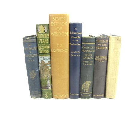
Lot 303
Travel, a collection, including Belt, Thomas The Naturalist in Nicaragua. 1874. First edition, 8vo, frontispiece, folding map, original blue cloth, rubbed; Edwards, A.E. Untrodden Peaks and Unfrequented Valleys. 1890. Second edition, 8vo, signed by the authoress, plates, folding map, original pictorial cloth gilt; Wakefield, P. A Family Tour through the British Empire. 1826. 12mo, coloured folding map, original boards, uncut, rebacked; Lawrence, T.E. Seven Pillars of Wisdom. 1935. 4to, original tan buckram, faded; Edwards, A.B. A Midsummer Ramble in the Dolomites. [1889], 4to., plates, original pictorial cloth; Waterton, C. Wanderings in S. America. 1893. 8vo, original cloth; Shackleton, E. The Heart of the Antarctic. 1910. 8vo, original cloth (7)
-
109182 item(s)/page