We found 109198 price guide item(s) matching your search
There are 109198 lots that match your search criteria. Subscribe now to get instant access to the full price guide service.
Click here to subscribe- List
- Grid
-
109198 item(s)/page


Lot 546
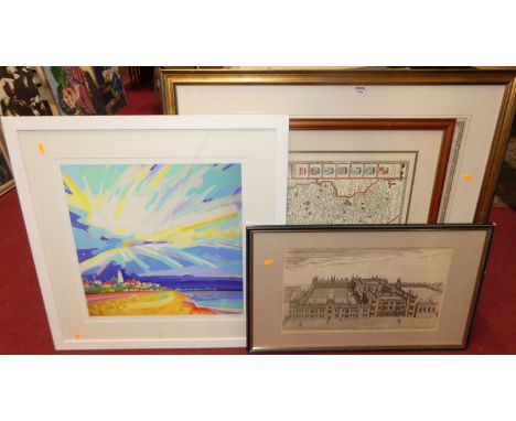
TWO BOXES AND LOOSE PAINTINGS AND PRINTS ETC, to include a Vic Bowcott landscape watercolour depicting Lichfield Cathedral across Stow Pool, approximate size 34cm x 53cm, an indistinctly signed Czech town view in winter, approximate size 21cm x 27cm, a Swedish print of a deer on hessian by Susan Jakobsson, a Reginald Smallindge etching depicting a fishing village, a Thomas Kitchin map of Devonshire together with assorted prints and reproduction maps

Lot 377
TWO CHINESE PAPER LEAF FANS, both Art Deco inspired design, one has a printed scene of two greyhounds chasing a hare in red, yellow and turquoise, 'Luna Park' printed in English above and in Chinese below, red and black banding on the reverse depicting the area map, the other fan has four stylised greyhounds chasing a hare 1234 below large yellow, turquoise and red 'Luna Park' lettering, the reverse has a red stylised hare and Luna Park in Chinese red lettering on a black and buff ground (2) (Condition report: both fans mechanism is still in working order, strong colours, very light wear to edges)


Lot 532
° ° Strickland, Agnes - Lives of the Queens of Scotland, vols 1-6 only, lacks vol. 7, engraved and printed titles, frontispiece, folded facsimiles; old half morocco and marbled boards, gilt decorated panelled spines and gilt tops, marbled e/ps., cr.8vo. 1850-; Aikman, James - A History of Scotland, translated from the Latin of George Buchanan ... 4 vols. frontispieces and coloured, folded map; old diced calf with gilt decorated panelled spines, marbled edges and e/ps. Glasgow & Edinburgh, 1827; Stevenson, Robert Louis - Memories and Portraits. 20th cent. half morocco and marbled boards, gilt lettered and panelled spine, ge., marbled e/ps., new impression, 1919 (11)


Lot 343
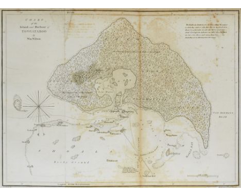
Ozeanien - Pazifik - - William Wilson. A Missionary Voyage to the southern Pacific Ocean performed in the Years 1796, 1797, 1798 in the Ship Duff commanded by Captain James Wilson... With a preliminary discourse on the geography and history of the south sea islands and an appendix including details never before published of the natural and civil state of Otaheite. Mit 7 teils gef. Karten uund 6 Kupfertafeln. London, Chapman, 1799. 6 Bl., C, 420 S., 6 Bll. 4°. HLdr. im Stil d. Zt. mit goldgepr. RSchild (leicht berieben). Erste Ausgabe. - Cox II 307 - Ferguson 301 - Taylor 170 - Sabin 49480. - Seltener Bericht über die von der London Missionary Society unternommene Reise deren Ziel war auf Tahiti eine Mission zu errichten. - "The 'Duff' was the first missionary vessel to sail the little-known waters of the Pacific Ocean. After 208 days the vessel reached Tahiti landing 17 missionares there a further twelve at Tonga and one on the Marquesas. Trouble with the native arose. Three of the missionaries on Tonga were killed. Others were compelled to seek refuge at Sydney. Several of the missionaries settled in Australia and founded families important in Australian history" (Ferguson). - Vorsätze erneuert. Stellenweise stärker gebräunt. Tafeln mit Abklatsch. Eine Karte eingerissen im Falz. Oceania - Pacific Ocean - First edition. - With 7 maps (partly folding) and 6 copper plates. - Rare account of the voyage undertaken by the London Missionary Society to establish a mission in Tahiti. - Half leather with gilt spine title (slightly rubbed). - Endpapers renewed. In some places browned. One map with tear.


Lot 60
UNITED KINGDOM. Elizabeth II, 1952-2022. Gold 5 pounds, 2020. Royal Mint. Proof. Commemorating the 150th anniversary of the British Red Cross.Fifth crowned head of Elizabeth II facing right; JC below; ELIZABETH II · D · G REG · FID · DEF · 5 POUNDS ·. Design by Jody Clark. / Red cross within small circle overlaid on the map of the United Kingdom; · 1870 · BRITISH RED CROSS · 2020 · above; THE POWER OF KINDNESS below. Design by Henry Gray. Edge milled.Comes with the original box as issued by the Mint and the certificate of authenticity (COA). In secure plastic holder, graded NGC PF 70 ULTRA CAMEO, certification number 5778453-008. NGC Census in this grade: 82, equal-finest graded.Total NGC Census: 88Diameter: 38.61 mm.Thickness: 2.89 mm.Weight: 39.9403 g. (AGW=1.1777 oz.)Composition: 917.0/1000 Gold.PLEASE NOTE: 18% Buyer Premium + VAT on this lot. Additional 6% fee charged on the Saleroom. Delivery cost will be added to your order.This lot is exempt from VAT. Payment can be made in EUR, CHF, or USD for an exchange fee. Please contact us to find out more.


Lot 214
WW2 Polish Commemorative medal of service in the 2nd Polish Corps. The obverse shows the Mother of God. On the reverse, in turn, there is a map of Italy and the combat trail of the 2nd Polish Corps in Italy, on the sides there are visible symbols of the 3rd Carpathian Rifle Division, 5th Kresowa Infantry Division, a mermaid being a symbol of the entire corps and a symbol of the 2nd Warsaw Armored Division, two dates are also clearly visible, 1946 placed in the upper part and 1943 in the lower part. The medallion has a hole that allows it to be worn on a chain or string. Size 34mm x 30 mm.


Lot 678
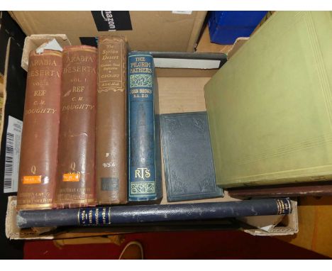
Pooley, Charles; An Historical Descriptive Account of the Old Stone Crosses of Somerset with map and plates, London, Longmans, Green & Co, 1877, first edition; together with various other volumes to include Baker, James; Pictures from Bohemia, Doughty, C.M.; Arabia Deserta vols I & II etc. (8)


Lot 1016
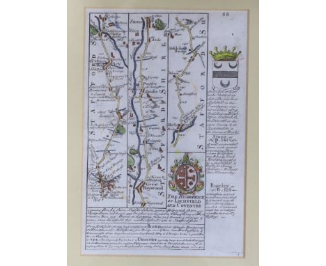
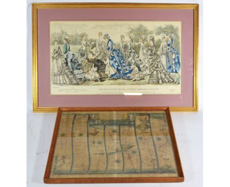
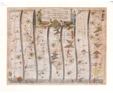
Greenwood (C. & J.)Map of the West Riding of the County of York; Map of the East Riding of the County of York; Map of the North Riding of the County of York. Walker, 1834, three hand-coloured engraved maps, tanned, framed and glazed;Bowen (Eman.), An Accurate Map of the West Riding of York Shire ....., Bowles and Sayer, no date, hand coloured engraved map, mounted framed and glazed. Ogilby (John), The Road from York to Lancaster, no date, hand-coloured engraved road map, mounted framed and glazed. (5)


Lot 215
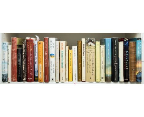
Lessing (Doris) The Grandmothers, first edition, signed by the author to title, 2003 § Smith (Ali) Girl Meets Boy, first edition, signed by the author to title, 2007 § Care (Peter) True History of the Kelly Gang, first English edition, signed by the author to half-title, loose map of New South Wales tipped onto 'Other Titles' leaf recto, 2000 § Byatt (A.S.) The Black Book of Stories, first edition, signed by the author to title, 2003, original boards, dust-jackets, fine copies; and 24 others, all but one signed, 8vo (28)
Lot 355
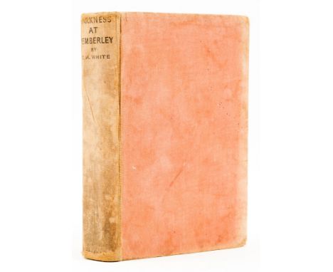
White (T.H.) Darkness at Pemberley, first edition, map frontispiece, front endpaper torn out, rear endpapers lightly browned, upper hinge rubbed but holding strong, original cloth, sunned and soiled, spine browned, rubbed, 8vo, 1932.⁂ Rare. White is best known for his Arthurian novels but this early mystery title stands alone as a "locked-room puzzle" which was dubbed by the author as a 'study in claustrophobia and fear'.
Lot 305
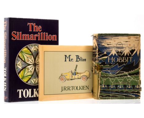
NO RESERVE Tolkien (J.R.R.) The Hobbit, or There and Back Again, second edition, fifth impression (ninth overall), colour frontispiece, illustrations and map endpapers by the author, original boards, spine sunned, dust-jacket, spotted, rather rubbed and worn along joints and extremities, portion of spine lacking with faded tape, portions of lower panel lacking, 1957; The Silmarillion, first edition, a fine copy, 1977; Mr. Bliss, first edition, a fine copy, 1982, original boards, dust-jackets,8vo & oblong 8vo (3)
Lot 13
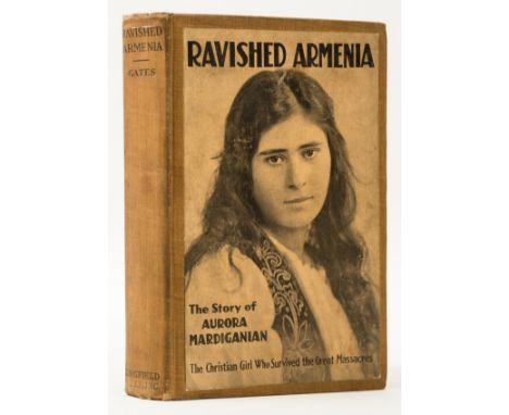
Armenian Genocide.- Gates (H. L.) Ravished Armenia. The Story of Aurora Mardiganian, first edition, photographic frontispiece and 3 plates, map illustration, facsimile letter from Mardiganian loosely inserted, contemporary ink gift inscription to verso of frontispiece, scattered foxing, original cloth with pictorial onlay to upper cover, rubbed, spine ends a little frayed, small stain to lower cover, 8vo, New York, 1918.⁂ Mardiganian's account of her experiences in the Armenian Genocide. This edition is scarce, with no copies traced at auction. The book inspired the 1919 film Ravished Armenia, also known as Auction of Souls, which is advertised to the verso of the dedication leaf.
-
109198 item(s)/page