We found 109198 price guide item(s) matching your search

Refine your search

Year

Filter by Price Range
  • List
  • Grid
  • 109198 item(s)
    /page

Lot 596

DOMESDAY BOOK STUDIES: THE BEDFORDSHIRE DOMESDAY, London, Electo Editions, 1987, 1988, 1991, 3 vols including map vol, folio, original two-tone cloth, slip-case (3)

Lot 65

IAN SINCLAIR: HACKNEY THAT ROSE-RED EMPIRE, ill Una Grimes, London, Hamish Hamilton/London Review Bookshop, 2009, (50) (45), numbered and signed, original black cloth backed watered silk, original solander box containing etching by Una Grimes, folding map of Hackney and a holograph postcard with original text by the author as called for, vgc

Lot 3073

A collection of prints and watercolours, including large 20th Century map

Lot 3077

Collection of four framed pictures, comprising: Alexander Prowse, river landscape, pencil & watercolour, signed l.r.; The Home of the Swans, photogravure after Fred Morgan; a 19th-century engraving of the infant Christ; a 20th-century facsimile of a Thomas Moule map of Derbyshire (4) 

Lot 3425

Geographia map of British Isles, four cloth bound sheets

Lot 321

Maps. A contemporary hand coloured map of Cambridge by Saxton and Kip; 5 various other later maps including East Anglia and a modern reprint of Devonshire after Speed (6)

Lot 323

Pratts High Test Map of the Great North Road, 93 x 37cm

Lot 365

A varnished wall map of Derbyshire, c.1883, 150 x 100cm (image)

Lot 100

Framed map, Gilling, Yorkshire, raised contour and a map plan Manchester and three others

Lot 46

Walter, R., A Voyage Round the World, by George Anson, 1761, ninth edition, charts, map torn, leather.

Lot 47

Maitland, W., History of London from its Foundation by Romans, 1739, raised bands, half green calf, map, fo.Condition report: The book appears to be complete although is missing several plates only having 10 full page plates and one folding plate.

Lot 863

A ROBERT MORDEN Col map of Herefordshire

Lot 133

Johanne Blaeu 1676 coloured Map of Montgomeryshire in a Hogarth frame20"x 24"L together with a coloured print of Dolforwyn castle S Cooper 1786.14" x 12" 80/120

Lot 136

Saxton coloured map of Montgomeryshire engraved by William Kip taken from 1610 edition of Camden's Britannia Hogarth frame 15"x13"

Lot 137

Saxton coloured map of Montgomery 1610 16h x 18L

Lot 138

Property particulars of the sale of Brixton Hill 1811 in 9 lots by Mr Willock framed 25" L x 13" h together with a small 18th century map of Montgomery framed 9.5" x 11"

Lot 140

John Speede coloured map of Denbighshire 23"h x 28" l

Lot 141

17th Century coloured map of Great Britain sold by I Sudbury and George Humble 1630 24" h x28" l. Corner of Map missing.

Lot 183

A Robert Morden map of Buckinghamshire originally sold by Abele Swale Awnfham & John Churchill, framed, (some foxing and repair work to previous tear) A/F

Lot 496

Belgium, Leopold I, Belgian Railway System Law 1834 and Opening 1835, bronze medal by Braemt, bust of Leopold left, rev. Belgica seated holding cornucopiae and map, locomotive behind, 50mm, extremely fine, Seraing Bridge on the Meuse opened 1843, bronze medal by C Jehoote, bridge, rev. legend, 38mm, very fine, Northern Railway opened 1843, bronze medalet by Lecomte, locomotives between pedestals of France and Belgium, 26mm, extremely fine (3)  

Lot 410

A Victorian photograph of a cricket team, a photograph of a country squire and a map of Gloucester

Lot 452

An 1834 map of Southport, in ebonised and gilt strip frame

Lot 43

A Benchmark Clock Company world time clock, The Boardroom, No 7624, the circular dial showing a map of the world, chapter ring bearing Roman numerals, Quartz time aperture, with setting time and rotating world time disc, brass cased, with presentation plaque, with instructions, 25.5cm diameter.

Lot 121

A Home and Handbooks Corporations Official Guide To Stamford, second edition, published by Frederick Warne & Company, London 1909., a WWI war map, published by George Philip & Son Ltd., W Heath Robinson, 'Some Frightful War Pictures', further guides to Lincolnshire., The Sketch, August 2nd 1946, and autograph album, theatre programmes, etc. (quantity)

Lot 212

Throsby (John). The Memoirs of The Town and County of Leicester, with map and numerous plates, published 1777, rebound with half leather and marbled boards, with gilt tooled spines, Ex Libris Drusilla Armitage.

Lot 226

to include, two copies of 'Iona, Past and Present with Maps' and 'Map of Iona with a sketch historical and geological of the Island' by Alexander Ritchie, with signature in pencil from A. Ritchie July 1928 to the latter; together with a letter addressed to Miss Roberts from A. Ritchie on letter headed paper 'Iona Celtic Art' dated 1939,

Lot 166

An early framed Robert Morden framed map of Essex, frame size 46 x 38, together with a later framed map of Billericay and Little Burstead.

Lot 255

An Egyptian silver plate cigarette box' VE World War II Battlefields of Europe':, the top with map of the European theatre, the side with lists of significant dates from 1939 to 1945, 5 x 16 x 16cm.

Lot 44

A FRAMED AND GLAZED REPRODUCTION MAP OF DUDLEY TOGETHER WITH ANOTHER FRAMED REPRODUCTION MAP AND A PRINT (3)

Lot 255

3 antique books relating to Norfolk and Suffolk. Comprising "The Land of the Broads" by Ernest R. Suffling 1895, "The Handbook To The Rivers & Broads Of Norfolk & Suffolk" by G. Christopher Davies, map missing and "Handbook Of Lowestoft" published by Thomas Coleman of Lowestoft 1858.

Lot 311

A large 19th Century monotone needlework map sampler, worked in black/brown cross-stitch on a two-piece linen back with "England & Wales" and mileage chart. No name or date. 67 x 72cm. Stained and wearing thin at edges. Modern frame.

Lot 312

A Georgian polychrome silkwork map sampler of oval form, worked in satin stitch on a linen ground with "European Map" by H. Ponting within a border of foliate tendrils. 50.5 x 45cm. Stained and wearing thin around the edges. Remounted.

Lot 313

A Georgian silk thread map sampler, worked in white, grey and black in tiny cross-stitch on a linen ground with "The Map of England", "Gauntlett Bristol, 11 May 1791". 52 x 45.5cm. Some discolouration and holes.

Lot 314

A late Georgian silk thread on linen sampler, "A Map of Europe", worked in tiny cross and running stitch, in black, shades of grey, blue and pink, and showing lines of latitude and longitude. No name or date evident. 36 x 44cm. Discoloured and some holes.

Lot 315

A Victorian schoolroom woolwork sampler, worked in cross-stitch on a large-holed canvas with a map of "Palestine in the Time of Our Saviour", dated 1867. 45 x 32cm. Slightly discoloured. No. 38 from Witney Antiques "Samplers - Mapped & Charted" exhibition.

Lot 316

A George III woolwork sampler in chainstitch on a printed linen ground, "A Map of England & Wales worked by Margaret Jermyn at Tottenham, 1787". 56 x 48.5cm. Some discolouration. Ex Witney Antiques.

Lot 512

A collection of sundry items to include a purple glass vase (possibly Whitefriars), together with a dough bowl, various tablecloths, etc and a map of "The Completion of Roads to Bath and Bristol with Roads Across the New Passage and Through Gloucester to Milford Haven as far as Neath and Llandovery", etc

Lot 797

AFTER JOHANNES BLAEU "Glocestriae Dvcatvs Volgo Glocestershire", a later coloured black and white engraved map, 53 cm x 63 cm including margins, impression size 49 cm x 41.5 cm

Lot 802

AFTER ROBERT MORDEN "Gloucestershire", a later coloured black and white engraved map, together with another by the same hand and various smaller and later maps (6)

Lot 436

A 152cm bevelled wall mirror in pine frame, alongside a framed geological map of the Isle of Wight

Lot 667

A 17th century style map of Northern France

Lot 3016

A group of nine assorted pictures, including a set of four Stevenographs of flowers, a map of the road from London to Horsham, a pair of flower prints and two further, (9).

Lot 872

Morden, Robert. Britannia Romana. (London: c. 1695). Hand-coloured engraved map, framed and glazed. Provenance: From the collection of HRH The Prince Henry, Duke of Gloucester

Lot 726

John Speede 17th century map of Essex, with hand colouring, image 38 x 51cm, glazed oak frame

Lot 227

A 1948 pre motorway UK road map

Lot 508

Leslie Cole, Extensive Landscape, watercolour, signed and dated 96 lowr right, together with a 20th century map of Cornwall

Lot 575

A 'MEDALLIC MAP OF THE WORLD' c.1820-30 double sided, depicting the Western and Eastern hemispheres, the edge inscribed 'Presented to George Burnett by Mr Robinson 1st Class Reading DecR 1829', with original card protector and in a chamois leather bag 7.3cm diameter PROVENANCE 'A Lifetime of Collecting' - The Property of a Gentleman.

Lot 81

JOAN BLAEU. 'WILTONIA SIVE COMITATUS WILTONIENSIS ANGLIS WIL SHIRE' MID-17TH CENTURY an engraved map, French text to verso, together with an engraved map with the same title by Jan Jansson, 'Wiltoniae comitatus herbida planicie nobilis vulgo will shire pars olim belgarum' by Christopher Saxton and William Kip, 'Mapp of Wiltshire with its hundreds' by Richard Blome, 'The continuation of the road from London to the Lands End plate 2d' by John Ogilby, all in later ebonised and gilt glazed frames and an untitled allegorical engraved map of Somersetshire and Wiltshire by Michael Drayton in a later fruitwood and gilt glazed frame (6) 65.5 x 57.5cm (max)

Lot 82

'ANGLESEY ANTIENTLY CALLED MONA. DESCRIBED 1610' JOHN SPEED (1552-1629) a hand-coloured engraved map with an inset map of Beaumaris, English text to verso, 52.8 x 41.3cm, in a later ebonised and gilt glazed frame

Lot 413

A box of pictures and prints, Margaret Pemberton oils on board, map of Durham, framed mirror etc

Lot 448

A framed Blaeu wall map together with a gilt framed print - Near Glencoe by R Gilroman, oil on canvas - rural scene

Lot 651

An oak framed map agricultural map of Northumberland

Lot 224

A box of Ordnance survey & walking maps, Dartmoor Explorer OL28, Peak District Tourist map, North York Moors travel map examples

Lot 331

Robert Morden (1650-1703), An engraved map of East Riding of Yorkshire, in later frame.

Lot 278

A Collection of WWII German Military Oddments including AFRIKAKORPS Ribbon, NSKOV German Cap Eagle 1939-1945, photographs, map, Russian POA Volunteer Sleeve Shield etc.

Lot 319

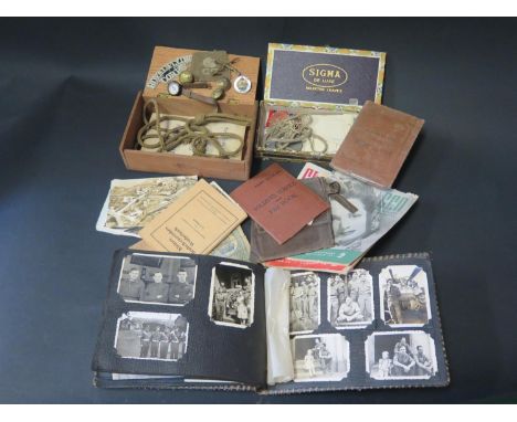
A WWI and WWII Father and Son Group of Military Oddments including Pay Book for 18716 LCpl. Charles L Salkield Coldstream Guards with cloth patch and Permanent Pass, Fearnaught MOP brooch, wrist compass, Royal Flying Corps cloth badge and menu R.A.F. staff dinner Heliopolis Palace Hotel Xmas Day 1918, map of Amiens marked in pen to 2Lt. Salkield "C" Coy. NORU. Also his son's Pay Book 7939368 Allen Macaulay Salkield Royal Armoured Corps Gunner, photograph album, loose photos and postcards and other ephemera including two medals and dog tags

Lot 208

A framed and glazed map of Great Britain

Lot 535

After Rex Whistler, lithograph, The Financial News, Map of The Stock Exchange, 1933, 41 x 56cm

Lot 832

A vintage Educational wall map, Scarborough Publishing Company, England and Wales

Lot 164

After I Blaeu, an 18thc map of Galloway highlighted with colour (47cm x 57cm)

Loading...Loading...
  • 109198 item(s)
    /page

Recently Viewed Lots