We found 109182 price guide item(s) matching your search

Refine your search

Year

Filter by Price Range
  • List
  • Grid
  • 109182 item(s)
    /page

Lot 203

London.- Bumpus (John) A New Plan of London and its Environs, map showing from Hyde Park to the Isle of Dogs, and Pentonville to Oval, engraving by S. W. Cooke, with original hand-colouring and the City of London highlighted in red, 405 x 770 mm (16 x 30 1/4 in), under glass, dissected and mounted on linen, some surface dirt and minor browning, framed and glazed, [Howgego 306 - unrecorded early edition], 1824⁂ Scarce folding map of London from an earlier edition not known to Howgego.

Lot 29

Golden Cockerel Press.- Bannet (Ivor) The Amazons, number 68 of 80 specially-bound copies signed by the author and artist, from an edition limited to 500, original pictorial brown morocco, gilt, slip-case, 1948 § Chair (Somerset de) The Story of a Lifetime, number 39 of 100 copies for subscribers, from an edition limited to 110 signed by the author original pictorial white morocco, gilt, spine slightly yellowed, cloth slip-case, 1954; Julius Caesar's Commentaries: A Modern Rendering..., number 5 of 70 specially-bound copies, signed by the author and artist, map endpapers, original pictorial crimson morocco, gilt, spine slightly faded, 1951, all with wood-engravings by Clifford Webb, most full-page, the last two with book-label of Mary Priscilla Smith, all bound by Sangorski & Sutcliffe, t.e.g., others uncut, 4to & small folio, Golden Cockerel Press (3)

Lot 336

Slavery.- A Group of 12 Parliamentary Slave Trade Papers, comprising: Papers Relating to Captured Negroes: Second Part of Major Moody's Report, 128 pp., folding map (light off-setting and spotting), title with minor amount of soiling and small paper repair, 24 February, 1826; [Slave Trade] At the Mauritius, Bourbon, and the Seychelles: from time of their capture to present time, 141 pp., map, 20th April, 1826 bound with Slave Trade Copies or Extracts Of any Correspondence... Slave Trade Mauritius, 33 pp., 15th February, 1827 also with Slave Trade Minutes of Evidence, whether the Slave Trade has prevailed in Mauritius, 89pp., 26th February 1827 and Slaves in Colonies... In all the slave colonies belonging to His Majesty, who are proprietors of Slaves, 33pp., 27th February, 1827, together 4 in 1 vol., lacking lower cover; Papers relating to Captured Negroes at Tortola, 57pp., tape repair to lower cover, 12th June, 1827; Papers relating to Captured Negroes at St. Christopher's, Nevis, and Tortolla, 76pp., 19th June, 1827; Papers relating to Captured Negroes at Demerara, 39pp., 19th June, 1827; Slaves Manumitted. Of the Number of Slaves Manumitted in each Colony, in each Year,for the last five Years; distinguishing the Number who paid for their Manumission, (and, if possible, the average Amount paid by each) from those emancipated by their Masters; and Males from Females, 48pp., tape repair to title, 1st March, 1827 bound with Slaves Imported, Exported; Manumissions, Marriages, 47pp., 1st march, 1827 also with Number of Slaves on the Estate of Bel Ombre in the district of Savanne, in the Mauritius, the makes from the females, and the Creoles from Foreign, 63pp., 1st May, 1827, together 3 in 1 vol., lacking covers; Trinidad Negroes. Extracts from the minutes of Evidence taken by the Committee of the Council of Trinidad, for enquiring into the Negroe Character, 57pp., lacking covers, 14th June, 1827, together 12 in 7, original printed wrappers, rebacked in marbled paper, light creasing, Ordered by the House of Commons to be Printers, folio (7)

Lot 371

Anderson (Sherwood) Winesburg, Ohio, first edition, first issue with top edge stained yellow, with "lay" for "lie" in line 5 on p. 86 and broken type in the word "the" in line 3 on p. 251., map of Winesburg, Ohio to front pastedown, original yellow cloth with paper label to spine, some chipping and fraying to spine ends and corners, light surface soiling to covers, dust-jacket, spine browned, spine ends and corners chipped, front panel washed and faded with much of the printed text removed and two ring marks visible, closed tear to head of lower panel, a few small chips and nicks to head and foot of panels, light surface soiling to panels, 8vo, New York, B.W. Huebsch, 1919.⁂ Anderson's first novel, a classic of 20th century American fiction, rare in the dust-jacket in any condition.

Lot 411

Mandela (Nelson) Long Walk to Freedom, first American edition, signed by the author and dated 14.12.94 on title, photographic plates, map endpapers, original cloth-backed boards, dust-jacket, slight creasing to spine tips and corners, else fine, 8vo, Boston, 1994.

Lot 439

Tolkien (J.R.R.) The Hobbit, first edition, first impression, frontispiece, one plate and 8 illustrations, including 7 full-page, map endpapers printed in red and black, all by the author, 2pp. advertisements, 1 plate detached, light marking and soiling to margins, lower split but holding, light foxing and marking to endpapers, remains of library labels to rear pastedown, original pictorial cloth, shelf-lean, spine darkened, bumping and fraying to spine ends and corners, remains of label to foot of upper cover, light soiling, 8vo, 1937.

Lot 9062

A quantity of local interest sale particulars, sale posters etc, including 'Ashwellthorpe, Fundenhall, and Wreningham. Norfolk. Highly Attractive Residential and Agricultural Estates', 1918 sale particulars, TW Gaze & son, large folding map, original printed wraps, 'The Uplands, Ipswich, 1908', sale particulars, folding map, original printed wraps (worn), Yew Tree & Grove Farms, Brundish, Suffolk, 1930, map, orig. printed wraps, plus others Stradbroke, Stowmarket, Woodbridge, Six Farms Bunwell/Aslacton/Diss Heywood/Carleton Rode/Gt Moulton/Tharston, 1954, 2 folding maps in rear pocket, orig. printed wraps, Gislingham, Mildenhall (9); plus sale posters Roydon Road, Diss; Fersfield and Bressingham; Salhouse, Mundesley; Rushmere (5), various sizes (14)

Lot 9083

Winston S. Churchill: 'The River War. An Historical Account of the Reconquest of the Soudan. Edited by Col. F. Rhodes. Illustrated by Angus McNeill, Seaforth Highlanders.', London, Longmans, Green & Co, June 1900, 1st edition, 3rd impression, 2 volumes, "Only 140 copies of the third printing were ever made available. it is far and away the scarcest of the first-edition printings" (Ronald I. Cohen, Churchill bibliographer), ex Prahran library, photogravure portrait frontispiece to volume 1 + 4 other portrait plates (lacks frontis of Kitchener to volume 2, else complete), one full-page photogravure to the text, 50 wood-engravings to the text by Angus Neil, 23 colour maps and battle plans, all but 3 folding (folding map vol.I facing p.146 "The Dervish Empire" with neat tape repair), 11 maps to the text of which 2 full-page, recased, retaining original publisher's dark blue cloth, with lettering and pictorial decorations to spines and front covers in gilt, replenished end papers and pastedowns, volume I with publisher's 32pp catalogue of adverts at end. This was Churchill's second book, after The Story of the Malakand Field Force (1898). "Overcoming the objections of Kitchener, the commander-in-chief of the expeditionary force, Churchill obtained a temporary posting with the 21st lancers, and arrived in the Sudan in time to take part in the celebrated cavalry charge at the battle of Omdurman (2 September 1898), in which the regiment galloped by accident into a hidden ravine crammed with armed men. Churchill, who shot and killed at least three of the enemy with his Mauser pistol, was cool and courageous but lucky to survive a bout of hand-to-hand fighting in which 22 British officers and men were killed. [In The River War] the story of the campaign is firmly embedded in a remarkably sympathetic history of the Sudanese revolt against Egyptian rule" (ODNB). Churchill himself graphically described his account as "a tale of blood and war". Cohen A2.1.d; Langworth pp. 27-29; Woods A2(a) (2)

Lot 9084

Winston S. Churchill: 'My Early Life. A Roving Commission.', London, Thornton Butterworth, 1930, 1st edition, 1st state, with 11 titles by Churchill listed to the verso of the half title as called for, portrait frontis of Lady Randolph Churchill + 28 illustrations and maps (of which many full page plates, folding general map illustrating Churchill's journey during his capture, imprisonment and escape in South Africa/Mozambique during the Boer War, etc), plates collated complete/as called for, bound in navy half morocco gilt, spine with raised bands, gilt ruled in six compartments, gilt lettering and gilt 'lion rampant' motifs in compartments, top edge gilt. Churchill's only volume of sustained autobiography, covering his formative years from his birth in 1874 until his election as MP for Oldham in 1900 - a "witty and elegiac account of his youth shot through with regret at the decline of the social and imperial order in which he had grown up" (ODNB). Among his most widely-read works, it provides a highly entertaining account of his childhood, schooldays at Harrow, military training at Sandhurst, experiences as a war correspondent in Cuba, and service attached to the Malakand Field Force on the North-West Frontier of India, charging with the 21st Lancers at Omdurman, and as a POW in South Africa during the Boer War. Cohen A91.1.c; Woods A37(a).

Lot 9113

Napoleon I: 'Copies of the original Letters and Despatches of the Generals, Ministers, Grand Officers of State, etc. at Paris, to the Emperor Napoleon at Dresden, intercepted by the advanced troops of the Allies in the North of Germany.', L, John Murray, 1814, 1st edition, original paper covered boards (worn); together with Lt. Col. Charles C. Chesney: 'Waterloo Lectures: A Study of the Campaign of 1815', L, Longmans, 1869, 2nd edition, folding map (worn with tear along vertical fold, but complete, ex Repton School Library, old calf gilt worn (2)

Lot 9117

Nine sport related titles, including Bernard Darwin: 'Tee Shots and Others', illustrated E.W. Mitchell, London, Kegan Paul et al, 1911, 1st edition, ix,271,[1]pp, original pictorial cloth gilt (slightly worn); John James Hardy: 'Salmon Fishing', L, Country Life, 1907, 1st edition, port. frontis + 33 full page illustrations as called for, foxing to leaves, ex Repton School library bookplate to front pastedown and inkstamp/ref number to FFEP, else no other lib markings; Gilbert Bourne: 'A Text-Book of Oarsmanship, with an Essay on Muscular Action in Rowing', 1925, 1st edition, frontis + 72 ills. and diagrams in text as called for, original cloth gilt; G.H. Lacy: 'North Punjab Fishing Club Anglers' Handbook', Calcutta, Newman, 1890, 2nd edition, large multi folding map frontis + four folding maps + 10 plates, original cloth gilt (worn); 'Cricket: A Weekly Record of the Game. Vol VI. Jan. 27th to Dec. 29th 1887', L, 1887, ex Repton School library, 476pp, original cloth gilt; 'M.C.C. Cricket Scores and Biographies. Vol XV', 1925, ex Repton School Library, original cloth gilt; plus 2 others cricket & Badminton Library 'Billiards', 1906, original cloth gilt (9)

Lot 9223

Alan Ross & John Minton: 'Time was away. A Notebook in Corsica', London, John Lehmann, 1948, 1st edition, 1st issue, black & white map frontispiece + 8 colour lithographed plates + over 50 other full page and in text black & white illustrations by John Minton as called for, original yellow cloth, the first issue stamped in green and gilt on the spine (v. light wear, else generally cloth VGC), wraparound pictorial dustwrapper by John Minton (worn with some part losses and internal repairs, some surface rubbing in places). A scarce first issue copy of Alan Ross and John Minton's classic artistic collaboration and ode to the island of Corsica

Lot 9273

Seven various Victorian illustrated titles, including [Elizabeth Tuckett]: 'How We Spent the Summer, or a "Voyage en Zigzag" in Switzerland and Tyrol, with some Members of the Alpine Club, from the Sketch book of one of the Party', London, Longmans et al, 1864, 1st edition, 43 lithograph illustrated leaves comprising illustrated title page, "Dramatis Personae" leaf + map + 40 numbered illustrated leaves, oblong folio, original pictorial paper covered boards, rebacked (not recent); Miss Brown: 'The Foreign Tour of the Misses Brown Jones and Robinson, being the History of what They Saw and Did at Biarritz & in the Pyrenees', London, Bickers, [1878], 1st edition, lithograph title page + 49 numbered lithograph illustrated leaves as called for, 4to, original cloth backed pictorial paper covered boards; 'The Golden Harp', L, Routledge, 1864, 52 engraved ills. by J.D. Watson, T. Dalziel and J. Wolf engraved by the Brothers Dalziel, orig. blindstamped cloth gilt; E.H. Knatchbull-Hugessen: 'The Mountain Sprite's Kingdom and Other Stories', L, Routledge, 1881, 1st edition, black & white ills. by Ernest Griset as called for, orig. pictorial cloth gilt; Mrs S.C. Hall: 'The Prince of the Fair Family, A Fairy Tale', Chapman & Hall, [1867], original pictorial cloth gilt, all edges gilt; Charles Welsh (intro.): 'The Butterfly's Ball and the Grasshopper's Feast; The Peacock "At Home"; The Lion's Masquerade; The Elephant's Ball', Griffith & Farran, 1883, 4 works bound in 1, facsimiles of the editions of 1807/08, 4to, contemporary half calf gilt, each with printed wraps bound in at end; Charles Kingsley: 'The Heroes; Or, Greek Fairy Tales for my Children', Cambridge, Macmillan, 1856, 1st edition, 8 plates, original decorative cloth gilt (7)

Lot 413

[MISCELLANEOUS] J.G. Harrod & Co.'s Royal County Directory of Devonshire and Cornwall, second edition, Norwich, 1878, original maroon cloth, period advertisements, quarto; Kelly's Directory of Devonshire, 1897, crimson cloth, folding map (torn, without loss), period advertisements, quarto (spine faded; covers splash-marked); Conan Doyle, A. Adventures of Gerard, Newnes, London, no date [preface dated March 1903], original blue cloth gilt, sixteen plate illustrations (including frontispiece, as called for), octavo (covers with damp-marked fore edges; spine ends nicked and torn; one plate detached, with torn and creased fore edge); Shaw, Bernard. The Intelligent Woman's Guide to Socialism and Capitalism, first edition, Brentano's, New York, 1928, original green cloth, tall octavo; and five assorted other works, (9).

Lot 414

[MAPS]. INDIA & ARABIA Mallet, Alain Manesson (French, 1630-1706), 'Partie de la Terre Ferme de l'Inde or l'Empire du Mogol', engraved map, uncoloured, 15cm x 10.5cm, framed and glazed; together with another map of India, 15cm x 10.5cm, framed and glazed; and Morden, Robert (English, c.1650-1703), 'A New Map of Arabia', engraved map, hand-coloured in outline, 11.25cm x 13cm, framed, (3) . Condition Report : ConGenerally good condition; Arabia foxe Condition reports are offered as a guide only and we highly recommend inspecting (where possible) any lot to satisfy yourself as to its condition.

Lot 9001

(Morocco, Travel), a collection of thirteen titles relating to Morocco, The Maghreb, North Africa, including: 'A Memoir Of Sir John Drummond Hay, Sometime Minister At The Court Of Morocco Based On His Journals And Correspondence, With A Preface by Sir Francis W. De Winton', London, John Murray, 1896, 1st edition, portrait frontis + 2 full page plates + 2 ills. in text as called for, original cloth gilt (slightly worn); Dr. Gerhard Rohlfs: 'Adventures in Morocco and Journeys Through the Oases of Draa and Tafilet', L, Sampson Low, 1874, 1st edition, port. frontis + folding map as called for, orig. cloth gilt (slightly worn); Walter B. Harris: 'Tafilet: The Narrative of a Journey of Exploration in the Atlas Mountains and the Oases of the North-West Sahara', Edinburgh & London, William Blackwood, 1895, 1st edition, folding map + 8 plates + ills. in text as called for, orig. cloth gilt (slightly worn); Budgett Meakin, 3 titles: 'The Moorish Empire - The Land of the Moors - The Moors', London, Swan Sonnenschein, 1899, 1901, 1902, 1st editions, 3 volumes, numerous maps, plans, charts, plates & illustrations, uniform original pictorial cloth gilt (worn & with some slight soiling, 1st and 3rd title lacking front end papers), covers depicting gate of citadel, Tangier, in gilt. Scarce as a set; H.M.P. De La Martiniere: Morocco, journeys in the kingdom of Fez and to the court of Mulai Hassan;: With itineraries constructed by the author and a Bibliography of Morocco from 1844-1887', L, Whittaker, 1889, 1st edition, 7 maps/plans (of which 5 folding) as called for, orig. cloth gilt (spine rubbed); G. Montbard: Among the Moors, Sketches of Oriental Life', L, Sampson Low, 1894, 1st edition, port. frontis + full page and in text ills. throughout, original cloth gilt, top edge gilt; Thomas Pellow: 'The Adventures of Thomas Pellow, of Penryn, Mariner, three and twenty years in captivity among the Moors', L, Fisher Unwin, 1890, 1st edition, 9 plates (of which 2 folding) as called for, orig. cloth gilt (slightly worn); G.E. Holt: 'Morocco the Piquant', [1914], 1st edition, 17 photo ills. on 16 plates as called for, contemporary notes on title page, orig. cloth gilt; Donald MacKenzie: 'The Khalifate of the West, being a General Description of Morocco', L, 1911, frontis, map + numerous ills. throughout, orig. cloth gilt; Macnab: 'A Ride in Morocco Among Believers and Traders', L, Edward Arnold, 1902, folding map + 8 plates (of 9, lacks frontis), orig. cloth gilt (slightly soiled); Budgett Meakin: 'Life in Morocco, and Glimpses Beyond', L, C & W, 1905, 1st edition, orig. cloth gilt (13)

Lot 9002

FALLS, Captain Cyril; MACMUNN, Lieutenant-General Sir George, and BECKE, Major A. F. (editors): 'Military Operations Egypt and Palestine Volume One: From the Outbreak of the War with Germany to June 1917. Volume Two (comprising two volumes): From June 1917 to the End of the War', London, HMSO, 1928-1930, set of 3 text vols and 2 cloth drop front map boxes, text vols original cloth gilt, dust wrappers (with some part losses), vol II pt I with folding map of Palestine in rear pocket as called for, and numerous other folding plates, maps, plates to text vols, map volume I with 15 folding maps as called for, map vol II with 23 folding maps as called for, these original cloth gilt, map vol II a/f. An exhaustive examination of Britain's role in the Sinai and Palestine Campaign of the Middle Eastern theatre of World War I, compiled from official documents by direction of the historical section of the Committee of Imperial Defence. From the estate of Gawain Westray Bell (1909-1995), British colonial administrator who became the Governor of Northern Nigeria, with his ownership signatures in pencil to FFEP of each text volume. Bell served in Sudan between 1931 and 1954, with secondments to Palestine in 1938 and the Arab Legion during the Second World War. In 1956, he was appointed political agent in Kuwait, surviving an assassination attempt, before serving as governor of Northern Nigeria between 1957 and 1962, where he oversaw the end of British rule. In 1965, following failed talks and an Adenese walkout from the Federal and Federal Supreme Council, Bell and Sir Ralph Hone (1896-1992) were approached by the federation's leadership travelled to Aden to act as constitutional advisors. During the course of their visit they recommended that Aden become the capital of a new United Republic of South Arabia, with enhanced representation in the legislative and executive branches. Following his work in south Arabia, he led other missions to Oman (1966 and 1974) and the Trucial States. Provenance by descent (5)

Lot 9003

Bertram Thomas: 'Arabia Felix: Across the Empty Quarter of Arabia', foreword by T.E. Lawrence, London, Cape, February 1932, 2nd impression, large folding coloured map of Southern Arabian Desert, + 2 maps and numerous plates, many from photographs, as called for, original cloth gilt. Pencil ownership signature/inscription to FFEP "Gawain Bell Kassala. June 1932". From the estate of Gawain Westray Bell (1909-1995), British colonial administrator who became the Governor of Northern Nigeria. Bell served in Sudan between 1931 and 1954, with secondments to Palestine in 1938 and the Arab Legion during the Second World War. In 1956, he was appointed political agent in Kuwait, surviving an assassination attempt, before serving as governor of Northern Nigeria between 1957 and 1962, where he oversaw the end of British rule. In 1965, following failed talks and an Adenese walkout from the Federal and Federal Supreme Council, Bell and Sir Ralph Hone (1896-1992) were approached by the federation's leadership travelled to Aden to act as constitutional advisors. During the course of their visit they recommended that Aden become the capital of a new United Republic of South Arabia, with enhanced representation in the legislative and executive branches. Following his work in south Arabia, he led other missions to Oman (1966 and 1974) and the Trucial States. Provenance by descent

Lot 9004

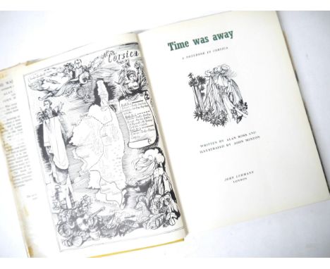
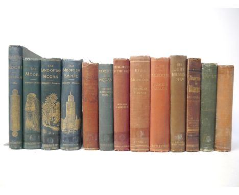
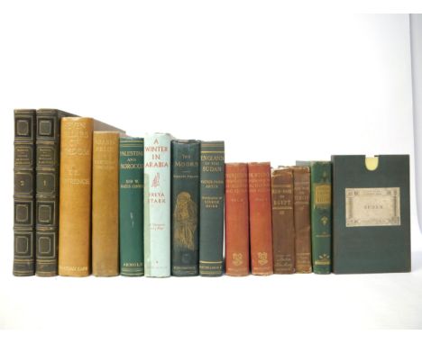
(Travel, Middle East, Arabia, North Africa), a collection of 13 titles and a map relating to the Middle East and North Africa, including Ahmad ibn Ali al-Makrizi & Etienne Marc Quatremere: 'Histoire des Sultans Mamlouks de l'Égypte', Paris, The Oriental Translation Fund of Great Britain & Ireland, 1837-1845, 1st edition. 4 parts in 2 volumes, vol. I xix,253,[1]pp;278pp, vol. II vi,288pp;324pp, ex Repton School Library, 4to, contemporary green morocco gilt, inner dentelles gilt, all edges gilt. Scarce; Yacoub Pasha Artin: 'England in the Sudan', translated George Robb, L, Macmillan, 1911, 1st edition, folding map + ils. from photos as called for, original cloth gilt; Edward Stanford Ltd (published): 'The Anglo-Egyptian Sudan', engraved folding map, coloured in outline, dissected & backed onto linen, printed at the War Office, December 1921, approx. 91 x 69cm, folding into original cloth slipcase, printed paper label to front; Sir Martin Conway: 'Palestine and Morocco, Lands of the Overlap', L, Edward Arnold, 1923, 1st edition, 8 plates as called for, ex Repton School Library, orig. cloth gilt; Freya Stark: 'A Winter in Arabia', London, John Murray, 1940, 1st edition, 3 maps (of which 1 folding), plus numerous photogravure illustrations by the author as called for, original cloth gilt (spine faded), dust wrapper (with tape repair, else 16s price intact and generally VGC). The author's beautifully illustrated account of her time in the Hadhramaut (in what is now Yemen), at a time when very few men, let alone women, had fully explored the vast hinterlands of Arabia. One of the most important pieces of literature on the region and a book that placed Freya Stark in the pantheon of great writers and explorers of the Arab World; Budgett Meakin: 'The Moors, a Comprehensive Description', L, Swan Sonnenschein, 1902, 1st edition, lacks front and rear endpapers, ills. throughout, original cloth gilt (worn/soiled); T.E. Lawrence: 'The Seven Pillars of Wisdom', L, Cape, 1935, 1st trade edition, folding maps & plates as called for, 4to, original cloth gilt; Bertram Thomas: 'Arabia Felix', L, Cape, February 1932, 1st reprint, large folding map + numerous photographic plates, ex Repton School library, orig. cloth gilt; Richard Burton: 'Personal Narrative of a Pilgrimage to Al-Madinah & Meccah', L, George Bell & Sons, 1898, 2 volumes, colour frontis to volume 1 + 3 folding maps/plans + 14 black & white plates as called for, uniform original cloth gilt. Disguised as a Pashtun Muslim and supported by the Royal Geographical Society, in 1853 Burton undertook a hajj journey to the two Muslim holy cities of Mecca and Medina, this two volume work recounts that journey. Burton spent years in preparation, mostly during his time in India. Although Burton was not the first non-Muslim to perform the hajj, the accuracy of his well-documented account, including his measurements of the Kaaba in Mecca and his Victorian-era observations on Muslims (especially his copious notes on manners), brought him immediate fame; two mid 19th Century Murray's Handbooks for Travellers in Egypt (1858) & Turkey (1854), each with folding maps/plans etc, each original cloth gilt (slightly worn), plus 1 other (14)

Lot 9006

(Nepal), Colonel William Kirkpatrick: 'An Account of the Kingdom of Nepaul, Being the Substance of Observations Made During a Mission to that Country, in the Year 1793', London, W. Bulmer for William Miller, 1811, 1st edition, stipple engraved title vignette, large multi-folding engraved map of Nepal + 14 engraved plates (of which one hand coloured aquatint) complete as called for, 4pp. publisher's catalogue at end, 4to, contemporary diced calf gilt (worn, boards detached but present, lacks part of backstrip at head and tail of spine), all edges gilt, inner dentelles gilt. William Kirkpatrick's account of his 1792 diplomatic mission to Nepal, "leading the first Britons into that kingdom". Kirkpatrick (1754-1812) was an officer with Lord Cornwallis in India and was dispatched to Nepal to settle a dispute between Nepal and Tibet. At the time Nepal was spoken of as another El Dorado and was the subject for 'Lost Horizon'. In this work Kirkpatrick outlines his route to Katmandu, provides an historical sketch of the country, and details the boundary and divisions of Nepal. The appendices contain official papers and letters relating to his mission and the origin of the war between Nepal and Tibet, and include the correspondence of Cornwallis with Tibet during the war. The work provides much on the topography, geography, climate, agriculture, botany, zoology, culture, peoples, economy, history and with an extensive vocabulary listing. Scarce

Lot 9007

(Nepal, Himalayas), Francis Hamilton: 'An Account of the Kingdom of Nepal, and of the Territories Annexed to this Dominion by the House of Gorkha', Edinburgh & London, 1819, 1st edition, half title, 7 engraved plates (of which 5 folding) plus large engraved folding map at end complete as called for, titled "..the Dominions of the House of Gorkha", this generally covering the mountainous Himalaya region of present day Himachal Pradresh and Uttarakhand in Northern India, Nepal, Sikkim, West Bhutan & Southern Tibet, the engraved plates comprising frontis "View of the Temple of Bouddhama in Kasacheit" (Boudhanath stupa, Kathmandu, Nepal), "View of Kathmandu and Lalita Patan from the West", plus 5 folding engraved sectional views of the Himalaya Mountains, 4to, contemporary calf gilt (worn, top board detached but present, lacks large part of backstrip), all edges gilt, Gulielmi Douglas armorial bookplate to front pastedown, later ownership inscription of H.A. Holdich (1874-1964), British Army Lieutenant, 5th Gurkha Rifles. This account describes the country as it stood previous to the war with the British in 1814, the book is divided into 2 parts: The first part has 3 chapters that describes the tribes that inhabit the Gorkha territories along with their manners and customs; the second chapter covers the geography of the country along with its flora and fauna; the third concerns the law and government. The second part has three sections: the first is a description of the states east from the river Kali, it includes a chapter on Sikkim. Further on the next section is of the dominions of the family descended from Makanda Sen, the king of Makwanpur. The book concludes with a section on Nepal proper and a notice on Kumaun, with charts of weather observations from Feb 1802 to March 1803. Surgeon to the Governor General of India, Lord Wellesley from 1803-04, Francis Buchanan-Hamilton (1762-1829) was appointed to a succession of survey posts in Asia, initially in Burma and India. His two years (1802-04) in Nepal were followed by a brief interlude as director of the Natural History Project of India, a short-lived scheme instigated by his patron, Lord Wellesley, and eventually a topographical survey of Bengal. Scarce

Lot 9008

(India, Sri Lanka), S.M. Edwardes: 'By-Ways of Bombay', illustrated M.V. Dhurandhar, Bombay, D.B. Taraporevala, 1912, 2nd edition, 20 black & white illustrations as called for, original cloth gilt; 'Illustrated and Descriptive Guide to Bombay and the Surrounding Districts. With a Map of Bombay', Bombay, The Times Press, 1909, 74pp, illustrations from photos and illustrated period adverts throughout, original printed wraps; Edward Stanford Ltd (published): 'Ceylon', fine and highly detailed colour lithograph folding map, dissected and backed onto linen, circa 1896, 'London Atlas Series', approx 63 x 52cm, folding into original red cloth binding, printed paper label to front cover; Flora Annie Steel: 'Tales from the Punjab', illustrated J. Lockwood Kipling, L, Macmillan, 1894, frontis + full page & in text black & white ills., original decorative cloth gilt (rubbed/worn) (4)

Lot 9014

Edward Stanford: 'Stanford's Map of Turkey in Europe and Her Tributary States; together with such parts of Russia, Austria, Turkey in Asia & Persia as more more immediately concerned in the settlement of The Eastern Question.', engraved folding map, original colour, dissected and backed onto linen, London, Stanford, 1877, 75.5 x 110cm, folding into the original covers, printed aper label to front cover. A map of the areas affected by the gradual weakening of the Ottoman Empire in the 19th century, covering from Greece to the Caspian Sea and the Persian Gulf. The map was published as matters came to a head with the 'The Great Eastern Crisis' of 1875-8, when Western powers took advantage of uprisings in the Balkan peninsula to acquire territory at Turkey's expense

Lot 9024

(Guatemala, Central America), Nicolas Sanson: 'Audience de Guatimala', Paris, 1657, engraved hand coloured map, plate impression aprox. 19 x 29cm, mounted

Lot 9026

(South America), Jean-Baptiste Bourguignon d'Anville: 'A Map of South America, Containing Tierra-Firma, Guayana, New Granada, Amazonia, Brasil, Peru, Paraguay, Chaco, Tucuman, Chili and Patagonia. [and a Chart of the Falkland Islands] From Mr. D'Anville, With several Improvements and Additions', engraved folding map, hand coloured in outline, London, Robert Sayer, July 1st 1787, two large folding sheets, each engraved area approx 51 x 118cm (the map in entirety approx 102 x 118cm); together with an a/f/worn 1775 printing of the same map (2)

Lot 9029

Edward Stanford: 'India and Adjacent Counties - Baroda', folding colour lithographic map, 1917, published under the direction of colonel S.G. Burrard, Surveyor General of India, sheets 41 and 46, covering roughly the area of the present day state of Gujarat, approx 57 x 91cm, folding into original covers, printed paper label to front cover

Lot 9030

James Kingston Tuckey: 'Narrative Of An Expedition To Explore The Zaire River, Usually Called The Congo. In South Africa. In 1816; To Witch Is Added, The Journal Of Professor Smith; Some General Observations On The Country And Its Inhabitants; An Appendix: Containing The Natural History Of That Part Of The Kingdom Of Congo Through Which The Zaire Flows', London, John Murray, 1818, 1st edition, engraved folding map frontis (with a couple of neat tape repairs verso) + 13 engraved plates (of which 1 hand coloured depicting squid etc) as called for, 4to, lxxxii,498pp, "withdrawn" inkstamp verso title page, no other markings, contemporary marbled paper covered boards, recased modern half morocco, oxblood morocco gilt title label to spine. Tuckey sailed with the Royal Navy and explored various parts of Africa during his career, and searched for a connection between the Congo and Niger Rivers of western and central Africa aboard the schooner Congo in 1816. The crew was unsuccessful, struggling to navigate rapids and eventually dying of fever. Although the expedition failed it inspired interest by the British to continue African exploration. The accounts of the expedition gleaned from officer's reports, incomplete journals, etc., provided useful information on the natural history and inhabitants of the region.

Lot 9042

(London), collection of 7 titles on London, including Rendle & Norman: 'The Inns of Old Southwark and Their Associations', London, Longmans, 1888, folding map (from Rocque's 1746 map) + 11 other full page plates and numerous ills. in text as called for, rebound half calf gilt; Philip Norman: 'London Vanished & Vanishing', L, A & C Black, 1905, limited edition de luxe, signed by Norman and numbered (128/225), 75 colour plates as called for, 4to, original cream cloth, lettered in gilt, top edge gilt; George Hennessy: 'Novum Repertorium Ecclesiasticum Parochiale Londinense, or London Diocesan Clergy Succession From the Earliest Time to the Year 1898', L, Swan Sonnenschein, 1898, 1st edition, fewer than 120 copies subscribed for, 4to, original black cloth gilt; Walter George Bell: 'Fleet Street in Seven Centuries', L, Pitman, 1912, 1st edition, 46 ills., rebound half calf gilt; John Diprose: 'Some Account of the Parish of Saint Clement Danes (Westminster) Past and Present', L, Diprose & Bateman, 1868, map frontis, orig. cloth gilt, rebacked retaining orig. backstrip; Walford: 'Greater London', Cassell, [nd], c. late 19th Century, 2 vols, uniform half calf gilt (worn); plus 1 other similar (8)

Lot 9043

'Froggett's Survey of the Country Thirty Miles round London. 1831', engraved folding map, hand coloured in outline, dissected and backed onto linen, published London, I.W. Froggett, June 14th 1831, printed area approx size 109 x 135, folding into original cloth slipcase, printed paper label to cover

Lot 9047

A Saxton/Kip engraved map of Suffolk, 1637, 'Suffolciae Comitatus', hand coloured, repaired top left, close trimmed to margins, bound together with the Suffolk text from 'Camden's Britannia', 1610 edition, pages 459-470, wooden boards, pen & ink title to front cover, bookplate of Richard Thurlow, Ipswich, to front pastedown; together with 'The History of Suffolk', [nd], circa 1814/15?, no title page, half title,[i]-108pp, bound together with 'The East Anglian Spectator', 1814, No.'s 1-3, 200pp, commencing with 'Biographical Memoir of Sir P.B.V. Broke, Bart. Captain in the Royal Navy -of Nacton Hall, Suffolk]', with engraved portrait frontis of Broke, old black cloth, later rebacked, contemporary printed paper label to spine (2)

Lot 9048

Frederic Shoberl: 'The Beauties of England and Wales. Vol. XIV [Suffolk]', London, 1813, 413pp + [10]pp index, extra illustrated edition with 48 engraved plates, mainly full page, plus double page map of Suffolk, handsomely bound in half tan morocco gilt, spine gilt decorated in compartments, all edges gilt, marbled pastedowns/EP's, by Sotheran & co, Piccadilly

Lot 9053

Eight Fenland and East Anglia interest titles, including Frederic John Gardiner: 'History of Wisbech and Neighbourhood...1848-1898', Wisbech, Gardiner & Co; London, Marlborough & Co, 1898, 24 leaves of plates/illustrations, including large folding map at end, as called for, original cloth gilt, top edge gilt; Miller & Skertchly: 'The Fenland Past and Present', Wisbech & London, 1878, a/f, inner joints split, leaves loose, lacking a few leaves, large folding map and majority of plates present, original cloth gilt; 'Kelly's Directory of Cambridgeshire 1937', large folding coloured map, original cloth gilt; T.J. Walker: 'The Depot for Prisoners of War at Norman Cross Huntingdonshire. 179to 1816', L, Constable, 1913, plates, original cloth gilt; plus 4 others (8)

Lot 9057

A small collection of Norwich interest titles, including Edward Preston Willins: 'Quaint Old Norwich', 1884, limited edition (421/500), numbered, frontis + 50 plates as called for, folio, original full vellum (worn); plus Augustus Jessopp & M.R. James: 'The Life and Miracles of St. William of Norwich', Cambridge University Press, 1896, 1st edition, 5 plates + map as called for, original cloth gilt; plus Helen Caroline Colman: 'Jeremiah James Colman, A Memoir', 1905, privately printed at the Chiswick Press, frontis + 28 illustrations as called for, original cloth gilt; Robert Fitch: 'Views of the Gates of Norwich, Made in the Years 1792-3, by the late John Ninham, with an Historical Introduction...', Norwich, printed by Cundall Miller & Leavins, 1861, 22 plates as called for, 4to, original cloth gilt; 'Illustrated Record of the Great Flood, of August, 1912', Norwich, Roberts & Co, [1912], 16 illustrations from photos, 16pp, original printed wraps (VGC); plus 2 others similar (7)

Lot 9060

(Cambridgeshire), Emanuel Bowen: An Accurate map of Cambridgeshire divided into its hundreds', engraved map, hand coloured in outline, published London, Robert Wilkinson, c.1750, engraved inset prospect of Ely, engraved vignette illustration of eel catching/hunting, approx 72 x 52cm, framed and glazed 91 x 70cm

Lot 9061

(Suffolk), John Speed: 'Suffolke described and divided into Hundreds', engraved hand coloured map, circa 1646, inset town plan of Ipswich, coats of arms of dukes and earls of Suffolk, approx 38 x 51cm, framed and glazed, the whole approx 53 x 64cm

Lot 106

A 1917 Cornwall Estates Property Auction catalogue of Captain Mowbray L. Buller - properties in the parishes of Redruth, Gwennap, Stithians, Kenwyn and Gwinear, 1 vol. with map

Lot 126

A 1917 Cornish Estates Property Auction catalogue of Captain Mowbray L. Buller including properties in the parishes of Redruth, Gwennap, Stithians, Kenwyn and Gwinear, 1 vol. (minus map)

Lot 148

The Modern Traveller - a property description, geographical, historical and topographical of the various countries of the globe - Russia, 1 vol. London 1825 with map, calf

Lot 62

Various military publications including Manual of Map Reading and Field Sketching 1912, Field Service Pocket Book 1938, AFV Recognition 1942, The Army List 1990, 1992 and others, the Air Force List 1995 etc.

Lot 2886

A large collection of prints, pictures, framed map etc

Lot 2893

A large maple-framed 19th century engraving, the wounded hound, Venetian print, Antique map etc (7)

Lot 153

Gareth Fuller (British b. 1980)Bristol, 2014Archival inkjet print on 310gsm fine art paperSigned and numbered 101/250 in pencilFramed and glazed92 x 92 cm (36 x 36 in)Fuller (born 1980) is a British artist known for his intricate drawings and map art of cities and places that he explores. He drafts impressionistic "mind maps" of places where he has lived. Fuller is the pen name of Gareth Fuller of London, England, who was previously known as Gareth Wood. Fuller, who says he has always enjoyed exploring and getting lost, observes contemporary culture and investigates urban existence through his art, while telling stories, provoking conversation and "celebrating the identity of places in all their glory". Fuller became an Irish Citizen in 2018.

Lot 409

A tin Mitchellin vintage full size road map, original sign, in good condition

Lot 183

Property of a Distinguished Gentleman of Title An antique South Asian silver cigarette box. The topside with an embossed Sri Lankan crest. The reverse embossed and chased with temples, elephants, trees, and a stylised map of Sri Lanka. No hallmarks. Dimensions: 0.5 (H) x 5 in. (W)

Lot 386

To be sold without reserve Property of Sir Christopher Ondaatje  Motor Map of Ceylon Ceylon Survey Department 1930 Dimensions:  9 in. (H) x 5 in (W)

Lot 61

Vincenzo Coronelli, 'Parte Occidentale Della China', a two-sheet map, late 17th Century, later hand coloured, 24.5" x 35" (62 x 89cm).

Lot 63

After Andrew Picken (1815-1845), 'Mount House Madeira', lithograph, published by Day and Haghe, 19th Century, 10.75" x 15" (27 x 38cm), along with a tourist map of Madeira, 18.5" x 21.5" (47 x 54cm), (2).

Lot 64

WWI map, 'Army Area Map No. 1, Map Issued with Summary of Information, August 18th 1918,' 20" x 24" (51 x 61 cm) overall, unframed and folded.

Lot 66

Jan Peeters, 'Gibraltar', a hand-coloured copper engraving, probably late 17th Century, 5" x 10.5" (12.5 x 27cm), along with a hand-coloured map of the Bay of Gibraltar, 18" x 23" (46 x 58.5cm), unframed, (2).

Lot 67

Willem Blaeu, Andaluzia Continens Sevillam et Cordubam, a 17th Century hand coloured map, 18" x 23" (46 x 58cm), along with an 18th Century map of Portugal originally published by Nolin, outline coloured, 26" x 19" (66 x 48cm), (2), both unframed.

Lot 502

John Ogsby - Map of London to the North, 50cm x 38cmLocation: RWF

Lot 137

Unusual Highly Collectable Lord of the Rings Presentation Map Showing Middle Earth. Gold Effect. Measures 31. 5 x 23. 5 inches overall. Good condition. All autographs come with a Certificate of Authenticity. We combine postage on multiple winning lots and can ship worldwide. UK postage from £5.99, EU from £7.99, Rest of World from £9.99

Lot 1679

Moll (Herman) - Map of Europe, dedicated to ‘Her Most Sacred Majesty Carolina, Queen of Great Britain, France and Ireland’, large two sheet map, printed by T Bowles, London, on laid paper with coloured borders, framed, 29½ x 38½in. (74.9 x 97.8cm.). Acidic mount. Four vertical folds.

Lot 1709

A collection of Channel Islands (Guernsey) postcards and ephemera etc, to include a RPPC "Vale Coronation Celebration, July. 1911; photographs of a Mill and Police headquarters; In Loving Memory cards, various Guernsey families, the earliest 1889; two-part 1938 Lancresse Bay map; bowling pin badges, together with various other souvenir photo cards etc, some Channel Islands, etc. (quantity)

Lot 1720

Lawrence (T. E.), Seven Pillars Of Wisdom, a triumph, first trade edition, 1935, original gilt decorated tan cloth, monochrome illustrations and folding maps, 4to, spine faded, shaken, cracked hinge at title, light spotting; together with Lawrence (T.E.), Revolt in the Desert, 4th imp. March 1927, monochrome illustrations and folding map, 8vo, original buff cloth, cloth soiled, ep's toned, occasional spotting. (2) - Seven Pillars Of Wisdom: spine faded, shaken, cracked hinge at title, light spotting - Revolt in the Desert: cloth soiled, ep's toned, occasional spotting.

Lot 1809

A WW2 British RAF Silk Escape & Evasion map of the Baltic and Scandinavia, double sided in colour, 22 x 18½in. (55.8 x 47cm.), folded. Very good and clean.

Lot 926

“Map of Kent with her Cities and Earles Described and Observed”,, John Speed, Kent county map with inset maps of Rochester and Canterbury, decorative strapwork cartouche, with seven armorials and Royal coat of arms with supporters to top edge, engraving with hand-colouring. On wove paper, a 19th century copy of the earlier map, framed behind glass, 16½ x 21¼in. (41.9 x 53.1cm.).. Time stained

Lot 356

Maps - Ordnance Survey, Quarter Inch Map of Great Britain first published 1946, England & Wales/Scotland Sheet 1, England & Wales, sheet 2, 4, 6, 7 and 12; Scotland, sheet, 2, 3, 4, 5, 6, and 7 (12)

Lot 514

An early 19th century Geographical Map of the British Islands, engraved by Benjamin Davies; others, The Town of Newark, Dorset and Northumberland (4)

Loading...Loading...
  • 109182 item(s)
    /page

Recently Viewed Lots