We found 109198 price guide item(s) matching your search
There are 109198 lots that match your search criteria. Subscribe now to get instant access to the full price guide service.
Click here to subscribe- List
- Grid
-
109198 item(s)/page
![[WINDSOR] A Series of Views of the Neighbourhood of Windsor, including the Seats of Several of the Nobility and Gentry, 4to,](https://cdn.globalauctionplatform.com/0e124d24-b5c4-4a1c-81d3-ad7500edc648/34fa4bb5-b034-454d-9f2d-ad7500efe9c6/468x382.jpg)

![[HUNTING] STEEDMAN (A.) Wanderings and Adventures in the Interior of Southern Africa, 2 vols, 8vo, 2 frontispieces, 2 pictori](https://cdn.globalauctionplatform.com/0e124d24-b5c4-4a1c-81d3-ad7500edc648/8bc84b6b-d4d0-405c-99ca-ad7500f09935/468x382.jpg)
![[HUNTING / STALKING] STOCKLEY (Lt.-Col. C.) Staling in the Himalayas and Northern India, 8vo, plates as called for, map e.p.'](https://cdn.globalauctionplatform.com/0e124d24-b5c4-4a1c-81d3-ad7500edc648/cac7d718-39bf-4271-a32b-ad7500f01dd1/468x382.jpg)


![[PRIVATE PRESS] HULBERT (Charles) The Picture of Shropshire, 4to, frontis., map, 16 plates, 4 pp. 1839 Appendix re the fire a](https://cdn.globalauctionplatform.com/0e124d24-b5c4-4a1c-81d3-ad7500edc648/8d0168e3-653c-4f70-a261-ad7500f04ed8/468x382.jpg)
![[WWI / FRANCE] WEISS (R.) La Croix de Guerre de la Ville de Paris, 4to, portrait plates, map, text illus., full vellum gilt b](https://cdn.globalauctionplatform.com/0e124d24-b5c4-4a1c-81d3-ad7500edc648/84da760e-8c30-44d6-b351-ad7500f07050/468x382.jpg)
![[AMERICA] Reports of Explorations and Surveys Mississippi River to the Pacific Ocean, 4to, vol. 2 only, incomplete, 1855; fol](https://cdn.globalauctionplatform.com/0e124d24-b5c4-4a1c-81d3-ad7500edc648/dc9d6ef6-eef6-4b88-bbc7-ad7500f08dbd/468x382.jpg)
![[MAP - HAMPSHIRE] BINFIELD (R.) surveyor: "Plan of Lower Farm and Lands being Dispersed in the Tything of Oxenbourn in the Pa](https://cdn.globalauctionplatform.com/0e124d24-b5c4-4a1c-81d3-ad7500edc648/698de497-c51a-47ec-9d30-ad7500ef7838/468x382.jpg)
Lot 67
[MAP - HAMPSHIRE] BINFIELD (R.) surveyor: "Plan of Lower Farm and Lands being Dispersed in the Tything of Oxenbourn in the Parish of East Meon and County of Southampton the Property of Thos. BONHAM Esq.," ink and watercolour map on vellum, title with decorative cartouche, undated, ca, 1820's / 30's, 78 x 96 cms, rolled


Lot 152
Antique Original 19 th C Map - a c.1851 hand coloured and framed map Map of the northern and western part of the Chinese Empire titled "Thibet, Mongolia, and Mandchouria". (The borders are shown as per the 1686 Treaty of Nerchinsk[They were to be which were changed drastically in 1858-60, by the Treaty of Aigun etc.]The main Russian center in Transbaikalia is still Nerchinsk, rather than Chita. It also shows the outline of Sakhalin Island is already shown fairly correctly, but the body of water separating it from the mainland is still labeled "Gulf of Tartary" [rather than '"Strait]). Bears vignettes of landmarks and people etc. Taken from John Tallis? atlas of the world , illustrated by H Winkles and engraved by G Greatbach, The map drawn & engraved by J Rapin.9 1/2 x 12 ins ( 24.1 x 30.4 cm)

Lot 157A
( 157A) Antique Original 19 th Colonial Map - a c. 1854 hand coloured and frames map of ? British India ? drawn and Engraved by J Rapkin , published by The London Printing and Publishing Company surrounded by vignettes of landmarks and people of the country and line drawings of proposed railways, measuring 13 1/8 x 8 3/8 ins ( 33.2 x 21.2 cm)


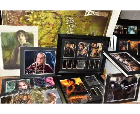
Lot 659
LORD OF THE RINGS FILM MEMORABILIA comprising eight framed limited edition film cells, collectors edition art portfolio of poster prints, signed photographs with certificates for Paul Norell, Harry Sinclair, Ian Holm, Andy Serkis, Craig Parker, Jed Brophy and Lawrence Makoare, Frodo print and map (box and loose map)
Lot 791
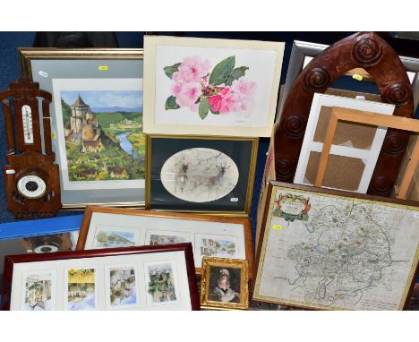
A BOX OF LOOSE PRINTS, MIRROR, LATE VICTORIAN BAROMETER IN AN OAK FRAME, ETC, including a limited edition Toni Goffe 'The Morning Wash' print, No 243/495, certificate attached verso, a late 17th Century Robert Morden map of Warwickshire, sold by Abel Swale, Awnsham and John Churchill, hand coloured, 37cm x 43cm framed and glazed (box and two loose)


Lot 26
A PROMOTIONAL MAP OF SINGAPORE 1963/1975 A scarse promotional map of Singapore published for Air India, published by Tien Wah Press, Singapore (founded in 1939 and is today a subsidiary of Dai Nippon Printing Co. Ltd.) Centered on the Downtown Core, the map extends from Pasir to Singlap and north to Serangoon. In the bottom right side there is the advertisment with Air India International routes . When the Indian airilines merged in 1953 , Air India took over all the International routes, while Indian Airlines , based in Delhi, focused on domestic routes. The map is undated . The heading "State of Singapore " suggests that it was published when Singapore was one of the 14 States of Malaysia, from 1963 to 1965 . According to the National Library, which holds one copy, it might have been printed in 1975. 107 cm x 83.5 cm (framed) Condition: Warm even toning, fold wear in various areas, minor repair on the edge on the left side and along some folds, tiny holes repaired, original condition


Lot 177
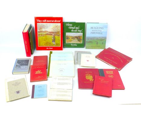
An 1844 'Hunting & Shooting' diary, with handwritten entries, together with a large collection of 20th century Sporting and Hunting books, including four Association of Masters of Harriers and Beagles Kennel Stud books for 1930-32 and 1936, 'Foxhounds and Their Handling in the Field' by Lord Henry Bentinck (pub. 1922, London) with pasted Neil Cawthorne signature and print to front page, together with 'Jackson's Map of the York and Ainsty Hunt'. (1 box)

Lot 193
A collection of sporting books and ephemera, including two list of Cheshire Hounds, one for the 'South Cheshire Hounds 1806 to 1882', and the other spanning 1888 to 1938' with printed entries up to 1905 and handwritten entries thereafter, 12mo, 'Illustrated Map of the Belvoir Hunt... Enlarged edition' and two small late 19th century 'Fixtures' maps for Cottesmore and Warwickshire hunt' two other pocket maps. (2 bags)


Lot 229
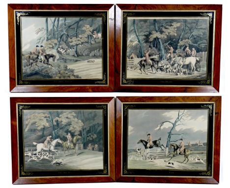
A group of 19th century and later prints, including a set of four hunting prints after Henry Alken, in titled verre eglomise mounts and rosewood veneered frames, each 49 by 59cm overall, originally from Cassiobury, the set of the Earl of Essex, and three further smaller prints, a map of 'Leicestershire', a view of 'Neville Holt' School, and a view of 'Lichfield'. (7)
Lot 230
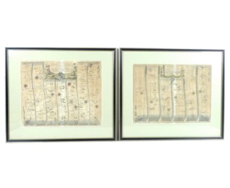
After John Ogilby: a pair of ribbon map engravings, comprising 'The Road from Cambridge to Coventry, by John Ogilby Esq, His Ma'sties Cosmograph'r, Containing 80 Miles, 6 Furl. Viz't From Cambridge to Ellsey ii.5 to St Neotss 5'4 to Great Stoughton 5'3 to Higham-ferries 12.m to Northampton 15.1 to Watford 11 m, 5 fur to Rubby 7.7 & to the City of Coventry 11,5', 36 by 43.5cm and 'The Road from London to Oakham, in Com Rutland, Continued to Richmond in Yorkshire, by John Oilby Esq'r His Ma'ties Cosmograph'r, Containing 262 mile, 2 furl, Vis't From ye Standard in Cornhill London, to St Albans in the Holyhead Road, 22.5, to Luton, 8m to Selso, gm, to Bedford 87, to Chellington 9, to Wellingborough, 9.1 to Kettering7.1 to Rokingham1j.2 to Uppingham, 4.6 and to Oakeham, 6.2. thence to Barnsley in Plate the 2nd, 81, and to Richmond in plate the 3rd, 87', 33 by 45, both framed and glazed, 51.5 by 60cm. (2)


Lot 1205
A framed map of the East Riding of Yorkshire by J & C Walker with an applied plaque to the frame inscribed " Removed from the County Hall, Beverley on the cessation of the E.R.C.C. 31st March 1974. 34 x 41cms.Condition ReportSlight water marks to top and bottom left corners. Some bugs under the glass. Overall good condition.


Lot 1253
Five prints to include "Fishing Party" drawing by Westall engraved by Cornoroto, Durham Cathedral and Framwellgate Bridge by Featherstone Robson, Lord Nelson, a new map of the Island of Minorca and "Hull" by G Balmer and engraved by W. Finden.Condition ReportAll in good condition. Durham with minor foxing. Fishing Party and Hull with very minor grime under glass.


-
109198 item(s)/page