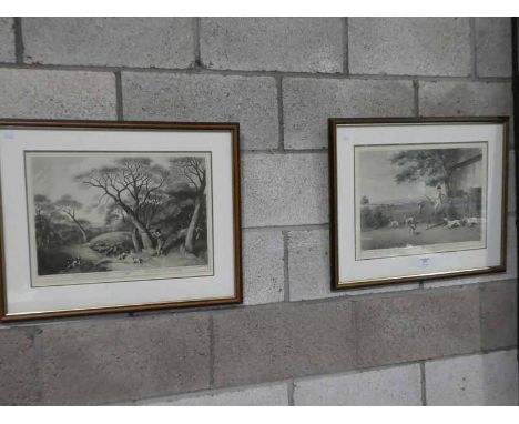
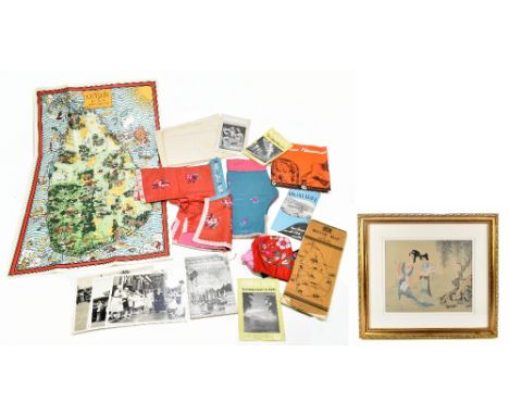
We found 109198 price guide item(s) matching your search

Refine your search

Year

Filter by Price Range
  • List
  • Grid
  • 109198 item(s)
    /page

Lot 162

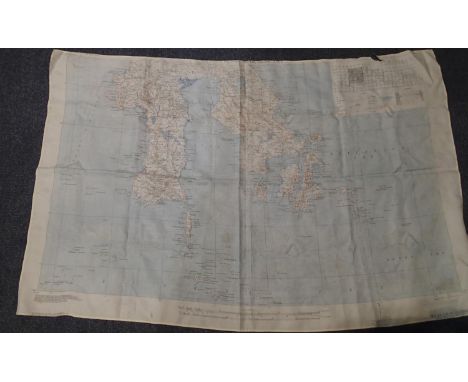
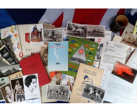
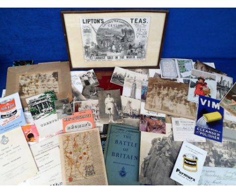
An early 20th century child’s silk outfit with matching hat, with floral decoration, together with an assortment of ephemera relating to Ceylon including maps and motor vehicle booklet, also a modern Chinese painting on silk depicting two figures in landscape setting.Additional InformationRegarding the printed map of Ceylon, it is a reproduction copy, it is stamped 'Printed and published under the direction of I.F. Wilson M.C Surveyor for General Caylon January 1849', but this is a copy of the original map and looks to be mid-20th century.

Lot 2109

ROBERT MORDEN; an original hand tinted map of the West Ridings of Yorkshire, 38.5 x 42cm, together with a further hand tinted map of Wiltshire, 38 x 47cm (2).

Lot 57

A SIGNED LIMITED EDITION SUZIE EMERY PRINT ENTITLED 'HEAD OF THE STORM' NO. 183/550, TOGETHER WITH A FRAMED AND GLAZED MATISSE POSTER AND AN AUSTRALIAN PRINT, A FRAMED AND GLAZED PRINT OF SAIL BOATS MOORED IN A HARBOUR, BY TONY WARREN 1992, OVERALL HEIGHT 58 CM, A FRAMED AND GLAZED REPRODUCTION ENAMEL PLAQUE OF A SUPERMAN COMIC COVER, OVERALL HEIGHT 58 CM, A FRAMED AND GLAZED COLOURED TINTED MAP OF WARWICKSHIRE, OVERALL HEIGHT 45 CM, A GILT FRAMED OIL ON CANVAS OF A SUB CONTINENTAL FISHING SCENE, INDISTINCTLY SIGNED LOWER CENTRE LEFT, OVERALL HEIGHT 76 CM (7)

Lot 79

A COLLECTION OF PRINTS TO INCLUDE A RETRO TWO IN ONE FRAME MICHAEL THOMAS PRINT, RETRO PRINT OF A LADY BY TORINO, SET OF FOUR NOVELTY PRINTS, MAP ETC. (9)

Lot 165

K.J.W, 'Cymru', limited edition annotated coloured print being a map of Wales, signed with initials by the artist, no. 16/100. 34 x 27cm approx, framed and glazed. (B.P. 21% + VAT)

Lot 35

The Silver Map of Great Britain with the boundary lines and Coats of Arms of the Historic Counties, London 1978, a limited edition authorised and issued by the council for the protection of rural England, with silver gilt decoration and crests within frame, hallmarked London, 70cm x 50cm

Lot 3195A

1994 dated American silk map of the Pacific ocean with four British cap badges. P&P Group 1 (£14+VAT for the first lot and £1+VAT for subsequent lots)

Lot 38

LARGE MAP FROM BESSBROOK MILL WHICH IDENTIFIES MILITARY AND ROYAL ULSTER CONSTABULARY CASUALTIES/FATALITIES 1969-1997 SOUTH ARMAGH TO INC CROSSMAGLEN, NARROWATER, NEWRY ETC

Lot 898

Ephemera, a large selection of vintage items to include 1930s Brighton Student Hospital Rag Mags, WW2 Military magazines, Cemsa Caproni photographs of factory, blue prints and advertising information c 1950s, vintage magazines (Screen Romances, Graphic etc.), maps, greetings cards, booklets, album of theatre programmes c 1950s (Al Read, The Crazy Gang, Sonja Henie, etc.), 1862 Thames Embankment Commission map (poor), 1950s ice hockey programmes, advertising cookery booklets, Cub and Scout booklets (3), 1909 Black Wyandotte Club Year Book, 1966 The Old Berkley Hunt Point to Point race card, 1960s Hastings guide book, 'Simone de Beauvoir Brigitte Bardot with a Photographic Selection' book, large collection of vintage book plates etc. (mixed condition poor to gd) (100s)

Lot 888

Ephemera, to include Bukta 1960s Scout & Guide uniform catalogue, 1957 World Scout Jubilee Jamboree programme, 1930s Guernsey Motors timetable, 1924 British Empire Exhibition catalogue, 1869 bound copies of 'Echoes' commencing No1 Jan 9th 1869, 1950s Swiss tourist tickets, maps and timetables, postcards to include Royalty, 1910 International Horse Show, Spanish Riding School etc., letters signed by Dorian Williams, Nicholas Soames, Major General Errol Lonsdale C.B., MBE, 1950s R.M.S. Queen Mary hard backed brochure, 1955 Manual of Map Reading Air Photo Reading and Field Sketching etc. (gen gd) (qty)

Lot 1179

Postcards, a collection of approx 125 cards of Switzerland, with strength in Railway, both main line and various moutain railways specifically Rigibahn, also Vitznau station, good chromo Gruss Aus and scenic art cards (11) one postally used 1896. Sold with map card of Oberland Bernois and pictorial postally used Hotel advert used 1878 (crease) (mixed condition, fair/gd)

Lot 892

Ephemera, a selection of items to include 1895 Whitman & Barnes Mfg. Co. promotional letter opener/calendar, WI membership card and exhibition certificate (1935), Nash Estate, Rayners Lane map showing layout of building plots, shops etc. 1935, Royal Geographical Society Christmas card, Trans-Antarctic Expedition with tipped in photo c1955 etc, (gen gd) (100+)

Lot 1229

Postcards, a collection of 17 cards of Cyprus with RPs of Ledra Palace Hotel Nicosia (2), map, donkey with 2 carrying baskets, printed cards of Famagusta harbour, Limassol, Tuck published (5) etc (mainly gd)

Lot 1146

Postcards, a good mixed subject collection of approx 104 Gruss Aus and Continental art cards. Gruss Aus cards mostly German, artists include Becker, Cassiers. Also Czechoslovakia, Austria, France, USA, Belgium. Also many chromos, map card, banknote, pre 1900 cards 1897, 98, 99 etc (mixed cond, some wtf)

Lot 821

Ephemera, Transport, selection of items, 1920's onwards including RP postcard of Phillips lorry, shipping & railway items, London Transport fold-out map of General Routes 1930, AA Foreign Motoring Guides, magazine adverts etc (mixed condition, fair/vg) (approx. 30 items)

Lot 890

Ephemera, 160+ items to include 1877 calendar, Sunlight, Vim and Lux advertising inserts, Lipton's Tea (1896), 1950s advertising maps and brochures (Clarks, Ching & Co Cigarettes, Duradio paint etc.), Victorian photographs (charabanc, Crystal Palace, uniformed staff, Royal Album of Windsor Views etc.), 1940s and 50s Ration Books, postcards, cigarette cards, bill heads, 16 b/w photographs of Dorothy Perkins offices and new stores showing staff in their uniforms, store layout etc., Spanish Riding School photograph, 1933 auction catalogue, 1960s Mount Kenya Safari Club leaflet, Treetops Safari Lodge menu, small 18thC map of Glastonbury, Glasgow University Graduate Apprenticeship booklet for The Bristol Aeroplane Co. Ltd., and other Glasgow Uni items, Lawson Wood book illustrations etc. (gen gd) (160+)

Lot 950

Postcards, a glamour collection of approx 215 cards, artists include Harrison Fisher, Boileau, Spurgin etc. Also large letters, pretty girls, romance etc. Sold with approx 34 novelty cards incl. pull-outs, window, applique, wood, HTL, alphabet for the deaf, embossed map of S. America, etc (fair/gd)

Lot 827

Ephemera, Transport, a qty. of items to include 1899 Bacon's County Map & Guide, Surrey, ABC Guide to London (1911), Notes on Map Reading (War Office 1940), How To 'Do' London In A Day (c1928), 1938 London Transport Map, 3 1955 Green Line coach maps, aviation postcards, petrol coupons, photographs, advertising etc. (gen gd) (60+)

Lot 880

Ephemera, approx. 100+ items of assorted Victorian and early 20thC insurance/assurance documents, sale particulars, Burial Board documents, Howshaw Common estate map, bills etc. (mixed condition fair/gd) (100+)

Lot 725

A FRAMED 1930S ORDNANCE SURVEY ROAD MAP, NORTH DEVON and two reproduction maps

Lot 839

A HARDWOOD FRAMED MAP-TOPPED COFFEE TABLE and another similar (2)

Lot 725a

'AN ACCURATE MAP OF DORSET SHIRE' BY EMAN BOWEN

Lot 719

IL PETRARCHA CON L'ESPOSITIONE D'ALLESSANDRO VELLUELLO E CON MOLTE ...' 1528, stamped leather binding, possibly lacking frontispiece, other damage, remains of paste-paper wrapper, inscriptions, annotations, map present

Lot 726

ROBERT MORDEN: COLOURED MAP OF SUSSEX and another of Hampshire

Lot 566

4 x Victory Vintage Boxed Plywood Puzzles Comprising Of British Isles Map. England Wales Map. The World Map And The Famous Steam Engine King George VI

Lot 196

A Silver plated cigarette case embellished with various London related maps,Post 1932 - Pre 1946, apparently no makers marks,Rectangular form with ribbed sides, the front cover engraved with a road map of greater London from Boreham Wood to Biggin Hill and Ealing to Woolwich, the back with London postal areas (such as WC1, EC2, N5, etc) against an engine turned ground, the inside having a London Underground map and two compartments for cigarettes,13.9 cm x 8.8 cmProperty of a Gentleman. Note: Dating of this cigarette case is approximate and based on the tube map on the inside of the cover - no ‘York Road' Station, between Caledonian Road and Kings Cross Stations, it was closed in 1932 - and the map has 'Mark Lane' station next to Monument which was renamed Tower Hill in 1946. Some light rubbing and wear to exterior surfaces - but maps are all legible. Interior with lighter wear. Generally good.

Lot 221

Robert Morden map of Essex, hand coloured, framed and glazed

Lot 219

1821 folding map of Essex and 1906 official map

Lot 623

Bacon's Large Print map of London and Suburbs dated 1894, together with a box of various other maps

Lot 222

William Kip map of Essex, hand coloured, in glazed frame

Lot 220

Johannes Janssen map of Essex, hand coloured, framed and glazed

Lot 421

Cecil Aldin - two Edwardian prints in glazed frames and another pair prints and a map (5)

Lot 439

Two continental posters : Pavorotti and a map (2)

Lot 454

A framed map of Denmark, 53 x 45 cm

Lot 254

John Speede, 'Hertfordshire Described, The Situations of Hartford and the most ancient towne S. Albans...', a map with coloured detail, 39 x 51cmCondition report: Close-mounted.This appears to be a period version. It has not been inspected out of the frame.

Lot 230

LEWIS & CLAYTON LTD (Producers of Titanium Fine Art) limited edition print - 'The Strawberry Girl', 65 x 50cms overall, harvesting scene print of similar size, titanium etching of 'Llyn Tegid or Bala Lake', a vintage Lewis & Clayton Ltd titanium etching of a horse, a COULSON print, a vintage Worcestershire map together with a pair of bamboo framed tapestries on silk featuring exotic bird and floral scenes, 46 x 46cms overall ETC

Lot 126

Of Falklands War interest, A collection of various restricted maps, including Stanley Minefield and Clearance Situation map, dated 84, a 1944 dated map of Britain and surrounding area, a kit bag marked '2285946 W.E Chicken 16 SQDN B.A.F.O c/o B.A.O.R, a gun sight and an Argentinian ammo case (parcel)

Lot 248

World War Two German Target Map of England, folder 11, south of England, loose-leaf maps and booklet of photographs, Berlin, 1941, G

Lot 667

A Bristol 'Greyhound' Motif with Transfers and other Transport memorabilia, the off-side (right-facing) Bristol Greyhound motif in cast aluminium, with polished ali 'hound and red-painted surround, G, slight corrosion to exposed metal areas, a set of Tearnes crimson 'Bristol-Greyh-ound' transfers (in three sections, the stylised 'B' being approx 9" high), G-VG, slight damage to the 'Bristol' section, a Tearnes 'Bristol' fleetname transfer in black-edged cream approx 30" long, VG-E, a legal ownership transfer from Holmes Saloon Coaches Ltd (Isle of Wight), VG, two 'on hire to... (NBC subsidiaries) paper labels, a London Transport central area tube map (18" x 6½") on plasticised hardboard, with later posters and model railway books (qty)

Lot 732

A 1965 Vietnam Zippo lighter, patent 2517191, with 1965 marking to base, original 251 insert, with engraved sides, with Vietnam map to one side and text to the other, together with a 1995 polished chrome Zippo with crest 'Brave' with Indian Headdress, unused, with case and cardboard sleeve (2)

Lot 97

An assortment of various paper ephemera, to include Indian Propaganda leaflets, notes of a training RAF pilot, Daily Telegraph Map 1938, The Salient 1915, The Ypres Times, two voice recordings, WWI Souvenirs, Anti Gass Eye Shield, Rovering To Success by Lord Baden Powell and more (parcel)

Lot 405

LYON, STUDY OF ROSS ON WYE, HEREFORD, WATERCOLOUR, F/G TOGETHER WITH JACQUELINE COPEMAN STUDY OF WALSINGHAM SNOWDROPS, WATERCOLOUR, F/G, AND A FRAMED MAP OF NORFOLK, LARGEST 48CM WIDE

Lot 147

BRADSHAWS GENERAL RAILWAY STEAM NAVIGATION AND HOTEL GUIDE 1937 TOGETHER WITH A POCKET MAP OF THE BRITISH ISLES

Lot 489

MIXED LOT COMPRISING A FRAMED MAP OF NORFOLK, COLOURED ENGRAVING 'CAISTER FROM THE BEACH', COLOURED ENGRAVING 'YARMOUTH', FURTHER OIL ON BOARD STUDY OF A RIVERSIDE SCENE, AND BOOK PRINT MARKED 'EVENING DRESS', ALL FRAMED, LARGEST 45CM HIGH

Lot 429

MIXED LOT OF PICTURES TO INCLUDE SIMON BULL LTD ED PRINT - RIVERSIDE COTTAGE, A COLOURED MAP OF SUFFOLK, COLOURED MAP OF DORSET AND VARIOUS OTHERS

Lot 644

A pine framed map of Suffolk

Lot 613

A framed print "Map of the World" by Richard Haldingham

Lot 442

A framed Belgian Trenches map

Lot 247

A map of Essex; and a coloured print of a seated partly naked woman

Lot 1580

Two coloured engraved maps and views - ‘’New map of the Cityes of London, Westminster and the Burrough of Southwark’’, 1707; ‘’View of London from Lambeth’’, 31 x 57cm.

Lot 1596

Three coloured engraved maps - ‘’Carte de Norwege & Suede’’, 1755, 50 x 57cm. ‘’The Kingdom of Denmarke’’, augmented by John Speede, 1626, 42 x 54cm. and ‘’A New map of Germany’’ augmented by John Speede, 1626, 41 x 52.5cm.

Lot 63

A large wall chart style map of england

Lot 94

An 18th century strip map from Carlisle to Lancaster, taken from a book and in two window slip mount, framed and glazed; together with a George III hand coloured map of the County of Lancashire25 cm x 20 cm, framed and glazed (2)

Lot 73

18th Century map of Sweden with Finland by T Bowen c1780, 31cm x 41.5cm, framed and glazed

Lot 70

17th Century map of England Anglia Regnum, pub Amsterdam c1646 by Jan Jansson, 39cm x 50cm, framed and glazed

Lot 76

A 17th century book map of Lancashire 20cm x 18cm, framed and glazed

Lot 66

17th Century map of England Angliae Regnum by Nicholas Visscher II, with dedication to William III pub Amsterdam 1696 56cm x 50cm, framed and glazed

Lot 737

ANTIQUE COLOURED MAP OF LANCASHIRE TOGETHER WITH A MAP OF THE HUNDREDS OF CRANBROOKE, BARKLEY AND ROLVENDEN, BOTH F/G, LARGEST 66CM HIGH

Lot 256

A pair of sporting prints, map of Lancashire, print and collage of film stars

Loading...Loading...
  • 109198 item(s)
    /page

Recently Viewed Lots