We found 109198 price guide item(s) matching your search

Refine your search

Year

Filter by Price Range
  • List
  • Grid
  • 109198 item(s)
    /page

Lot 556

A map, Westmoria, Westmorland, attributed to Blaeu, 17th century, later coloured

Lot 596

A late 17th/early 18th century map of Westmorland by Robert Morden, later coloured

Lot 597

A late 18th/early 19th century map of Cumberland, published by Duncan, later coloured

Lot 598

A late 17th/early 18th century map of Westmorland by Robert Norden, later coloured

Lot 324

17thC ANTIQUARIAN COLOURED MAP OF NORTHUMBERLAND after Blaeu dated 1645, 40.5cms x 49.5cms to outer margins

Lot 330

17thC ANTIQUARIAN COLOURED MAP OF CUMBRIA after Blaeu dated 1645, 41cms x 50cms to outer margins, framed

Lot 427

Johannes Norden and William Kipcoloured engravingMap of Sussexia9 x 15.5in.

Lot 883

AN ANTIQUE MAP of Oxfordshire 30cm x 40cm

Lot 278

A VICTORIAN PARIAN WARE BUST OF 'CLYTIE', STAMPED B.B-W & M (H: 28.5 cm) TOGETHER WITH A SET OF POSTAL SCALES AND A MAP OF SUSSEX PUBLISHED AND ENGRAVED BY PIGOT & CO. MANCHESTER [3]

Lot 88

MAP OF OLD LONDON, framed and glazed, 91cm x 133cm.

Lot 2122

'Vignoble de la Champagne', Institut National Des Appellations D'Origine Des Vins et Eaux-de Vie, colour map, 86cm x 108cm Condition Report Click here for further images, condition, auction times & delivery costs

Lot 562

Emmanuel Bowen (British cartographer, 1694-1767): an 18th century map of Lincolnshire, divided into its Wapontakes, with cartouches, perpetual Tides Table for The Washes, and dedication to Peregrine Bertie, Duke of Ancaster, hand coloured, printed by Robert Sayer, with dedication legend verso, 70 by 52cm, framed and glazed, 94 by 75cm.

Lot 567

After Wilfrid Rene Wood (1888-1976): an 'Illustrated Street Map of Stamford', coloured lithograph, signed and dated 1950 to the plate lower left, 43 by 56cm, framed and glazed 60 by 62cm.

Lot 106

Framed Robert Morden map print 'Essex' (47cm x 39cm including frame)

Lot 35

JOHN SPEED coloured & tinted antiquarian map - Denbighshire, Sudbury and Humble edition, 1610, 39 x 51cms

Lot 37

ROBERT MORDEN a coloured and tinted map of the county of Monmouth, 34.5 x 41cms

Lot 48

FIVE COLOURED & TINTED ENGRAVINGS - various scenes of Beaumaris and an interesting map of the Town and environs of Beaumaris together with a smaller geographical map of Beaumaris and the area, estimated date late nineteenth century, 30 x 9cms (parcel of six)

Lot 464

LARGE WALL HANGING MAP OF THE BRITTISH ISLES EST [£15- £30]

Lot 154

Robert Morden Hand coloured Map of Cumberland titled upper left and inscribed lower right, sold by Abel Swale Awnsham and John Churchill, in a glazed frame, 39 x 44cm

Lot 188

John Speed Framed hand coloured map 'The Kingdome of Scotland' circa.1670, in a glazed frame, 52 x 42cm

Lot 1059

A Trench Art desk-piece, modelled on a rifle stock, mounted with R.E.M.E. badge, together with an Ordinance Survey Guillemont Trench Map dated 1916, three W.W.1 Christmas cards, and a small book 'Ten Chapters 1942 to 1945', by Field Marshall B. L. Montgomery (a lot)

Lot 1046

A set of four framed coloured prints of 19th century military personnel, a 19th century hand coloured map of Glasgow and eight other engravings and prints (13)

Lot 460

A collection of military buttons, badges, silk map, 2 sporran's & pocket knife ( 1943 Fife Constabulary item of evidence with original log tag)

Lot 120

A framed map of the Borders size 31.5 x 24.5cm

Lot 331

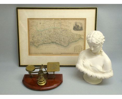
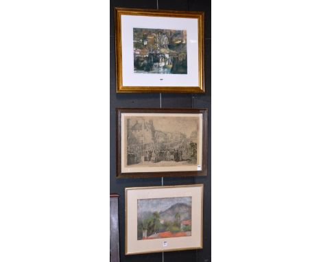
Raymond (?) (Contemporary)'Seascape'Oil on board, signed, 40 x 50cm, together with other pictures and prints to include a pastel of Alicante, an antique print 'Laying the Foundation Stone of Edinburgh University 1789', signed print by Miranda Watson 'The Ancient Kurdish City of Hasankey, Turkey', a map of Edinburgh and a map of the Isle of Mull etc (7)

Lot 314

A collection of metal wares, together with a map of Suffolk and a map of Middlesex

Lot 127

Early 19th Century silkwork map of England & Wales dated 29th March 1802 in birds eye maple frame, L46cm x H51cm Condition Report Click here for further images, condition, auction times & delivery costs

Lot 91

'Country Durham', 17th century map by Christopher Saxon engraved by William Kip hand coloured 29cm x 35cm Condition Report Click here for further images, condition, auction times & delivery costs

Lot 1057

A reproduction County Map of Nottinghamshire; and two other reproduction county maps (3)

Lot 1093

A Map of Birmingham by Bernard Sleigh and Ivy Anne Ellis published Studio Press

Lot 251

AN EARLY FRAMED MAP, CASTILIAE VETERIS ET NOVAE DESCRIPTIO.

Lot 252

JOHN SPEEDE. A COLOUR FRAMED MAP, RUTLANDSHIRE.

Lot 253

ROBERT MORDEN. A COLOUR FRAMED MAP, HUNTINGDONSHIRE.

Lot 162

Game of Thrones map in gilt frame

Lot 237

A large framed 'Historical Map of England & Wales'

Lot 494

Colour & tinted antiquarian map of South Wales by EMANUEL BOWEN together with a framed watercolour of a figure on a woodland path

Lot 659

A parcel of collectables & jewellery including Accurist wristwatch, hip flask, boxed vintage map measure, cuff links etc

Lot 262

MAP OF FRANCE SLATE CHEESE BOARD BY SLATEDthe natural slate board cut into the shape of the country and backed with felt, 35.5cm high, in presentation box

Lot 263

MAP OF SCOTLAND SLATE CHEESE BOARD BY SLATEDthe natural slate board cut into the shape of Scotland and backed with felt, 50.5cm high, in presentation box

Lot 114

MORDEN (Robt.) Staffordshire, a hand coloured engraved map, framed and glazed, 42 x 36cm; Another, A Moules English Counties Map of Worcestershire, 27 x 20cm. (2)

Lot 117

JAILLOT (H) Les Isles Britannique, hand coloured engraved map, framed and glazed, 49 x 60cm.

Lot 258

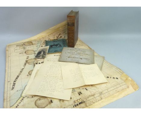
Livingstone, David: Missionary Travels and Researches in South Africa. 1857. Full calf leather binding with gilt panelled spine and marbled edges; together with a small archive of paper ephemera relating to Samuel Richardson of Brandesburton who assisted Livingstone as his penman in the preparation of the manuscript for this book whilst Livingstone was staying with Colonel and Mrs Webb at Newstead Abbey in Nottinghamshire. The archive includes Richardson's writing and other exercise books, photographs, letters of provenance from Samuel's brother, William, etc. Also a 19th century map of Palestine dated 1850 which was over-drawn and handcoloured by his sister Mary Richardson of Brandesburton School. 70cm x 56cm

Lot 442

LE ROYAUME D'ECOSSEThe Kingdom of Scotland, a French map of Scotland, 49cm x 57.5cm

Lot 290

A Southern Railway general system map

Lot 558

A framed, coloured map of Somerset Shire by Robert Morden

Lot 713

A framed Ordnance survey map centred on Axminster

Lot 169

After Tombleson,'Panoramic Map of the Thames and Medway,coloured lithograph,114 x 24 cm

Lot 354

A WWII Nazi canvas back map titled Feldzug in Frankreich 10.5.1940-19.9.1940, showing details of France, southern Belgium and England, together with a Nazi paper map of Germany and the bordering countries, and a picture album titled 'Kriegserinnerungen 1939-1945' containing a collection of black and white photographs (3)

Lot 438

A large mid 20th century canvas map titled Volksrepublik China map, suspended on two ebonised wooden poles

Lot 439

A large mid 20th century canvas map titled Alpenlander, suspended on two wooden poles

Lot 239

A fine Chad Valley moon eyed teddy bear 1920s, with blonde mohair, bright clear and black glass eyes with orange backs, pronounced clipped muzzle, black stitched nose, mouth and claws, swivel head, jointed limbs with brushed light brown cotton pads, the feet card lined, rounded hump, growler and rare map of England celluloid covered button on upper chest -22¾in. (58cm.) high (slight thinning on back) - this bear is known as Lewis and was purchased from the Tetbury Teddy Bear Museum

Lot 294

19th century English miniature terrestrial globe, in a turned mahogany box, the globe 3cm diameter, case 5cm x 4.2cm. CONDITION REPORT: The cover has been broken into four pieces and visable re-glued. The base of the case is in good condition. The globe has a slightly yellowed varnish and a few minor scrathes to the the varnish. No obvious losses to the "map"

Lot 1142

A German WWII (PATTERN) flag pole top, an NSDAP Party flag, 1944 marked map of Germany and a German WWII (PATTERN) Red Cross sachet

Lot 594

E. Mentelle, hand tinted map of Spain and Portugal, 1808, folding in square sections and on canvas backing, original outer slip case, published by John Stockdale, Piccadilly.

Lot 1105

A Decorative Clock Unusual clock housed in octagonal laquered wood hinged case. Internal clock features gold tone hardware with moving bezel and central world map design in gold tone. Very good condition.

Lot 1480A

3 Framed Disney Memorabilia. Comprises 1/ Mickey Mouse Treasure Map Adventures, 2/ Collectable Stamps from The 101 Dalmation Film. 3/ Set of Snow White and The 7 Dwarves Cards. All From a Private Collector.

Lot 371

Robert Sayer - 18th Century hand coloured engraved map - A Modern Map Of The Post Roads Of England And Wales With Part Of Scotland, framed and glazed Condition:

Lot 428

MODERN CANVAS MAP IN 4 SECTIONS

Lot 418

A 'Geographia No 2 Western Front' folding map and sixteen various ordnance survey maps.

Loading...Loading...
  • 109198 item(s)
    /page

Recently Viewed Lots