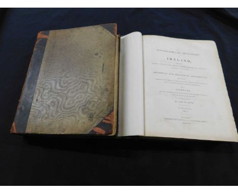
JEAN-MARIE CARRE: LA VIE AVENTURESUSE DE JEAN ARTHUR RIMBAUD, Paris, Librairie Plon, 1926, folding map at end, leaves browned, original pictorial wraps plus ANDRE ROLLAND DE RENEVILLE: RIMBAUD LE VOYANT, Paris, Sans Pariel, 1929 first edition, leaves browned, original wraps, plus ALAN ROLAND CHISHOLM: THE ART OF ARTHUR RIMBAUD, Melbourne University Press, 1930 first edition, original cloth d/w, plus JACQUES RIVIERE: RIMBAUD, Paris, Editions Era, 1930 (1800) numbered (931), original wraps plus BENJAMIN FONDANE: RIMBAUD LE VOYOU, Paris, Denoel Et Steele, 1933 first edition, original pictorial wraps, plus PAUL VERLAINE: RIMBAUD RACONT..., Paris, Mercure, 1934 first edition, leaves browned, original wraps, plus SIMON GODCHOT: ARTHUR RIMBAUD NE VARIETUR 1854-1871, Nice, Chez L'Auteur, 1936 (1000) numbered (857), original wraps plus CECIL ARTHUR HACKETT: RIMBAUD L'ENFANT, Paris, Jose Corti, 1948 first edition, original wraps, plus PIERRE PETITFILS: L'OEUVRE ET LE VISAG D'ARTHUR RIMBAUD, Paris, Nizet, 1949 first edition, leaves browned, original wraps plus HENRI MATARASSO & PIERRE PETITFILS: VIE D'ARTHUR RIMBAUD, preface Jean Cocteau, Paris, Hachette, 1962 first edition, original cloth d/w (10


![[THOMAS KITSON CROMWELL]: EXCURSIONS IN THE COUNTY OF NORFOLK..., London for Longman, Hurst, Rees, Orme & Brown, 1818-19,](https://cdn.globalauctionplatform.com/6f60fccf-4fac-47f6-9867-af8600f8a0a5/e68f05f0-b5e8-409f-9fcd-afe400d83295/468x382.jpg)
![ERNEST R SUFFLING: THE LAND OF THE BROADS, Stratford, Benjamin Perry, [1896], re-written and illustrated edition, folding fro](https://cdn.globalauctionplatform.com/6f60fccf-4fac-47f6-9867-af8600f8a0a5/97a3c82b-6e9e-4d12-b752-afe400d833af/468x382.jpg)


![Hendrik Hondius: Orcadum et Shetlandiae Insularum Accuratissima Descriptio, engraved hand coloured map, Amsteodami [1638], ap](https://cdn.globalauctionplatform.com/6f60fccf-4fac-47f6-9867-af8600f8a0a5/3099084a-35f9-44d5-afa9-afe400d8a29d/468x382.jpg)
![JOHN SPEED: MIDDLE-SEX DESCRIBED WITH THE MOST FAMOUS CITIES OF LONDON AND WESTMINSTER, engraved hand coloured map [1627], ap](https://cdn.globalauctionplatform.com/6f60fccf-4fac-47f6-9867-af8600f8a0a5/fc7066b1-8ff3-48ad-8081-afe400d8a2f2/468x382.jpg)

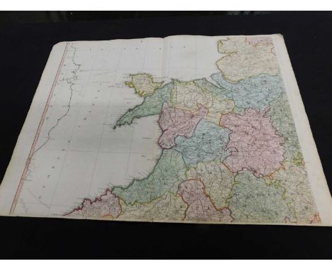
![Joan Blaeu: Nortfolkcia Norfolke, engraved hand coloured map [1645], approx 380 x 495mm, framed and glazed](https://cdn.globalauctionplatform.com/6f60fccf-4fac-47f6-9867-af8600f8a0a5/4cf2012a-2789-4fb7-8e9b-afe400d8a456/468x382.jpg)