We found 109182 price guide item(s) matching your search
There are 109182 lots that match your search criteria. Subscribe now to get instant access to the full price guide service.
Click here to subscribe- List
- Grid
-
109182 item(s)/page


Lot 12
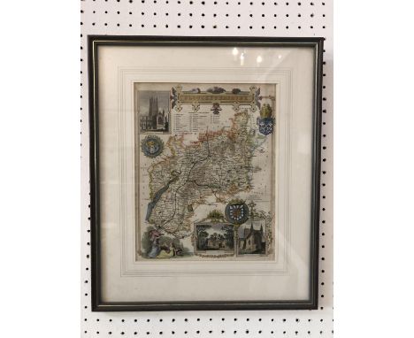
TWO HAND-COLOURED MAPS: GLOUCESTER AND LANCASHIRE. J. & C. Walker - 'Map of the County of Gloucester, from and Actual Survey Made in the year 1823, by C. & J. Greenwood, Published by the Proprietors, Greenwood & Co. 13 Regent Street Pall Mall, London, Corrected to the present Period and published Jan'y 26, 1831', 62 x 69 cm; together with a map of Lancashire 18 x 23 cm (2)


Lot 102
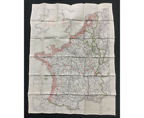
J. COVENS & C. MORTIER - Map of the Viscounty of Paris (published by Guillaume de L'Isle 1675-1726): 'Carte de la Prevosté et Vicomté de Paris: dressée sur un grand nombre de memoires particuliers assujettis aux observations de Mrs. de l'Academie Rle. des Sciences par G.De L'Isle Premier Geog. du Roy a Amsterdam', 52 x 65 cm


Lot 104
A COLLECTION OF PRINTS INCLUDING EIGHT MAPS: Thomas Kitchin (1718-1784) - 'A New Map of Pembrokeshire' and 'Norfolk Drawn from an Actual Survey with Improvements'; J. Roper - 'Colchester', London, published for the proprietors by Vernor & Hood, Poultry, 1805; John Chapman & Peter André - 'Cambridge' and 'North Fambridge', approx. hand-coloured engravings, 47 x 60 cm each, published 1777; Map of roads in Yorkshire, printed on both sides, hand-coloured engraving; and two other later maps of 'Cambridgeshire' and 'Colchester'; together with pages from books including 'The New and Complete British Traveller Chapter II. Lincoln', and four engravings of Colchester, Essex and Norwich (14)


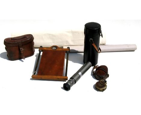
Lot 5146
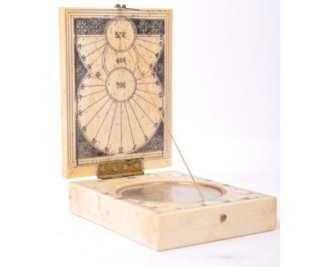
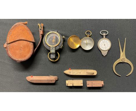
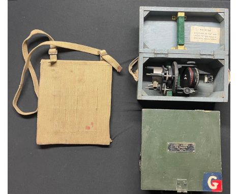
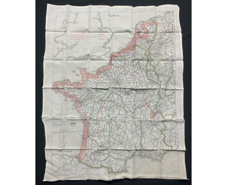
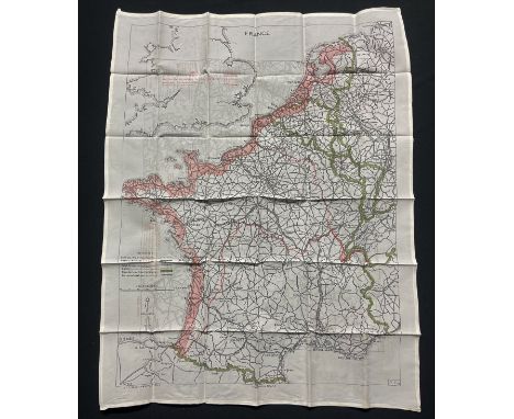
WW1 British Compass maker marked and dated "1918 E Koehn, Geneve, Suisse" serial number 136761. Marked with double facing Broad Arrow sold out of service mark. Complete with locking mechanism. Good original finish. Complete in leather pouch, strap very short. Along with a small pocker compass in brass marked "Made in France" and a French made map distance measuring tool, brass plotting table measuring tool and two wooden ship shaped items with brass hooks.


![Godofredo Henselio [i.e., Gottfried Hensel], Scholae A. C. ap. Hirschb, four mappae geographico-polyglottae, in various langu](https://cdn.globalauctionplatform.com/e9bcdf6e-d59c-4a7a-aa90-afba00f26717/98cac51d-3df3-4fdb-be90-afba00f5ff30/468x382.jpg)


Lot 217
Complete set of The Leibstandarte books, with map books, from JJ Fedorowicz. I. Hand-signed bookplate from Hubert Meyer (German Cross in Gold) II. Hand-signed bookplate from Hubert Meyer (German Cross in Gold) III. Hand-signed bookplate from Manfred Thorn, Panzer IV. driver in Peiper's Panzer Regiment IV/1. Hand-signed bookplate from Co-Author Ralf Tiemann (German Cross in Gold) IV/2. Hand-signed bookplate from Otto Kumm (Knight's Cross with Swords holder)

Lot 330
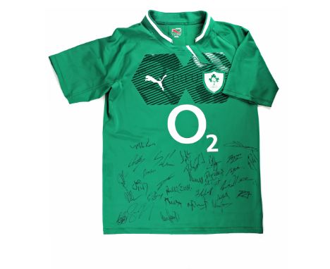
Rugby, Ireland senior international player's jersey, 2010, rugby jersey with silicon grips, holographic IRFU badge, and padded GPS pocket (match issued jerseys only, unavailable on retail sold jerseys). Signatures include: Mike Ross, Conor Murray, Ian Madigan, Robbie Henshaw, Devin Toner, Rhys Ruddock, Paul O'Connell, Rob Kearney, Gordon D'Arcy, Felix Jones, Rory Best, Brian O'Driscoll, Cian Healy, Tommy O'Donnell, Sean Cronin, Chris Henry, Peter O'Mahoney, Jordi Murphy, Iain Henderson, Jamie Heaslip, Dan Tuohy, Kieran Marmion, Luke Fitzgerald, Luke McGrath, Dave Kearney, Marty Moore, Darren Cave, Eoin Reddan et al. together with a signature map.

Lot 338
Gaelic Athletic Association, GAA, Hurling, 2004 Vodafone Hurling All Stars signed jersey, signed (faded) by (amongst others): Eoin Kelly, Ollie Canning, Tony Browne, Paul Kelly, Kevin Broderick, Tommy Walsh, John Hoyne, Cyril Lyons, Liam Dunne, Ken McGrath, Noel Hickey, Benny Dunne, Eddie Brennan, Michael Jordan, John Mullane; together with signature map.


Lot 58
Pablo Seminario (Peruvian b. 1948-) A pair of Peruvian motif tiles, hand-coloured incised terracotta tiles together on a shed mount, 30.5" x 27.25" (78cm x 69cm (each).*Pablo Seminario worked as an architect in Lima before moving to Urubamba in 1979 where he met his partner Marilu Behar, and together they developed their ceramic art studio. Seminario integrates elements from the ancient Peruvian cultures in his creations. His ceramic pieces have received several awards, including the Nacional Joaquin Lopez Antay award. Works by Seminario are exhibited in museums worldwide, including the MAP (Pre-Colombian Art Museum in Cusco), The Smithsonian National Museum of the American Indian, and the Field Museum of Chicago.


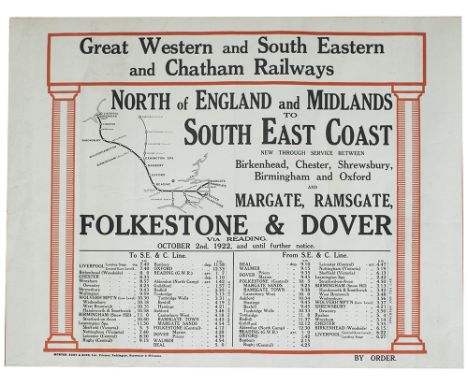
Lot 241
Official Map of the BURY PORT & GWENDREATH VALLEY RAILWAY system showing the lines and also images of the Stations, Docks and Office of the company. A rare if not unique survivor in good condition with some cracking and small areas of loss, mounted on linen with original wooden display mounts. Measures 25in x 19in.

Lot 242
Official map of the PORT TALBOT HARBOUR & RAILWAYS. Black gilt embossed cover with fold out hand drawn and coloured map on brown parchment type paper, signed Fred H Eynon, dated 29-8-91 and measuring 32in x 27in when opened out. Shows the floating harbour and various railway company lines, in very good condition.

-
109182 item(s)/page