We found 109182 price guide item(s) matching your search

Refine your search

Year

Filter by Price Range
  • List
  • Grid
  • 109182 item(s)
    /page

Lot 74

BULMER T. F. History, Topography & Directory of East Cumberland. Fldg. map. Orig. blue cloth. Manchester, 1884.

Lot 4

GAY JOHN. The Beggar's Opera. Ltd. ed. 50/950. Frontis & plates. Quarto. Orig. cloth backed brds. Daniel O'Connor, 1922; also John Gay, Trivia, endpaper map, frontis & plates, quarto, orig. white cloth gilt in slip case, Daniel O'Connor, 1922 & one other vol. (3).

Lot 274

WALKER J. & C. England & Wales ... Shewing All the Mail Coach, Turnpike & Rail Roads, The Rivers & Navigable Canals ... etc. Large fldg. hand col. linen map in slip case. 1847.

Lot 84

MORGAN WILLIAM. Ogilby's and Morgan's Pocket-Book of the Roads. Fldg. eng. map. 94pm. Small square 8vo. Book label & ownership inscr. as previous lot, 1732.

Lot 419

John Blaeu (1596-1673) - 'Map of Montgomeria', Montgomeryshire, hand coloured, and inscribed with the cartographers name in a later hand verso, 16.5" x 21"

Lot 209

'Accurate map of the county of Middlesex' by Thomas Bowen, 16.5" x 20"

Lot 429

Robert Morden (1650-1703) - 'Map of Northumberland', inscribed within a decorative cartouche, hand coloured, 16" x 13.5"; together with another map of 'Berkshire' by John Carey (2)

Lot 446

Robert Morden (1650-1703) - 'Suffolk', inscribed with a decorative cartouche, the map sold by Abel Swale, Awnsham and John Churchill, the date written by a later hand in green biro 1722, also with the cartouche, 14.5" x 17"

Lot 527

Motoring, a car badge of London, of heraldic design in standard wreath and crown chrome pattern by JR Gaunt in original box, together with a large vintage London Transport, Central Bus Routes map ( folded).

Lot 473

Cycling Map, a vintage Wallis revolving lap map in wooden display case together with a complete set of 5 UK maps and leather carry case

Lot 437

Motoring Mixed a Michelin "tin" wall road map of the UK 87cm x 72.5cm together with a collection of 1950's magazines including Practical Motorist, Car mechanic, Autocar and Old Motor (approx 25) together with four Brook Bond tea card albums and WWII paperback books on German forces.(2)

Lot 342

CAPTAIN ANDREW ARMSTRONG, THE MAP OF LINCOLN-SHIRE REDUCED FROM THE ACTUAL SURVEY MADE IN THE YEARS 1776, 7&8, ENGRAVING HAND COLOURED IN OUTLINE 1779, MOUNTED TO IMAGE, 51CM X 66.5CM FRAMED, THREE VELLUM INDENTURES, ONE FRAMED, ILLUSTRATED LONDON NEWS SOUVENIR OF THE CORONATION 1937, ETC

Lot 281

MAPS. THE POST OFFICE MAP OF DORSETSHIRE DEDICATED TO ROWLAND HILL ESQR, WITH ENGRAVED VIEW OF THE ARCHED ROCK LULWORTH AND IN CONTEMPORARY COLOUR, BACKED ON LINEN, ORIGINAL SCARLET BOARDS WITH EARLY OWNERSHIP INSCRIPTION OF WILLIAM KEMP MARCH 22ND 1879, LONDON: WILLIAM DARTON & SON: SIDNEY HALL (ENGRAVER) - DEVONSHIRE FROM THE SET OF THE ENGRAVER'S POCKET COUNTY MAPS, IN CONTEMPORARY COLOUR, ORIGINAL GREEN CLOTH COVERED BOARDS, LONDON: CHAPMAN & HALL, BOTH MID 19TH CENTURY (2) WAF

Lot 473

After Robert Morden, An 18th century map of Surrey, in glazed frame, 19.5cm by 24cm

Lot 505

After Isaak Tirion, an 18th century map of Holland, coloured, W van Poelgeest label verso, in glazed frame, 33.5cm by 38.5cm

Lot 506

After J Cary, an early 19th century map of Norfolk, in glazed frame, 40.5cm by 52cm

Lot 415

The Pilgrims Progress from this world to that which is to come, John Bunyan, explanatory notes by W. Mason, published by Alex Hogg, No. 16 Paternoster Row, undated, c.1782 (a/f missing frontispiece, loose binding, partial map with plates 3-16)

Lot 112

A framed map of China

Lot 120

Ephemera - tins; blotter pads; darning mushroom; tie press ; map measurer; etc (1 box)

Lot 281

T Kitchin (18thC). Map of Lincolnshire, hand coloured engraving, 23.5cm x 18.5cm, further map of Lincolnshire, after John Cary, and J.C Walker, map of Rutlandshire, 23.5cm x 18.5cm. (3)

Lot 279

J Ellis. A modern map of Lincolnshire, engraving, published by Carrington Bowles & Robert Sayer, London, 26cm x 20.5cm and J & C Walker. Lincolnshire, showing hunt areas and places of meeting of foxhounds, coloured engraving, published by J & C Walker, 9 Castle Street, Holborn, London, 41cm x 34cm. (2)

Lot 434

Johannes Blaue (Dutch 1598-1673). A hand-coloured engraved map of Hampshire, inscribed 'HANTONIS SIVE SOUTHANTONENSIS COMITATUS VULGO HANTSHIRE', the verso with Dutch text, mid 17th century , 41.6 x 50cm, in a later glazed double-sided Hogarth type frame.

Lot 456

An 18th century carved limestone column, with a Corinthian capital and a rectangular plinth, 411.5cm high (approximately). Provenance: Roger Warner Antiques, Burford Purchased from Roger Warner's cousin Robin Eden, Corsham, 17th January 1986. The property of the Rt. Hon. Sir Mathew Thorpe. Please note this lot is being sold in situ, it is located on a ridge just outside of Seend, a map is available on our website, alternatively contact the department for details. This lot is being sold under the condition that the buyer collects it by the 31st January 2017.
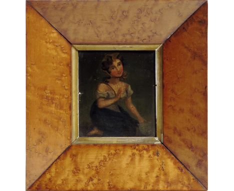
Lot 435

English School (19th century). An oil painting on board of a lady kneeling holding a letter in her left hand, in a bird's eye maple frame, 11 x 9.6cm, together with a pastel portrait of a lady, together with a map of SurrEy by Richard Blome, a sepia portrait of a man, the verso inscribed 'By Hy Edridge' and a stipple engraving of 'PATTY'. (5) Provenance: From the collection of the late Victor Needham.

Lot 1088

A large quantity of maps and posters of various themes to include Raleigh-Creda professional racing team, map of Germany, animal wall posters, poster of Switzerland, RSPB poster, Durham Cathedral etc.

Lot 1644

A 19thC rosewood chiffonier or collector's cabinet with an arrangement of thirteen brush slide trays within. Would suit lace, textile, map, music, mineral collectors etc (H93 x W127 x D51cm)

Lot 1175

Environs de Paris, linen-backed folding map of Paris, E Andriveau-Goujon (1876) with hand-colouring (32in x 40in)

Lot 1411

A large quantity of prints and pictures, a large proportion being signed limited edition to include Peter Kolodziejozyk, Wendy Reeves, Angela Bullock, Tina Weeks, map of the Thames and hunting, equine interest etc

Lot 1020

Mr Marshall, The Rural Economy of the West of England (London, G & W Nicol, 1805). Half leather and mottled boards, uncut pages complete with map

Lot 1144

Christopher Saxton map of Somerset "Somersettensis" 29x39cm

Lot 1120

An 18thC hand coloured 'Accurate Map of the Counties of Gloucester and Monmouth divided into their respective hundreds collected from the best materials and illustrated with historical extracts relative to their natural produce, trade, manufactures &c MLCCLX, dedicated to the Honourable John Thynne Lord Chedworth, Lord Lieutenant of The County of Gloucester...., printed for John Bowles in Cornhill...... 1760

Lot 1182

A map of Gloucester with calendars for 1924-1926 to top and bottom and local adverts to border (77x60cm)

Lot 1157

British Columbia railway belt, sicamous sheet, map showing lands disposed of, crica 1907 of Canada interest

Lot 12

TWO COMICAL GOLFING PRINTS TOGETHER WITH A FRAMED MAP OF STAFFORDSHIRE

Lot 389

Robert Morden, an original, sparsely coloured map of Kent. Framed and glazed.

Lot 409

Saxton and Kipp, an original sparsely coloured map, 'Radnor', Framed and glazed.

Lot 410

An original sparsely coloured map of Radnor, 'Radnoriensis', Hogarth frame and glazed.

Lot 406

Thomas Kitchin, 'an original sparsely coloured map of Shropshire', together with after John Speede, 'a facsimile coloured map of Wales'. Framed and glazed. (2)

Lot 411

John Speede, an original uncoloured map of the 'County of Radnor', together with a small uncoloured original map of Radnor, after John Owen and Emanuel Bowen. Framed. (2) CONDITION REPORT: This map is mounted very close to its margin and the frame is enclosed so the full extent of the map is not visible. Appears to be two or three vertical tears and some creasing along its top edge. Minor surface loss to the crease line. Frame is loose at its corners.

Lot 109

A Robert Morden map, The County Palatine of Chester, 35.5 x 42cm.

Lot 50

A small quantity of Third Reich and other items, including a relic SS dagger blade with traces of rare Himmler honour inscription (appears to have been in a fire and has scale and some deep pitting), together with an engraved brass plaque in similar condition with German inscription to SS Gruppenfuhrer Rediess, and bearing facsimile Himmler signature, which presumably relates to the dagger blade, 2 reels of coloured cotton with original paper wrappers and RZM/SS paper labels; a sports vest with large printed cloth eagle badge (very worn); 3 Elastolin SS figures and 3 others; an officers brown leather belt with beaded rectangular grey metal buckle, dated 1939; 2 soldiers leather belts lacking buckles (worn, one cut down); a leather map case, and a brass paper knife with runic symbols; also an Italian brass ring with bust of Mussolini; an Italian painted metal sew on shield badge to “X Flottiglia Mas”; 2 Italian War medals (1 AF); a WWI brass trench art brass cap with Canadian badge; 5 volumes of “Deeds that thrill the Empire” and several other small items. Average GC

Lot 380

An engraved and hand coloured map of Cheshire, 38.5 x 50.5cm

Lot 357

Robert Morden, Leicester Shire, hand coloured County map, stained and foxed, 37cm x 43cm.

Lot 341

Johan Blaeu, Rutlandia Comitatus - Rutlandshire, hand coloured county map, 38cm x 50cm.

Lot 151

A large vintage style map of London in black painted frame

Lot 270

C & J Greenwood coloured map of Dorset in a gilt frame, 30" x 25 1/2"

Lot 391

An oblong coffee table depicting a map of the World

Lot 129

"The Oarsman's and Angler's Map of the River Thames, London" published by John Reynold & Sons(New Edition 1895)

Lot 7

PICTURE MAP, historical map of London and river Thames, 92cm H x 132cm L.

Lot 201

Published 1832. A hand-tinted map of London and surrounding area in a glazed frame with reveal; legend to upper border 'Pigot & Co.s New Map of the Environs of London Extending 14 Miles Round St. Pauls in Every Direction' with vignettes of London Bridge and the Custom House in Lower Thames Street, published in the British Atlas of the Counties of England. 3.6 kg, 52 x 60cm (20 1/2 x 23 3/4"). Property of an Essex gentleman; acquired 1960s-1980s. Fine condition. [No Reserve]

Lot 137

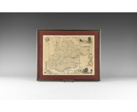
Circa 1843. A hand-coloured map of Essex from Moule's English Counties engraved by I. Dower with vignettes of Chelmsford and Southend to the right edge, heraldic shields, key to the Hundreds and estuarine scene; old label to the reverse stating 'This print is guaranteed to be over 100 years old. Verity Prints, Sunnyside, Flowton, Ipswich'. 691 grams, 33.5 x 27.5cm (13 1/4 x 10 3/4"). Property of an Essex gentleman; acquired 1960s-1980s. Fine condition. [No Reserve]

Lot 202

Published 1832. A hand-tinted map of England and Wales in a glazed frame with reveal; legend to upper right corner 'Pigot & Co.s Map of England and Wales with Part of Scotland including the new lines of Canals, Rail Roads, & C.'; taken from Pigot & Co British Atlas of the Counties of England, with map of England & Wales, London 1832. 5.4 kg, 82 x 63cm (32 x 24 3/4"). Property of an Essex gentleman; acquired 1960s-1980s. Fine condition. [No Reserve]

Lot 1389

Two folding Knives, map reading Compasses, pedometer, etc.

Lot 1123

Emmanuel Bowen: an early engraved Map of Lancashire, 1749 - 1755.

Lot 1058

Three pieces of Needlework including Hereford Cathedral, Map of England and Wales by E.K.H. dated 1933 and a Sampler

Lot 1191

A 1905 map of Llanwarne, Pencoyd, Llandinabo, parts of Orcop and St. Weonards.

Lot 697

A framed and glazed map of Huntingdonshire by Robert Morden - 56.5cm x 52.5cm Condition report: Has been folded and hand coloured

Lot 753

A collection of eleven silk maps including France, Moscow, Baku Borneo, Sumatra and a Tissue map of Germany

Lot 1120

Two framed colour engravings, Naval engagements, early 19th century and a 17th century map of Leeds, after John Boulter, 26.5cm by 40.5cm, 26.5cm by 40.5cm, 42cm by 44.5cm respectively (3)

Lot 800

An 18th century coloured engraving of the North West View of Lambeth Palace by Sam & Nathan Buck,along with a vintage world print map, oil painting of Edington and a Leon Bakst print

Loading...Loading...
  • 109182 item(s)
    /page

Recently Viewed Lots