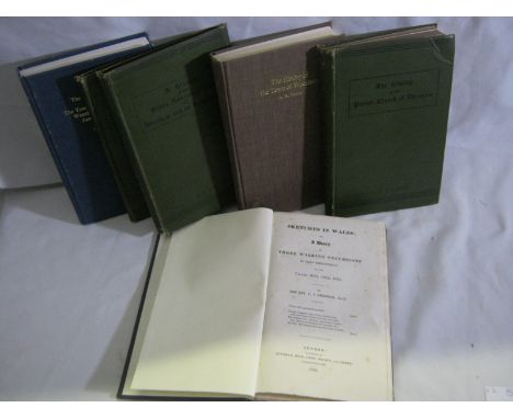

THE REV G J FREEMAN: SKETCHES IN WALES OR A DIARY OF THREE WALKING EXCURSIONS IN THAT PRINCIPALITY IN THE YEARS 1823, 1824, 1825, L, 1826 1st edn, 15 plts complete as list, rebnd modern cl, cf label to spine + A N PALMER: THE HISTORY OF THE PARISH CHURCH OF WREXHAM, Wrexham and Oswestry, Woodall, Minshall and Thomas [1886] 1st edn, ex-lib, orig cl + A N PALMER: A HISTORY OF THE OLDER NON-CONFORMITY OF WREXHAM AND ITS NEIGHBOURHOOD, [1888], orig cl + A N PALMER: HISTORY OF THE TOWN OF WREXHAM, ITS HOUSES, STREETS, FIELDS AND OLD FAMILIES, Bridge Books 1982 reprint, ttle pge with leaf pasted verso and 2 cuttings, ex-lib + A N PALMER: JOHN WILKINSON AND THE OLD BERSHAM IRONWORKS, 1899, 1 fdg map + 4 plts, orig cl + A N PALMER: THE HISTORY OF THE PARISH OF RUABON AND THE TOWN, FIELDS AND FOLK OF WREXHAM IN THE TIME OF JAMES THE FIRST ETC..., Bridge Books 1992 ltd edn (300), orig cl gt, + A N PALMER: THE TOWN OF HOLT TOGETHER WITH THE PARISH OF IS Y COED AND NOTES ON THE HISTORY OF BANGOR IS Y COED, Bridge Books 1991, ltd edn (400), orig cl gt + MARGARET MAHLER: A HISTORY OF CHIRK CASTLE AND CHIRK LAND WITH A CHAPTER ON OFFA'S DYKE, 1912, ex-lib, A/F, orig cl gt + T C MENDENHALL: THE SHREWSBURY DRAPERS AND THE WELSH WOOL TRADE IN THE 16TH AND 17TH CENTURIES, 1953, 1st edn, previous owner's ink stps to front and rear end papers, orig cl (9)
We found 108737 price guide item(s) matching your search
There are 108737 lots that match your search criteria. Subscribe now to get instant access to the full price guide service.
Click here to subscribe- List
- Grid
-
108737 item(s)/page


JAMES CONNOLLY: LABOUR IN IRELAND..., 1917, orig cl gt ex-lib + WILLIAM HENRY HURLBERT: IRELAND UNDER COERCION, THE DIARY OF AN AMERICAN, Edinburgh, David Douglas 1888 1st edn, 2 vols, col'd map, each vol with ownership signature of Robert Bannatyne Finlay, 1st Viscount Finlay (1842-1929), vol 2 with his armorial book plte to front paste down, orig cl gt + GODDARD HENRY ORPEN: IRELAND UNDER THE NORMANS 1169-1216, 1911, vols 1 and 2, 2 fdg maps, orig cl gt, worn, + STEPHEN GWYNN: A HOLIDAY IN CONNEMARA, 1909, 1st edn, frontis + 15 plts complete, orig cl gt + JOHN P PRENDERGAST: THE CROMWELLIAN SETTLEMENT OF IRELAND, 1865, 1st edn, 3 fdg col'd maps, fdg map frontis and ffep loose, inner joints totally split, orig cl gt v worn, + R MANIFOLD-CRAIG: THE WEIRD OF "THE SILKEN THOMAS", AN EPISODE OF ANGLO-IRISH HISTORY, Aberdeen 1900, 1st edn, orig pict cl gt + GEORGE CAMPBELL: THE IRISH LAND, 1869, orig cl gt + J G SWIFT MACNEILL: HOW THE UNION WAS CARRIED, 1887, orig cl + STEPHEN J BROWN (ed): A GUIDE TO BOOKS ON IRELAND, Dublin and L, 1912, orig cl gt + LORD JOHN MANNERS: NOTES OF AN IRISH TOUR IN 1846, 1881, new edn, orig cl gt + BRIAN ALOYSIUS KENNEDY: SHARMAN CRAWFORD, 1780-1861, A POLITICAL BIOGRAPHY, typescript thesis presented for the Degree of Doctor of Literature in the Faculty of Arts of the Queen's University of Belfast on 9 November 1953, signed and dated by the author, 557pp, bnd in cl (13)


HERBERT B J ARMSTRONG: (ed): A NORFOLK DIARY - PASSAGES FROM THE DIARY OF THE REV BENJAMIN JOHN ARMSTRONG..., 1949, Advance proof copy, orig prtd wraps, top wrap ffep and hf ttle loose + SAMUEL WOODWARD: AN OUTLINE OF THE GEOLOGY OF NORFOLK, Norwich & L, 1833, fdg col'd map + fdg col'd sectional plt + 6 black and white plts complete, old cl worn, lacks backstrip + GEORGE A STEPHEN: ONE HUNDRED PICTURES OF NORWICH, THE CITY OF GARDENS, CHURCHES AND ANTIQUITIES, 1935, orig pict bds worn, (3)
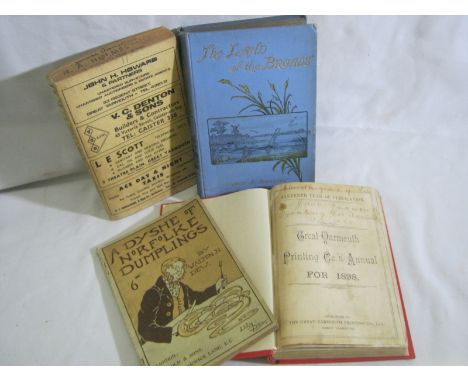
WALTON N DEW: A DYSHE OF NORFOLKE DUMPLINGS, L, Jarrold & Sons 1898, orig pict wraps, + GREAT YARMOUTH PRINTING CO'S ANNUAL FOR 1898 - 11TH YEAR OF PUBLICATION, Great Yarmouth, The Great Yarmouth Printing Co Ltd, rbnd modern cl, orig wraps bnd in + ERNEST R SUFFLING: THE LAND OF THE BROADS..., circa 1895, 20th thousand new and revised edn, fdg map with tape repairs, ffep with large loss of paper, orig pict cl gt + KELLY'S DIRECTORY OF GREAT YARMOUTH, GORLESTON AND SOUTH TOWN 1969, orig limp cl (4)


After Randolph Caldecott, Hunting prints and two postcards, after Henry Alken, aquatint by Duncan of 'To the Crack Riders of England', a small Albert Buckle etching of York Minster, circa 1880, a reproduction map of the Railways of Norfolk and a coloured engraving for The Complete English Traveller entitled 'View of the remarkable Cataract on the River Teese which divides the Counties of York and Durham' and other topographical prints (all framed & glazed)


Later 6th-7th century AD. A silver sword mount formed as a central square panel with cell above, four beast-head arms; the cell with inset garnet cloison and crimped gold foil behind; the centre hollow with slider-bar to the reverse; each arm a stylised beast-head with bilinear collar, bilinear brow-ridge and nasal, pellet eyes and nostrils with bilinear frames. See Franceschi, G., Jorn, A. & Magnus, B. Mennesker, Guder og Masker i Nordisk Jernalderkunst, vol.1, Borgen, 2005; Hammond, B. British Artefacts vol.1 - Early Anglo-Saxon, Witham, 2009; Menghin, W. Das Schwert im Frühen Mittelalter, Stuttgart, 1983; Pollington, S., Kerr, L. & Hammond, B. Wayland's Work: Anglo-Saxon Art, Myth & Material Culture from the 4th to 7th century, Ely, 2010; Mortimer, P. Woden's Warriors. Warriors and Warfare in 6th-7th Century Northern Europe, Ely, 2011. Supplied with a positive X-Ray Fluorescence analysis certificate. Sword pyramids were once a very rare class of find, discovered only in very high-status burials such as Niederstotzingen (Germany), Sutton Hoo Mound 1 (Suffolk, England) and the Broomfield barrow (Essex, England). Since the 1980s, a quantity of such finds have come to light and the object-class is now better understood. They are found predominantly in England, the Rhineland, central Europe and southern Scandinavia, and were a short-lived display item. The classic form is a truncated hollow gold (or silver, or bronze) pyramid with a bar to the reverse, inset garnet and glass plaques to the four faces and top (Pollington et al., fig.8.52 and plates 19, 54, 55; Hammond, p.73-4; Menghin, map 22). Several variant forms do exist, such as the octagonal-base and the conical types (Hammond, 2009, item 1.4.2.2-f; Mortimer, 2011, p.117). Another common Continental variant includes a flat-section rectangular plaque, as well as a form with curved edges to the plaque (Menghin, map 23). The present example with four beast-heads is apparently unique, although it has parallels in later harness and other mounts. The beast-heads have close parallels on the headplate of a 6th c. silver bow-brooch from Stora Gairvide, Gotland (Franceschi et all, item 75) and on the footplate of another from a burial mound at Sandal, Norway (Franceschi et al., item 66). The exact purpose of the pyramids is not known, but when they occur in graves they are usually placed in pairs high on the sword's scabbard (Menghin, p.150 and fig.90) which suggests that they were used in the suspension of the scabbard from its belt, or more evocatively in the fastening of textile 'peace-bands' which secured the sword in its scabbard and provided a very visible demonstration that the owner did not intend to draw it in haste (Mortimer, p.116). 18 grams, 39mm (1 1/2"). Property of a Scottish gentleman; acquired from continental Europe in the early 1960s; gifted to his daughter in the early 1980s; thence by descent 2004. "Fine condition, usage wear to upper face."

19th century AD. A map of the Temple Mount in Jerusalem with German-language legend, titled Grvndriss des Tempels zv Jervsalem, durch den König Saloman erbaut nach Anzeige der Bücher derer Könige und der Chroniken; mounted in a glazed frame. 1.2 kg, 46cm (18"). Property of a Norfolk, UK, collector; part of a family collection by descent. [No Reserve] Fine condition.

Published 1732 AD. Framed map of Arabia by Christophe Cellarius, author of Geographia Antiqua, first published 1686; this edition published Leipzig by Gledisch, 1732; depicting the region of Arabia to Babylonia and including the Holy Land area from the Mediterranean Sea in the east to Chaldea in the west, with vignette of two camels in top corner. 1.1 kg, 44 x 34cm including frame (17 1/4 x 13 1/2"). Property of a Norfolk, UK, collector; part of a family collection by descent. [No Reserve] Fine condition. Scarce.

Published 1777 AD. First edition, by John Gibson (Merchant in Glasgow), published 'for the author' [title; preface, vii pp.; text, 391 pp.], original full calf boards, later spine reinforcement, text block solid. Walter Steinberg has been a well-known figure at fairs, sales and events for many years. Born in 1922 in Philadelphia, Walter has had a life-long passion for collecting. A long-time resident in London, he has now retired to New York and decided that the time has come to pass on the antiquities and coins he has collected over his lifetime. Walter acquired coins and artefacts that interested him, so his collection, although containing many lovely examples, also contains many affordable specimens. Much of the material has been unavailable to the market for 30 to 50 years. Walter hopes that the items he collected will now find new homes with the next generation of collectors. 550 grams, 21.5 x 14cm (8 1/2 x 5 1/2"). Ex Walter Steinberg collection. [No Reserve] "Good condition; some browning, boards rubbed and corners bumped; no map."
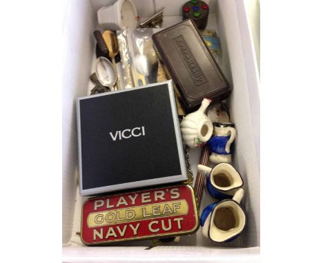
A box of vintage miscellaneous items to include: Brown bakelite Ever Ready razor, Rolls razor blades, miniature spirit level, tin whistle, propelling pencil, Coronation 1937 calendar, nail polish papers, map measuring gauge, mini iron, pill box, Players tobacco tin, EPNS salt spoon, Vicci powder compact, Ronson lighter, miniature ceramics & collectors spoons


Mainly Military: British Battles on Land and Sea by James Grant. Pub: London Cassell Petter & Galpin. Vol 2. Note page 302 - Bravery of the Irish. Three quarter maroon leather with coth boards. Contains many illustrations and maps of battles; Sir Douglas Haig's Despatches ed. by J H Boraston. Pub: London Dent. N.d. but c. 1919. 1st. ed. Does not include the map volume. Red cloth binding with gilt lettering and decorative stamping on spine and front; Professional Papers of the Corps of Royal Engineers. Pub: Chatham 1878-1887. 7 Vols. Broken run of 7 volumes. Green cloth with gilt lettering to front board and spine. Spines faded, and some staining to most covers. However, each of these volumes is replete with detailed plates. Absolutely fascinating books for anyone interested in history and military matters and those who appreciate excellent prints and maps; Story of the Rear Column of the Emin Pasha Relief Expedition by James S. Jameson. London: Porter 1890. 1st Ed. Original publishers olive green cloth with gilt lettering and decorative stamping to the front board. 96 illustrations, folding coloured map of 'River Congo from Stanley Falls to Kassongo to illustrate the journey of James S. Jameson'. Very scarce with maps and fontis of Jameson tissue guard intact. Many full page illustrations throughout the text, by C. Whymper from the author's original sketches. Thick 8vo; The Franks from their First Appearance in History to the Death of King Pepin by Walter C Perry. Longmans...1857. 1st Ed.,Full brown leather, with gilt tooling. Eton College pres. copy. Austria. Vienna Prague Hungary Bohemia and the Danube by JG Kohl. Chapman 1844; also Topographical Issues of: Picturesque Excursions in Devonshire and Cornwall by T. H. Williams. London Murray 1804. 1st Ed. Scarce and Collectible. Recently rebound in three quarter red leather and marbled boards. Gilt tooling to spine and maroon Morocco label & Devonshire Illustrated in a Series of Views by J.Britton & E W Brayley. London: Fisher 1832, etc. (14).


Potoki, Sport in Somaliland, Rowland Ward, London 1900, Limited Edition numbered 43 of 200, signed by Rowland Ward, cloth CONDITION REPORT: Front cover slightly dirty, slightly marked, corners bumped 18 photogravure plates Spine rough at bottom at top rubbed Some spotting to the pages particularly the protective plate sheets, some slight transference to plates particularly 'A Brace of Lions' opp p55 See images Pages generally clean and bright Book plate oninside cover left Pg32 annotated note by Henry Courtenay Morland with individual text (in ink) Plate 'Stalking Beisa' foxing lower left of margin and slight to other areas of margins Map present at back

Group of early 20th century books on Somaliland language including a Hand Book of Somaliland by Adam 1900 for HM Stationery Office, Official History of Operations in Somaliland 1907, Colonial Office List Map Supplement 1948, Drake Brockman, Mammals of Somaliland 1910 and Herbert, two Dianas in Somaliland

Mainwaring, A Soldier's Shikar trips, Grant Richards, London 1920, Frances, Three Months Leave in Somaliland, London 1895, and Gleichen, Mission to Menelik, London 1898 (3) CONDITION REPORT: One double map present and two images Frontis illustration One further illustration Two page map 'Country Round Route'

Pearce, Rambles in Lion Land, London 1898, Mellis Lion Hunting in Somaliland, London 1895, Wolverton, Lord, Sport in Somaliland, Chapman and Hall, London 1894 and Stockley, Big Games Shooting, London 1913 (4) CONDITION REPORT: Sport in Somaliland:- One large fold out map '5 months' sport in Somaliland 23 plates present Lion hunting in Somaliland - all plates present Rambles - map missing, plates all present Big game shooting:- Yak plate pg 220 missing, rest of plates present

-
108737 item(s)/page