We found 109198 price guide item(s) matching your search

Refine your search

Year

Filter by Price Range
  • List
  • Grid
  • 109198 item(s)
    /page

Lot 186

Goa. Van Linschoten (Jan Huygen), Ailhae Cidade de Goa Metropolitana da Indiae partes Orientais que esta en 15 Graos da Banda do Norte, circa 1598, uncoloured engraved city plan, orientated to the south, 'ribbon' cartouche, upper horizontal margin trimmed with slight loss, old folds, 380 x 430 mm, together with Merian (Matthaus), Grundriss von Goa, circa 1695, uncoloured engraved plan, old folds, slight water staining to margins, 215 x 355 mm The first described item is the reduced version of Van Linschoten's map by Theodore de Bry. (2)

Lot 190

Hertfordshire. Blaeu (Johannes), Hertfordia comitatus vernacule Hertfordshire, published Amsterdam, circa 1648, engraved map with contemporary outline colouring, 385 x 490 mm, Latin text on verso, together with Bedfordiensis comitatus Anglis Bedfordshire [on sheet with] Buckinghamiensis comitatus Anglis Buckingham Shire, published Amsterdam, circa 1648, two engraved maps on one sheet (as published), contemporary outline colouring, each map approximately 420 x 270 mm, Latin text on verso (2)

Lot 191

*Hungary. Speed (John), The Mape of Hungari newly augmented..., published George Humble, circa 1627, hand coloured engraved carte-a-figure map, eight costumed figures to vertical margins and four oval vignettes of principal cities along upper horizontal margin, 395 x 520 mm, English text on verso (1)

Lot 192

India. Pierson (Francis, Royal Engineers, Surveyor), Sketch of Road from Baghdad to Khanuakin, 29th February 1864, manuscript pen and ink map with notes to margins and on verso, old folds, small split along old fold, 410 x 320 mm A map which trys to illustrate the feasibility of a London to India Telegraph. One of Pierson's marginalia states "The red line marks the proposed direction for the Telegraph. Note. There may be some error in the representation of the road between Bakooba & Sheraban, owing to the loss of my note book. It is however, approximately accurate. FP". (1)

Lot 194

Ireland. Speed (John), The Province of Connaugh with the citie of Galwaye described, published John Sudbury and George Humble, circa 1627, uncoloured engraved map, inset town plan of Galway, vertical margins trimmed with loss to strapwork borders, central fold split and crudely repaired on verso, some abrasion to image, some marginal closed tears, slight staining, 390 x 505 mm, English text on verso, with The Countie of Leinster with the citie Dublin described, 1st edition, published John Sudbury and George Humble, circa 1611, uncoloured engraved map, inset town plan of Dublin, trimmed to strapwork margins, central fold split with old sellotape stains, repaired marginal closed tears, slight worming, 390 x 510 mm, English text on verso, with The Isle of Man exactly described..., 1st edition, circa 1611, uncoloured engraved map, large strapwork cartouche and compass rose, abrasion to printed surface causing some loss to image, 380 x 505 mm, English text on verso, plus half of John Speed's map of the Isle of Wight (3)

Lot 195

Ireland. Ortelius (Abraham), Eryn. Hiberniae Britannicae Insulae nova descriptio, [1592] uncoloured engraved map orientated to the east, large strapwork cartouche and mileage scale, worm hole affecting central fold, slight staining to margins, 355 x 480 mm, Latin text on verso Marcel van den Broecke, Ortelius Atlas Maps, no. 22. (1)

Lot 196

Ireland. Lea (Philip), An Epitome of Sr. William Petty's large survey of Ireland..., circa 1690, uncoloured map engraved by Sutton Nicholls, inset map of the British Isles showing Ireland in relation to Britain as a whole, old folds, narrow margins, some fraying to margins with slight loss, left hand vertical margin extended, some spotting and staining, 480 x 555 mm, together with Speed (John),Merionethshire, published Henry Overton, circa 1710, engraved map with sparse outline colouring, slight fraying to margins, backed with archival tissue, 380 x 505 mm, with Braun (Georg & Hogenberg Franz),Znaymum vulgo Znaym, Moraviae civitas primaria, published Cologne, circa 1620, uncoloured engraved city prospect, 320 x 500 mm, mounted (3)

Lot 197

Ireland. A mixed collection of five maps, mostly 18th century, including Porcacchi (Tomaso), Descrittione dell' isola D'Irlanda, published Venice, [1572 or later], engraved map orientated to the west, Italian text below and on verso of map, map size 105 x 145 mm, together with Moll (Herman), Ireland, circa 1701, uncoloured engraved map, English text below and on verso of map, map size 190 x 180 mm, with Von Reilly (Franz Johann Joseph), Das Konigreich Ireland, [1796], engraved map orientated to the west, contemporary wash colouring, 215 x 280 mm, plus Bickham (George), A Map of Ireland divided into Provinces and Counties, [1754], uncoloured engraved map, calligraphic title above map, overall size 250 x 150 mm, and Le Rouge (George Louis), L'Irlande [1748], engraved map with contemporary outline colouring, 285 x 215 mm (5)

Lot 200

*Java. Van Keulen (Gerard), Insulae Iavae Pars Occidentalis Edente Hadriano Relando / Insulae Iavae Pars Orientalis Edente Hadriano Relando, published Amsterdam, circa 1753, engraved map on two conjoined sheets with contemporary outline colouring, inset map of the harbour of Batavia and a large panorama view of Batavia from the sea, decorative cartouche and ten compass roses and numerous rhumb lines, old folds, some spotting, 515 x 1180 mm, framed and glazed The second state of this large and scarce map of Java; published in volume VI of Van Keulen's 'De Nieuwe Groote Ligtende Zee-Fakkel, 't Vyfde Deel'. (1)

Lot 201

Kent. Blaeu (Johannes), Cantium vernacule Kent, published Amsterdam, circa 1648, engraved map with contemporary outline colouring, slight staining to margins, 385 x 530 mm, Latin text on verso (1)

Lot 204

London. Gill (Macdonald), Wonderground Map of the London Town, published The Westminster Press, circa 1928, colour photolithographic map, old folds, slight surface abrasion, laid on later card, faded overall, 745 x 930 mm This is the slightly smaller and later edition of Gill's original 1913 map. There is a 1924 edition which is assumed to have been altered to help the promotion of the 1924 British Empire Exhibition that was held at Wembley between April and October of that year. It can be identified by a sign saying:- 'On To Wembley' and an empire lion in the top left hand corner below the man pushing a bus. This example is a slightly later state with a greyhound replacing the lion. Greyhound racing started at Wembley in 1927 so this edition probably dates from 1927 or 1928. The map remains highly stylised and whimsical and was held in great affection by Londoners. It was originally commissioned by The London Underground and was designed to be displayed in tube stations. The intense pictorial content of the map caught the public's imagination and as a result Gill is often credited with creating a resurgence in the genre of decorative map making. Much work and research has been done by Roderick Barron and Bryars & Bryars on the maps of the Underground and the work of Macdonald Gill and I am also grateful to Claire Dobbins book, London Underground Maps: Art, Design and Cartography. (1)

Lot 205

London. Environs of London - Windsor Castle to Gravesend, published 'The Illustrated London News', [1855], uncoloured engraved map by John Dower, decorated with approximately 100 topographical vignettes, old folds, occasional marginal closed tears, 535 x 780 mm, together with Warburton (John), A New and Correct mapp of Middlesex, Essex and Hertfordshire..., [1725], one sheet from Warburton's monumental map of South east England, this being the top left corner, including the cartouche, ninety heraldic shields to left hand margin and showing the North east of Hertfordshire including St. Albans, Hemel Hempstead, Hertford, Watford and Tring, old folds, slight creasing, some repaired marginal closed tears, 540 x 625 mm, with Metcalf (R.), Plan and Elevation of London Bridge in its present state..., by Mr Dance, 1799, large engraved plan with contemporary outline colouring, old folds, slight dust soiling and marginal fraying, 630 x 2510 mm, with another two single sheet plans from the same series, with another single sheet from a larger (possibly Dutch) plan of east London around the Isle of Dogs, and three engraved topographical views of London, various sizes and condition (10)

Lot 207

Manuscript maps. The Frome Highway District, circa 1820, pen, ink and watercolour map laid on linen, explanation code to the various types of roads to lower right corner, dust soiled with some rust marks, some damage with slight loss to margins, 750 x 550 mm, presented on contemporary turned and stained wooden battens, together with Map of the Town of Yeovil Somerset, Drawn by W.Bidder Yeovil, 1843 (but early 20th century copy), manuscript ink and watercolour map based on Bidder's earlier map of Yeovil, slight water staining, laid on card, 285 x 385 mm (2)

Lot 212

*Merionethshire. Speed (John), Merionethshire described, George Humble, circa 1627, hand coloured engraved map, inset town plan of Harlech, strapwork cartouche and mileage scale, 385 x 510 mm, English text on verso, mounted, framed and double glazed (1)

Lot 213

Mexico. Ortelius (Abraham), Hispaniae novae sivae magnae recens et vera descriptio, [1592 - 1612], engraved map, large ornate strapwork cartouche, sparse later colouring, 350 x 505 mm Marcel van den Broecke, Ortelius Atlas Maps, no.13. (1)

Lot 214

Middlesex & Hertfordshire. Jansson (Jan), Middelsexiae cum Hertfordiae comitatu Midlesex & Hertfordshire, published Amsterdam, circa 1650, engraved map with contemporary outline colouring, ornate cartouche and mileage scale, slight offsetting and toning, 445 x 550 mm, Latin text on verso, mounted, together with Hantoniae comitatus cum Bercheria, published Amsterdam, circa 1650, engraved map with contemporary outline colouring, decorative cartouche and mileage scale, some toning and staining, one small rust hole affecting image, one short marginal repaired closed tear, central fold a little frayed, strengthened on verso, 450 x 550 mm, Latin text on verso, with Comitatus Northumbria vernacule Northumberland, published Amsterdam, circa 1650, engraved map with contemporary outline colouring, slight staining and offsetting, 415 x 495 mm, Latin text on verso, mounted, plus Episcopatus Dunelmensis vulgo The Bishoprike of Durham, published Amsterdam, circa 1650, engraved map with contemporary outline colouring, slight staining and offsetting, 410 x 515 mm, Latin text on verso, mounted (4)

Lot 215

*Monmouthshire. Saxton (Christopher & Hole William), Monumethensis comitatus quem olim incoluerunt silures, circa 1610, hand coloured engraved map, decorative strapwork cartouche, mileage scale and compass rose, 275 x 340 mm, mounted, framed and glazed, together with Bowen (Emanuel), Herefordshire divided into hundreds..., [1767], engraved map with contemporary outline colouring, originally published in the 'Atlas Anglicanus', 230 x 325 mm, mounted, framed and glazed, with Kitchin (Thomas), An Accurate Map of the County of Radnor..., published R. Baldwin in 'The London Magazine', [1747 - 1760], hand coloured engraved map, old folds, toned overall, 170 x 220 mm, mounted, framed and glazed, plus Kitchin (Thomas), Middlesex drawn from an accurate survey, circa 1760, uncoloured engraved map, sectionalised and laid on linen, 185 x 195 mm (4)

Lot 216

*Montgomeryshire. Speed (John), Montgomery Shire, published John Sudbury & George Humble, [1627], hand coloured engraved map, inset town plan of Montgomery, strapwork cartouche, compass rose and mileage scale, central fold partially strengthened on verso, 380 x 505 mm, mounted, framed and double glazed (1)

Lot 219

New Zealand. Pickstock (J. W.), New Zealand, 1842, pen, ink and watercolour map, artist's name and date below title, slight dust soiling largely confined to margins, 240 x 175 mm The South Island carries the inscription 'High mountains said to be covered with perpetual snow'. (1)

Lot 221

Norfolk. Speed (John), Norfolk. A Countie florishing & populous. Described and devided, with the armes of such noble families as have borne the titles thereof, published John Sudbury & George Humble, circa 1627, uncoloured engraved map, thread margin to vertical borders, slight staining, slight worming affecting image, 380 x 510 mm, English text on verso (1)

Lot 222

North America. Porcacchi (Tomaso), Mondo Nuovo, published Venice, [1572 or later], uncoloured engraved map, Italian text below and on verso of map, map size 105 x 145 mm, together with Montanus (Arnoldus), Nova Virginiae tabula, circa 1672, hand coloured engraved map, ornate cartouche and mileage scale, slight creasing, 290 x 355 mm, with Bowen (Emanuel), A Map of the British American Plantations extending from Boston in New England to Georgia..., published in 'The Gentlemen's Magazine', [1754], uncoloured engraved map, old folds, slight creasing, 225 x 275 mm, plus Kitchin (Thomas), Mexico or New Spain in which the motions of Cortes may be traced, published T.Cadell, 1821, uncoloured engraved map, inset map of the Environs of Mexico, old folds, slight staining and spotting, 290 x 395 m (4)

Lot 223

Northamptonshire. Speed (John), Northamtonshire, 1st edition, published George Humble, circa 1611, uncoloured engraved map, inset town plans of Northampton and Peterborough, lower border trimmed with loss to strapwork margin, slight worming affecting image, some adhesion to central fold causing slight loss to printed surface, slight staining, 375 x 505 mm, English text on verso, together with Leicester both Countye and Citie described..., 1st edition, published John Sudbury, circa 1611, uncoloured engraved map, trimmed with loss to the vertical strapwork margins, central fold torn with loss and crudely repaired on verso, 380 x 505 mm, English text on verso, with Rutlandshire with Oukham and Stanford..., 1st edition, published John Sudbury & George Humble, circa 1611, uncoloured engraved map, inset town plans of Oakham and Stanford, trimmed with loss to vertical strapwork margins, central fold split with slight loss, slight worming affecting image, 385 x 500 mm, English text on verso, plus Huntington both shire and shire towne..., 1st edition, published George Humble, circa 1611, uncoloured engraved map, inset town plan of Huntingdon and Ely, slight worming, trimmed with loss to lower strapwork margin, some adhesion to central fold causing slight loss, 385 x 510 mm, English text on verso, and The Countie of Nottingham described..., 1st edition, published John Sudbury & George Humble, circa 1611, uncoloured engraved map, inset town plan of Nottingham, trimmed with loss of vertical strapwork margins, central fold frayed, repaired on verso, slight dust soiling, 385 x 505 mm, English text on verso (5)

Lot 228

Poland. Blaeu (Johannes), Polonia regnum et Silesia ducatus, published Amsterdam, circa 1648, engraved map with contemporary outline colouring, 415 x 515 mm, Latin text on verso, together with Hungaria Regnum [and] Transylvania Sibenburgen, published Amsterdam, circa 1648, together two engraved maps with contemporary outline colouring, slight toning and dust sailing, each approximately 425 x 515 mm, Latin text on verso (3)

Lot 229

Porcacchi (Tomaso). A collection of thirty-nine maps, originally published in 'La Isole piu famaso del Mondo', published Venice, [1572 or later], uncoloured engraved map with Italian text below and on verso, each map approximately 105 x 145 mm (39)

Lot 23

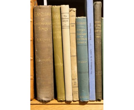
Lyne (Robert Nunez). Zanzibar in Contemporary Times, a short history of the Southern East in the Nineteenth Century, 1st edition, Hurst and Blackett, 1905, monochrome plates after photographs, 2 single-page maps, occasional marks and a little spotting, author's presentation copy to De Castro F. Lyne, inscribed by the author to front endpaper, and dated 21 June 1905, with contemporary news cutting from the East African Standard to front pastedown, and manuscript transcriptions of letters from Buckingham Palace and the Middle Temple, acknowledging receipt of a copy of the present work (apparently in the author's hand), and further newscuttings to rear endpaper, original cloth, a little rubbed and soiled, with some discolouration to spine, together with Newman (Henry Stanley), Banani: The Transition from Slavery to Freedom in Zanzibar and Pemba, 1st edition, [1898], folding colour map, monochrome illustrations after photographs, original pictorial cloth gilt, very lightly rubbed, plus Egerton (Lady Francis), Journal of a Tour in the Holy Land, in May and June, 1840, 1st edition, Harrison & Co., 1841, tinted lithographed plates, some light spotting, and several plates waterstained, original blindstamped cloth gilt, partially detached along upper inner hinge, and other travel interest, principally relating to East Africa, including Eugene Politovsky, From Libau to Tsushima, A Narrative of the Voyage of Admiral Rojdestvensky's fleet to Eastern Seas..., 1906, R.N. Lyne, The Chathams in the 1880's, privately printed by the author, Bath, England, 1958, E.C. Richards, The Chatham Islands, Christchurch, 1952, A.C. Madan, Kiungani: Or, Story and History from Central Africa, 1887 (signed by the author), P.E. Pieris, Ceylon: The Portuguese Era, volume 2 only, Colombo, 1914, H.F. Macmillan, A Handbook of Tropical Gardening and Planting with special reference to Ceylon, 2nd edition, Colombo, 1914 (author's presentation copy to R.H. Lyne), etc., mostly original cloth, 8vo (14)

Lot 230

Reference. A mixed collection of eighteen map reference books and facsimile atlases, 20th century, including Ogilby (John), Britannia volume the first..., 1675, facsimile edition, published Osprey, 1971, 100 double page strip road maps, publisher's cloth gilt, folio, together with facsimile atlases of 'Britannia Depicta' and Taylor & Skinners 'Survey of the Roads of North Britain or Scotland', with Shirley (Rodney W.), Early Printed Maps of the British Isles 1477 - 1650, revised edition 1991, [and] Printed Maps of the British Isles 1650 - 1750, published 1988, two volumes, each with numerous illustrations, dust jackets, publisher's cloth gilt, 4to, plus Manasek (F.J.), Collecting Old Maps, published Terra Nova press, 1998, numerous black and white illustrations throughout, dust jacket, publisher's cloth gilt, 4to, and Booth (John), Antique Maps of Wales, 2nd edition, 1978, numerous black and white illustrations throughout, dust jacket, publisher's cloth gilt, 4to, with Skelton (R.A.), County Atlases of the British Isles, 1579 - 1850, revised edition 1978, numerous black and white illustrations throughout, dust jacket, publisher's cloth gilt, 4to, with others similar (18)

Lot 231

Rome. Feltrini (Domenico), Pianta di Roma publicata nell'anno MDCCCLXVII da Luigi Piale, published Rome, 1867, engraved map of Rome, sectionalised and laid on linen, two inset topographical vignettes and a general map of the west coast of Italy, sparse contemporary hand colouring, descriptive text and location guides to vertical margins, some dust soiling, slight spotting, 660 x 900 mm (1)

Lot 232

*Scotland. Jansson (Jan), Scotia Regnum, published Amsterdam, circa 1650, engraved map with contemporary outline colouring, inset map of the Orkney Islands, laid on card, 385 x 505 mm, mounted, framed and glazed (1)

Lot 233

Scotland. Schenk (Petrus & Valk Gerard), Tabula Leogi et Haraiae ac Skiae vel Skiane Insularum, published Amsterdam, circa 1705, engraved map with contemporary hand colouring, some oxidisation to old colour causing slight cracking, together with Blaeu (Johannes & Pont Timothy), Insulae quaedam monores ex aebudisquae Mulam et Skiam insulas interjacent. Some of the smaller Western Isles lying between the yles of Mule and Skye, circa 1660, engraved map with contemporary outline colouring, 400 x 530 mm, no text on verso (2)

Lot 234

Sicily. Homann (Johann Baptist, heirs of), Regni & Insulae Siciliae tabula geographica, 1747, hand coloured engraved map, some tape staining largely confined to margins, 465 x 545 mm, together with Marzolla (Benedetto), Provincia di Circenti..., published Naples, 1853, lithographic map with contemporary outline colouring, 435 x 580 mm, with Merian (Matthaus), Sicilia Regnum, circa 1665, uncoloured engraved map, some worming with loss to central fold, repaired on verso, 275 x 360 mm, plus Cluver (Philip), Siciliae antiquae descriptio, circa 1715, hand coloured engraved map, lower margin extended, 265 x 315 mm, with another eleven maps of Sicily, various sizes and condition (15)

Lot 235

Sicily. Ruscelli (Girolamo), Tavuola nuova di Sardigna et di Sicilia, published Venice, circa 1574, uncoloured engraved map, 190 x 255 mm, Italian text on verso, together with Magini (Giovanni Antonio), Tabula Europae VII, [1548 or later], uncoloured engraved map, 135 x 175 mm, Italian text below and on verso of map, additional map of Sarmatia on verso, with Munster (Sebastian),Beschreibung der Inseln und des Gantzen Koenigreichs Sicilie, circa 1578, uncoloured woodblock map with German text below and on verso of map, map size 160 x 130 mm, additional map of Elba on verso, plus Bertius (Pieter), Sicilia, circa 1609, uncoloured engraved map, 95 x 135 mm, French text on verso, with another eight small format maps of Sicily, including examples by Mercator/Hondius, Cluver, Walker and Moll, various sizes and condition (12)

Lot 238

Spain & Portugal. Munster (Sebastian), Tabula Europae II, circa 1545, uncoloured woodblock map on a trapezoidal projection, slight staining to margins, 280 x 350 mm, Latin text on verso (1)

Lot 239

*Spain & Portugal. Moll (Herman), A New and Exact Map of Spain & Portugal Divided into its Kingdoms and Principalities &c. published J. & T. Bowles, P. Overton, and J. King, circa 1720, large engraved map on two conjoined sheets, contemporary outline colouring with some later enhancement, old folds, 615 x 980 mm, mounted, framed and glazed (1)

Lot 24

Lyon (Captain G.F.). A Brief Narrative of an Unsuccessful Attempt to reach Repulse Bay, through Sir Thomas Rowe's "Welcome," in His Majesty's Ship Griper, in the Year MDCCXXIV, 1st edition, 1825, folding engraved chart, seven engraved plates, occasional light offsetting, top edge gilt, later half morocco, spine faded, 8vo, together with Stray Leaves from an Arctic Journal; or, Eighteen Months in the Polar Regions, in search of Sir John Franklin's Expedition, in the Years 1850-51, by Lieut. Sherard Osborne, Commanding H.M.S. Vessel, "Pioneer", 1st edition, 1852, folding map (lacking one folding flap?), four chromolithographed plates, light toning, later half calf gilt by Morell, 8vo, with three others including F. Debenham's Report on the Maps and Surveys, 1923 from the British (Terra Nova) Antarctic Expedition 1910-1913 (5)

Lot 244

Staffordshire. Speed (John), Stafford, Countie and Shire Towne with the ancient Citie Lichfeild described, published Thomas Bassett and Richard Chiswell, circa 1676, hand coloured engraved map, inset town plans of Stafford and Lichfield, laid on card, 385 x 510 mm, framed and glazed, together with Bowen (Emanuel), An Improved Map of the County of Stafford divided into its hundreds..., published T & J Bowles and Robert Sayer, circa 1764, engraved map with contemporary outline colouring, large uncoloured decorative cartouche, 700 x 535 mm, with An Accurate Map of Hereford Shire divided into its Hundreds, published T & J Bowles and Robert Sayer, circa 1764, engraved map with contemporary outline colouring, large uncoloured decorative cartouche, 525 x 700 mm (3)

Lot 248

Surrey. Smith (William), Surriae comitatus continens in se oppida Mercatoria..., published John Overton, circa 1680, hand coloured engraved map, some fraying, creasing and repaired closed tears to margins, 380 x 480 mm An uncommon map prepared for Hans Woutneel's proposed but unpublished atlas. A later issue by John Overton of one of only twelve completed county maps which are sometime referred to as the 'anonymous series'. (1)

Lot 249

Surrey. Speed (John), Surrey described and divided into hundreds, 1st edition, published John Sudbury & George Humble, circa 1611, engraved map with near contemporary hand colouring, inset views of Richmond and Nonsuch palaces, slight staining, occasional marginal repaired closed tears not affecting image, 390 x 515 mm, English text on verso A scarce combination of the first edition and early hand colouring. (1)

Lot 250

Sussex. Blaeu (Johannes), Suthsexia vernacule Sussex, published Amsterdam, circa 1648, engraved map with contemporary outline colouring, slight staining to margins, 385 x 525 mm, Latin text on verso (1)

Lot 252

Tuscany. Ortelius (Abraham), Thusciae descriptio auctore Hieronymo Bellarmato, [1592], uncoloured engraved map, large strapwork cartouche, 320 x 495 mm, Latin text on verso Marcel van den Broecke. Ortelius Atlas Maps, no.130. (1)

Lot 258

Wales Mercator (Gerard & Jansson Jan), Cambriae Typus auctore Humfredo Lhuydo Denbigiense Cambro Britanno, [1647 or later], engraved map with contemporary hand colouring, decorative cartouche and mileage scale, compass rose and numerous rhumb lines, 350 x 490 mm, no text on verso John Booth. Antique Maps of Wales no.5. (1)

Lot 260

Wales. Lhuyd (Humphrey), Cambriae typus auctore Humfredo Lhuydo Denbigiense Cambrobritano, 1st state, [1573 or later], uncoloured engraved map, large strapwork cartouche and mileage scale, printers fold affecting image, 370 x 500 mm, Latin text on verso John Booth. Antique Maps of Wales, no.1. (1)

Lot 264

World. Schreiber (Johann Georg), Globus Terrestris ex probatissimis recentiorum..., circa 1750, engraved map with contemporary hand colouring, slight dust soiling to margins, 170 x 250 mm (1)

Lot 265

*World. Covens (Jean & Mortier Corneille), Carte Generale du Monde ou description du Monde Terrestre & Aquatique, published Amsterdam, circa 1730, map on a Mercator projection, engraved by J. van Luchtenberg with contemporary outline colouring, five additional hemispheres show day & night, the western & eastern hemispheres, phases of the moon and the flood, insular California, 405 x 470 mm, mounted framed and glazed R.W.Shirely. The Mapping of the World, no.622. (1)

Lot 266

World. Porcacchi (Tomaso), Descrittione del Mappa Mondo, circa 1620, uncoloured engraved map on an ovoid projection, 105 x 150 mm, Italian text below and on verso of map, together with Discorso Intorno all carta da Navigare, circa 1620, uncoloured engraved map, 110 x 145 mm, Italian text above, below and on verso of map, with Delamarche (Charles Francois), Mappe-Monde ou description du Globe terrestre..., circa 1800, hand coloured engraved map on a hemispheral projection, old folds, 140 x 235 mm, plus Tirion (Isaak), Nieuwe Kaart van de Noord Pool..., published Amsterdam, 1735, hand coloured projection of the world from the North pole, old folds, ribbon cartouche, 295 x 335 mm (4)

Lot 28

Roberts (David). The Holy Land, Syria, Idumea, Arabia, Egypt & Nubia, volume III only, 1849, lithographed title, engraved map, 36 tinted lithographed plates, including 18 full page, bound with Egypt & Nubia, volume I only, 1846, lithographed title, 42 tinted lithographed plates, including 21 full page, scattered light spotting, hinges reinforced, all edges gilt, contemporary green half morocco, rubbed and scuffed, with small tear at head of spine and small loss at foot, folio Abbey Travel 385 and 272. (1)

Lot 29

Santa Maria (Giuseppe di). Prima Speditione all' Indie Orientali, 1st edition, Rome, 1666, half title, folding engraved map at end, lacking signatures U1-4 (pages 153-160), occasional light browning, contemporary limp vellum, some soiling, small 4to Account of the first Carmelite voyage to the Malabar Coast of south west India, in an attempt to reconvert the Christians there who had seceded from the Church of Rome in 1653. Provides an interesting account of the customs of the Malabar people. (1)

Lot 293

*Kip (Joannes). Berkley Castle the Seat of the Earle of Berkley; Alveston the seat of Edward Hill; Kingsweston the seat of Edward Southwell Esq; Boughton Court the seat of Sr. Barnham Rider Kt.; [and] Amney the Seat of Robert Pleydell Esq., circa 1720, together five engraved views, Alveston view with later hand colouring, each approximately 355 x 435mm, initial four views mounted, framed and glazed, Amney unframed, plus Gardner (Thomas), The Road from Oxford to Chichester; The Road from Tinmouth in Northumberld., to ye City of Carlisle in Cumberld., [1719], together two hand-coloured engraved strip road maps, 'The Road from Tinmouth..., with one worm hole, each approximately 185 x 270mm, mounted, framed and glazed, plus Sayer (R. & Bennett J.), The Road from Dartmouth to Minehead in Somersetshire, circa 1775, hand-coloured engraved strip road map, with 'The Road from St David's to Holywell..., printed to the verso (map on verso uncoloured), 160 x 215 mm, mounted, framed and double glazed (8)

Lot 30

Santini (P. Francois). Atlas Universel dress‚ sur les Meilleures cartes modernes, 2 volumes, published Venice, 1784, decorative engraved title page (detached), 100 (only of 136) double page engraved maps with contemporary outline colouring, including one folding (Africa), maps by Janvier, De Vaugondy, Bellin, Didier, Bonne, D'Anville and Rizzi-Zannoni, one map with closed marginal tear, one map detached and one map stained, occasional creasing and slight dust soiling, lacking endpapers, boards and spines but text blocks largely intact, folio Remondini's reprint of Santinis' ambitious world atlas. Although its principal sources are the great French mapmakers of the mid 18th century, its immediate publishing origins show themselves in the twenty-seven maps of Italy and its regions. Although lacking some maps this example retains the maps of the African continent and five of the maps of parts of North America. Sold as a collection of maps,not subject to return. (2)

Lot 36

Stein (M. Aurel). Ruins of Desert Cathay. Personal Narrative of Explorations in Central Asia and Westernmost China, 2 volumes, 1st edition, 1912, numerous illustrations, maps and panoramas, occasional light spotting, one or two maps torn without loss, some leaves loosening, hinges breaking, library label and small book label, top edge gilt, original cloth gilt, joints and edges rubbed, small tears at spine ends, thick 8vo, together with The History of Australian Exploration from 1778 to 1888, by Ernest Favenc, 1888, four maps (three foldng), three facsimile letters, five plates of cave paintings, light spotting and toning, partly unopened, hinges tender, original red cloth, spine faded with small chip, 8vo, with two others: J. Lort Stokes' Discoveries in Australia; with an account of the Coasts and Rivers Explored and Surveyed during the Voyage of H.M.S. Beagle, in the Years 1837-38-39-40-41-42-43, 2 volumes, 1st edition, 1846 (lacking one map) and R.W. Layland's A Holiday in South Africa, 1882 (lacking the two Rorke's Drift plates) (6)

Lot 397

Embroidered binding. The Holy Bible: Containing the Olde Testament and the New..., printed by Robert Barker, 1638, with separate title to New Testament, titles within wood engraved border, bound with The Genealogies by John Speed, 1638, at front, containing double-page map, and The Whole Booke of Psalmes, 1637, at rear, close-trimmed, sometimes just clipping headlines, early manuscript names and ink trials on front endpapers, hinges strengthened, all edges gilt, contemporary embroidered cream silk binding, worn, rebacked with linen, preserving remains of original spine, covers with large flower head in centre and smaller pansy flowers at corners, embroidered in long and short stitch in shades of blue, green, yellow, and brown, and with leaf fronds worked in metal threads, much loss of stitching, 12mo Darlow & Moule 407; Herbert 527. (1)

Lot 406

Almanack. The Treble Almanack for the Year MDCCLXXXVIII, Containing I. Watson's Irish Almanack, II. Exshaw's English Court Registry, III. Wilson's Dublin Directory, W. Wilson, Dublin, 1788, engraved advertisement frontispiece and title, map of Dublin wanting, a line of text marked in ink and few other marks, contemporary calf, red and green spine labels, rubbed, small 8vo in 4s, together with Cooke (G.A.), Topographical and Statistical Description of the County of Middlesex, n.d., circa 1810, hand-coloured engraved county map, contemporary half calf gilt, slim 12mo, with The Royal Kalendar, or Complete and Correct Annual Register for England, Scotland, Ireland and America, for the Year 1785, printed for J. Debrett, [1785], contemporary sheep, upper board loose, worn, 12mo, with The Seventh Edition, corrected to March 25, 1767, of The Royal Kalendar, or Complete and Correct Annual Register for England, Scotland and Ireland, for the Year 1767, engraved plates of coats of arms, ink stamp to title and endpapers, later red buckram, rubbed, 12mo, with The Royal Kalendar, and Court and City Register for England, Scotland, Ireland and the Colonies, for the Year 1822, contemporary sheep, joints cracked and some wear, small 8vo, plus two others (7)

Lot 515

Baker (George P.). Calico Painting and Printing in the East Indies in the XVIIth and XVIIIth Centuries, 2 volumes (including portfolio), 1st edition, 1921, 20 illustrations and map in text volume, occasional small ink library stamps to lower margin of text leaves including title-page, untrimmed, original decorative linen-backed stiff wrappers, the portfolio with 37 coloured plates on 35 leaves (complete), a few plates with some slight marginal damp staining or spotting, several leaves with short closed tears to margins, original decorative linen-covered portfolio with straps and printed label to upper cover, rubbed, large folio (2)

Lot 57

Meinertzhagen (R.). Birds of Arabia, Edition de luxe 270/295, 1980, numerous colour and black and white tipped in plates, folding map to rear, some minor marks to fore-edge, publisher's original gilt decorated green three quarter morocco, spine lightly rubbed and marked to foot, folio (1)

Lot 582

Raleigh (Walter & Jones, H.A.). The War in the Air. Being the Story of the Part Played in the Great War by the Royal Air Force, 5 volumes & 2 map volumes, (including Maps & Appendices), 1st edition, Oxford: Clarendon Press, 1922-35, numerous folding maps, title of volume 5 signed by H.A. Jones, some ink stamps and bookplates, original cloth gilt, some light wear and few marks etc., 8vo (7)

Lot 589

Connolly (T.W.J.). History of the Royal Sappers and Miners..., volumes 1 & 2, 2nd edition, 1857, black and white plates with tissue guards, some light spotting and marks, uniform rebound red cloth retaining original gilt decorated embossed red cloth, boards and spines rubbed with some loss, 8vo, together with Head (Francis B.), The Royal Engineer, 1869, black and white plates including frontispiece, some light toning and spotting, original gilt decorated blue cloth, rubbed to head and foot, 8vo, and McKenzie (Frederick Arthur), From Tokyo to Tiflis, uncensored letters from the war, 1905, 31 black and white illustrations, plus map to rear, period inscription to half title, some minor spotting, original gilt decorated blue cloth, slightly rubbed to head and foot, 8vo, plus other 19th and early 20th century military history and reference, including History of the Corps of Royal Engineers, volumes 1-3, by Whitworth Porter, 1889, all orignial cloth, some in dust jackets, G/VG, 8vo/4to (2 cartons)

Lot 614

L'Abb‚ Paul (M.). Abreg‚ De Histoire Grecque Et Romaine, ..., Paris, 1765, black & white engraved frontispiece, bookplate to front pastedown, some light toning and marks, contemporary gilt-decorated mottled calf, boards and spine rubbed, 8vo, together with Clarkii (Samuelis), Homeri Opera Omnia: Ex Recensione Et Cum Notis, volumes 1-5, Glasgow, 1814, black & white folding map frontispiece to volumes 1 & 2, bookplates to front pastedowns, some light toning and spotting, uniform later gilt-decorated calf bound by Budden, Cambridge, spines slightly rubbed to head and foot, 8vo, plus Dickens (Charles), Our Mutual Friend, volumes 1 & 2, 1865, black and white illustrations by Marcus Stone, period inscriptions to head of title-pages, some toning and spotting, uniform contemporary half calf, boards and spine rubbed, 8vo, plus other classical and Middle Eastern and Chinese literature reference, including Ceylon, An Account of the Island, by James Emerson Tennnant, volumes 1 & 2, 1859, some leather bindings, some original cloth, G/VG, 8vo/4to (6 shelves)

Lot 615

Hoare (Richard Colt). The Itinerary of Archbishop Baldwin Through Wales, A.D. MCLXXXVIII, by Giraldus De Barri, volumes 1 & 2, 1806, 59 black & white plates, front endpapers and title-pages blind-stamped to head, bookplates to front pastedowns, some light spotting, uniform original gilt-decorated calf, boards and spine slightly rubbed, large 4to, An Historical Tour in Monmouthshire..., A New Map of the Country and Other Engravings by William Coxe, volumes 1 & 2, 1801, black and white plates including repaired folding map to front of volume 1, some light marks and spotting, bookplates to front endpapers, volume 2 front board and front endpapers detached, uniform gilt-decorated cross-hatched calf, boards and spines rubbed with some loss, large 8vo, together with Davies (J.L., et al, editors), Cardiganshire County History, volumes 1 & 2, 1994-98, numerous black and white illustrations, original cloth in dust jackets, large 4to, plus other Welsh topographical reference, some leather bindings, some original cloth, G/VG, 8vo/4to (3 shelves)

Lot 62

Bowen (Emmanuel). Britannia Depicta or Ogilby Improv'd being a correct coppy of Mr Ogilby's actual survey of all ye Direct & Principal cross roads in England and Wales..., 2nd edition, London printed for & sold by Tho. Bowles, Print & Map seller next ye Chapter House in St. Pauls Church-Yard & E.Bowen Engraver & Print Seller near ye stairs in St.Katherines, 1720, [1721], engraved title, four pages of tables & maps, 273 uncoloured engraved county maps and strip road maps printed back-to-back, slight staining and spotting throughout, bookplate of Sir Cedric Wolseley Bart, all edges yellow, 19th century mottled half calf with decorative gilt spine with contrasting morocco labels, slight rubbing to extremities, 8vo Chubb CXLVIII. This edition with the pagination numbers corrected on pages 121 & 124. (1)

Lot 636

Hobson (R.L.). Worcester Porcelain..., Bernard Quaritch, 1910, numerous black and white illustrations including 108 plates and tipped in colour frontispiece, some light spotting, original gilt decorated blue cloth, spine lightly rubbed to head and foot, folio, together with Underwood (Thomas, illustrator), The Buildings of Birmingham Past & Present Sketched & Described, published by Walter J. Sackett, Birmingham, 1866, numerous monochrome plates including folding map and plates, bookplate and period inscriptions to front pastedown, some light spotting, new endpapers, modern red half calf retaining original boards, slightly rubbed, oblong 4to, and Davison (Charles), The Hereford Earthquake of December 17, Birmingham, 1896, 1899, period inscription to front endpaper, original blue cloth, slightly rubbed to head of foot, 8vo, plus other 19th and early 20th century topographical and miscellaneous reference, in A History of British Birds, volumes 1-4, by William Yarrell, 1871-74, some leather bindings, many original cloth, condition is generally good/very good, 8vo/folio (2 shelves)

Lot 64

Cary (John). Cary's New and Correct English Atlas: Being a new set of County Maps from actual surveys..., 1st edition, published 1787, title, dedication, advertisement and contents list, forty-seven (complete as list) engraved maps with contemporary outline colouring, each map with a page of descriptive text, slight spotting and offsetting largely confined to the text pages, later endpapers, all edges gilt, contemporary diced calf gilt, rebacked but retaining old spine, spine a little chipped and worn, bumped and worn at extremities, 4to Chubb CCLX. (1)

Loading...Loading...
  • 109198 item(s)
    /page

Recently Viewed Lots