We found 109182 price guide item(s) matching your search

Refine your search

Year

Filter by Price Range
  • List
  • Grid
  • 109182 item(s)
    /page

Lot 139

Dorset. Dorsetshyre with the shyre-towne described as also the armes of such noble families as have bene honored with the titles thereof since the Normans conquest to this present, 1st. edition, [1611], uncoloured engraved map, inset town plan of Dorchester, central fold strengthened on verso, 385 x 510 mm, English text on verso (1)

Lot 140

*England & Wales. Speed (John), The Kingdome of England, 1st. edition, published John Sudbury & George Humble, [1611], engraved map with early hand colouring, eight costumed figures to vertical margins, 385 x 515 mm, English text on verso, mounted, framed and double glazed, together with Bowen (Emanuel), An accurate map of the county palatine of Chester divided into its hundreds..., published J. & C. Bowles and Robt. Sayer, circa 1764, hand coloured engraved map, some staining and creasing several closed tears affecting image, central fold partially split, additional horizontal fold, laid on card, 535 x 700 mm, framed and glazed (2)

Lot 142

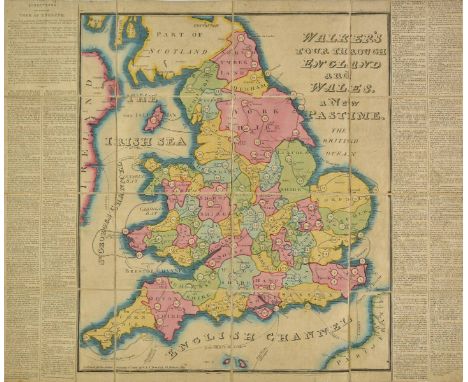
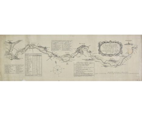
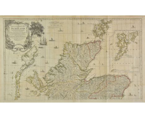
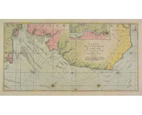
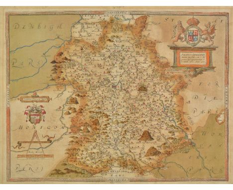
England & Wales. Walker (John), Walker's tour through England and Wales, a new pastime, published W. & T. Darton, 1809, engraved map with contemporary hand colouring, sectionalised and laid on linen, a map game with the 'rules' printed on the vertical margins, slight dust soiling. 505 x 635 mm, contained in a contemporary card slipcase with printed label to upper board, slight staining and wear, together with Cary (John), Cary's reduction of his large map of England and Wales with part of Scotland..., 1796, engraved map with contemporary outline colouring, sectionalised and laid on linen, 755 x 625 mm, contained in a contemporary marbled card slipcase with printed label to upper boards, some wear to extremities, with Bayly (John Abraham), England and Wales drawn from all the surveys..., [1766], hand coloured engraved folding map, 570 x 485 mm, plus Cruchley (G. F.), British Isles by Cruchley, circa 1855, engraved map with contemporary outline colouring sectionalised and laid on linen, inset map of the Shetland and Orkney Islands, some finger soiling and slight staining, 640 x 520 mm, marbled endpapers, and Wallis (John), Wallis's tour through England and Wales, A new geographical pastime, circa 1795, engraved map with contemporary hand colouring, sectionalised and laid on linen, a map game with the 'rules' and list of towns printed in the vertical margins, stained and marked, 505 x 660 mm, lacking slipcase, together with Mannert (C.), England nach Cary's Zeichnung mit hulfe der charten von Rocque, Kitchin, Campbell..., Nuremberg, 1796, engraved map with contemporary outline colouring, sectionalised and laid on linen, inset map of the Scilly Isles, slight staining, occasional pencil annotations, 655 x 540 mm, contained in publisher's card slipcase with manuscript label to upper board, worn, with Kitchin (Thomas), Kitchin's enlarged map of the Roads of England & Wales with the exact distances by the Mile Stones between town and town, published R. Sayer and J. Bennett, 1779, engraved map with contemporary outline colouring, sectionalised and laid on later linen, slight staining, 555 x 455 mm, lacking slipcase, plus Smith (Charles), Smith's new map of England and Wales and part of Scotland..., 1806, large engraved map with contemporary hand colouring, sectionalised and laid on linen, water stained, small hole affecting image, 1150 x 935 mm, lacking slipcase, and Darton (William, publishers), New and Improved map of England and Wales including the principal part of Scotland..., circa 1820, engraved map with contemporary outline colouring, sectionalised and laid on linen, slight staining, long closed tears along linen folds, 765 x 645 mm, contemporary cloth board, lacking spine and upper board, with Faden (William), A Map of England, Wales & Scotland describing all the direct and principal cross roads in Great Britain..., to accompany Paterson's Book of Roads, 1801, engraved map with contemporary outline colouring, sectionalised and laid on linen, inset map of the north part of Scotland, dust soiled and with slight staining, holes where linen folds cross, 735 x 615 mm, contained in a contemporary card slipcase with printed label to upper board, worn and frayed (10)

Lot 143

England & Wales. Blaeu (Johannes), Anglia Regnum, published Amsterdam, circa 1648, engraved map with contemporary outline colouring, toned overall, 385 x 495 mm, Latin text on verso, with another copy heavily wormed and stained, together with Hole (William), Britannia. [1607 or later], uncoloured map set in a decorative border (the title page for William Camden's 'Britannia'), trimmed to neatline and laid on later paper, some handling marks to paper margins, 265 x 160 mm, with Kitchin (Thomas), A New & Accurate map of the Roads of England and Wales with the distances by the mile stones..., circa 1760, uncoloured engraved map, old folds, slight fraying and wear to folds, 350 x 350 mm, plus De Vaugondy (Robert), Britannicae Insulae in quibus Albion seu Britannia Major et Ivernia seu Britannia Minor..., 1750, engraved map with contemporary outline colouring, 490 x 540 mm, and another copy similar, and Wilkinson (Robert), England and Wales, 1805, engraved map with contemporary hand colouring, 290 x 235 mm, with another thirty maps of England and Wales including examples by J & C Walker, Chatelain, Jefferys, Moll, De Vaugondy, Morden and Bonne, various sizes and condition (37)

Lot 144

England & Wales. Homann (Johann Baptist), Magnae Britanniae pars meridionalis in qua regnum Angliae tam in septem antiqua Anglo-Saxonum Regna..., published Nuremberg, circa 1720, engraved map with contemporay hand colouring, large uncoloured cartouche and historical vignette, slight marginal fraying, one repaired tear affecting image, 570 x 485 mm, together with Blaeu (Johannes), Anglia regnum, published Amsterdam, circa 1640, hand coloured engraved map, slight marginal staining but not affecting image, 385 x 500 mm, French text on verso, with Le Rouge (George Louis), Le royaume d'Angleterre divis‚ en comtez et baronies..., published Paris, 1745, engraved map with contemporary outline colouring, toned overall with some marginal staining, 575 x 490 mm, plus another seven maps similar, including examples by La Feuille, Bacon, Delamarche, Johnson and Bellin, various sizes and condition (10)

Lot 145

England & Wales. Andrews (John), A New Physical, Historical & Political Map of England and Wales from actual survey & Astronomical Observations of the Royal Society, exhibiting the natural state of its surface by describing the great range of mountains, hills and high lands which seperate the heads of the rivers & point out their course from its spring to the ocean..., published John Andrews, 1786, large hand coloured engraved map on three separate sheets, table of the vales and valleys, table of explanation, compass rose and dedication, inset map of the Scilly Isles, old folds, each sheet approximately 535 x 1315 mm, together with Thomson (John & Co. publishers), British Isles, 1815, engraved map with contemporary hand colouring, 615 x 515 mm, with Pigot (James), Pigot & Co.s. Map of England & Wales with part of Scotland..., 1830, engraved map with contemporary outline colouring, old folds, some toning, some marginal closed tears, some dust soiling, some repaired tears affecting image, 690 x 535 mm, with another copy similar, plus Goubaud (J.), Carte G‚ographique des Œsles Britanniques..., circa 1825, engraved map with contemporary hand colouring, French text below and to the sides of the map, overall size 520 x 665 mm (7)

Lot 147

English Channel. Visscher (Nicolas), Tabula Nova complectens praefecturas Normanniae et Britanniae una cum Angliae parte et Manica, circa 1690, engraved map with contemporary hand colouring, some dust and finger soiling to margins, 480 x 570 mm (1)

Lot 148

Estate Plan. An exact map of Trevithe & John Prichard's land: Together with the cottages upon nain-y-givis and the land Incroch'd on. Allt-Rillo in the Parish of Ilanvillo, circa 1700, ink and watercolour plan, title cartouche and a scale of chains, compass rose, inset tables of remarks and field names and sizes, old folds, some staining, slight creasing, 560 x 695 mm Appears to be a plan of a village near Tregarth in central Wales. (1)

Lot 152

Geological Maps. Ramsay (Andrew C.), Geological Map of England & Wales, 3rd edition, published Edward Stanford, January 15th, 1873, lithographic map with contemporary hand colouring, sectionalised and laid on linen, six geological cross sections and index key, slight staining, 950 x 800 mm, contained in a contemporary cloth slipcase with gilt title to upper board, a little worn, together with, Walker (J. & C.), A Geological Map of England, Wales and part of Scotland, showing also the Inland Navigation by means of Rivers and Canals..., 1837, engraved map with contemporary hand colouring, sectionalised and laid on linen, two geological cross sections, some staining and spotting, 1390 x 955 mm, contained in a contemporary card slipcase with morocco gilt label to upper board, worn and frayed (2)

Lot 156

Gloucestershire. Blaeu (Johannes), Glocestria ducatus vulgo Glocestershire, published Amsterdam, circa 1648, hand coloured engraved map, 410 x 500 mm, Dutch text on verso, together with Wigorniensis comitatus et comitatus Warwicensis; nec non Coventrae Libertas. Worcester, Warwik Shire and the Liberty of Coventre, published Amsterdam, circa 1652, engraved map with contemporary outline colouring, slight spotting and staining to margins, 410 x 500 mm, Spanish text on verso (2)

Lot 157

Hampshire. Speed (John), Hantshire described and devided, published Thomas Bassett & Richard Chiswell, [1676], hand coloured engraved map, inset town plan of Winchester, central fold repaired on verso, 380 x 510 mm, English text on verso (1)

Lot 158

*Herefordshire & Worcester. Bowen (Emanuel), An Accurate Map of the County of Worcester divided into its Hundreds and drawn from the best authorities..., [and] An Accurate Map of Herefordshire divided into its hundreds drawn from the best maps and surveys..., published R. Sayer & Carington Bowles [and] J.Tinney, 1765 & 1755 respectively, together two large engraved maps with contemporary outline colouring, each with a large uncoloured decorative cartouche, slight staining to the map of Herefordshire, each approximately 525 x 700 mm, uniformly mounted, framed and glazed (2)

Lot 160

Holy Land. De Wit (Frederick), Terra Sancta sive promissionis olim Palestina recens delineata..., published Amsterdam, circa 1680, engraved map with contemporary outline colouring, inset plan of the encampment of the Israelites flanked by the figures of Moses and Aaron, orientated to the west, slight oxidisation to old watercolour, cracks strengthened on verso, 465 x 555 mm (1)

Lot 163

*Isle of Wight. Blaeu (Johannes), Vectis Insula Anglice The Isle of Wight, published Amsterdam, circa 1650, engraved map with contemporary hand colouring and some later enhancement, 385 x 505 mm, mounted, framed and glazed, together with Philip (George & Son, publisher), Channel & Scilly Isles, Isles of Man & Wight, 1852, five engraved maps on one sheet (as published) with contemporary outline colouring, 510 x 610 mm, framed and glazed (2)

Lot 164

Italy. Blaeu (Johannes), Stato el Piemonte, published Amsterdam, circa 1648, engraved map with contemporary outline colouring, 390 x 505 mm, Latin text on verso, mounted, together with Contado di Molise et Principato ultra, published Amsterdam, circa 1648, engraved map with contemporary outline colouring, slight overall toning, 390 x 500 mm, French text on verso, mounted (2)

Lot 165

Jamaica. Ogilby (John), Novissima et Accuratissima Jamaicae descriptio, 1671, hand coloured engraved map, several marginal closed tears with some loss, repaired and replaced in facsimile, lacking right hand vertical margin with loss of printed margin, replaced in facsimile, some folding and creasing, strengthened and repaired on verso, 430 x 530 mm (1)

Lot 166

Lancashire. Hennet (G.), A map of the County Palatine of Lancaster divided into hundreds and parishes from an accurate survey made in the years 1828 and 1829, published Henry Teesdale, 1830, large scale map, engraved by James Bingley, sectionalised and laid on linen, contemporary hand colouring, large calligraphic cartouche, table of explanation, compass rose and engraved vignette of the custom house Liverpool, slight staining and offsetting, edged in green silk, 1615 x 1115 mm, contained in a contemporary calf bookbox, worn and rubbed (1)

Lot 168

London. Stanford (Edward, publisher), Stanford's Library Map of London and its Suburbs, 1877, two large engraved sheets of central London with contemporary outline colouring, sectionalised and laid on linen, slight marginal fraying, each approximately 645 x 805 mm, together with a modern copy of another sheet, with Ordnance Survey (publishers), Three large engraved maps, 1810 - 1816, three engraved maps on a scale of one inch to a mile, one (Surrey) with contemporary hand colouring, the others being of Southern Dorset and Hampshire, slight marginal fraying, each approximately 635 x 920 mm, plus Bacon (G. W., publishers), Twenty-nine (only) sheets from 'Map of the Environs of London', circa 1890, lithograph maps of parts of London, each approximately 325 x 475 mm, and Stanford (E., publisher), Stanford's Library Map of London and its Suburbs, 1877, five lithographic map sheets, (nos. 4, 20, 22, 23 & 24), each approximately 335 x 420 mm, with Telford (T.), Metropolis Water Supply. Plan and section of a line of Aqueduct from the River Verulam above Watford to Primrose Hill, published G. Hansard & Sons by order of the House of Commons, 1834, lithographic map by S. Arrowsmith with contemporary outline colouring, old folds, 285 x 755 mm (41)

Lot 170

London. Faden (William), A New Topographical Map of the Country in the Vicinity of London, Describing all the New Improvements, published by W. Faden, 1819, engraved map with hand-colouring, dissected and mounted on linen in 28 panels, some light browning and offsetting, 815 x 830 mm, without slipcase (1) NB: Amendment - revised estimate now £300-400 (was £200-300)

Lot 173

Middlesex. Blaeu (Johannes), Middle-sexia, published Amsterdam, circa 1648, engraved map with contemporary outline colouring, some creasing, slight overall toning, several marginal tears, repaired on verso, 390 x 410 mm, Latin text on verso, together with Morden (Robert), Midlesex, [1722], uncoloured engraved map, bound with pages of descriptive text, later endpapers, 19th century marbled boards, with green cloth gilt spine, slim folio, with another unbound copy, plus Rocque (John), Middlesex, [1746], uncoloured engraved map, 160 x 200 mm, with another approximately fifty regional, county and ward maps, including examples by Cary, Seller/Grose, Moule, Bowen & Owen, Archer, Harris, Van den Keere, Cole, Pigot, Cole & Roper, Phillips, Paterson, Bowen, Neele and Fullarton, occasional duplicates, various sizes and condition (approx.55)

Lot 174

New York. National Geographic Magazine (publishers), The Reaches of New York City, published Baltimore, 1939, large decorative folding lithographic map by Albert H. Bumstead, inset map of South Jersey, margins decorated with portraits of prominent Americans, topographical vignettes and vistas, old folds, 705 x 645 mm, together with Historic and Scenic Reaches of the Nation's Capital, published Baltimore, 1938, decorative folding lithographic map, the vertical margins decorated with portraits of illustrious personages, 645 x 765 mm (2)

Lot 179

Oxfordshire. Kitchin (Thomas), A new Improved Map of Oxfordshire from the best surveys and intelligences, divided into hundreds..., published J. & C. Bowles and Robert Sayer, circa 1764, engraved map with contemporary outline colouring, large uncoloured decorative cartouche, very slight staining to central fold, 715 x 525 mm Originally published in 'The Large English Atlas'. (1)

Lot 180

Railway Maps. Kemp (George), A new map of England and Wales with part of Scotland showing the Mail Coach, Turnpike & Railroads, Canals &c., 1847, engraved map with contemporary outline colouring, sectionalised and laid on linen, 750 x 620 mm, contemporary cloth boards with printed label to upper cover, some staining and adhesion to lower board, together with Betts (John), Betts's new itinerant and commercial map of England & Wales on which the various lines of railroad, the turnpike & principal cross roads with the courses of the rivers & canals are carefully laid down..., 1839, engraved map with contemporary outline colouring, sectionalised and laid on linen, some staining, 895 x 760 mm, endpapers of publisher's advertisements, contained in a contemporary gilt cloth slipcase, case worn and frayed, with another edition from 1846, with Cruchley (G. F.), Cruchley's Railway map of England and Wales, 1842, engraved map with contemporary outline clouring, sectionalised and laid on linen, 340 x 255 mm, some toning and offsetting, publisher's cloth boards with printed title to upper cover, plus Airey (John), Airey's Railway map of England & Wales..., published McCorquodale & Co. Ltd., 1884, lithographic map with contemporary outline colouring, sectionalised and laid on linen, 1020 x 740 mm, contemporary morocco gilt boards, worn and rubbed at extremities, and Kell (Thomas & Sons, publishers), Map of Railways in England, Wales and Scotland, 1864, very large engraved map with contemporary outline colouring, sectionalised and laid on linen, some staining, inset maps of London, Birmingham, Manchester and Liverpool, one fold split along linen, 2730 x 1470 mm, morocco endpapers, with another five similar including examples by Jobbins, Orr, Macaulay, Stanford and Arrowsmith, various sizes and condition (11)

Lot 182

River maps. Smeaton (John), A plan of the River Calder from Wakefield to Brooksmouth and from thence to Salter Hebble Bridge laid down from a survey taken in October and November 1757; with a projection for continuing the navigation from Wakefield to Salter Hebble Bridge near Halifax in the county of York, [1758], uncoloured pictorial linear map, engraved by R. W. Seale, some marginal fraying and chipping, one tear just affecting plate mark, some dust soiling, largely confined to margins, 235 x 835 mm, together with Fairbank (William), A plan of the course of the River Dun from Sheffield to its confluence with the Ouse shewing all the cuts made & those intended to be made to facilitate the navigation thereof, 1801, engraved linear map with contemporary outline colouring, near contemporary ownership signature to upper central margin, slight overall toning, 265 x 915 mm (2)

Lot 183

River Thames. Tombleson (Thomas), Tombleson's Panoramic map of the Thames and Medway, published J. Reynolds, circa 1860, engraved panoramic map with bright contemporary hand colouring, old folds, laid on linen, 1280 x 245 mm, publisher's blue gilt cloth boards A later issue of Tombleson's 1834 map of the River Thames. The complexity of the railway network shown on the map would indicate a date of circa 1860. A clean, bright example. (1)

Lot 185

Russia. De Wit (Frederick), Tabula Russia vulgo Moscovia, circa 1680, hand coloured engraved map, two small rust holes to image, 450 x 560 mm (1)

Lot 187

Scotland. Kitchin (Thomas), A New and Complete Map of Scotland and Islands thereto belonging; from actual survey, the shires properly divided and subdivided, the forts lately erected & roads of communication or military ways; carried on by His Majesty's command..., [published Robert Sayer, 1773 or later], large engraved wall map of Scotland with contemporary outline colouring, four sheets conjoined in pairs, inset map of the Shetland islands, large uncoloured decorative cartouche, table of 'remarkable places in Scotland', compass rose, old folds, one short split along old fold on lower sheet, each sheet approximately 600 x 1010 mm The Early Maps of Scotland to 1850. Published The Royal Scottish Geographical Society. Volume 1 pp. 195. Published in 'A General Atlas describing the whole Universe...,'. This edition without imprint. Uncommon. (2)

Lot 188

Scotland. Visscher (Nicolas), Exactissima Regni Scotiae Tabula tam in Septentrionalem et Meridionalem quam in minores earumdem Provincias..., published Amsterdam, circa 1700, engraved map with contemporary hand colouring, heightened with gilt, decorative cartouche and mileage scale, slight overall toning, slight creasing, thread margins, 565 x 475 mm (1)

Lot 189

Scotland. Hole (William), Scotia Regnum, circa 1610. hand coloured engraved map, large strapwork cartouche and compass rose, 265 x 310 mm, together with Zatta (Antonio), Il Regno do Scozia, di nuova projezione, published Venice, circa 1778, engraved map with contemporary outline colouring, inset map of the Shetland Islands, 305 mx 405 mm, with De Fer (Nicolas), Table des latitudes et longitudes des principaux lieux du Royaume d'Ecosse, published Paris, circa 1710, engraved map with contemporary outline colouring, inset maps of the Shetland and the Faroe Islands, 375 x 515 mm, plus Mariette (Pierre), L'Ecosse Royaume en ses deux principales parties..., published Paris, 1665, engraved map with contemporary outline colouring, 410 x 510 mm, with another twelve city plans, sea charts, regional and country maps, including examples by Robinson, Dower, Dorret, Greenville Collins and Bartholomew, various sizes and condition (16)

Lot 19

Dheulland (Guillaume). Th‚ƒtre de la guerre en Italie, ou Carte nouvelle des principaut‚s de Pi‚mond, R‚publique des Gˆnes, duch‚s de Milan, Plaisance, et confins, 1st edition, Paris: Dheulland, Martin and Jullien, 1748, engraved title, 25 maps and 2 letterpress leaves, all folding and mounted on guards, nearly all the maps hand-coloured in outline, damp-staining to endpapers and title page, and to gutter and margins of letterpress leaves and first few maps, then receding to two small tide-marks to either end of the gutter, shallow splits to ends of folds, longer splits to folds of title page, general map (unnumbered) and maps 1 and 4, contemporary French marbled sheep, rubbed, front joint split at ends, corners worn, narrow folio (25.5 x 11 cm) (1)

Lot 190

Sea chart. Van Keulen (Johannes), Pascaart van de Noortcust van Yrland als meede de Westcust van Schotland..., published Amsterdam, [1695 or later], uncoloured engraved chart of Scotland and Ireland, large allegorical cartouche, compass rose and numerous rhumb lines, 510 x 580 mm, together with A new gradually encreasing compass map of a part of the sea coasts of England in which is contained the coasts of Sussex. Extending eastward of Hastings to Arundel haven with their shallownesses and depths, published Amsterdam 1698 [or later], hand coloured engraved chart, compass rose and numerous rhumb lines, title repeated in Dutch, trimmed with very slight loss to lower margin, repaired, 515 x 595 mm, with Collins (Captain Greenville), Untitled sea chart of the east coast of England and Wales, circa 1690, hand coloured engraved chart, orientated to the east, compass rose and numerous rhumb lines, some staining and dust soiling, 450 x 570 mm (3)

Lot 193

Sea chart. Jaillot (Alexis Hubert), Carte de l'entree de la Tamise avec les bancs, passes, isles et costes comprises entre Sandwich et Clay, published Paris, circa 1705, large engraved chart with bright contemporary hand colouring, orientated to the east, inset map of the course of the River Thames from London to Isle of Grain, compass rose and numerous rhumb lines, slight oxidisation, 455 x 890 mm (1)

Lot 194

Sea charts. Van Keulen (Gerard), Afteekening van de Rivier van London of River Thames [on sheet with] Afteekening van de Iarmouthse Banken geleegen voor Iarmouth Aan de Oost Kust van Engeland in de Noord Zee, circa 1750, two uncoloured engraved charts on one sheet (as published), slight spotting, 510 x 585 mm, together with Collins (Captain Greenville), Untitled chart of the North sea, circa 1790, uncoloured engraved sea chart, slight staining, 450 x 575 mm, with Mercator (Gerard), Northumbria, Cumberlandia et Dunelmensis Episcopatus, [1595 or later], engraved map with contemporary outline colouring, some marginal closed repaired tears, 355 x 465 mm, French text on verso (3)

Lot 195

Sea charts. Seven sea charts, 19th & 20th century, including China South Coast Hong Kong Waters West, 1893 (updated 1930), uncoloured printed Admiralty chart, 650 x 995 mm, together with New Zealand North Island - West Coast, Manukau Harbour, 1853 (updated 1863), uncoloured chart, engraved by J & C Walker, inset map of the Continuation of the Waiuku River, slight dust soiling to margins, ink book seller's/admiralty agent's stamp to image, 635 x 940 mm, with New Zealand North Island - West Coast Kawhia Harbour, 1854 (updated 1857), uncoloured chart, engraved by J & C Walker, slight overall toning, occasional marginal closed tears, slight fraying to base of central fold, 615 x 970 mm, plus Australia East Coast Queensland and New South Wales, Wooli Head to Cape Moreton, 1952 (updated 1957), uncoloured printed sea chart, two horizon profiles, 1000 x 670 mm, and Australia South East Coast, Wilson Promontory to Cape Howe, 1953 (updated 1967), large printed sea chart, 865 x 1150 mm, with two other charts similar of the Pacific and Indian Oceans, various sizes and condition (7)

Lot 197

Shropshire. Saxton (Christopher), Salopiae comitatus summa cum fide cura et diligebtia descrtiptionem haec tibi tabula resert, [1579], engraved map with contemporary hand colouring, 'altar' cartouche surmounted by the royal coat of arms with an additional heraldic crest of Thomas Seckford, slight spotting, slight mount staining, central fold strengthened at top and base on verso, one printer's crease, 295 x 510 mm The first printed map of Shropshire. An early state with the 'bunch of grapes' watermark. (1)

Lot 199

Society for the Diffusion of Useful Knowledge. Complete atlas of modern, classical and celestial maps together with plans of the principal cities of the world..., published Thomas Letts, 1877, printed title, ninety-eight engraved maps with contemporary outline colouring, most maps affected by a library blind stamp to lower right, last map (Japan) heavily dust soiled, all edges gilt, lacking boards and spine, last few leaves loose, folio, together with another volume from circa 1840 containing fifty-five engraved maps, twenty-five town plans and six celestial charts (only), several closed tears, some dust soiling throughout, a few maps trimmed to margins, lacking boards and spine, partially disbound, folio Sold as a collection of maps, not subject to return. (2)

Lot 2

Back (Sir George). Narrative of an Expedition in H.M.S. Terror, Undertaken with a View to Geographical Discovery on the Arctic Shores, in the Years 1836-7, 1st edition, John Murray, 1838, twelve tinted lithographed plates, folding engraved map (with short closed tear), some light offsetting, light waterstains to last two plates, armorial bookplate of Henry Perkins, Hanworth Park, contemporary calf gilt, rebacked with original spine relaid, clear tape marks to cover margins, 8vo Sabin 2617. A scarce Arctic travel book. George Back was sent by the Admiralty to gain knowledge of the coastline between Prince Regent Inlet and Turnagain Point. However, HMS Terror became stuck in the ice near Frozen Strait, suffering considerable structural damage, and eventually limping back to Ireland. Although failing in his main aim, Back was able to make many detailed observations on conditions and surroundings, including ice floes, the terrain of Southampton Island, trading with Baffin Island Eskimos, the weather and privations endured. (1)

Lot 20

Weller (Edward). Dispatch Atlas [1863], lacking titles and preliminaries, approximately 130 (only) engraved map sheets with contemporary outline colouring, some marginal fraying and closed tears with occasional loss, some dust soiling, several maps detached, contemporary half calf, lacking spine, boards detached, rubbed and worn, folio Sold as a collection of maps, not subject to return. (1)

Lot 201

Spain. Blaeu (Johannes), Gallacia regnum [and] Territorio di Pavia, Lodi, Novarra, Tortona, Alessandria et altri vicini dello stato di Milano, published Amsterdam, circa 1650, two engraved maps with contemporary outline colouring, each approximately 385 x 500 mm, together with Schenk (Petri & Valk Gerard), Granata et Murcia regna, published Amsterdam, circa 1700, engraved map with contemporary hand colouring, 375 x 485 mm, with Senex (John), A Map of Old & New Castile from the observations of Rodrigo Mendes Silva and others, circa 1730, engraved map with contemporary outline colouring, additional horizontal fold strengthened on verso, 450 x 555 mm, plus Neele (S. J.), Present Spain and Portugal, circa 1800, engraved map with contemporary hand colouring, 370 x 400 mm, and Mitchell (S. A.), Spain and Portugal, published Philadelphia, [1846], engraved map with contemporary hand colouring, 320 x 395 mm, with Mitchell (A. M.), Map of France, Spain and Portugal, published Philadelphia, 1862, engraved map with contemporary hand colouring, 345 x 275 mm (7)

Lot 202

Spain. Moll (Herman), A New and Exact Map of Spain & Portugal divided into its Kingdoms and Principalities &c., published George Grierson, Dublin, circa 1730, large engraved map on two conjoined sheets, contemporary outline colouring, large uncoloured martial cartouche, old folds strengthened on verso, some worming repaired on verso, 610 x 975 mm (1)

Lot 204

Surrey. Bowen (Emjanuel), An Accurate Map of the County of Surrey; Divided into its hundreds; Drawn from late surveys and illustrated with various additional improvements..., published Carington Bowles and Robert Sayer, circa 1764, engraved map with contemporary outline colouring, large uncoloured decorative cartouche, slight toning, 530 x 715 mm (1)

Lot 206

*Warwickshire. Speed (John), The Counti of Warwick. The shire towne and citie of Coventre described, published John Sudbury & George Humble [1627], hand coloured engraved map, inset town plans of Warwick and Coventry, occasional repaired marginal closed tears, central fold partially strengthened on verso, 380 x 510 mm, English text on verso, framed and double glazed, together with Hollar (Wenceslaus), The Ground plott of Warwick circa 1754, etched plan with sparse hand colouring, 175 x 225 mm, mounted, framed and glazed (2)

Lot 208

*Worcestershire. Smith (William), Vigorniensis vulgo Worcestershire comitatus descriptio..., published John Overton and Peter Stent, [1670 or later], hand coloured engraved map, three large strap work cartouches, slight creasing and toning, 355 x 465 mm, mounted, framed and glazed (1)

Lot 210

World. Bellin (Jacques Nicolas), Carte reduite du Globe Terrestre, published Paris, circa 1764, engraved map with contemporary outline colouring, some overall toning, 230 x 350 mm Originally published in 'Le Petit Atlas Maritime'. (1)

Lot 212

World. Munster (Sebastian), Figura del Mondo Universale, Basel [1558 or later], uncoloured woodblock map, some water staining, 265 x 350 mm, Italian text on verso (1)

Lot 213

World. Chatelain (Henry Abraham), MappeMonde ou Description Generale du Globe Terrestre, circa 1740, uncoloured engraved hemispheral projection of the world, text below map describes various geographical and cartographic terms, 335 x 435 mm (1)

Lot 214

World. Coronelli (Vicenzo Maria), Aevi veteris usque ad annum salutis non agesium supra milles quadringentos cogniti tantum typus geographic, Venice, circa 1695, uncoloured engraved hemispheral map of the ancient world, signs of the zodiac to margins, occasional marginal fraying and one small hole but not affecting image, 455 x 615 mm (1)

Lot 217

Yorkshire. Blome (Richard), The North Ridinge of Yorkshire [and] A Mapp of ye East Rideing of Yorkshire with its Wapontakes circa 1673, two hand coloured engraved maps, 255 x 310 mm and 230 x 285 mm respectively, together with Saxton (Christopher & Hole William), Eboracensis comitatus pars septentrionalis vulgo North Riding [and] Eboracensis comitatus...., pars orientalis vulgo East Riding, [1610], two hand coloured engraved maps, the East Riding with some repaired marginal closed tears, 195 x 340 mm and 195 x 250 mm respectively, with Blome (Richard), A Generall Mapp of Yorkshire [1715], engraved map with contemporary hand colouring, 195 x 275 mm, plus Moll (Herman), The West Riding of York Shire [1724], hand coloured engraved map, toned overall, 190 x 315 mm, and Morden (Robert), The West Riding of Yorkshire, [1708], uncoloured engraved map, old folds, 170 x 220 mm, together with Seller (John), Yorkshire, [1701], hand coloured engraved map, 125 x 165 mm, with another eight engraved maps of Yorkshire Ridings, including examples by Kitchin/Jefferys, Osborne, Moll, Morden and Kitchin, various sizes and condition (16)

Lot 219

Yorkshire. Knox (Robert), A Map of the Country round Scarborough in the North & East Ridings of Yorkshire from actual Trigonometrical Survey with Topographical, Geological and Antiquarian Descriptions, Scarborough, 1821, engraved map with contemporary outline colouring, sectionalised and laid on linen, engraved by A.Findlay, dust soiled, one closed tear to linen repaired on verso, 595 x 605 mm, marbled end papers, contained in publisher's marbled card slipcase with printed label to upper board, rubbed and worn, together with another later copy from 1849, with the addition of geological strata, bound in near contemporary green cloth boards, with Cruchley (G. F., publisher), Map of 40 miles round Leeds, circa 1870, engraved map with contemporary outline colouring, sectionalised and laid on linen, 980 x 1250 mm, marbled endpapers, bound in contemporary morocco gilt boards, worn and frayed at extremities, plus Plan of the Borough of Kingston upon Hull shewing Municipal Boundary as defined by act of 1882 also ward bounderies settled in pursuance of the said act, 1882, large lithographic map with contemporary outline colouring, sectionalised and laid on linen, 820 x 1295 mm, bound in contemporary blue gilt cloth boards, stained, and Richmond (George, publisher), New Map round Halifax from the Ordnance Survey, published Birmingham, circa 1880, large lithographic map with contemporary outline colouring, sectionalised and laid on linen, 1025 x 1285 mm, marbled endpapers, bound in contemporary cloth boards with red gilt morocco label to upper board (5)

Lot 220

Yorkshire. Dix (Thomas), A new map of the County of York divided into its Ridings with their subdivisions, exhibiting the whole of the mail, direct and principal cross roads, navigable canals, rivers &c. &c., published William Darton, 1830, engraved map with contemporary hand colouring, sectionalised and laid on linen, uncoloured vignette of the 'South east view of York', table of the principal hills, list of the Wapentakes and of the Market towns and their market days, 590 x 720 mm, contained in a contemporary marbled card slipcase with printed label to upper board, worn and frayed, together with Coltman (Nathaniel), Laurie & Whittle's New Map of the County of York laid down from astronomical observations as published in the Philosophical Transactions..., published Laurie & Whittle, 1809, engraved map with contemporary outline colouring, sectionalised and laid on linen, some dust soiling, 525 x 675 mm, marbled endpapers, contained in a contemporary marbled card slipcase with printed label to upper board, worn and frayed, with Langdale (Thomas), Yorkshire for the Topographical Dictionary, published Ripon, 1822, engraved map with contemporary outline colouring, sectionalised and laid on linen, dust soiled, 325 x 405 mm, marbled endpapers, bound with a triangular mileage table, bound in contemporary cloth gilt boards, plus Bowen (Emanuel), An accurate map of the county of York divided into its Ridings and subdivided into Wapontakes..., published J & C Bowles and Robert Sayer, circa 1777, engraved map with contemporary outline colouring, sectionalised and laid on linen, 535 x 710 mm, and Greenwood (C. & J.), Map of the North Riding of the County of York from an actual survey..., 1834, uncoloured engraved map, sectionalised and laid on linen, engraved vignette of York Minster, dust soiled and with some offsetting, 610 x 770 mm, cloth endpapers (5)

Lot 221

Yorkshire. Saxton (Christopher & Lea Philip,), York - Shire described by Ch:Saxton. Many additions and Corrections as ye Roads, Wapentakes &c. by P.Lea, [1693], uncoloured engraved map on two sheets not conjoined, upper margin partially trimmed with small area of loss to strapwork margin, each sheet approximately 530 x 370 mm (2)

Lot 25

Guthrie (William). A New Geographical, Historical, and Commercial Grammar; and Present State of the several Kingdoms of the World..., 12th edition, corrected and improved, printed for Charles Dilly, 1790, folding double hemisphere world map frontispiece, and 21 engraved maps (including one plate of an 'Artifical Sphere', complete as contents list), title with some soiling, and with contemporary inscription at head 'ex-libris James Simpson', occasional minor marks (all plates generally in good condition), contemporary calf, rubbed and scuffed, together with Brookes (Richard), The General Gazetteer; or, Compendius Geographical Dictionary, 13th edition, with considerable additions and improvements, 1807, 8 folding engraved maps (East Indies torn with loss of outer fold), some minor marks and light browning to maps, contemporary tree calf, gilt decorated spine, rubbed, both 8vo (2)

Lot 29

Japanese Government Railways. Guide to China, with land and sea routes between the American and European Continents, second (revised) edition, issued by the Japanese Government Railways, Tokyo, Japan, 1924, numerous folding coloured maps, monochrome frontispiece and illustrations to text, colour printed maps to endpapers, and folding colour printed map of China contained in pocket at rear, all maps in very good condition, original red cloth lettered in gilt, very slightly rubbed (generally in excellent condition), 8vo (1)

Lot 36

Meyer (Dr. Hans). Ostafrikanische Gletscherfahrten, 1st edition, Lepzig, 1890, colour frontispiece (small marginal chip), two maps (folding map at end with closed tear along one fold), photogravure and mounted half-tone plates, a little light toning, original green pictorial cloth gilt, rebacked with original spine relaid, 8vo Neate M92. Meyer's account of his successful ascent of Mount Kilimanjaro in 1889. (1)

Lot 37

Nugent (Thomas). The Grand Tour. Containing an Exact Description of most of the Cities, Towns, and Remarkable Places of Europe. Together with a Distinct Account of the Post-Roads and Stages, with their Respective Distances..., 4 volumes, 1st edition, 1749, all edges gilt, contemporary panelled calf, gilt decorated spines lacking some title labels, joints cracked and spines worn at head and foot, 12mo, together with Duppa (Richard), A Brief Account of the Subversion of the Papal Government. 1798, 2nd edition, London: G.G. and J. Robinson, 1799, four engraved plates, folding engraved map hand-coloured in outline and folding plan of Rome, some toning and scattered spotting, contemporary marbled calf, gilt decorated spine with green morocco title label, joints cracked and a little wear to extremities, 8vo (5)

Lot 377

Universal Magazine. The Univeral Magazine of Knowledge and Pleasure, volume 32, 1763, engraved allegorical frontispiece, sixteen engraved plates (including four folding), two folding maps by R. W. Seale of North America and Worcestershire, the map of North America with contemporary hand colouring and measuring 265 x 350 mm, contemporary speckled calf, joints cracked and frayed, bumped and worn, 8vo, together with Volumes 34 & 35 (bound as one), 1764, allegorical frontispiece to each volume, thirty-two engraved plates (including ten folding), one single plate with contemporary hand colouring, three maps including a map of the West Riding of Yorkshire by R. W. Seale and two folding maps of London, contemporary speckled calf, hinges and joints cracked, worn at extremities, 8vo, and The Lady's Magazine, Mirror of the Belles-Lettres, Fashions, Fine Arts, Music, Drama &c. New Series, volume 7, 1826, decorative title, sixteen uncoloured engraved portraits, genre and topographical scenes and twenty four engraved fashion plates with contemporary hand colouring, contemporary half morocco gilt frayed and worn, spine partially split, 8vo Sold as a collection of prints and maps, not subject to return. (3)

Lot 378

Vernet (Carle). Tableaux historiques des campagnes d'Italie, depuis l'an IV jusqu'… la bataille de Marengo, 1st edition, Paris: Auber, 1806, half-title, 24 engraved plates including additional title showing Napoleon on horseback, double-page map of Italy coloured to outline, section title with 2 roundel portraits of Napoleon and Josephine, 2 engraved vignettes depicting Napoleon's coronation and the Battle of Abukir, tissue-guards throughout, light spotting mainly to plate margins (stronger on tissue-guards), edges untrimmed, original green printed paper boards, spine defective, joints split, heavily rubbed and worn overall, large folio (57 x 42 cm) Imposing work issued to commemorate Napoleon's campaigns in Italy, Germany and Egypt, rare in the original binding, and this copy with particularly rich impressions of the plates. PLEASE NOTE THIS IS LACKING THE FOLDING PLATE OF THE BATTLE OF AUSTERLITZ FOUND IN SOME COPIES.(1)

Lot 39

Pardoe (Julia). The Beauties of the Bosphorus, Illustrated in a Series of Views of Constantinople and its Environs, 2 volumes, published George Virtue, 1838, additional decorative title, one uncoloured engraved map and seventy-eight (only) engraved plates, very slight spotting, all edges gilt, contemporary red morocco with gilt decorated spines and boards, worn and rubbed at extremities, 4to, together with Bartlett (William), The Danube: Its History, Scenery and Topography..., published Virtue and Co., circa 1840, portrait frontispiece, additional decorative title, two engraved maps and seventy-four (only) engraved plates, some water staining and slight spotting throughout, near contemporary cloth gilt, worn, 4to, with approximately 110 engraved views, most from the above two publications, occasional duplicates, various sizes and condition Sold as a collection of prints, not subject to return. (approx.110)

Lot 4

BarrŠs du Molard (Alphonse). M‚moires sur la guerre de la Navarre et des provinces basques, depuis son origine en 1833, jusqu'au trait‚ de Bergara en 1839, 1st edition, Paris: Dentu, 1842, half-title (with small mark), folding map, folding table, engraved portrait (very faintly spotted), original wrappers bound in (slightly soiled), modern quarter morocco, 8vo, together with Douglas (Sir Howard), A Treatise on Naval Gunnery, 2nd edition, John Murray, 1829, half-title, 4 folding tables, 5 engraved folding plates, spotting to preliminaries and plates, occasionally to text, contemporary marbled boards, rebacked in morocco, 8vo (2)

Lot 447

Milne (Alan Alexander). Winnie-the-Pooh, with Decorations by Ernest H. Shephard, 1st edition, 1926, map endpapers slightly browned, top edge gilt, original green cloth gilt, slightly rubbed and marked, together with Now We Are Six, with Decorations by Ernest H. Shephard, 1st edition, 1927, some browning to half-title and endpapers, contemporary ink ownership name to front flyleaf, top edge gilt, original maroon cloth gilt, slightly rubbed and spine faded, plus a 5th edition of When We Were Very Young, 1924, original blue cloth gilt, rubbed and upper cover marked, all 8vo (3)

Loading...Loading...
  • 109182 item(s)
    /page

Recently Viewed Lots