We found 109198 price guide item(s) matching your search

Refine your search

Year

Filter by Price Range
  • List
  • Grid
  • 109198 item(s)
    /page

Lot 472

Miscellaneous collection of maps by John Cary, Samuel Lewis, Thomas Kitchin, A. M. Perrot (x 5), J. Roper, Pigot, Brightly & Kinnersley, Van den Keere (x 2), Robert Dawson, Badeslade & Toms, Armstrong, and others, predominantly counties, the majority mounted in printseller's wrappers, a small quantity loose, together with eight 20th-century reference books on maps & map collecting, and a Kelly's Post Office Directory Map of London. Condition generally good, but varied, sold as found with all faults (129)

Lot 476

Münster, Sebastian. Woodcut map of England, Wales, and parts of Scotland and Ireland, [1540 or later], on laid paper. The first separately printed map of England. Unexamined out of frame, but a title with border is showing through from verso. Appears very good & bright, possibly cleaned. Framed & glazed

Lot 482

Siegfried Atlas. Switzerland. Mountaineering Interest. Cased set of nine maps, Bern: Landestopographie, 1910-1923. Sectional & linen-backed with the exception of Grindelwald, which is a smaller map on paper. Bearing mapseller's paper label & stamp: Sifton, Praed & Co. Ltd., 67 St. James's Street, London. Comprising: Grindelwald; Visperthal; Berninapass; Splugenpass; Scheidegg; Sustenpass; Interlaken-Gsteig; Albula; Grimsel. All of the maps are very well-preserved, clean, bright; the linen has very pale discolouration, and a few of the paper labels have slight wear. Housed in a lockable leather carrying case with some wear from use

Lot 487

Map of the County of Northampton, London: A. Bryant, 1 June 1827. Hand-coloured engraving with inset view of Peterborough Cathedral, on two sheets, sectional, linen-backed. Housed in a full calf lidded book-box lettered in gilt with marbled edges. The map is good & bright, the hand-colouring well-preserved & vibrant, a few light handling marks, the green paper finish to linen is worn, the calf book-box is worn

Lot 488

Map of London, engraved for the Post Office Directory, 1906, showing underground railways & tramway routes, sectional, linen-backed, 76cm by 107cm, toning, spotting in places, wear at fold-lines & corners

Lot 491

London Map. Ellis, J. The London Guide, or A Pocket Plan of the Cities of London & Westminster, & Borough & Southwark, with the New Buildings &c. to the Year 1771, London: Carington Bowles. Copper engraving, sectional, linen-backed, some wear/loss at fold-lines, complete with worn marbled slipcase bearing publisher's label

Lot 6

Dobie, Rowland. The History of the United Parishes of St. Giles in the Fields and St. George Bloomsbury, London: Printed for the Author, 1829. Folding frontispiece map with inset views. 432pp. Internally good, a few pale marks; creasing to title & first leaf of preface; frontispiece loose but in good order; contemporary half-calf worn with upper board detached. Scarce

Lot 475

Collection of five framed & glazed maps and prints, comprising: a 17th-century map of Huntingdonshire, by Joan Blaeu, uncoloured engraving on laid paper; an 18th-century map of the South Part of Scotland, by Andrew Johnston, hand-coloured engraving on laid paper; a sheet of engraved designs for a bridge to cross the Thames from Blackfriars to Southwark, submitted to The Rt. Hon. Slingsby Bethell Esq., published 1756; a 19th-century French architectural lithograph of a hotel design by E. Duquesne, and an etching of two girls carrying branches over a mound, 'Annie & Christine', numbered 8/10, signed indistinctly & dated 1978 at lower margin (5)

Lot 1854

Niederlande.: Ausführliche und grundrichtige Beschreibung der Freyvereinigten Staaten und Spannischen Niederlanden, in gewisse und sonderbare XVII Länder abgetheilet. Ffm. u. Lpz., Riegel 1691. 12°. Mit 120 Kupfertaf. 4 Bl., 1078 S., 5 Bl. Prgt. d. Zt. mit hs. Rtitel. VD 17, 39:107693 D. Erste Ausgabe. - Neben dem gest. Front. fehlt (wie bei allen bekannten Ex.) die auf dem Titel angekündigte Karte. - Tafeln tls. gering gebräunt, insgesamt gutes Ex. - 4 volumes. Contemporary vellum with title on spine. First edition. - In addition to the engraved frontispiece, the map announced on the title is missing (as with all known ex). - Boards partly slightly browned, overall a good copy.

Lot 1837

Andree,R.: Andrees stora Handatlas. Andra nordiska upplagan. 130 stora kartor och 140 bikartor... Bearbetad och med nordiska specialkartor tillökt efter det tyska originalets 4:de af A. Scobel omarbetade upplaga. Stockholm, Bonnier (1899). Fol. Mit zahlr. farb. Karten. Ohldr. (Etw. berieb.). Seltene (2.) schwedische Ausgabe, nach der 4. dt. Ausg. - A Swedish edition enriched with nordic maps, i.a. a relief map of Scandinavia (no.96a, signed "Herm. Markman 98"). As opposed to the first Swedish edition of 1881, in which all text except the title and geographical notes were still in German, in this second edition almost everything is in Swedish. Espenhorst p.268, 5.3.1, S.4.

Lot 1845

Robert de Vaugondy,(D.).: Nouvel atlas portatif destiné principalement pour l'instruction de la jeunesse, d'après la geographie moderne de feu l'Abbe Delacroix. Revu, corrigé et augmenté par (C. F. De)lamarche. Paris, (De)lamarche, An II.e (= 1794). 28,5 x 24 cm. Mit 9 S. gest. Text u. 53 (statt 54; 1 gefalt.) doppelblattgr. grenzkol. Kupferkarten. Ldr. d. Zt. mit Rückenverg. u. farb. Rsch., wasserfleckig bzw. fleckig u. beschabt, Ecken bestoßen u. Bezug abgestossen. Vgl. Shirley T.ROBV-2a Anm. sowie Phillips 3528 u. öfter. - In mehreren Auflagen erschienener Handatlas für die Jugend. Vorliegend Variante mit 2 Karten mehr, als das Tafelverzeichnis angibt, nämlich der gefalteten Frankreichkarte mit Departements (auf dem Titel angegeben) sowie der zusätzlichen Karte "Premiers ages du monde" (47.2). Enthält Weltkarten (3 von 4), Erdteilkarten (4), Detailkarten von Europa (29), Asien (4), Afrika (2) und Amerika (4) sowie 7 historische Karten. Karten wie meist verso nummeriert. - Vereinzelt etwas gebräunt od. kl. Läsuren (Einrisse od. Löchlein), Oberecken fast durchgehend wasserfleckig, teilw. bis in das Kartenbild. Die gefalt. Frankreichkarte mit mehreren langen Einrissen. Fehlt Kte. 4. - Leather of the time with spine gilding a. col. spine label, waterstained resp. stained and scuffed. scuffed, corners bumped and cover worn. The present variant with 2 more maps than the list of plates indicates. - Occasionally somewhat browned or with small tears or holes, upper corners waterstained almost throughout, partly reaching the map image. The folded map of France with several long tears. Map 4 missing.

Lot 1843

(Mercator, G.).: Atlas minor, Das ist: Eine kurtze, jedoch gründliche Beschreibung der gantzen Welt. 2 Tle. in 1 Bd. Amsterdam, J. Janssonius, 1651. Qu.-4to (19:24,5 cm). Mit 1 gest. Titel (statt 2) und 215 ganzseitigen Kupferkarten. 1 (statt 5) Bl., 460 (recte 468) S., 2 Bll.; 428 (recte 436) S., 1 Bl. Etwas späterer Hldr., etwas beschabt, Ecken, Kanten und Kapitale etwas bestoßen, Rücken am Kopf mit kl. Fehlstelle. Koeman IIIB, 352:33; Phillips 461. - Letzte deutsche Ausgabe, hinsichtlich der Anzahl der Karten eine der umfangreichsten. - Etwas gebräunt, fleckig u. angestaubt sowie fingerfleckig, einige stärker betroffen; S. 285ff. von Tl. 2 auch etwas wasserrandig; die Karten meist mit Blattweisern, diese stellenw. ein- oder abgerissen, vereinzelt kl. rep. Randläsuren. Der gest. Titel u. die ersten 4 Bll. zu Tl. 1 in Fotokopie ergänzt, das letzte Registerbl. zu Tl. 1 zu 1/3 vorhanden. Spanien kopfstehend eingebunden. - Last German edition, two parts in 1 vol. With 215 engraved maps. - Overall some browning, spotting, thumbing and somewhat dusty, somewhat stronger in places; p. 285ff. of 2nd part also with some marginal water staining; most of the maps with finger tab, some of them torned resp. torned out; a few repaired marginal defects. Engr. title and first 4 leaves of part 1 replaced in photocopy, last leaf of index of the first part torn with loss of two thirds. Map of Spain bound upside down. Somewhat later half-calf; somewhat rubbed and extremities worn, small hole to cover of spine.

Lot 1623

Niebuhr,C.: Beschreibung von Arabien. Kopenhagen, Möller für Breitkopf in Lpz. 1772. 4°. Mit gest. Titelvign., 1 gest. Kopfvign., 6 (davon 1 grenzkolor.) gefalt. Kupferstichkarten, 19 (davon 2 teilkolor.) tls. gefalt. Kupfertaf. u. 1 dplblgr. Stammtaf. XLVII S., 1 Bl., 431 S. Ldr. d. Zt. mit Rverg. (Berieb. u. best., Rsch. fehlt). Lipperheide Lc 6. Gay 3589. Bruun II, 55. Cox I, 237. - Erste Ausgabe. "A justly famous and popular work. (N.'s) accounts are probably the best and most authentic of their day" (Cox). - Die Tafeln zeigen arabische Schriftzüge und Inschriften, Hausrat, Kleidung, Münzen, Kriegsübungen, Landwirtschaft, Ansichten der Moscheen von Mekka und Medina u.a. - Die Karte des Jemen lose. Tls. gering fleckig, Kupfer in den Rändern tls. leicht angestaubt u. vereinzelt leicht angestaubt.- Leather of the time with gilt on spine (rubbed and damaged, slipcase missing). Mosques of Mecca and Medina a.o. - The map of Yemen loose. Partly slightly spotted, copper partly slightly dusted in the margins.

Lot 1253

Antique Dutch map of the Netherlands (Schertz print). Of illustrious events in the past and present. By Ton van Tast, 1930. Folding. Dimensions: H 50 x W 38 cm. In fair/good condition.

Lot 1304

Antique Dutch map Ditio-Isulana. Joannes van Waesberge, 1645 - 1660. Hand colored. Geldriae + Frisiae. Engraving on paper. Dimensions: H 39 x W 49 cm. In good condition.

Lot 1306

Antique Dutch map Ditio Trans-Isulana. Drenthe/Friesland. By Petrus Kaerius, 1612. 1570 - 1630. Pieter van der Keere. Hand colored. Engraving on paper. Dimensions: H 42 x W 53 cm. In good condition.

Lot 2006

Various reproduction posters, to include map of The Great British Empire, Royal England, View of South of France by His Royal Highness Prince Charles, etc., and a cast metal door stop on form of a teashop, 22cm high.

Lot 2007

Various pictures, prints, etc, to include a map of Lincolnshire, embroideries, photographic prints, gilt framed wall mirrors, canvas print, etc. (a quantity)

Lot 490

The New Map of Wiltshire, John Cary, framed and glazed. H.62 W.56cm

Lot 150

John Corcoran A winter landscape Oil on canvas Signed Together with a map of the South coast, prints and photographs

Lot 264

A map of Lincolnshire together with Silver 3d coins, commemorative medallions and costume jewellery

Lot 1231

M. Bonne, a hand coloured 18th Century map of Ireland, 12.5" x 17".

Lot 366

Boxed French Military Dinky Toys 883 AMX 13 Bridge Layer, complete with instruction leaflet, with illustrated lidded box, in near mint original condition plus 884 Military Brockway Bridge-layer, with plastic bridge sections, 2x inflatable boats, instruction/map leaflet, in very good original used condition, with original blue/white Supertoys box, which is fair, missing inner packing. (2 items)

Lot 470

Vintage Palitoy Action Man Escape From Colditz, Escape officer, on blond flocked hair fixed hands doll with cap, wool hat, greatcoat, scarf, trousers, boots, torch, attache case (missing contents) map, card suitcase and ID tags, artwork illustration from original box, Camp Kommandant, on blond flocked hair, gripping hands doll, complete with artwork illustration from original box, card sentry box, 2 x card signs, plus two German Stormtroopers, 1st and 2nd versions both on blond flocked hair fixed hands dolls, both missing Iron cross medal, one with Identity tag, dolls in good used condition, gripping hands on Camp Kommandant are fair, uniforms are good, some fading. (5 items)

Lot 480

Vintage Palitoy Action Man Secret Mission To Dragon Island, on gripping hands, eagle eyes, brown realistic hair doll, complete with jacket trousers, boots, haversack, dynamite, mess kit, torch, pliers, grenades, belt, compass, map, helmet, L593 Dragon Island map, L590 correct leaflet, uniform is sun faded, gripping hands on doll have gone hard and Sabotage 1st issue on gripping hands, brown realistic hair eagle eye doll, missing TNT with detonator, artwork illustration from original box, in good original condition, some sun fading to jumper. (2 items)

Lot 485

Palitoy Vintage Action Man German Luftwaffe Pilot, on blond flocked hair, gripping hands, eagle eyed doll, flying helmet, oxygen mask, goggles, scarf, jacket, trousers, boots, luger pistol, holster, belt, map and life jacket with tie, in very good original condition, some fading to uniform and Battle Of Britain RAF Pilot, on blond flocked hair, fixed hands doll, flying helmet, oxygen mask with air hose, goggles, scarf, tunic, trousers, boots, belt, map and Mae west life jacket, in very good original condition. (2 items)

Lot 117

Nearly complete mint collection housed in a Lighthouse hingeless album, issues running from #1 to early 1980s, with an excellent showing of the 1922 overprints over seven pages including nineteen different seahorse issues, in fact the only empty spaces are for the Thom 10/- (the present stamp in our opinion is the Dollard), three 1927 wide/narrow spacing se-tenant pairs and the rare 1934 2d coil stamp. Includes Dollard 2/6d reddish brown MNH, Thom overprints 2/6d and 5/- in extremely attractive quality (SG.44/45, cat. £525), 1923 long '1' varieties set with three of the four values in MNH se-tenant pairs with normal (1½d natural shaved perfs), 1925 wide and narrow dates seahorses sets, the wide dates MNH, (5/- oiled UL corner, likewise the 1935 lower two values), followed by 1933/35 map issue coil stamps never hinged or vlh, St. Patrick 1937 set (SG.102/104) and later sets on both papers, etc. Cat. over £4,300.

Lot 668

A framed map of Glasgow, Old Kilpatrick and the Firth of Clyde Condition Report:Available upon request

Lot 805

A MAP OF THE COUNTY OF ESSEX IN 1774 - 1960, REPRINT

Lot 96A

A HAND TINTED 19TH CENTURY MAP OF KILLALA, ROSCOMMON AND BOYLE, 22X12CM

Lot 1716

A LARGE WALL HANGING MAP, PROJECTOR SCREEN, VIDEO PLAYER, SPEAKERS AND A BT BOX

Lot 261

A paper covered canvas map "Froggett's Map of the Country 30 miles round London", engraved from actual survey on a scale of 1" to the mile, published by W New, 11 Strand August 19th 1833, boxed CONDITION REPORTS The cover indentations of some writing - possibly name and address, indistinct. Cover is also very worn and the binding is coming away. The top right hand quarter is severely discoloured. Some of the sections have folding / are dog eared and the bottom left hand section has a bent corner. Discolouration / foxing in various areas throughout. There are one or two noticeable pencil marks to the borders, however the majority of the annotation is on the canvas side.

Lot 358

PETER FOSTER "Tolduqu Hill Nochty" a rural cottage landscape with sheep in foreground, titled lower left, signed and dated "Aug 75" lower right 32 cm x 49 cm, together with AFTER IOANNIS IAMBONII "Essexiae descriptio - the description of Essex" a hand coloured engraved map with script pages 203 and 204 verso in French 38 cm x 49 cm and J A TOFT "River scene with bridge in background, lighting along quayside in moonlight" watercolour heightened with white, signed lower right 33 cm x 47 cm

Lot 1014

CORBETT, Sir Julian S, History of the Great War Based on Official Documents. Naval Operations, 1920-31. 9 vols including 4 separate map vols (9) (box)

Lot 1042

MAP. Survey of the River Blythe from Blyford Lock to Southwold Harbour by James Walker and John R Wright, 1840. 670mm x 1240mm, laid down on linen. Scale about 1 inch to 800 feet

Lot 1044

MAP OF THE EASTERN STATES of the United States of America, circa 1834. 330mm x 440mm. Outline hand colour. Framed and glazed

Lot 1045

SPEED, John, Map of Flintshire, Sudbury & Humbell, 1610 or later, 390mm x 515mm, hand-coloured, English text to verso, framed and glazed

Lot 1046

ORDNANCE SURVEY. Very large map of Shropshire and the surrounding area on a scale of one inch to a mile. 2210mm by 1615mm (over 7 feet by 5 feet). On wooden rollers. Linen backed. Centred on Ludlow and extending from Whitchurch in the north to Monmouth and Gloucester in the South, and from Newtown and Builth Wells in the west to Wolverhampton and Cheltenham in the east. Retailers name plate of Sifton Praed and Co, The Map House, 67 St James's St, SW1

Lot 1047

THE DEVIL AMONG THE LAWYERS, print by Bowles and Carver, 1695. 355mm x 255mm hand coloured. With a Saxton / Kip map of Warwickshire, 290mm x 345mm, circa 1610 or later. Both items framed and glazed (2)

Lot 1059

SPEKE, John Hanning, Journal of the Discovery of the Source of the Nile, 1863. Original cloth recased. Lacks map in pocket at end and frontis has been bound in the wrong way round.

Lot 1126

COOK, Captain James, Plate volume only from Troisieme Voyage de Cook, 4 vols, Paris 1785, 4to. With 87 of 88 plates and maps. Lacks carte general (large folding map). Contemporary quarter calf, blue paper-covered boards.

Lot 1153

RICHARDSON, William, architect, and CHURTON, Edward, The Monastic Ruins of Yorkshire, 2 vols folio, York 1843 - 55. WIth engraved title and 53 half page or full page plates and plans and a map. This set has been bound in 3 vols and lacks vol 2, containing pages 41 - 66 and corresponding plates (Abbey plates 24 to 56). Half morocco, boards, damp marked. Abbey, Scenery, 381 (2)

Lot 1156

CONDER, CR AND KITCHENER, HH, Map of Western Palestine in 26 Sheets from Surveys conducted for the Committee of the Palestine Exploration Fund during the Years 1872 - 77. Oblong folio 1880. Lacks lower cover, loose, edge tears, chips and soiling. Sold with all faults

Lot 558

English School, 18th Century, 'Prospect of y ancient & beautiful Town of Shrewsbury, taken from barn near Coleham', with printed dedication to Richard Newport, Earl of Bradford, engraving,measurements Pl.44.5 x 115.7cm frame 44.5 x 115.7cm)This map would appear to date from between 1708 and 1723.It is sold with a coloured engraving after Paul Sandby depicting The Welsh Bridge, ShrewsburyIn reasonable  condition. With general surface dirt and some surface rubbing..  With centrefold vertical crease and other creases. With a number of other  surface paper creases, surface abrasions (of varying lengths) and folds in various areas. Some old tears ( some repaired) in various areas.. For instance a tear approx 4 in long  downwards  from  near the word' a Prospect', and a tear approx 2 in long near the word Stone in printed inscription lower right. The map is possibly laid down. Sold unexamined out of Frame

Lot 111

A quantity of early 20thC newspapers, to include the Grantham Journal, January 26th 1901, Evening Standard, January 28th 1936, reproduction Daily Telegraph war map, etc. (a quantity)

Lot 271

A 19thC map of Hindoostan by Alexander Macpherson, published December 1st 1822 by Sherwood Neely and Jones, 20 Paternoster Row, London, 25cm x 19cm.

Lot 783

WILLIAM ENFIELD; 'Enfield's History of Liverpool: An Essay to ward the history of Liverpool drawn up from papers left by the late Mr George Perry, and from other materials since collected by William Enfield, with views of the principal public structures, a chart of the harbour, and a map of the environs', Warrington printed MDCCLXXIII (1773), with black and white etching of churches and views of Liverpool harbour and city, and various fold-out maps. CONDITION REPORT All present, some areas of foxing to the pages, maps intact as are the illustrations. Generally in good condition. Has been rebound in 1949 by Stanley Roberts 41 Ribbledale Road Mossley Hill Liverpool 18.

Lot 787

Five Liverpool related books comprising Thomas Baines 'Baines' Liverpool History of the Commerce and Town of Liverpool and Rise of Manufacturing Industry in the Adjoining Counties', published by the author 1852, wine leather and gilt tooled binding with coat of arms for Liverpool, Ramsay Muir 'Bygone Liverpool', illustrated by ninety-seven plates reproducing original paintings, drawings, manuscripts, and prints with historical descriptions by Henry S. and Harold E. Young, published Liverpool by Henry Young and Sons 1913, 'The History of Liverpool from the Earliest Authenticated Period Down to the Present Time: Illustrated with Views of the Principal Buildings in the Town and its Vicinity; A map of the town and one of the adjacent country', published Liverpool 1810, Henry Smithers 'Liverpool: Its Commerce', with various statistical charts and pull-out charts, printed in Liverpool by Thomas Kaye 1825, and Richard Brooke Esq. F.S.A. 'Liverpool as it was During the Last Quarter of the 18th Century 1775 to 1800', with black and white etchings of various Liverpool buildings and statistical charts, published Liverpool by J. Mawdsley & Son Castle Street 1853 (5). CONDITION REPORT The History of Liverpool from the Earliest Authenticated Period Down to the Present Time; - rebound, the original paper cover is present, foxing throughout, all pages present, one or two pages have tears, evidence of some damp damageHenry Smithers; Liverpool It's Commerce - in the original marbled card binding, missing part of the hide spine

Lot 788

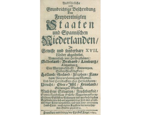
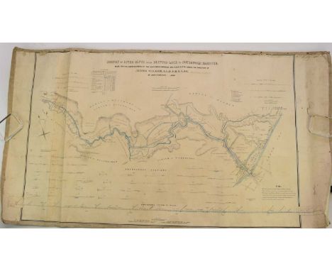
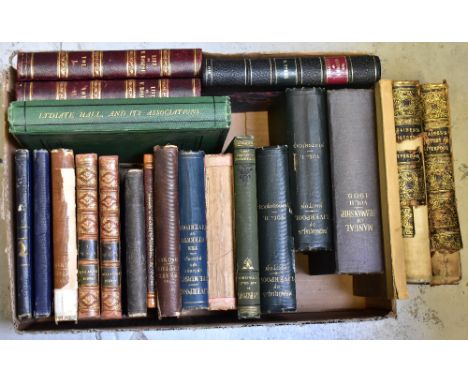
A group of 19th and 20th century Liverpool related books, By Authority of the Lords Commissioner of the Admiralty; 'Manual of Seamanship Vol 2 1909', volumes 1 and 2, J. A,. Picton, F.S.A.; 'Memorials of Liverpool Historical and Topographical including a history of the Dock Estate', 2nd Edition with Revised with Additions, 'Liverpool a Few Years Since: by An Old Stager' 3rd Edition, published Adam Holden 48 Church St 1885,' The Liverpool Bootle, Birkenhead and Wallasey Official Red Book 1914', Benjamin Blower: 'Liverpool History of the Mersey Ancient and Modern', published in Liverpool by Edward Howell Church Street, Thomas Dignan: 'The Slave Captain', published 1847 (two copies), John Drayton volumes 1 and 2, 'A History of the Early life and Development of a Liverpool Engineer', 2nd edition published London Richard Bentley, New Burlington Street 1851, Braithwaite Poole; 'The Commerce of Liverpool', published London and Liverpool 1854, R Syers; 'The History of Everton including familiar dissertations on the people and descriptive delineations of the several and separate properties of the township with various maps plates and woodcuts', published by G & J Robinson Liverpool 1830, volumes 1 and 2; 'The Life of William Roscoe, by his son Henry Roscoe', published London 1833, The Reverend Thomas Ellison Gibson Priest of Our Lady's Church Lydiate; 'Lydiate Hall and its Associations', printed for the author by Ballantyne, Hanson & Co 1876, and Thomas Baines; 'Baines' History of Liverpool, History of The Commerce and Town of Liverpool and the Rise of the Manufacturing Industry in the Adjoining Counties', with pull-out map, published Liverpool by the author 1852. CONDITION REPORT Many in original bindings, one is missing the spine, all have age related wear in the form of dust, dirt to covers, foxing to some pages, books are complete but in varying conditions.
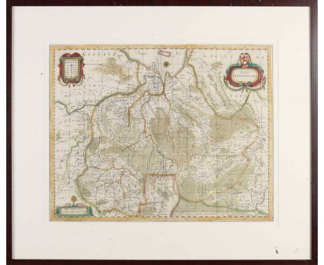
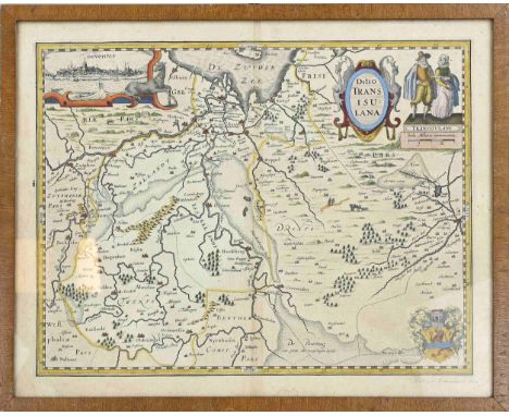
Lot 471

JOHN OVERTON; an 18th century hand coloured engraved map of part of Italy, titled 'Status Mediolanensis Nec Non Ducatuum Mantuæ, Modenae and Parmae ut et Genuensis Reipublicae Fuis cum Finitimis Dominus Accuratillima Delineatio Opera Gerar di Valce', published by John Overton at the White Horse Without Newgate, 50 x 61cm, framed and glazed, together with a hand coloured engraved map of England and Wales, titled 'Oceanus Britannicus', 39 x 50cm, framed and glazed (2).

Lot 472

JOHN SPEED & GEORGE HUMBLE; an 18th century double-sided colour map, 'The Countie Westmorland and Kendale, The Cheif Town Described with the Arms of Such Nobles as Have Bene Earls of Either of Them' (sic), the front showing the map with shields of Kendal etc, verso has alphabetical table of the towns and also chapter 18, 41 x 53cm, framed and glazed.

Lot 416

1960 framed and glazed map of Coleshill/Highworth/Watchfield, and a quantity of other pictures and prints, including framed and glazed silk prints from production at the Alexandra Theatre Birmingham, Hunting interest, and countryside interest, including a humorous Leech

Lot 417

A framed and glazed replica from the mould to the original key of the Bastille, Paris; a map of Berkshire; and a quantity of other pictures and prints, oil painting of a cross, verso marked Tory Lawrence 1988; framed and glazed picture of 60the rifles

Lot 701

An Antique hand coloured map of The Hundreds of Great Barnfield and Selbrittenden, image 36cm x 50cm, framed

Lot 132

John Speede, original map of 'Glamorgan Shyre', uncoloured, cropped. 38x51cm approx. (B.P. 21% + VAT)

Lot 136

John Speede, original hand coloured map of 'Glamorgan Shyre', cropped, 39x51cm approx. framed.(B.P. 21% + VAT)

Lot 144

Michael Drayton, original uncoloured map of Cardiganshire, cropped. 26x34cm approx. Hogarth frame. (B.P. 21% + VAT)

Lot 381

Box of mixed items to include continental study of a kingfisher, Leonardo Collection border collie, figurines of spaniels, cased travelling razor set with brass holder containing 3 razors, by 'Ever ready', wheel barometer, pair of oak barrel shaped tea caddies/biscuit barrels with china linings, white metal lids and shield decoration, Leonardo collection boxed mug and biscuit saucer combo, 1946 ordinance survey map of South Wales etc. (B.P. 21% + VAT)

Lot 247

Ange Mullen-Bryan Where Do Roots Begin?, 2022 Acrylic on Paper Signed on Verso 15 x 10cm (5¾ x 3¾ in.) About My paintings take their inspiration from the lakes, forests and skies of a vast Swedish landscape and a very particular Nordic light. This is where they begin like snapshots from a road trip or plotted points on a map. I weave threads of paint onto coloured linens and canvases and make exaggerated, luminous, livid landscapes. I invite an escape into a kind of utopia, where you can smell freedom and pine in the air, a place I think I know. Yet these paintings tell darker tales of tension, foreboding and longing, I dress them up in the fabric and costume of colour and light.   Select Exhibitions/Awards   Coming up in 2022 17th Feb - 12th March 2022 ' Into the Woods' Group Exhibition Spring Gallery Cheltenham 10th March 2022 'A room of her own' Irving Contemporary Gallery Oxford 28th April - 28th May 2022 'Trees and the Sacred' Norwich Cathedral Hostry, Norwich. 25th Nov 21 - 17th April 2022 'A Generous space' Hastings contemporary Gallery.   You must not reproduce, duplicate, copy, sell, resell or exploit any works. In doing so, you endanger our relationships with artists, and directly jeopardizes the charitable work we do. Anyone found doing will subject to legal action.      

Lot 200

LOCAL INTEREST PHOTOS AND A MAP

Loading...Loading...
  • 109198 item(s)
    /page

Recently Viewed Lots