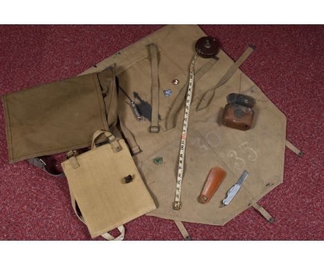
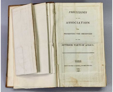
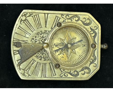
9ct gold charm bracelet (with hand chased decoration to the links) with charms inc 14ct gold map of Switzerland set with a ruby, antique carved amethyst stone set seal fob, antique (touch tests as high carat gold) seal fob, bible, Irish stone set harp etc - total weight 64.2g ~ 1 old repair to a link
We found 109198 price guide item(s) matching your search
There are 109198 lots that match your search criteria. Subscribe now to get instant access to the full price guide service.
Click here to subscribe- List
- Grid
-
109198 item(s)/page
Jurassic Park (1993) - A Framed Prop Display containing a piece of prop Visitors Map from the Film, signed & inscribed by Ariana Richards who played Lex Murphy. 15x12.5x1 inches overall. Provenance: The Prop was originally acquired through Vendors Screenused. The autograph was signed at The London Film & Comic Con on 8th July 2022. With Certificate on reverse.
Maritime interest - 1950s Cunard RMS Queen Elizabeth first class accommodation plan, luncheon and dinner menus, others SS America; Pitt American Football publications program, University of Pittsburgh V University of Oklahoma sept 21st 1957; map; Cunard Chad Valley wooden jig-saw puzzle 2167 Aquitania; wooden sailing boat etc
Collection of four Antiquarian maps comprising of: "A correct map of North Weft (sic) part of Germany" by Eman Bowen, 35.5cm x 43.5cm, a County map of Oxfordshire by Robert Morden, 43cm x 37cm, map of England & Wales (Saxton), Englalond Anglia Anglo Saxonum, 30.5cm x 35.5cm and an Italian antiquarian map "Insulae Tremitanae, olim Diomedeae dictae" (sic) Isles de Diomede ou Tremitanes, by Mortier, 38cm x 50cm (4)Overall wear and marks to all. Some foxing staining, slight time fade. All with fold and crease marks. Overall wear, display marks, some losses to the frames.
TWO WWII DATED MILITARY BAGS, to include a TANGYE ARP badge, folding knife, tape measure etc, the bags include a 1945 dated map case bag, a much larger bag dated 1941 which possible was a mail bag, plus one other undated bag, the ARP badge was made by Fattorini of Birmingham for the TANGYE Cornwall works based in Birmingham, also included is a 1953 dated fold up military knife, a white metal general nurses council badge, a whistle, a concertina tape measure and another badge, the 1941 bag has got what appears to be an ink stain on it but all straps and buckles appear to be okay, there is also a small tank savings box that has rusted and needs a clean
Fullt title: The photo archive of temples and artworks by Willem Grootaers for his book 'The sanctuaries in a North-China city', ca. 1942-1948Description: Dim.: 17,2 x 12,5 cm (the largest photo)Dim.: 44 x 31 cm (each map) This archive comprises the research undertaken by Willem Grootaers, a Belgian Scheutist missionary and sinologue, for his publication 'The sanctuaries in a North-China city : a complete survey of the cultic buildings in the city of Hsu_an-hua (Chahar)' (external link available on rm-auctions.com). It contains an impressive archive of 133 photos (not counting the included negatives) of the temples and their artworks in the former city of Xuanhua, now an urban district of Zhangjiakou in northwestern Hebei Province, China. A very instructive overview of the situation before the systematic destruction in later periods. All photos have their captions on the back, as well as their placement info for his publication. Also included are four hand-drawn maps.
Fullt title: Emil Bretschneider (1833 Ð 1901): Map of China and the surrounding regions, second edition, Edward Stanford Ltd., London, 1900Description: Dim.: 79,5 x 69 cm (the map)Dim.: 18 x 12,5 cm (the cover, size when folded) An interesting map of China 'to illustrate the author's botanical discoveries in China'.With a label to the bottom right reading: Edward Stanford - 26 and 27 Cockspur St., Charing Cross, S.W.- Geographer to the Queen.
A military Zippo for the Desert Rats, the brushed stainless steel lighter printed the obverse OP Granby 1990 1991 an image of the Desert Rat emblem THIS WAS ISSUED IN THEATRE the reverse with a Map of Saudia Arabia, showing Dhahran, Riyadh & Mecca SAUDI ARABIA the date code 1990; a Zippo black leather belt pouch (2)
INTERESTING COLLECTION OF WORLD WAR TWO MATERIAL RELATING TO SGT. C. F. CHARLTON - two USAAF silver pilot's wings marked 'Amcraft, Attleboro Mass Sterling', 2cms H, 7.5cms L, white metal RAF I.D. bracelet marked 'Colin F. Charlton 1523953', pair of dog tags, Service Release Book, two Royal Canadian Air Force Pilot's Flying Log Books 1944 - 1945, group of four medals (Burma Star, The 1939 - 1945 Star, Defence Medal and War Medal), medal ribbon bar, cloth RAF badges and others, cloth flying under cap and scarf, brass cased map magnifying glass, boxed flying goggles Mk VIII with spare lenses, pair of Taylor Hudson military binoculars No 2 Mk III, in canvas case, and ephemera relating to RAF Dum Dum (Calcutta), ETC
A rare Derby figure of the Map Seller's companion, c.1762-65, after the Cris de Paris series at Meissen, standing and holding a box of trinkets before her, a partially furled map in her left hand, standing before flowering bocage, restoration, 16.3cm.Provenance: the John Buckingham Collection.
A Regency silk work map of England and Wales, early 19th century, of oval form with a vignette of Britannia to top right, with painted place names, within floral border, in a giltwood frame with verre eglomise mount, panel 49cm x 44.2cm, frame 65cm x 61.5cmProvenance: Property from the estate of the late David Cornwell, best-known as the author John le Carré.Condition Report: As can be seen from the on-line photograph, there are numerus splits to the silk ground overall. The colours have faded, this is most notable in Britannia where her painted arms have almost disappeared and her face and hair are heavily faded. The frame is knocked, scuffed and chipped.The provenance of the lot is: from the estate of the late David Cornwell, best-known as the author John le Carré.
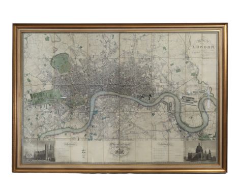
Greenwood, Charles and John, Map of London, An Actual Survey made in the Years 1824, 1825 & 1826, engraved by James & Josiah Neele, 352 Strand, published by Greenwood, Pringle and Co., 13 Regent Street, Pall Mall, London, August 21, 1827, large engraved hand-coloured folding map, dissected and backed onto linen, with calligraphic cartouche and table of explanation, dedication to George IV, and engraved views of St Paul's Cathedral and Westminster Abbey, framed and glazed, 123cm x 184cmProvenance: Property from the estate of the late David Cornwell, best-known as the author John le Carré.Condition Report: Has not been examined out of the frame. There are numerous areas of damage and wear to include: tearing, creasing, and folding to edges of dissected sections, visible linen is stained brown. Some general discolouration with some light marks, to include scuff marks and light brown marks to lower centre. Tearing and discolouration to centre fold. 'Top Front' written in pencil to top right. There are later light ink marks, to include pink, yellow and blue demarking areas to the centre, and there are red wax marks. Some spotting to include lower left.
Wyld, James, A New Map of the Country Twenty-Five Miles Round London, mid to late 19th century, hand-coloured engraved map, dissected, backed on linen and split into four maps, each with front and back boards labelled North East, North West, South East and South West, published by James Wyld, Geographer to the Queen, Charing Cross, London, contained in a contemporary cloth slipcase with publisher's printed label, plate sizes: North West 54cm x 65cm, North East 54cm x 65.5cm, South East 54cm x 65cm, South West 53.5cm x 64.5cm (4)
Conder, Thomas, North America Agreeable to the Most Approved Maps and Charts, engraved for Millar's New Complete Universal System of Geography, last quarter 18th century, Revolutionary Era map of North America, hand-coloured engraving, framed, 33cm x 37cmCondition Report: The sheet may or may not be stuck down as it is unexamined out of the frame. There is a small dark circular stain and sunken short tear to the right margin. There are multiple prominent vertical and diagonal creases. There are tape marks to the top. There is brown discolouration to paper in horizontal lines and vertical bands. The mount has acidified.
Scripture Topography. Being some account of the places mentioned in the Holy Scriptures. , published by The Society for Promoting Christian Knowledge, London 1849. 475 pages, including index. Folding map frontispiece with many engravings. Publisher's brown boards, decorated in blind, titled in gilt. Very good copy 1849. We combine shipping on all lots. Single book £5.99 UK, £7.99 Europe, £9.99 ROW. We can ship a parcel up to 20kg which will take approx. 40 books in UK £12, EUROPE £39.99, ROW, £59.99
Allison Uttley Buckinghamshire. Illustrated with a map. Published by Robert Hale Ltd. Excellent copy in partially torn D/W. 1st edition 1950. We combine shipping on all lots. Single book £5.99 UK, £7.99 Europe, £9.99 ROW. We can ship a parcel up to 20kg which will take approx. 40 books in UK £12, EUROPE £39.99, ROW, £59.99
The Marquis Curzon of Kedleston, Viceroy and Governor General of India January 1899 - May 1904 and December 1904- November 1905 British Government in India. The Story of the Viceroys and government Houses. Published by Cassell and Co. Ltd. London, New York, Toronto, Melbourne. Two volumes offered of this work. Both are third impressions of 1995 volume one. 259 pages. Illustrated with many photographs and plans and an opening map. Volume Two 268 pages including index. With many photographic illustrations. A very fine set of two separate volumes. Large format work. Publisher's blue boards decorated and titled in gilt. We combine shipping on all lots. Single book £5.99 UK, £7.99 Europe, £9.99 ROW. We can ship a parcel up to 20kg which will take approx. 40 books in UK £12, EUROPE £39.99, ROW, £59.99
S. and E. B. Worthington Inland Waters of Africa. The results of two expedition. Published by Macmillan and Co. Ltd. London. 1933. 259 pages including index. Work contains folding map at rear and many full-page photographs, plans and drawings. Fine copy in D/W 1st edition 1933. We combine shipping on all lots. Single book £5.99 UK, £7.99 Europe, £9.99 ROW. We can ship a parcel up to 20kg which will take approx. 40 books in UK £12, EUROPE £39.99, ROW, £59.99
Ordnance Survey map of Dorking and Leith Hill. Scale 1 to a mile. Coloured map. Large, folded map contained in card covers. 1929. Fair condition 1919. We combine shipping on all lots. Single book £5.99 UK, £7.99 Europe, £9.99 ROW. We can ship a parcel up to 20kg which will take approx. 40 books in UK £12, EUROPE £39.99, ROW, £59.99
Small folding map of Palestine in publisher's card covers. Nelsons School Maps No. 10. Divided into squares of 10 English miles. Published by Nelson and Sons. London, Edinburgh, New York. Circa 1910? Measuring 10 x 10. Excellent condition in pale blue decorative paper covers. Circa 1910?. We combine shipping on all lots. Single book £5.99 UK, £7.99 Europe, £9.99 ROW. We can ship a parcel up to 20kg which will take approx. 40 books in UK £12, EUROPE £39.99, ROW, £59.99
-
109198 item(s)/page