We found 109182 price guide item(s) matching your search
There are 109182 lots that match your search criteria. Subscribe now to get instant access to the full price guide service.
Click here to subscribe- List
- Grid
-
109182 item(s)/page


Lot 122
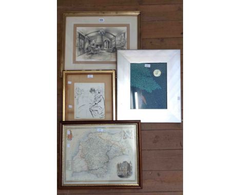
J F ALLEN (20th Century) oil on board - title verso 'Llyn Padarn', signed lower right, 23.5 x 39cms, J & C WALKER coloured engraved map of Anglesey, 20.5 x 25.5cms, J ARCHER coloured engraved map of Cheshire, 19 x 23.5cms, rosewood framed coloured print 'The Betting Post', 29.5 x 36cms and 3 x various coloured engravings of local views


Lot 1190
Full title: Nineteen various chapbooks printed in Ghent by 'Snoeck-Ducaju en zoon', 19th C.Description:Mostly 15 x 10 cm. The Ghent firm 'Snoeck-Ducaju' was founded in 1809 through the marriage of Jozef Snoeck to Isabelle Ducaju of the Dendermonde printers' family. Under the name 'Snoeck-Ducaju en zoon', from 1840 - and for a century onwards - a whole series of age-old chapbooks was printed in a new version that was easy to read and popular for the general public. This lot offers 9 different titles of these chapbooks (Ulenspiegel in several editions). Supplemented with 8 other popular publications by 'Snoeck-Ducaju en zoon' from the 19th century, o.a. a riddle book and a dream book. Almost all books have their original publisher's cover. - ’Schoone Historie van Fortunatus BORZE en zijn Wenschhoedeken. Tweede Uitgave.’ 104 pp., some ill.Ref.: Peter Altena, Leon Stapper, Michel Uyen: “Fortunatusâ€, in: ‘Van Abelard tot Zoroaster. Literaire en historische figuren vanaf de renaissance in literatuur, muziek, beeldende kunst en theater’, SUN Nijmegen, 1994, pp. 102-105. Published in DBNL. - ’JELLEN en MIETJE …Gevolgd door Het AVOND-PARTYTJEN of Die Niet verliezen wil moet T’Huis blyven. Tweede Uitgave.’ 132 pp. The author of the original version of this chapbook, the script of which dates from 1811, is Karel Brouckaert from Ghent, clerk of the justice of the peace in Aalst. See 'Berigt' in this issue, pp. 7-10. In Aalst Broeckaert became an active member and even stage manager of the rhetoric chamber of the Catharinists. All known publications by Snoeck bear the mention 'Tweede Uitgave'.Ref.: Jozef Huyghebaert, Jellen en Mietje, ‘Twee eeuwen Jellen en Mietje’, in: Facultes Universitaires St-Louis, Cahier 7 (1992), pp. 46-47. With bibliography. Published in DBNL. - ’Leven van GENOVEVA van BRABANT Huisvrouw van den doorluchtigen Palatijn Sifridus. Verbeterde uitgave.’ [1836],168 pp.. Cover loose. Handwritten ex-libris ‘Jules Fonteyne’.Ref.: Nele Bemong, ‘Genoveva van Brabant in de Nederlandse letteren, en de unieke rol van volksboeken in de negentiende eeuw’, in ‘Zacht Lawijd’, literair-historisch tijdschrift, 8 (2009), no 8-1, pp. 47-48. Published in DBNL. - ’De Vrouwenperels of historien van HELENA…GRISELDIS…en FLORENTINA…Nieuwe uitgave.’ 76 pp. - ’Historie van de twee broeders en vrome ridders VALENTYN en OURSSON DE WILDEMAN…Nieuwe verbeterde druk.’ 144 pp. - ‘Historie van de VIER HEEMSKINDEREN Vermaard volksboek Zesde verbeterde Uitgave.’ 136 pp. Together with: ‘Vermakelijk leven van THYL-UILENSPIEGEL Met aardige kluchte kluchten, poetsen en boeverijen. Zevende verbeterde druk. Voor de eerste maal versierd met 24 nieuwe en fraaie Platen.’ 1898, 72 pp.Gilt spine. Handwritten ex-libris ‘Andre Van Acker Brugge 1907’ and ex-libris (stamp) ‘Verzameling Guill. Michiels Brugge’. - ’Schoone historie van den RIDDER HELLAS genaamd den RIDDER MET DE ZWAAN. Nieuwe verbeterde uitgave.’ 46 pp. - ’REINAART DE VOS of het oordeel des dieren. Vierde uitgave.’ 80 pp. Richly illustrated. - ’Vermakelijk Leven van THYL-UILENSPIEGEL Met Aardige Kluchten, Poetsen en Boeverijen. Vierde verbeterde druk.’. 1885, 72 pp. Richly illustrated with woodcuts. Beautifully bound with original cover. The editions of Snoeck-Ducaju van Tijl Uilenspiegel are an (adapted) Flemish translation of the French edition of Ulenspiegel by the Bruges historian and bibliophile O. Delepierre of 1840 with the cliched illustrations of P. Lauters from the 1840 edition. Ref.: Lori van Biervliet , Ulenspiegel in het volkboek van Snoeck-Ducaju, Biekorf 1979, 79, 1979, no. 5-6, pp. 161-166. - ’IDEM. Achtste verbeterde druk. Voor de eerste maal versierd met 24 nieuwe en fraaie Platen.’ [1898], 72 pp. - Vie Joyeuse de Thyl Uilenspiegel . Prix 10 Centimes. FRANCE Paris Bernardin-Bechet and Fils, Lib.-Edit. Quai des Grands Augustins, 53. / BELGIQUE Gand Snoeck-Ducaju and Fils Libraires-Editeurs 70, Rue du Roseau, 70.’ 32 pp. Part of the series of the French publisher: ‘Bibliotheque Recreative A 10 centimes le Volume’. Others: - ’ATLAS of Reis rond de Wereld Zeer…Negende uitgave.’ 264 pp. With fold-out 'World map' outside text for title page. About Ghent: pp. 51-67. - ’Grooten dubbelen droomboek of de sleutel der nachtelijke verschijningen’. 18,5 x 11 cm. 270 pp. Bound. Compl. exc. front cover and title page. Richly illustrated (+200). - ’Den Schat der KINDEREN, tot onderwyzing der JONGHEYD...Met platen. Nieuwen Druk.’ 162 pp + [2]. Front cover and back missing. - ’De Kunst om SERVETTEN te Vouwen door Albrecht Duranvat naar het fransch vertaald door E. SNOECK.' 24 pp. - ’Le petit livre des SONGES.’ 24 pp. - ’Het Bloemkorfje of laster en onschuld door C. Schmid’. 124 pp. - ’Verstandigen Hovenier vermeerdert met 200 onfaelbare Geneesmiddels om metre haest allerhande toevallen, ziekten en gebreken…te genezen.’ Incomplete. Until p. 172. Rare. - ’Snoeck’s Raadselboek dienende om oud en jong te vermaken. Vijfde uitgave’. Incomplete.


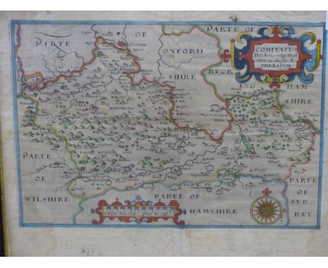
Lot 3748
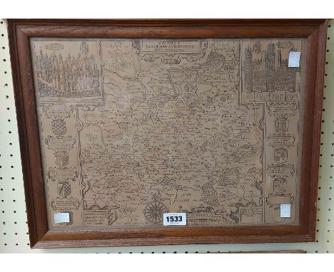
SAXTON- HOLE, (C.1637). HAND COLOURED ENGRAVED MAP OF BERKSHIRE FROM CAMPDEN'S BRITTANICA 33 X 24 cm. Condition of lots is NOT referred to in the lot descriptions.The absence of a condition report does NOT indicate that the lot if free from damage.Detailed condition reports and additional images are available on all lots upon request, please use the “ask a question” button against the lot you have an interest in. We strongly advise that unless you are able to view the lots in person that you request all of the details you feel may be pertinent to your intention to bid.

Lot 3774
M BELLIN ( 18TH CENTURY) CARTE DU GRAND THIBET- A HAND COLOURED MAP. C1749.32 X 23 cm. Condition of lots is NOT referred to in the lot descriptions.The absence of a condition report does NOT indicate that the lot if free from damage.Detailed condition reports and additional images are available on all lots upon request, please use the “ask a question” button against the lot you have an interest in. We strongly advise that unless you are able to view the lots in person that you request all of the details you feel may be pertinent to your intention to bid.

Lot 2274
1982 Spain World Cup collectors cards and memorabilia, comprising Tarjeta Postal Copa Mundial de Futbol FDC postcards, majority stamped with postal stamps attached, (23); Espana 1982 Nouvelles images cards, (14); Campionato mondial de foot ball Espagne '82 postcards, (4); PAG SA collection Perla not a complete run, lacking no.9, 13, 21, some with pencil annotations on reverse, (26); Lesotho World Cup Espana '82, each stamped and applied with postal stamp, (13); Rochy postcards numbered 1 to 11, (11); Carte Maximum cards, each stamped with postal stamps, (3); Official England World Cup poster, road map, fixtures & Stadium information; Catalunya I El Barca Ofereixen El Camp Nou Mundial 1982, one in plastic, (2); sold with a selection of commemorative coins for this and later World Cup competitions, (qty)


Lot 605
A smart example of the sought-after Type-2 'Early-Bay', which has benefited from a recent restoration and is now ready to be personalised. On offer at No Reserve, this is an unmissable opportunity.Starting in 1951, Volkswagen offered an officially sanctioned camper conversion for its Type 2 by Westfalia-Werke of Franz Knobel & Sohne in Rheda-Wiedenbruck, Germany. Interiors were panelled in birch plywood, and standard equipment included screened jalousie windows, a laminated folding table, storage cabinets, an icebox and electrical hook-ups. Some models included a sink and pressure water system. A number of fold-out seat arrangements provided sleeping accommodation and optional equipment included a pop-up roof section, awnings and side tents, a chemical toilet, camping equipment, a small map table and even a child's crib in the driver's cab.This is an original UK-supplied, right-hand drive Volkswagen T2 Campervan that was first registered on 26th June 1972. It has been subject to a recent restoration which included a full strip-down to bare metal, the removal and replacement of all rusted panels and a full respray with the interior fully retrimmed and painted, and a new 'pop-top' roof, fitted with body-matching blue and white stripes. When the camper was prepared, it was finished in Pastel Blue and Cumulous White and sits on a set of white-painted, Fuchs-style steel wheels wearing Continental ContiEcoContact 3 tyres. The interior has been refreshed with new beige cloth upholstery and matching carpets, and the rear has been fitted with a plank effect, light grey Vinyl flooring. The recently-painted cockpit features manually-operated windows, a Benkson CR3 radio, heater and ventilation controls and push-up roof ventilation panels, and the naturally-aspirated 1.6-litre engine sits in an engine bay which appears to be smartly-presented. Transmission is classic Type 2 4-speed, and the odometer indicates a mileage of 54,000, however this is not warranted. Unlike the majority of campervans that we see, this example hasn't been personalised by previous owners, offering an opportunity for its next owners to furnish and equip it exactly as they and their family would like. This genuine early bay-window bus strikes the perfect balance between 1960s camper-van cool, VW-enthusiast credibility and real-life modern drivability. It's fast enough, but not too loud, long legged and is easy to drive and is ready-made fun for all the family. We invite you to have a look at the Silverstone Festival and start planning how you would fit out the interior ready for those long weekends away. SpecificationMake: VOLKSWAGENModel: CAMPERVANYear: 1972Chassis Number: 2322156957Registration Number: EKE 526KTransmission: ManualDrive Side: Right-hand DriveOdometer Reading: 53856 MilesMake: RHDInterior Colour: Fawn / Blue / WhiteClick here for more details and images


Lot 13
A 1946 Cyclostyled transcript "diary" of The British (Sumatra) POW Battalion, a group of 500 British military personnel selected from the 1200 captured by the Japanese at Medan, Sumatra in March 1942 and marshalled as Prisoner of War labour working on railway construction. Apparently produced under the auspices of Major D P Apthorp, The Royal Norfolk Regiment and distributed to survivors and relatives of casualties. Covering the period May 1942 to March 1945 it comprises a narrative history with route map and sketch illustrations, together with appendices including a diary proper, transcript of an address given by a Japanese Colonel to POWs upon their transfer, notes on clothing issues, "salaries", propaganda etc, a Nominal Roll and casualty records. Also period and research documents pertaining to a casualty one Lance Bombardier Laird of 30 Battery, Heavy Anti-Aircraft, Royal Artillery. [See https://www.cofepow.org.uk/armed-forces-stories-list/the-british-battalion ]


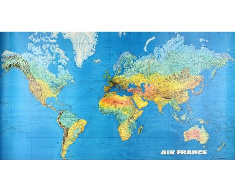
Lot 2561
Air France World Map Route Poster a large map depicting the airlines routes across the world, Cartographie Graindorge Perceval, Paris, Jean Masse collection, printed in France, c. 1960s-70s, rolled, 58 x 33 inches. Condition Report: pin holes to corners, some light foxing and marks to margins, otherwise overall good condition.

Lot 2287
James Bond From Russia with Love (1963) A Framed Section of Map depicting vicinities in Moscow including illustrations of historical buildings, a football club & a communal Park. Maps of this kind would have been used throughout the film, particularly when Rosa Klebb (Lotte Lenya) meets with Tatiana Romanova (Daniela Bianchi) as part of a plot to steal a decoding machine for SPECTRE. Maps were also produced for scenes including the Soviet Consulate & government offices. Linen backed in a framed display with corresponding images. Display measuring 21 x 16 inches.
Lot 363
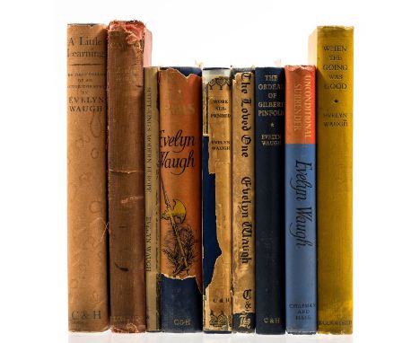
Waugh (Evelyn) When the Going was Good, Tom Rosenthal's copy with his pencil inscription to endpaper, frontispiece, folding map, covers a spine darkened and a little soiled, 1946; Unconditional Surrender, pencil notes in Tom Rosenthal's hand to endpaper, dust-jacket, light sunning to spine, 1961, first editions, original cloth; and 7 others by the same, 8vo (9)⁂ Thomas Rosenthal (1935-2014), publisher and art critic.
Lot 337
NO RESERVE Stevenson (Robert Louis) Kidnapped, first edition, second issue with "pleasure" to p.40, folding colour map, 12pp. advertisements in earliest state dated "5G.4.86", bookplate of Bradley Martin to pastedown, 1886 [&] Catriona, first edition, light foxing, 1893, original cloth, spines lightly faded, ends bumped and frayed; and 4 others, 19th century works from the same series, illustrated by Charles Robinson, 8vo (6)
Lot 322
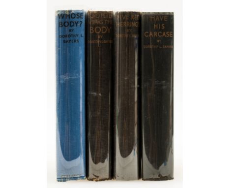
Sayers (Dorothy L.) Lord Peter Views the Body, front free endpapers torn out, half-title browned, 1928; The Five Red Herrings, ink ownership name to map endpapers, lightly browned, book-label verso, 1931; Have his Carcase, 1932, first editions, original cloth, spines faded, ends a little rubbed and creased, joints rubbed; and another by the same, 8vo (4)⁂ The first is listed as No.76 in the Queen's Quorum, Sayers here "weds the detective story to the legitimate novel of manners".


Lot 5433
Palitoy Action Man Vintage 34153 Soldiers of the World - German Staff Officer - comprising cap, jacket, breeches, jack boots, waist belt, Luger, holster, map case, map, Iron Cross, sand goggles, binoculars - Near Mint to Mint on an Excellent Plus sealed backing card, comes with white card display box.


Lot 1109
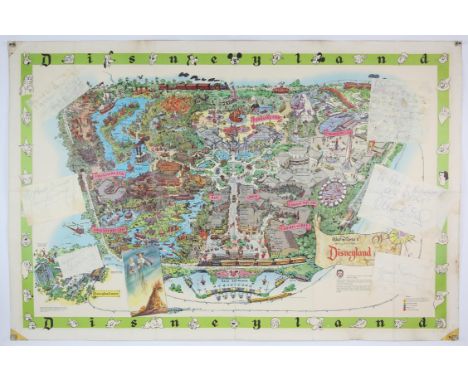
Walt Disney - 1964 Disneyland Map Poster with Hollywood signatures, including Walt Disney and others an early colour map poster of the American theme park Disneyland, Anaheim, California, USA., printed in the USA, Walt Disney Productions, 1964, with seven autographs written on six separate pieces of paper pasted down on left and right hand portions of the map, the signatures include, To Ron and Doreen All the Best Walt Disney, Good Wishes Kathleen Gladys Cooper, Good Luck Barnes Trevor Howard, All Good Wishes Jack Hawkins, Kathleen- Its boiling hot and we are all dying with the heat! And I have a feeling your parents are already hankering for the fog! See you soon Hayley!, and Moira Shearer / Michael Wilding , both signatures written in green ink on the same piece of paper, flat, 45 x 30 inches. (1)Provenance: The signatures were signed in person for the vendors mother and father, Doreen and Ronald Barnes, who were employed in the 1960s-70s as butler and housekeeper to British actor, Sir John Mills and his wife Mary Hayley Bell. Mr. and Mrs. Barnes and their daughter Kathleen lived with the Mills family in their Richmond London home, The Wick, and their farm in Cowden, East Sussex.Sir John and his family travelled to Hollywood in 1964 and took Doreen and Ronald Barnes with them on the trip. Walt Disney, a friend of Sir John Mills, had first noticed Hayley Mills, in the film Tiger Bay (1959) which also starred her father, and offered her the lead role in Pollyanna (1960) and The Parent Trap (1961). Disney also offered Sir John Mills the lead in the adventure film Swiss Family Robinson (1960) which was a huge hit. Condition Report: pin holes and sellotape to corners of the poster with some marks and very light foxing to margins, overall bright colour and strong signatures,

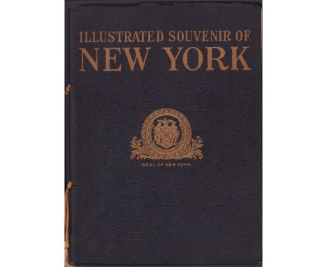
Lot 486
A Visible Story Of New York Soft covered book containing 64 pages, published in 1937 by Supervue Map and Guide Company and by Samuel Freedman. It shows large black and white photos on every page with accompanying written captions. This historic and nostalgic booklet has a tight staple binding, and a yellow cord through two holes. Issued: 1937Dimensions: 8.75"L x 0.5"W x 11.75"HManufacturer: Supervue Map and Guide CompanyCountry of Origin: USACondition: Age related wear.
-
109182 item(s)/page