Tartary. Speed (John), A New Mape of Tartary..., Roger Rea [1662], hand-coloured engraved carte-a-figures map, eight costumed figures to the vertical margins, four oval vignettes of the principal cities along the upper horizontal margin, occasional repaired marginal closed tears, trimmed with loss to the strapwork margin, 385 x 500 mm, English text on versoQty: (1)
We found 109182 price guide item(s) matching your search
There are 109182 lots that match your search criteria. Subscribe now to get instant access to the full price guide service.
Click here to subscribe- List
- Grid
-
109182 item(s)/page
Wales. Morris (William), To the Right Honourable the Lords Commissioners for executing the Office of Lord High Admiral of Great Britain, Ireland, &c. This Chart of St. George's Channel &c. Surveyed under their Lordships' direction by the late Lewis Morris Esqr. which is now extended by an Actual Survey (the whole Corrected & much Improved) from Liverpool to Cardiff in the Bristol Channel; is by Permission most respectfully dedicated by their Lordships' obedient humble servant William Morris, 25th November 1800, uncoloured blue-backed chart on two conjoined sheets, engraved by William Simpkins, large calligraphic cartouche, old folds, slight staining, 890 x 880 mmQty: (1)NOTESLewis Morris was hired to survey some of the Welsh ports in 1737 and though this project was temporarily suspended, it was resumed in 1741 - it was in 1748 that his 'Plans of Harbours, Bays, and Roads in St. George's and the Bristol Channels' was published. This example is the amended second edition, produced by his son - William Morris - which was separately published. Lewis Morris was born in Anglesey and despite having little formal education, mastered the art of land surveying and in 1724 he was commissioned by Owen Meyrick of Bodorgan to survey his estates on Anglesey. In 1729 he was appointed a Customs officer based at Holyhead and Beaumaris and it was his everyday contact with sea captains who told him of the inadequacy and inaccuracy of the existing charts and the hidden dangers of the Anglesey coastline and the whole of the Irish Sea. Six years later he approached the Admiralty offering to survey the Welsh coastline but was met with a lukewarm response. However, the survey commenced in 1737. Morris's main problem was that he had no vessel in which to undertake his survey and the Admiralty were less than helpful and refused to loan him one of theirs. Morris eventually resorted to hiring local boatmen, at five shillings a day, and paid for this out of his own pocket. In 1739 the Customs Commissioners at Holyhead refused to grant Morris any further leave of absence and it appeared that the survey was doomed to never be completed. At this point, his early benefactor, Owen Meyrick, intervened on Morris's behalf and used his influence with the Admiralty to get the project resumed and the surveying re-commenced in 1742. It was the 1744 war with France that finally brought the work to a standstill. In 1748, the Admiralty appeared to have a change of heart and urged him to publish his general chart of the Welsh coast and St George's Channel together with the plans of the bays and harbours. Lewis moved to Ceregigian in 1746 to Allt Fadog near Aberystwyth. Lewis was also a poet and a scholar of Welsh literature and his correspondence was published by J H Davis 1907 - 09. A true polymath and a man of great talent, enthusiasm and energy which although not altogether fulfilled, left an important legacy on Welsh cartography and surveying. The initial atlas had had 1230 subscribers and had sold out, so not unreasonably, his son William believed that there was a market for a second edition. The charts were largely unaltered save for the area around Liverpool Bay and Amlwch harbour, which was now of much greater importance due to the rise of the copper mining industry. I am grateful to Dr Robert Colley for his scholarship and research into the lives and work of Lewis and William Morris. The Map Collector volume 8, pages 32 - 36. 'Lewis Morris, Chart Maker Extraordinary.
Wales. Saxton (Christopher), Radnor, Breknok, Cardigan et Caermarden, quatuor australis Cambriae comitatuum (B.Dehenbart. A Southwales) descriptio, Ano. Dini, 1578, [1579], engraved map of the four counties on one sheet with contemporary hand colouring, large strapwork cartouche and with the arms of Thomas Seckford, central fold strengthened on the verso at the base, two old folds strengthened with tape on the verso, very slight cracking to the printed surface, 370 x 480 mmQty: (1)NOTESThe first printed map of these central and western Welsh counties, with the 'bunch of grapes' watermark.
World. George Philip & Son Ltd (publishers), Navy League Map of the British Empire [1922], colour lithographic map of the world with numerous statistical information and diagrams surrounding the map, laid on contemporary linen, slight adhesion scaring to verso, 490 x 620 mm, contained in publisher's printed card wrappersQty: (1)
World. Sylvanus (Bernard), Untitled Map of the World, Venice, 1511, woodblock cordiform map on two conjoined sheets, printed in red & black, the margins decorated with wind heads and zodiacal symbols, old folds but not visible on the recto, slight dust soiling and creasing to the upper margin, central fold with small 'stitching holes', 420 x 570 mm, no text on versoQty: (1)NOTESR. W. Shirley. The Mapping of the World. no. 32. The first and only edition of this 'heart-shaped' map of the world. The map shows the western coast of North America and is the earliest printed map to show the Corte-Real brothers discoveries (Winsor vol.2 page 123). It is only the second atlas map of the world to show North America; pre-dated by Johann Ruysch's map of 1507. It is also one of the earliest obtainable maps to show and identify Japan, Sylvanus' map was not reprinted and hence remains relatively scarce (Shirley, page 35).
Wallis (James). Wallis's New Pocket Edition of the English Counties or Travellers Companion in which are carefully laid down all the Direct & Cross Roads, Cities, Townes, Villages, Parks. Seats and Rivers with a General Map of England & Wales, published J. Wallis and sold by Davies & Eldridge, Exeter [1810], letterpress title and contents list, forty-three (complete) engraved maps with contemporary hand colouring, including 1 double-page (Yorkshire), plus a small map of the Isle of Wight, Bedfordshire detached, marbled endpapers, contemporary bookseller's label to front pastedown, slight staining to endpapers, contemporary diced calf gilt, re-backed but retaining the original spine, bumped with some wear to the extremities, 12moQty: (1)NOTESChubb. CCCXLIV.
Darwin (Charles). The Descent of Man, 2 volumes,1st edition, 2nd issue, London: John Murray, 1871, half-titles, numerous in-text illustrations, spotting to preliminaries, hinges cracked, near-detached along front inner hinge in volume 1, volume 1 front free endpaper loose, uncut in places, original cloth, boards rubbed and marked, joints rubbed, rear joint of volume 1 split to head of spine, spine extremities rubbed, 8vo, together with: Origin of Species, 6th edition, London: John Murray, 1894, fold-out map, ownership inscription to front blank, spotting to prelimary leaves, hinges cracked, original cloth, spine extremities and joints slightly rubbed, a couple of marks to base of spine, 8voQty: (3)
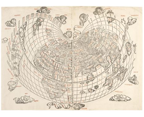
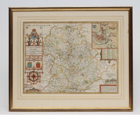
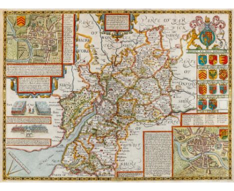
Bindings. A collection of ten Arts & Crafts style bindings, including: 1. Malory (Thomas), Le Morte Darthur. The history of King Arthur and of his noble knights of the Round Table, reprinted, London: Medici Society, 1935, colour plates after Russell Flint, decorative patterned endpapers, all edges gilt, contemporary terracotta morocco, elaborate gilt decoration with oak tree and acorn design, green morocco shield onlays to upper board, 8vo, 2. Shakespeare (William), The Sonnets of William Shakespeare, Birmingham: printed by Birmingham Guild of Handicraft, London: Tylston & Edwards and A.P. Marsden, 1895, decorative initials and page decorations by Ernest G. Treglown engraved on wood by Charles Carr, printed endpapers, top edge gilt, remainder untrimmed, contemporary gilt & blind decorated brown morocco, binder's monogram to turn-in to lower board MSK 1927, small 4to, 3. Argyll (John Douglas Sutherland Campbell, Duke of), Guido and Lita: A Tale of the Riviera, London: Macmillan & Co., 1875, wood engraved frontispiece, vignette title and plates, all edges gilt, contemporary gilt decorated dark green morocco, small 4to, 4. Keats (John), Odes, London: Curwen Press for Duckworth & Co., 1923, frontispiece and illustrations by Vivien Gribble, printed endpapers, top edge gilt, remainder untrimmed, contemporary gilt decorated blue-green morocco, slim 8vo, 5. Bright (William), Chapters of Early English Church History, 3rd edition, revised, Oxford: Clarendon Press, 1897, colour map frontispiece, all edges gilt, contemporary gilt decorated terracotta brown morocco by F. Garrett, gilt armorial of Lichfield Theology College to centre of upper board, 8vo, 6. Aesop, Fables, a new translation by V.S. Vernon Jones, London: William Heinemann, 1912, colour plates after Rackham, all edges gilt, contemporary gilt decorated dark green morocco, scratch to upper board and board edge rubbed at head, 8vo, and four others similarQty: (10)
Gratton (Frederick M). The History of Freemasonry in Shangai and Northern China, Containing a Complete List of all the Regular Lodges & Royal Arch Chapters, Tientsin: North China Printing and Publishing Co, 1913, 10 photographic plates, minor spotting to prelims, contemporary red half morocco, joints slightly rubbed, corners bumped, boards rubbed, spine extremities slightly worn, 8vo, together with: The History of Freemasonry in Northern China, 1913-1937, Shanghai: Kelly & Walsh, no date, frontispiece, 27 photographic plates, 1 folding map, some leaves uncut, contemporary red half morocco, joints slightly rubbed, corners bumped, boards rubbed, spine extremities slightly worn, 8vo with Northern China medal, 3 bars with floral embellishments, yellow metal with sword design, blue ribbon, signed 'KS' and a feline figurehead to versoQty: (3)
Tolkien (J.R.R.) The Lord of the Rings: The Fellowship of the Rings; The Two Towers; The Return of the King, 3 volumes, 2nd edition, 5th impression, London: George Allen & Unwin, 1970, folding map to each, original cloth, dust jackets, clear tape residue marks to flaps, 8vo, together with The Fellowship of the Ring, 7th impression, 1957; The Two Towers, 5th impression, 1957; The Return of the King, 4th impression, 1958, folding maps, one or two minor spots, previous owner signatures to Fellowship & Return of the King, original cloth, some fading to spines, rubbed at foot, a few small indentations and small marks, 8vo, plus The Hobbit, 3rd edition, 6th impression, 1971, The Lord of the Rings, 3 volumes, Folio Society, 1977, and The Hobbit, Folio Society, 1979Qty: (11)
Stark (Freya). Letters From Syria, 1st edition,1942, period ink inscription to front endpaper, Perseus In The Wind, 1st edition, 1948, The Journey's Echo, 1st edition, 1963, previous owner bookplate to front endpaper, The Zodiac Arch, 1st edition, 1968, price clipped, London: John Murry, original cloth in dust jackets, 8vo, together with; Abraham (George D.), Motor Ways In Lakeland,1st edition, London: Methuen & Co. Ltd., 1913, with 24 black & white illustrations and map endpaper, light spotting throughout, publishers original gilt decorated cloth, 8vo, and, Noyce (Wilfrid) Mountains And Men, 1st edition, London: Geoffrey Bles, 1947, 17 black and white illustrations plus 4 maps, endpapers toned, original cloth in dust jacket, covers and spine lightly rubbed to head and foot, 8vo, Scholar Mountaineers Pioneers Of Parnassus, 1st edition, London: Dennis Dobson Ltd, 1950, numerous black and white illustrations, original cloth in dust jacket, price-clipped, covers and spine slightly rubbed, 8vo, plus 24 other modern travel reference, mostly original cloth in dust jackets some original cloth, G/VG, 4to/8voQty: (2 cartons)
Lambert (B.). The History and Survey of London And its Environs. From the earliest period to the present time, 4 volumes, London: printed for T. Hughes, 1806, monochrome illustrations, folding map frontispiece to volume 4, bookplates to the front pastedowns, some marginal toning & spotting, contemporary gilt decorated full calf, boards & spines slightly rubbed with minor some minor loss to head & foot, 8vo, together with; Brayley (Edward Wedlake), London and Middlesex; or, an historical, commercial, & descriptive Survey of the Metropolis of Great-Britain:...5 volumes, London: Longman, Hurst, Rees et al, 1810-15, monochrome plates, some light spotting & toning throughout, contemporary gilt decorated half calf, boards & spines slightly rubbed with minor loss to head & foot, 8vo, plus C. Dilly [printed for], A Treatise on the Police of the Metropolis; containing a detail of the various crimes and misdemeanours..., 3rd edition, by A Magistrate, London: printed by H. Fry, 1796, folding table to pp.230, some toning & light spotting throughout, contemporary endpapers, gilt decorated black half calf, boards & spines rubbed with some minor loss to the head of the spine, 8vo, and other 18th & 19th-century London history & reference, including Old and New London:..., 6 volumes, by Walter Thornbury, London: Cassell, Petter, & Galpin, circa 1880, large 8vo, mostly leather binding, some original cloth, overall condition is generally good/very good, most volumes have a previous owner inscription to the front pastedown or endpaper, 8vo/4to 54 volumesQty: (3 shelves)
Savage (James). History of the Hundred of Carhampton, in the County of Somerset, 1st edition, Bristol: William Strong, 1830, black & white frontispiece plus a colour geological folding map with a small tear to the bottom right margin, some toning & spotting throughout, bookplate to front pastedown, cracked gutters, spine partially detached, contemporary blue cloth spine to boards, rubbed, paper spine label rubbed with some loss, 8vo together with other 19th & early 20th-century British history & topography reference & related, including Census of England and Wales 1911, London: H. M. S. O., 12 volumes, 1911, large 8vo, some leather bindings, some original cloth, some odd volumes, all ex-library with some associated marks, overall condition is fair/good, 8vo/4toQty: (6 shelves )
Mantell (Gideon). The Geology of the South-East of England, 1st edition, London: Longman, Rees, Orme, Brown, Green & Longman, 1833, half-title discarded, lithograph frontispiece, title with wood engraved vignette (both leaves washed), five lithograph plates (including one folding), folding colour geological map (few tears with slight loss, archival tissue-lined to verso), illustrations to text, chapter 10 with few coloured pencil markings to blank margins, occasional light toning, modern half calf, contrasting morocco labels to spine, 8voQty: (1)NOTESChapter 10 refers to Mantell’s discovery of a fossilised dinosaur in the Weald in 1832. It was the first armoured dinosaur discovered and he named it Hylaeosaurus or ''fossil lizard of the Weald'', proving that some dinosaurs at least had dwelt on land.
Montelius (Oscar). The Civilisation of Sweden in Heathen Times, 1st English language edition, London: Macmillan and Co., 1888, colour frontispiece map plus 205 black & white illustrations, later inscription to the front endpaper, some spotting, publishers original gilt decorated red cloth, spine faded, boards & spine lightly rubbed, 8vo, together with; Thomson (James), A Great Free City The Book of Silchester..., 2 volumes, limited edition, London: Simpkin, Marshall... & Co., 1924, signed by author to the limitation page, black & white illustrations, illustration opposite B1 cut-out, bookplates to the front pastedown, some spotting & toning, publishers original brown cloth, boards & spines rubbed & lightly marked, large 4to, plus Morgan (Thomas), Romano-British Mosaic Pavements: a history of their discovery and a record and interpretation of their designs, London: Whiting & Co., 1886, colour & monochrome illustrations plus a folding map to the rear, some spotting & toning, publishers original gilt decorated green cloth, boards & spines rubbed, 8vo, and other 19th & early 20th-century archaeology & history reference, including Celtic Researches, on the Origin, Traditions & Language, of the Ancient Britons;..., by Edward Davies, London: printed for the author, 1804, 8vo, some leather bindings, mostly original cloth, G/VG, 8vo/4toQty: (6 shelves )
Four assorted maps comprising Mathew Simons circa1635 map of Lancashire with triangular distance table 11cm x 11cm, a linear road map Cheshire Lancashire circa 1600 12cm x 19cm, Peter Van Den Keere (c1599-1620) Lancaster 12cm x 8cm and Badeslade & Toms market towns of Lancashire 15cm x 14cm, all glazed and framed.
Cecinsky, Herbert and Webster, Malcolm R, English Domestic Clocks, illustrated hardback edition, pub: London, The Waverley Company, Gray, Thomas, Poems, pub: London 1887, The Chiswick Press, and Philips Series of Maps for Travellers, a cloth backed map of the United States including California, Texas &c., pub: London & Liverpool, George Philip & son (3)
1798 CORNWALLIS AND THE IRISH REBELLION A large creamware jug, c.1798, printed in black with a portrait flanked by Classical figures and trophies, the reverse with a map of Ireland, beneath the spout inscribed 'Success to the Yeomanry' within an oak leaf cartouche, some restoration, 24.5cm. Between the 24th May 1798 and 12th October 1798 a series of violent clashes occurred, with Cornwallis being appointed both Lord Lieutenant and Commander-in-Chief of Ireland in the June. A large force of both regular troops and militia was sent to Ireland to quell the uprising. Provenance: with Garry Atkins, October 2009.
1803 RESUMPTION OF WAR WITH FRANCE A small creamware jug, c.1803, printed in black with an inscribed satire depicting John Bull addressing Bonaparte standing upon a map of Europe, titled' The Governor of Europe stoped [sic] in his Career', the reverse inscribed 'Success to the Volunteers', a short body crack, 14cm. A letter accompanying the lot, written by David Drakard to Robin Simpson and dated 6th December 1992, provides a likely explanation as to the statement by John Bull; 'Paws of Pompey' meaning 'Keep your hands off Britain'. Pompey is the Naval nickname for Portsmouth, home of British Fleet. Cf. David Drakard, Printed English Pottery, pl.501 for the satire published by Fores on 16th April 1803.
ADMIRAL BOSCAWEN AND THE CAPTURE OF LOUISBOURG A rare Worcester mug, c.1760, the cylindrical body printed in black with a three-quarter length portrait of the Admiral holding a chart titled 'Louisbourg', the reverse with two warships, centred by the arms of Boscawen, 8.7cm. This portrait of Admiral Edward Boscawen is after the 1747 painting by John Faber, but has been embellished with the inscribed map of Cape Breton. Highly regarded as a fighting Admiral, Boscawen was wounded in the neck in 1747 in action off Cape Finisterre thus earning him the nickname 'Wrynecked Dick'. Boscawen took Louisbourg at the mouth of the St Lawrence River in July 1758, paving the way for the assault on Quebec the following year. Cf. Simon Spero Exhibition 2000, number 8.
A collection of five maps, coloured field map, plan of Mr John Blamire's Estate at Hill House Dash Nook. Surveyed and drawn April 1796 by I Norman, a map laying out of ground for proposed villas at Knowefield 29/1/76 (near Carlisle). Field map Priest Hill (Earl of Lonsdale). Map plan of Morton Estate surveyed 1822 for John Foster. Ordnance Survey map Boustead Hill 1880 coloured. (5)
Thirlmere interest. Book and two maps. Harwood Sir John James, History in description of the Thirlmere Water Scheme parts 1 & 2 with an appendix. One diagram and three folding maps in colour and nine photographic plates. Published Manchester Henry Blacklock & Co 1893. Original paper covers detached and worn. Together with a large lithographed map of Parish of Crosthwaite, showing Thirlmere lake and large sheet with transverse and longitudinal sections of Thirlmere lake (both soiled).
JOHN SPEED (1552-1629), "The West Riding of Yorkshire .... 1610", hand coloured engraved map, with title cartouche, plan of York City, figural scale and arms of the Royal Princes, text to reverse, 14 3/4" x 19 3/4", Hogarth frame (Est. plus 21% premium inc. VAT)Generally very good, some creasing to top left corner colouring neatly done and vivid, no staining, margins possibly damaged/cut as mount is close to image
JOHN SPEED (1552-1629), "Shropshire", hand coloured engraved map with title banner, plan of Shrowesbury (sic), scale cartouche and sketch of the Battle of Shrewsbury, text to reverse, 15 1/4" x 20 1/2", gilt frame (Est. plus 21% premium inc. VAT)Generally good, no tears/creading/staining, perhaps some very faint foxing top right corner (?)
JOHN SPEED (1552-1629), "Cambridge Shire", hand coloured engraved map with title cartouche surmounted by the Royal Arms, plan of Cambridge, Arms of the Royal Princes and Colleges and figural scale, text to reverse, 15 1/4" x 21", Hogarth frame (Illustrated) (Est. plus 21% premium inc. VAT)Very good condition
JOHN SPEED (1552-1629), The North and East Ridings of Yorkshire, hand coloured engraved map with title cartouche, plans of Richmond and Hull, figural scale and arms of the noble families, 15 1/2" x 20 1/2", Hogarth frame (Est. plus 21% premium inc. VAT)No foxing/creasing/tears, mildy stained brown - no margin showing
JOHN SPEED (1552-1629), Northumberland, hand coloured engraved map with title cartouche, plans of Berwick and Newcastle, scale and arms of Noblemen, 15 1/4" x 20 1/4", Hogarth frame (Est. plus 21% premium inc. VAT)Generally good, only top margin showing and small hole to centre of same, some creasing towards the lower end centre, small stain just above "wall" of "the picture? wall"
JOHN SPEED (1552-1629), "Gloucestershire", hand coloured engraved map with title cartouche, Royal and Noble arms, plans of Gloucester and Bristol and scale, text to reverse, 15" x 24", Hogarth frame (Illustrated) (Est. plus 21% premium inc. VAT)Generally very good, no tears, foxing, staining, margins clear and good
ROBERT MORDEN (c.1650-1703), "Westmorland", hand coloured engraved map with title cartouche and scale, 14 1/4" x 16 1/2", together with another similar "Cumberland", 14 1/4" x 16 1/2", both framed (2) (Est. plus 21% premium inc. VAT)Westmorland - mild foxing, otherwise good, very little margin showingCumberland - generally very good, odd very mild stain spots, small crease lower left corner near "Ocean"
ROBERT MORDEN (c.1650-1703), "Northumberland", hand coloured engraved map with title cartouche and scale, 16 1/4" x 73 3/4", together with another similar "Durham", 14 1/4" x 16 1/2", and John Speed (1552-1629) Map of Durham with title banner, Royal Arms, plan of Durham and compass rose, 15" x 19 3/4", all in Hogarth frames (3) (Est. plus 21% premium inc. VAT)Northumberland very mild brown staining throughout and very slight creasing to right side edge, otherwise goodDurham - very mild brown staining and mild creasing - not quite flatDurham (Speed) brown staining throughout bar centre fold, mild creasing on left side edge
JOHN SPEED (1552-1629), Cumberland , c.1627, hand coloured engraved map with title cartouche, map of Carlisle, scale, an account of "The Picts Wall and Arms of the Earls of Carlisle, text to reverse, 14 3/4" x 19 3/4", stained frame, together with a Robert Morden (1650-1703), Map of Shropshire, 14 1/4" x 16 1/2", Hogarth frame (2) (Est. plus 21% premium inc. VAT)Speed - Generally good, no foxing, very mildly brown stained, small tear at base of centre fold, margins goodMorden - perhaps some fading, otherwise good
JOHN OGILVY (1600-1676), The Road from Ferrybridge to Boroughbridge continued to Barnard Castle, hand coloured engraved map with title cartouche, 13 1/4" x 17 1/2", mounted on card, unframed (Est. plus 17.5% premium)Some foxing especially along right hand side, very mild creasing, otherwise very good
NICHOLAS VISSCHER (1618-1709), "Hiberniae", hand coloured engraved map, c.1690, with title cartouche and scale with Royal Coat of Arms, 23 1/2" x 20", gilt frame (Est. plus 21% premium inc. VAT)Small hole and tear in County Cork West of Kinsale, tear in centre West of Kildere, otherwise good
-
109182 item(s)/page