We found 109182 price guide item(s) matching your search
There are 109182 lots that match your search criteria. Subscribe now to get instant access to the full price guide service.
Click here to subscribe- List
- Grid
-
109182 item(s)/page


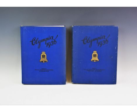
Lot 274
Olympic Games / Third Reich interest: OLYMPIA 1936 BAND I and BAND II, two German cigarette card collector's albums commemorating the 1936 Berlin Summer and Winter Olympics, each containing numerous pasted in photographic images of the events, the athletes and the venues of the games, including photographs of Adolf Hitler and Jesse Owens, together with further full page colour and black and white plates and a fold out map, both albums complete with all cards present, each in blue cloth boards with gilt detail (2)

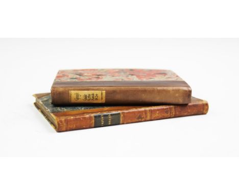
Lot 299
PATERSON (D), PATERSON'S BRITISH ITINERARY being a New and Accurate Delineation and Description of the Direct and Principal Cross Roads of Great Britain, 2 vols, 1st edition, full leather, gilt titles and decoration to spine, engraved title page and dedication page to each volume, hand coloured fold out map to front of volume one, 360 column maps across two volumes, London, Carrington Bowles 1785 (2)

Lot 301
SMITH (C), SMITH'S NEW POCKET COMPANION TO THE ROADS OF ENGLAND AND WALES AND PART OF SCOTLAND, 1st edition, 3/4 leather with marbled boards, gilt title and decoration to spine, folded map to frontispiece, strip road maps engraved on 43 plates, map of the Isle Of Wight, full index, London, Charles Smith And Son 1826, with GRAY (G.C.), GRAY'S NEW BOOK OF ROADS, The Tourist and Traveller's Guide To The Roads Of England And Wales And Part Of Scotland On An Entirely New Plan, 1st edition, later bound 1/2 leather with marbled boards, engraved frontispiece, fold out hand coloured map, London, Sherwood, Jones, And Co 1824 (2) For condition information please view this lot on our website HERE

Lot 304
Four editions of PATTERSON (D), A NEW AND ACCURATE DESCRIPTION OF ALL THE DIRECT AND PRINCIPAL CROSS ROADS IN GREAT BRITAIN, comprising: the 3rd EDITION, full leather, gilt title to spine, fold out map to frontispiece, London, T. Carnan 1776, the 7th EDITION, London, T. Carnan 1786 (at fault), the 12th EDITION, full leather, gilt title to spine, marbled end papers, gilt edges to block, two fold out maps to frontispiece, London, Longman And Rees 1799, and the 18th EDITION, full leather with embossed decoration, gilt title to spine, marbled end papers, marbled edges to block, fold out map to frontispiece with seven further pull out maps, includes part of Scotland (4)
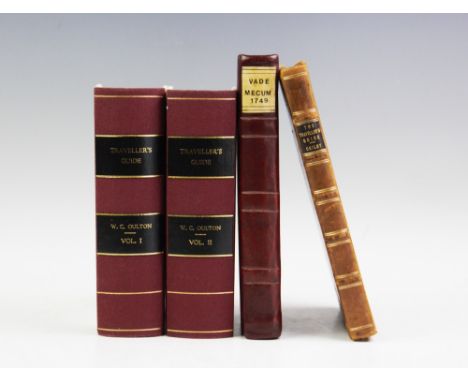
Lot 306
OULTON (W.C.), THE TRAVELLER'S GUIDE; OR, ENGLISH ITINERARY, 2 vols, later bound red cloth with white boards, gilt title to spines, fold out map to frontispiece of volume 1, sixty six engraved illustrations throughout, London, James Cundee 1805, with OGILBY, THE TRAVELLER'S GUIDE: OR, A MOST EXACT DESCRIPTION OF THE ROADS OF ENGLAND, full leather with embossed two tone decoration, gilt title to spine, fold out map, London, William Bray, and VADE MECUM: OR, THE NECESSARY POCKET COMPANION, Containing Sir Samuel Ireland's Perpetual Almanack, 3/4 red leather with red boards, fold out lunar table, London, R Ware 1749 (4)
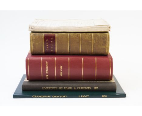
Lot 310
CARY (J), CARY'S NEW ITINERARY, 3/4 leather with marbled boards, gilt title to spine, fold out map to frontispiece and six further fold out maps, engraved dedication to the Duke Of Manchester, London, G. & J. Cary 1828, with CARY (J), CARY'S NEW ITINERARY, later bound 1/2 red leather with pink boards, gilt title to spine, fold out map to rear flyleaf and further fold out maps, engraved dedication to the Duke Of Manchester, London, G. & J. Cary 1821, with EDGEWORTH (R.L.), AN ESSAY ON THE CONSTRUCTION OF ROADS AND CARRIAGES, later bound 1/2 leather with marbled boards, gilt title to spine, fold out diagrams to rear flyleaf, London, R. Hunter 1817, PIGOT (J), OXFORDSHIRE DIRECTORY, 1830, and OWEN'S NEW BOOK OF ROADS, 1784, (unbound) (5)


Lot 334
CARTOGRAPHIC INTEREST: Cary's Reduction Of His Large Map of England And Wales With Part Of Scotland, published by J. Cary, 1834, in original cardboard sleeve, with Cary's Travelling Map Of Ireland, Published by G. and J. Cary, 1834, in original cardboard sleeve (2) For condition information please view this lot on our website HERE

Lot 358
A collection of 18th century and later hand coloured maps and etchings, to include a William Kip map of Norfolk, a map of the West Riding of Yorkshire, The Road from Oxford to Salisbury, a View of Powis Castle in Montgomeryshire etc, and a pair of English school, oil on panel landscapes of abbey ruins, 15.5cm x 26cm (10)

Lot 380
E Parker (English School), Pair of oils on board, Still lives of fruit on the branch, Signed lower right, 56cm x 30cm, Framed and glazed, With CARTOGRAPHIC INTEREST: After John Cary, Hand coloured engraving on paper, linen backed, A New Map Of Cheshire, Dated 1801, 50cm x 56cm, Framed and glazed (3)

Lot 690
RAILWAY INTEREST: An L&NWR railwayman's cast brass armband, the curved band with embossed and red painted lettering and adjustable leather arm strap, stamped '140' verso, with two Booths miniature cream jugs, each marked 'Southern Railway Chatham Section', a circular cast metal sign for 'H.M. Fox & Son, Heswall Cheshire' and a hand coloured map of Cumbria (5)


Lot 220
An advertising mirror entitled Ogden's Robin Cigarettes by The Super Five Imperial Tobacco Company and a Saxton's map of England and Wales, 1579 (British Museum Maps C.7.C.I), framed under glass, image size of map approximately 38 cm x 49 cm (2) This lot must be paid for and removed no later than close of business on Tuesday


Lot 70
A Pre-First World War Map of the North Riding of Yorkshire, produced by W G Bryning, County Surveyor's Office, Northallerton, 1912, showing Roads reserved for Military, Common Roads - Military and Civilian, Boundaries - Petty Sessional Divisions, Collecting Centres for Stock, Collecting Centres for Tools, Collecting Centres for relevant Group Leaders (Malton Division), Proposed Area for Assembly of Light Transport (Malton Division), Proposed Centre for Population brought into the District, etc, linen backed paper, the reverse inscribed Greta Bridge, 73cm by 123cm Footnote:- Possibly produced for planning action to be taken in case of invasion by Germany.


Lot 356
James Wyld, "The Islands of New Zealand from the Admiralty Surveys of the English and French Marine from the observations of the officers of the New Zealand Company and from Private Surveys & Sketches compiled by James Wyld, Geographer to the Queen and HRH Prince Albert", Charing Cross, East London, 1845, map dissected and laid on cotton, in publisher's slip case, 117 cm x 84 cm


Lot 358
John Arrowsmith, engraved map of "La Provincia de Buenos Aires" based on the surveys of Royal Navy Captain Fitzroy and dedicated from Governor and Captain General Don Juan Manuel de Rosas to Woodbine Parish, published 1836 by John Arrowsmith, dissected and laid on cotton, in publisher's slip case with label, 104 cm x 82 cm
Lot 127
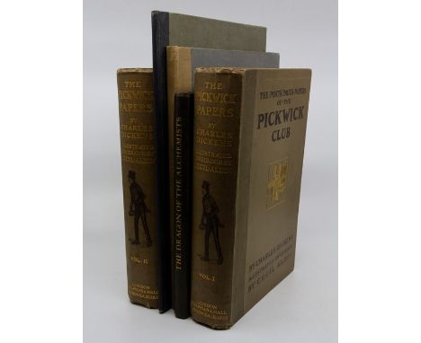
Collection of books comprising: The Dragon of the Alchemists, by Frederick Carter, illustrated with wood engravings by W. M. R. Quick, London: Elkin Matthews, 1926, publisher's quarter-cloth with paper covered boards; Twenty-Five Caricatures, by Sava, signed limited edition [of 250], London: Elkin Matthews, 1926, publisher's quarter-cloth and paper covered boards; Pickwick Papers, illustrated by Cecil Aldin, in two volumes, London: Chapman & Hall, 1910, publisher's gilt pictorial cloth; A Map of the World, engraved by Roselli after Contarini, 1506, second edition, London: British Museum, 1926, publisher's quarter-cloth and paper covered boards (5)
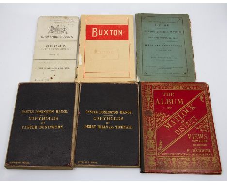
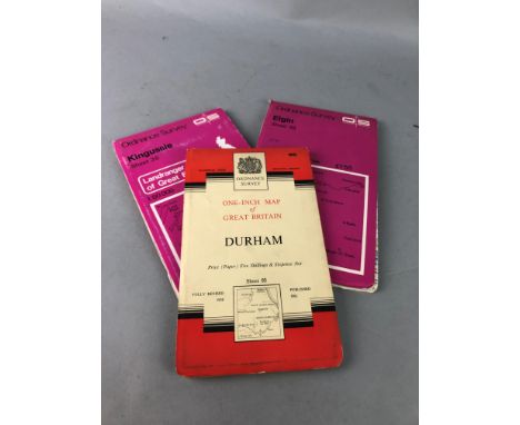
Lot 160
Derbyshire History Interest. Collection of maps and guides comprising: Derby Corporation town planning map, Ordnance Survey, extensively hand-coloured with manuscript key, signed by the surveyor and dated January 1920, sectional, linen-backed; two sectional linen-backed folding maps for Castle Donington Manor (Copyholds in Derby Hills & Ticknall; Copyholds in Castle Donington); linen-backed folding Ordnance Survey map of Darley Abbey, marbled paper ends, slipcase bearing Stanford label; OS map of Derby dated in black ink (16 January 1912); three late-Victorian/Edwardian guides to Buxton; two albums of printed views depicting Buxton and Matlock (10)

Lot 168
Holy Bible, beginning with part of the Book of Common Prayer, no title page before Old Testament (opens with First Book of Moses), no title page before New Testament (opens with 'names & order of all the bookes' with woodcut map of Holy Land verso, followed by first page of Matthew: Aai), woodcut capitals and several woodcut maps/illustrations (including the full-page 'great figure describing the forme of the Temple & citie restored'), front pastedown inscribed 'Great Bible 1539'. Quarto, contemporary reverse calf with brass corners and remnants of clasps, lacking spine, upper board detached, incomplete as found (not collated)
Lot 204
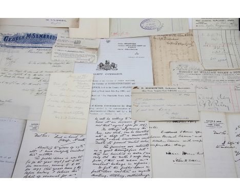
Collection of 18th & 19th century vellum indentures relating to Staffordshire (predominantly Newcastle-under-Lyme), including wills, probates, admittance, conveyances, marriage settlements, mortgages, surrenders. Names include Hollins, Simpson, Sherwin, Yates, Cooke, Bishton, Hanbury, Stocker, Brain, Blackwall, Preston, Dudson, Roberts, and many others. To include a manuscript map, 'Plan of a Manufactory' in Longton (pottery works), 1857, ink & watercolour, linen-backed, and a vellum indenture relating to James Meakin and Thomas Wedgwood, 1774. Includes a quantity of Victorian auction catalogues for various estate sales. In one box
Lot 239
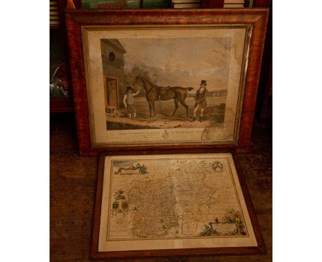
Jansson, Jan (1588-1664). 17th-century map of Staffordshire, hand-coloured copper engraving on laid/chain-lined paper featuring decorative cartouche, heraldic shields and figures, Dutch text to verso, framed & glazed. Together with a sporting portrait of John Twemlow of Hatherton, Cheshire, with his favourite horse, 'Sultan', after John Bryan, hand-coloured lithograph published in London by J. Graf, 1841, maple veneer frame, discolouration/wear as found (2)

Lot 313
Almanacks for the year 1678, collection of 18 bound as one (sammelband), including John Bucknall ('a student in astrology and physick'); John Partridge; William Andrews; John Lord & Vincent Wing; a 'Yea and Nay Almanack for Quakers, for the Meridian of the Bull and Mouth within Aldersgate'; 'Fly, for the Meridian of Kings-Lyn'; 'Swallow' (Cambridge, John Hayes); John Woodhouse; Perkins; William Dade; Thomas White; Thomas Trigge; George Rose. Featuring several woodcut illustrations, including a map of the British Isles, the 'Anatomy of the Body of Man' (representing zodiac signs and constellations), a 'Representation of the Comet seen in April 1677', and an illustration of the eclipse with a face. Bound by Bayntun of Bath in full black calf with marbled endpapers and gilt gauffered edges


Lot 886
JOHANNES BLAUE; 'Lincolne-Shire', 17th century and later coloured map, 'The Theatrum Orbis Atlas Novus' with PP.265 and 266 to reverse, 42 x 50cm, in glazed double sided frame, also two maps of Staffordshire and Lancashire after John Speed (3).Additional InformationBlaue map - area of surface loss and staining, upper centre, spotting and waviness to the paper. The second and third maps detailed in this lot are, as catalogued, reproductions.


Lot 1215
CHARLES HORNER; a George V hallmarked silver rattle inscribed 'Baby' to both sides (af), Chester 1923, 2.9 x 2.6cm, a vase on loaded base, a silver handled pen knife, a further pen knife and a map reader/measurer (5).Additional InformationThe rattle and vase dented, the rattle has a split to one side, general wear throughout.

Lot 805
Fermor (Patrick Leigh). The Traveller's Tree. A Journey through the Caribbean Islands, 1st edition, 1950, half-tone illustrations by A. Costa, double page map, contemporary ownership inscription, a few minor spots, original cloth, dust jacket, a couple of tiny nicks and tears at spine ends, 8vo, together with A Time to Keep Silence, Queen Anne Press, 1953, colour frontispiece, top edge red, original cloth, dust jacket, a few faints spots, 8vo, limited edition 236/500, with 8 others by Fermor, a few duplicates and signed, including A Time of Gifts, 1977, Three Letters from the Andes, 1991 and Artemis Cooper's Patrick Leigh Fermor. An Adventures, 2012 (signed by the author) (Qty: 10)

Lot 822
Hardy (Thomas). Jude the Obscure, 1st bookform edition, volume VIII of the Wessex Novels, Osgood, Mcilvaine & Co., 1896 [1895], etched frontispiece by H. Macbeth-Raeburn, single page map at end, a little light marginal toning, top edge gilt, original green cloth gilt, corners a little bent, a few light marks, dust jacket remnant (part of upper panel and front flap), 8vo (Qty: 1)

Lot 858
Ransome (Arthur). 'Swallows and Amazons'. A complete set of all twelve titles, 1930-1950, all 1st editions except Peter Duck, 22nd impression, 1950 and Pigeon Post, 2nd impression, 1936, illustrations, a few minor spots, previous owner inscription to The Big Six, map endpapers, original cloth (light fading to Swallows and Amazons, more pronounced fading to Swallowdale), dust jackets for all except Swallowdale and The Picts and the Martyrs, Peter Duck and Secret Water price-clipped, some toning to spines, a few tears and losses to spines of Winter Holiday, The Big Six, Missee Lee and Great Northern?, small light water stain to Swallows and Amazons front panel and small nicks and tears to spine ends, a little light spotting to a few panels, 8vo (Qty: 12)NOTESFrom the Library of Alan and Joan Tucker, Stroud, Gloucestershire.


Lot 873
Tolkien (J.R.R.). The Lord of the Rings: The Fellowship of the Ring, 4th impression, 1955; The Two Towers, 2nd impression, 1955; The Return of the King, 2nd impression, 1955 (in a 3rd impression or later dust jacket), George Allen & Unwin, folding map at end of each, some light spotting, mainly to endpapers and fore margins and edges, bookplates of Pat Milne Henderson, top edges red, original cloth (Return of the King front cover with crease mark to lower corner), dust jackets,a little light spotting and soiling, a few nicks and short closed tears, 8vo (Qty: 3)NOTESProvenance: Patricia Milne Henderson, art historian, wife of Michael Jaffé (1923-1997, former director of the Fitzwilliam Museum), whose important library on coins, medals and antiquities was sold at Sotheby's in 2016. With a 2 page autograph letter from J.R.R. Tolkien tipped-in at front of the Fellowship of the Ring, dated July 1956, addressed to Patricia Milne Henderson replying to and declining an invitation to the English Club, Cambridge, 'I am actually overwhelmed with correspondence, and invitations, and am alas! find it necessary to say no to all - though to Cambridge only with great regret ... I am absolutely loaded up with work, not only "Lord of the Rings" and all that though it's heavy enough, but long long overdue philological stuff. Having now let the cat out of the bag and revealed how I have wasted my time for years, I am pretty well in a debtor's prison under philological guard. Not that I have anything to say at the best of times that's suitable, being able only to express myself in a kind of phonological algebra, or mythologically'.


Lot 875
Tolkien (J.R.R.). The Hobbit or There and Back Again, 2nd impression, George Allen & Unwin, 1937, 1 black & white and 4 colour plates from illustrations by the author, plate at p. 192 detached, some scattered spotting, finger soiling and minor marks, small split at foot of first text leaf, later three-line ink inscription about Lord of the Rings written in black ink to title verso, map endpapers printed in red and black, ink ownership name overwriting a contemporary ownership inscription to upper margin of front free endpaper and some pencil transcriptions written on the map beneath, upper inner hinges split, original decorative light green cloth, some fraying with loss of cloth exposing boards beneath at head and lower half of spine and board edges, 8vo (Qty: 1)NOTESA binding copy of this second impression, published in the same year as the first and the first edition to include colour plates.


-
109182 item(s)/page