We found 109182 price guide item(s) matching your search

Refine your search

Year

Filter by Price Range
  • List
  • Grid
  • 109182 item(s)
    /page

Lot 156

Shaw (Tsen-Hwang). The Birds of Hopei Province, 2 volumes, Peking, 1936, folding colour map, 25 black & white plates and illustrations to text, continuously paginated, first and last leaves to both volumes slightly yellowed, bound without wrappers in near-contemporary cloth, 4to, together with Wilkinson (E.S.), Shanghai Birds, A Study of Bird Life in Shanghai and the Surrounding Districts, 1st edition, Shanghai, 1929, 23 colour plates and one plain plate as listed, original cloth gilt, plus The Shanghai Bird Year, a Calendar of Bird Life in the Country around Shanghai, Shanghai, 1935, black & white plates from photographs, illustrations to text, original cloth gilt, both large 8vo, plus others related to Chinese ornithology (13)

Lot 157

Vaurie (Charles). Tibet and its Birds, 1st edition, H.S. & G. Witherby, 1972, colour and black & white plates, double-page map, top edge gilt, original half morocco gilt by Sangorski & Sutcliffe, 8vo, (signed limited edition 5/65 specially bound copies), together with Chapman (Abel & Buck, Walter J.), Unexplored Spain, 1st edition, 1910, black & white plates and illustrations, final leaves and adverts slightly water wrinkled, modern half morocco gilt, large 8vo, plus Chapman (Abel), Savage Sudan, Its Wild Tribes, Big-Game and Bird-Life, 1st edition, 1921, map frontispiece, black & white plates and illustrations, top edge gilt, modern half morocco gilt, plus Wild Norway: With Chapters on Spitsbergen, Denmark, etc., 1st edition, 1897, black & white plates and illustrations, some spotting, contemporary half morocco gilt by Mudie, both 8vo (4)

Lot 164

Bristol. Braun (Georg & Hogenberg Frans), Brightstowe vulgo quondam venta flore tissimum Angliae Emporium, [1581], engraved map with contemporary hand colouring, toned overall with slight mount staining, some oxidisation to old watercolour causing slight splitting, 345 x 435 mm, Latin text on verso (1)

Lot 167

British Isles. Bordone (Benedetto), Inghilterra secondo Tolemeo [printed on map], 1st edition, published Venice, [1528], uncoloured woodblock map in the Ptolemaic manner, with a map of England and Wales with Italian text on verso, 235 x 155 mm, together with Munster (Sebastian), Von den Britannichen Inselm Albione..., [1569], hand coloured woodcut map with German text above, below and on verso of map, map size 80 x 135 mm R. W. Shirley. Early Printed Maps of the British Isles, 1477 - 1650, nos. 19 & 53a respectively. (2)

Lot 168

British Isles. Ruscelli (Girolamo), Tabula Europae I, Venice, [1574], hand coloured engraved 'Ptolemaic' map on a trapezoidal projection with Scotland orientated to the east, 190 x 260 mm, Italian text on verso, together with Munster (Sebastian), Das Under Buch von den Britannischen Inseln, Basle, [1578 or later], hand coloured engraved 'Ptolemaic' map, some staining, 250 x 170 mm, German text on verso R. W. Shirley, Early Printed Maps of the British Isles, 1477 - 1650, nos. 67 & 122 respectively. (2)

Lot 169

British Isles. Schenk (Petrus), Novissima prae caeteris aliis accuartissima Regnorum Angliae Scotiae Hiberniae..., Amsterdam, circa 1690, engraved map with contemporary outline colouring, inset map of the Shetland, Faroes and Orkney Islands, central fold and cartouche strengthened on verso, some repaired marginal closed tears, blindstamp affecting image, 580 x 490 mm, together with De Wit (Frederick), Nova totius Angliae, Scotiae et Hiberniae, circa 1675, engraved map with contemporary outline colouring, slight toning and spotting, 485 x 570 mm (2)

Lot 172

*British Isles. Pine (John), A Chart shewing the several Places of Action between the English and Spanish Fleets, with the Places where several of the Spanish Ships were destroyed in their return to Spain, North about the British Islands, June 25th 1739, hand coloured engraved map with a highly decorative pictorial & allegorical border, slight fraying to lower margin, occasional repaired tears, 375 x 600 mm, mounted, framed and glazed (1)

Lot 173

*British Isles. Saxton (Christopher & Hole William), Englalond Anglia Anglo Saxonum Heptarchia [1607 - 1610], hand coloured engraved map, one old printer's crease, slight toning, 280 x 330 mm, framed and glazed, together with Bertius (Pieter), Magna Britannia, [1616], hand coloured engraved map orientated to the west, 95 x 140 mm, mounted, framed and glazed, with Porcacchi (Thomaso), D'Irlanda, published Venice [1572 - 1590], hand coloured engraved map orientated to the west, Italian text below map, map size 105 x 145 mm, mounted, framed and glazed (3)

Lot 174

*Cheshire. Blaeu (Johannes), Cestria comitatus Palatinus, circa 1645, engraved map with contemporary hand colouring, decorative cartouche and mileage scale, 380 x 505 mm, mounted, framed and glazed, together with Morden (Robert), Hereford [1695 or later], hand coloured engraved map, 365 x 425 mm, framed and glazed (2)

Lot 175

*Cheshire. Blaeu (Johannes), Cestria comitatus palatinus, circa 1645, engraved map with contemporary hand colouring, some printer's creases, 385 x 505 mm, mounted, framed and glazed, together with Saxton (Christopher & Hole G.), Cestriae comitatus Romanis legionibus et coloniss olim insignis vera et absoluta descriptio [circa 1610], hand coloured engraved map, 260 x 310 mm, mounted, framed and glazed (2)

Lot 176

*China. Seutter (George Matthaus), Opulentissimum Sinarum Imperium juxta recentissimam delineationem in suas provincias disterminatum cura et suntibus..., published Augsburg, circa 1730, engraved map with contemporary hand colouring, large ornate uncoloured allegorical cartouche representing European trade with China, two vertical creases, 490 x 570 mm, mounted, framed and glazed (1)

Lot 177

Derbyshire. Speed (John), Anno Darbieshire described, published John Sudbury & George Humble, circa 1627, uncoloured engraved map, inset town plan of Derby and a vignette of St. Anne's Well at Buxton, large strapwork cartouche and compass rose, 385 x 515 mm, no text on verso (1)

Lot 178

*East Indies. Speed (John), A new map of East India, published Thomas Bassett & Richard Chiswell, [1676], hand coloured engraved map, large margins, 385 x 500 mm, English text on verso, framed and glazed (1)

Lot 179

East Yorkshire. Bowen (Emanuel), An accurate map of the East Riding of Yorkshire divided into its Wapontakes &c. Drawn from surveys with various additional improvements..., published T. Bowles, T. Tinney, John Bowles & Son & Robt. Sayer, circa 1760, engraved map with contemporary outline colouring and some later enhancement, inset map of 'the epitomised map of the East Riding of Yorkshire', inset panorama of Kingston upon Hull, slight staining and offsetting, 530 x 660 mm, together with Kitchin (Thomas), A new map of the East Riding of York-Shire divided into its Wapontakes..., published T. Kitchin, J. Bowles, H. Parker, Carington Bowles, H. Overton, R. Sayer & J. Ryall, circa 1762, hand coloured engraved map, some creasing, some repaired closed tears, 425 x 505 mm, with Morden (Robert), The East Riding of Yorkshire, [1695 or later], uncoloured engraved map, trimmed with slight loss to printed margin along upper horizontal border, 360 x 425 mm, plus Blome (Richard), A mapp of ye East Rideing of Yorkshire, [1695], uncoloured engraved map, slight dust soiling, 230 x 285 mm, and Jansson (Jan), Ducatus Eboracensis pars orientalis. The East Riding of Yorke Shire, circa 1650, uncoloured engraved map, 385 x 505 mm, French text on verso (5)

Lot 18

Isabelle (ArsŠne). Voyage … Buenos-Ayres et … Porto-AlŠgre, par la Banda-Oriental, les missions d'Uruguay et la province de Rio-Grande-do-Sul (de 1830 … 1834), 1st edition, Le Havre: J. Morlent, 1835, half-title, 4 lithographic plates including frontispiece, folding map, errata leaf, list of subscribers, spotting, contemporary maroon quarter morocco, rubbed, 8vo (23.5 x 14.7 cm), together with: Biard (Fran‡ois), Deux ann‚es au Br‚sil, 1st edition, Paris: L. Hachette et Cie, 1862, numerous wood-engraved plates and text illustrations, folding map, contemporary red quarter morocco, green vellum tips, extremities slightly rubbed, 8vo (24.5 x 15.5 cm), and 2 others (travel, leather-bound) Borba de Moraes I p. 355 and 91-2, Sabin 35240 and 5134. 'Isabelle's book ... is full of interest, and precious in its Brazilian section ... This work is not easy to find today' (Borba de Moraes). (4)

Lot 180

England & Wales. Quad (Matthias), Angliae regni florentissimi nova descriptio auctore Humeredo Lhuyd Denbygiense, Cologne, [1592 or later], hand coloured map engraved by Henricus Nagel, slight staining to margins, 185 x 270 mm, German text on verso, together with Mercator (Gerard), The Map of Great Brittaine and Ireland, circa 1625, uncoloured engraved map, some staining and spotting, largely confined to margins, map size 125 x 180 mm, English text above, below and on verso of map (2)

Lot 181

England & Wales. Browne (Christopher), A new map of England. To the most exellent Majesties of William & Mary of England, Scotland, France & Ireland King & Queen, printed & sold by Christopher Browne..., S. Paske..., & Mris. Feltham, [1693], engraved map on two conjoined sheets, contemporary outline colouring, tables to vertical margins, old folds, slight creasing, dust soiling and staining, folds strengthened and repaired on verso, trimmed to neatline along upper horizontal margin, 595 x 855 mm Scarce. R. W. Shirley. Printed Maps of the British Isles, Browne 1. (1)

Lot 182

England & Wales. Geography Bewitched! or, a droll caricature map of England & Wales. Printed for Bowles & Carver, 4th June, 1794, engraved allegorical map after Robert Dighton, contemporary hand colouring with some later enhancement, trimmed to plate mark with margins extended and strengthened on verso, occasional marginal tears and repairs, 210 x 170 mm (1)

Lot 183

*England & Wales. Saxton (Christopher & Ortelius Abraham), Anglia regnum si quod aliud in toto Oceano ditissimum et florentissimum, published Jan Baptiste Vrints, Antwerp, [1603], map engraved by Pieter van den Keere, with contemporary hand colouring, large decorative cartouche and strapwork mileage scale, additional strapwork cartouche paying tribute to Christopher Saxton and a large maritime vignette commemorating the attack of the Spanish Armada to lower-left, large margins, one worm hole to lower horizontal strapwork margin, 385 x 485 mm, framed and glazed R. W. Shirley, Early Printed Maps of the British Isles 1477 - 1650 no. 258 Marcel Van den Broecke, 'Ortelius Atlas Maps' no.20. (1)

Lot 184

*England & Wales. Munster (Sebastian), Anglia II. Nova Tabula, published Basle, circa 1550, woodcut map with early outline colouring, key with prominent place names, two 'standards' of England and Scotland decorate the map, one small repaired hole to central fold, 265 x 340 mm, mounted, framed and glazed R. W. Shirley. Early Printed Maps of the British Isles 1455 - 1650, no. 28. Munster's map was the first separately printed map of England and a landmark in the cartographic history of British maps. (1)

Lot 185

Essex. Chapman (John & Andre Peter), Nineteen sheets only from the large scale 'A map of the county of Essex..., ' numbers 1 - 7, 10 - 12, 14 - 16, 19 & 20, 23 & 24, [1777 or later], nineteen engraved maps with contemporary hand colouring, two duplicate sheets (nos. 5 & 12), some oxidisation to a few sheets causing cracking and flaking with occasional loss, some spotting, toning and staining, each sheet approximately 490 x 610 mm (19)

Lot 186

Essex. Blaeu (Johannes), Essexia comitatus, published Amsterdam, circa 1645, engraved map with contemporary hand colouring, 420 x 525 mm, Dutch text on verso (1)

Lot 187

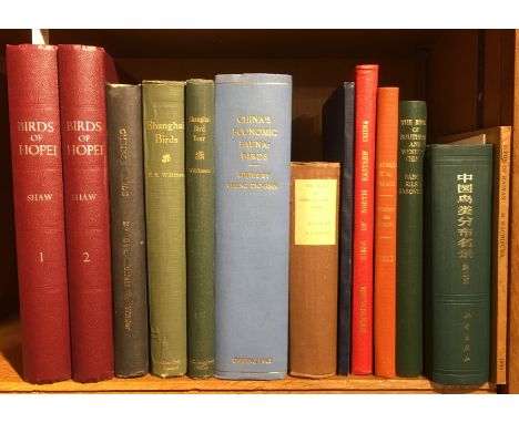
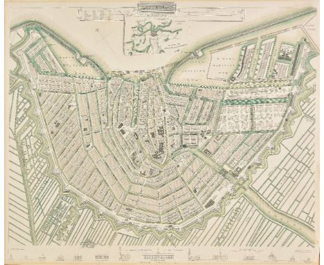
Folding maps. Wyld (James), Wyld's Military Staff Map of Central Asia and Afghanistan, circa 1870, lithographic map with contemporary outline colouring, sectionalised and laid on linen, 890 x 1175 mm, marbled endpapers, contemporary cloth boards with printed label to upper cover, lacking spine, worn at extremities, together with British Broadcasting Corporation, (publisher), "World-Radio" Map of European Broadcasting Stations, in relation to the British Isles, circa 1930, colour lithographic map, laid on linen, old folds, 690 x 930 mm, publisher's printed boards, a little worn and frayed, with Philip (George & Son, publishers), The West India Committee, Incorporated by Royal Charter, Map of the West Indies, 1952, colour lithographic map, sectionalised and laid on linen, four inset maps, 900 x 1180 mm, contained in publisher's green cloth slipcase with printed label to upper cover, plus Wyld (James, publisher), Wyld's Map of the Theatre of war in the Baltic and Black Seas including the whole of Russia & Turkey and the Mediterranean Sea, circa 1860, folding lithographic map with contemporary outline colouring, 340 x 490 mm, bookplates of Lord Raglan and Cefntilla to verso of map, manuscript ownership signature to upper cover of The Lady Georgiana Lygon, publisher's printed paper wrappers stained, upper cover detached, and Black (Adam & Charles, publishers), Black's Tourist's and Sportsman's Companion to the Counties of Scotland..., circa 1850, double page hand coloured frontispiece of the comparative heights of the principal hills in Scotland, thirty-five double page maps with contemporary hand colouring, a few maps with contemporary manuscript annotations to verso, contemporary limp morocco gilt covers, worn and frayed, rebacked, 8vo (5)

Lot 188

Folding maps. A collection of thirteen maps, 19th & early 20th century, including Betts (John), Betts's new Map of India, Birmah, The Punjab and parts of Afganistan, circa 1860, engraved map with contemporary outline colouring, sectionalised and laid on linen, 750 x 640 mm, cloth endpapers, contained in publisher's cloth slipcase with printed label to upper board, together with Hall (Sidney), Surrey [and] Sussex, published Chapman & Hall, circa 1850, two engraved maps with contemporary outline colouring, sectionalised and laid on linen, bound in publisher's cloth gilt boards, with Ordnance Survey,, Five maps, published Edward Stanford, [1830 or later], five engraved maps (of the environs of Bath, Basingstoke & Hungerford, Salisbury, Shaftesbury and Yeovil), each sectionalised and laid on paper, each with contemporary outline colouring, each approximately 625 x 720 mm, marbled endpapers and each contained in publisher's cloth slipcase with printed label to upper board with added manuscript title, plus four early 20th century Ordnance Survey maps of Gloucestershire and one other similar, various sizes and condition (13)

Lot 189

France & Belgium. Lotter (Tobias Conrad), Mappa geographica in qua Ducatus Lotharingiae et Barr..., Augsburg, circa 1740, engraved map with contemporary hand colouring, 500 x 585 mm, together with Nouvelle carte de Cercle de Bourgogne on l'on voit toutes les possessions de la Maison d'Autriche dans les Pays Bas..., Augsburg, circa 1740, engraved map with contemporary hand colouring, 470 x 620 mm, together with Homann (Johann Baptist and heirs of), Comitatus Flandriae in omnes ejusdem subjacentes ditoes cum adjacentibus accuratissime divisus..., Tabula Ducatus Britanniae Gallis le Gouvernemt. general de Bretagne..., Charte von Lothringen und Barr..., [and] Gubernatio generalis Languedociae occitania olim dictae..., circa 1790, together four engraved maps with contemporary hand colouring, two maps with some overall toning, each approximately 485 x 585 mm, together with Cassini de Thury (Cesar Francois), Nouveau Tableau pour servir a l'Assemblage des feuilles de la carte de France par Cassini et de celle des Pays-Bas par Ferraris, au D‚p“t G‚n‚ral de la Guerre, Paris, 1808 [or later], index sheet (with duplicate) and 123 (only?) uncoloured engraved sheets, some marginal fraying and closed tears, occasional sheets torn with loss, occasional spotting, each sheet approximately 620 x 920 mm, (some smaller sheets) The Cassini maps were the first general maps of France using a measuring apparatus were made by the Cassini family during the 18th century on a scale of 1:86,400 (one centimetre on the chart corresponds to approximately 864 meters on the ground). These maps were, for their time, a technical innovation. They were the first maps based on geodetic triangulation, and took more than fifty years to complete. Four generations of the Cassini family were involved in their production. These maps, known as "Cassini Maps" or "Maps of the Academy," are still referenced by geographers, historians and genealogists. In 1808, Napoleon I decided to produce a map intended to be more accurate than that of Cassini. However, Napoleon demanded that the primary goal of the work was to produce battlefield maps. The triangulation for this new map began also from the Paris meridian arc or French meridian line, surveyed this time by Delambre and M‚chain. Work on this map took place between 1817 and 1866. During this period several different scales were tested, with the scale 1:80,000 being chosen. This became known as the "Geological Survey" map. The funding for this work was provided by the Department of War. The first work was done by the D‚p“t de la Guerre (as referenced on the index map) and later by the Geographical Service of the Army, whose first director General Fran‡ois Perrier and his successor General Bassot re-measured the French meridian arc. The variety of paper used on this example is noticeable and indicative of a map produced over a long period of time. (131)

Lot 19

Jessen (B.H.). W.N. McMillan's Expeditions and Big Game Hunting in Sudan, Abyssinia & British East Africa, for private distribution only, 1906, large folding map contained in rear pocket, numerous illustrations, endpapers renewed, original red cloth gilt, spine a little faded and rubbed at ends, large 8vo (Czech 2011, pages 141-42), together with The Geographical Journal for February 1905 (with extract of Jessen's work 'South-Western Abyssinia'), tear and loss to front cover, with loose folding letter from the Royal Geographical Society, 1947, awarding a Fellowship of the Society to Ian Mumford (map historian) (1)

Lot 190

France. Mercator (Gerard & Hondius Henricus), a collection of thirty-four maps, circa 1635, uncoloured engraved maps of France (and three of Switzerland), six maps with the English title partially printed on map, each approximately 205 x 155, partially bound, with English text on verso (34)

Lot 191

Geological Maps. Ibbeson (J.), Section of Strata of the South Yorkshire Coal field..., published Pawson & Brailsford, Sheffield, 1869, colour lithograph map, sectionalised and laid on linen, some short splits to linen, two ink stains affecting image, slight dust soiling, marbled endpapers, 625 x 865 mm, together with three engraved sheets with contemporary hand colouring from the 'Geological Survey of England and Wales', circa 1845, each sectionalised and laid on linen, each related to London and South East England, each approximately 345 x 500 mm, each with a manuscript ownership name and address of Horace B. Woodward in the margin of the maps and on a manuscript ownership label to upper cover, marbled endpapers H. B. Woodward was one of the original surveyors of the Geological Survey. (4)

Lot 192

Germany. Mercator (Gerard & Hondius Henricus), A collection of thirty-two maps of Germany & Austria, circa 1635, uncoloured engraved maps, partially bound with English text, four maps with English title partially printed on to map, each approximately 195 x 150 mm, English text on verso (32)

Lot 193

Germany. Lotter (Tobias Conrad), Nova et accuratior repraesentatio geographica Sacr. Rom. Imperii episcopatus Wurceburgensis Francie Orientalis ducatus..., Augsburg 1741, engraved map with contemporary hand colouring, small margins, very slight staining to borders, 485 x 560 mm, together with Trevirensis Archi-Episcopatus et Electoratus..., Augsburg, circa 1730, engraved map with contemporary hand colouring, trimmed to plate mark, 495 x 585 mm, with Accurata delineatio Episcopat. Frisingensis una cum Dynastia Burkrainensi et Comitatu Werdenfelsensi..., Augsburg, circa 1740, engraved map with contemporary hand colouring, small margins, 565 x 500 mm, plus Synopsis Circuli Rhenani Inferioris sive Electorum Rheni..., Augsburg, circa 1740, engraved map with contemporary outline colouring, small margins, 495 x 570 mm, and Ducatus Juliacensis Cliviensis et Montensis..., Augsburg, circa 1740, engraved map with contemporary hand colouring, slight creasing, one small hole in printed margin, 570 x 500 mm, with another four similar maps of German and Prussian regions by Lotter and Homann, all with contemporary hand colouring, various sizes and condition, plus Lotter (Tobias Conrad), Status Mediolanensis in principales suas partes divisas quarum aliquae venetorum aliae Ducatorum Mantuae Parmae et Modena..., Augsburg, circa 1740, engraved map with contemporary hand colouring, 475 x 590 mm, and Novissima et accuratissima delineatio Status Ecclesiae et magni Ducatus Hetruriae publici juris facta..., Augsburg, circa 1740, engraved map with contemporary hand colouring, some staining and toning, trimmed to plate mark, 495 x 575 mm (11)

Lot 194

Gloucestershire. Speed (John), Glocestershire contrived into thirty thre severall hundreds & those againe into foure principall devisions. The citie of Glocester & Bristowe discribed with the armes of such noble men as have bene dignified with ye titlles of Earles & Dukes thereof, published Henry Overton, circa 1707, engraved map with sparse early outline colouring, inset town plans of Bristol and Gloucester, slight overall toning, slight chipping to margins, 380 x 510 mm, no text on verso (1)

Lot 196

*Gloucestershire. Saxton (Christopher), Glocestriae sive Claudiocestriae Comit (Claudy Caesaris Nomine ad huc Celebrat) Verus Tipus atq Effigies. No. Dni. 1577, [1579], engraved map with contemporary hand colouring, elaborate strapwork cartouche, and mileage scale, 385 x 500 mm, mounted framed and glazed Engraved by Augustine Ryner and decorated with the arms of Queen Elizabeth I, a fine example in very good condition of the first ever published map of Gloucestershire. (1)

Lot 198

*Hertfordshire. Speed (John), Hartford Shire described. The sittuations of Hartford and the most ancient towne S. Albans with such memorable actions as have happened, published John Sudbury & George Humble, circa 1627, engraved map with sparse outline colouring, inset town plans of Hertford and Verolanium (St. Albans), roads added in ink manuscript, central fold partially split, some later pencil annotations to map, additional horizontal fold, 375 x 500 mm, mounted, framed and glazed (1)

Lot 200

Hungary. Schenk (Petrus), Nova Et Accurata Tabula Sedis Belli In Regno Hungariae. Accedunt Cetera Regna, Sclavonia, Croatia, Bosnia et Servia: ut et Princip: Septimontium. una cum reliquis circumjacentibus regionibus, published Amsterdam, 1717, engraved map with the cartouche, vignette and table of explanation with later hand colouring, 510 x 575 mm, together with Demeter (G”rog), A collection of thirty-six regional maps of Hungary, circa 1815, engraved regional maps with contemporary outline colouring, some maps with staining affecting engraved image, each approximately 250 x 300 mm (37)

Lot 201

India. Stanford (Edward, publisher), Stanford's map of India based on the surveys executed by order of the Honourable The East India Company..., showing the Latest Territorial Acquisitions of the British Empire and the Independent and Protected States, 1857, large scale lithographic map with contemporary outline colouring, sectionalised and laid on linen on two sheets, circular cartouche, inset map of the Malay peninsula, three circular distance and bearings charts, overall size 1500 x 1230 mm, contained in a contemporary cloth slipcase with printed label to upper cover (1)

Lot 202

Ireland. Ordnance Survey (publishers), Index to the Townland Survey of the County of Louth and the County of the Town of Drogheda, Index to the Townland Survey of the County of Cavan, Index to the Townland Survey of the County of Donegal, Index to the Townland Survey of the county of Monaghan [and] Index to the Townland Survey of the County of Armagh, 1836, together five engraved maps with contemporary hand colouring, sectionalised and laid on linen, each map with a table of explanation and a table of areas, very slight dust soiling and spotting, each edged in red silk, each 620 x 970 mm, with canvas chemise, the whole contained in a contemporary red diced calf slipcase with 'envelope style' lid, gilt decorated spine and with the gilt crest of the Ordnance Survey to upper cover, spine faded, worn and frayed at extremities (5)

Lot 205

Leicestershire. Speed (John), Leicester both countye and citie described, The honorable famylies that have had the titles of earls thereof. With other accidents therein observed, published John Sudbury & George Humble, [1646], hand coloured engraved map, inset town plan of Leicester, 385 x 505 mm, English text on verso (1)

Lot 206

Leicestershire. Speed (John), Leicester both countye and citie described, The honorable famylies that have had the titles of earls thereof. With other accidents therein observed, published Thomas Bassett & Richard Chiswell, [1676], hand coloured engraved map, inset town plan of Leicester, 385 x 515 mm, English text on verso, mounted (1)

Lot 207

Lincolnshire. Bee (Stephen), A Survey and Plan of the road from the city of Lincoln. Over the Heath, thro' Dunsby Lane, Sleford, Folkingham, Bourn and Market Deeping to the city of Peterborough and also Bourn thro' Edenham, Grimsthorp Park by Swinstead and Corby to Colsterworth, sold by R. Sayer, circa 1760, large scale engraved map with sparse contemporary outline colouring, with the lettering and draughtsmanship by William Rower, dedication to 'The most noble Peregrine Bertie, Duke of Ancaster & Kesteven, Lord Great Chamberlain of England &c....', old folds, slight creasing and dust soiling, slight overall toning, occasional marginal closed tears, trimmed to neatline along right hand vertical margin, 705 x 640 mm A rare broadsheet map. No auction records found, Copac records only one copy (Oxford University). Worms & Bayton-Williams. British Map Engravers, page 572. (1)

Lot 208

London. Greenwood (C. & J.), Map of London from an actual survey made in the years 1824, 1825 & 1826..., extended and comprising the various improvements to 1830, published Greenwood & Co., 2nd. edition, August 31st 1830, fine large scale map with contemporary hand colouring, engraved by Josiah Neele, sectionalised and laid on linen, calligraphic cartouche, table of explanation and reference to the parishes, inset views of Westminster Abbey and St. Pauls, dedication to King William IV, very slight staining, edged in green silk, marbled endpapers, 1250 x 1890 mm, contained in a contemporary green morocco gilt book box, all edges gilt, some wear to extremities Howgego, Printed Maps of London 1553 - 1850, 309, state 2. The Greenwood brothers Christopher and John spent three years preparing this remarkable new survey of London, prepared on the lavish scale of 8 inches to a mile, illustrating for the first time the planned development of Belgravia by Thomas Cubitt, the completion of the Grand Surrey Canal and Regent's Park one year before it was completed in 1828. This second edition has the additions of the Lea Union Canal and the names of Bayswater and East Greenwich. (1)

Lot 209

London. Cary (John), Cary's New and Accurate plan of London and Westminster, the borough of Southwark and parts adjacent..., 1819, large engraved map with contemporary outline colouring, sectionalised and laid on linen, heavily toned overall with occasional splits to linen, with a list of over 500 of the principal streets. 810 x 1485 mm, contained in publisher's marbled card slipcase with printed label to upper board, worn and frayed at extremities, together with Wyld (James, publisher), A new map of the country twenty-five miles round London, circa 1860, large engraved map with bright contemporary outline colouring, sectionalised and laid on linen, slight worming to lower margin but not affecting printed surface, biro annotation to upper margin but not affecting printed surface, 1050 x 1270 mm, cloth endpapers, contained a contemporary cloth slipcase with printed label to upper cover, split along one joint, worn and frayed, with another copy similar dated 1828, on four sheets but split along linen and now in seven sheets, contained in a contemporary marbled card slipcase with printed label to upper cover, frayed and worn, with another six folding maps relating to London, 19th & early 20th century, including examples by Kelly, Reynolds and Airey, various sizes and condition (10)

Lot 214

Mercator (Gerard, and Hondius, Jodocus). A collection of eighteen maps of Germany, Switzerland and the Low Countries, circa 1635, eighteen uncoloured engraved maps, five maps with the English title printed partially over the map, partially bound with text, each map approximately 235 x 170 mm, English text on verso (18)

Lot 215

Middle East. Stanford (Edward, publishers), Untitled map of Syria, Palestine, and Turkey, printed by the Survey of Egypt under authority from the War Office, 22nd January 1917, very large varnished photolithographic map stretching from Missis (Turkey) in the north to the southern edge of the Dead sea in the south, slight creasing, 2860 x 1280 mm, presented on stained wooden battens, upper batten detached We cannot find a location or auction record for this very large wall map. Designed for military use its circulation was probably restricted. (1)

Lot 217

Monmouthshire. Greenwood (C. & H.), Map of the county of Monmouth, from an actual survey made in the years 1829 & 1830..., published August 23rd. 1830, large scale engraved map with contemporary outline colouring, sectionalised and laid on linen, calligraphic cartouche, table of explanation, compass rose and engraved vignette of Tintern Abbey, edged in green silk, slight spotting, 955 x 910 mm, marbled endpapers, contained in a contemporary calf book box, worn and rubbed (1)

Lot 218

Netherlands. Senex (John), The VII United Provinces corrected from the observations communicated to the Royal Society at London & ye Royal Academy at Paris, 1709 [or later], large engraved map with contemporary hand colouring, on two conjoined sheets, 645 x 940 mm, together with Moll (Herman), Les Provinces des Pays-Bas Catholiques ou A most exact map of Flanders or Austrian Netherlands &c..., published D. Midwinter & T. Bowles, circa 1720, large engraved map with contemporary outline colouring, on two conjoined sheets, inset maps of Luxembourg, Isle de France and a plan of 'fortifications', old folds, very slight toning to folds, 610 x 1005 mm (2)

Lot 219

Northamptonshire. Eyre (Thomas & Jefferys Thomas), The county of Northampton as surveyed and planned..., 2nd edition, published William Faden, 1791, uncoloured large scale map, engraved by William Faden on four sheets (conjoined into two), two engraved vignettes of Queen's and Geddington Cross, slight offsetting, slight marginal dust soiling and fraying, overall size 1240 x 1300 mm, contained in a modern purpose made marbled card portfolio (1)

Lot 220

Northamptonshire. Speed (John), Northampton, published Thomas Bassett & Richard Chiswell, [1676], hand coloured engraved map, inset town plans of Northampton and Peterborough, slight creasing, occasional marginal closed tears, 390 x 515 mm, English text on verso, mounted (1)

Lot 222

Northern England. Lamberti (Aniello), Carta II. per L'Inghilterra, published Florence, [1779], engraved playing card map of the northern half of England & Wales, (nine of cups), contemporary hand colouring, a list of the counties and rivers below map, 100 x 60 mm Geoffrey King. Miniature Antique Maps (2nd. edition), page 180.A tarot suit card from a pack known as the 'Minchiate', which comprised of ninety-seven cards with seven relating to the British Isles. Rare. (1)

Lot 225

*Oxfordshire. Speed (John), Oxfordshire described with ye citie and the armes of the colledges of ye famous university, published Thomas Bassett & Richard Chiswell, [1676], hand coloured engraved map, inset town plan of Oxford, eighteen coats of arms to the vertical margins, central fold split and repaired on verso, one repaired closed tear affecting image, some browning to lower right corner, 390 x 530 mm, framed and double glazed, English text on verso (1)

Lot 226

*Oxfordshire. Plot (Robert), The Map of Oxfordshire, [1677], hand coloured engraved map, decorative cartouche, mileage scale, table of explanation and compass rose, old folds, small closed tears with slight loss affecting image, repaired with facsimile, one long closed tear affecting image, 500 x 480 mm, mounted, framed and glazed, together with Plot (Robert), The Natural History of Oxford-shire, being an essay toward the natural history of England, printed at the Theatre in Oxford..., 1677, decorative title, dedication to Charles II, sixteen uncoloured engraved plates, index bound at rear, bookplates of Effingham and Simon Nowell-Smith, later endpapers, 19th century half calf gilt, worn at extremities, 4to Created by the first keeper of the Ashmolean Museum of Oxford, the map is decorated with 172 coats of arms of the county's gentry, Oxford colleges, the city and the four county towns. One of the most decorative maps of Oxfordshire ever produced. (2)

Lot 227

Persia. Ortelius (Abraham), Persici sive sophorum regni Typus, [1595], hand coloured engraved map, slight fraying to margins but not affecting image, 350 x 500 mm, Latin text on verso, together with Kitchin (Thomas), New map of Persia divided into its provinces from the latest authorities, circa 1790, engraved map with contemporary outline colouring and some later enhancement, old folds, 385 x 345 mm The first map described:- Marcel van den Broecke. Ortelius Atlas Maps, no. 167. (2)

Lot 228

*Scotland. Scobie (Mathew), A map of Roxburgh Shire of Tiviotdale, circa 1770, large scale map with contemporary outline colouring, engraved by John Bayley, on four conjoined sheets, inset map of East Point and Chivot Hill, table of remarks and a list of the principal seats, table of explanation, ornate cartouche and compass rose, slight overall toning and some dust soiling, 1050 x 950 mm, framed and glazed (1)

Lot 23

Mandelslo (Johann Albrecht von). Voyages celebres et remarquables, faits de Perse aux Indes orientales ... contenant unde description nouvelle et trŠs-curieuse de l'Indostan, de l'Empire du Grand-Mogol, des Œles et presqu'Œles de l'Orient, des royaumes de Siam, du Japon, de la Chine, du Congo, etc. ... mis en ordre et publiez ... par Adam Olearius, traduits de l'original par A. de Wicquefort ... nouvelle edition rev–e et corrig‚e exactement, augment‚e considerablement, Amsterdam: Michel Charles Le CŠne, 1727, half-title to volume 1, title pages printed in red and black, engraved arms to dedication, portrait 20 maps and plans (most of them folding), 16 folding views including panorama of Tokyo, 1 folding plate depicting Hottentots, 7 further plates not mentioned in the 'avis au relieur', 19 vignettes in the text, final privilege leaf, additional engraved title and volume 2 half-title lacking, occasional spotting and browning, later hand-colouring to folding map 'Royaume de Perse' and the views of Gamron (i.e. Bandar Abbas) and Anvers, plan of Goa with small rupture to intersection of folds, map of the Congo with short split along one fold, short closed tear to 'La rade de Batavia' plate not affecting image, mild damp-staining towards rear, near-contemporary calf, gilt spine, joints cracking superficially at ends, folio (31 x 19 cm) Atabey 884 (accompanied by a copy of Olearius's Voyages ... faits en Moscovie, Tartarie, et Perse), Cordier Indosinica 883, Japonica 367-8, Sinica 2077, Cox I pp. 271-2 for other editions. Re-issue of Van der Aa's 1719 Leiden edition, the preferred edition of a work first published in German in 1647. Mandelslo travelled to Persia in 1633 as part of an embassy sent by the Duke of Holstein; the other ambassadors remained in Persia but Mandelslo obtained permission to continue to India, sailing from Hormuz on the Persian Gulf in 1638 and landing at Surat, thence travelling throughout India and returning to London via Ceylon and Madagascar. In addition to the regions visited, the plates and maps depict China, Japan, and various locations in the Dutch East Indies. (1)

Lot 231

Shropshire. Greenwood (C. & J.), Map of the county of Salop from an actual survey made in the years 1826 & 1827, published July 2nd. 1827, large scale engraved map with contemporary hand colouring, sectionalised and laid on linen, calligraphic title, compass rose, table of explanation and a vignette of the south west prospect of Shrewsbury, inset map of part of Shropshire, slight staining and offsetting, library stamp below cartouche, edged in green silk, several library stamps to verso, library label to endpaper and inside lid of book box, 1485 x 1230 mm, contained in a contemporary green morocco gilt book box, rubbed and worn at extremities (1)

Lot 232

Society for the Diffusion of Useful Knowledge. A collection of eighteen city plans, circa 1840, engraved city plans with contemporary hand colouring, some with later additional watercolour, one map with mount staining, slight spotting, occasional marginal closed tears, one duplicate, each approximately 330 x 395 mm The plans consist of:- Amsterdam, Oporto, Lisbon, Pompeii, Naples, Florence, St. Petersburg (2), Turin, Milan, Genoa, Bordeaux, Marseille, Edinburgh, Vienna, Plan of Ancient Rome, Plan of modern Rome [and] Paris [on two sheets]. (18)

Lot 235

*Turkish Empire. Speed (John), The Turkish Empire, published George Humble, [1627], hand coloured engraved 'carte-a-figures' map, ten costumed figures to the vertical margins, eight oval vignettes of principal cities to upper horizontal margin, 395 x 515 mm, mounted, framed and double glazed, English text on verso A clean bright example in very good condition of one of the most decorative maps of the region issued in the 17th Century and the first map of the region to be published in England. (1)

Lot 236

Underground map. Beck (Henry C.), London Underground Transport, 1937, colour photolithographic on card, an example of Beck's iconic map of the London Underground four years after its first appearance, slight spotting, the verso shows a detail of the interchange stations in the central area with the names of the stations within diamonds, some staining to verso, two folds, 155 x 225 mm, together with a London Transport 1935 untitled folding map of the bus routes in the central area of London, old folds, 430 x 565 mm (2)

Lot 237

Vienna. De Hooghe (Romain), Untitled engraving of the siege of Vienna, published Amsterdam, Nicolas Visscher, circa 1685, uncoloured engraving, faded manuscript title above map, vertical margins extended, 460 x 575 mm A view of Vienna as it was when besieged by the Turks in 1683. (1) Now supplied with a modern reproduction of the print, together with a key plate to the engraving produced by Historisches Museum der Stadt Wien

Lot 238

Wales. Jansson (Jan), Ceretica sive Cardiganensis comitatus Anglis Cardigan Shire, published Amsterdam, circa 1648, engraved map with contemporary outline colouring, 385 x 505 mm, Latin text on verso, mounted, together with Van den Keere (Pieter), Wales, circa 1627, hand coloured engraved map, 85 x 125 mm, English text on verso, mounted, with Mercator (Gerard & Cloppenburg H. Jan Evertsz), Cambriae typus auctore Humeredo Lhuydo, Denbigiense Cambrobritanno, circa 1630, hand coloured engraved map, 185 x 255 mm, mounted, plus Bertius (Pieter), Cambria, [1618], uncoloured engraved map, 100 x 130 mm, Latin text on verso, mounted, and Luffman (John), Caerdiganshire, [1803], circular miniature map with contemporary hand colouring, English text below map, map size (to plate mark) 80 x 70 mm, mounted, with another four county maps of Cardiganshire and three strip road maps of north west Wales, including examples by Van den Keere, Miller, Cowley, Osborne, Owen & Bowen and Senex, various size and condition, mounted, with a 1901 lithographic folding map of the Great Western Railway, sectionalised and laid on linen, 750 x 820 mm (13)

Lot 240

*Wiltshire. Saxton (Christopher & Kip William), Wiltoniae comitatus herbida..., 1st edition, [1607], engraved map with contemporary outline colouring, 280 x 355 mm, mounted, framed and glazed (1)

Loading...Loading...
  • 109182 item(s)
    /page

Recently Viewed Lots