Joseph ENOWY. A New Map of Scotland . . . improved edition. 65 x 50cms., hand-coloured, folded on linen within marbled covers & in labelled slipcase. Richard H. Laurie, 1821. * insets of Orkneys & Shetlands; Joseph ENOWY - A New map of Ireland . . . new edition, considerably improved. 66 x 52cms., hand-coloured, folded on linen within marbled covers & in labelled slipcase. Richard H. Laurie, 1822; sold with Oliver & Boyd's Travelling Map of Scotland (hand-coloured, in book form, (1821); and 3 Scottish others.
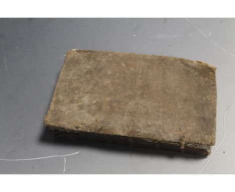
We found 109198 price guide item(s) matching your search
There are 109198 lots that match your search criteria. Subscribe now to get instant access to the full price guide service.
Click here to subscribe- List
- Grid
-
109198 item(s)/page
The OARSMAN'S and ANGLERS MAP of the River Thames, from its Source to London Bridge. new edition. 269 x 16cms., coloured, folded on linen & within gilt-lettered cloth covers. Edward Stanford, 1916. * a most attractive item (1 inch to mile, with concertina extension of over 8 feet); includes all locks, other features & adjacent roads etc.; apart from much marginal printed information a 19pp. booklet (of bye-laws, tolls etc.) is integrally provided; sold with J. & C. WALKER - Isle of Wight. 44 x 65cms., hand-coloured, folded on linen within labelled cloth covers. (ca. 1900). * detailed, with many houses & farms named. Illustrated
EDMONDS (J.E.), editor. History of the Great War: based on official documents . . . 39 vols. (including 11 map boxes). v. many maps (num. coloured & folded), photo. plates & other illus., some addenda/corrigenda slips inserted; gilt cloth. (various dates from 1921). * a substantial part of this important set; a sample collation (of 12 vols. & boxes) found all complete - but sold not subject to return.
A gold and green gem set five stone brooch, centred by a map of Australia, a pair of Victorian gold and blue enamelled stickpins, connected by a chain, a silver curb link charm bracelet, a silver watch Albert chain, fitted with a swivel and a T bar, a Sterling silver and enamelled brooch designed as a bird, an oval malachite pendant and two further items, (8).
NAPIER (W.) The Life and Opinions of General Sir Charles James Napier . . . First Edition, 4 vols. folded map, 4 portraits, errata leaf (vol. 3) & advert leaves; blind, gilt-decorated & gilt-lettered cloth, partly unopened. 1857. * mostly the Peninsula, North America & India ('I have Scinde'- as every schoolboy used to know). Illustrated
RALEIGH (W.) & JONES (H.A.) The War in the Air: being the story of the part played in the Great War by the Royal Air Force. First Editions, 6 vols., (text), Appendices vol., & 2 Map boxes. 142 maps (mostly coloured & folded, but 68 loose in the boxes) & num. folded tables, facsimile plate; gilt-buckram. 1922-37. * vol. v with a typescript presentation note (headed notepaper-Historical Section, Ctte. of Impl. Defence, Nov. 1935) to Lady Raleigh; perhaps the most detailed account of aerial warfare.
[The] BIBLE, that is, the Holy Scriptures conteined in the Olde and New Testament . . . with most profitable annotations . . . num. OT. illus. (incl. title) & separate Second Part title; NT. with prelim leaf (incl. map) after illustrated title, text followed by tables & Sternhold/Hopkins Psalmes; old leather, sometime rebacked with panelled spine, 8vo., contained in cloth box, with red label on spine. imprinted at London by the Deputies of Christopher Barker, 1599. * d-column printing, extensive marginal notes; lacks one prelim, leaf, this text & tables with 452 (mostly numbered) folios.; Sternhold's Psalmes 98 (ex 104?)pp.; collates - q4 (lacks q2), A-28, &6, Aa-Pp8, Qq7, Aaa-Qqq8, Rrr4 & (Psalmes) A-F8, G3. Geneva version; this edition probably adopted by Barker, having been printed on the Continent at various dates, see Darlow & Moule 248
John CARY - Cary's Reduction of his Large Map of England and Wales . . . 76 x 64cms., folded on linen within marbled covers, outline colour, in labelled slipcase. 1821. * detailed turnpike & other roads, navigable canals, etc.; towards the height of the coaching era, & 'published by order of . . . the Post Master General'; sold with 4 others, including Smith's England & Wales (1826, slipcase) & Walker's Railway Map (1837).
A 20th Century Egyptian copper cigar box by Granger, engraved to the top with a map of the battlefields of Europe during World War II, the sides engraved with dated historical events during the war years, made to celebrate Victory Europe, 6.5ins square x 2.25ins high Note: The underside of the base is engraved - "Brass Used in the Manufacture of this Box was Salvaged from the Battlefields of World War II"
Of Kent interest- 17th Century English School - Ink and watercolour on vellum - Estate Map and description of -"One Capitale Messuage Comonly called the Mote", with title - "A Map & Description of one Capitale messuage Commonly called the Mote with: 28: parcells of Errable and : 7: parcells of wood thereunto belonginge lyinge in the parishes of St Martins St Paules: Fordwich: and Litleboorne Contayninge of Errable, 320-3-24: woodes, 112-2-2-35 beinge parcelle of the possessions of the right honorable Sr John Finch Lord Cheefe Justice of the Comon Pleas", within a cartouche of "Mannerist design" and with elaborately decorated scale with dividers and motto and date 1635 over, and further dated "Anno Domini: 1635", with some contemporary ink descriptions and land values outside the main image, 33.75ins x 15.75ins, (upper left and lower right corners cut and missing), framed and glazed
Of Kent interest - A collection of six 19th and 20th Century English hand drawn/printed and coloured Estate maps on paper, including- "A Map of Great and Little Hollowell and Other Lands in Upchurch and Holstow Kent" belonging to William Jordan Gent, with hand colouring and contents tables, 33.5ins x 26.5ins, "A Map of a Farm called South Dean Green Situate in the Parish of Stockbury, Kent, Belonging to a Mr John Smith of Sittingbourn", drawn by W. Peckham and Son, surveyors, 1835, hand coloured and with contents table, 17.5ins x 21.5ins, together with four others, various, all unframed
Of Kent interest- 17th Century English School - Ink and watercolour on vellum - Estate Map by James Tull and description of Stile Farm, Chartham, with title "A Map and Description of a certaine Messuag and Land called Stile Farme lying in the Parish of Chartham, & a small parcell partet of with a rid pricked line in the Parish of Chartham and in the County of Kent beinge the Demeasnes of Peter Webster Gent: Surveyed the nine and twenty day of March Anno Dni 1695 by James Tull Surveyor", within a border of running leaf design which also forms a border to this plan, and with elaborately decorated scale with dividers and the date 1695 over, and decorated compass points, 18.75ins x 25.25ins, framed and glazed
Miller, Lee"Wrens in camera" 1945, numerous photographic illustrations, blue cloth, dust jacket, not priced clipped, Boyle, Major Patrick and Musgrave-Wood, Major Jon "Jungle, Jungle Little Chindit", Hollis & Carter (1944), numerous illustrations, map on end papers, cloth, dust jackets, not priced clipped and other volumes (1 box)
Of Kent interest- 18th Century English School - Ink and watercolour on vellum - Estate Map by Thomas Hogben - "Measure and Map of Bobbing Court Lodge Farm in the County of Kent belonginge to Thomas Tyndale Esqr of North Cerney in Gloucestershire now in the Occupation of Mr John Boykett", within a decorative cartouche of rococo design with scrolls and flowers, and with "A Table of REFERENCES", scale with dividers over and a pictorial representation of "A View of the Court Lodge and Buildings", and elaborately decorated compass points, "Survey'd Delineated and Admeasured by Thomas Hogben 1769", 24ins x 37ins Note: Thomas Hogben (1702-1774) may be identified with the land surveyor and schoolmaster of Smarden of that name, son of Thomas Hogben (the Elder) of Ashford, surveyor (1672-1703). The younger Thomas is also known to have produced brass sundials and possibly, occasionally clocks
Of Kent interest- 17th Century English School - Ink and watercolour on vellum - Estate Map and description of the Manor of Ratlinge Court, Kent with title -"A Map & Disscription of the Mannor of Ratlinge Court with: 13: parcells of Errable: &: 4 & percells of woodlande thereunto: belonginge lyinge in the parish of Nonington in East Kent contayninge of Errable..." within a cartouche of "Mannerist" design, and with elaborately decorated scale with dividers and motto over, and decorated compass points, dated "Anno Domini 1637", with some faint later pencil annotations, 21.75ins x 14.75, framed and glazed
John Andrews (1736-1809), Andrew Drury and William Herbert - Coloured engraving - Plate 14 from "A Topographical Map of The County of Kent in 25 Sheets, On a Scale of 2ins to a Mile, From an Actual Survey...", published January 1st 1769, showing Bridge, Petham and Wye Hundreds etc, 18ins x 27ins, framed and glazed
William Faden (1750?-1836) - Coloured print - A Map of "The Country Twenty-Five Miles Round London, Planned from Scale of One Mile to an Inch" (third edition, 1802), 41ins x 50.5ins, published and sold by W. Faden, No. 5 Charing Cross Road, London, "Geographer to His Majesty and to His Royal Highness the Prince of Wales", dissected into thirty two sections and backed on to linen, with original marbled paper cover slip case with printed paper label
19th Century English School - Photozincograph - An "Ordnance Survey Map of Canterbury", (second edition, 1898) 25.25ins x 30ins, published at The Ordnance Survey Office, Southampton, and with Board of Agriculture, Ordnance Survey embossed stamp to upper right, with some coloured detail, framed and glazed
Dawson Murray RSW RGI ARE (Scottish b.1944)'Gleam'Artist's proof aquatint, signed in pencil lower right, 29 x 35cmProvenance Glasgow Group 30th Exhibition label verso dated 1987, together with a variety of prints some signed to include, George Downing, Frank Sherwin, Robert Houston, City of Glasgow Map, Egyptian painting and a needlepoint etc (a lot)
A collection of leather bound books To include Wrestling and Wrestlers by Jacob Robinson & Sidney Gilpin published by Bemrose & Sons, London 1893, The Modern Traveller, containing the compressed travels of Mungo Park in the Western Interior of Africa, two volumes, volume one with fold-out map, published by George Cawthorn, London 1800, further volumes to include Famous Regiments by Adams, Life of Burke etc (22).
JOSEPH PITTS - 'A FAITHFUL ACCOUNT OF THE RELIGION AND MANNERS OF THE MAHOMETANS. In which is a particular Relation of their Pilgrimage to Mecca, the Place of Mahomet's Birth; and a Description of Medina, and of his Tomb there: As likewise of Algier, and the Country adjacent; and of Alexandria, Grand Cairo, &c. With an Account of the Author's being taken Captive; the Turks Cruelty to him; and of his Escape. In which many Things never publish'd by any Historian before.', Third Edition corrected with Additions. To this edition is added a Map of Mecca, and a Cut of the Gestures of the Mahometans in their Worship. Printed for J. Osborn and T. Longman, at the Ship in Pater-noster-row; and R. Hett, at the Bible and Crown in the Poultry. 1731 Condition Report:Missing leather from front board, missing endpapers, some damp stainingPlease note: every page of every book is not checked, if you are unable to view yourself please ask for detailed information
-
109198 item(s)/page