We found 109182 price guide item(s) matching your search
There are 109182 lots that match your search criteria. Subscribe now to get instant access to the full price guide service.
Click here to subscribe- List
- Grid
-
109182 item(s)/page


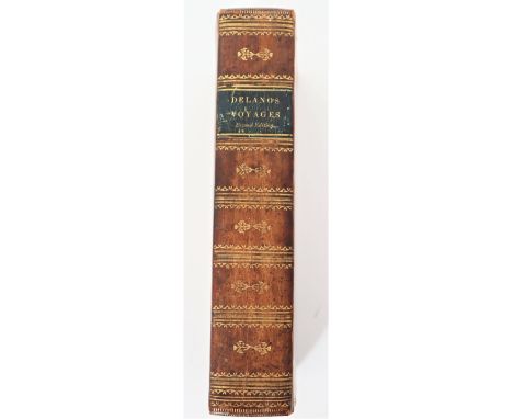
Lot 236a
Amaso Delano, A Narrative of Voyages and Travels in the Northern and Southern Hemispheres, Comprising Three Voyages Round the World, Together with a Voyage of Survey and Discovery, in the Pacific Ocean and Oriental Islands, Second Edition 1818, Printed by E G House for the Author; gilt decorations on the spine and covers, with two engraved portraits and one fold-out map, the first portrait shows Captain Delano, an American sea captain from Duxbury, Massachusetts and author of the book, the second depicts Abba Thulle, King of the Pelew Island, in 1791, with descriptive accounts of some of the voyages Delano’s ship took to various parts of the Pacific, including Hawaii, Palau, the Galapagos Islands, and Australia; his travelogue describes the different cultures he encountered and provides a unique account of the Bounty and Captain Bligh, including an early map of Pitcairn Island, and this may have been the basis for the film “The Mutiny on the Bounty”. A rare book, but a front free endpaper is missing, parts of the map are missing, there is foxing, and the bottom tips have wear. Very desirable. Several modern reprints have been found, but only two original copies on the rare book website we use at the auction house. The book measures 8 3/4 x 5 1/2 in. wide.


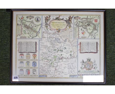


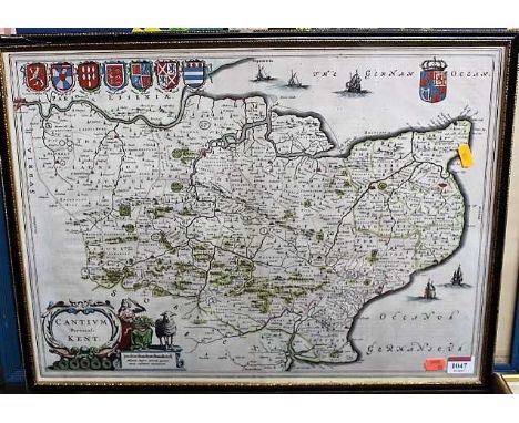
Lot 1047
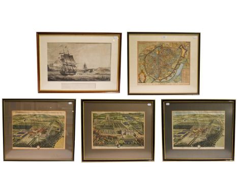
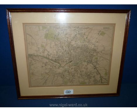
Kent. Blaeu (Johannes) - Cantium Vernacule, Kent, Amsterdam, circa 1645, engraved map with bright contemporary hand colouring, decorative cartouche and mileage scale, Latin text verso, 38 x 53cm, framed and glazedCondition report: Crease to centre.No tears.Very light discolouratino only.Generally very good.


Lot 3010
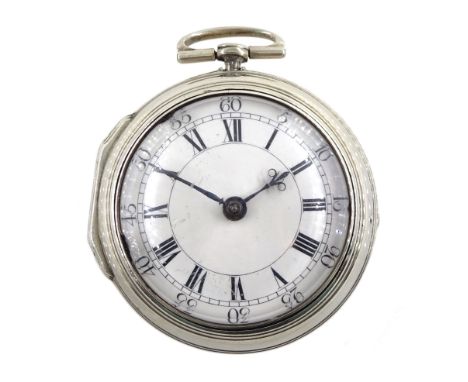
18th century silver pair cased verge fusee pocket watch by Alexander Hare (London ca.1781-1824), No. 200, square baluster pillars, pierced and engraved balance cock, white enamel dial with Roman hours and outer Arabic minute ring, beetle and poker hands, case makers mark G H, London 1770, with a fabric watchpaper embroidered with map of EuropeCondition Report:Movement currently functioning and clean, movement depth = 12mm from base of pillar to top of balance cock, hands moving freely, dial good (very very small scratch at 6 o'clock) glass has some chips around the outer edge, inner case solder marks at the top otherwise clasps and hinges good, Click here to view further images, condition reports, sale times & delivery costs for this lot.


Lot 515
Harrier XV762 Pilot Flt Lt Nick Gilchrist signed special cover SC32aA2 Return from the Falkland Islands. 5p Falkland Islands stamp postmarked Port Stanley, Falkland Islands 19th Sept 82. Backstamps of cover, RAF Wittering 8th Nov 82 in black, RAF Detachment Port Stanley 24th Sept 82 in blue-green and Ascension map in black. Certified No 83. Good condition. All autographs come with a Certificate of Authenticity. We combine postage on multiple winning lots and can ship worldwide. UK postage from £4.99, EU from £6.99, Rest of World from £8.99


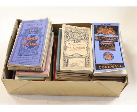
Lot 1225
A quantity of vintage maps, etc including engraved folding map of Rome and surrounding area, 1855, backed onto linen; Bacon's Cycling Road Map of England and Wales, Sheet No. 2 England, silk map circa late 19th Century in original cloth gilt sleeve; Philips Map of Essex, circa 1892; Map of Palestine 1892; two maps of Normandy & Brittany circa 1930's etc

Lot 1303
Four framed and glazed maps/topographical prints, comprising Saxton/Hole "Brecknoc" 17th Century engraved hand coloured map of Brecknockshire, frame a/f; S & N Buck "The West View of Tavistock Abbey, in the County of Devon", engraved view; J. Wallis "Hertfordshire", engraved hand coloured map; 1841 engraving of Trinity Church, Cambridge


Lot 50
Palitoy, Action Man - A small collection of loose and incomplete Action Man accessories from the Palitoy Action Man 'Escape from Colditz'. The lot includes a Red Cross Parcel box in Poor condition with creasing and taping, containing various accessories such as German Sentry tunic and trousers, Schmeisser machine gun; backpack; holster, Escape Officer Great Coat, 'forged documents' (with pen marking), escape map, cardboard sentry signs and similar. Items have signs of play and use but generally appear to be in Good overall condition.


Lot 636
Various items of plated ware to include trays, pierced baskets, cruets, egg cup with spoons and salt and pepper, sugar sifter, jug, ashtrays, also wooden box with glass chess pieces, a modern wooden box with engraved map of Australia to the top, a plated cigarette box decorated in the Chinese style (af) and a modern boxed Mah-jongg set.


-
109182 item(s)/page