We found 109198 price guide item(s) matching your search
There are 109198 lots that match your search criteria. Subscribe now to get instant access to the full price guide service.
Click here to subscribe- List
- Grid
-
109198 item(s)/page


Lot 39
LEJEUNE BARON, Aide-De-Camp to Marshals Berthier, Davout & Oudinot. Memoirs. 2 vols. Rubbed dark half calf, rather poor internally. 1897; also H. N. Coleridge, Six Months in the West Indies, fldg. eng. map, 16mo, half calf, 1832 & Bruce's Travels in Abyssinia & Nubia, dark prize calf, 1873. (4).


Lot 309
Various Kent related Hasted maps to include, 18th century map of the hundred of Eyhorne Kent, 49 x 38cm another of the hundreds of Great Barnfield and Selbrittend and another of the hundreds of Cranbrooke Barkley and Rolvenden (3)Generally in a good condition with no major signs of damage or repair. All show signs of wear and discolouration that is commensurate with age.Map of Eyhorne- Some small nicks on the paper surface and some creases.Selbrittenden- small area of damage between the E & D of 'Hundred' in the lower right quadrantCranbrooke- most noticeable discolouration out of all three
Lot 2015
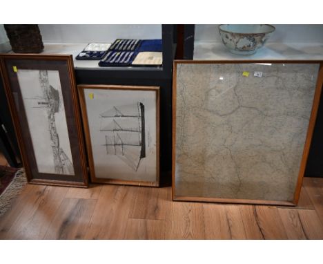
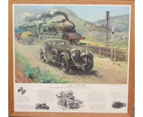
A framed 'Bentley V Blue Train', Terenco Cuneo, print, 'From the Original Oil Painting'. With Printed Text across the bottom, frame measuring approx. 32" x 34"; together with a framed Great Western Railway map; a framed print of Dainton Conquered, Alan Fearnley; two framed sets of Wills' cigarette railwayana cards; David Shepherd The East Somerset Railway print and others. (Q)
Lot 12
NO RESERVE China.- Ellis (Henry) Journal of the Proceedings of the late Embassy to China..., first edition, portrait frontispiece, 7 hand-coloured aquatints, 2 engraved maps only (of 3, lacking folding map), some light marginal finger soiling, cracking to gutter in several places, some pages and a couple of plates loose or working loose, dis-bound, some bumping to corners, 4to, 1817.
Lot 14
NO RESERVE Europe.- Brydone (Patrick) A Tour through Sicily and Malta. In a series of Letters to William Beckford, 2 vol., second edition, engraved folding map, occasional scattered spotting, slight browning, contemporary calf, lightly rubbed, joints splitting but covers holding firm, 1775 § Davies (Rev J. Sanger) Dolomite Strongholds. The Last Untrodden Alpine Peaks, second edition, map and 9 plates, finger-soiling to half-title, cloth gilt, lightly rubbed, 1896 § Conway (Sir W. M.) The Alps from End to End, 16 plates, very occasional splitting at gutter, the odd spot, endpapers slightly browned with scattered spotting, covers rubbed, spine ends chipped with small loss to foot, t.e.g., others uncut, 1905, half-titles, all but first original cloth with spines sunned; with others travel and sport, v.s. (9)
![Herodotus. Historion logoi [graece]...Historiarum libri IX, Greek & Latin text in parallel columns, folding engraved map](https://cdn.globalauctionplatform.com/000945ca-6f1d-4be5-a1b9-aee700ed4404/2ac0e04e-299b-4ccc-a3a4-aee700f912d6/468x382.jpg)
Lot 162
Herodotus. Historion logoi [graece]...Historiarum libri IX, Greek & Latin text in parallel columns, folding engraved map (a couple of tears, repaired), worming to first half of volume (mostly single hole but worse at beginning and affecting map), lower corner of 3O4 torn away not affecting text, later half calf, worn, joints split with upper cover almost detached, lacking corners, [Wing H1584], E.Horton & J.Grover, for J.Dunmore [& others], 1679 § Plinius Secundus (Gaius) Naturalis Historiae, 3 vol., engraved additional titles, letterpress titles with woodcut printer's device, contemporary ink signature of Geo. Nicols, vol.3 broken with some leaves becoming loose, contemporary calf, rather worn, spine of vol.3 defective, Leiden & Rotterdam, Hackius, 1669-68; and another, folio & 8vo (5)
![Holy Land.- End of the British Mandate for Palestine.- Macmillan (Lt.-Gen. Gordon H. A.) Palestine [2nd Phase], lithographed](https://cdn.globalauctionplatform.com/000945ca-6f1d-4be5-a1b9-aee700ed4404/33ce46c2-f62d-43c6-b1fa-aee700f9a457/468x382.jpg)
Lot 17
Holy Land.- End of the British Mandate for Palestine.- Macmillan (Lt.-Gen. Gordon H. A.) Palestine [2nd Phase], lithographed map printed in red and black ink, with date added in manuscript pen and ink, 300 x 260 mm (11 3/4 x 10 1/4 in), exposure lines and toning, ring-binder holes present in lower right margin, surface dirt, unframed, 17th May 1948⁂ In February 1947 Macmillan was appointed GOC British Forces in Palestine and Trans-Jordan. Soon after his arrival, the British Government decided to bring to an end its Mandate in Palestine. This decision triggered an escalation of violence in the territory, leading to the withdrawal of all British forces by 30 June 1948.

Lot 184
Defoe (Daniel) The Life and Strange Surprising Adventures of Robinson Crusoe, 2 vol., seventeenth edition, engraved frontispiece, folding map, and plates, light foxing or offsetting, bookplates to pastedown, contemporary ink ownership name to front free endpaper, contemporary calf, rebacked, endpapers renewed, an attractive set, 1791; and 6 others, antiquarian, including a Restoration play from 1673, v.s. (7)

Lot 20
India.- Coronation Durbar at Delhi (The), ink gift inscription "given to Lady Llangattock who was present at the Durbar" to half title, Baroness llangattock's bookplate to pastedown, map of Delhi to rear, very light foxing to first few pp., contemporary half morocco, spine gilt in compartments, g.e., one or two bumps to extremities but overall a near-fine copy, 8vo, Allahabad, Pioneer Press, 1903.⁂ The Delhi Durbar of 1903 was conceived by Lord Curzon to celebrate the succession of Edward VII and Alexandra of Denmark as Emperor and Empress of India. On 24 January 1901, two days after the death of Queen Victoria, King Edward VII was proclaimed the Emperor of India. King Edward, for many ruling heads of the states in the Indian subcontinent, was remembered as the 'Prince of Wales' after his prolonged tour of the country in 1875-1876. The book is made up of telegrams which appeared in "The Pioneer". Provenance: Georgina, a Rolls, Baroness Lady Llangattock (1837-1923) was a socialite and supporter of Horatio Nelson and wife of John Rolls, 1st baron Llangattock, mother of Charles Stewart Rolls of Rolls-Royce motoring fame.
Lot 23
Japan.- Milne (John) and W. K. Burton, The Great Earthquake in Japan, 1891, second information, 30 photographic plates by Kazumasa Ogawa, with captioned tissue guards, map, occasional light damp-staining, some slight splitting at gutter, original cloth, spine sunned, covers slightly soiled, extremities rubbed, Yokohama, [1894] § Ledoux (Louis V.) A Descriptive Catalogue of an exhibition of Japanese Figure Prints, colour frontispiece, plates, endpapers browned, calf-backed boards, extremities a little scuffed, uncut, New York, The Grolier Club, 1924 § Fraser (Mrs. Hugh) A Diplomatist's Wife in Japan, 2 vol., second edition, plates and illustrations, bookplates, some spotting or foxing, endpapers browned, original pictorial cloth, gilt, spines sunned, ends bumped, 1899; and 12 others, Japan and Asia, v.s. (16)⁂ The first, a superb photographic record of the devastating earthquake in Japan.

Lot 243
NO RESERVE Klibansky (Raymond), Erwin Panofsky and Fritz Saxl. Saturn and Melancholy, plates, original cloth, dust-jacket, lightly toned, chips and small tears to extremities, 1964 § Asbridge (Thomas S.) and Susan B. Edgington. Walter the Chancellor's The Antiochene Wars, map, original cloth, 1999, 8vo (2)
Lot 32
NO RESERVE Southeast Asia.- Wheatcroft (Rachel) Siam and Cambodia in Pen and Pastel, plates, folding map at end, bookplate of C. E. Rusbridge, some light spotting, occasional splitting at gutter, endpapers browned, original cloth, quite rubbed, spine slightly sunned, shelf-lean, 1928 § Houghton (Rev A. T.) Dense Jungle Green. The First Twelve Years of the B.C.M.S Burma Mission, photographic plates, contemporary ink ownership inscription to half-title, spine creased with a few chips to head, 1937 § Aung (Maung Htin) Burmese Drama. A Study, with Translations, of Burmese Plays, ink stamp of the People's Literature House Rangoon to front free endpaper, 1956, all but first with original wrappers, lightly rubbed with a few patches of soiling; and others Thailand, Myanmar and Cambodia related, v.s. (c.55)
![Tonga.- [Vason (George)] An Authentic Narrative of Four Years' Residence at Tongataboo, engraved frontispiece, previous owner](https://cdn.globalauctionplatform.com/000945ca-6f1d-4be5-a1b9-aee700ed4404/171ca7ee-a39e-4fb3-8a46-aee700f90a36/468x382.jpg)
Lot 34
Tonga.- [Vason (George)] An Authentic Narrative of Four Years' Residence at Tongataboo, engraved frontispiece, previous owner's ink signature and notes to title, engraved map, trimmed at edges, lacking 2F1, scattered spotting and staining, ex-library with occasional ink-stamps, later half-morocco, rubbed and worn, 1810; and 2 others on the life of Vason, 8vo (3)

Lot 4
NO RESERVE Africa.- Morgan (John) Reminiscences of the Founding of a Christian Mission on The Gambia, very occasional spotting, original cloth, spine gilt but sunned, lightly rubbed, Wesleyan Mission House, 1864 § Dun (Major T. I.) From Cairo to Siwa: Across the Libyan Desert with Armoured Cars, second edition, illustrations, some photographic, 1 mounted plate printed in silver and another in gold, folding map (creased) and coloured plan of Cairo, text printed in red and black, some scattered spotting, original cloth-backed boards, rubbed, upper cover lightly soiled, Cairo, [c.1933]; and others, 19th century Africa, v.s. (5)
Lot 40
Kent.- Harris (John) The History of Kent, first edition, engraved portrait frontispiece, list of subscribers, contemporary ink notes to pp.236, 319 & 543, 38 engraved plates only (of 41), all but 3 double-page, lacking folding double-page map, frontispiece torn and repaired verso, bookplate to pastedown, several plates trimmed to plate mark, some marginal tears, some browning and damp-staining, contemporary panelled calf, spine gilt with red morocco spine label, rebacked, upper cover detached, rubbed, [Wing N7830], folio, printed and sold y D. Midwinter, 1719.

Lot 44
Scotland.- Martin (Martin) A Description of the Western Islands of Scotland, second edition, folding engraved map (short closed tear to fore-edge, affecting border but not image), 1 folding engraved plate, the odd spot, wormhole / trace to lower margin from sig. T onwards, not affecting text, endpapers browned, hinges cracked but covers holding firm, contemporary panelled calf, spine gilt, rubbed, joints split at head and foot, [Goldsmiths 5286], 8vo, for A. Bell & others, 1716.
Lot 47
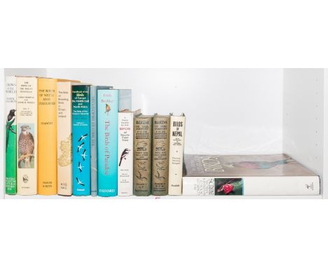
NO RESERVE Birds.- Clancey (P. A.) The Birds of Natal and Zululand, first edition, colour plates, illustrations, folding map at end, bookplate of Bernard King, dust-jacket with some light spotting, adhesive remains to upper flap, Edinburgh & London, 1964 § Fleming (Robert L. Snr.) & others. Birds of Nepal, second edition, full-page illustrations, dust-jacket with abrasion marks to flaps, 1979 § Stockelbach (Lavonia) The Birds of Shakespeare, 30 tipped-in illustrations, [1953], occasional light spotting, original cloth, lightly rubbed, dust-jackets, all but first with a few small chips to extremities and light surface soiling; and others birds, v.s. (12)

Lot 7
America.- Missouri prospectus.- Moore (Thomas, Boston based lithographer and publisher, active 1830s) Missouri City, lithographed city plan of the proposed new town that was planned to prosper from the riches of the nearby Iron Mountain Lode in St. Francois County, and shows St. Louis, a convergence of railroads and roads including the Kickapoo Rail Road, with inset map of the 'State of Missouri' in the lower left corner, and various vignettes, lithograph, on wove paper without watermark, 605 x 920 mm (23 3/4 x 36 1/4 in), several old folds with repairs verso and associated splitting, handling creases, rough edges, some scattered spotting, browning and surface dirt, residual label in upper right corner margin, unframed, [circa 1836].


Lot 192
A quantity of books to include various bound 18th and early 19th century music sheets, Dante Gabriel Rosetti's The Blessed Da Mozel illus. by Byam Shaw, Cicely Mary Barker - Spring Songs with Music from Flower Fairies of the Spring, books on architecture and The English House, Hoppus's Practical Measurer, Bartholomew's Contour Motoring Map of France, Elegant Extracts on useful and entertaining Pieces of Poetry new edition, London printed for Charles Dilly 1790, and others Location:


Lot 545
9 10 38 Teblitz ( Now Teplice) -The Large Red Map shows the Greater German Reich including the Sudatenland. Sudatenland became an object of Nazi expansionist policies and was ceded to Germany as a result of the Munich Agreement of September 1938. In 1945 the area was returned to Czechoslovakia. Good condition. All autographs come with a Certificate of Authenticity. We combine postage on multiple winning lots and can ship worldwide. UK postage from £5.99, EU from £7.99, Rest of World from £9.99


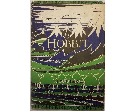
Lot 105
Tolkien (J.R.R.) The Hobbit, 2nd edition, 15th impression, London: George Allen & Unwin, 1965, illustrations by the author, a few minor spots, map endpapers, original cloth, light partial fading to spine, price-clipped dust jacket, small areas of worming head and foot, slight toning and spotting to spine and front panel, 8vo QTY: (1)

Lot 11
Teichman (Eric). Travels of a Consular Officer in North-West China, 1st edition, Cambridge: CUP, 1921, 2 folding maps contained in rear pocket, half-tone illustrations, inscribed in pencil to "Mr Teesdale, from the author, Sept. '21", original cloth, joints splitting, damp stains to covers, 8vo, together with Affairs of China. A Survey of the Recent History and Present Circumstances of the Republic of China, 1st edition, London: Methuen, 1938, map illustrations, original cloth, spine a little darkened, 8vo, inscribed by the author to Mr Teesdale, plus Scott (Robert Falcon). Scott's Last Expedition, 2 volumes, 4th edition, London: Smith, Elder & Co., 1914, maps and illustrations, some spotting, small bookplates of Sidney Frederic Harmer (1862-1950, zoologist and President of the Linnean Society 1927-31), top edge gilt, original cloth, some fading to spines, one or two stains, 8vo, with others including John Hunt's The Ascent of Everest, 1st edition, 1953, signed by the author, and A Journey to Alaska in the Year 1868: being the diary of Emil Teichmann, edited with an introduction by his son Oskar, Kensington: Cayme Press, 1925, limited edition 51/100 QTY: (15)

Lot 13
Willis (N. P.). American Scenery; or Land, Lake and River, Illustrations of Transatlantic Nature, from Drawings by W. H. Bartlett..., 2 volumes, George Virtue, 1840, portrait frontispiece, additional decorative titles, contents, preface and engraved map by W. Hughes with contemporary outline colouring, 117 (complete as lists) uncoloured engraved views, occasional spotting and staining throughout, presentation label to front pastedown of volume 1, contemporary ownership signature to the pastedown of volume 2, contemporary green cloth with morocco gilt labels to the spines, bumped and a little rubbed, 4toQTY: (2)

Lot 14
Aikin (John). A Description of the Country from thirty to forty Miles round Manchester, first edition, London: John Stockdale, 1795, engraved frontispiece, additional engraved title, large folding linen-backed map of Manchester (torn to folds and with old adhesive tape residue to folds), hand-coloured linen-backed folding map of the country around Manchester (strengthened to folds with slight loss), engraved maps and plates, some gatherings strengthened, occasional spotting and toning, later endpapers with withdrawn library stamps, 20th century library buckram, 4to, together with:Baines (Edward), History of the County Palatine and Duchy of Lancaster, 4 volumes, London: Fisher, Son, & Co., 1836, engraved plates and maps, few folding pedigrees, volume 4 without title, contemporary half calf, cloth joint repairs, some wear, 4to, with other related topography including Victoria County Histories, General Introduction & Supplement, 1970 & 1990 (ex-lib. copies), VCH Chester, volumes I-III, 1979-1987, VCH Stafford, volumes III & VI, plus Roman Cheshire..., by W. Thompson Watkin, 1886; Cathedrals, Abbeys and Churches of England and Wales, by T.G. Bonney, 2 volumes, 1898, etc.QTY: (14)
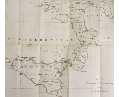
Lot 149
Wilhelmina (Frederica Sophia). Memoirs of Frederica Sophia Wilhelmina, Princess Royal of Prussia, Margravine of Bareith, Sister of Frederic The Great, 2 volumes, 1st English edition London: printed for Henry Colburn, 1812, modern inscription to the front endpaper, volume 1 front gutter cracked, contemporary uniform gilt decorated full tree calf, spines rubbed & leather cracked, 8vo, together with:Hill (Brian), Observations And Remarks in a Journey Through Sicily and Calabria, in the Year 1791:..., 1st edition, London: printed for John Stockdale, 1792, folding map frontispiece, bookplate to the front pastedown, some light toning & spotting, contemporary gilt decorated, boards & spine rubbed with some loss, 8vo, plusMerrick (J.), The Destruction Of Troy, Being The Sequel of the Iliad, Oxford: printed at the Theatre, 1739, period inscription to the front endpaper, engraved vignette title page with bookplate to the verso, water stain to the title through to the preface, contemporary gilt decorated full calf, boards & spine slightly rubbed, 8vo, and other 17th - 19th-century literature, including Poetry of the Anti-Jacobin, 4th edition, London: printed for J. Wright, 1801, later morocco spibe retaining contemporary gilt decorated mottled calf boards, large 4to, Archaeologia Graeca: Or, The Antiquities of Greece, 2 volumes, by John Potter, 4th edition, London: printed for Sam Palmer, 1722, 8vo, mostly in contemporary leather bindings, some gilt decorated, overall condition is generally good/very good, 8vo/4to85 volumesQTY: (3 shelves )
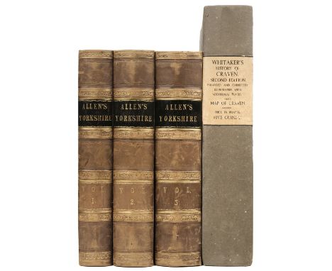
Lot 15
Allen (Thomas). A New and Complete History of the County of York, 3 volumes, 1828-31, steel-engraved frontispieces to volumes 1 & 2, 91 steel-engraved plates (only) on India paper, vignette titles to each volume, armorial bookplates of Thomas Sebastian Bazley to front free endpaper rectos, some offsetting, contemporary half calf gilt, lightly rubbed, 4to, together with:Whitaker (Thomas Dunham). The History of Antiquities of the Deanery of Craven, 2nd edition, London: J. Nichols, 1812, engraved portrait frontispiece of the author, additional lithograph title, illustrations throughout, engraved folding map of Craven, contemporary manuscript note pasted to front blank verso, some offsetting and spotting, endpapers and blanks renewed, original blue paper-covered boards, some wear, folioQTY: (4)

Lot 168
Dostoyevsky (Aimée). Fyodor Dostoyevsky, A Study, 1st English edition, London: William Heinemann, 1921, some light spotting & toning throughout, original gilt decorated red cloth, small water Mark to the top edge, spine & boards slightly faded, 8vo, together with:Queen Victoria, Leaves From The Journal of Our Life in the Highlands from 1848 to 1861, London: Smith, Elder and Co., 1868, period inscription to the head of the title pageMore Leaves From The Journal...from 1862to 1882, 1884, both 1st editions, some light toning, original gilt decorated green cloth, lightly rubbed to head & foot, 8vo, plusPottle (Frederick A., editor), Boswell In Holland 1763-1764, limited edition, London: William Heinemann, 1952, 14 monochrome illustrations & map, original quarter vellum with gilt decorated blue cloth boards in glassine wrapper & slipcase, 8vo, 1045/1050, and other late 19th & early 20th-century biography, including The Letters Of Queen Victoria...1837-1901, 9 volumes, edited by Arthur Christopher Benson & Viscount Esher, London: John Murray, 1907-32, original uniform gilt decorated red cloth, 8vo, all original cloth, G, 8voQTY: (6 shelves )
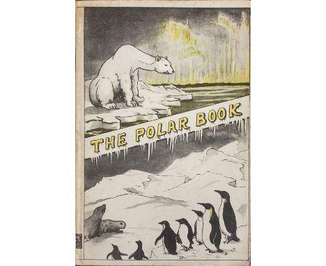
Lot 170
E. Allom & Co., publisher. The Polar Book, 1st edition, London, 1930, colour folding map to the rear with a small tear to the bottom left, some light toning & spotting, original wrappers, lightly toned with minor rubbing to head & foot, 8vo, together with:Fuchs (Vivian & Edmund Hillary), The Crossing of Antarctica, The Commonwealth Trans-Atlantic Expedition 1955-58, 1st edition, London: Cassell, 1958, numerous colour illustrations, some light toning & spotting, original cloth in dust jacket, covers lightly rubbed with minor tears to head & foot, 8vo, plusAktie-Bogtrykkeriet, publisher, Norway, Official Publication For The Paris Exhibition 1900, Kristiania/Oslo, 1900, monochrome illustrations, title page & preface partially detached, some light toning & spotting throughout, original boards, spine & boards toned & rubbed with minor loss, hinges cracked, large 8vo, and other modern travel & Arctic exploration reference, including 8 Baedecker's travel guides & 14 further similar, mostly original cloth in dust jackets, G/VG, 8vo/4to QTY: (3 shelves )

Lot 185
Antigua. Luffman (John), Antigua in the West Indies, America laid down by actual Survey in the years 1787 and 1788, William Faden, 1793, large uncoloured engraved map on four conjoined sheets, laid on near-contemporary hessian, inset map of the town of Saint John, dedication to Thomas Shirley, Major General, Governor of Leeward Islands, compass rose and two lists of subscribers, toned overall, some marginal chipping and fraying with slight loss, some closed tears and cracking affecting the printed image, 935 x 1000 mm, secured with bulldog clips between a sheet of perspex and cardQTY: (1)NOTE:A rare map of Antigua printed on 4 sheets, surveyed by John Luffman during his 3-year tour in the West Indies. It was published to accompany Luffman's 'A Brief Account of the Island of Antigua' in 1788, but very few seem to have survived. Only 6 copies can be traced in institutional holdings (there are 3 copies [one damaged] in the National Archives at Kew and one each at the British Library, University of London Senate House Library, and Biblioteca Nacional de Espana, Madrid). Few copies can be traced as selling at auction (RareBookHub)
Lot 186
Australasia. Johnston (W. & A. K.). Dominion of New Zealand, circa 1880, colour lithographic map, inset maps of Chatham island, Environs of Aukland, Environs of Wellington, Environs of Dunedin and New Guinea, 585 x 450 mm, together with Vandermaelen (Phillipe Marie Guillaume). Iles des Amis, circa 1827, engraved map with contemporary outline colouring, inset descriptive text in French, 480 x 555 mm, with Walker (J. & C.). Western Australia Containing the Settlement of Swan River and King George's Sound [and] Van Diemen Island, 1833, two engraved maps on one sheet (as published), contemporary outline colouring, 320 x 405 mm, plus Bonne (Rigobert). Isles de la Reine Charlotte [and] Carte de la Terre Van-Diemen, Paris, circa 1787, two hand-coloured engraved maps, slight spotting, each approximately 250 x 360 mm, and another seven maps similar, including examples by or after Cook, Morse and Walker, plus a small late 18th century uncoloured engraved portrait of Captain James Cook, 175 x 110 mmQTY: (13)
Lot 191
British County Maps. A mixed collection of 36 county maps, 17th - 19th century, engraved and lithographic maps including Speed (John). The North and East Ridins of Yorkshire, John Sudbury & George Humble, circa 1627, hand-coloured engraved map, inset town plans of Richmond and Hull, toned overall, some creasing, several repaired marginal closed tears, slight marginal fraying, 390 x 515 mm, mounted, framed and glazed, together with Norden (John & Kip William). Sussexia sive Southsex olim pars Regnorum [1607], uncoloured engraved map, large strapwork cartouche and mileage scale, 225 x 395 mm, mounted, framed and double-glazed, Latin text on verso, with Bowen (Emanuel). An Accurate Map of Oxford Shire Drawn from the best Authorities, Divided into Hundreds, circa 1780, engraved map with contemporary outline colouring, originally published in 'The Royal English Atlas', additional horizontal fold, some creasing and dust soiling, 500 x 405 mm, framed and glazed, plus Blome (Richard). The County Palatine of Chester with its Hundreds [1673] hand-coloured engraved map, very slight spotting, 260 x 320 mm, mounted, framed and glazed, with another 32 maps, including examples by or after Morden, Harrison, Cary, Van Langeren, Lewis, Archer, Kitchin, Gibson, Conder, Moule, Owen & Bowen, Senex, Dawson, Seller/Grose, Tallis, Neele and Morris, various sizes and condition, all framed and glazedQTY: (36)
![British Isles. Bertius (Pieter & Hondius J.), Anglia, Scotia et Hibernia [and] Scotia, circa 1636, two uncoloured, engrav](https://cdn.globalauctionplatform.com/4839b208-d815-4d8e-b853-aeeb010dbac6/18535d66-65bb-4c49-8f01-aef20110c6a9/468x382.jpg)
Lot 192
British Isles. Bertius (Pieter & Hondius J.), Anglia, Scotia et Hibernia [and] Scotia, circa 1636, two uncoloured, engraved miniature maps, each approximately 100 x 135 mm, mounted, framed and glazed, together with Langenes (Barent). Cambria, circa 1598, hand-coloured engraved miniature map, 90 x 125 mm, mounted, framed and glazed, with Van den Keere (Pieter). Shropshire, circa 1627, uncoloured, engraved miniature map, slight overall toning, 85 x 125 mm, mounted, framed and glazed, plus Luffman (John). Somersetshire, circa 1803, uncoloured circular map with descriptive text below, overall size 140 x 75 mm, mounted, framed and glazedQTY: (5)

Lot 193
British Isles. De Wit (Frederick), Nova Totius Angliae, Scotiae et Hiberniae Tab, circa 1680, engraved map with contemporary outline colouring, lower corners torn with slight loss and replaced in facsimile, some toning to the margins, 480 x 565 mm, together with Homann (Johann Baptist). Magnae Britanniae pars Meridionalis in qua Regnum Angliae tam in Septum Antiqua Anglo-Saxonum Regna..., Nuremberg, circa 1720, engraved map with contemporary outline colouring, slight oxidization to the old watercolour, 570 x 490 mmQTY: (2)
Lot 194
British Isles. Jansson (Jan & Ortelius Abraham), Insularum Britannicarum Acurata Delineatio ex Geographicis Conatibus Abrahami Ortelii, Amsterdam, 1646 [or later], an historical map engraved by Pieter Van den Keere with contemporary outline colouring, large decorative cartouche, compass rose and numerous rhumb lines, orientated to the west, slight toning to the central fold, 395 x 510 mm, no text on verso, together with Homann (Johann Baptist). Magnae Britanniae pars Meridionalis in qua regnum Angliae tam in Septem Antiqua Anglo-Saxonum Regna..., Nuremberg, circa 1725, engraved map with contemporary outline colouring, large uncoloured cartouche and historical vignette, old folds, 575 x 490 mm, with another five maps of England & Wales, including examples by or after Kitchin, Dilly & Robinson and Vivares, one duplicate, various sizes and conditionQTY: (7)NOTE:The first item described. R. W. Shirley. Early Printed Maps of the British Isles, 1477 - 1650, number 575.
![British Isles. Mercator (Gerard & Hondius J.), Anglia Scotia et Hibernia [and] Anglia, circa 1621, two hand-coloured engr](https://cdn.globalauctionplatform.com/4839b208-d815-4d8e-b853-aeeb010dbac6/b193578e-bcbc-4bb5-b40e-aeec01149fb7/468x382.jpg)
Lot 195
British Isles. Mercator (Gerard & Hondius J.), Anglia Scotia et Hibernia [and] Anglia, circa 1621, two hand-coloured engraved maps, each approximately 135 x 180 mm, Latin text on verso, together with Ortelius (Abraham & Marchetti Pietro). Ingiltera, Brescia, circa 1598, uncoloured engraved miniature map, slight spotting to the margins, 80 x 105 mm, Italian text on verso, with Ortelius (Abraham & Coignet Michael). Anglia, Antwerp, circa 1602, uncoloured engraved miniature map, some staining, 90 x 120 mm, French text on verso, plus Jansson (Jan). Anglia, Amsterdam, circa 1628, uncoloured engraved map, 150 x 205 mm, French text on verso, and another 10 maps of the British Isles and England & Wales, with examples by or after Badeslade & Toms, Kitchin, Leigh, Seller, Senex, Archer and Pigot, occasional duplicates, various sizes and condition QTY: (15)

Lot 197
Canada & The Arctic. Zatta (Antonio), Le Isole di Terra Nuova e Capo Breton di Nuova Projezione, Venice, circa 1778, engraved map with contemporary outline colouring, 435 x 340 mm, together with Bowen (Emanuel). A New & Accurate Map of the North Pole..., circa 1747, hand-coloured engraved map, 375 x 425 mm, with Colton (G. W. & C. B. & Co. publishers). Northern Regions [and] Southern Regions, New York, circa 1865, two engraved maps on one sheet (as published), contemporary wash colouring, overall size 400 x 680 mm, with another four maps similar, with examples by or after Zatta, J. & C. Walker, Gall & Inglis and Levasseur, various sizes, good conditionQTY: (7)

Lot 199
Carnarvonshire. Speed (John), Caernarvon Both Shyre and Shire-Towne with the ancient Citie Bangor Described, John Sudbury & George Humble [1627], hand-coloured engraved map, inset town plans of Carnarvon and Bangor, 380 x 505 mm, mounted, framed and double-glazed, English text on versoQTY: (1)NOTE:A bright clean example.
![Collins (Capt. Greenville). Fowey & Mounts Bay..., [1693 -1779], hand coloured engraved sea chart, inset map of Mount's B](https://cdn.globalauctionplatform.com/4839b208-d815-4d8e-b853-aeeb010dbac6/8148bd5a-f165-469d-8a9c-aeec0114a347/468x382.jpg)
Lot 201
Collins (Capt. Greenville). Fowey & Mounts Bay..., [1693 -1779], hand coloured engraved sea chart, inset map of Mount's Bay, elaborate cartouche, compass roses and numerous rhumb lines, 450 x 565 mm, together with A Large Draught of the Downes..., hand coloured engraved sea chart, 430 x 535 mm, with a chart of Rye and its harbour, 450 x 290 mm, with Mercator (Gerard). Zelandia Comitatus, circa 1600, hand-coloured engraved map, large strapwork cartouche, 345 x 490 mm, French text on verso, plus Johnston (A. K.). West India Islands, circa 1850, engraved map with contemporary outline colouring, some marginal fraying, slight toning to the central fold, 505 x 605 mm, and Johnston (Keith). Ireland, circa 1870, engraved map with contemporary outline colouring, 430 x 340 mm, with two other maps similarQTY: (8)

Lot 204
England & Wales. Rocque (John), England and Wales drawn from the most accurate Surveys containing all the Cities, Boroughs, Market Towns & Villages..., Robert Sayer, 1794, large engraved map with contemporary outline colouring on four sheets (not conjoined), inset map of the Scilly Isles, large uncoloured allegorical cartouche, very slight staining, some fraying to the margins but not affecting the printed image, central fold partially strengthened on the verso, overall size if conjoined approximately 1200 x 1000 mm, together with Mercator (Gerard & Hondius Henricus). Eboracum, Lincolnia, Derbia, Staffordia, Notinghamia, Lecestria, Rutlandia et Norfolcia (2 copies), [with] Warwicum, Northamtonia, Huntingdonia, Cantabrigia, Suffolcia, Oxonium, Buckinghamia, Bedfordia, Hardfordia, Essexia, Southantonia, Surria, Cantium et Southsexia, circa 1612, together three uncoloured engraved regional maps, some creasing and slight marginal fraying, each approximately 370 x 470 mm, Latin text on verso, with another fifteen regional maps of England & Wales and Yorkshire, sheets from large scale maps, and triangular mileage tables, including examples by or after Smith, Ogilby, Thomson, Cary, Mercator (small format) Speed, Hall and Van Langeren, various sizes and conditionQTY: (22)

Lot 206
Europe. Kitchin (Thomas), A New and Accurate Map of Europe, Divided into its Empires, Kingdoms, States and Republics, Drawn by the Sieur Robert De Vaugondy..., Robert Sayer, 1st August, 1772, engraved map with contemporary outline colouring and some later enhancement, on 4 conjoined sheets with an inset map of Iceland, the vertical margins with details and statistics, the lower horizontal margin decorated with 70 flags of European, African and Asian countries, old folds, 1015 x 1225 mm, together with Vuillemin (Alexandre). Nouvelle Carte Illustree de l'Europe Presentant les Grandes Divisions Physique, la Distribution Geographique des Vegetaux et des Mineraux..., Paris, 1859, engraved map with contemporary outline colouring, 24 uncoloured engraved panels in the vertical margins illustrate the produce and industry of each nation, 620 x 845 mmQTY: (2)
Lot 209
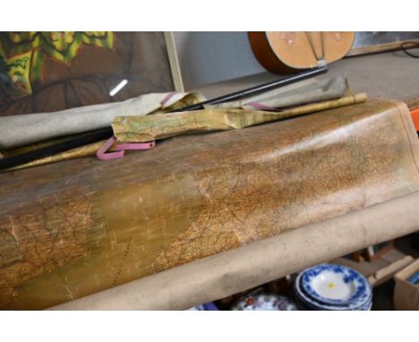
Folding Maps. A collection of nine folding maps, mostly 19th century, engraved and lithographic regional and touring maps, including Wyld (James). A New Map of England & Wales Projected upon the Trigonometrical Operations made for the General Survey of the Kingdom, James Wyld (Successor to Mr Faden), 1st. January 1830, large engraved map with bright contemporary hand colouring, sectionalised and laid on linen on two sheets, calligraphic title, table of the altitudes of the principal mountains and table of explanation, slight offsetting, edged in green silk, each sheet approximately 625 x 950 mm, paper endpapers, contained in a contemporary cloth slipcase with a publisher's printed label to the upper cover, together with Wallis (John). Wallis's New and Correct Map of the Post Roads of England & Wales, 1790, engraved map with contemporary outline colouring, sectionalised and laid on hessian, some staining, small holes where old folds cross, old manuscript ownership signature to the upper margin, 555 x 470 mm, contained in a contemporary marbled card slipcase with publisher's printed label to the upper cover with an additional manuscript ownership signature, heavily worn and frayed, with Cassell, Petter, Galpin & Co. (publishers). Map of Greater London, printed by Edward Stanford, circa 1890, folding lithographic map laid on linen, slight spotting and staining, 740 x 630 mm, contemporary cloth boards with the gilt letters 'J. H. L.' to the upper siding, plus Johnston (W. & A. K. publishers). Northern Part of Ross and Cromarty Shires, Compiled from Actual Surveys by John Craig, Glasgow, circa 1850, engraved map with contemporary outline colouring, sectionalised and laid on linen, inset map of Lewis, 1020 x 700 mm, contained in a contemporary blind-stamped cloth slipcase, and Brion de la Tour (Louis). Cartes des Postes D' Allemagne et des États Voisins..., Paris, 1791, engraved map with contemporary outline colouring, sectionalised and laid on linen, edged with pink linen, 730 x 1060 mm, two string ties in the upper corners, with another four folding maps, including examples by or after Ordnance Survey, Foley. Headley and Dufourcet, various sizes and condition, with Lewis (Samuel). A Topographical Dictionary of England..., 1831, folding engraved map of England and Wales and forty (only) uncoloured engraved county maps (including 10 folding), bookplate of Earl Granville, contemporary half gilt with gilt decorated spine, upper board detached, worn at extremities, 4to, plus Taylor (A. E.). Twenty-five City Plans, circa 1930, uncoloured photolithographic plans with English text below and on the verso of each map, map size approximately 120 x 180 mm, and Blomfield (Ezekiel). Lectures on the Philosophy of History..., 1819, printed title, advertisement and contents list, twelve (complete as list) engraved hemispherical maps with contemporary hand-colouring, partially uncut, slight spotting throughout, contemporary boards, 4to, together with Kent. Porcelain plate, possibly Coalport, circa 1880, colour transfer design featuring a map of the county of Kent, on a white background with a gilt and floriate rim, 225 mm diameter, and Treen. Spooled Length of Ribbon, circa 1880, yellow ribbon contained between two wooden circular discs, one disc painted, the other with an uncoloured circular lithographic map centred on Tunbridge Wells, diameter 55 mm, with a vellum indenture dated 1690, with one red wax seal and a small attached simple manuscript map, overall size 650 x 750 mmQTY: (39)
-
109198 item(s)/page