We found 109198 price guide item(s) matching your search
There are 109198 lots that match your search criteria. Subscribe now to get instant access to the full price guide service.
Click here to subscribe- List
- Grid
-
109198 item(s)/page


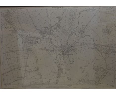
Lot 347
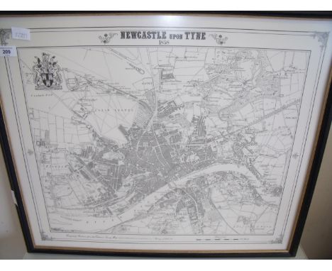
A pair of 19th Century hand-coloured maps published by Greenwood & Co., comprising 'Map of the County of Derby', with a vignette of Chatsworth, from a survey of 1824-1825, engraved by J&C Walker, published 1830; 56 cm x 66.5 cm; and 'Map of the County Palatine of Lancaster', with a vignette of Lancaster Castle and Church, from a survey of 1818, engraved by J. Dower, published 1830; and 62 cm x 68 cm; together with a reproduction of a first edition ordnance survey map of Baslow and Bubnell (Derbyshire Sheet XXIV.I.), 70 cm x 101 cm, all framed and glazed (3)

Lot 352
A 17th Century later hand coloured map of Berkshire after Christopher Saxton (c.1540-c.1610), 'Comitatus Bercheriæ vulgo Barkshyre qui olim fedes A-trebatvm', 24 cm x 33 cm, framed and glazed; together with an 18th Century later handcoloured map of Cornwall by Thomas Kitchin (1718-1784), 19.5 cm x 27 cm, framed and glazed; and a 17th Century distance chart Berkshire, 12 cm x 11.5 cm

Lot 184
A limited edition 'Australia Puzzle', by Ilaria Logi, executed in phosphorated bronze, it is formed of 22 animals and one person that fit together to make a map of Australia, it is housed within a cork box, topped with eucalyptus leaves, numbered 239 of 760, complete with instructions and certificate


Lot 236
Two Robert Morden hand coloured engraved maps of Herefordshire and The County of Monmouth17th century, with decorative title cartouches, sold by Abel Smale Awnsham & John Churchil, 13¾ x 16in. (35 x 40.5cm.), in period style gilt & composition frames; together with a 19th century bookplate map of Wiltshire. (3)

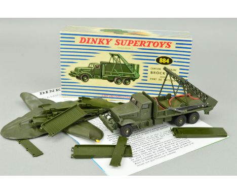
Lot 424
A BOXED FRENCH DINKY SUPERTOYS BROCKWAY BRIDGE LAYER, No.884, complete with bridge, two inflatable boats and instructions/map, very lightly playworn condition with a few minor paint chips, inflatable boats have some surface marking but does appear to have perished, bridge sections and instructions in very good condition, blue stripe box in fairly good condition, but missing inner packing piece

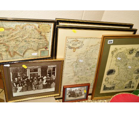
Lot 835
STAFFORDSHIRE MAPS ETC, to include 'A Mapp of Staffordshire with its Hundreds' drawn by W.Hallar, printed by Thomas Taylor, size 18.5cm x 26.5cm, 'Staffordshire' by Robert Morden, size 43cm x 36cm, a reproduction map of Derbyshire by James Bingley, a reproduction map of Staffordshire from 1577 and two photographs, the first of Edward VII, the second of a group of people in a vehicle (6)


Lot 811
A collection of ephemera of Lancaster and Morecambe, including Ordnance Survey map, 6inches to 1 mile, Penny's Hospital Recipentsw of Penny's Charity Book 1875-1882, Lancaster and Morecambe and Heysham Town map final written statement, report on layout plans for Aldcliffe Estate Lancaster 1931, Lancaster and Morecambe Regional Planning scheme 1927


Lot 98
A collection of early 19th century railway plans and ephemera including Jonathan Binns (engineer) plan of railway between Preston and Lancaster, 1846 map of the NorthWest Railway, 1840 railway communications with plans, 1839 prospects and map for the West Cumberland Railway, plan and estimate for a railway crossing of Morecambe Bay etc


Lot 244
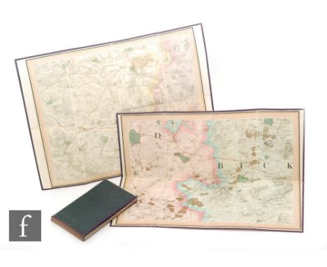
A collection of hand-coloured engravings of 17th century county maps:- Lincolnshire and Gloucestershire by Robert Morden in bird’s eye maple frames each 45cm x 51cm (a pair), Cornwall by William Kip, Wiltshire by Richard Blome 1673, The Road from London to Oakeham by John Ogilby Glocestria 13cm x 17cm together with two 19th century maps: A New map of the County of Gloucester 1808 and Map of the County of Rutland by C & J Greenwood, London 73cm x 87cm, all framed. (8)


Lot 1351
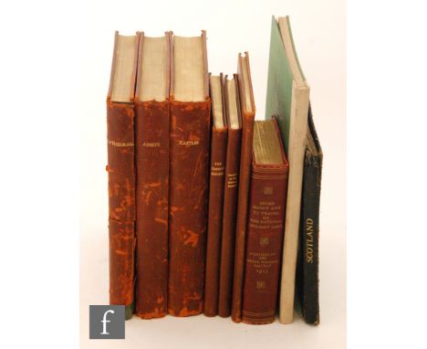
Gregsons Fragments And Antiquities Of Lancashire Second Edition Published by G.H. Harris's Widow And Brothers 1824 Later bound in brown leather with gilt embossed spine; the book consists of the book "Fragments" bound with other material to include a page of manuscript notes relating to the text, also the "Notice of Publication Sheet" for the book dated 1817. Along with portrait of Matthew Gregson, updated subscribers list and large folding map. Part II dated 1817 continues the pagination through to page 302. Part III has one page prospectus for forthcoming fourth part, along with page titled "A List of the Sheriffs of Lancashire'' etc. Very good overall condition, all pages and plates intact, please see accompanying image.


Lot 171
1975 Medals - 'Coupe Europe Athletisme' at Nice, '16-17 Aout, AEA, FFA with abstract triangles, in a bronzed metal, 64mm diameter silvered and gilt Greek medals featuring map of Europe with three female athletes to reverse, two South African International Meeting for 200m (women) with Port Elizabeth, Pretoria and Cape Town name bars, Longford Park and on other.


Lot 12
NORMAN ACKROYD (b.1938) 'Travels with Copper and Zinc 1981-1983', a portfolio of sixteen etchings printed by Alan Smith and published by The Penny Press 1983, each etching signed, titled and numbered 11/25, the portfolio with slip case, contents page, map and title page, signed and numbered 11/20 and dated 1983, the etchings of varying sizes and all but four works now mounted and framed (16)
-
109198 item(s)/page